Mount Rushmore brochure maps
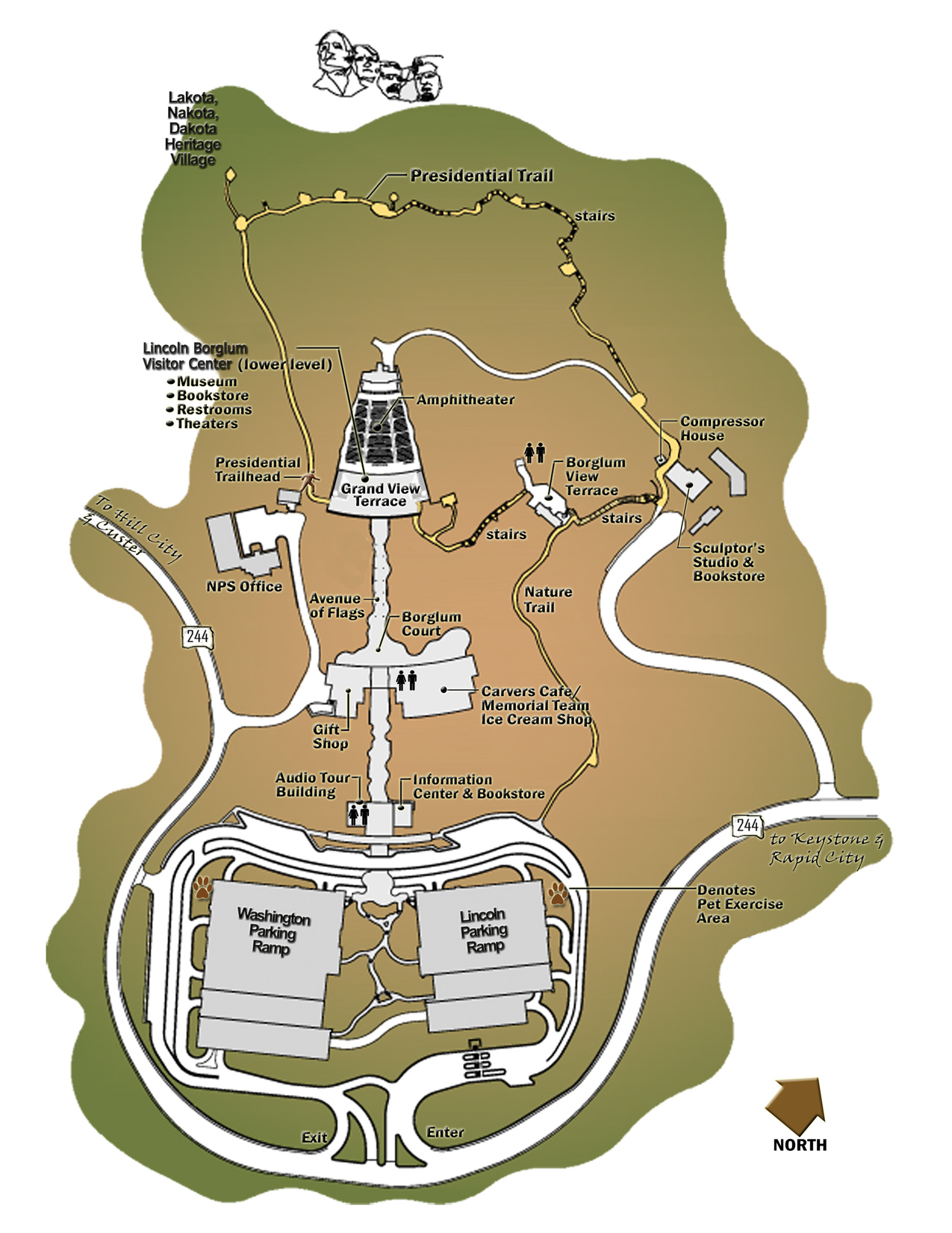
 Here’s the brand new official Mount Rushmore map, showing all the visitor services and trails from a three-dimensional perspective of the entire Mount Rushmore National Memorial landscape.
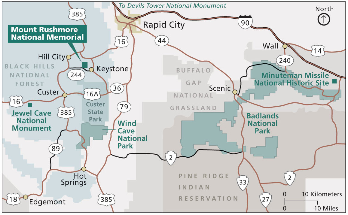 This is the regional Mount Rushmore map from the brochure, showing the park in relation to the surrounding Black Hills area parks and cities – Badlands, Wind Cave, Custer State Park, Rapid City, etc.
Detailed Mount Rushmore maps
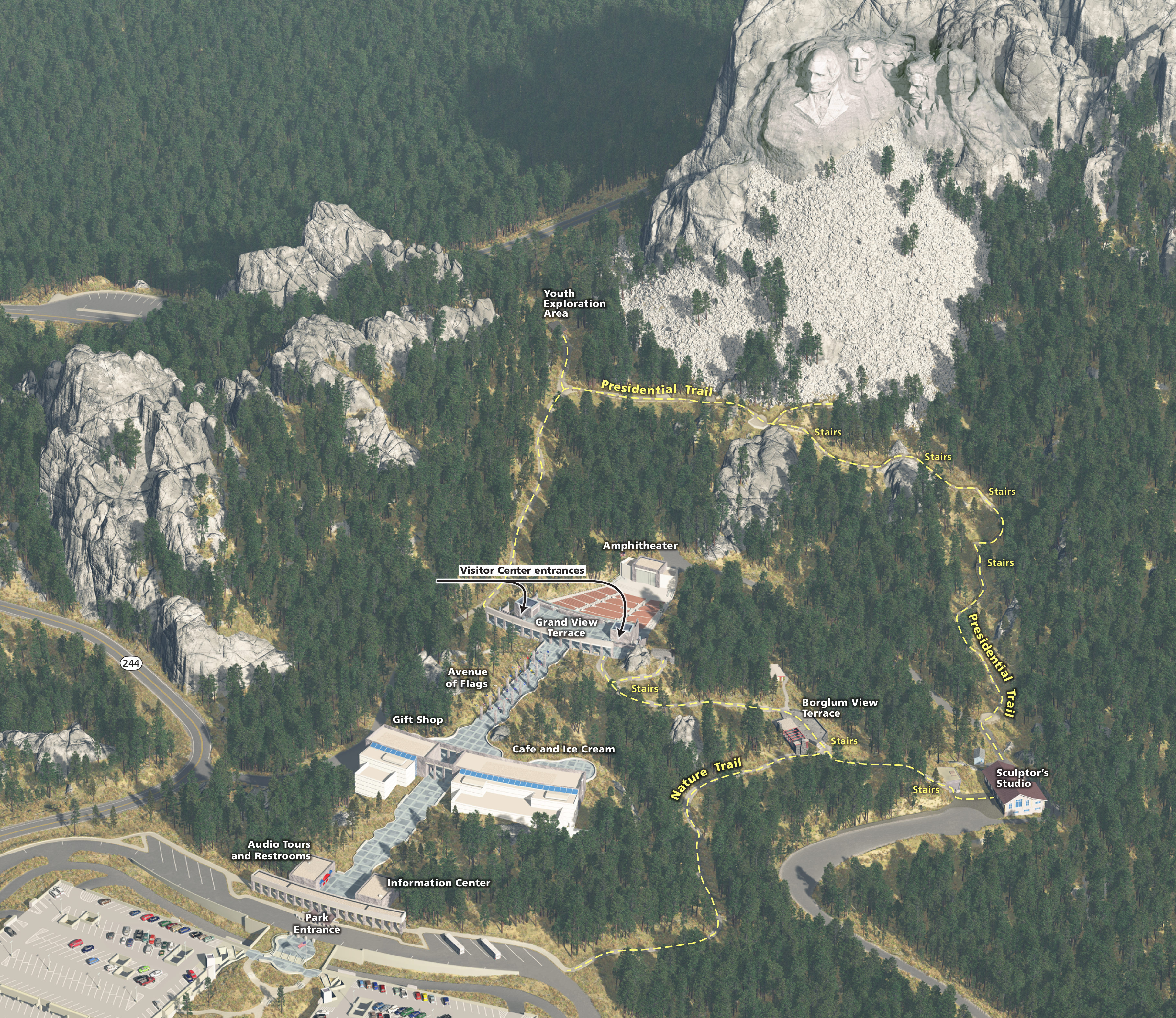
 This is the most recent detailed Mount Rushmore map, zooming in on the monument and showing the buildings and facilities as well as the loop trail that takes you right to the base of the presidents.
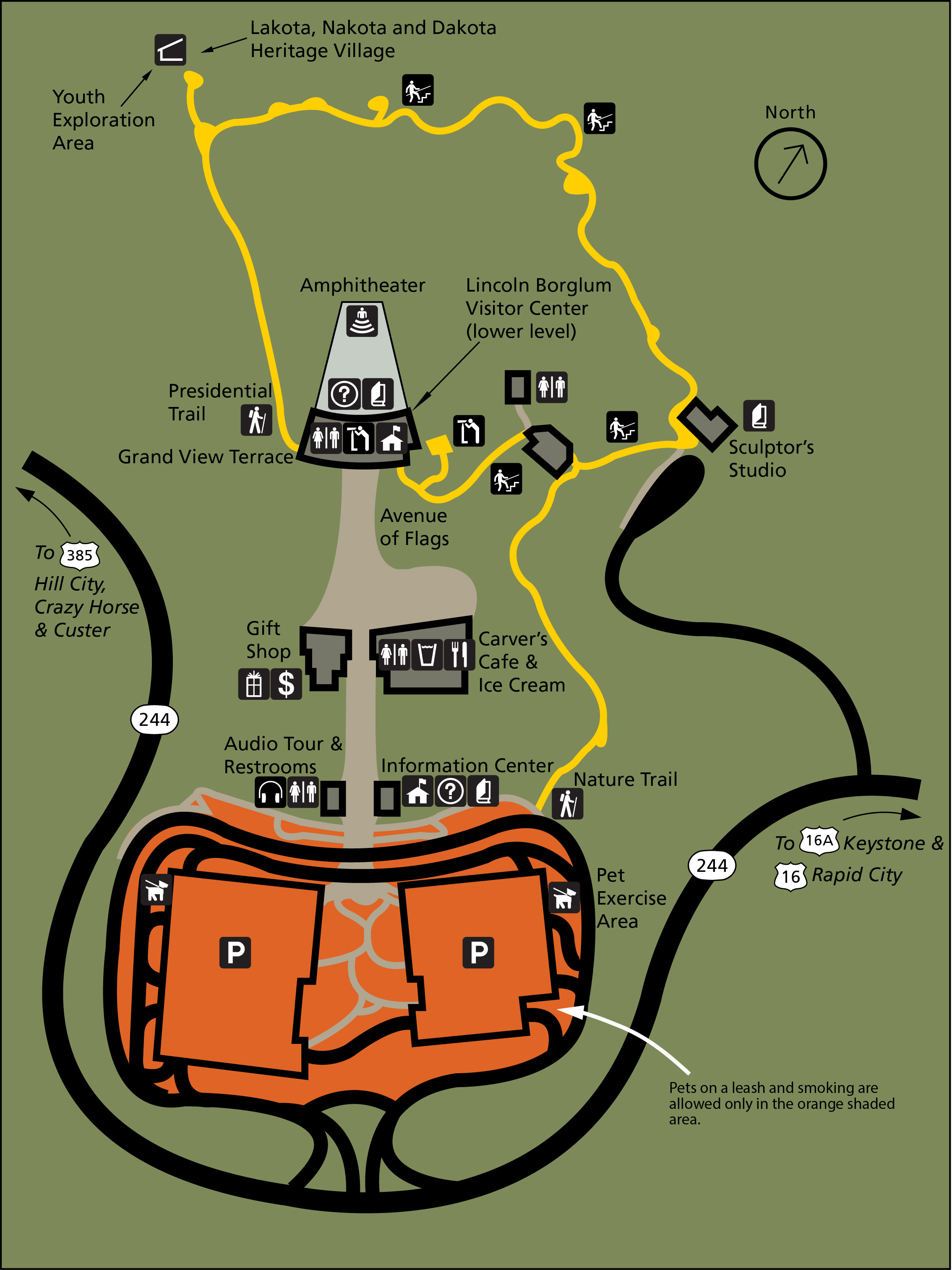
 Here is a older Mount Rushmore map that shows the parking, trails, visitor center, amphitheater, and viewing areas inside the park. It also labels the staircases on the Presidential Trail.
Mount Rushmore trail map
 If you’re doing hikes around Mount Rushmore and at other places in the Black Hills, you should probably grab the National Geographic Trails Illustrated map for the southern Black Hills. It also covers other national and state park sites including Wind Cave, Jewel Cave, Custer State Park, and other locations in the Black Hills. A Black Hills North map is also available for your further Black Hills wanderings.
Regional Mount Rushmore map
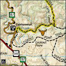
 Here’s another regional map of Mount Rushmore, showing the roads, trails, and points of interest in the Black Hills area surrounding Mount Rushmore in much more detail than the map above.
Scientific Mount Rushmore maps
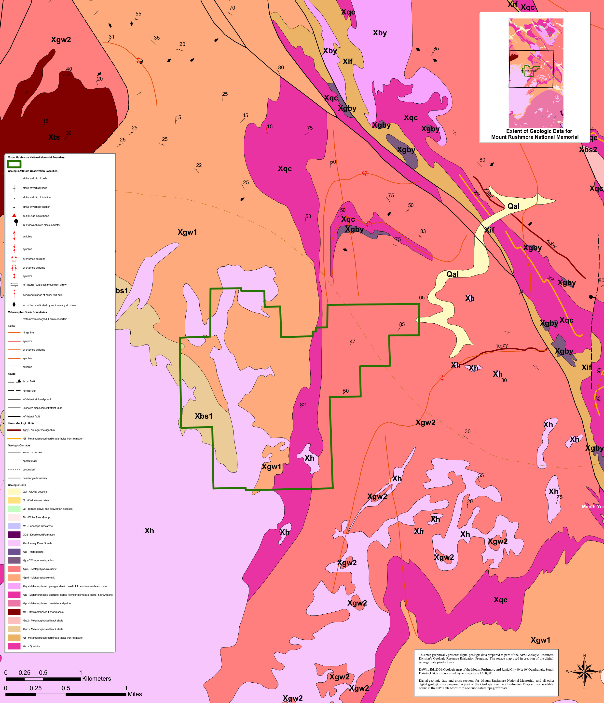 The Mount Rushmore geologic map includes the rock layers both inside the park as well as in the surrounding area of the Black Hills. Since it’s the Black Hills, you’ll of course find lots of granite.
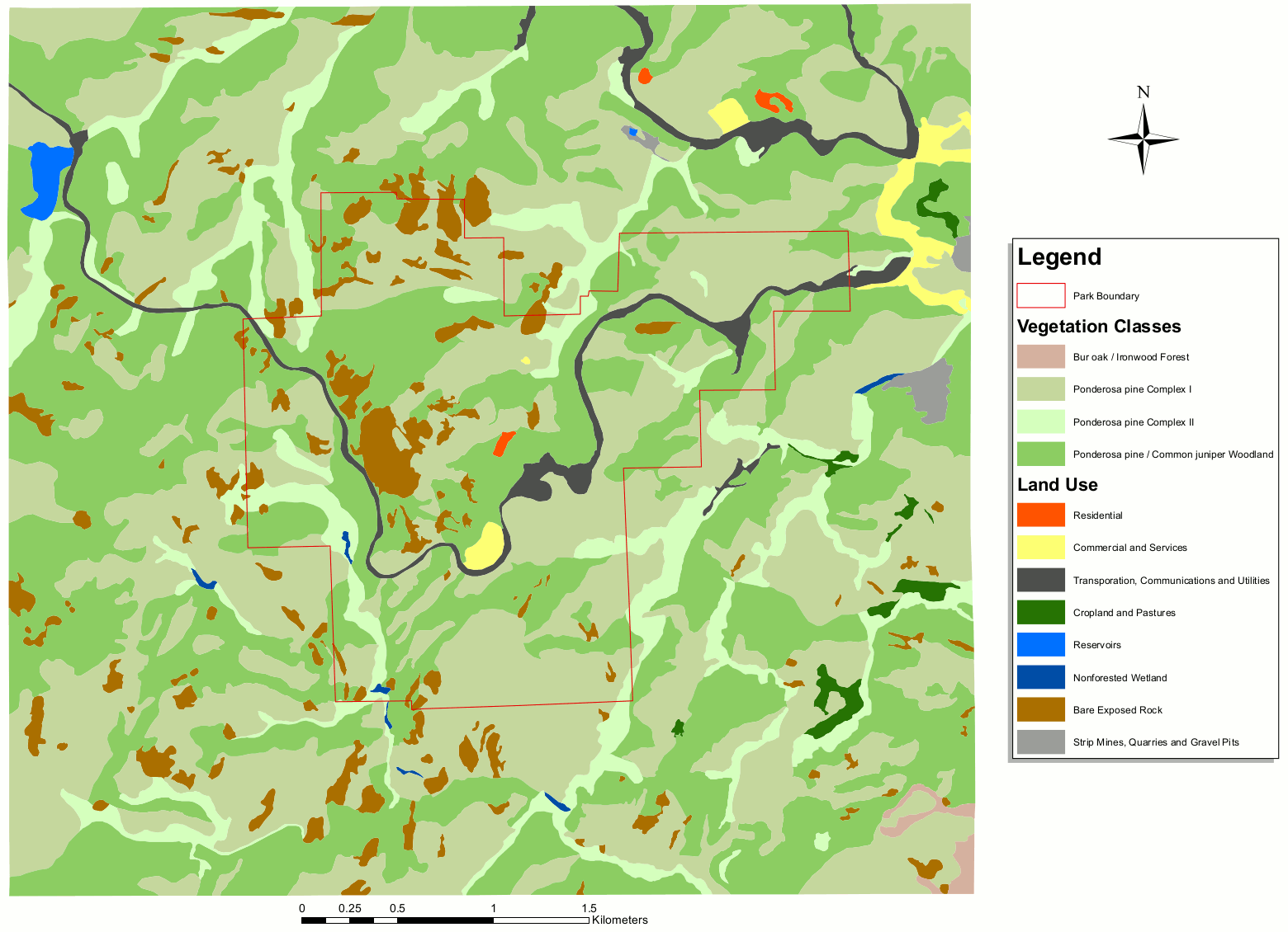 The Mount Rushmore vegetation map shows the types of land cover inside the memorial lands and also nearby in the surrounding region – ponderosa pine forest, oak forest, and so on.
Mount Rushmore lodging map
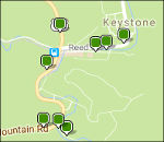 If you want to stay as near to Mount Rushmore as possible, check out the town of Keystone; to the right is an Expedia interactive lodging map showing your option in and around the area. Rapid City is the nearest big town, but it’s about 30 minutes away. If you’d like to browse reviews, I’ve provided a link to Expedia’s top-rated Mount Rushmore area lodging, where you can also see photos, reviews, locations, and prices.
…and more!
< Return to National Park Maps home
< Return to Park List
< Return to List by State