Devils Tower map from the park brochure
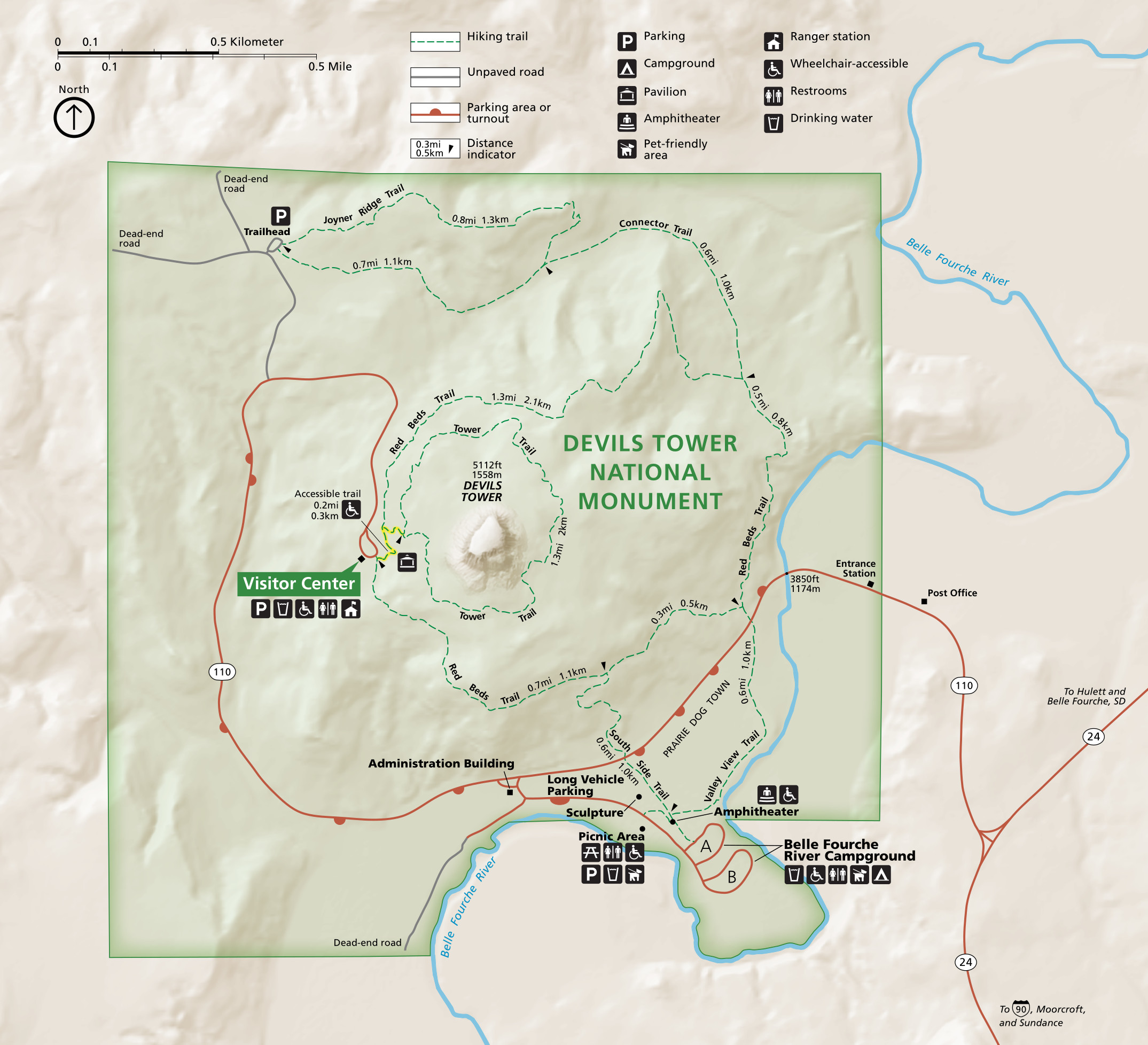 This is the official National Park Service Devils Tower map, last revised in 2022. It labels trails and mileages, which is a nice touch most NPS maps don’t have. Click the image to view a full size map or download the PDF.
Devils Tower lodging map
 Devils Tower is in a remote setting but there are some places to stay just outside the park and in Hulett, WY. Browse Expedia’s interactive lodging map of Devils Tower to the right, and consider zooming out to see options along I-90 if you’re road-tripping. Or browse Expedia’s top-rated Devils Tower lodging first so you can compare photos and reviews.
Various Devils Tower maps
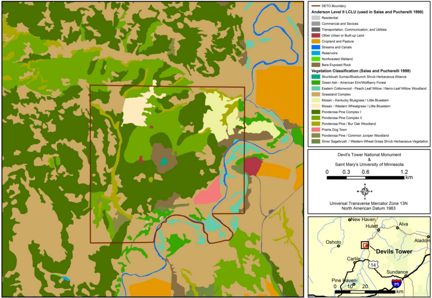 The Devils Tower land cover map shows what you’ll find on the ground everywhere in the park – ponderosa pine forest, sagebrush, cottonwood woodlands, grasslands, bare rock, etc.
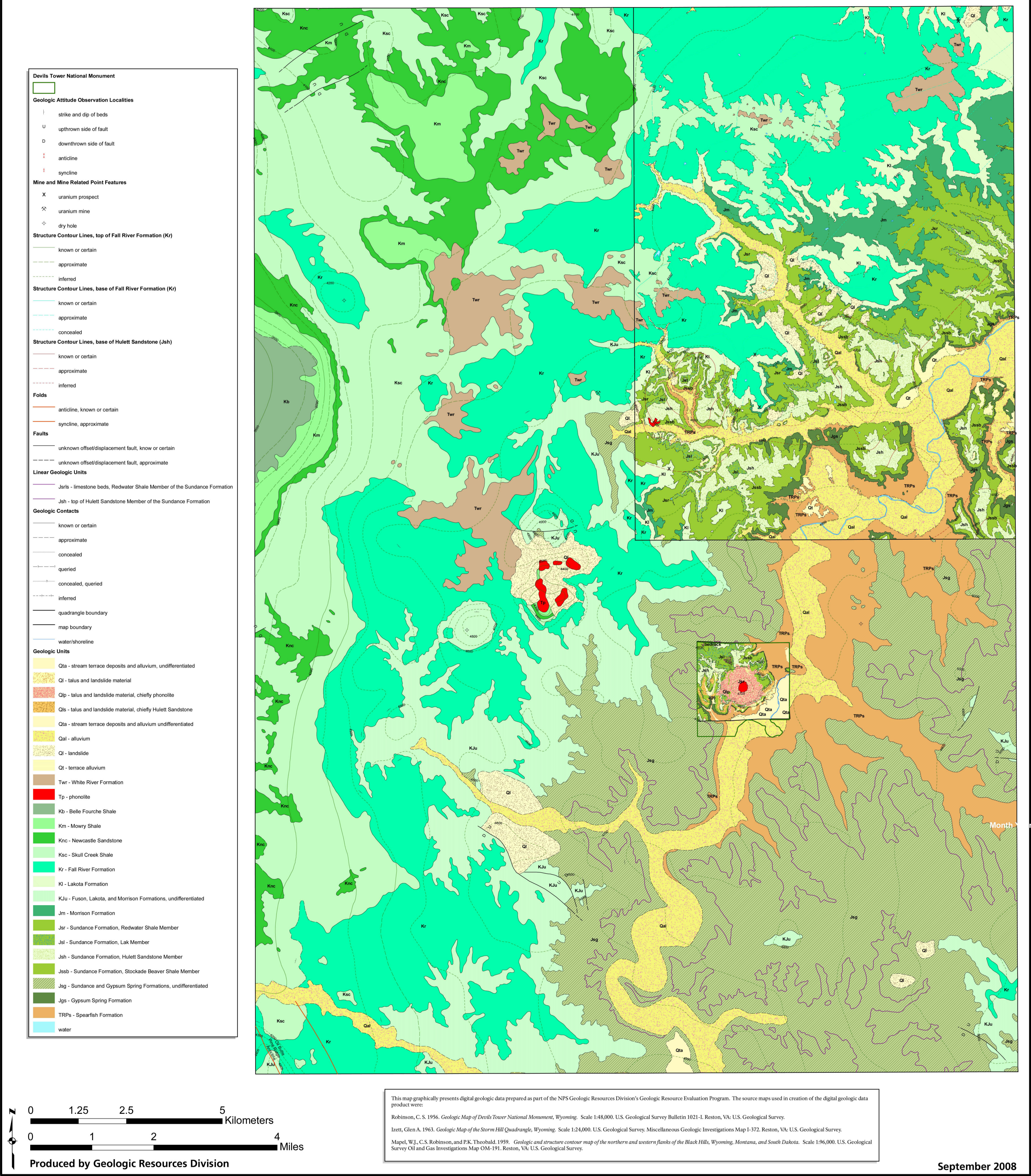 Here’s a geologic map of Devils Tower, which may not be incredibly useful for trip-planning but it’s certainly great for learning about the park! It includes the surrounding Wyoming region as well.
 Here is a topographic map of Devils Tower and the surrounding area, including many of the roads and trails. It is only available as a PDF download here.
 Here’s the previous official Devils Tower National Monument map. It was superseded by the updated one on top of this page in 2022. Click the image to view a full size map or download the PDF.
…and more!
< Return to National Park Maps home
< Return to Park List
< Return to List by State