I’ve got 2016 off to a strong start! Not only have I updated a number of pages with new maps (such as Olympic, Grand Canyon, Theodore Roosevelt, and more), but I’ve got 11 new pages created from scratch. Here’s the rundown:
 The Congaree maps page has 2 maps – both a full park map and a detailed hiking trail map.
 The Mount Rushmore maps page has 3 maps, ranging from a map of the Black Hills to a detailed map of the memorial area.
 So far there are 3 Muir Woods maps on the Muir Woods National Monument page, including two detailed trail maps.
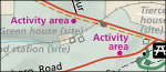
 I’ve got 11 Point Reyes maps, especially highlighting the backcountry wilderness areas and campsites.
 Here are 8 Apostle Islands maps, highlighting trails and camping areas on the islands in Apostle Islands National Lakeshore.
 The Statue of Liberty maps page features 4 maps of both parts of Statue of Liberty National Memorial, including Ellis Island.
 Here are 3 Devils Tower maps – the official park brochure map, a geologic map, and a topographic map.
 There are 5 maps on the Kennesaw Mountain maps page; the best three are the trail maps highlighting each area of the park.
 The Cedar Breaks maps page has 5 maps, including four detailed maps of the surrounding region in Dixie National Forest.
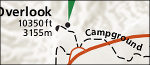
 There are 7 Craters of the Moon maps, highlighting campgrounds, trails, and detailed road maps.
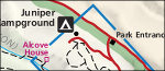 I’ve uploaded 6 Bandelier maps, with everything from campground layouts to trail and regional maps.
 I created some new pages as well! Introducing
  Newest is the
  For the latest update, I split things geographically, adding in