Hot Springs map from the park brochures
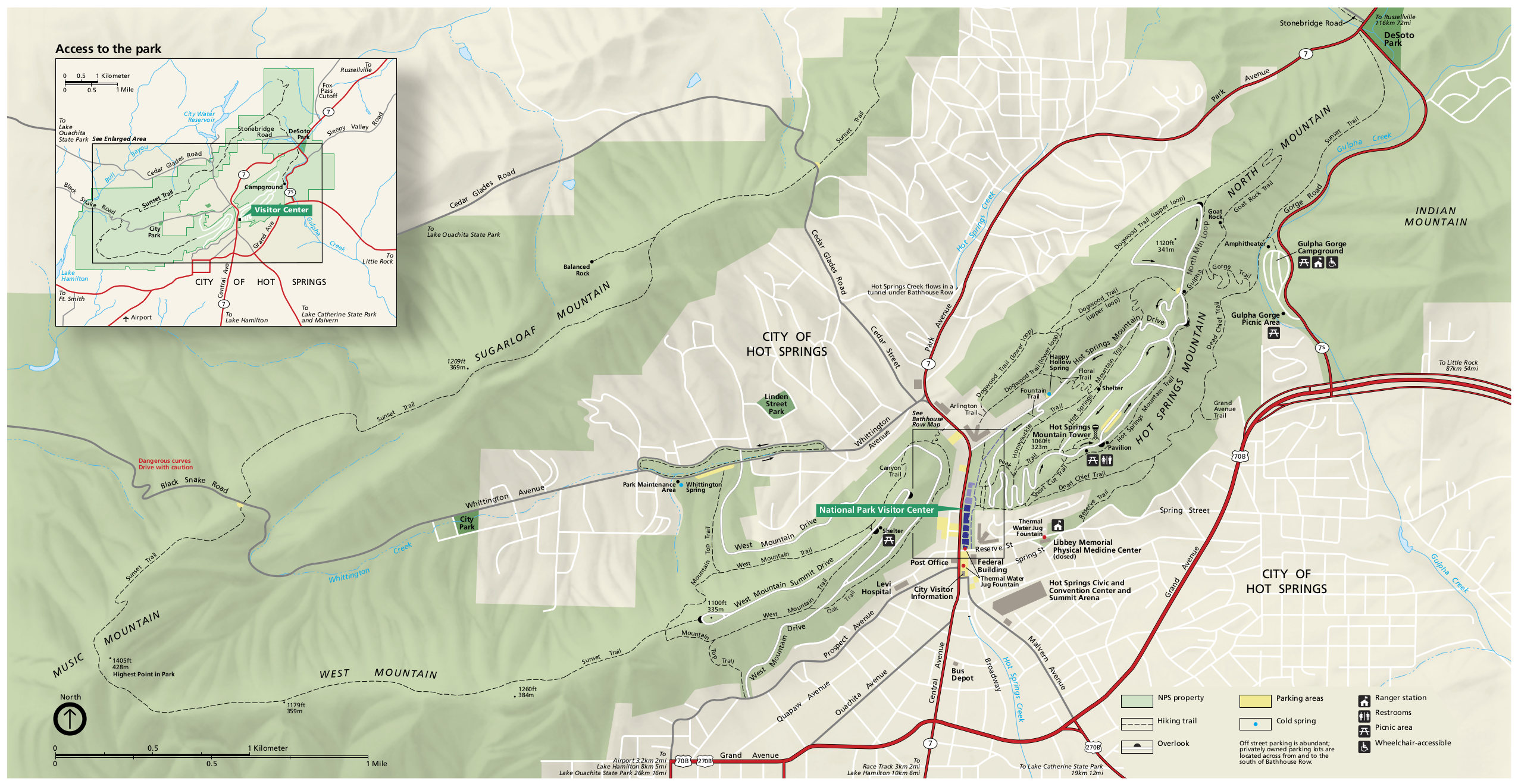 This is the complete Hot Springs National Park map from the brochure, showing the park, hiking trails, and city of Hot Springs. Click the image to view a full size map or download the PDF.
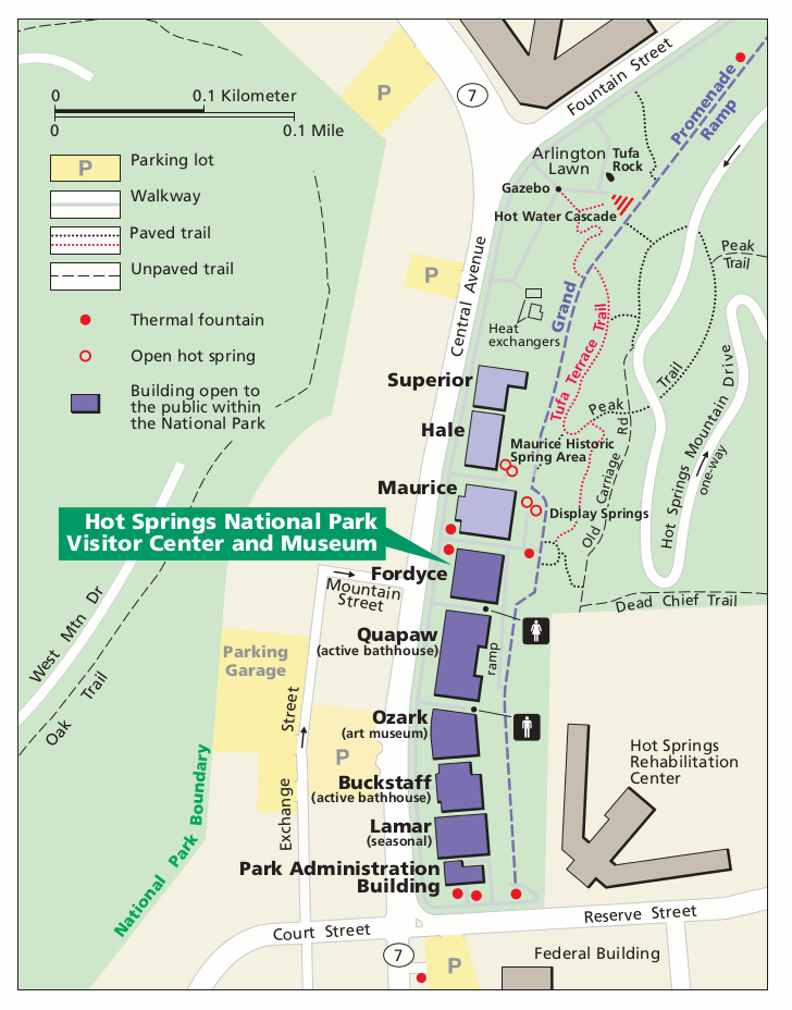 This is a Hot Springs visitor center area map, zoomed in on the most visited part of Hot Springs National Park including the bathhouses, springs, roads, parking, trails, and visitor center.
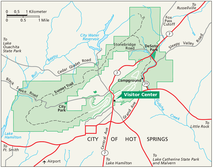 This is a regional map of Hot Springs that shows the roads and highways leading into and around the park from surrounding Arkansas. Click the image to view a full size map or download the PDF.
Hot Springs geologic map
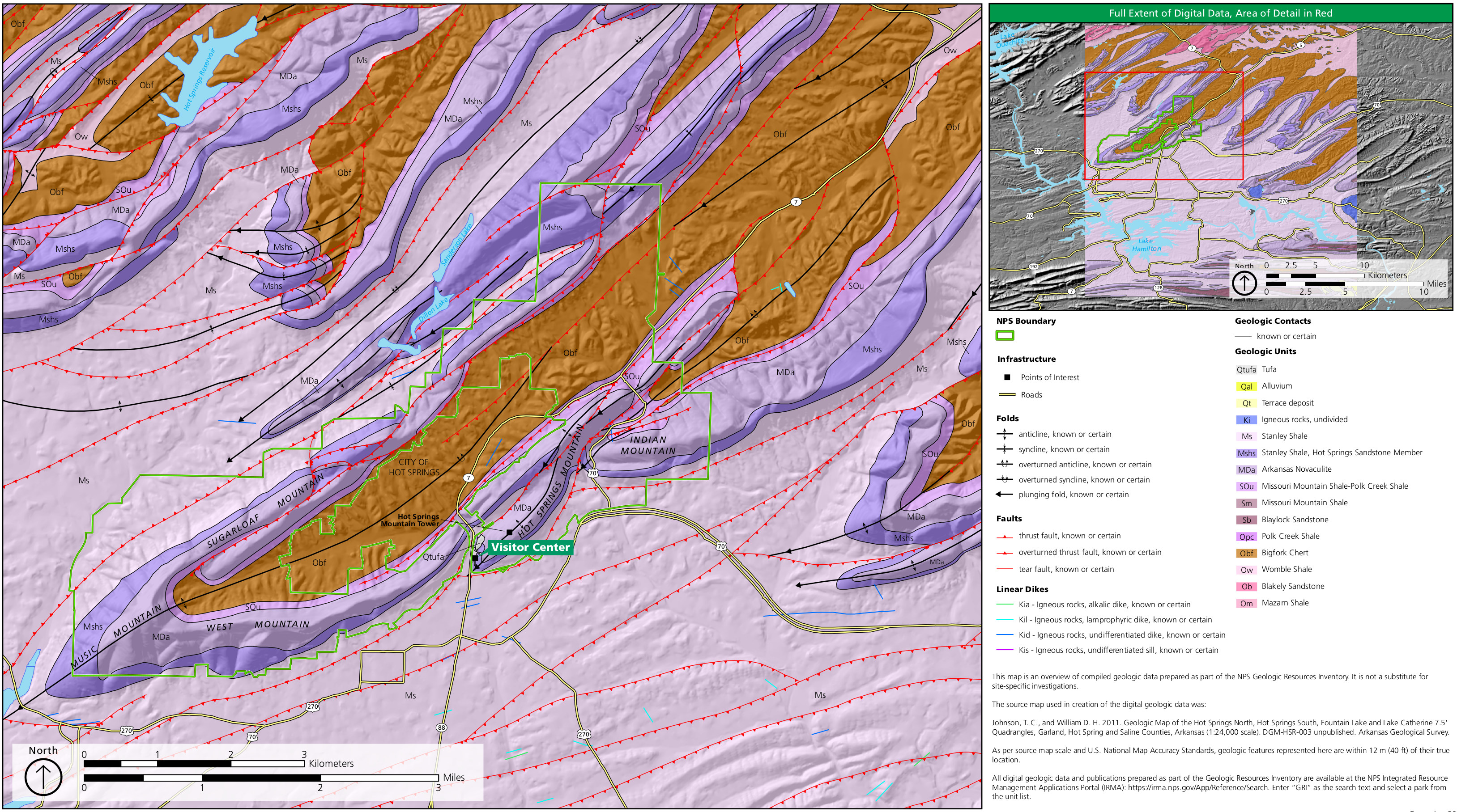 The geologic map of Hot Springs National Park zooms in on the national park lands while also showing the bedrock, folds, faults, and dikes in the surrounding region in Arkansas.
Hot Springs lodging map
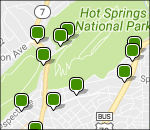 If you’re visiting Hot Springs National Park, you’ll likely want to stay in (shocker!) Hot Spring, AR. To the right you can open an Expedia interactive lodging map of Hot Springs, making it easy to see where your choices are in reference to the park. I’d also recommend browsing the top-rated Hot Springs lodging in order to read reviews, compare prices, and see photos and amenities of each place you’re considering.
Hot Springs topo map
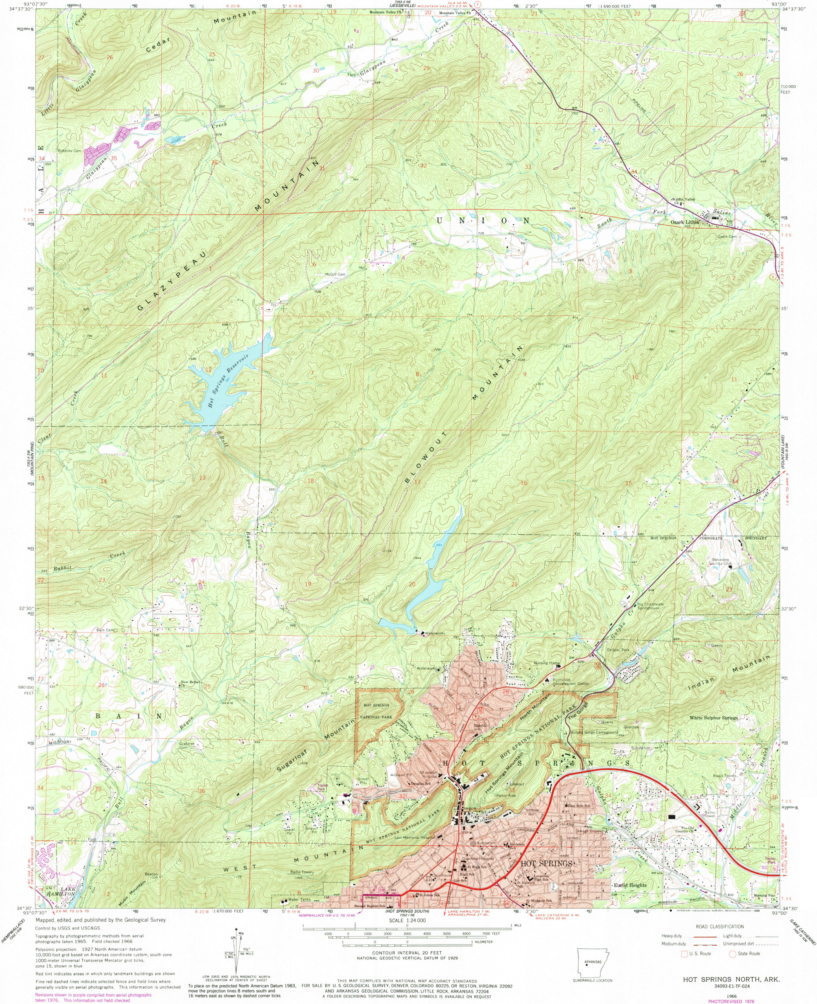 Here’s a Hot Springs topographic map, which includes a large section of park lands as well as the town of Hot Springs, Arkansas and the surrounding hills – Sugarloaf Mountain and Hot Springs Mountain.
…and more!
< Return to National Park Maps home
< Return to Park List
< Return to List by State