Big Cypress brochure maps
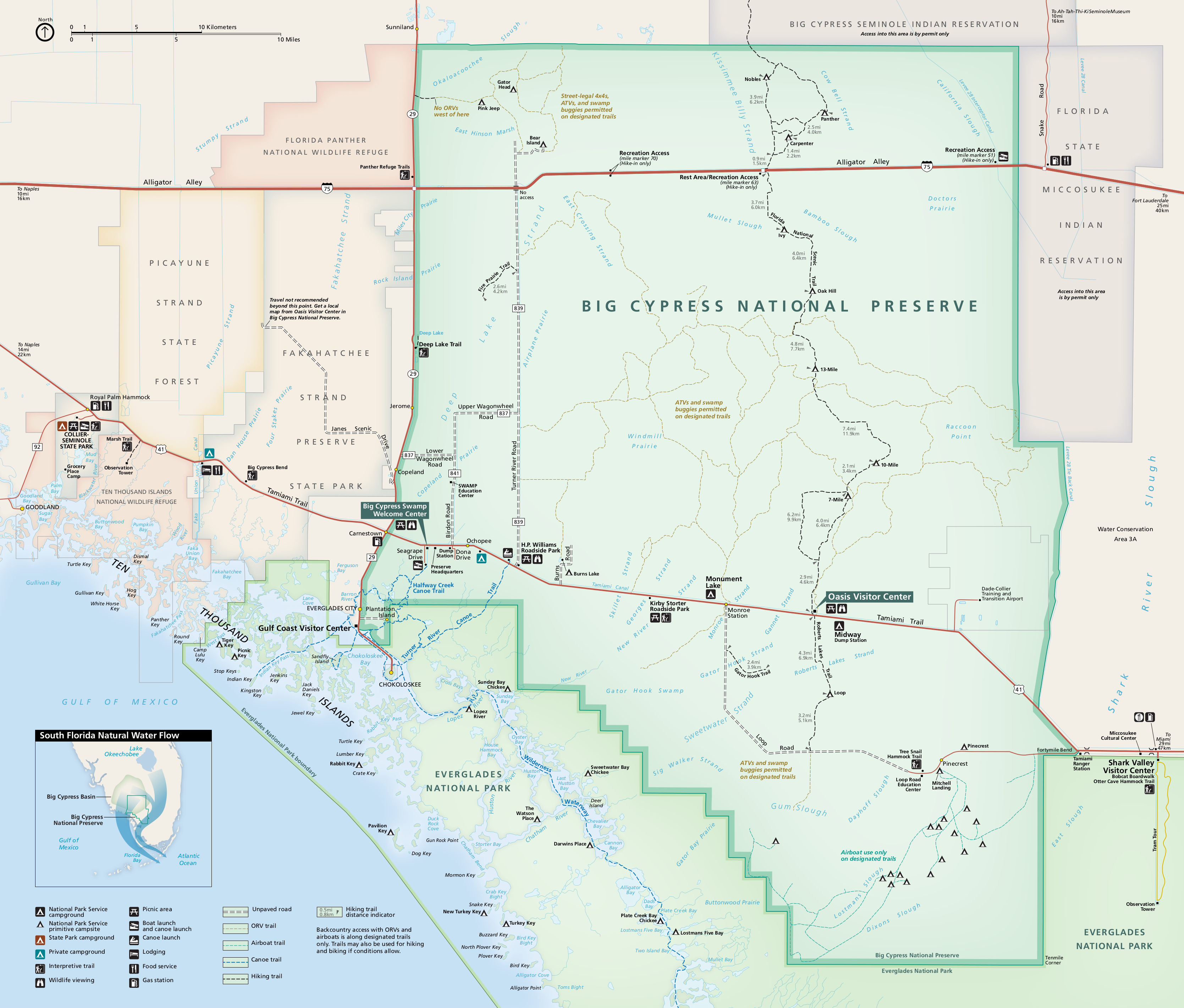 Here’s the main Big Cypress map, showing roads, trails, and points of interest, including part of Everglades National Park. Click the image to view a full size map or download the PDF.
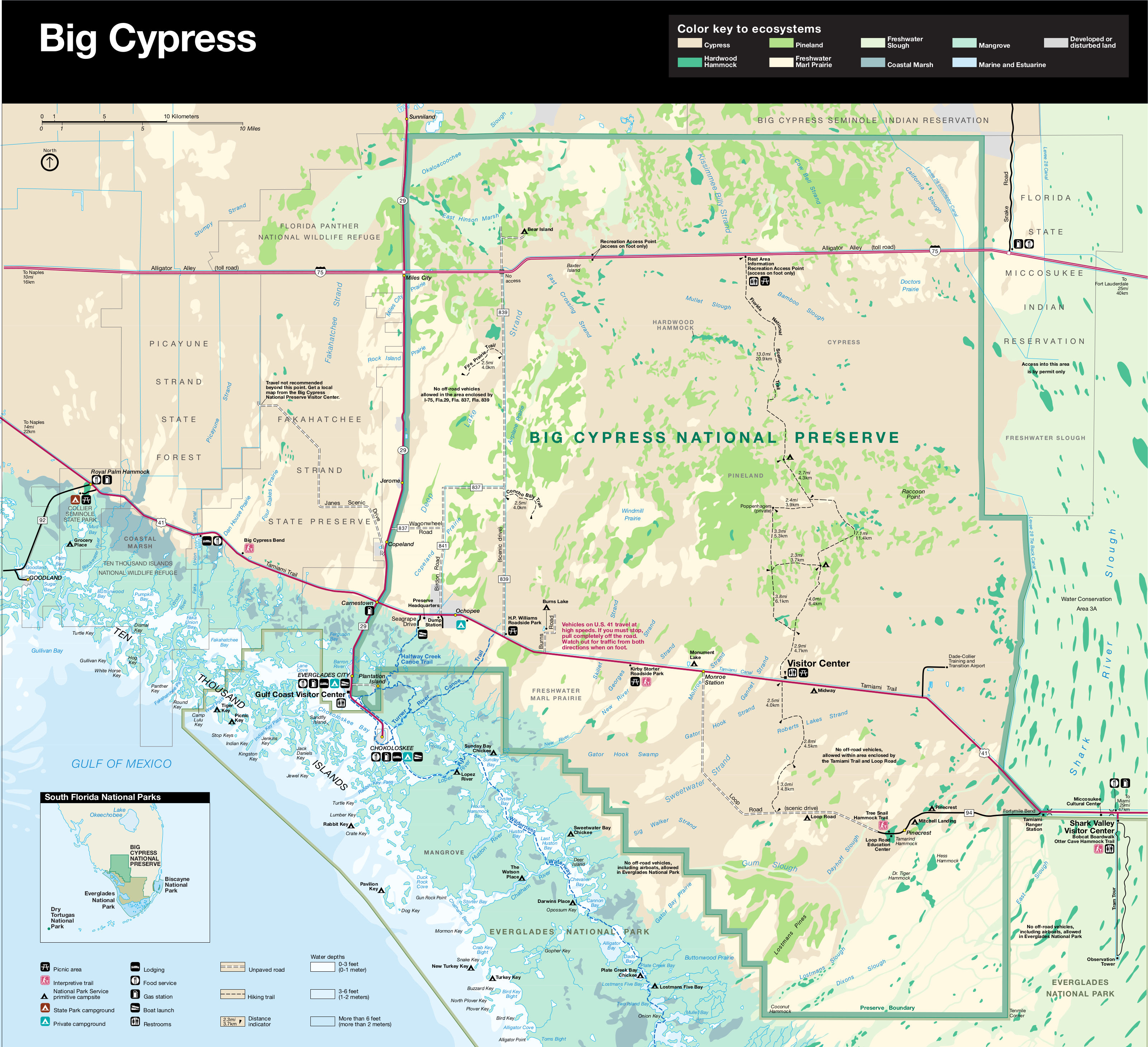 This is the previous Big Cypress National Preserve map. It’s no longer updated, but I like it because it shows all the different ecosystems. Click the image to view a full size map or download the PDF.
Various Big Cypress maps
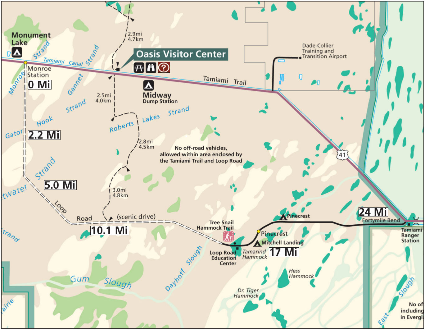 Here’s a Big Cypress loop road scenic drive map, showing the route of the unpaved scenic drive. Essentially, it’s a cropped down version of the map above, but it also includes mile-marker labels.
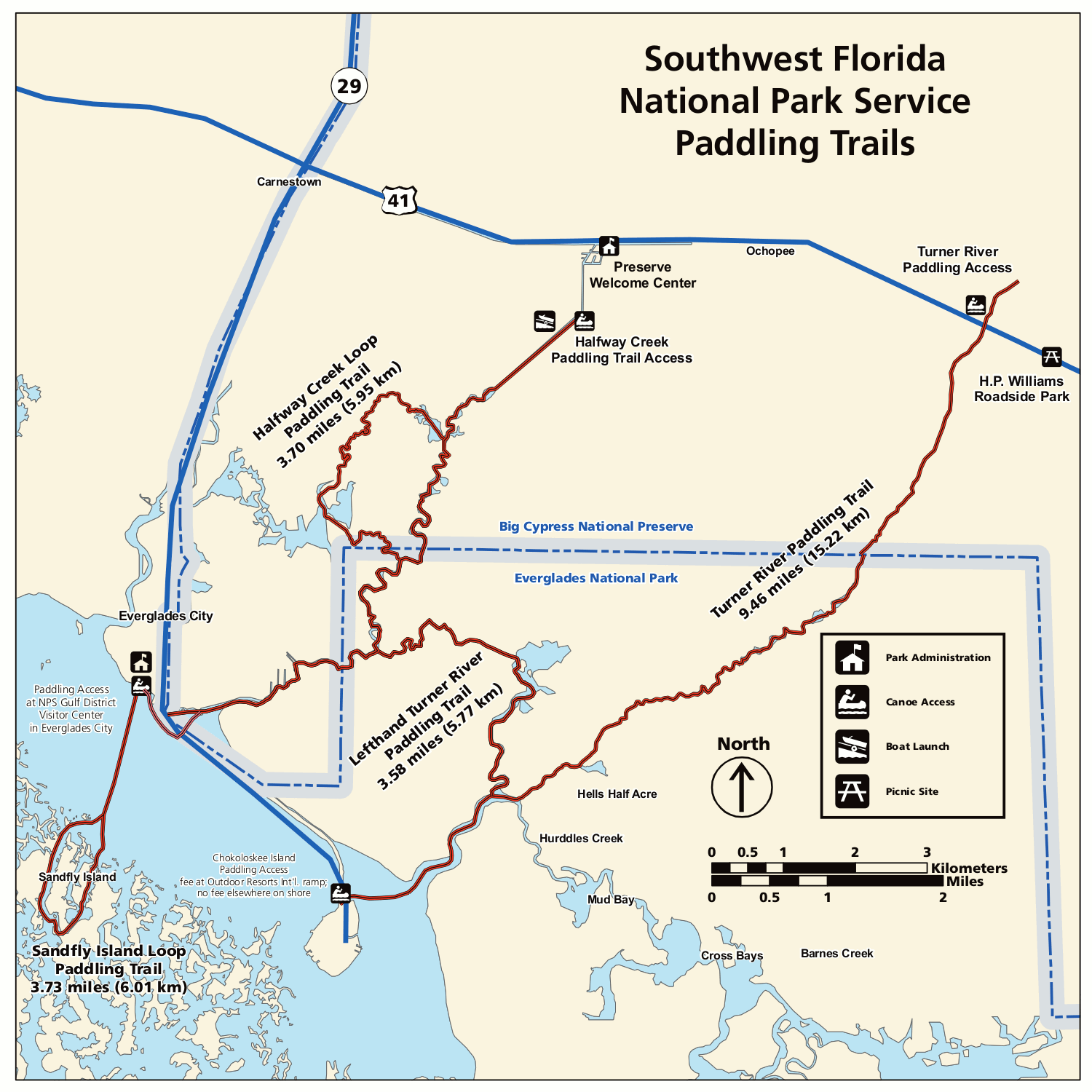 Here’s a Big Cypress canoe trails map, showing a few of the paddling routes accessible from the preserve that lead into the Everglades. Click the image to view a full size GIF (200 kb) or download the PDF (600 kb).
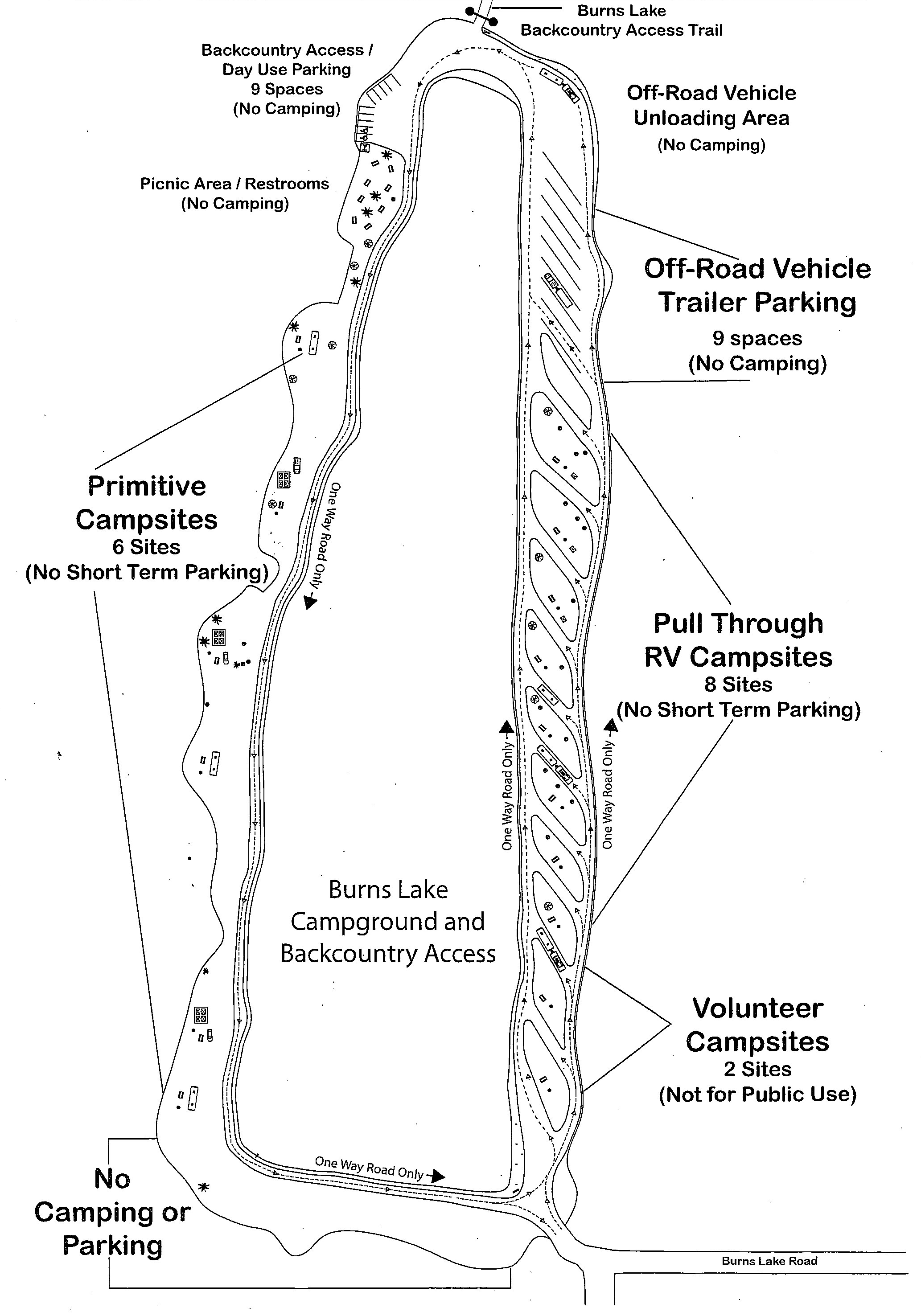 This is a Burns Lake Campground map, zooming in on this campground just off the Tamiami Trail (Highway 41). It shows both the primitive campsites as well as the pull-through RV sites.
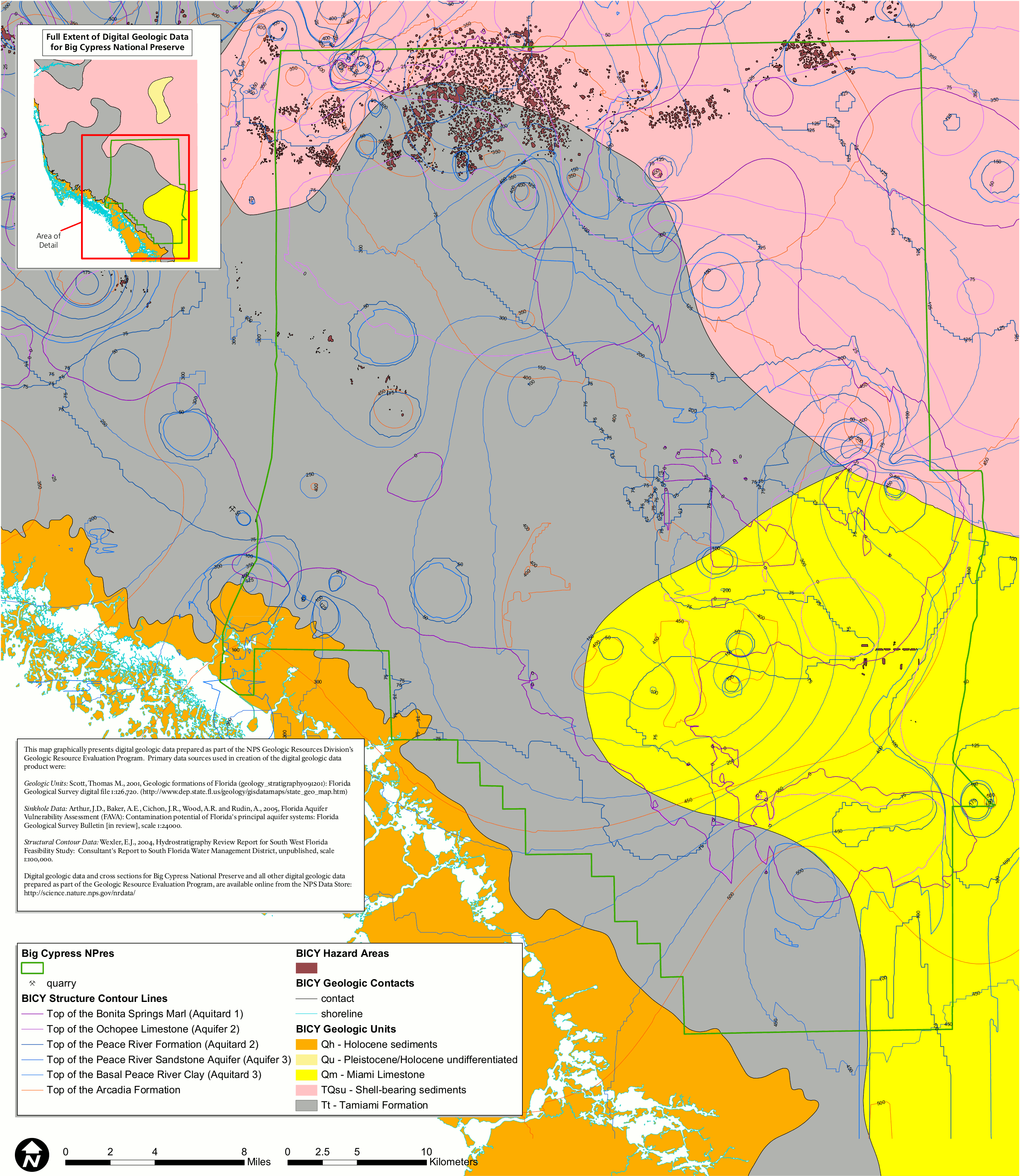 Here’s a Big Cypress geologic map, showing the different layers of limestone, sediments, and formations that make up the park’s bedrock, with particular emphasis on water flow.
Big Cypress ORV maps
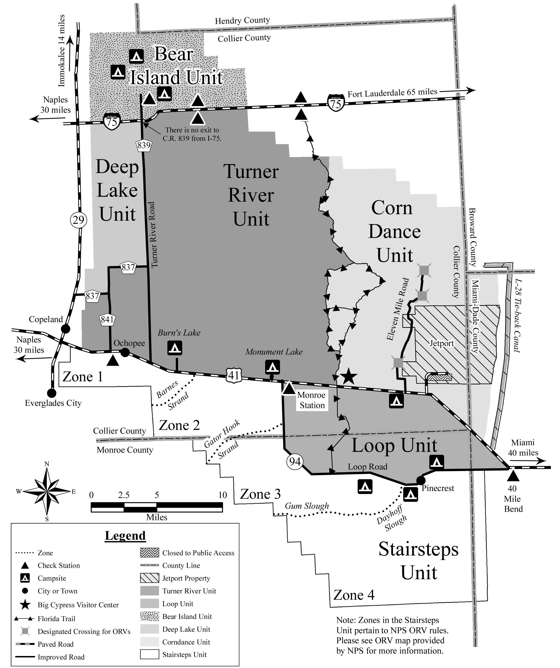 Here’s a unit map of Big Cypress, providing a zoomed out context for the detailed ORV trail maps below. These maps roughly show the area from I-75 in the north to the Tamiami Trail in the south.
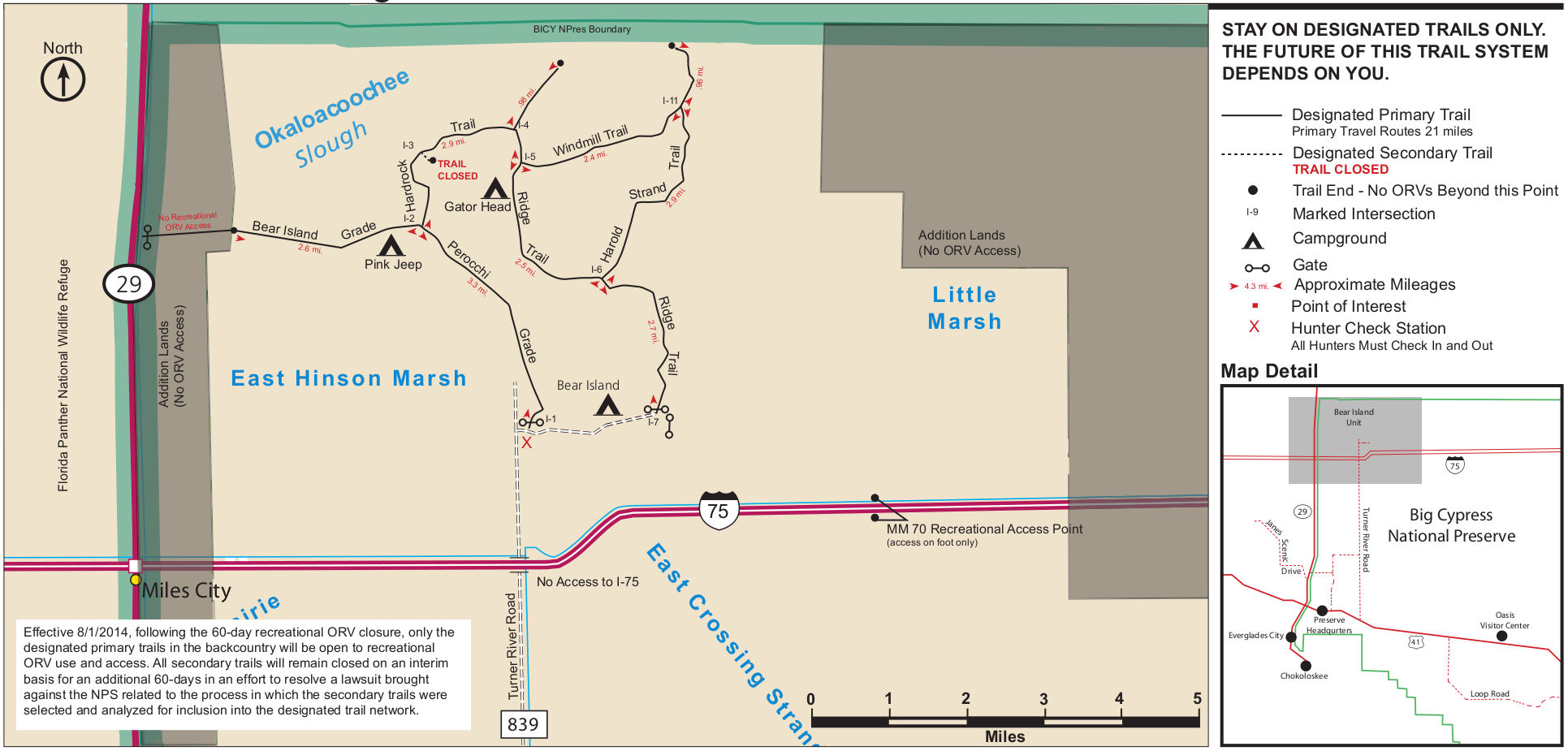 The Bear Island ORV map shows the ORV trails and campsites accessible from the Turner River Road. Although these lands are adjacent to I-75, there is no direct access from the freeway.
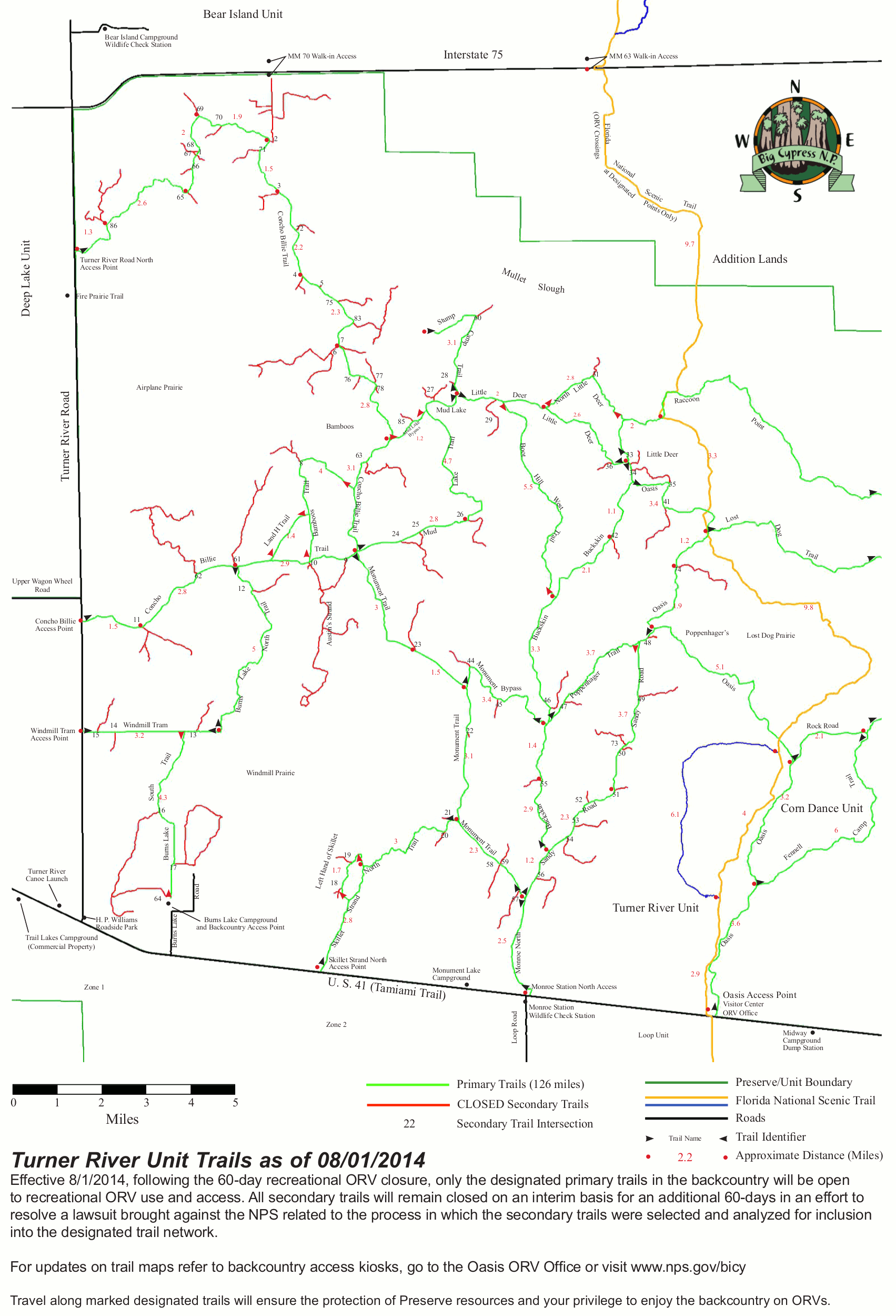 Here’s a Turner River ORV map, covering the largest area of any of these ORV maps. There are several access points to these trails from the Tamiami Trail and Turner River Road.
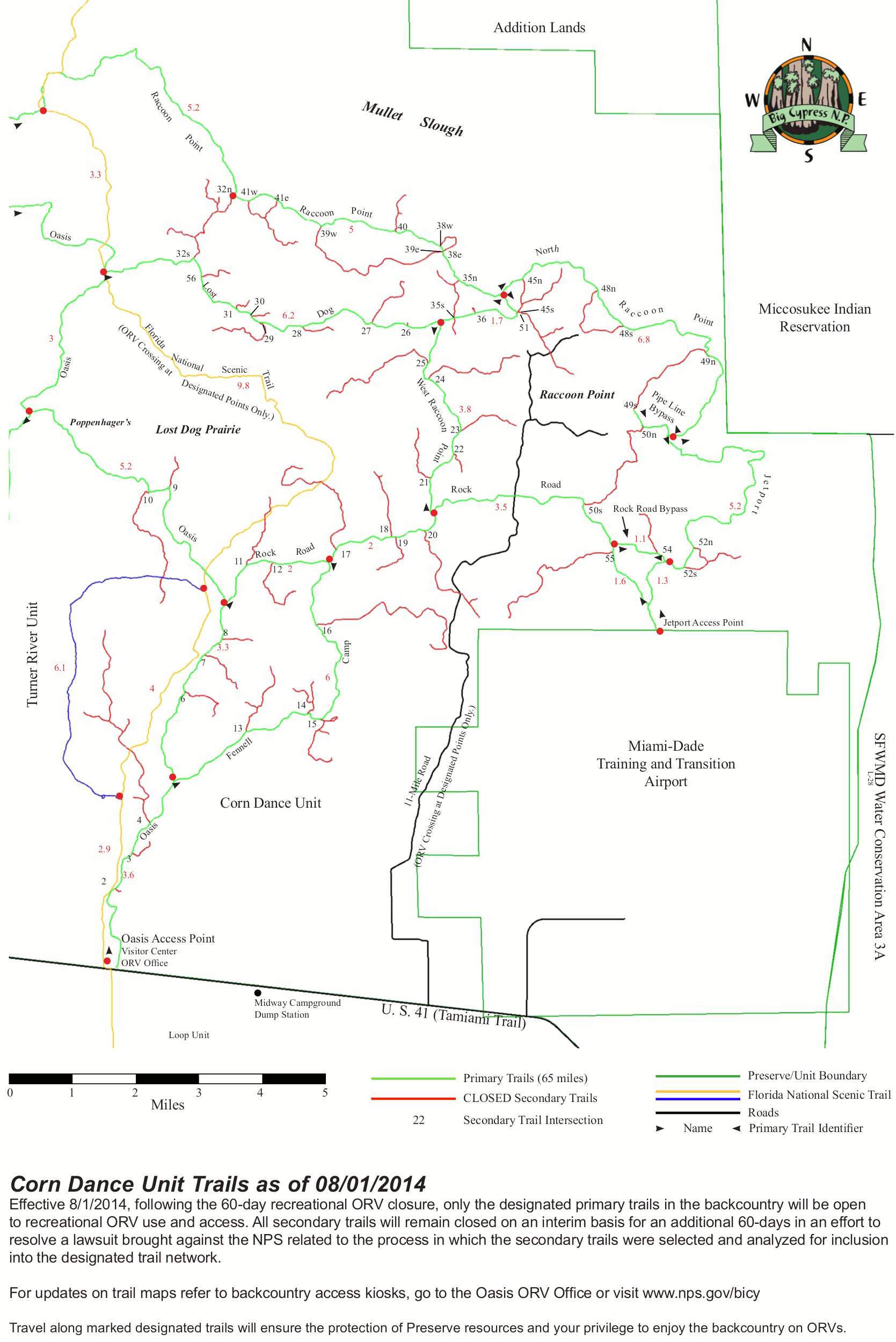 This is a Corn Dance ORV map, which shows the complex network of ORV trails throughout these unit. The Florida National Scenic Trail (Florida Trail) is also shown.
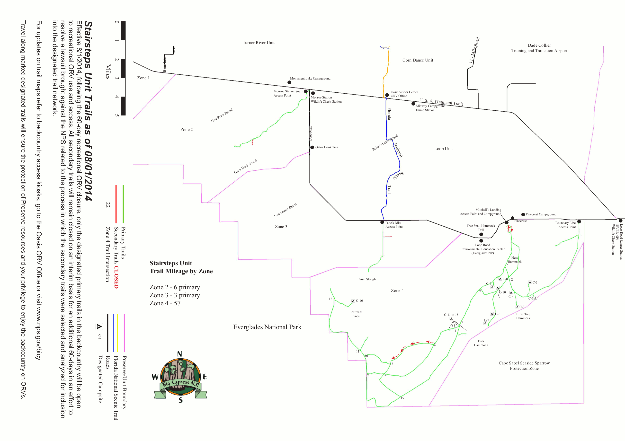 The Stairstep ORV map covers the southernmost section of Big Cypress National Preserve, south of the Tamiami Trail (U.S. 41) and the loop road scenic drive.
…and more!
< Return to National Park Maps home
< Return to Park List
< Return to List by State