White House map from the official brochure
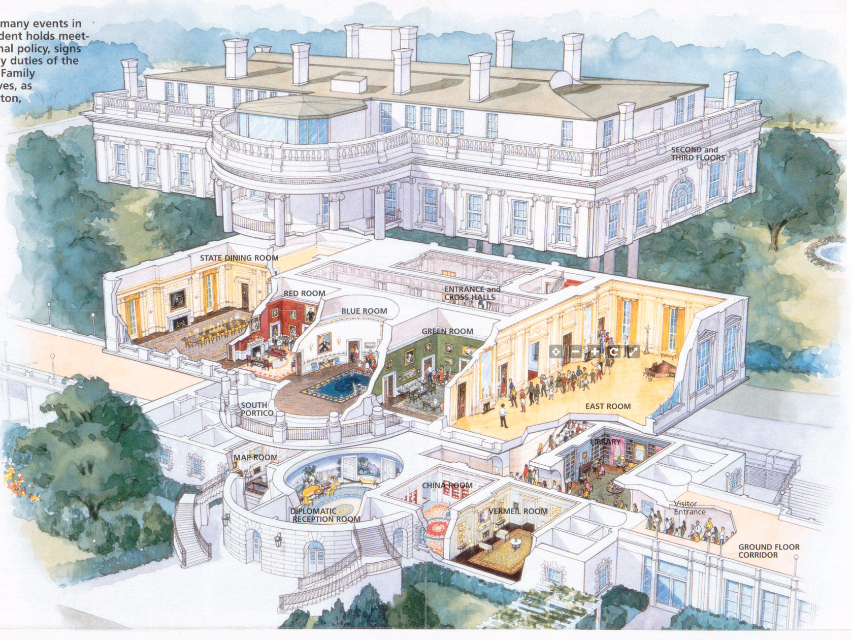 Here’s the White House map of the interior rooms from the park brochure, showing a cutout view of the lower floor rooms that are accessible to the touring public. (See maps of other rooms lower on this page.)
White House grounds maps
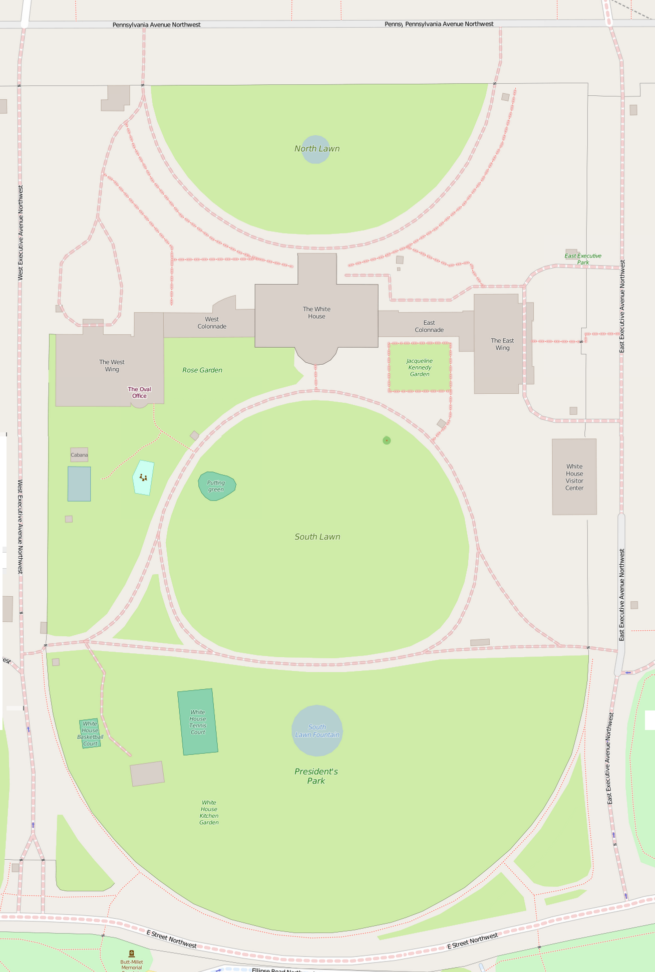
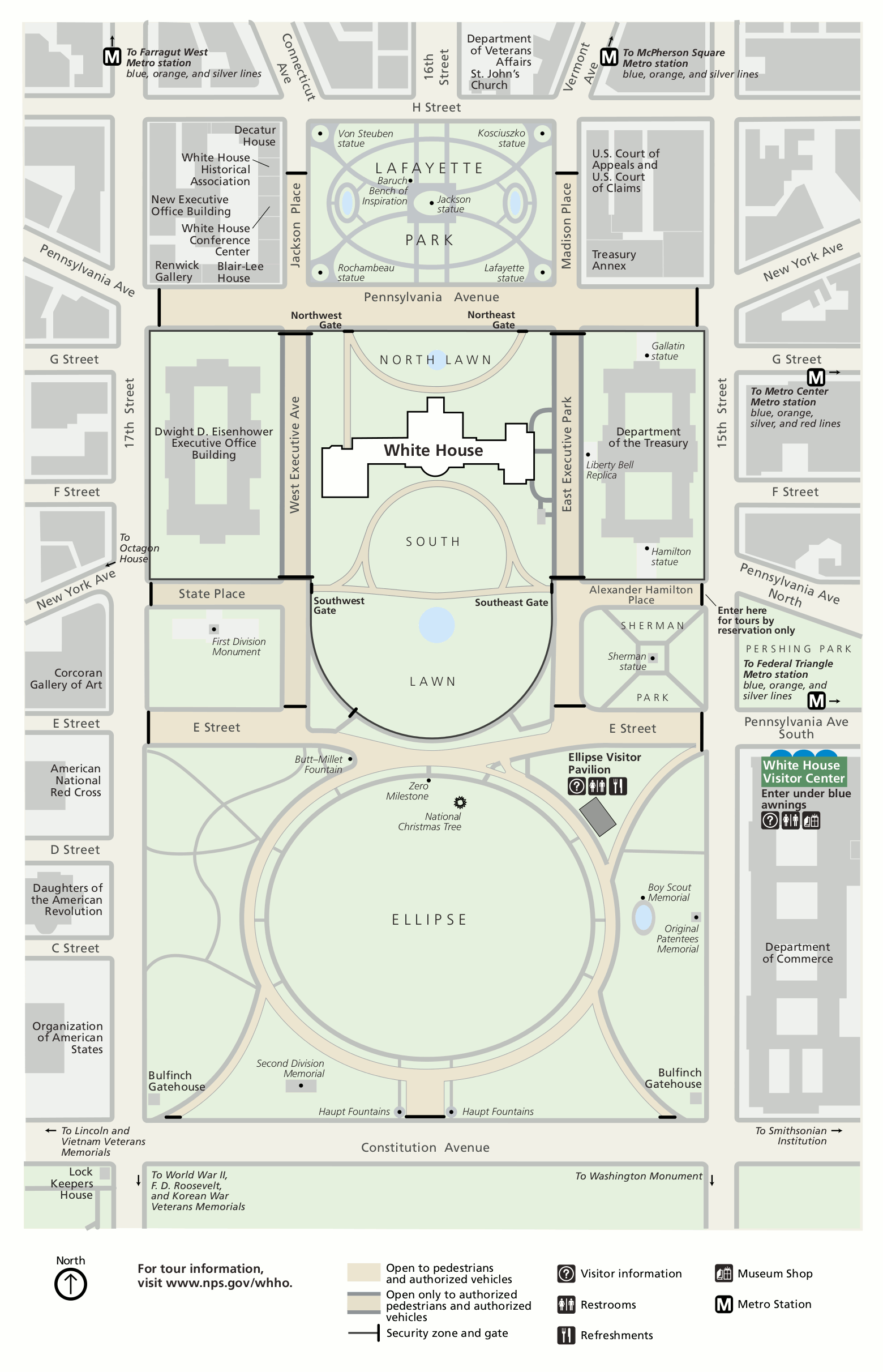 This White House grounds map shows the entire grounds of the White House, including the South Lawn, Ellipse, and location of the National Christmas Tree. Click the image to view a full size map or download the PDF.
 Here’s a White House garden map. This map focuses on the landscape features of the White House, including the 2025 transformation of the Rose Garden into something—shall we say—somewhat less “rosy” and “gardeny.”
White House lodging map
 If you stay near the White House during your D.C. trip, you’ll be pretty conveniently located for sightseeing. To the right, you can open an Expedia interactive lodging map of D.C. that shows different hotel options in relation to the White House; it can be filtered by price or rating. You can also browse the top-rated D.C. hotels to compare prices, reviews, amenities, and distances from the White House.
Assorted White House maps
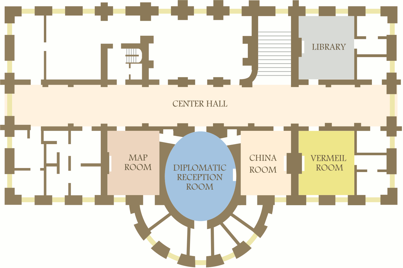 The White House Ground Floor map shows the few public rooms on the ground floor (the rest of the rooms down here are mostly for infrastructure and staff support). (Credit to ZooFari.)
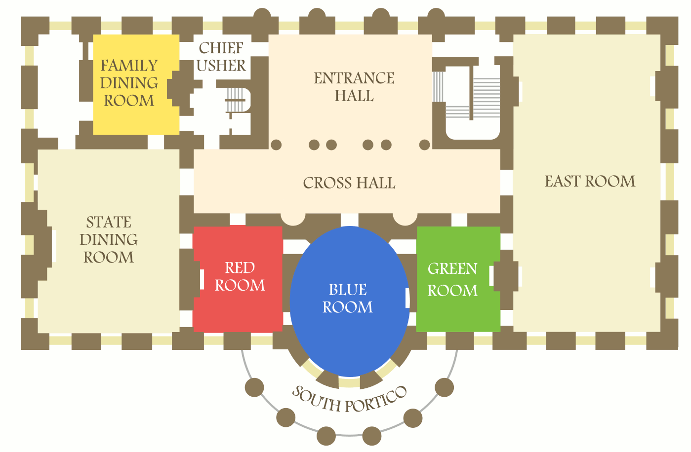 This is a White House First Floor map, showing the rooms on the main floor that serve as ceremonial and receiving rooms for guests and events. You can see these on White House tours. (Credit to ZooFari.)
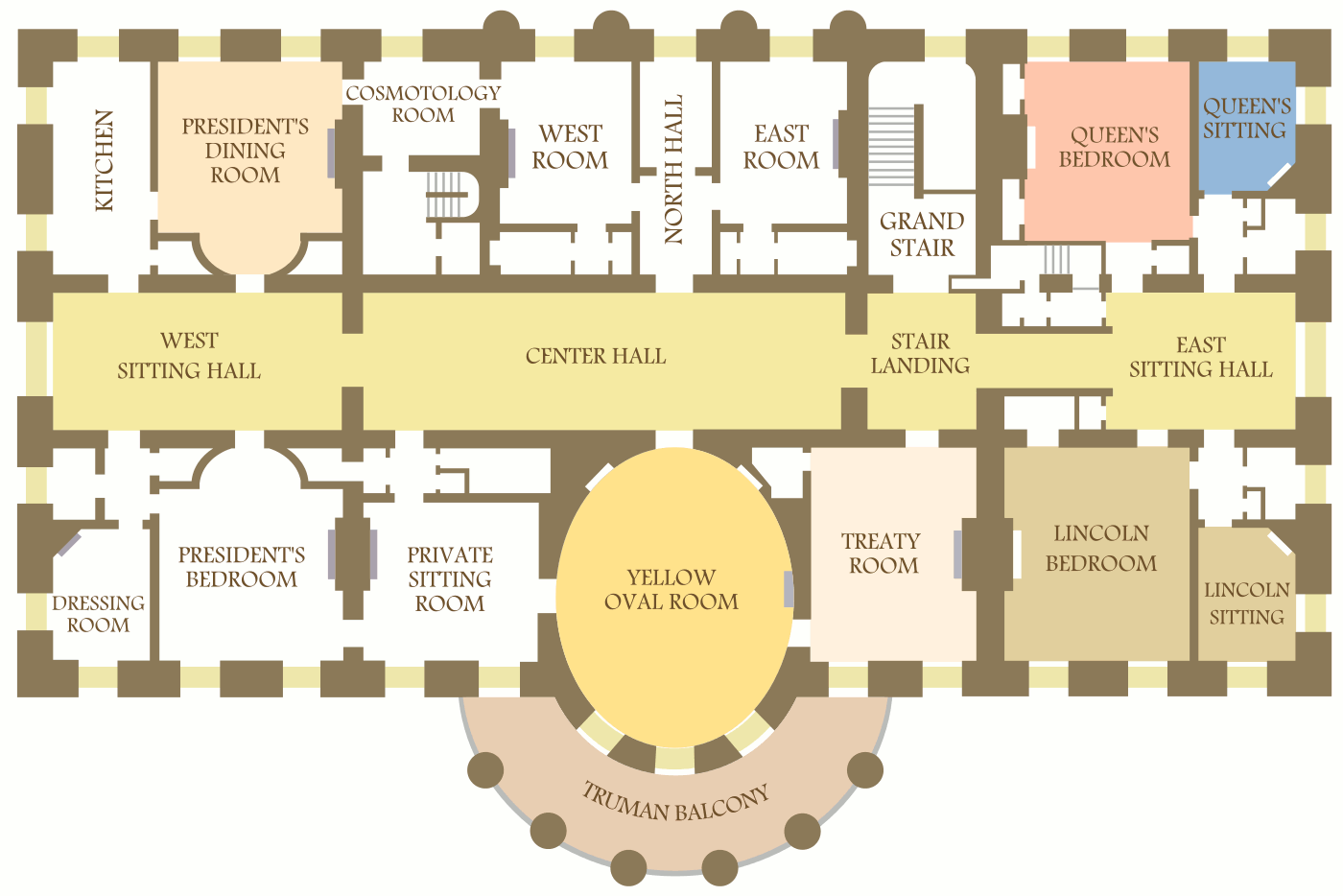 The White House Second Floor map includes the large second floor of the White House that serves as the President’s family living quarters. This is closed to the general touring public. (Credit to ZooFari.)
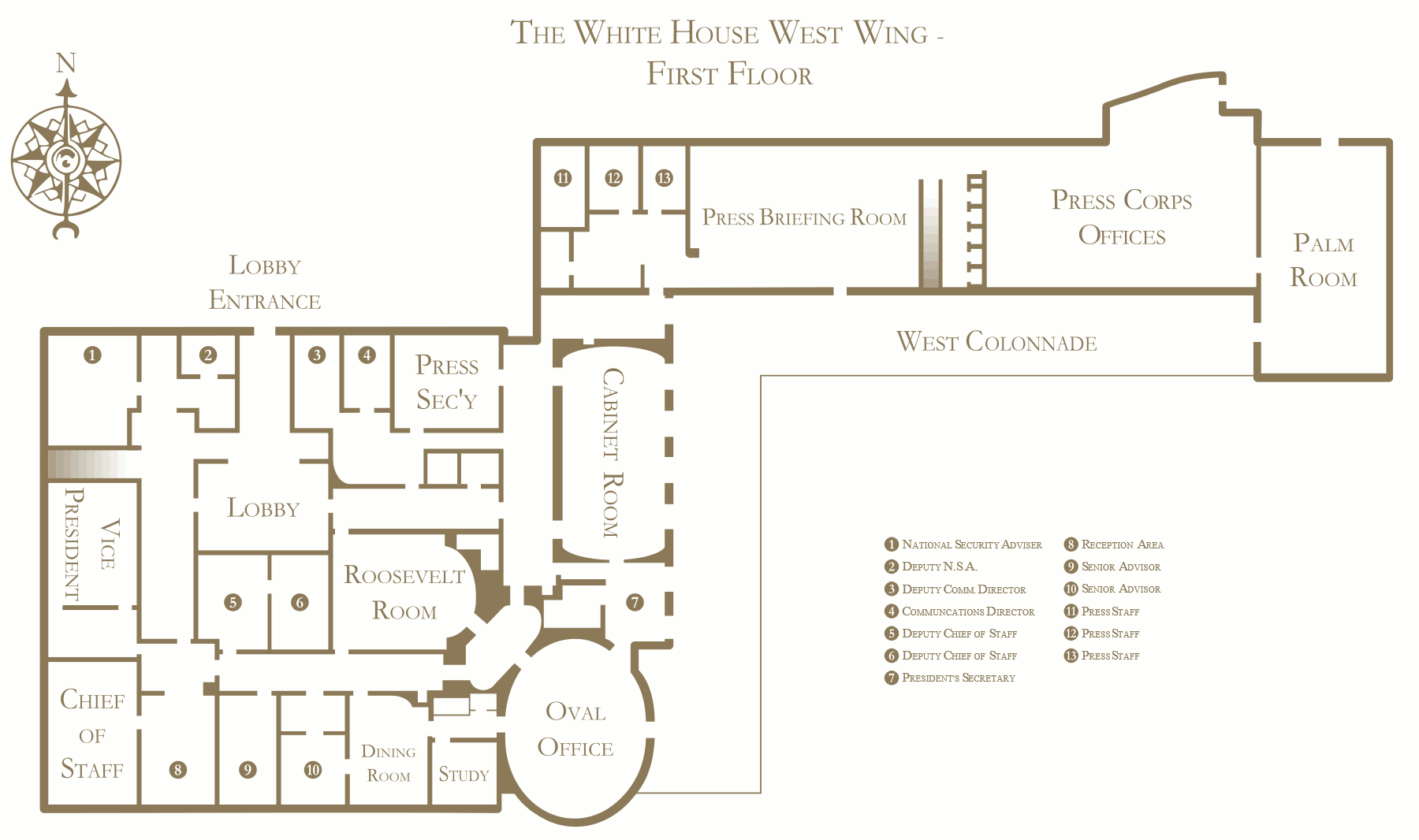 Here’s a White House West Wing map, labeling the rooms of the first floor of the West Wing, where most of the action occurs around the Oval Office. (Credit to Adam Lenhardt.)
 Here’s a White House map from 1900, focusing on the first floor. Compare it to the first floor map above to see how things have changed. (You’ll need to rotate it for proper orientation.)
 Here’s an old map of the White House grounds, zoomed in more than the map above to show the area inside the security perimeter. (This map was courtesy of OpenStreetMas circa 2015.)
Official National Mall maps
If you’re visiting other sites in DC along the National Mall, you may want to check out the National Mall Maps page, focusing on the memorials and monuments along the Mall. Here are a couple maps of the Mall, from the National Park Service.
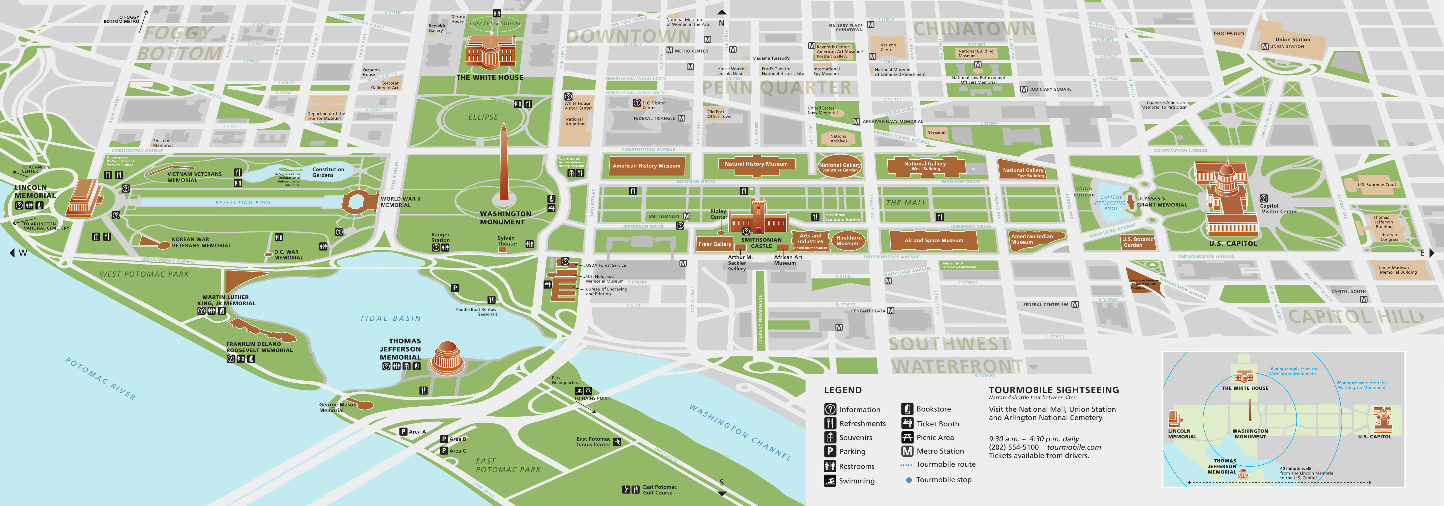
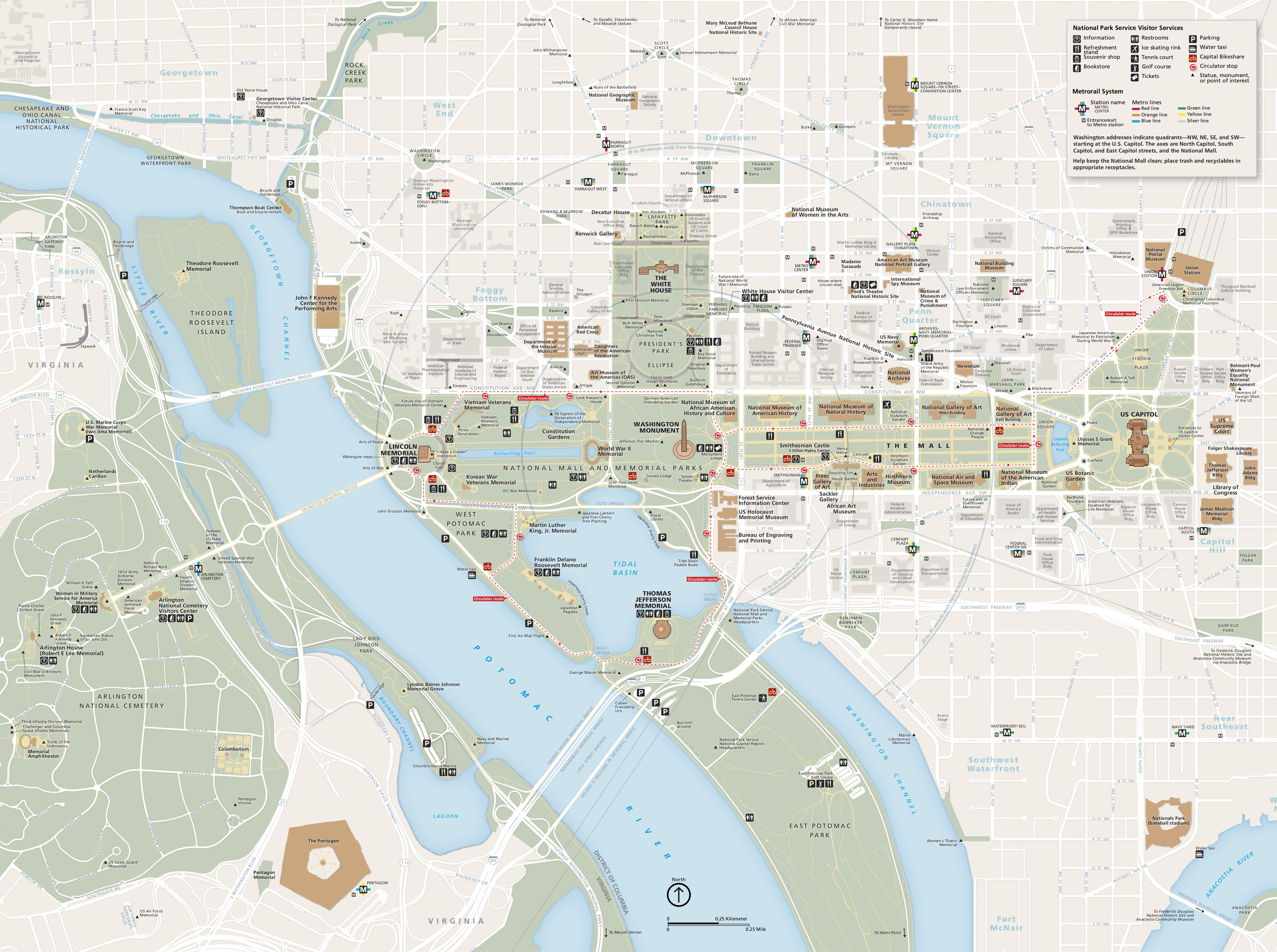 This is the National Mall map from the official brochure that shows all the sites and attractions on the Mall and in surrounding DC. Click the image to view a full size map or download the PDF.
 Here’s a 3D National Mall map, showing just the Mall area and White House from an oblique view with 3D buildings. Click the image to view a full size map or download the PDF.
…and more!
< Return to National Park Maps home
< Return to Park List
< Return to List by State