Statue of Liberty and Ellis Island ferry map
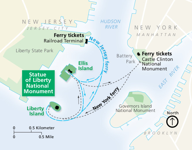 This is a Statue of Liberty ferry map that shows the routes to Liberty Island and Ellis Island from both Manhattan and New Jersey. Click the image to view a full size map or download the PDF.
Official Statue of Liberty map
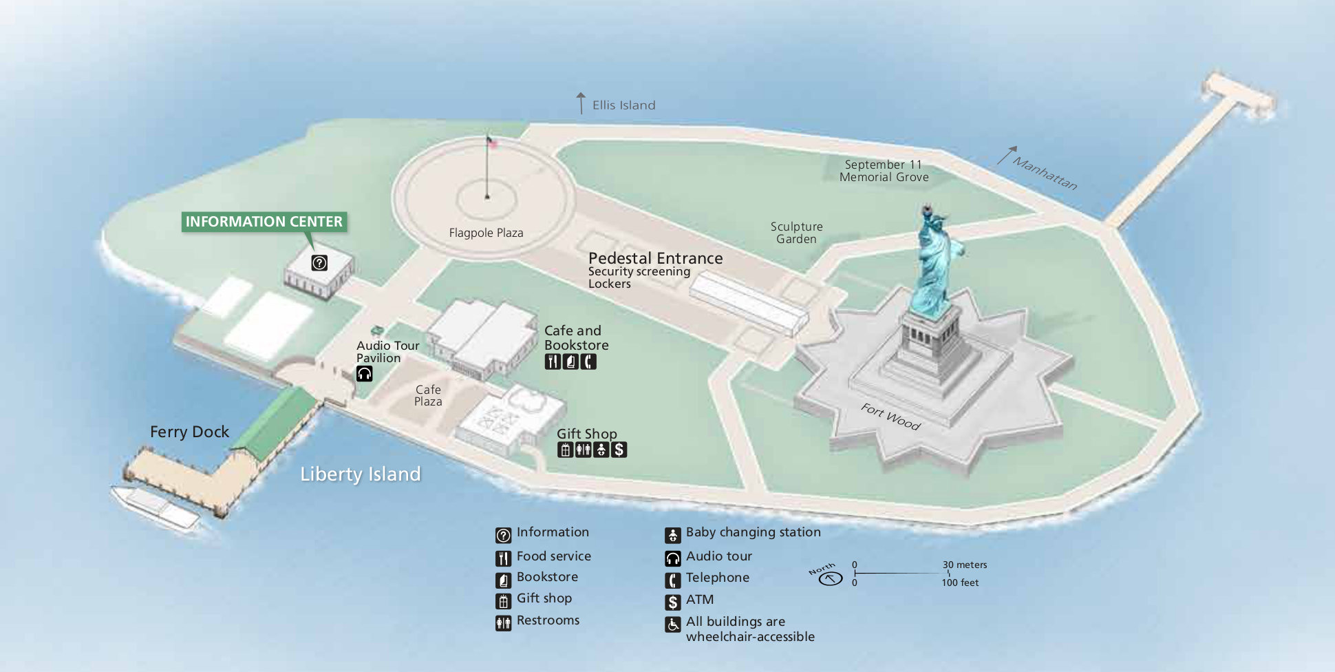 This is a Statue of Liberty map showing Liberty Island, the ferry dock, the pedestal entrance, and Fort Wood. Click the image to view a full size map or download the PDF.
Official Ellis Island map from the park brochures
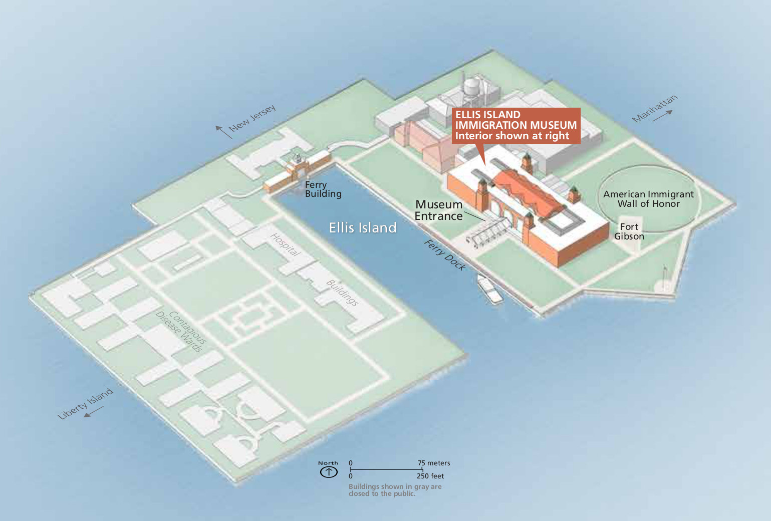 Here is an Ellis Island map, showing the immigration museum, American Immigrant Wall of Honor, Fort Gibson, ferry building, and ruins of past structures, as well as where the passenger ferry docks.
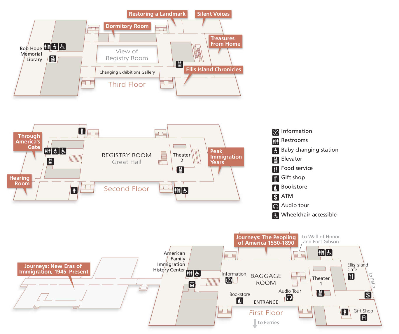 This is an Ellis Island floor map, showing the various exhibits and each of the three main floors including the Baggage Room, Registry Room (Great Hall), and third floor overlook of the Great Hall.
…and more!
< Return to National Park Maps home
< Return to Park List
< Return to List by State