If you’re looking for a Gateway National Recreation Area map, you’ve come to the right place; currently I’ve collected 31 free Gateway maps to view and download. (PDF files and external links will open in a new window.) Here you’ll find maps that show the entire park and many that zoom in on the specific districts. You can also browse the best-selling Gateway maps and books on Amazon.
Gateway map from the park brochure
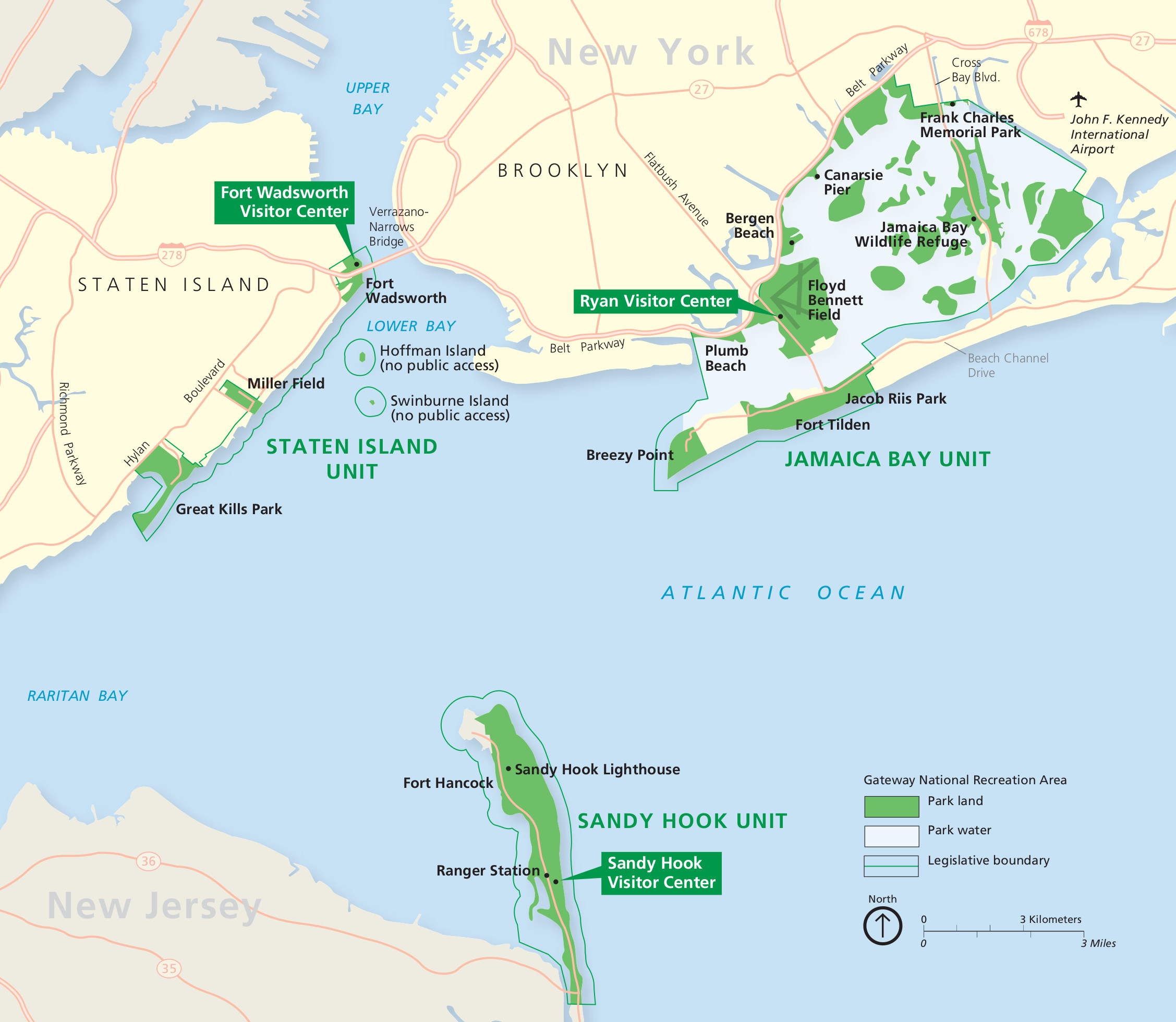 Here is the official Gateway National Recreation Area map, showing the layout of the park: Jamaica Bay, Staten Island, and Sandy Hook. Click the image to view a full size JPG (500 kb) or download the PDF (1.0 mb).
Jamaica Bay maps of Gateway
 This detailed Jamaica Bay map (7.9 mb) comes from a wayside exhibit at Jamaica Bay Wildlife Refuge between East and West Pond. It covers similar terrain to the map below, but in more realistic colors.
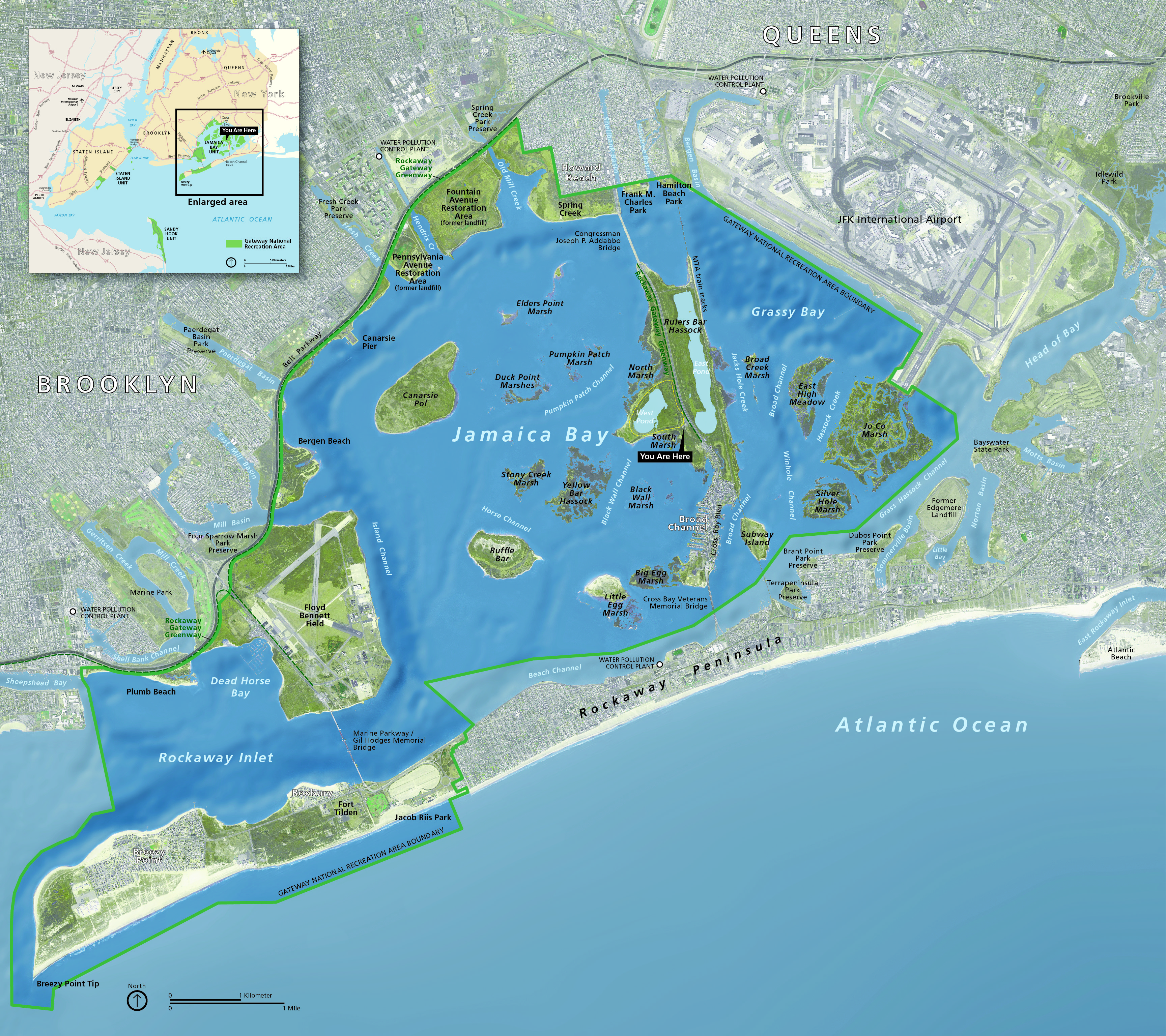
 This is a Jamaica Bay map showing an overall view of the entire Jamaica Bay unit of Gateway National Recreation Area. Click the image to view a full size JPG (1.0 mb) or download the PDF (950 kb).
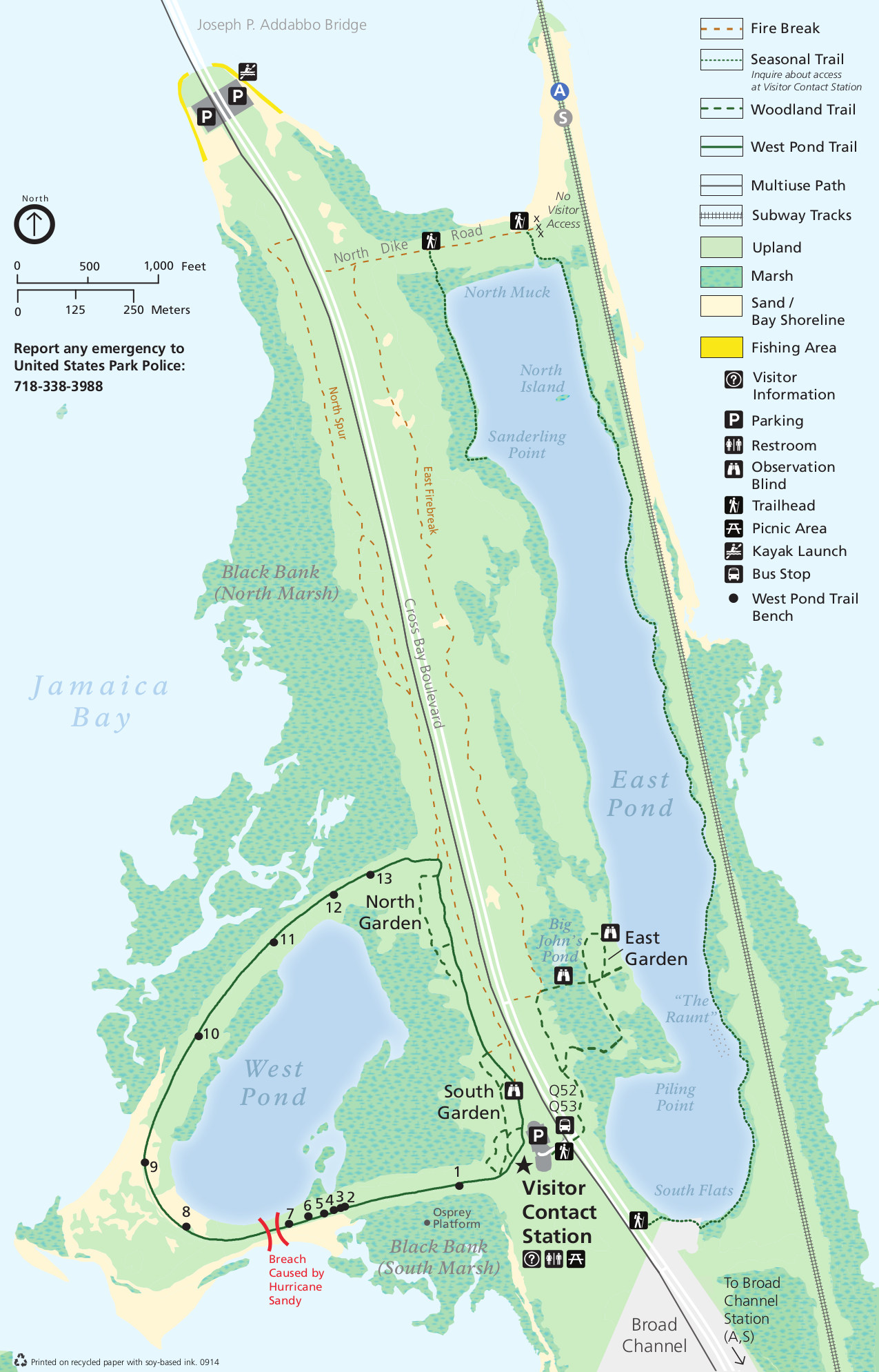 This is the Jamaica Bay Wildlife Refuge map (500 kb), zoomed in on the refuge that includes East and West Pond and the nearby trails through the marshes and uplands in Brooklyn, NY.
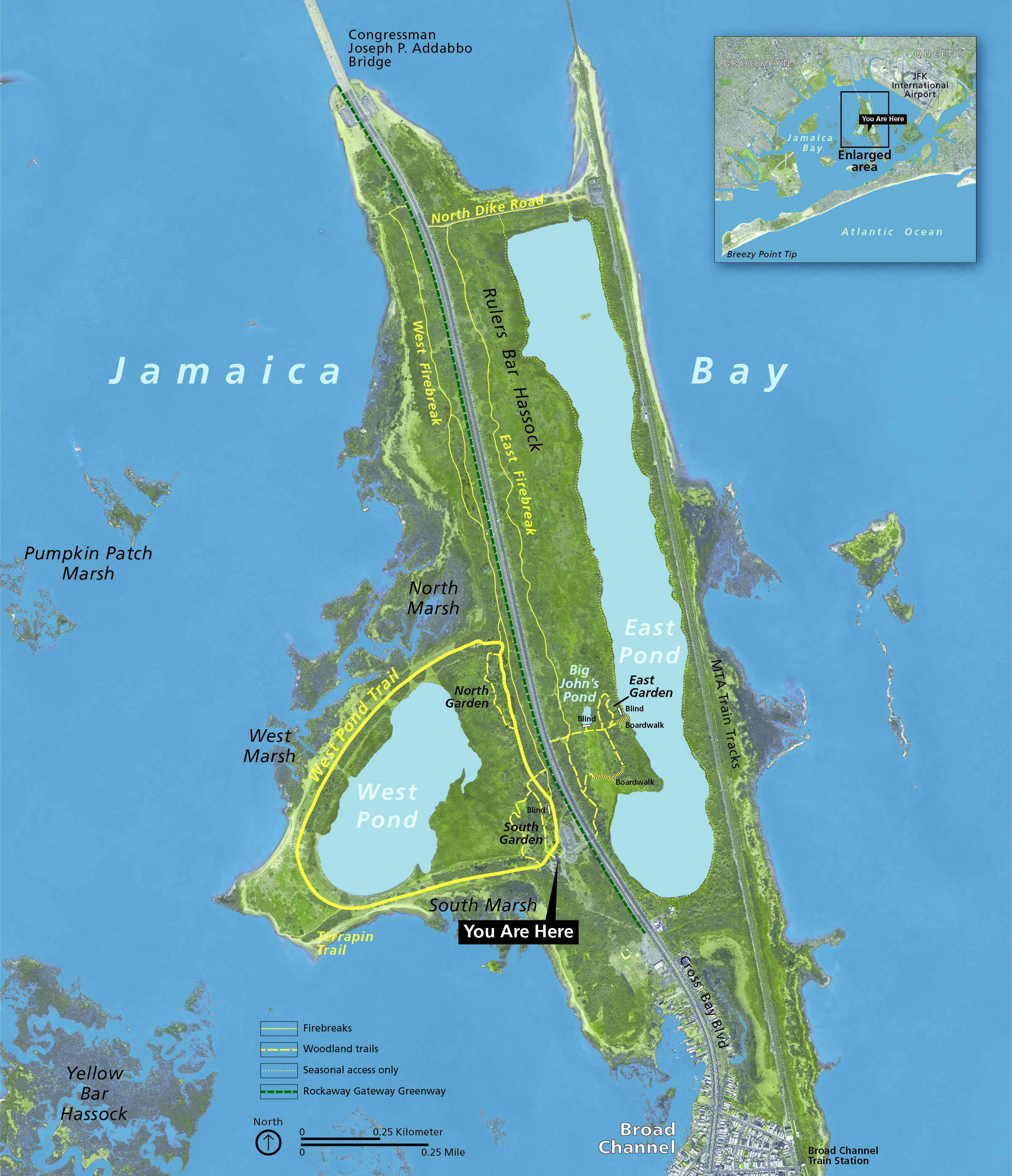 Here’s a West Pond trail map (3.9 mb), similar to the one directly above, but much better looking. It also includes Big John’s Pond and East Pond, as well as the garden trails (north, south, and east).
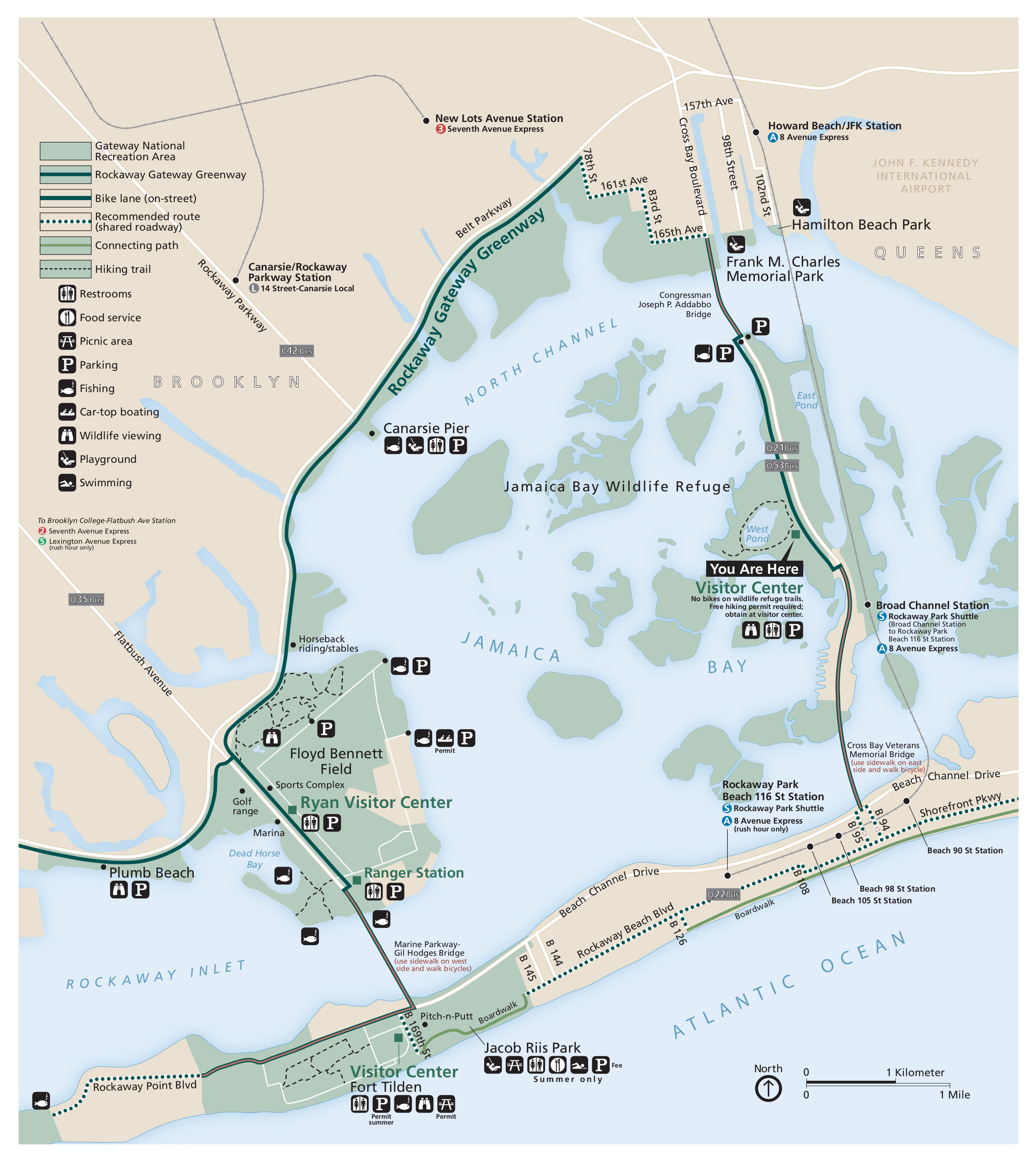
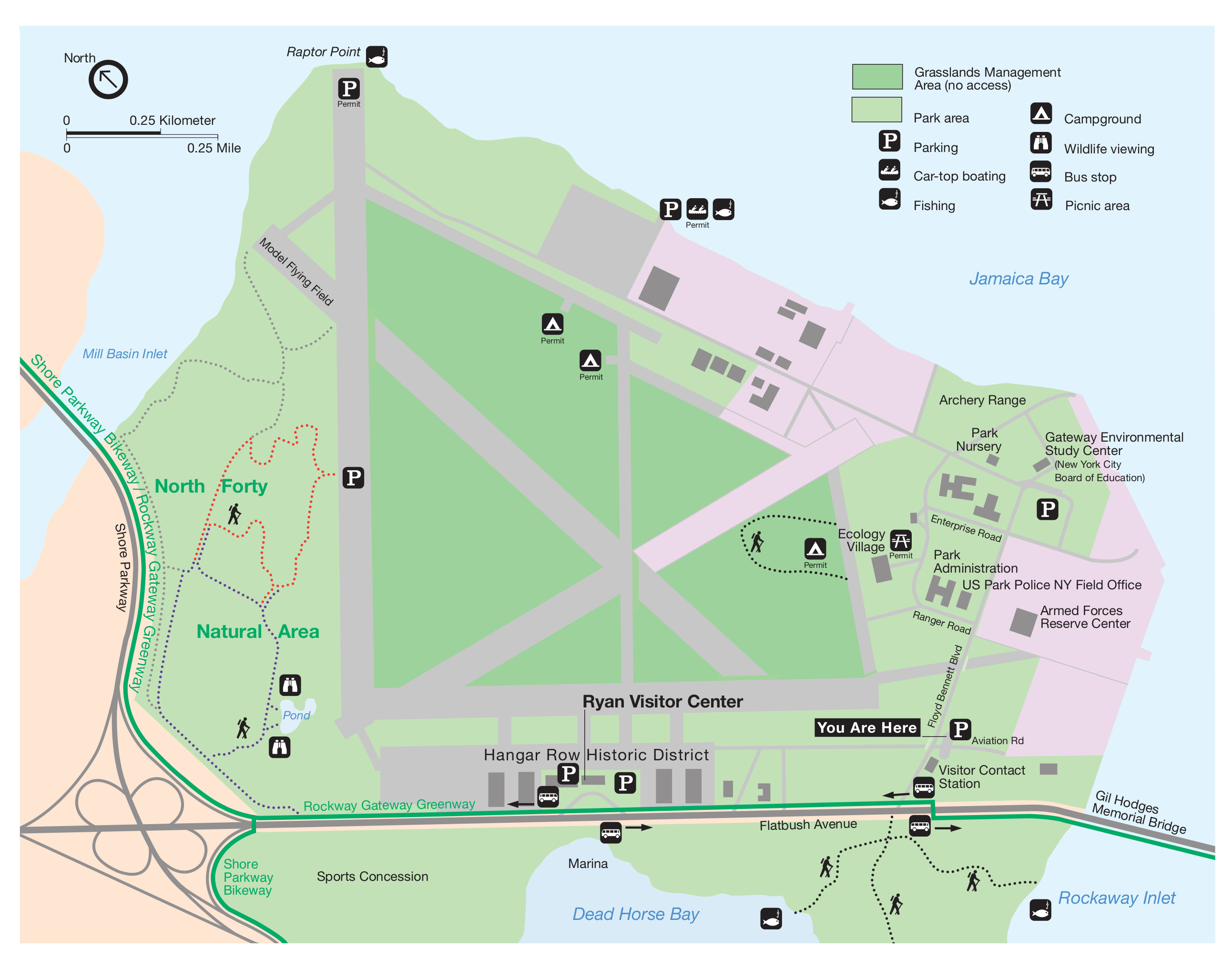 The Floyd Bennett Field map shows the visitor areas and trails near the Ryan Visitor Center. Click the image to view a full size JPG (500 kb) download the PDF (200 kb).
 The Jamaica Bay kayaking map (800 kb) includes the various launch sites and shows estimated travel times to complete the various kayaking routes throughout the Jamaica Bay Wildlife Refuge.
 Here’s a Frank Charles Park fishing map (300 kb) that shows the areas that are open to fishing in this part of Gateway National Recreation Area in the northern part of Jamaica Bay.
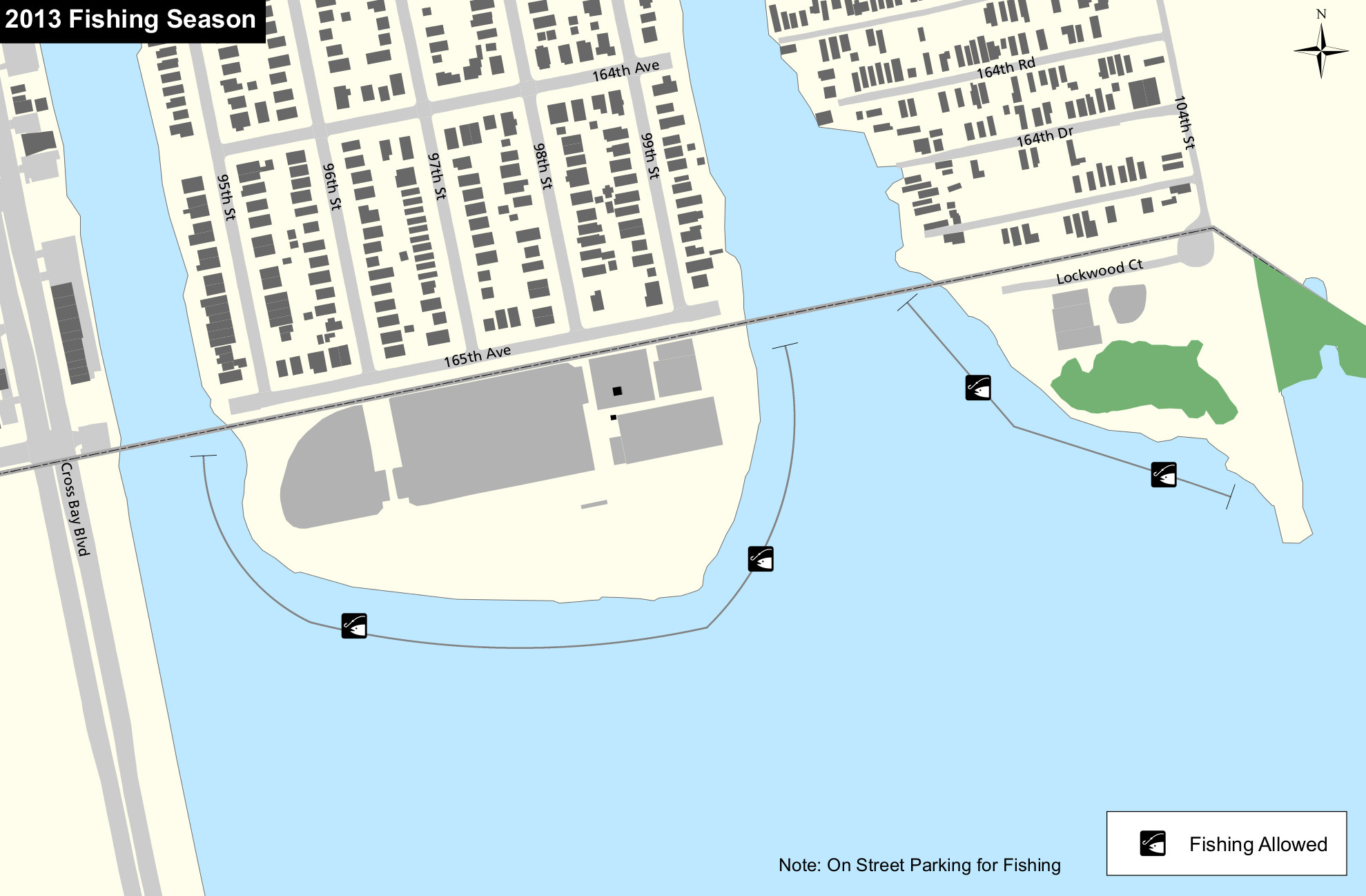
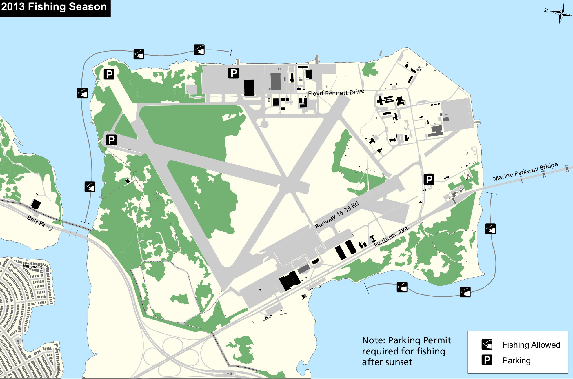 This is a Floyd Bennett Field fishing map (400 kb), showing the different areas along the beach that are open for public fishing – both the northwest and southeast corners (note that north is to the left).
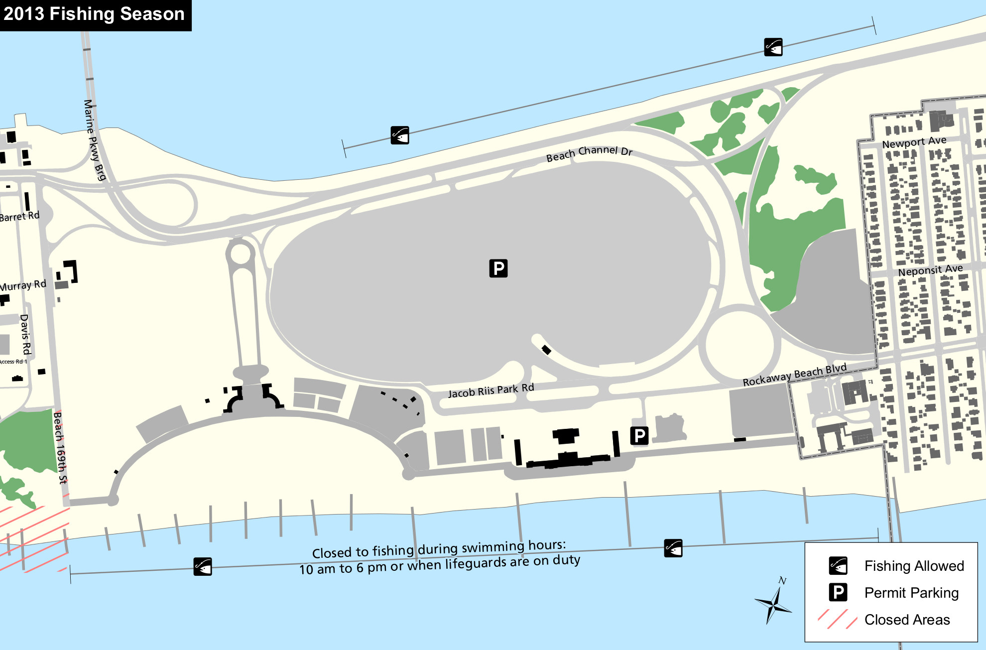 This Jacob Riis Park fishing map (300 kb) shows the public fishing areas located on both the Rockaway Inlet side and Atlantic Ocean side of Jacob Riis Park near the very popular beach.
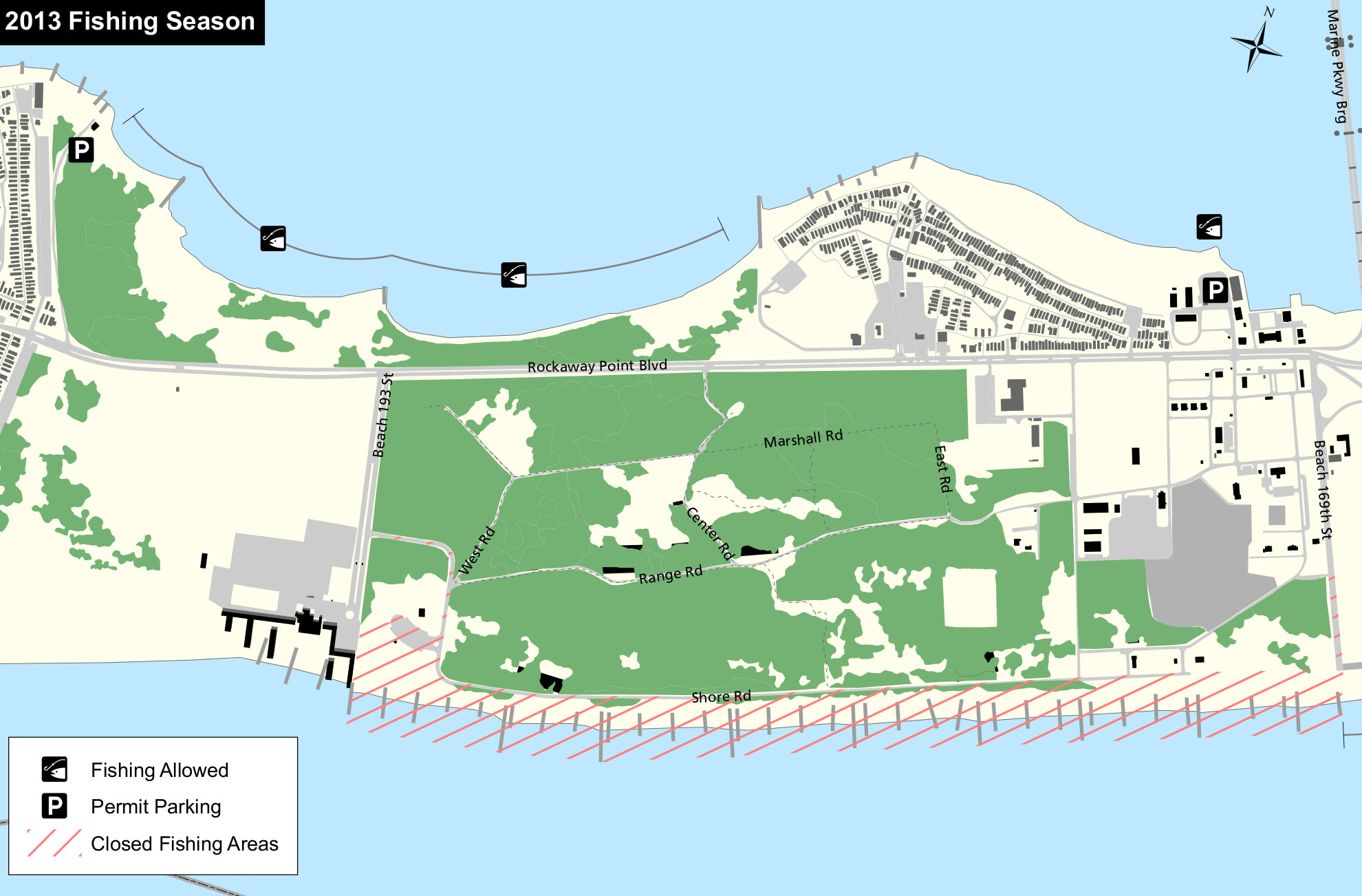 The Fort Tilden fishing map (350 kb) shows where fishing is allowed near Fort Tilden – in this case, only on the Rockaway Inlet side. The Atlantic Ocean side is closed to fishing.
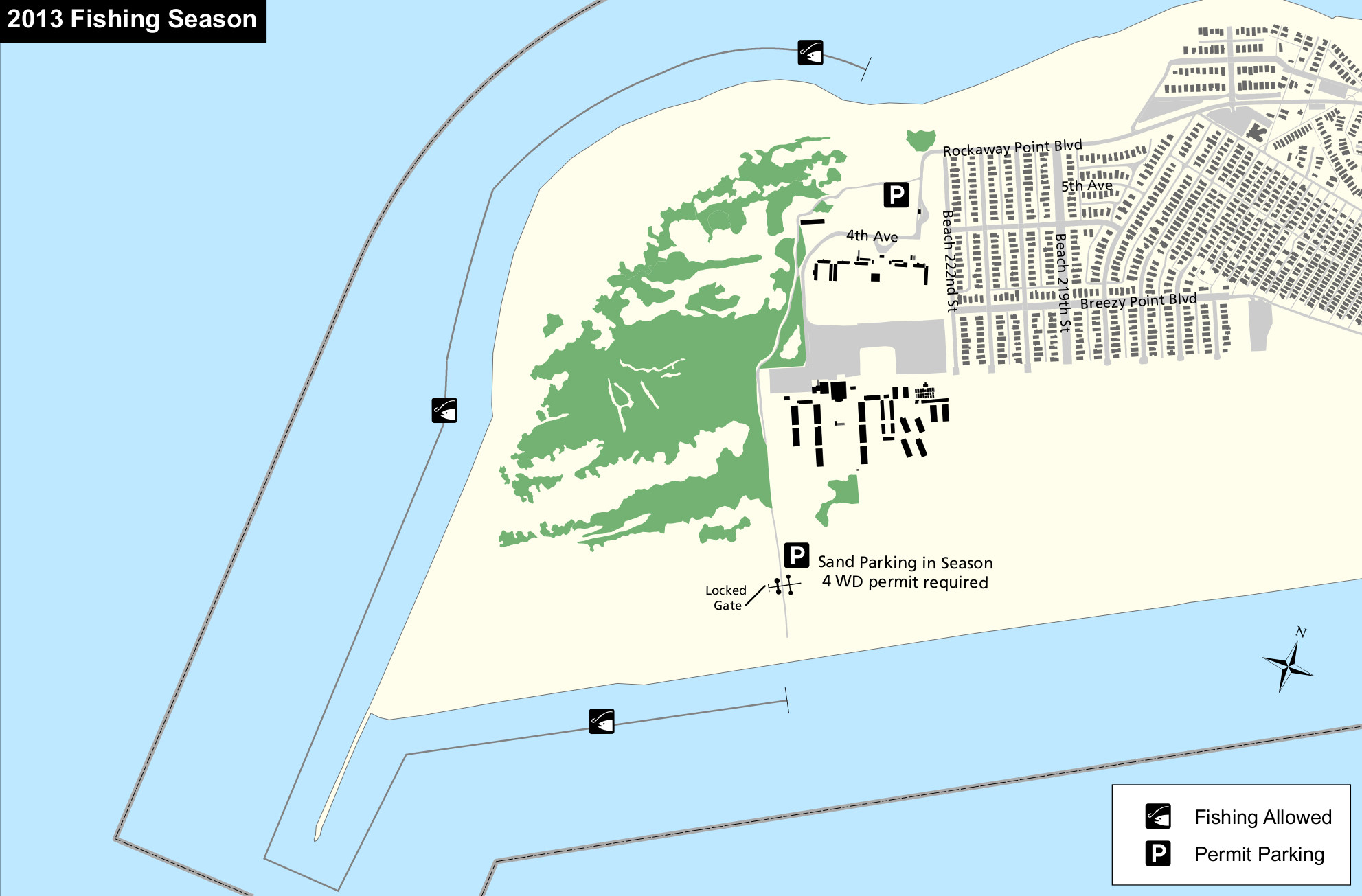 Here’s a Breezy Point fishing map (300 kb), showing the areas at the end of the road on Rockaway Point that are open to public fishing. Basically, you’re good around the tip of the peninsula.
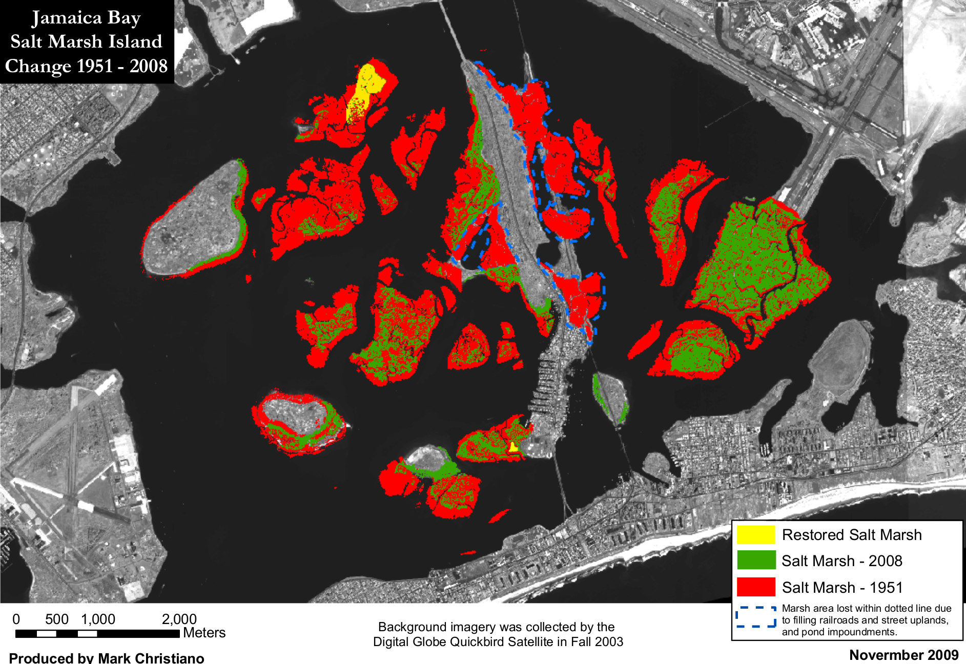 The Jamaica Bay salt marsh change map (500 kb) demonstrates how sea level rise has contributed to the decline of salt marsh habitat in Gateway. (The marsh is likely to continue retreating.)
Staten Island maps of Gateway
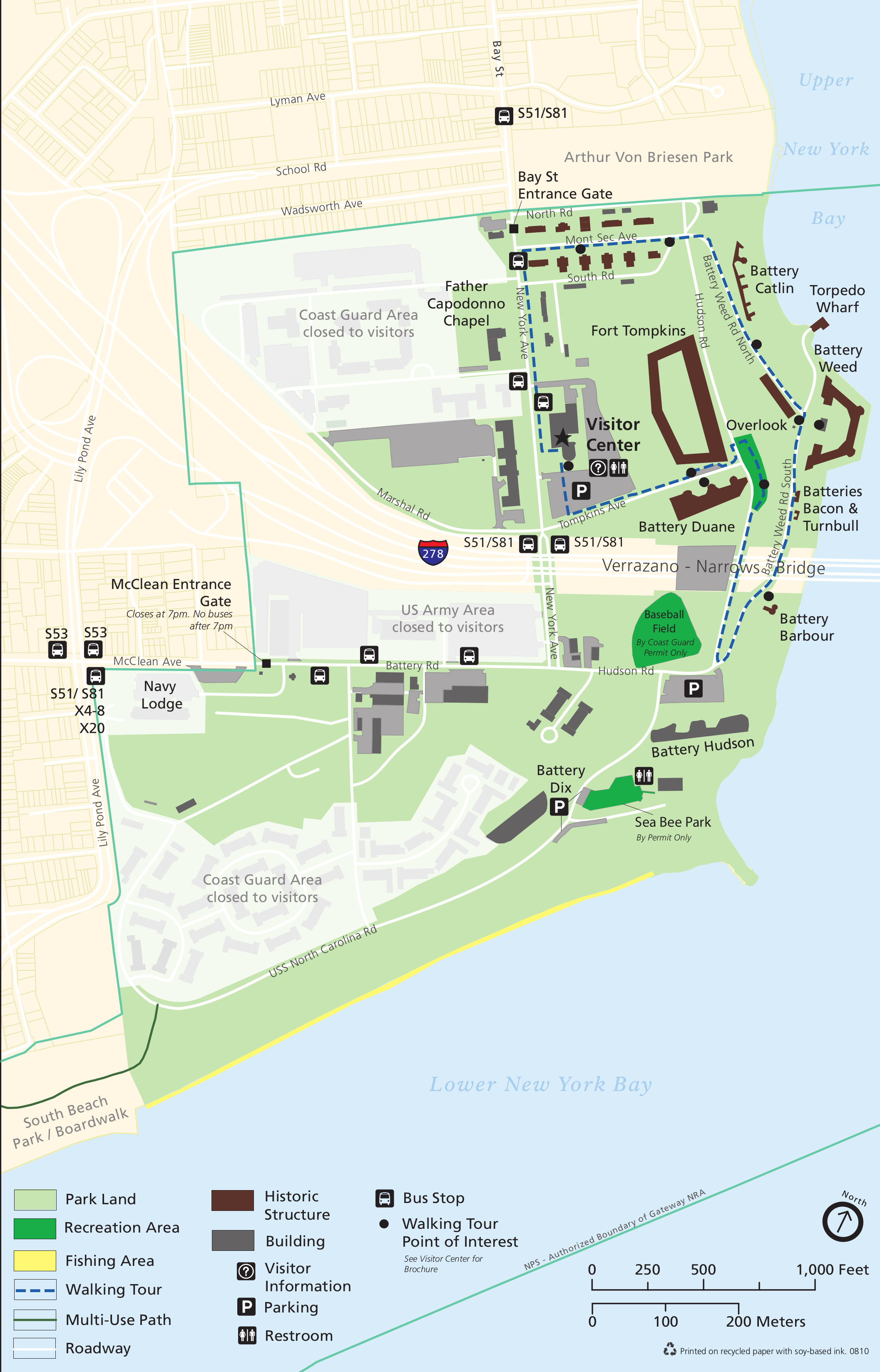 Here’s a Fort Wadsworth map (900 kb) that shows the visitor services and points of interest around Fort Wadsworth on Staten Island, under the Verrazano-Narrows Bridge connecting Staten Island to Brooklyn.
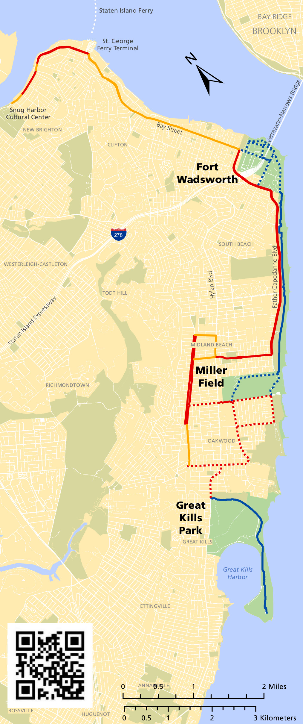 The Staten Island bicycle map (800 kb) shows the various bike trails that connect Fort Wadsworth, Miller Field, and Great Kills. The maps below zoom in on each of these locations in greater detail.
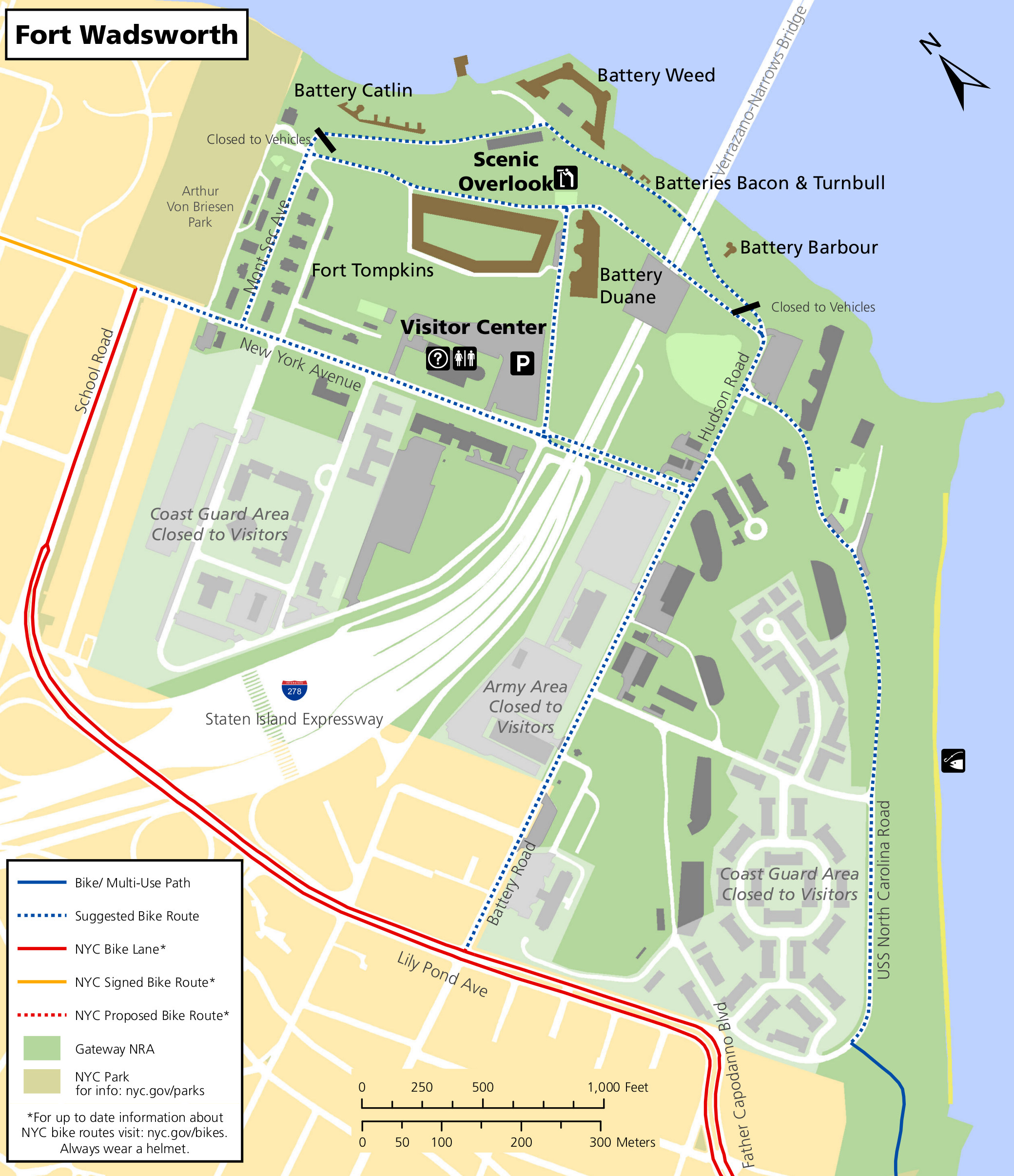 This Fort Wadsworth bicycle map (800 kb) shows bike lanes and some suggested bike routes through the Fort Wadsworth area. It also labels some buildings and additional points of interest.
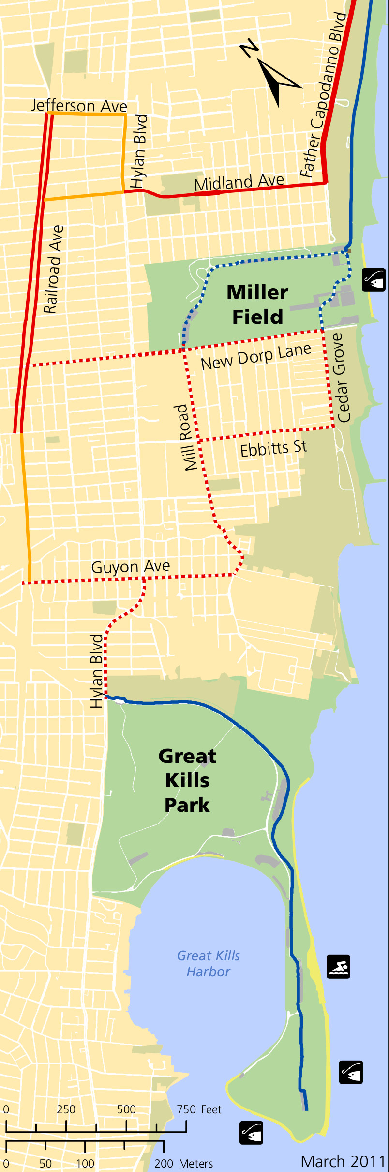 The Miller Field and Great Kills bicycle map (400 kb) shows a few different options for bicycling throughout these areas. See the Fort Wadsworth bike map above for a key to the different colored routes.
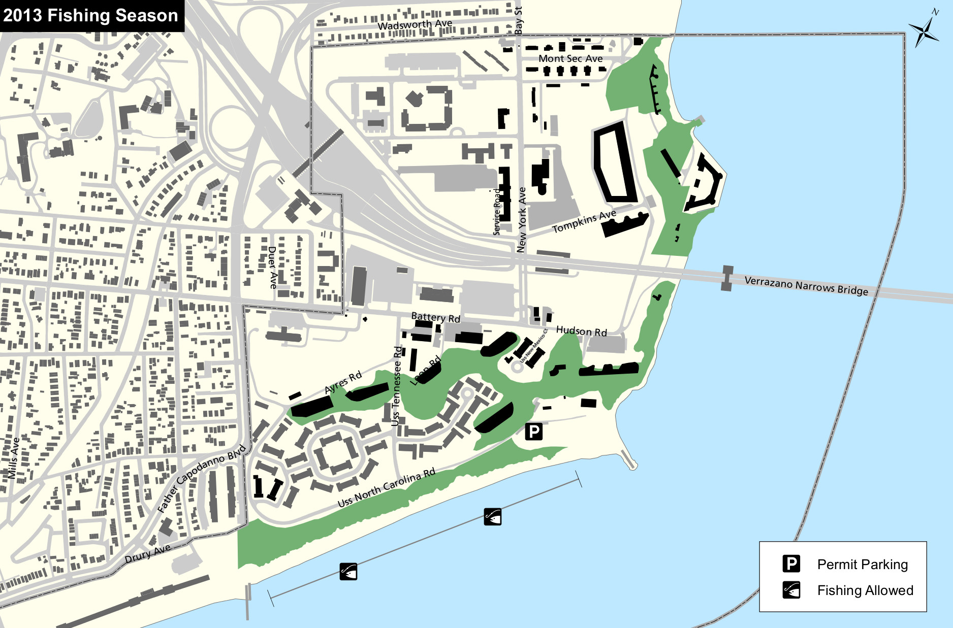 Here’s a Fort Wadsworth fishing map (400 kb), showing the fishing area open to the public just south of the Verrazano-Narrows Bridge along USS North Carolina Road.
 The Miller Field fishing map (150 kb) shows the limited fishing areas open for public fishing near Miller Field on Staten Island. Parking for this area is also labeled.
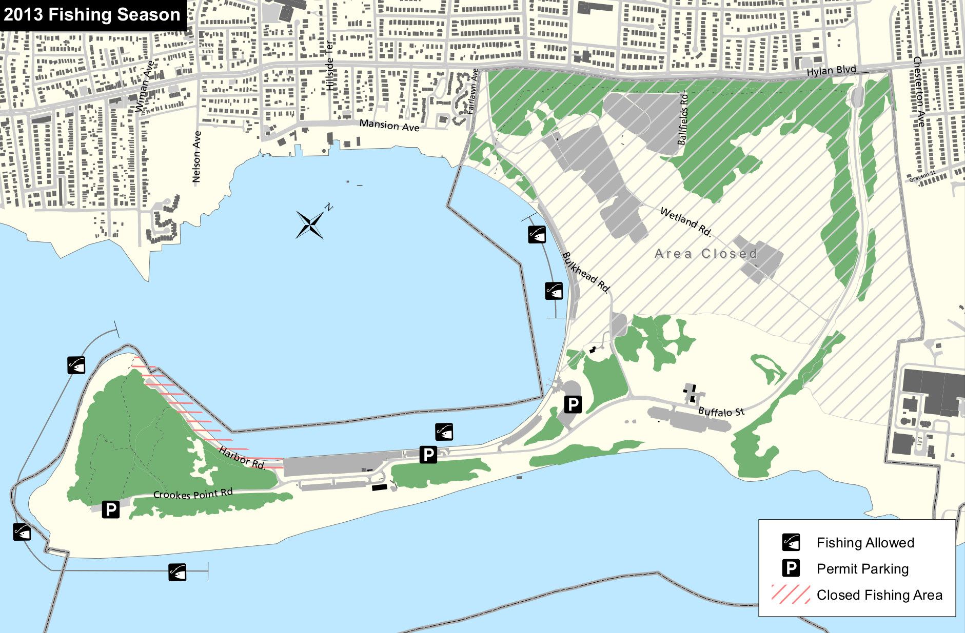 Here’s a Great Kills fishing map (450 kb), showing the numerous areas open to fishing in Great Kills Park around Great Kills Harbor, at the southern end of the Staten Island unit of Gateway.
Sandy Hook maps of Gateway
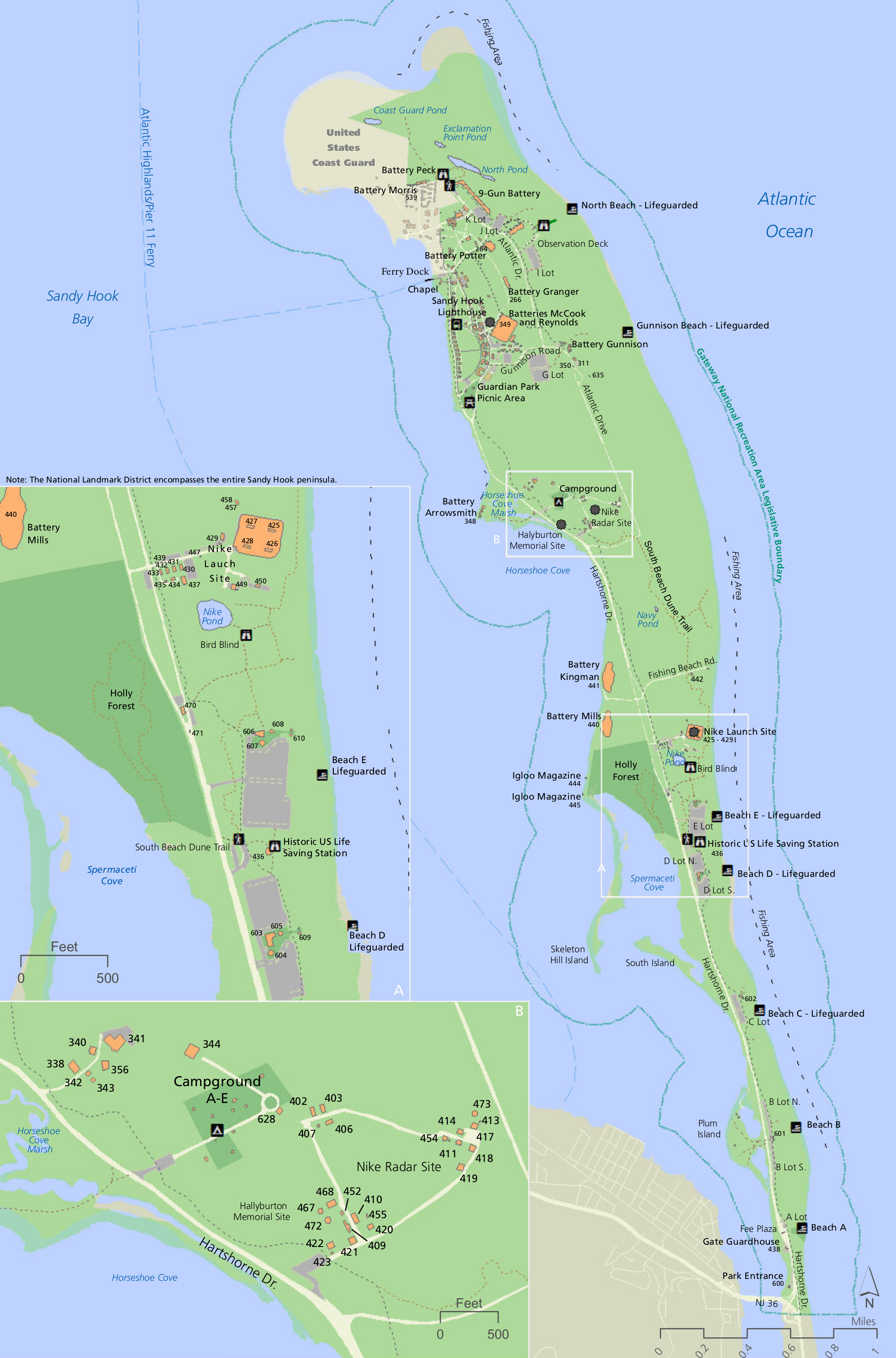
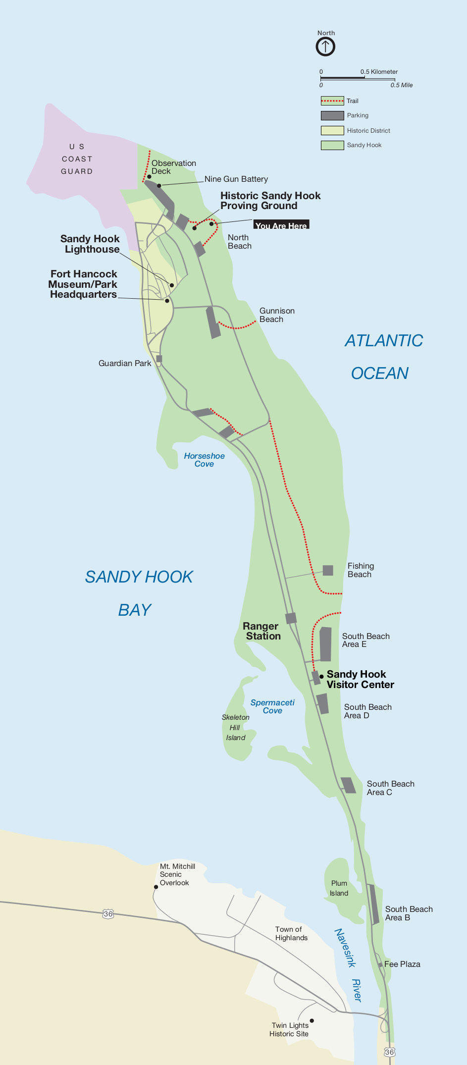 This Sandy Hook map shows the overall view of this part of Gateway National Recreation Area. Click the image to view a full size JPG (170 kb) or download the PDF (170 kb).
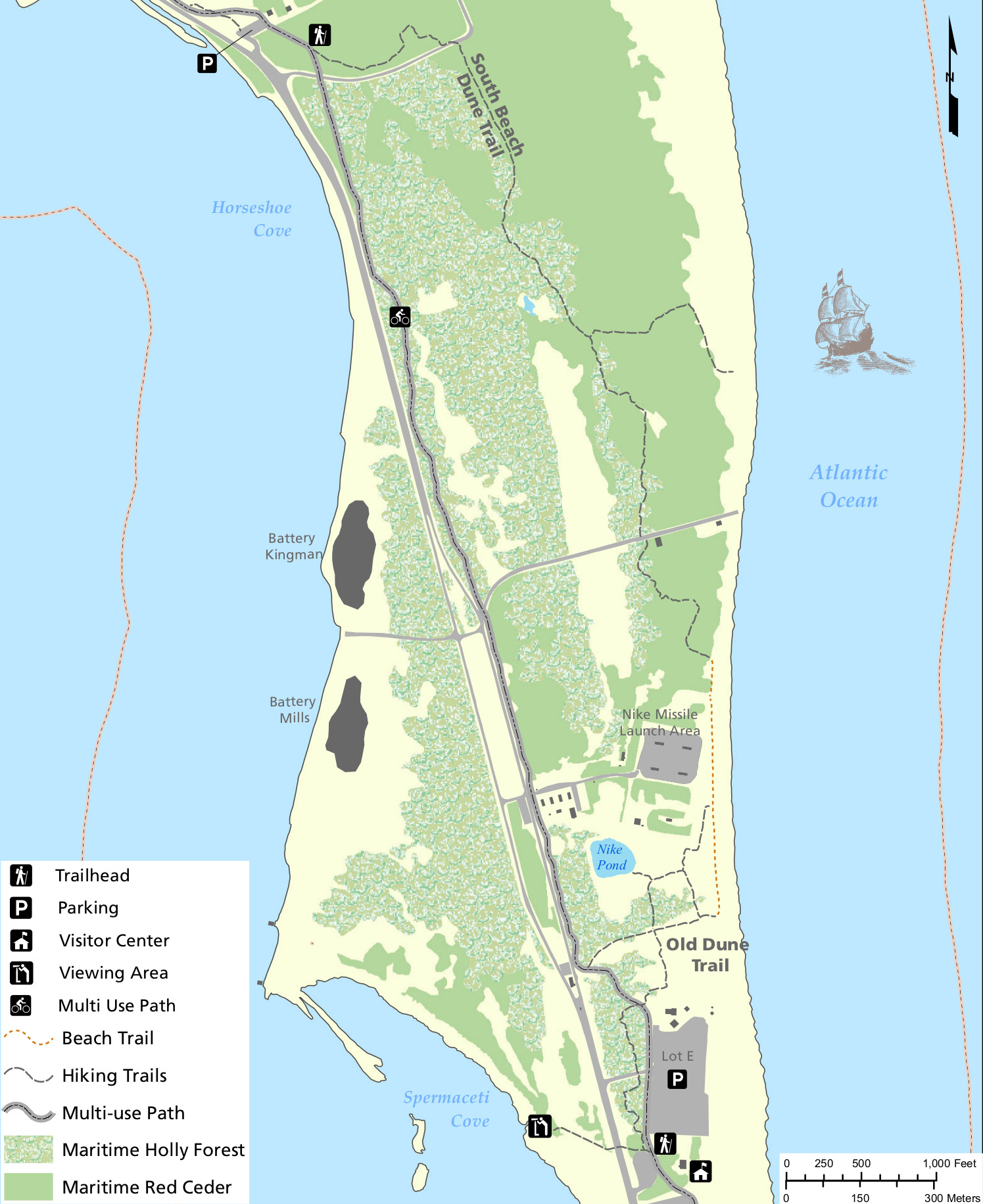 Here’s a Sandy Hook trail map (500 kb) that includes both the South Beach Dune Trail as well as the Old Dune Trail through the various vegetation types — Holly Forest and Red Cedar.
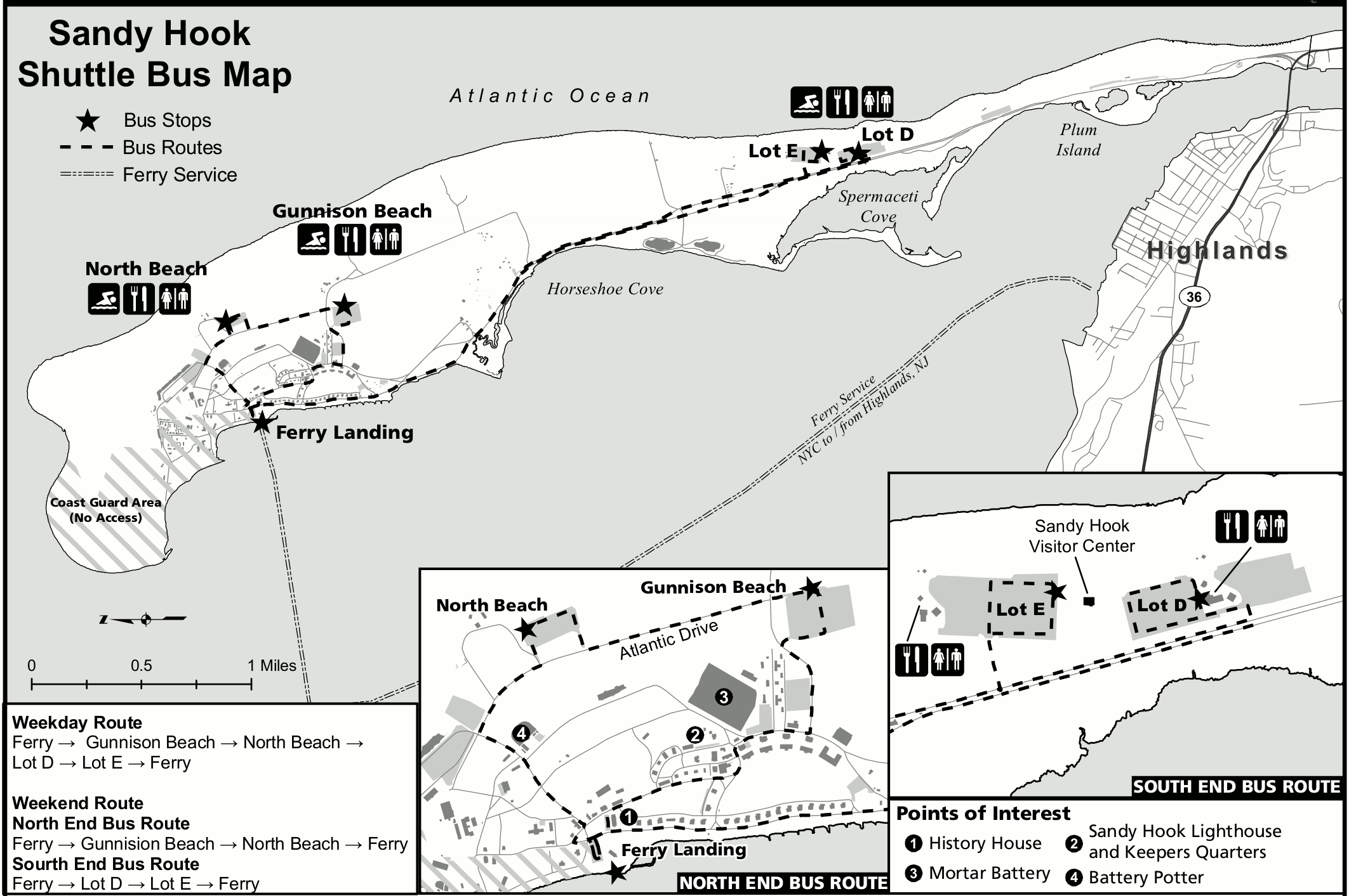 The Sandy Hook shuttle bus map (300 kb) shows the shuttle stops as well as the weekend/weekday routes during Gateway’s busy summer season. Check with the park staff for current shuttle status.
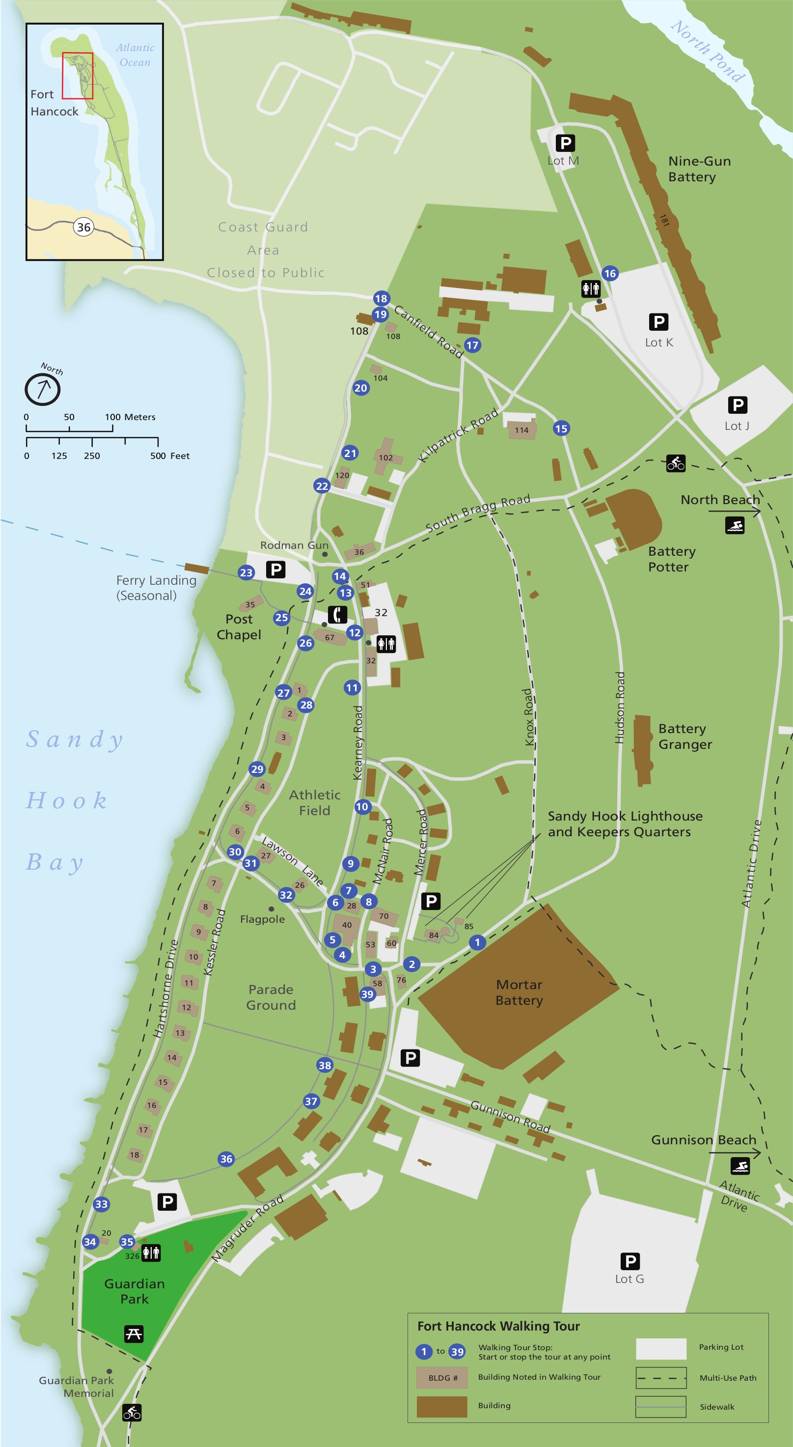
 This Fort Hancock map (450 kb) labels bike trails, footpaths, historic sites, parking areas, and the Sandy Hook Lighthouse. It’s a great one-stop-shop printable map for visiting Fort Hancock.
 The Fort Hancock walking tour map (600 kb) labels the route of the walking tour in order – you can pick up the tour in any location and follow along to see the most important historic sites.
 Here’s a Sandy Hook historic buildings map (800 kb), labeling and identifying many historic structures not just in Fort Hancock but throughout the rest of Sandy Hook unit too.
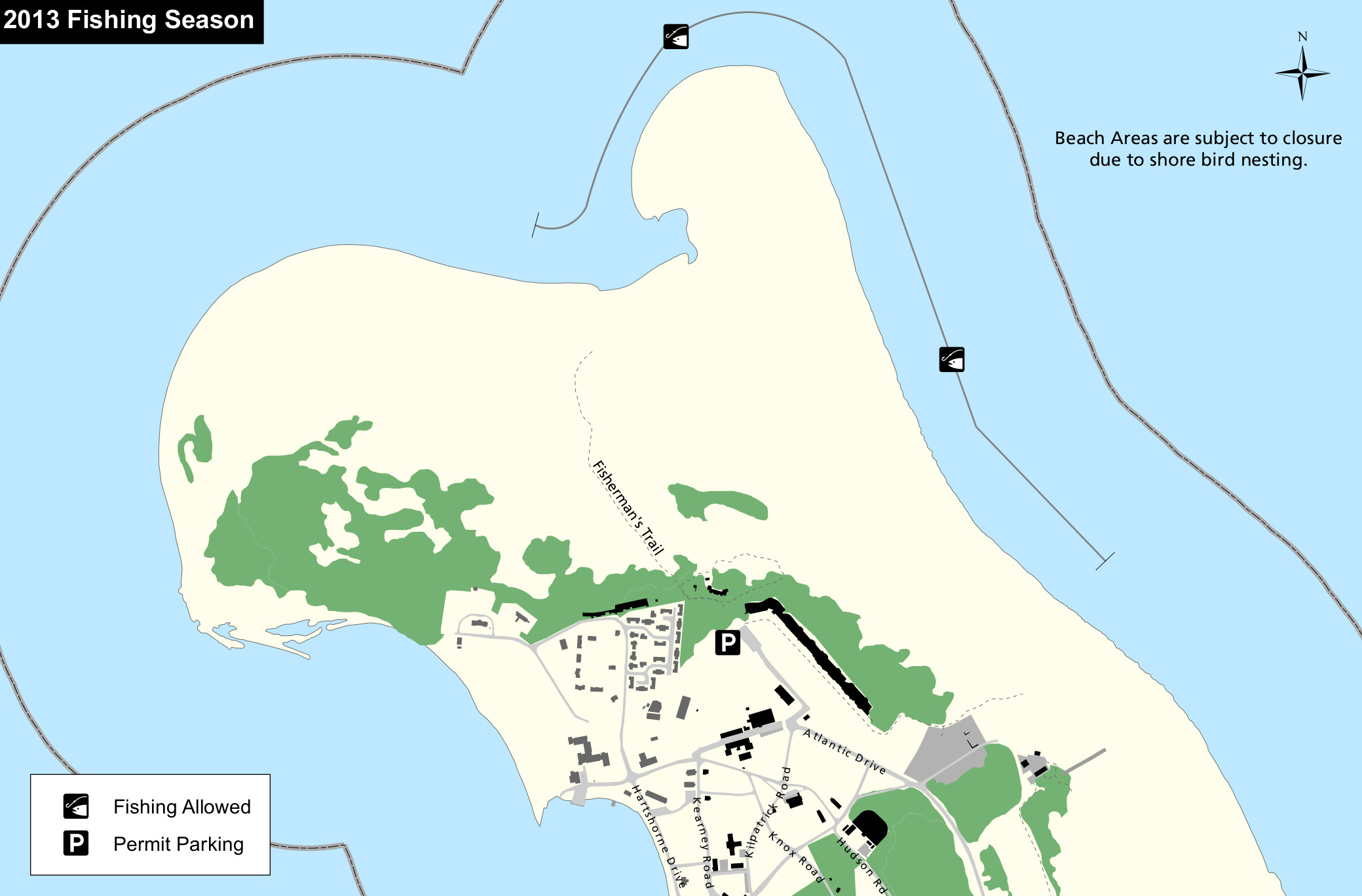 This Sandy Hook North fishing map (250 kb) includes the publicly-accessible fishing areas on the northeastern tip of Sandy Hook. Also shown is the Fisherman’s Trail to access this location.
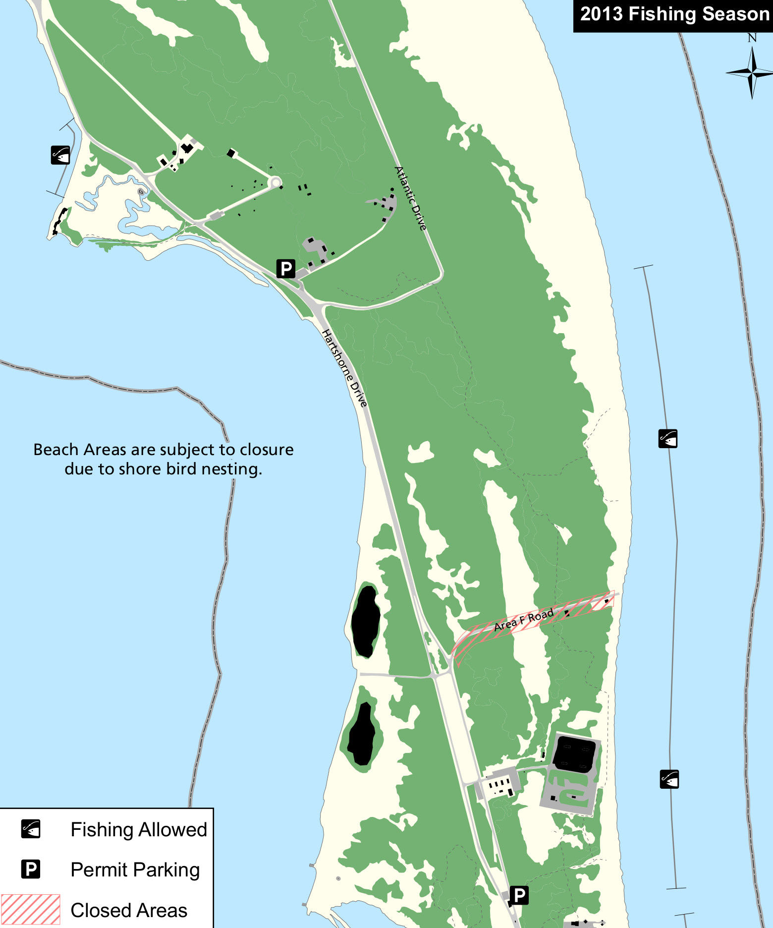 The Sandy Hook beach fishing map (300 kb) shows a couple fishing areas located on the east side of Sandy Hook (the west side is mostly closed to fishing and often has nesting shore birds).
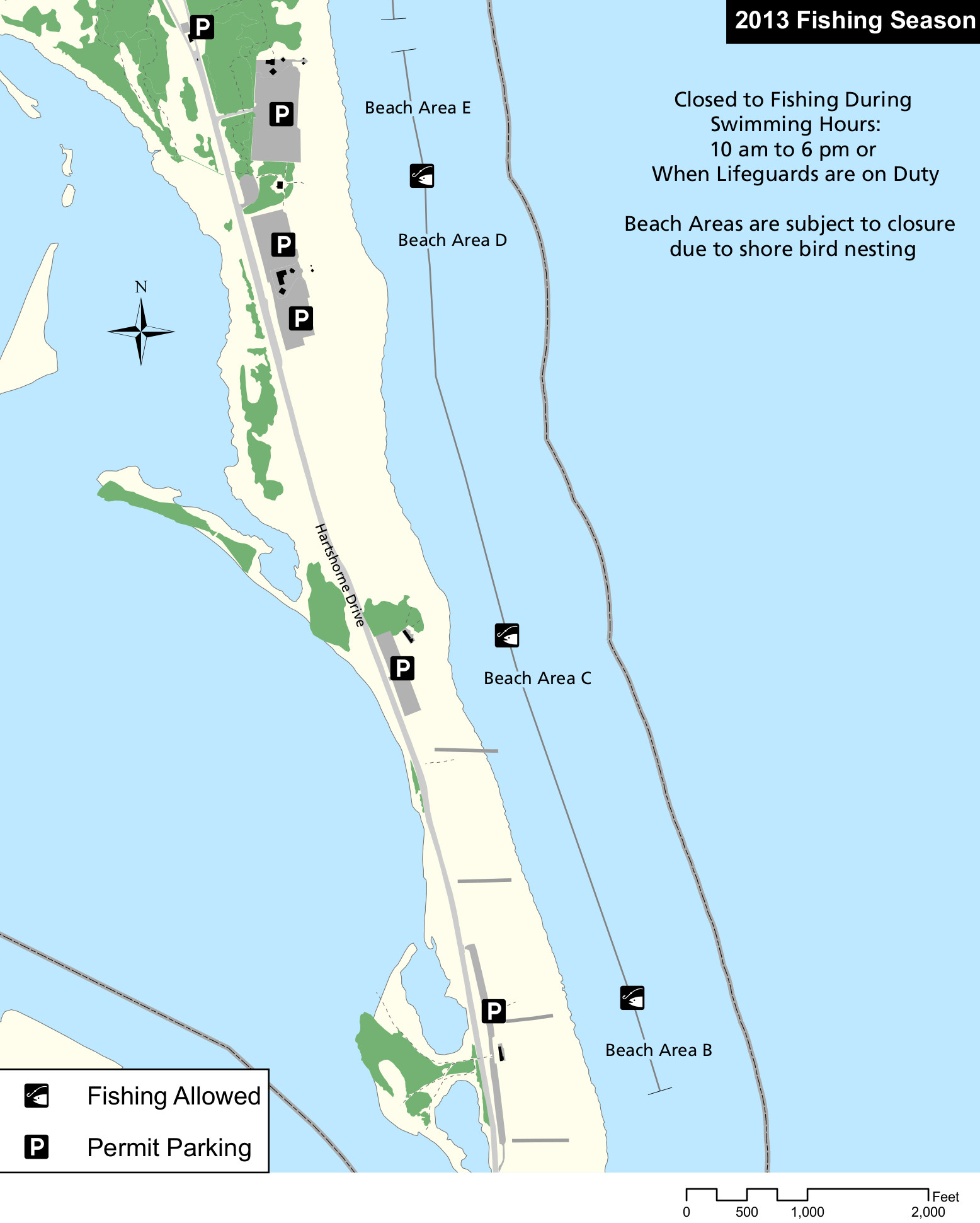 This Sandy Hook South fishing map (300 kb) shows the various beach areas that have public fishing in the south part of Sandy Hook. Note that the beaches are closed to fishing during swimming hours.
Gateway Dive Map
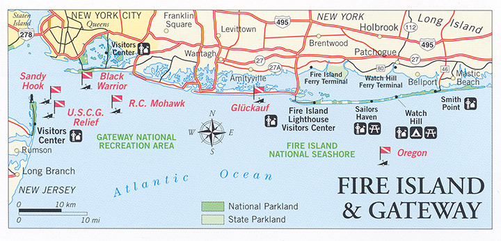 This is a Gateway and Fire Island dive map (150 kb), showing the shipwrecks and dive sites at Fire Island and in Gateway National Recreation Area near Sandy Hook and Rockaway Beach.
…and more!
< Return to National Park Maps home
< Return to Park List
< Return to List by State
Need more planning help? Browse Amazon’s best-selling Gateway maps and books.