National Mall maps from the park brochures
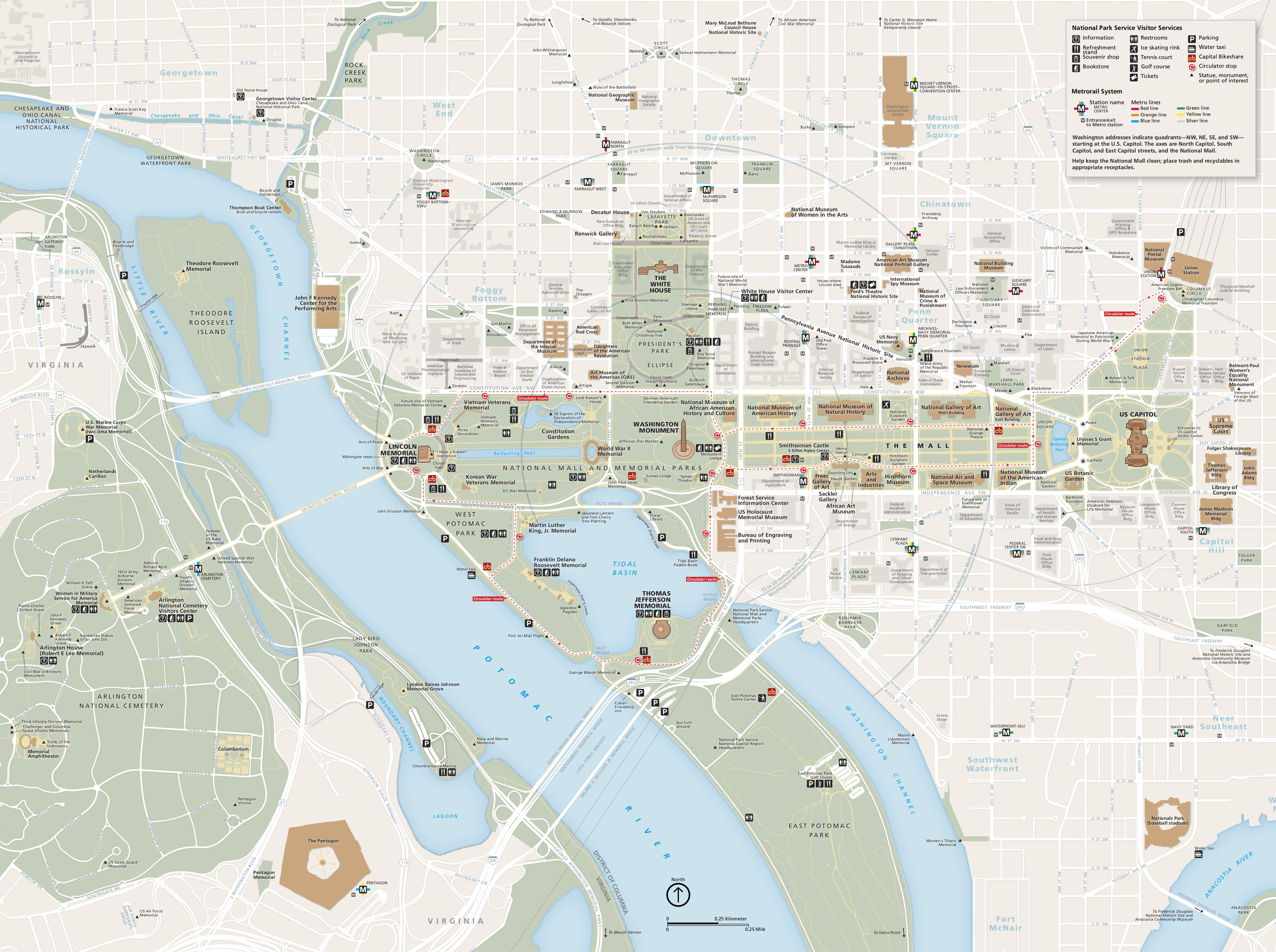 This is the National Mall map from the official brochure that shows all the sites and attractions on the Mall and in the surrounding D.C. Click the image to view a full size map or download the PDF.
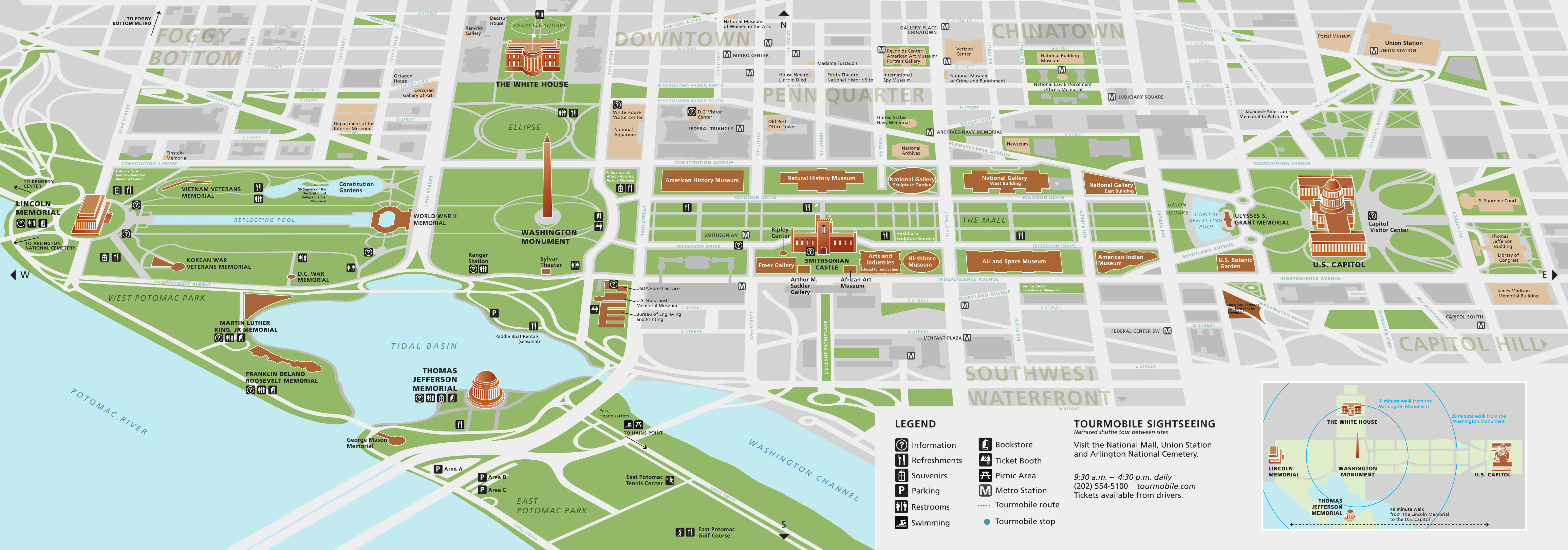 Here’s a 3D National Mall map, focusing on the Mall area and showing some 3D buildings, including the Thomas Jefferson Memorial and Lincoln Memorial. Click the image to view a full size map or download the PDF.
National Mall lodging map
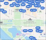 The National Mall is the centerpiece of D.C. tourism and you’ll find no shortage of hotels a short walk away. To the right, you can open an Expedia interactive Washington D.C. lodging map that shows the locations of your options in relation to the Mall. (You can filter it by price, rating, or neighborhood to narrow it down.) Also consider browsing Expedia’s top-rated D.C. hotels to compare reviews and photos.
D.C. Memorial maps
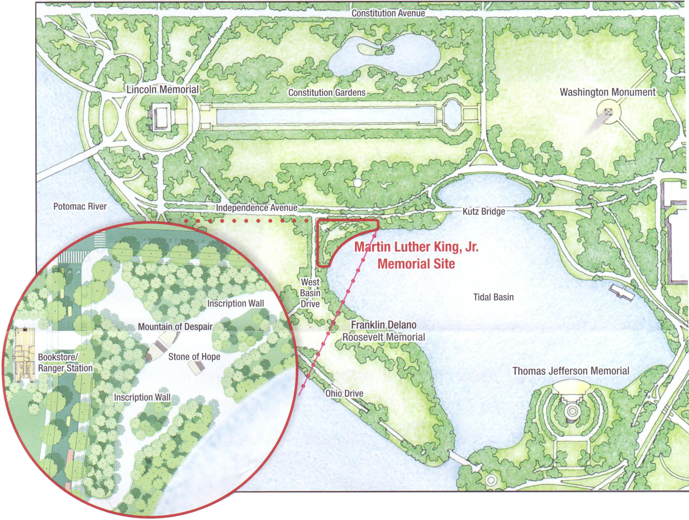 Here’s an MLK Memorial map, zooming in on the Martin Luther King Jr. Memorial, just south of the Mall along the Tidal Basin. It also shows where you’ll find the nearby museum and bookstore.
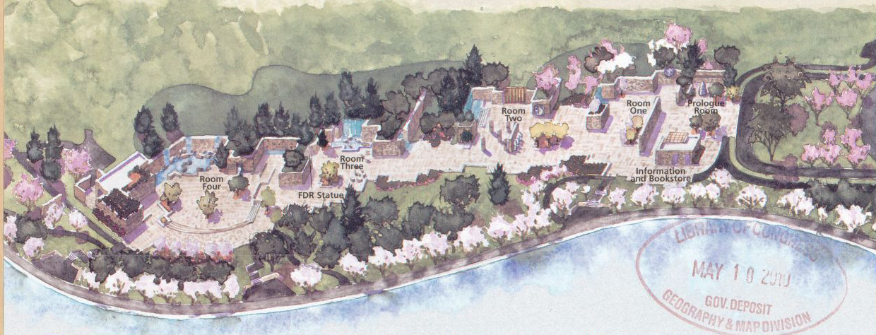 This FDR Memorial map shows the layout of Franklin Delano Roosevelt Memorial, located adjacent to the MLK Memorial along the Tidal Basin (both are south of the Lincoln Memorial).
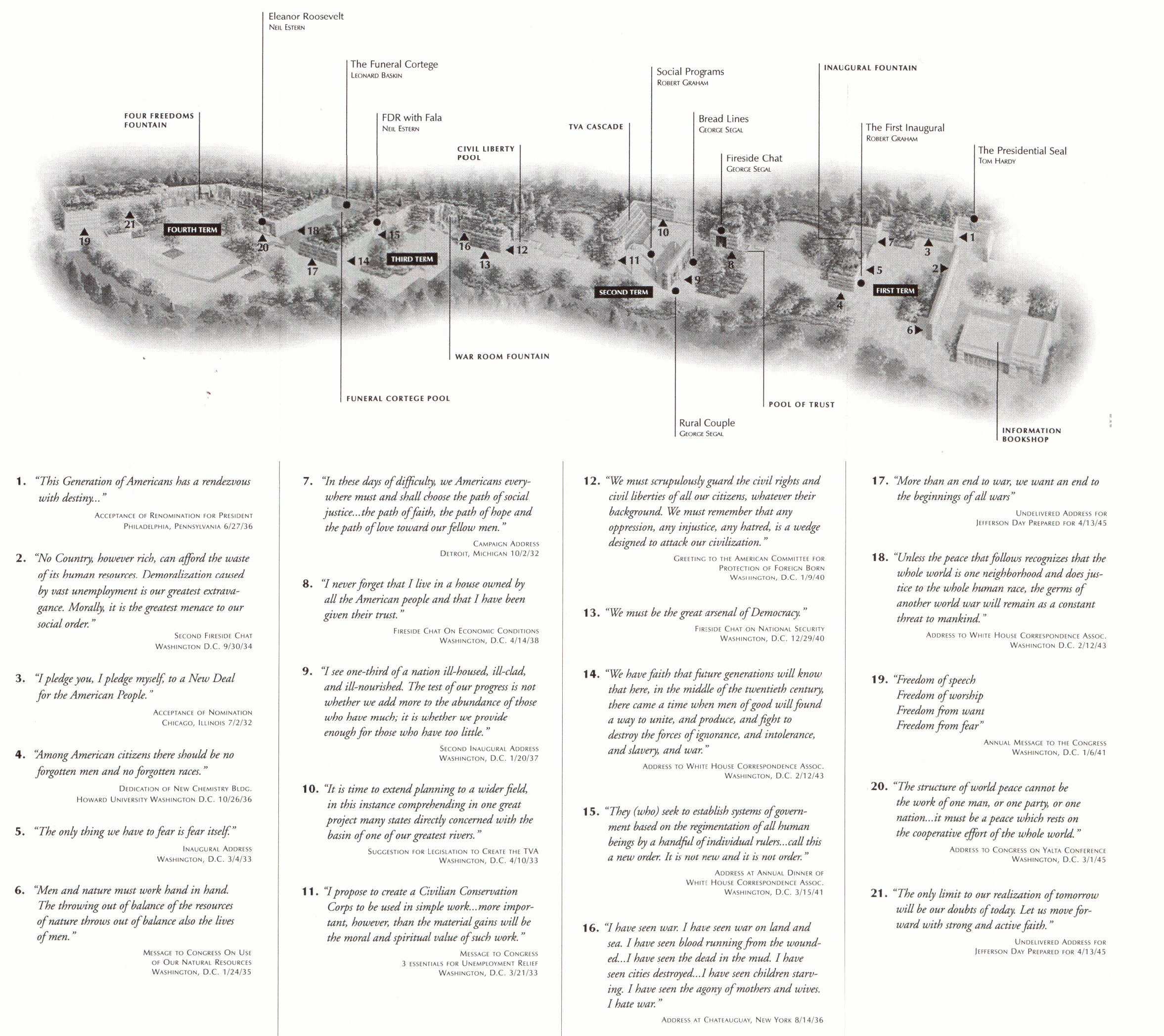 The FDR Memorial map and guide includes the text of every inscription and identifies each inscription’s location in memorial. Bring this along to make sure you don’t miss anything.
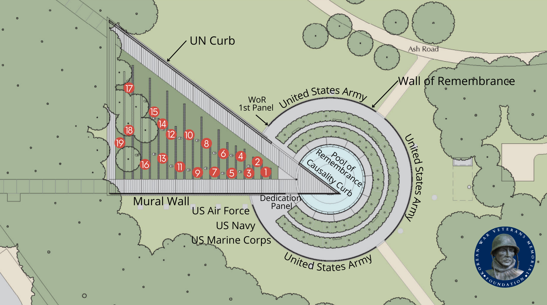 The Korean War Veterans Memorial map zooms in to show the layout of this memorial just southeast of the Lincoln Memorial. This map was produced by the Korean War Veterans Memorial Foundation.
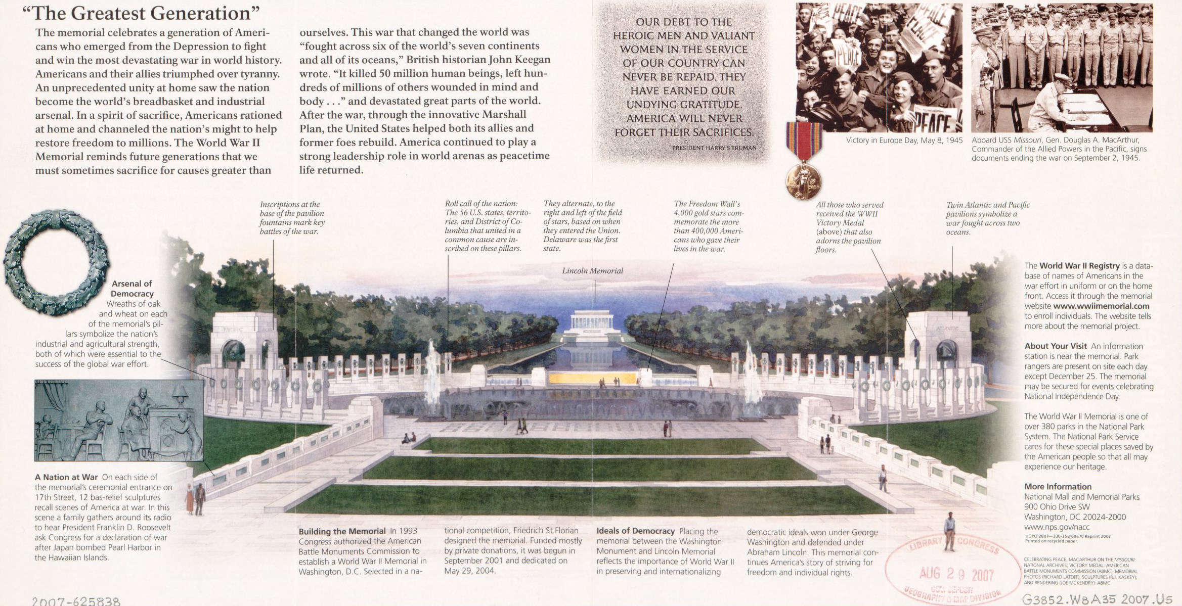 The World War II Memorial map is an illustration showing and labeling the memorial from an oblique angle, explaining the symbolism behind the memorial features and design choices.
Assorted National Mall maps
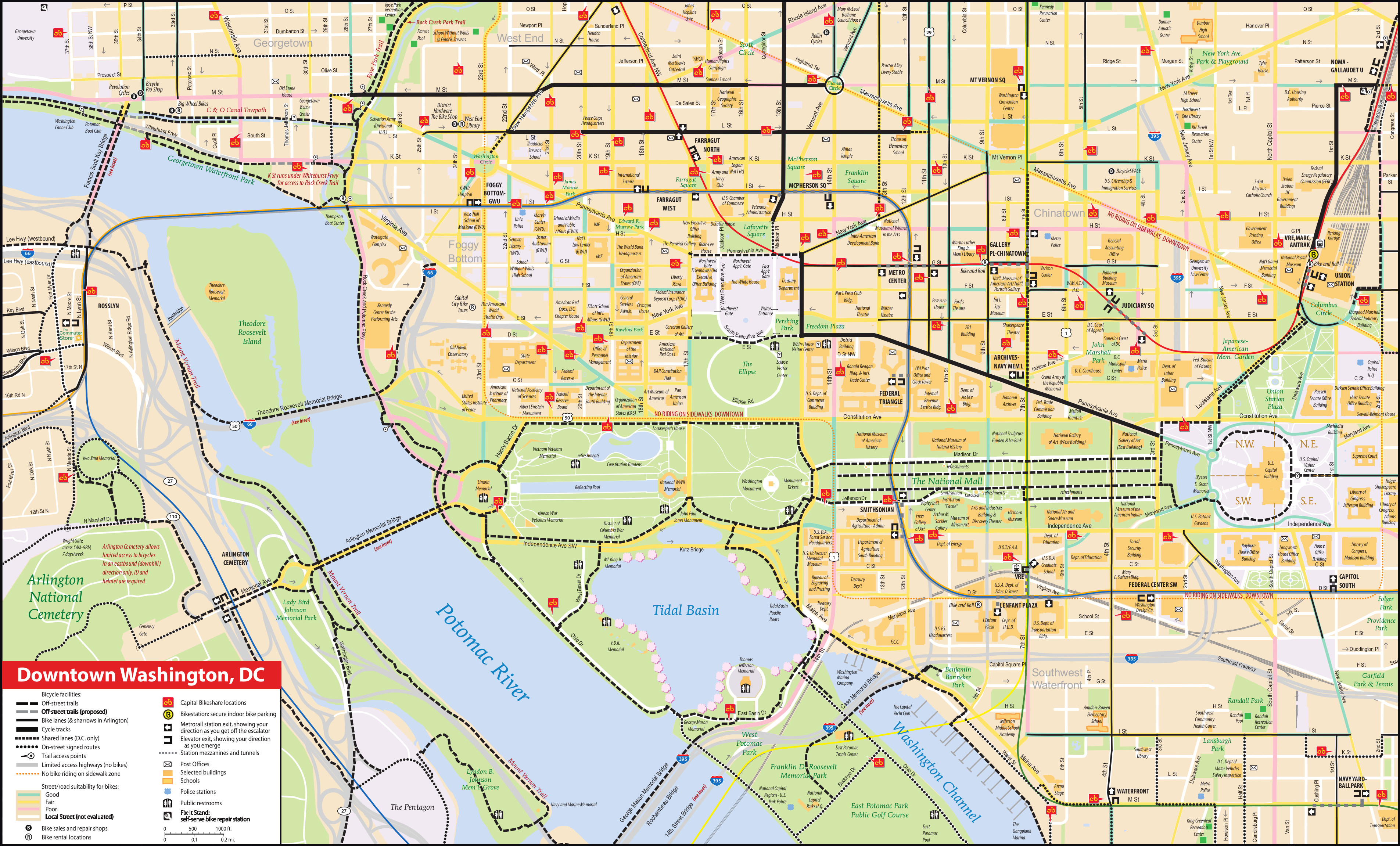 This National Mall bike map shows the biking trails and routes on the National Mall as well as in the surrounding area in Washington, D.C. It also labels Capital Bikeshare locations for renting your bicycle.
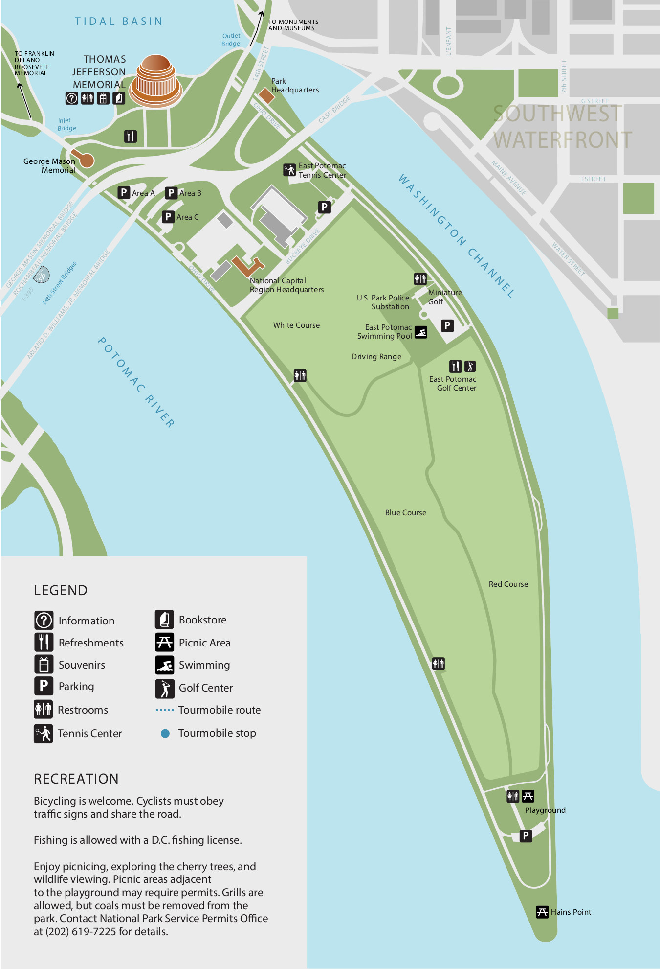 This is an East Potomac Park map, showing the park located south of the Thomas Jefferson Memorial that leads to Hains Point. Click the image to view a full size map or download the PDF.
Cherry blossom maps
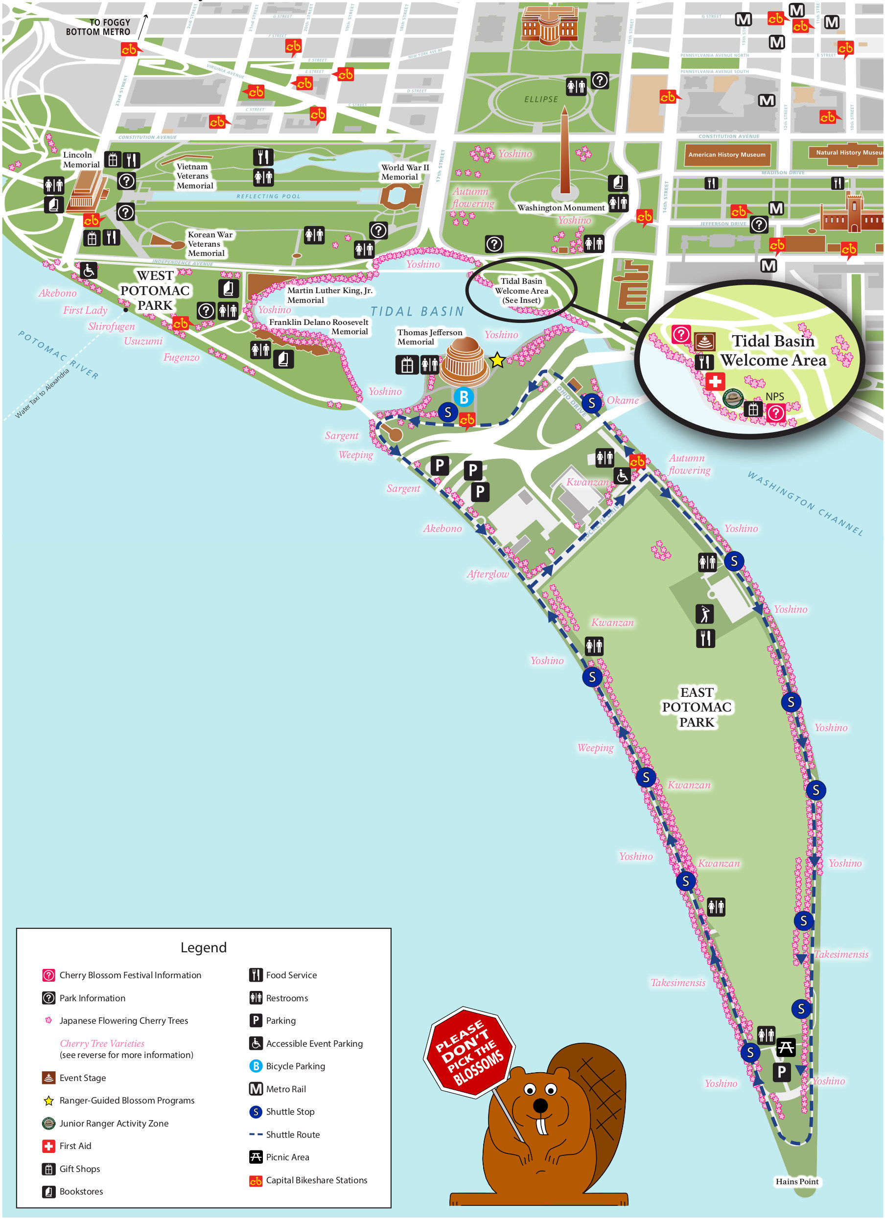 Here’s a Cherry Blossom Festival map, showing the locations of the cherry trees around the tidal basin as well as the festival welcome area. Bring this along so you don’t miss the best groves of trees!
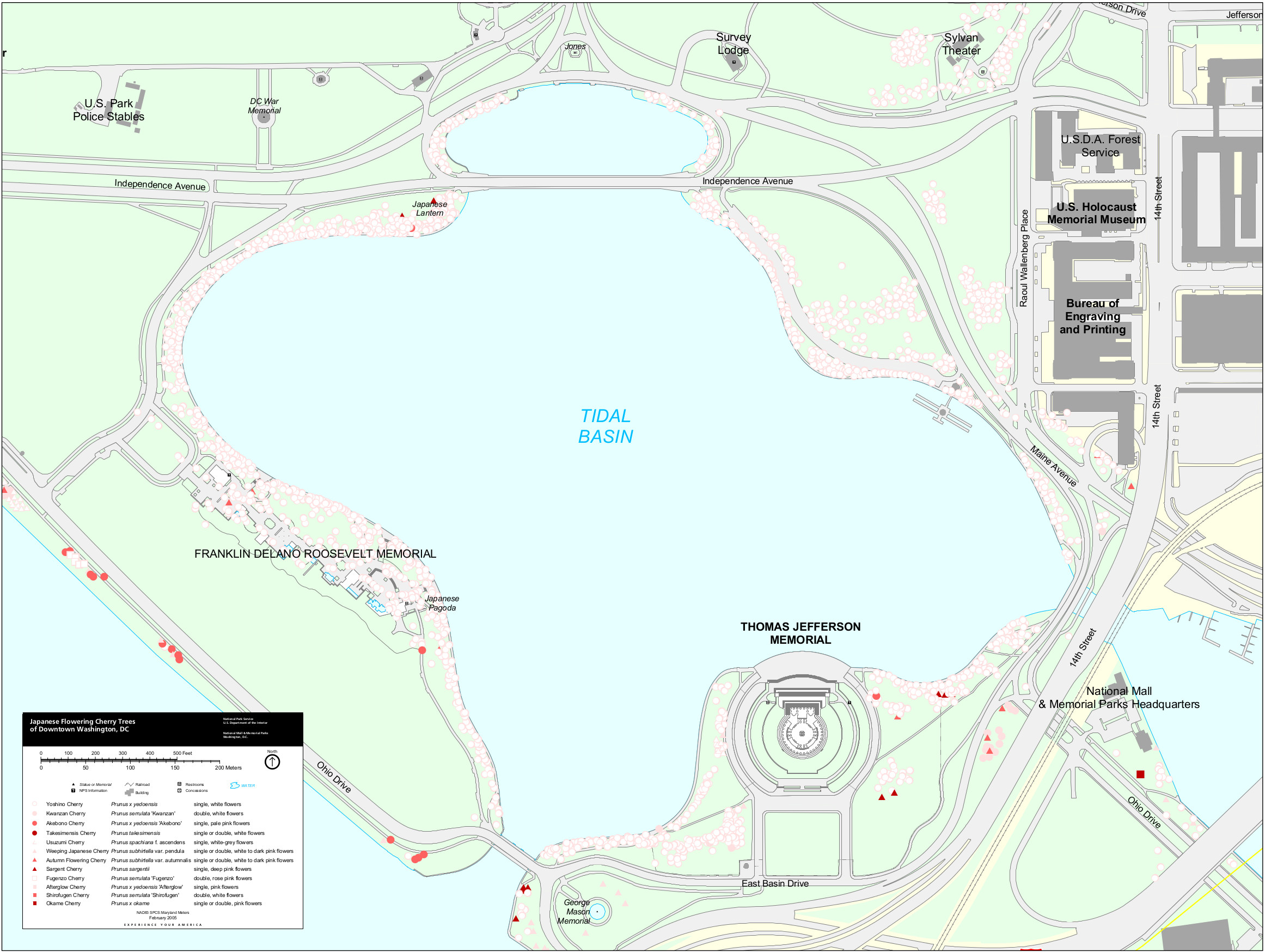 Here’s a Tidal Basin cherry blossom map, zooming in on the tidal basin and showing and labeling the individual cherry blossom trees. The map might be less pretty, but it is 100% accurate.
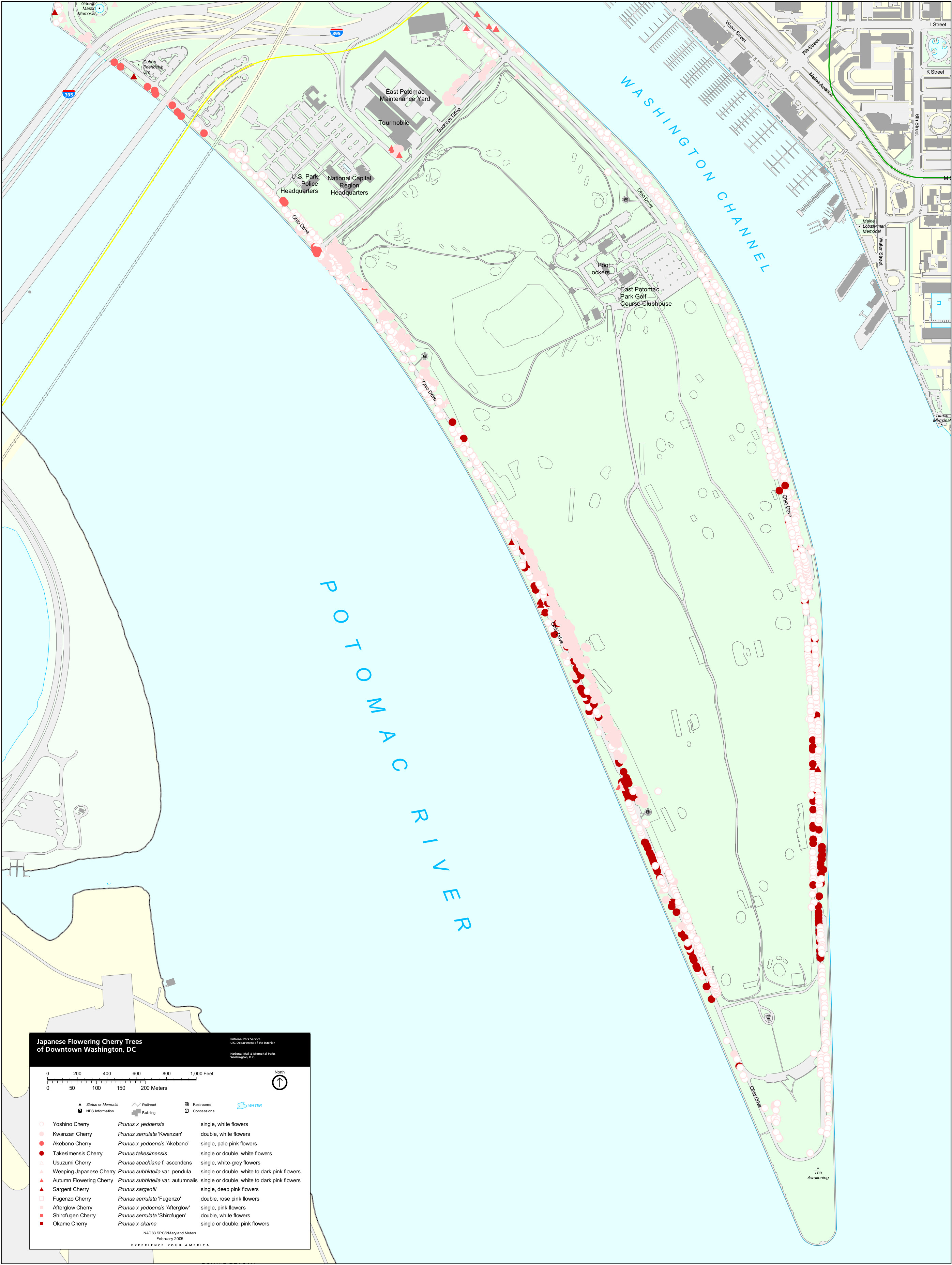 This is an East Potomac Park cherry blossom map, labeling the trees that stretch along the Potomac south to Hains Point (south of the Jefferson Memorial). It’s a continuation of the map immediately above.
Looking for the White House?
The White House is also a national park site, but is not a part of the National Mall and is administered as a separate park unit called President’s Park. See my White House Maps page for maps of President’s Park and the White House.
…and more!
< Return to National Park Maps home
< Return to Park List
< Return to List by State