Natchez Trace map from the park brochures
 This is the official Natchez Trace map from the park brochure, showing the entire length of the trace from Mississippi to Tennessee. Click the image to view a full size map or download the PDF.
Below are a four maps of the Natchez Trace that are identical to the one above but cropped down into bite-sized chunks to make it easier for printing and viewing.
 Map 1: Here’s a Natchez to Jackson map, showing the first segment of the Natchez Trace – the southwest terminus. Click the image to view a full size map or download the PDF.
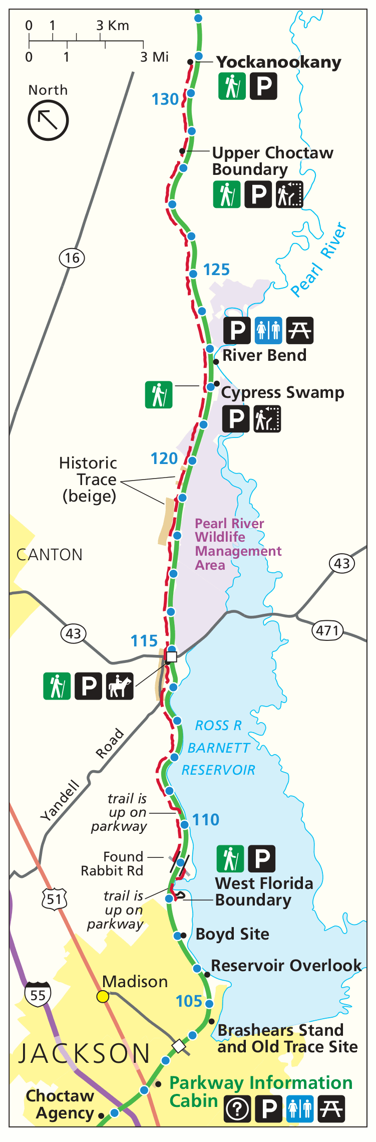
 Map 2: This is a Jackson (and north) map that begins in Jackson, MS and extends northward from there. Click the image to view a full size map or download the PDF.
 Map 3: The Mississippi to Alabama map covers the part of the Natchez Trace that leaves behind Mississippi and enters Alabama. Click the image to view a full size map or download the PDF.
 Map 4: The Tennessee Natchez Trace map focuses on the Tennessee segment at the northeastern terminus of the Natchez Trace. Click the image to view a full size map or download the PDF.
Natchez Trace detail maps
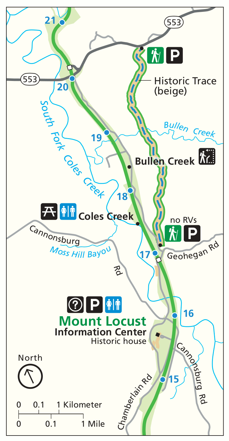
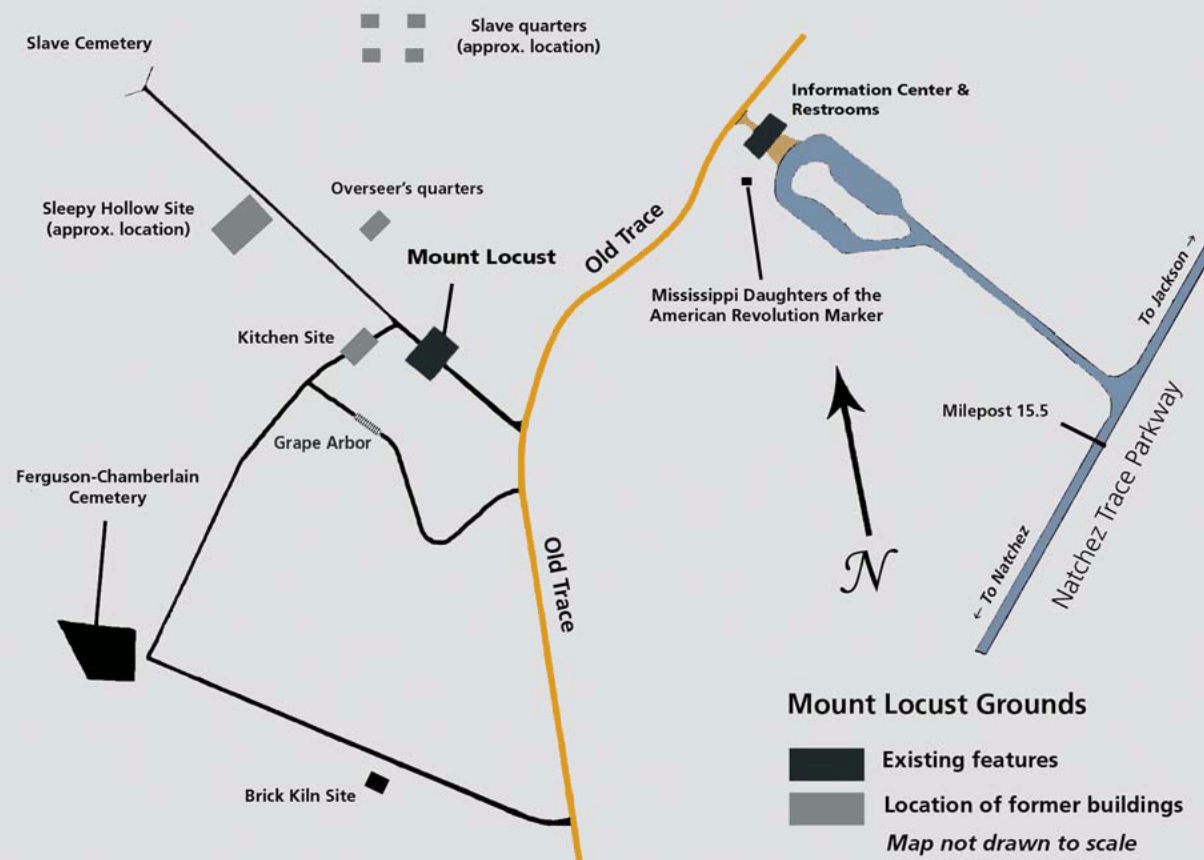 This Mount Locust map includes the information center, parking, restrooms, and historic sites at Mount Locust, near the beginning of the Natchez Trace in Mississippi.
 Here’s a Rocky Springs map, showing a major developed area of the Trace (campground, picnic area, trails, etc.) near Vicksburg, MS. Click the image to view a full size map or download the PDF.
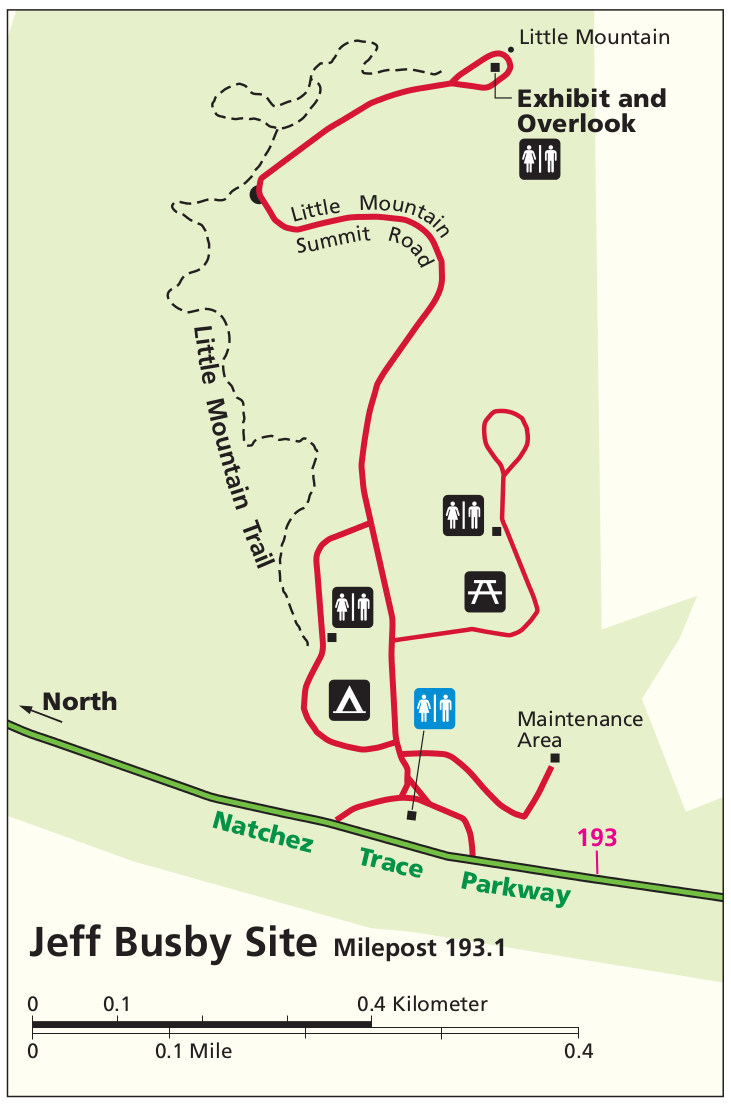 The Jeff Busby map shows the trails, picnic area, campground, and services on the Trace midway between Jackson and Tupelo, MS. Click the image to view a full size map or download the PDF.
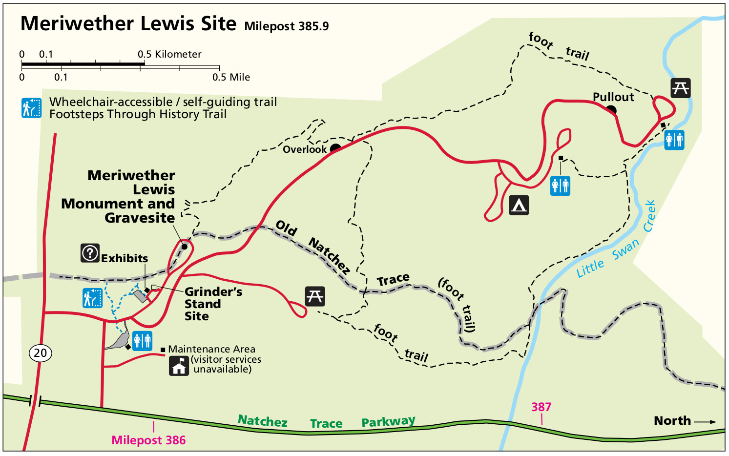 This Meriwether Lewis map focuses on the gravesite and monument for Meriwether Lewis, near the end of the Trace in Tennessee. Click the image to view a full size map or download the PDF.
Natchez Trace trail maps
The following maps are all part of Natchez Trace National Scenic Trail – technically a separate park site than Natchez Trace Parkway, but I’ve grouped them on this page to make things less confusing. These maps are presented in order, from southwest to northeast.
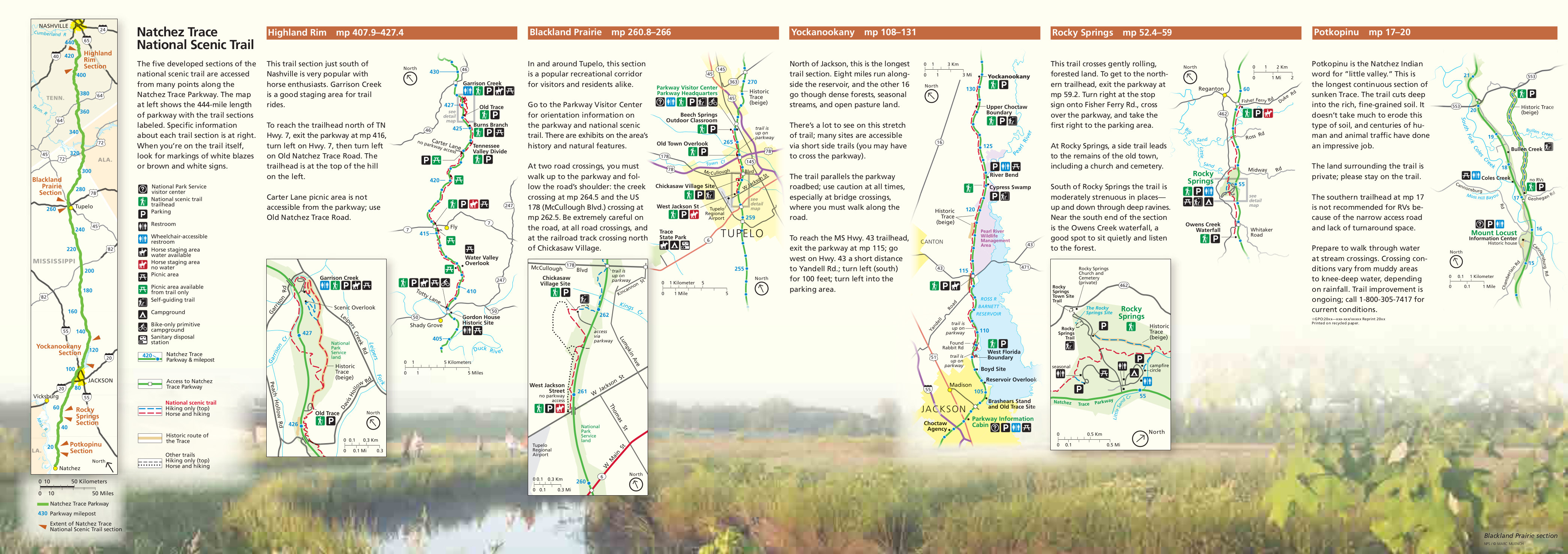
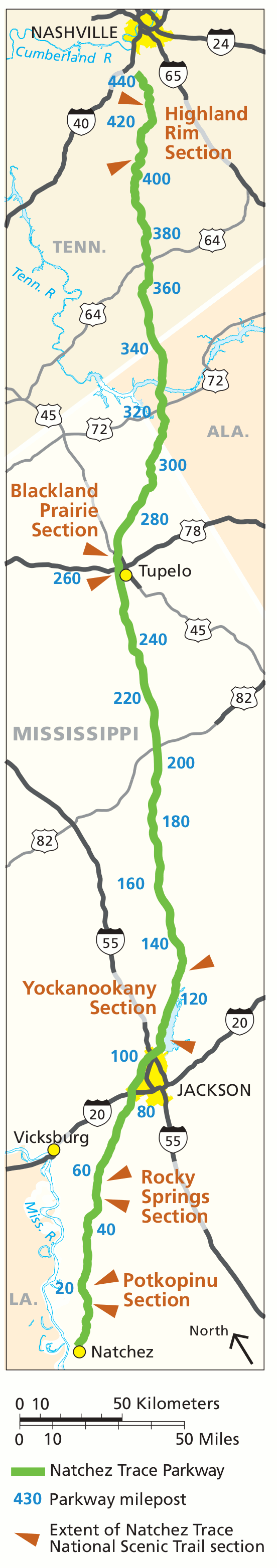 Here is an overview map of each section of the Natchez Trace National Scenic Trail, shown here in comparison to the parkway. Click the image to view a full size map or download the PDF.
 This is a Potkopinu section trail map, showing the stretch of trail near the parkway’s beginning in Natchez. Click the image to view a full size map or download the PDF.
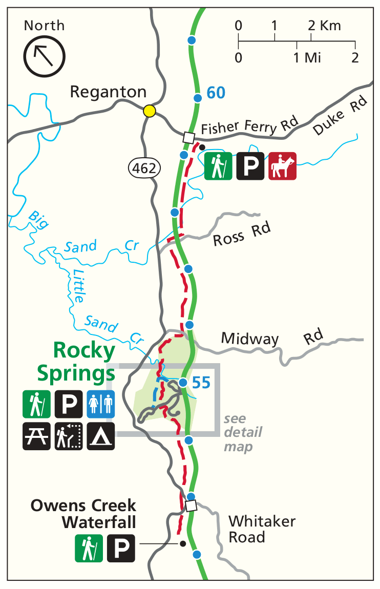 The Rocky Springs trail map includes the Owens Creek Waterfall, located in between Natchez and Jackson. Click the image to view a full size map or download the PDF.
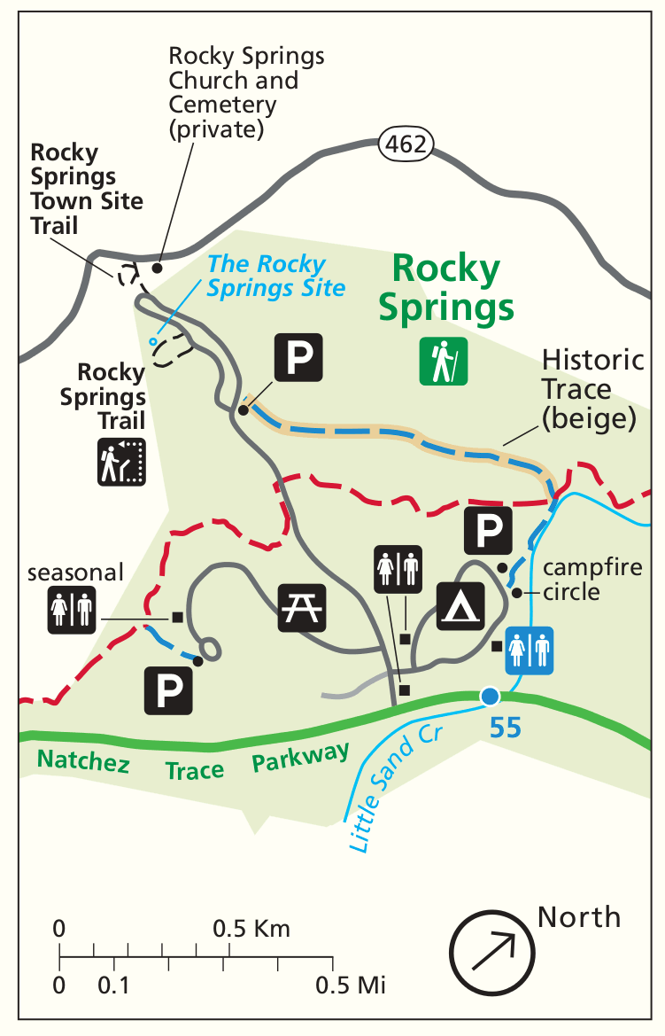 This Rocky Springs detail map zooms in on the Rocky Springs developed area, highlighting the trail specifically. Click the image to view a full size map or download the PDF.
 Here’s a Yockanookany trail map that shows the trail north of Jackson, MS near the Ross R. Barnett Reservoir. Click the image to view a full size map or download the PDF.
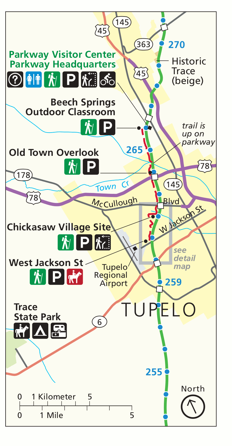 The Blackland Prairie trail map shows the trail route through Tupelo, MS. A more zoomed-in map is listed immediately below. Click the image to view a full size map or download the PDF.
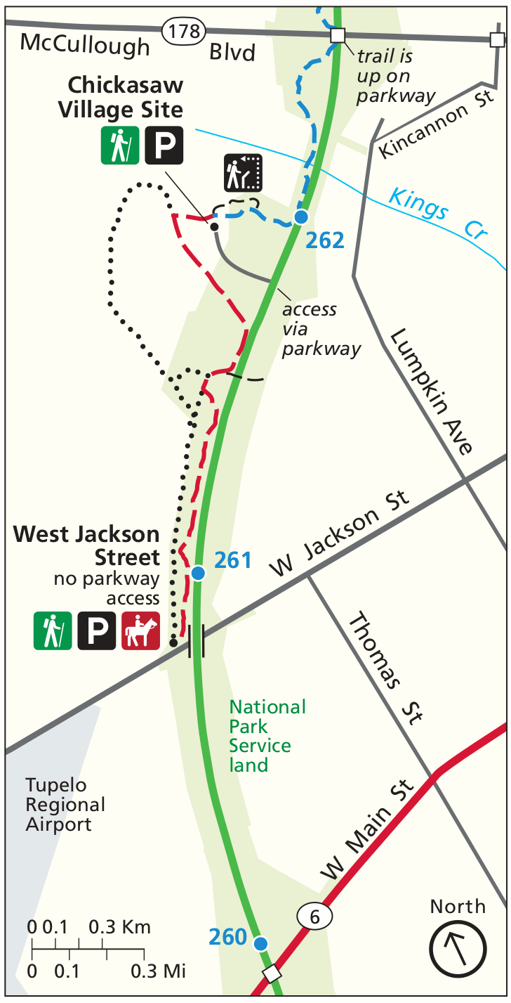 This Blackland Prairie detail map zooms in on the trails near the Chickasaw Village Site in Tupelo. Click the image to view a full size map or download the PDF.
 Here’s a Highland Rim trail map, showing the section of the trail nearest Nashville in Tennessee. Click the image to view a full size map or download the PDF.
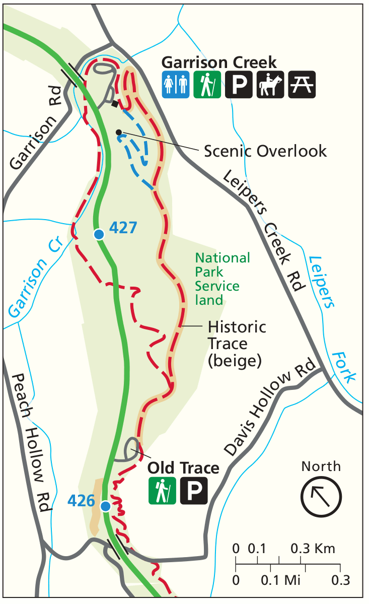 The Highland Rim detail map zooms in on the denser network of trails near Garrison Creek and shows the route up to the scenic overlook. Click the image to view a full size map or download the PDF.
 Finally, we have a single Natchez Trace National Scenic Trail map that shows all the above maps combined, along with text descriptions. Click the image to view a full size map or download the PDF.
Natchez Trace bicycle map
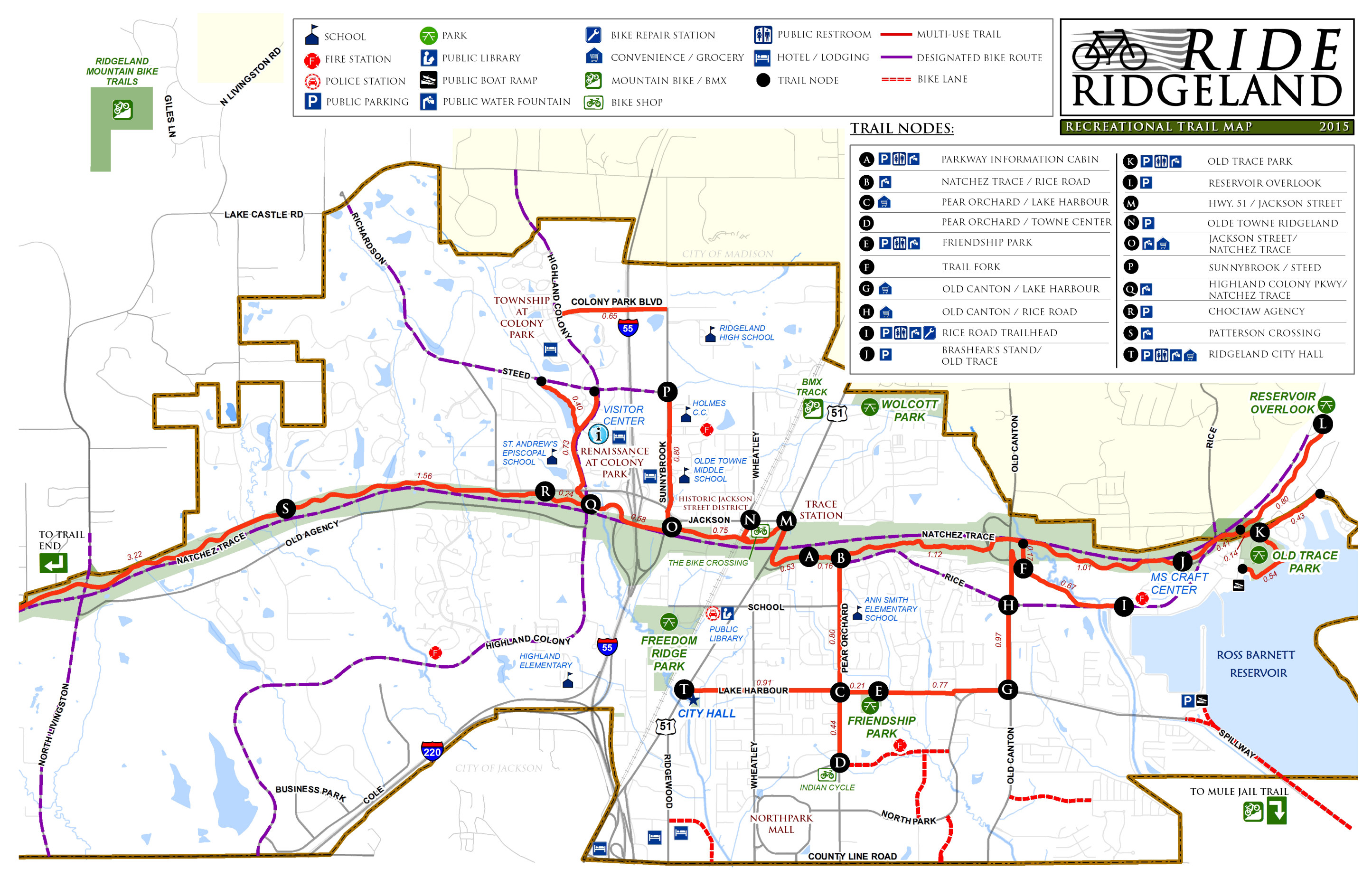 This Ridgeland bicycle map shows the bike routes in the town of Ridgeland, just off the Natchez Trace. Click the image to view a full size map or download the PDF.
…and more!
< Return to National Park Maps home
< Return to Park List
< Return to List by State