If you’re looking for a Mount Rainier map, you’ve come to the right place; currently I’ve collected 28 free Mount Rainier National Park maps to view and download. (PDF files and external links will open in a new window.) Here you’ll find maps covering the entire park and also maps focusing on specific areas, such as the trail and campground maps. You can also browse the best-selling Mount Rainier maps and guidebooks on Amazon.
Mount Rainier map from the park brochures
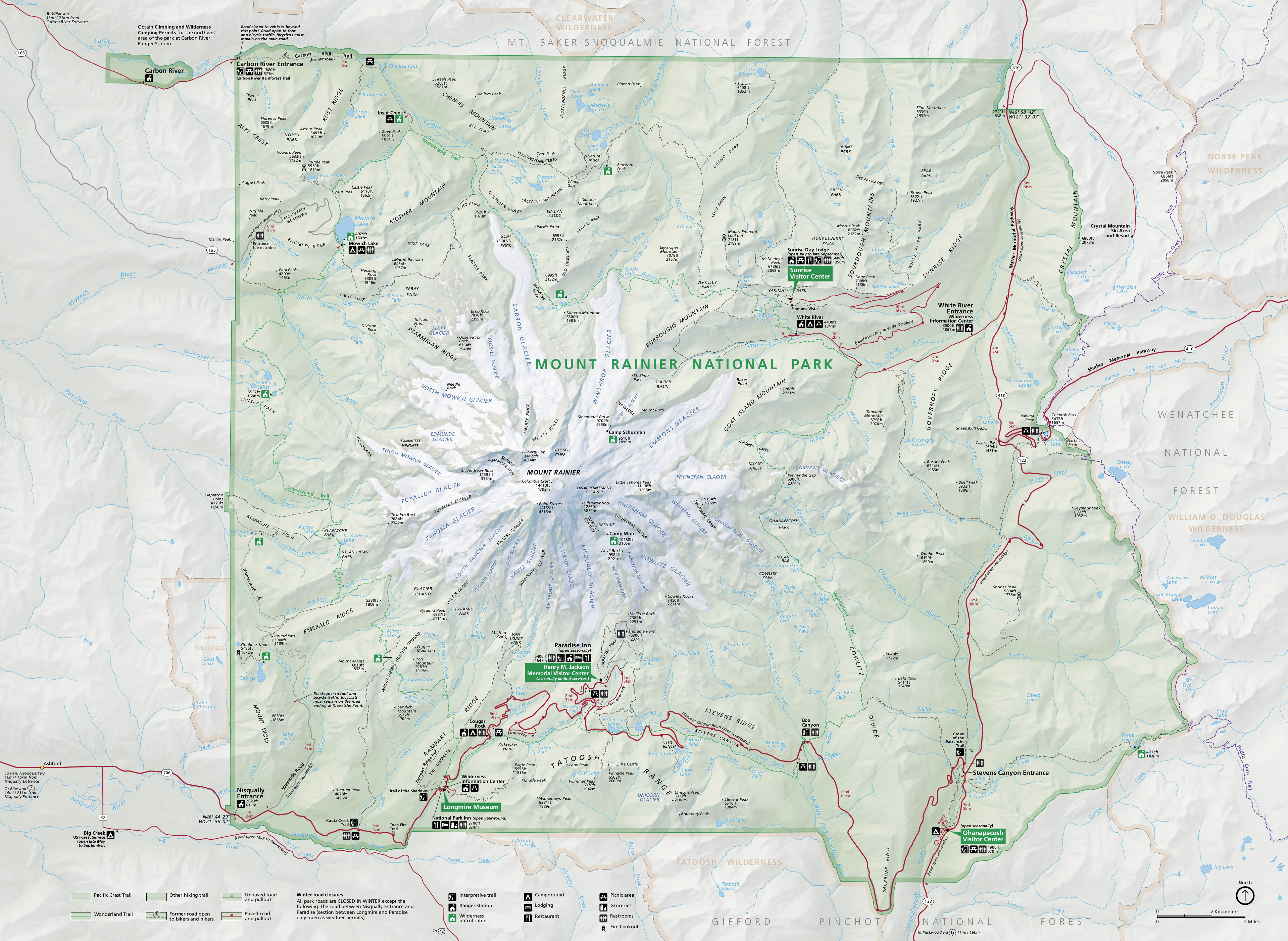 Here’s the official revised Mount Rainier map from 2015, which includes minor updates at the expense of a much larger PDF file size. Click the image to view a full size JPG (2.5 mb) or download the PDF (16.9 mb).
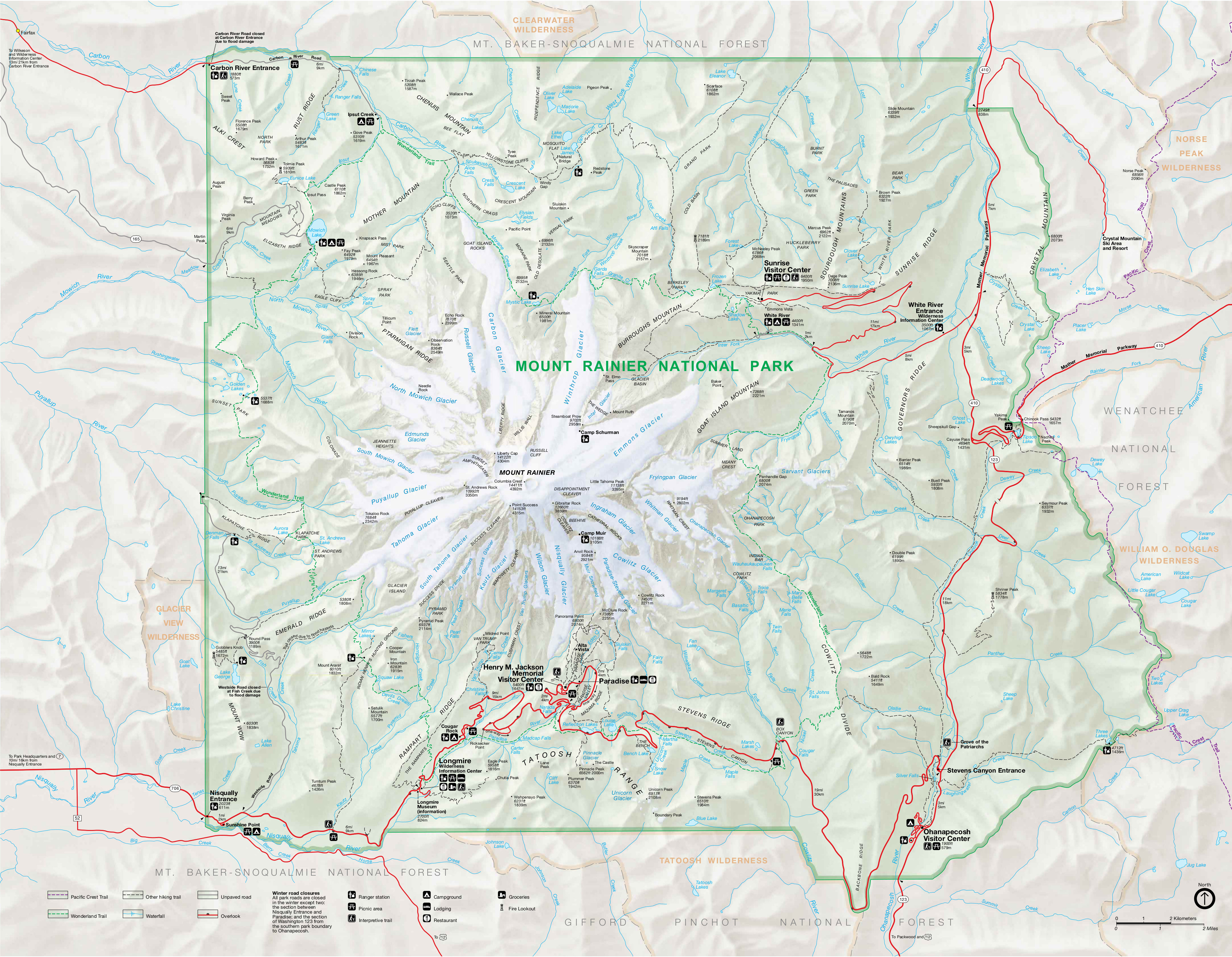 This is the main Mount Rainier National Park map from the park brochure, showing roads, major trails, and points of interest. Click the image to view a full size JPG (2.5 mb) or download the PDF (700 kb).
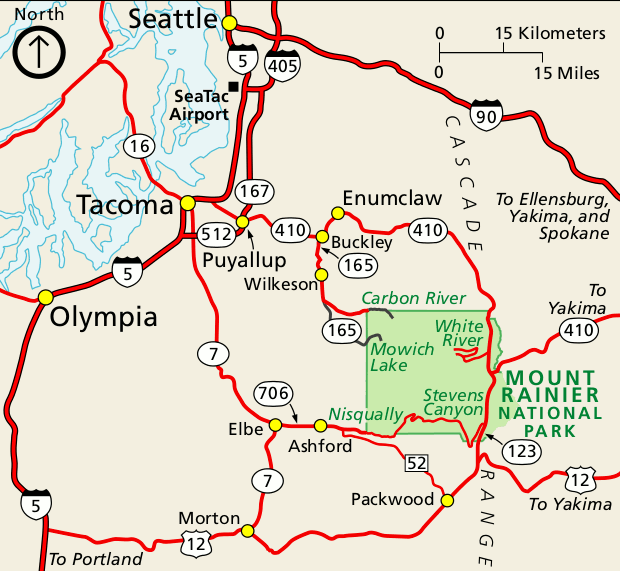 This is a regional Mount Rainier map, showing the primary roads used to reach Mount Rainier from Seattle and Tacoma. Click the image to view a full size GIF (60 kb) or download the PDF (100 kb).
Mount Rainier trail maps
 If you want a full color waterproof trail map with topographic lines, you should probably purchase the National Geographic Trails Illustrated map. The free maps below work well for trip planning and for short hikes, but aren’t going to be too useful for overnight wilderness trips. This map includes mileages, backcountry campgrounds, and detailed topo lines, and is the one you should take with you when backpacking.
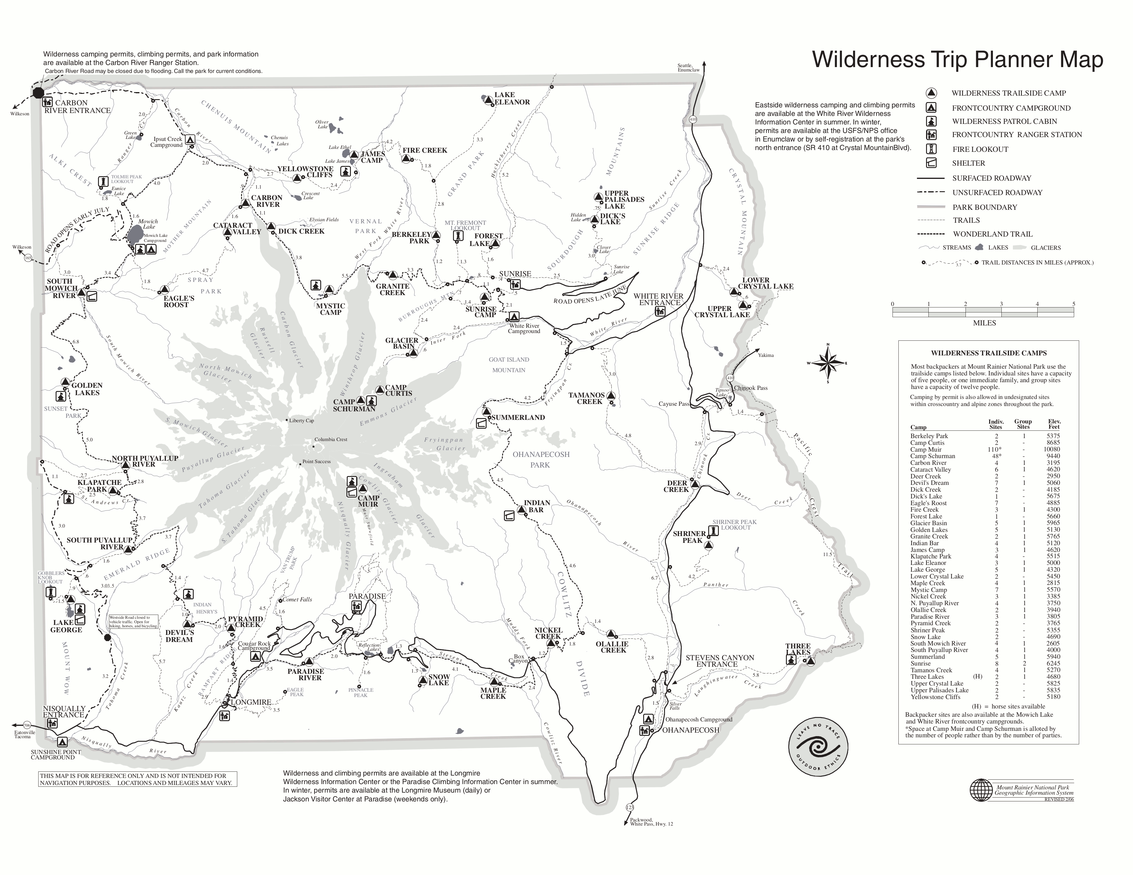 This is a Mount Rainier trail map, showing backcountry wilderness campsites and trail mileages, focusing on the Wonderland Trail. Click the image to view a full size GIF (500 kb) or download the PDF (1 mb).
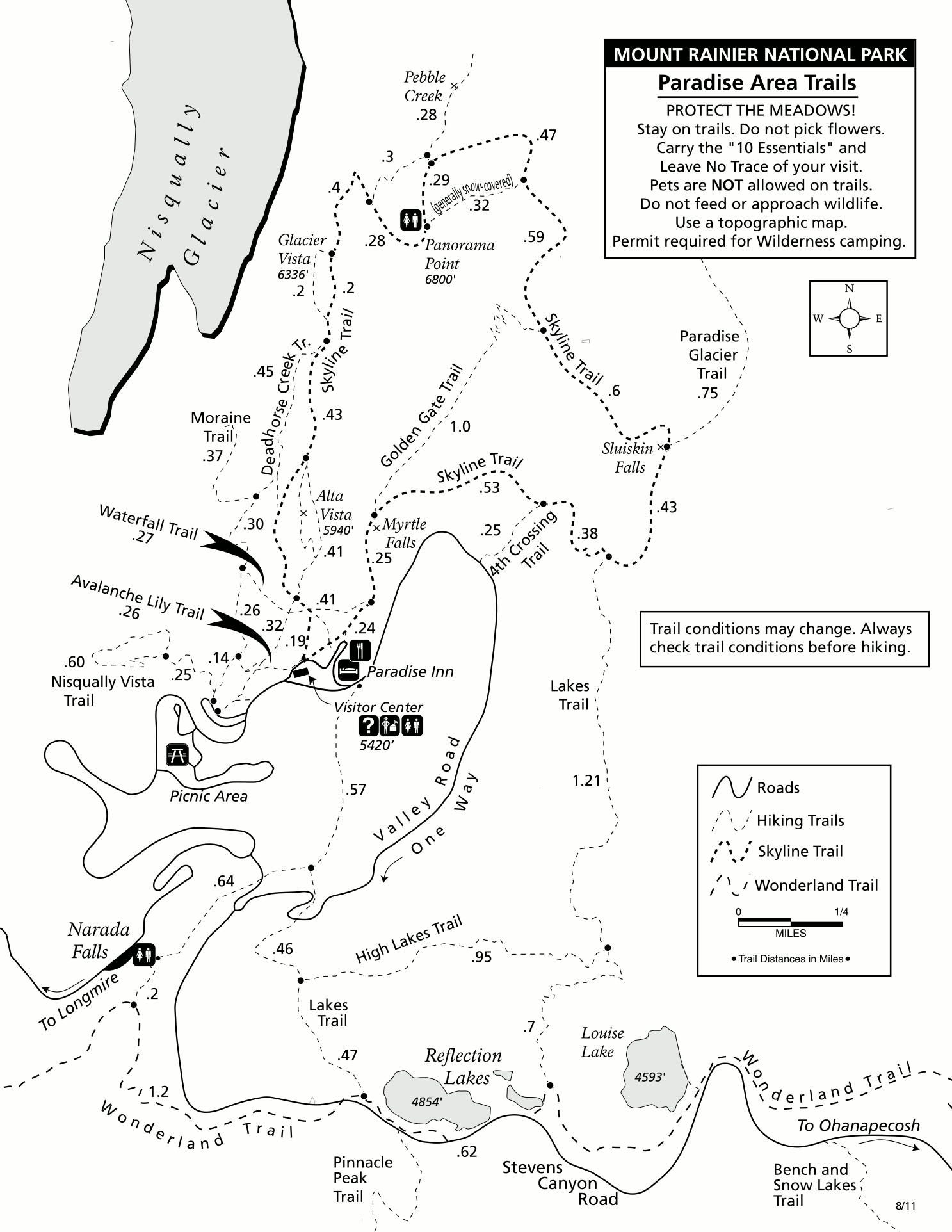 This is a summer Paradise trail map (200 kb), showing popular hiking trails to views of waterfalls (Myrtle Falls, Sluiskin Falls), lakes, Nisqually Glacier, Paradise Glacier, and more.
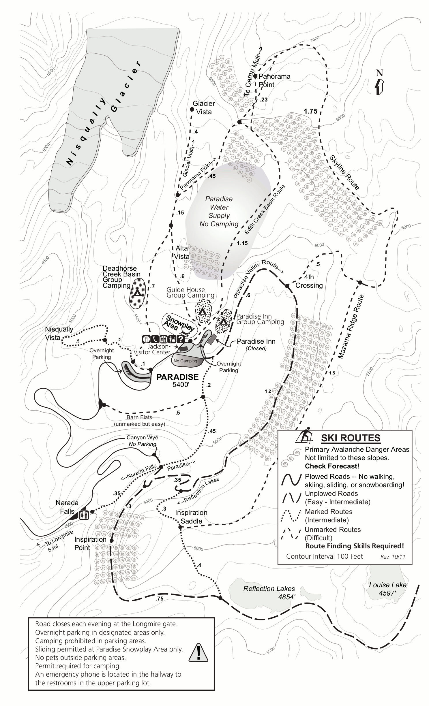 This is a Paradise winter trail map (600 kb), showing the snowplay area, popular ski and snowshoe routes, avalanche danger zones, and snow camping areas near the Jackson Visitor Center.
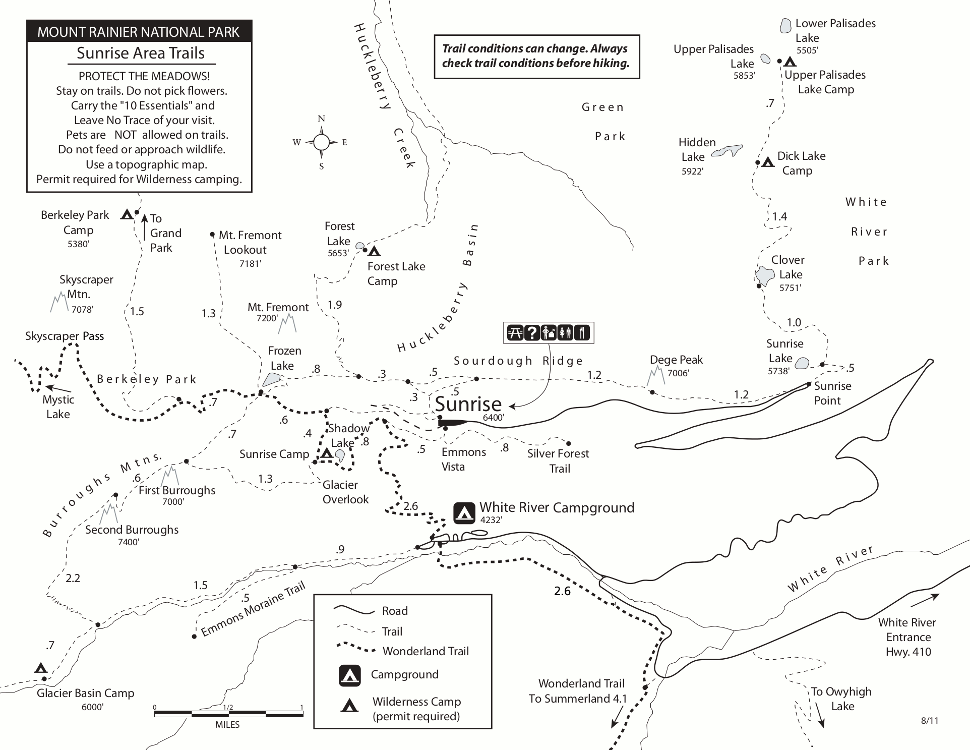 This is a Sunrise trail map (200 kb), showing trails along Sourdough Ridge, Burroughs Mountain, and popular lakes and campsites along the Wonderland Trail like Shadow Lake and Frozen Lake.
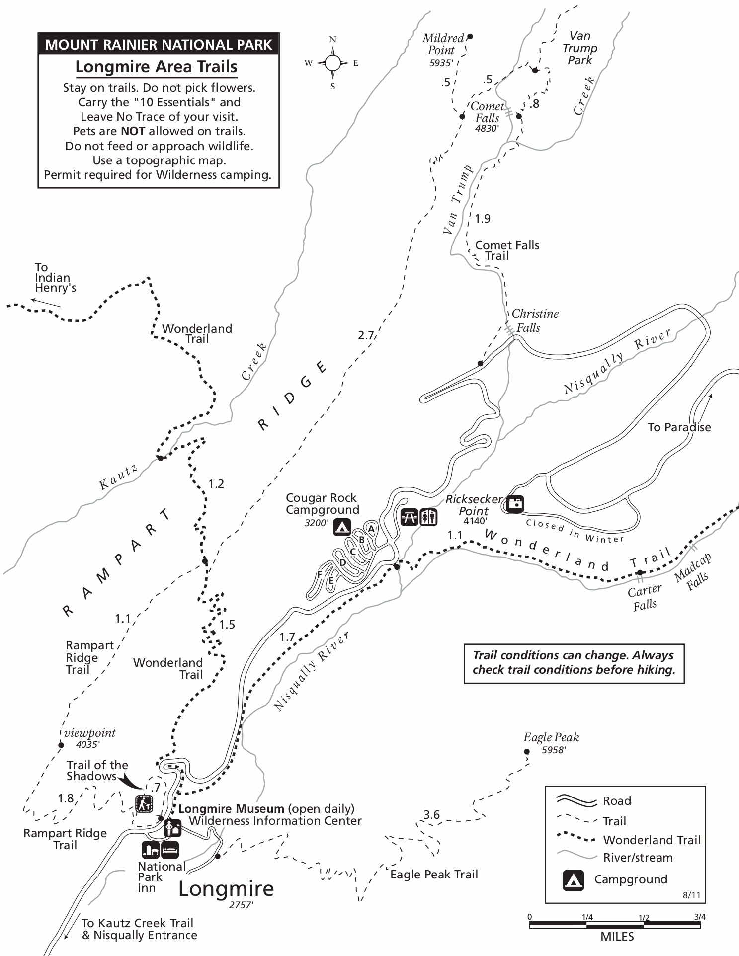 Here’s a Longmire trail map (200 kb), showing the Wonderland Trail, Cougar Rock Campground, and a few hiking trails leading toward waterfalls (Christine Falls, Comet Falls, Carter Falls, Madcap Falls).
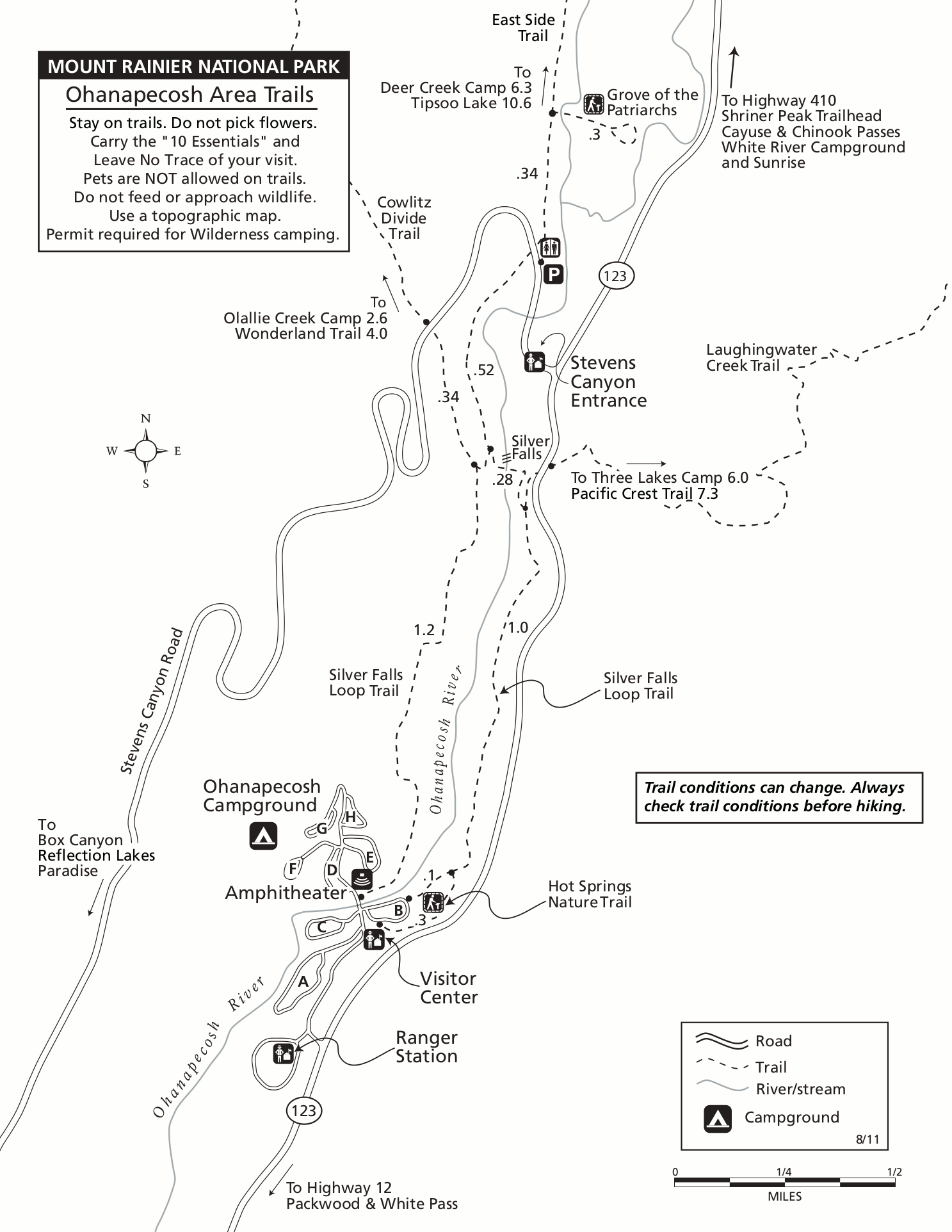 The Ohanapecosh trail map (200 kb) includes hikes to Silver Falls, Grove of the Patriarchs, and others in the Stevens Canyon area of Mount Rainier along the Ohanapecosh River.
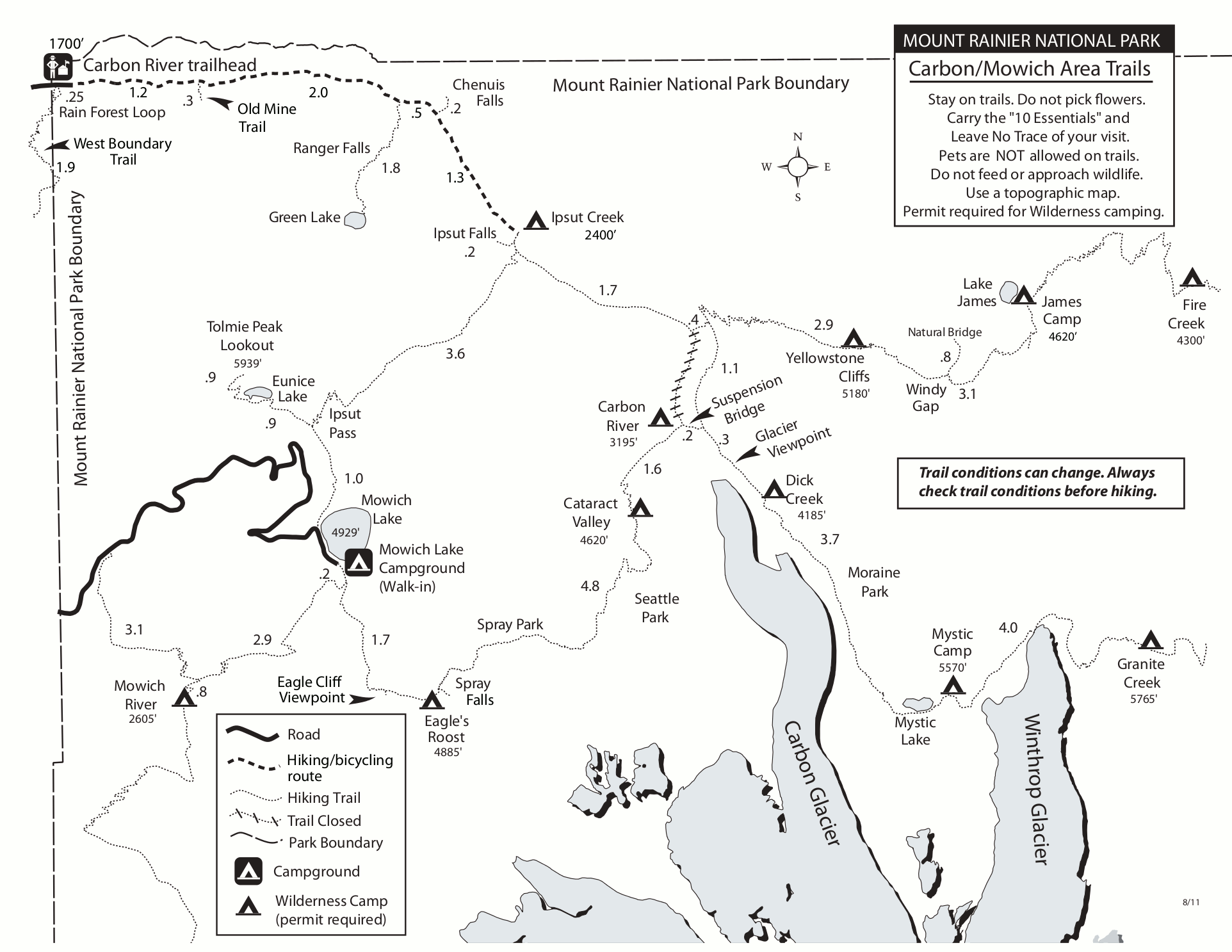 This is a Carbon River and Mowich Lake trail map (200 kb), showing trails in the northwest corner of Mount Rainier National Park to places like Spray Park, Seattle Park, Carbon Glacier, and more.
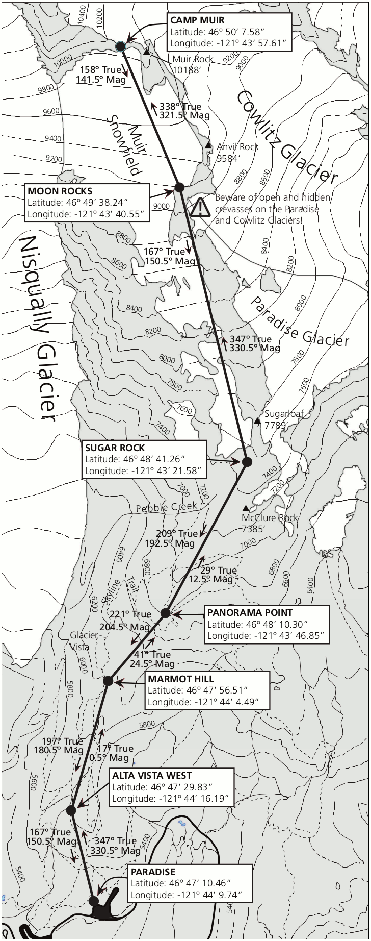 This is a navigation map to Camp Muir from Paradise (300 kb), showing the route across the snowfields. This is not a hiking trail and should only be done by hikers with considerable off-trail experience.
Mount Rainier hiking maps
The following maps are from trailhead wayside exhibits throughout the park.
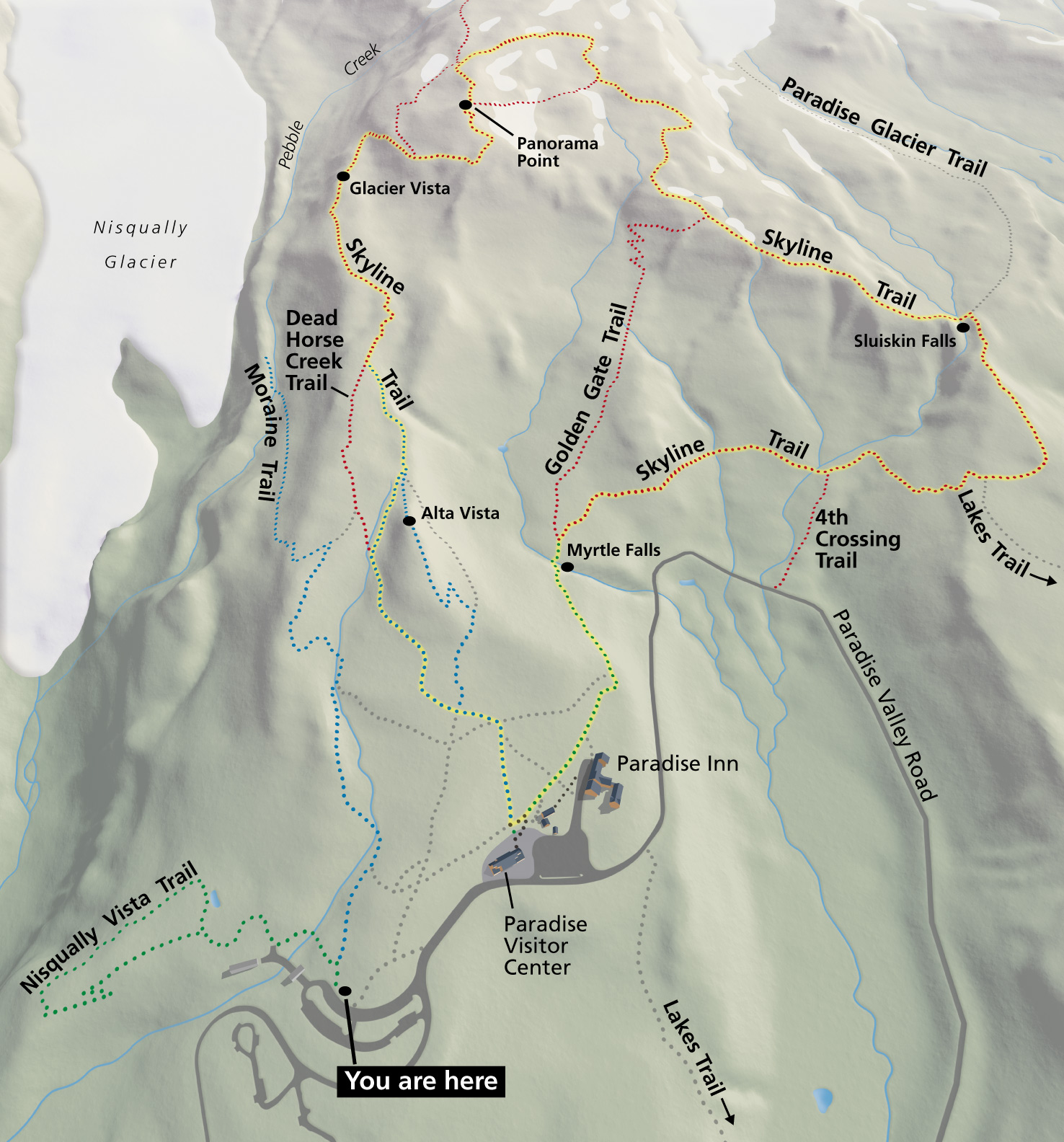 This Paradise area trails map (500 kb) is from a sign at the Paradise parking lot. It shows the entire network of trails that view the Nisqually Glacier, Paradise Glacier, Myrtle Falls, and Panorama Point.
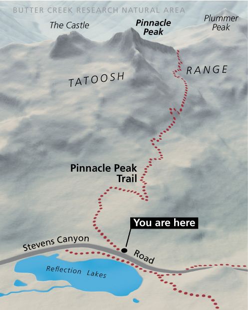 The Pinnacle Peak trail map (90 kb) shows the route to the top of (what else?) Pinnacle Peak, accessible from the Stevens Canyon Road near Reflection Lake, just south of the Paradise area.
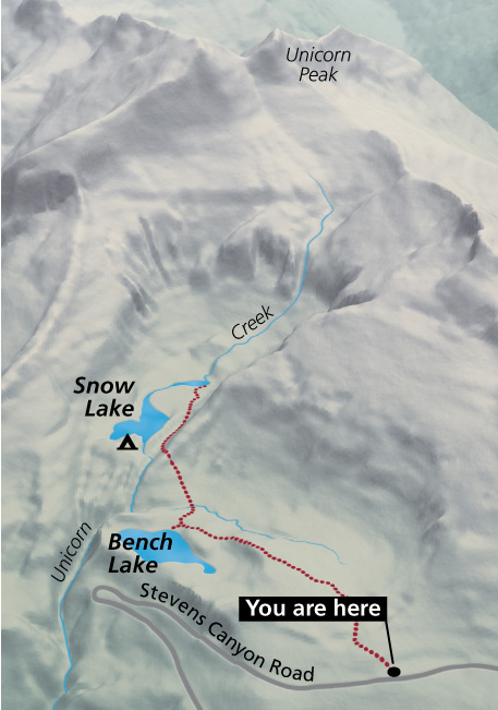 Here’s a Bench Lake trail map (80 kb), from the trailhead sign at the parking area southeast of Paradise. The trail travels past Bench Lake to Snow Lake in the Tatoosh Range near Unicorn Peak.
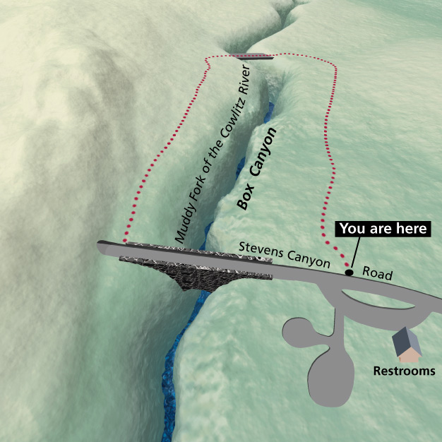 The Box Canyon trail map (100 kb) shows this very simple, flat loop of less than a mile. It’s located further down the Stevens Canyon Road, east of Paradise, Pinnacle Peak, and Bench Lake.
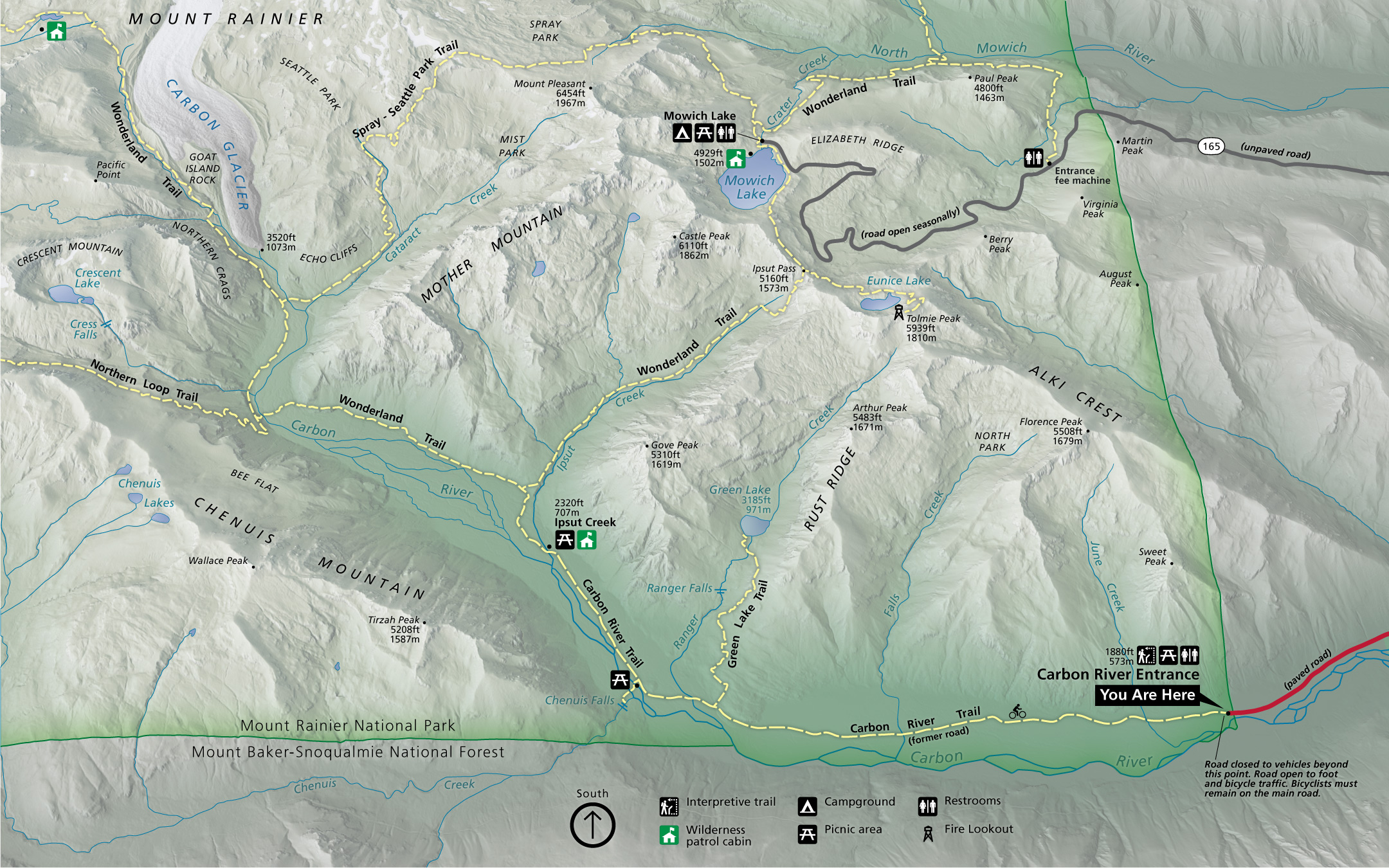 This Carbon River trail map (1.0 mb) is from a sign at the Carbon River entrance at the end of the road. It shows the trail network including Mowich Lake, the Carbon Glacier, and part of the Wonderland Trail.
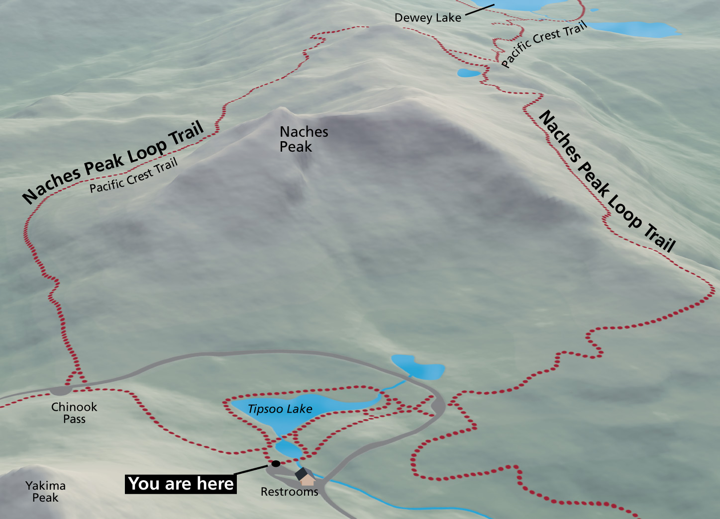 Here’s a Naches Peak trail map (250 kb), showing the routes that depart Tipsoo Lake to loop around Naches Peak. Access to this trail is just inside the park boundary, west of Chinook Pass on Highway 410.
Mount Rainier lodging map
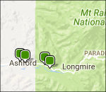 If you want to stay just outside Mount Rainier National Park, your closest bet will be the town of Ashford; to the right you can open a Hotels.com interactive lodging map centered there. Zooming out will show other lodging options in nearby towns, though they’re all further away. Instead, you may be best off browsing Hotels.com’s top-rated Mount Rainier lodging where you can compare reviews, photos, locations, and prices.
Paradise area maps
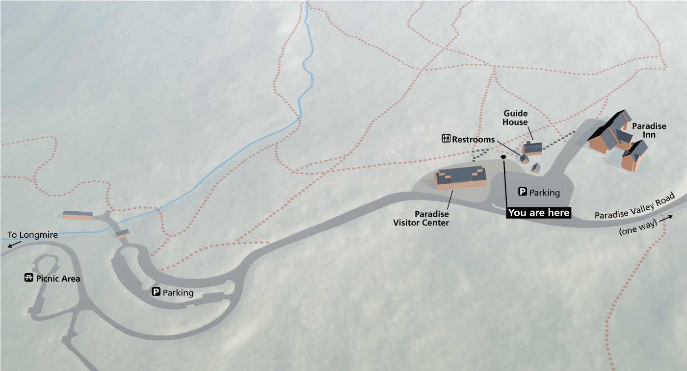 Here’s a current Paradise map (150 kb), taken from a wayside exhibit in front of the Paradise Visitor Center. This will help you get oriented between the visitor center, Paradise Inn, and parking areas.
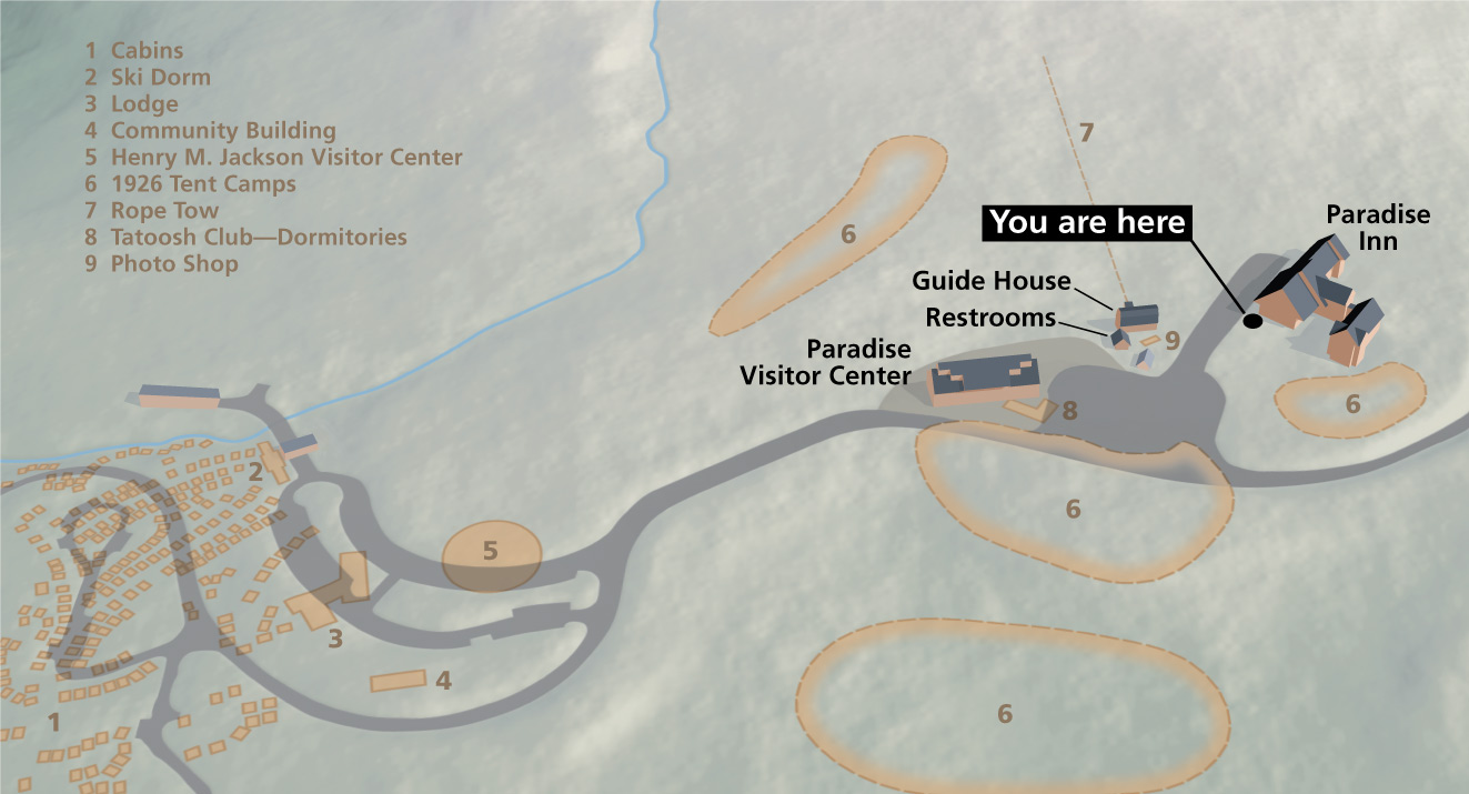 This is a historic Paradise map (180 kb), located on the wayside next to the Paradise Inn. It shows the former locations of buildings from earlier days, such as cabins, ski dorms, rope tow, and old visitor center.
Mount Rainier topographic maps
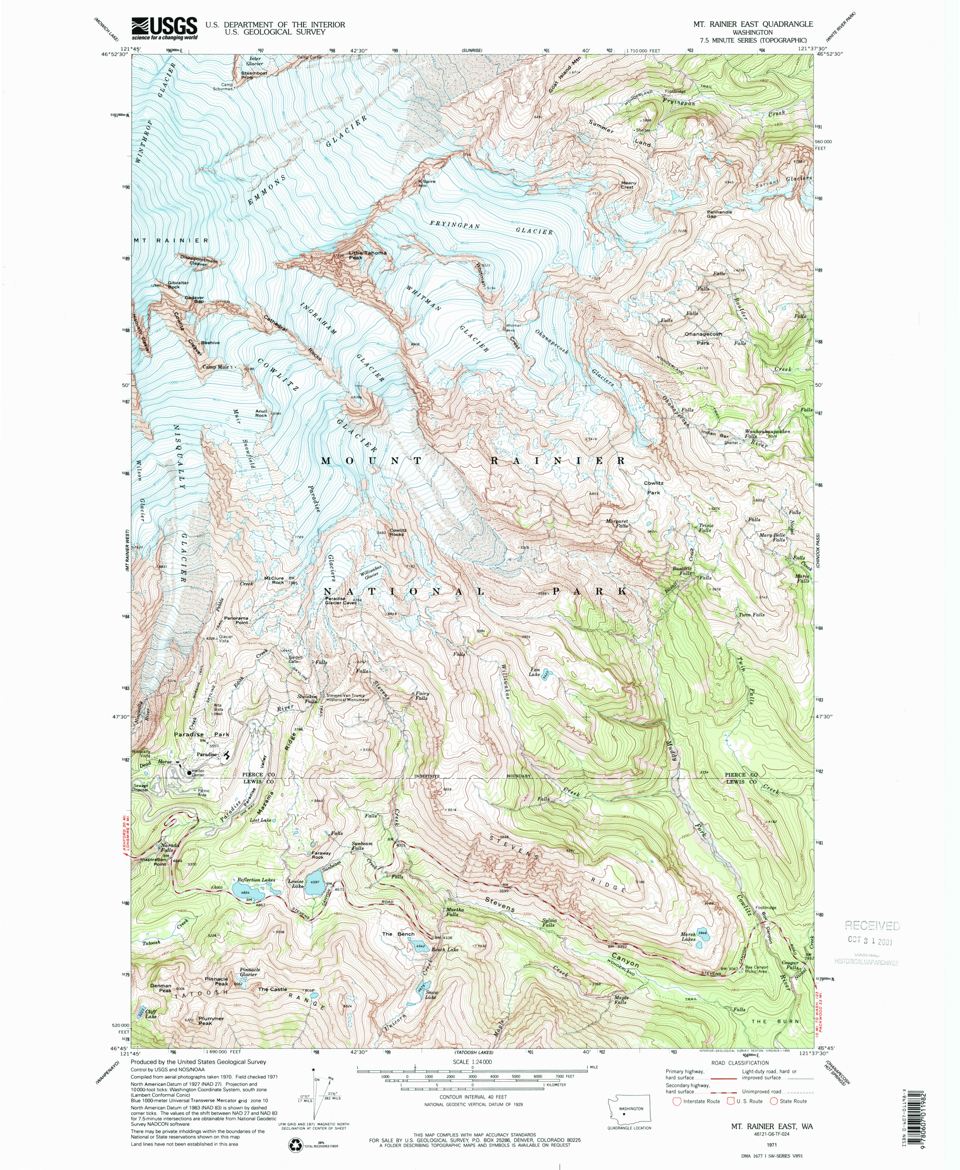 This Mount Rainier East topo map focuses on the southeast side of Mount Rainier and includes the Paradise developed area. Click the image to view a full size JPG (3.3 mb) or download the PDF (17.6 mb).
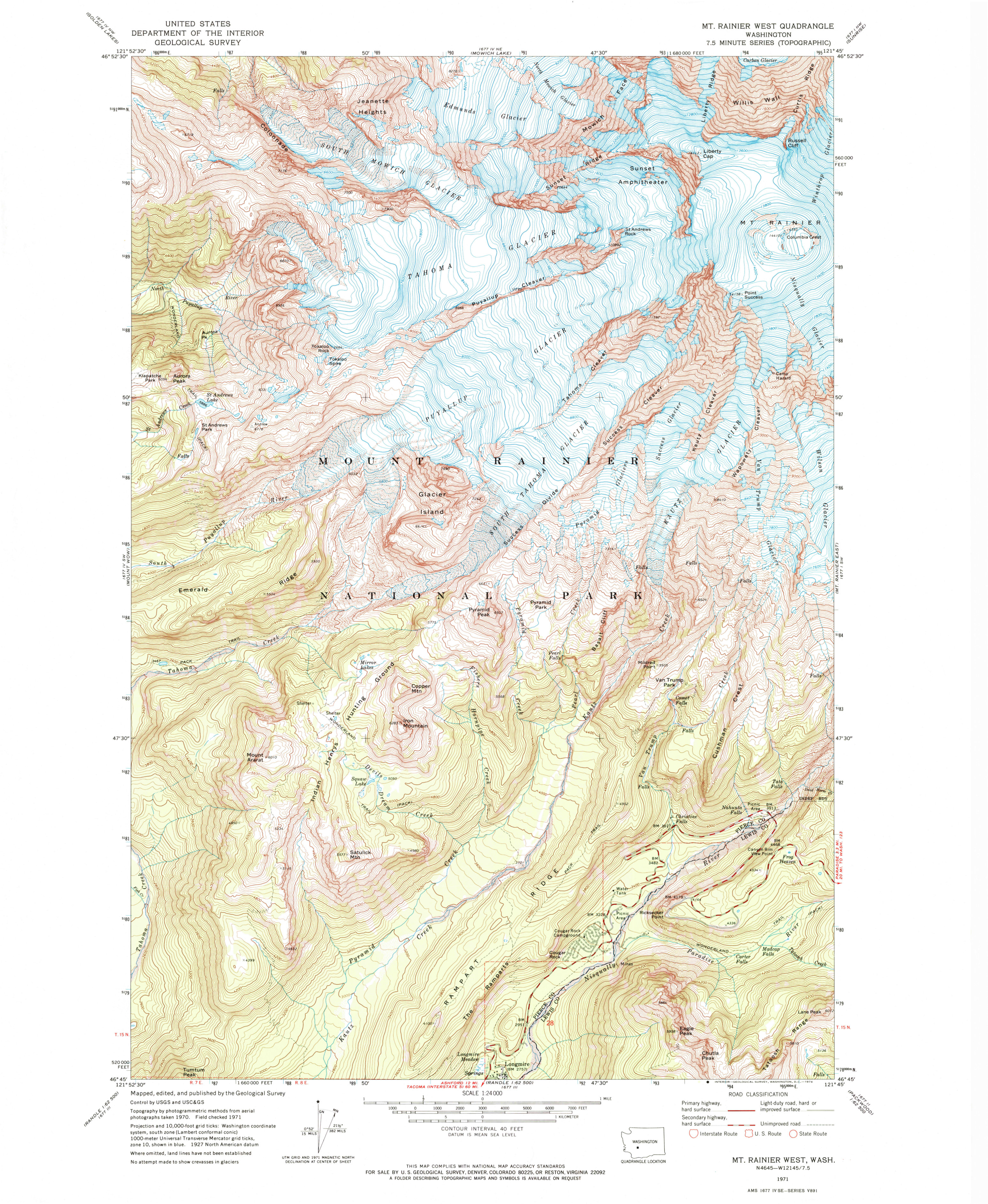 The Mount Rainier West topo map includes the Mount Rainier summit and the glaciers and features on the mountain’s southwest side. Click the image to view a full size JPG (3.5 mb) or download the PDF (18.4 mb).
Mount Rainier geologic maps
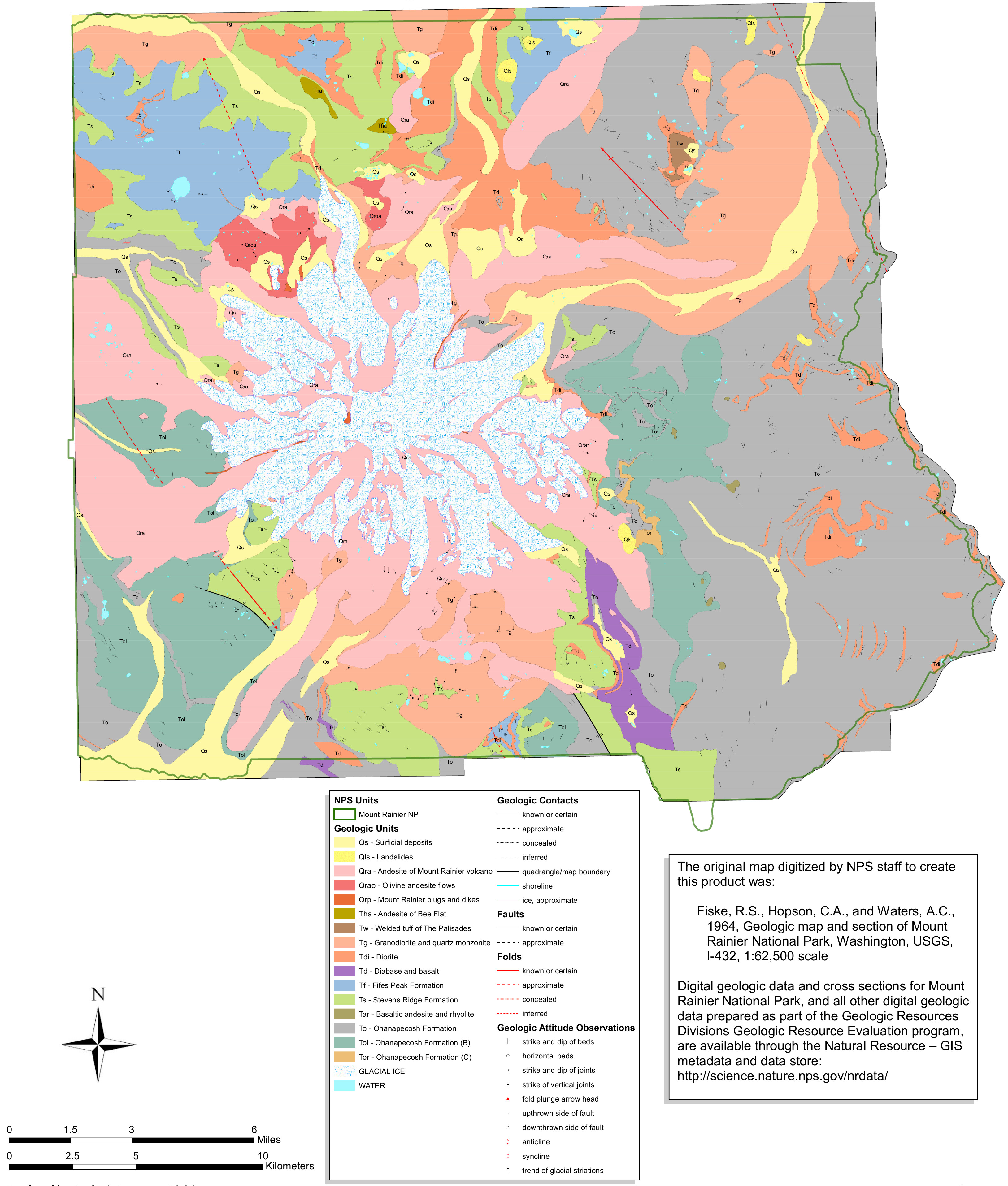 Here’s a bedrock geology map of Mount Rainier (2.1 mb), showing the various volcanic rocks that make up the foundation of Mount Rainier and the surrounding lands throughout the national park.
 This is a Mount Rainier geologic map of surficial geology (2.1 mb), showing mudflows and other more-recent features that appear on the ground surface, overlying the bedrock below.
Mount Rainier campground maps
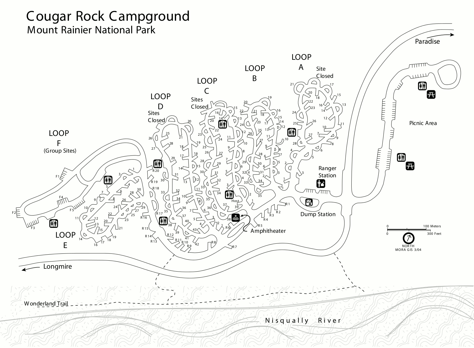 This is a Cougar Rock Campground map. Cougar Rock is located between Longmire and Paradise in the southwest corner of the park. Click the image to view a full size GIF (200 kb) or download the PDF (200 kb).
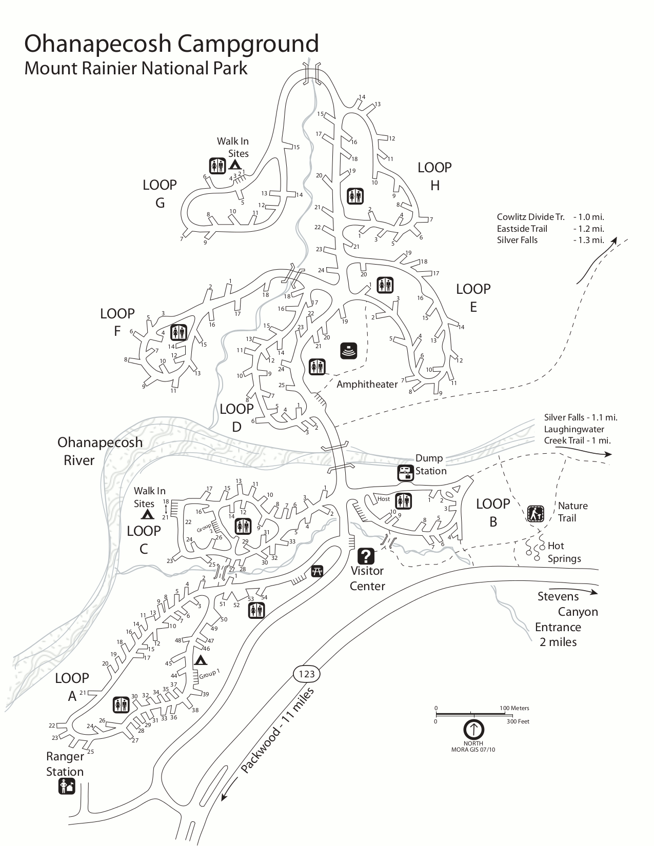 This is a map of Ohanapecosh Campground, which is located near the Ohanapecosh Visitor Center in the southeast corner of the park. Click the image to view a full size GIF (200 kb) or download the PDF (1.2 mb).
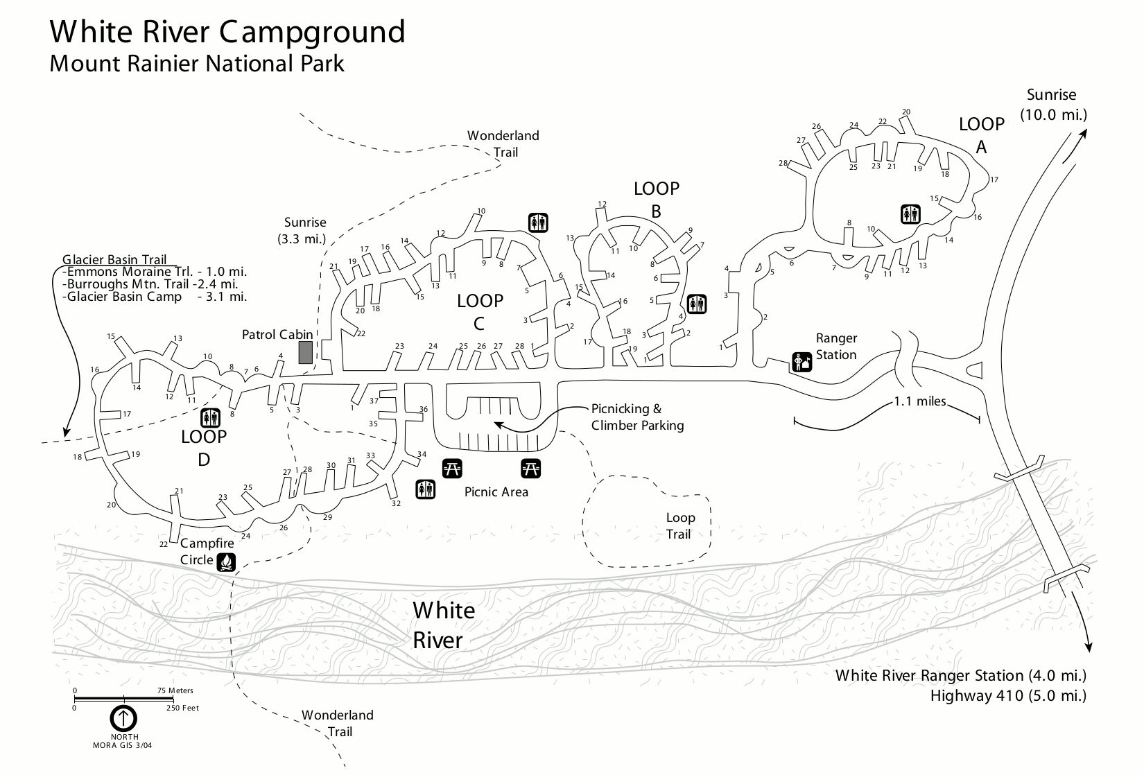 This is a White River Campground map. White River is the highest elevation campground and is located on the way to Sunrise. Click the image to view size GIF (200 kb) or download the PDF (100 kb).
Mount Rainier night sky map
 The Mount Rainier night sky map (350 kb) shows how Mount Rainier National Park’s dark skies compare to locations in Seattle, Tacoma, Yakima, and throughout the Puget Sound region.
Mount Rainier map prints and gifts
 Printed high-resolution Mount Rainier map posters and other products are available at the Mount Rainier Maps store. For prints, gift ideas, and souvenirs featuring other national parks, support this site and visit the National Park Maps store; you’ll find items to bring on vacation, keep at home for the memories, or give to your park-enthusiast friends and loved ones.
…and more!
< Return to National Park Maps home
< Return to Park List
< Return to List by State
Need more help? Browse Amazon’s best-selling Mount Rainier maps and guidebooks.