Gettysburg brochure maps
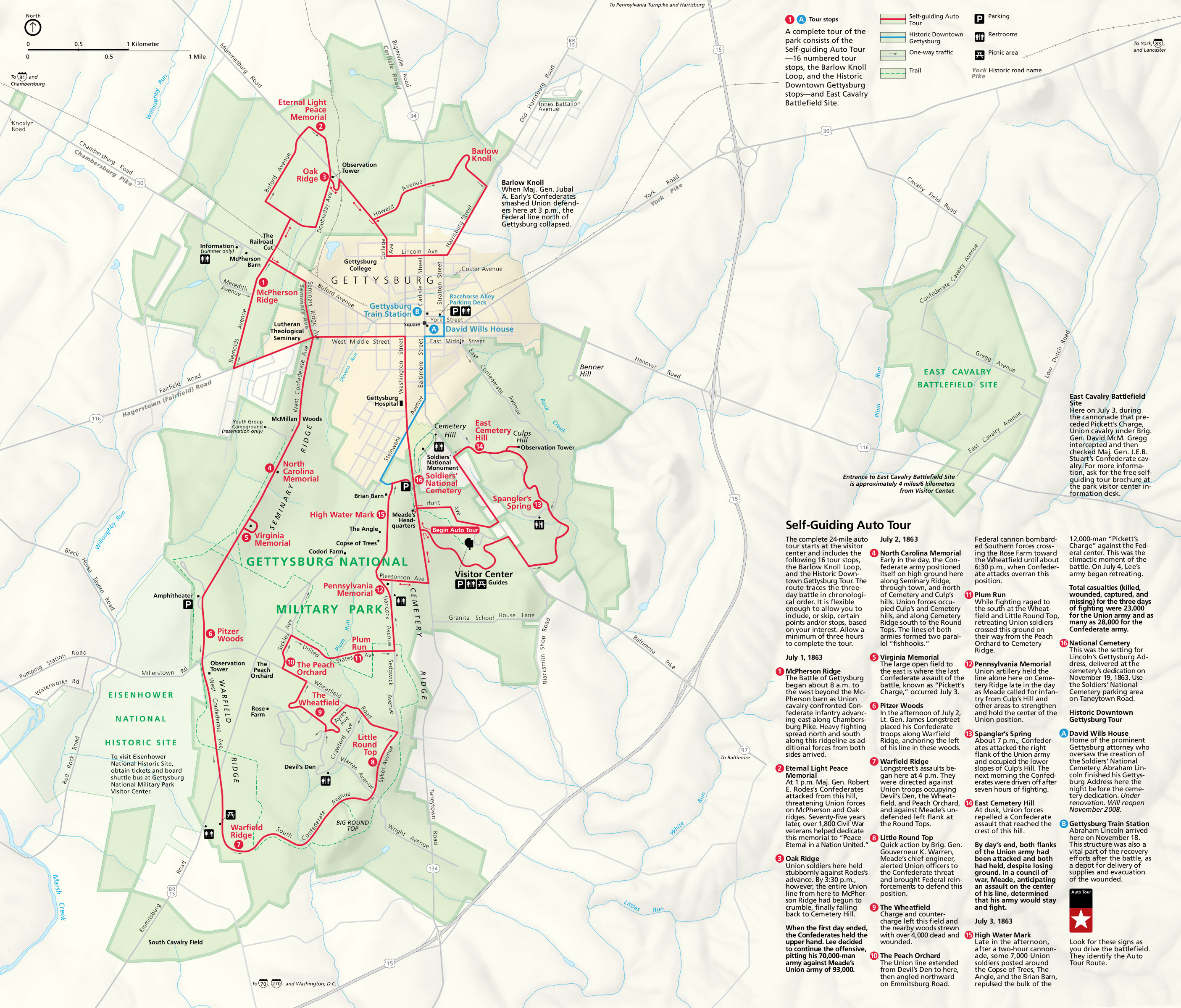 This is the official NPS Gettysburg map, including labels and tour stop descriptions for a self-guided auto tour 24 miles in length. Click the image to view a full size map or download the PDF.
Gettysburg battle maps
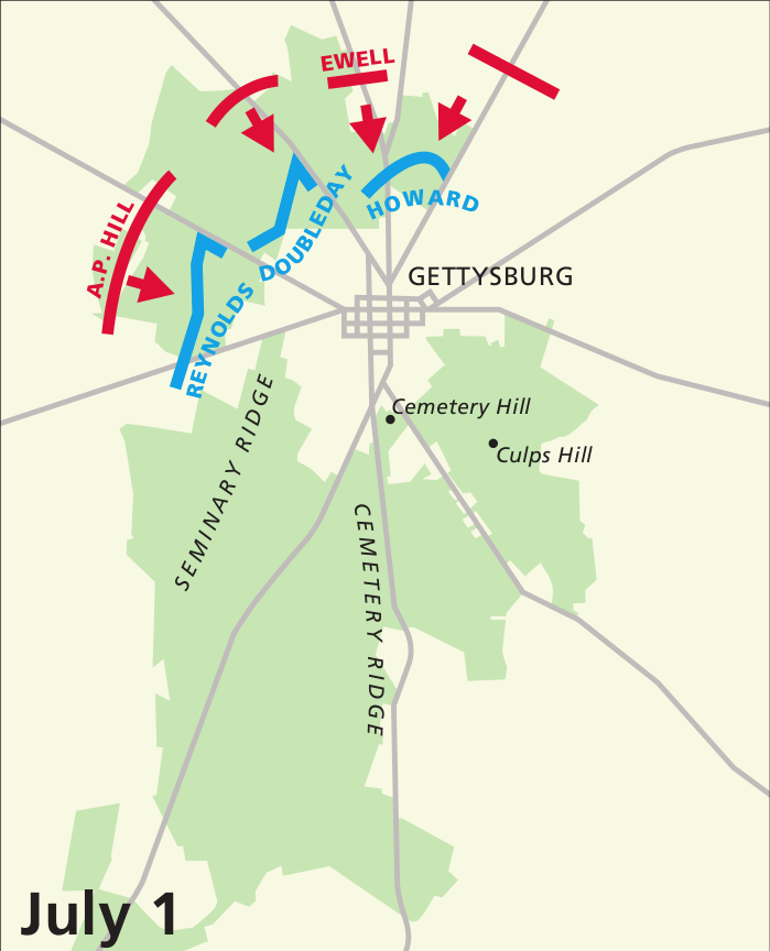 This is the July 1 battle map, focusing on the Confederate attack and the Union’s defense north of the town of Gettysburg. Click the image to view a full size map or download the PDF.
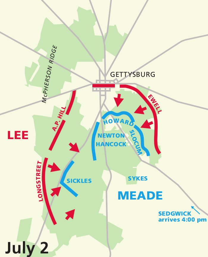 The July 2 battle map shows the Union’s new defensive line south of town, after Day 1’s Confederate successes. Click the image to view a full size map or download the PDF.
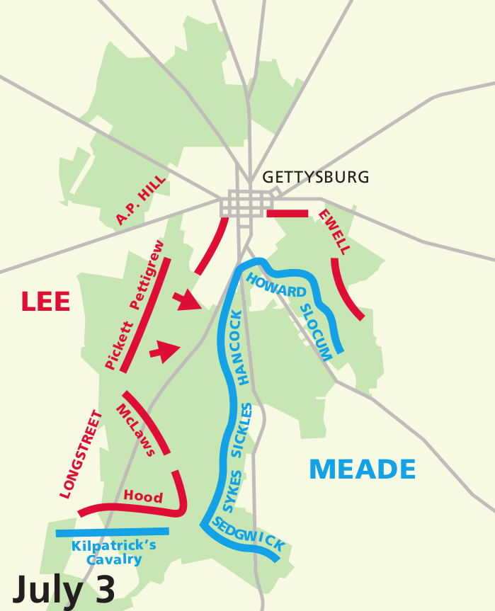 Here’s a July 3 battle map, showing the lines during the final bloodiest day of the battle, which culminated in a Union victory. Click the image to view a full size map or download the PDF.
Gettysburg lodging map
 You have a huge variety of places to stay in and around Gettysburg, so it can be difficult to decide where to choose. To the right you can view an Expedia interactive lodging map, centered on Gettysburg but also showing the surrounding communities. You might also want to browse the top-rated Gettysburg area lodging to compare prices, guest reviews, photos, and amenities.
Gettysburg recreation maps
 Here’s a Gettysburg trail map, showing both pedestrian trails and horse trails. Horse trails can be used by both horseback riders and pedestrians, while pedestrian trails cannot be used by those on horseback.
 This is a Gettysburg bike map. It color-codes roads and trails within the park based on cycling regulations: where bikes can be ridden, where they must be walked, and so on.
Gettysburg National Cemetery maps
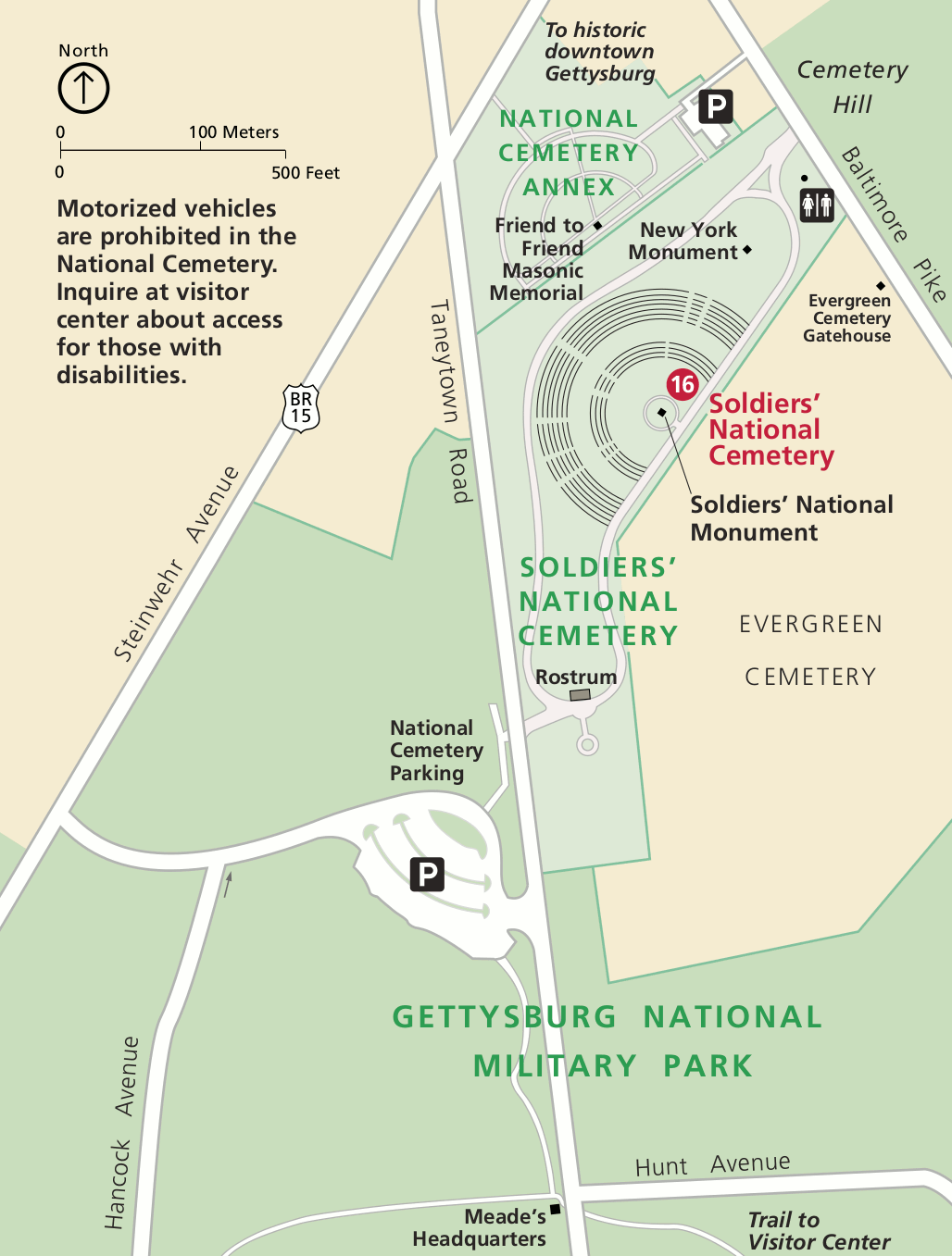 Here’s a Soldiers’ National Cemetery map, zooming in on the cemetery famously dedicated in Abraham Lincoln’s Gettysburg Address. Click the image to view a full size map or download the PDF.
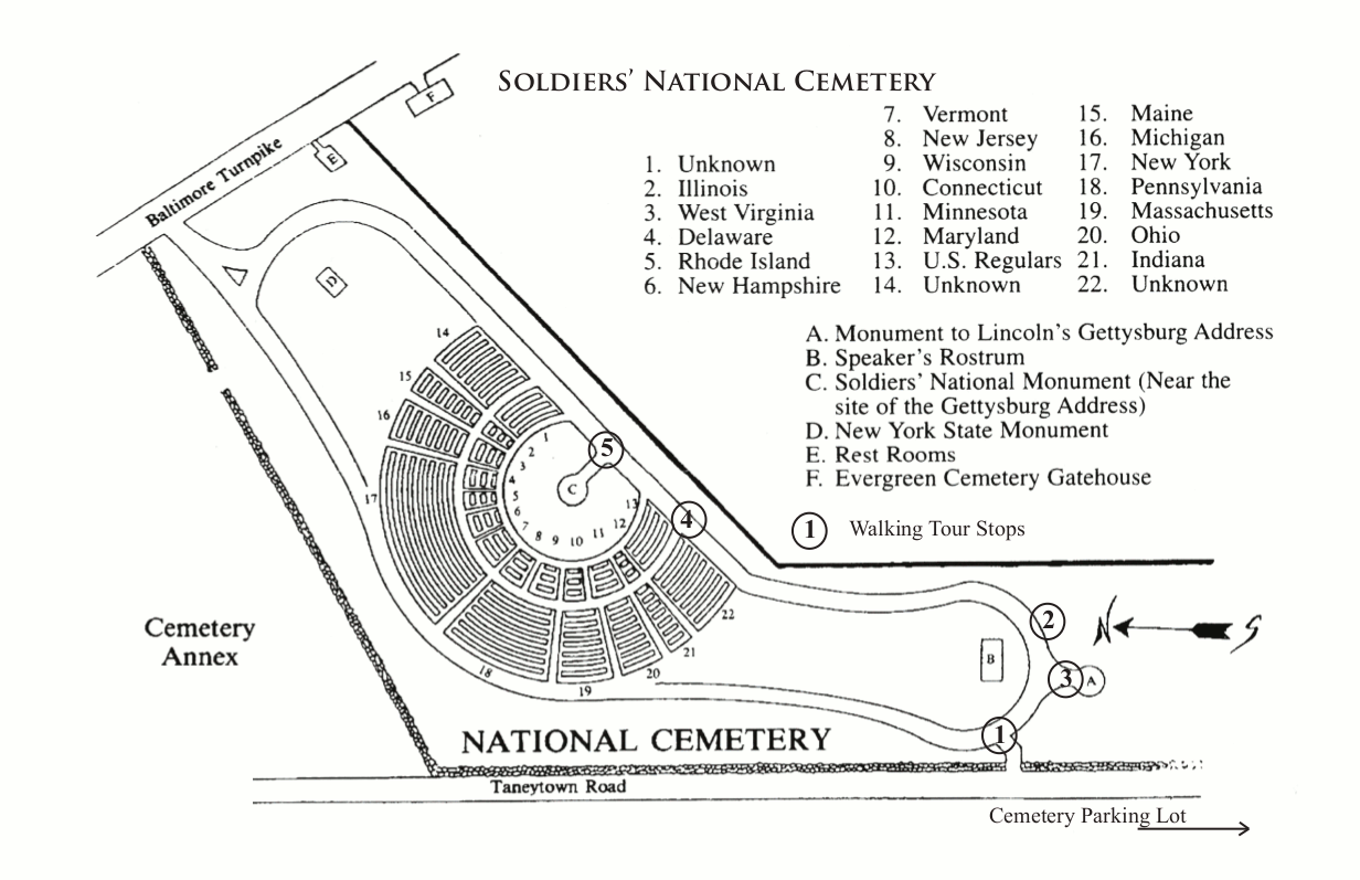
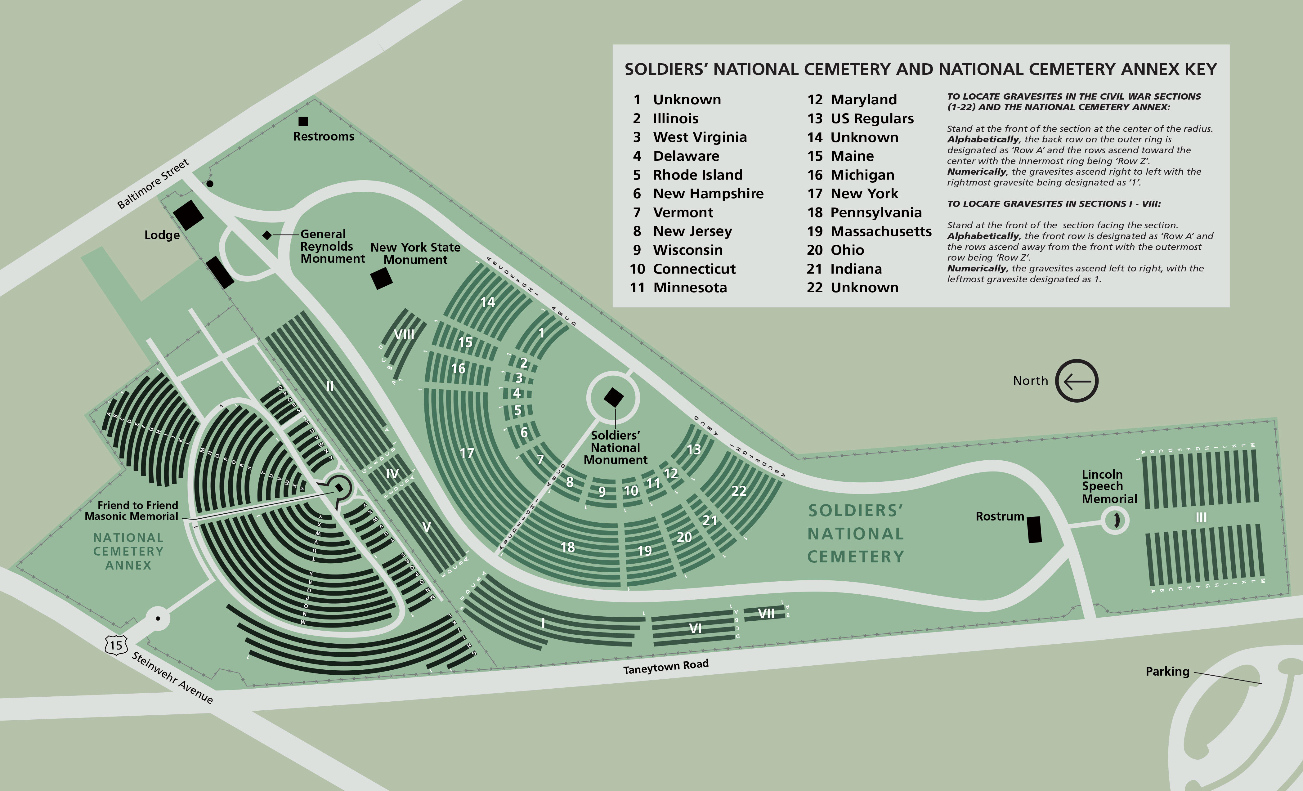 Here’s a Soldiers’ National Cemetery map, the final resting place for thousands of Union soldiers. This map provides more detail than the map above, including a key to find soldiers from each state.
Assorted Gettysburg maps
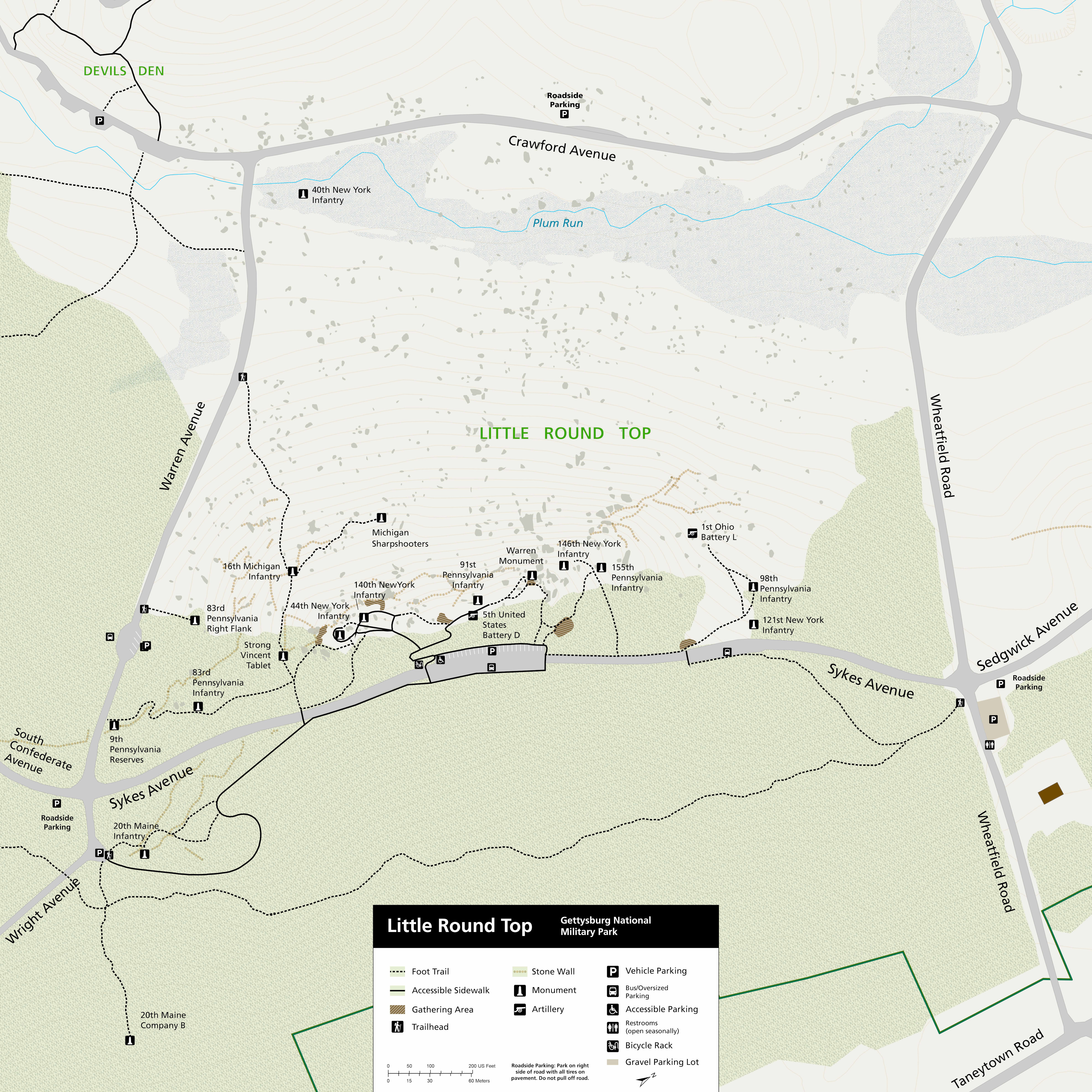 This is a Little Round Top map, reflecting the changes made during the 2022-24 rehabilitation project that improved accessibility with new trail alignments and gathering areas.
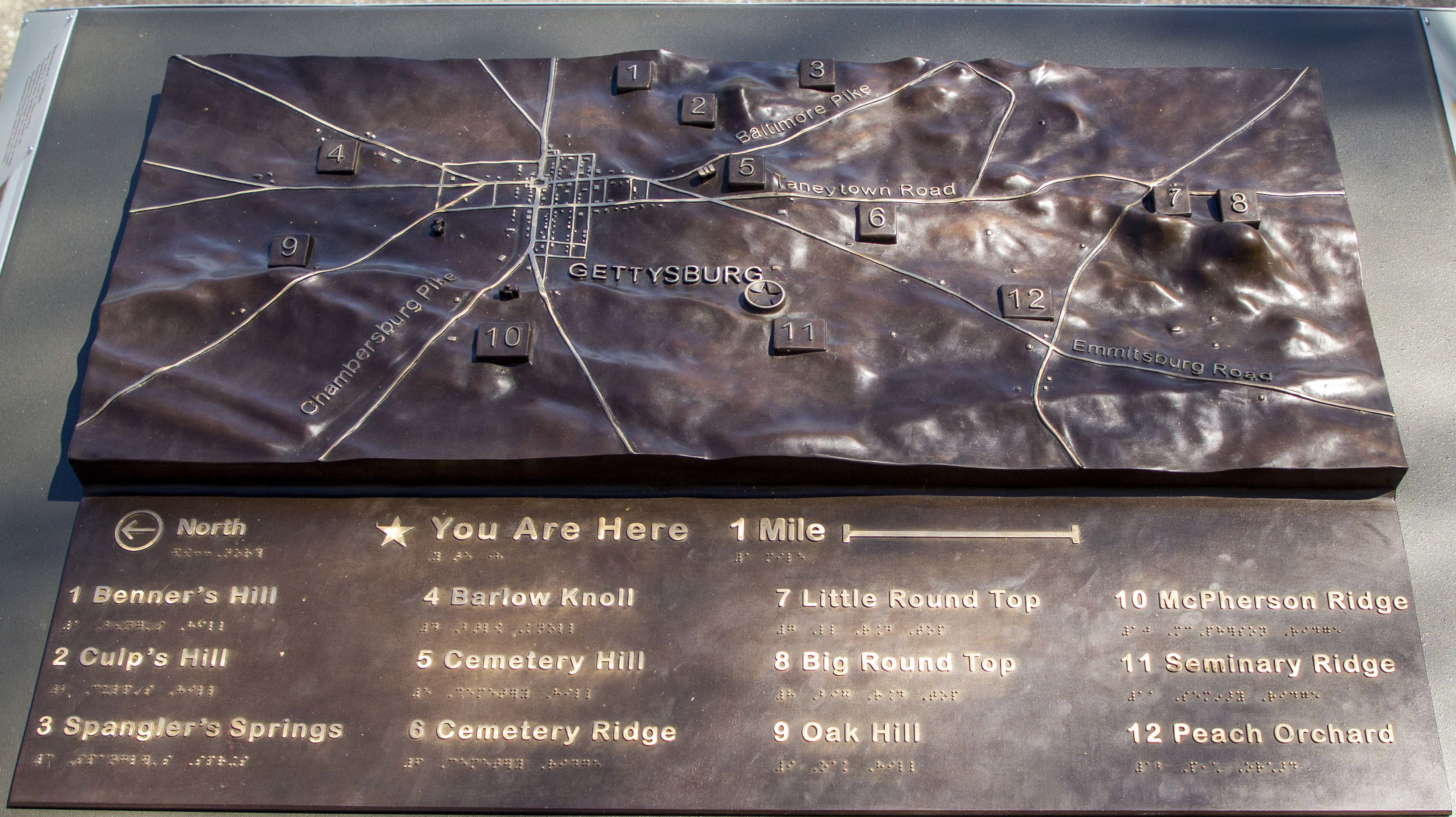 This Gettysburg tactile map shows a photo of one of three bronze relief tables in the park. They include Braille and raised lettering so visitors can touch and feel the battlefield topography.
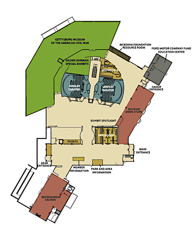 Here’s a Gettysburg visitor center map. This park’s museum and visitor center is not owned by the National Park Service, but instead by the nonprofit Gettysburg Foundation.
 The McMillan Woods campground map shows the youth campground that is available for reservation in advance by any youth group (e.g. scout troops) during their visit to Gettysburg.
Archived Gettysburg maps
The National Park Service often updates maps, and I do my best to include the newest Gettysburg maps on this page. As maps get replaced, I move the old versions down to this section. (I don’t delete maps, as I believe it’s important to preserve how park sites change over time.) Any maps you see in this section have a newer version somewhere above.
 This old detail map of Soldiers’ National Cemetery labels the burial plots according to the soldiers’ home states. Nearby points of interest such as the Gettysburg Address monument are also labeled.
 Here’s an old Gettysburg horse trail map, showing the paths of horse trails throughout the park and labeling points of interest especially relevant to those on horseback, such as hitching posts.
…and more!
< Return to National Park Maps home
< Return to Park List
< Return to List by State