Cumberland Gap maps from the official brochure
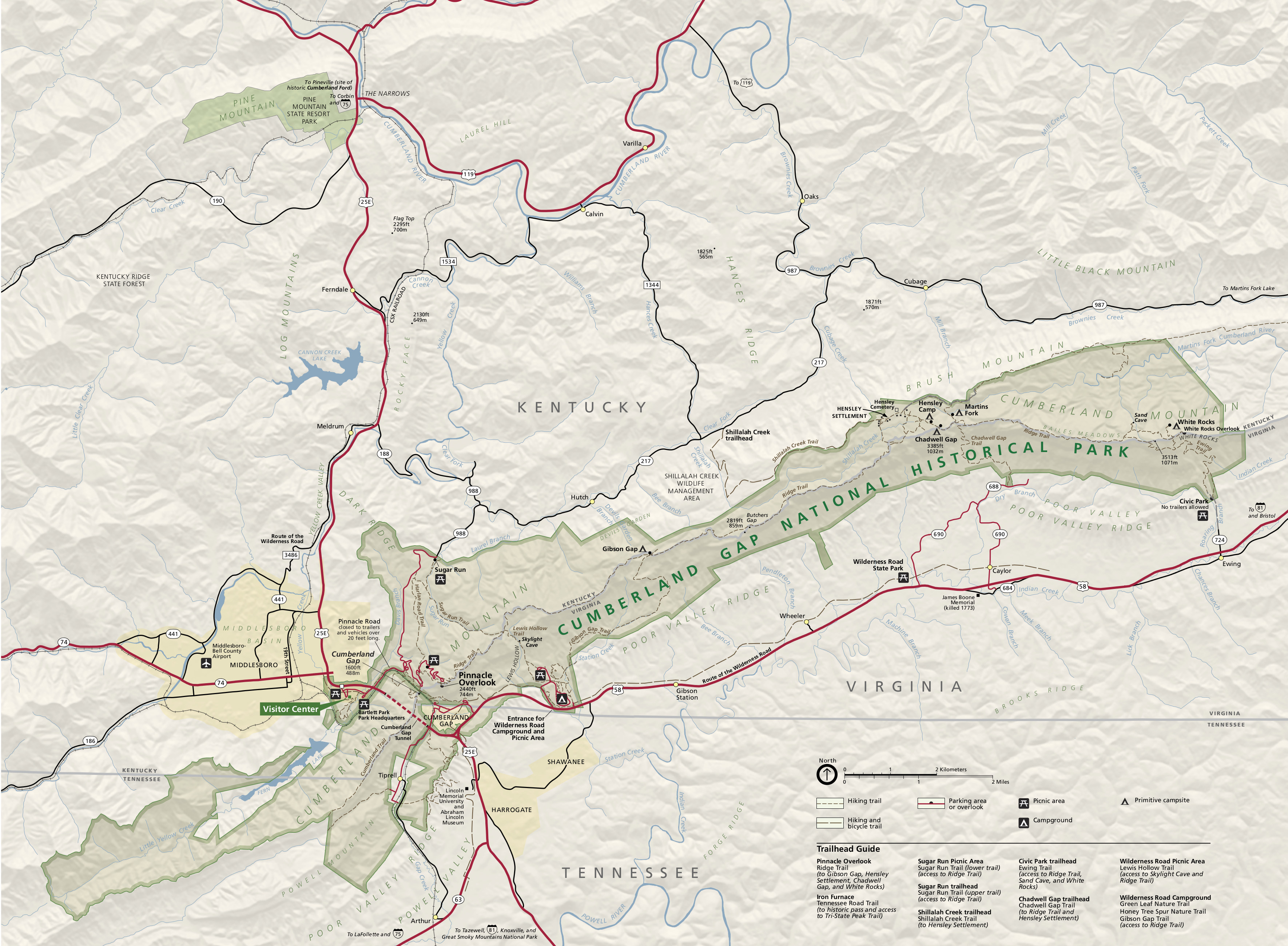 Here is the main Cumberland Gap map from the park brochure, showing the entire park and surrounding landscape of Kentucky, Virginia, and Tennessee. Click the image to view a full size map or download the PDF.
 This is a detail map of Cumberland Gap, zooming in on the gap itself and the busiest area of the park featuring overlooks and visitor centers. Click the image to view a full size map or download the PDF.
Cumberland Gap trail maps
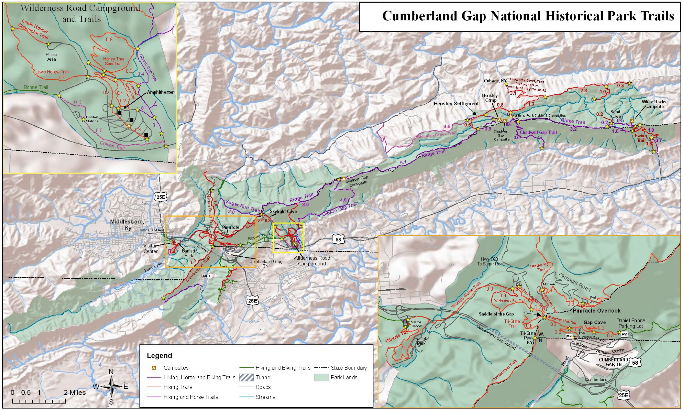 Here’s a set of Cumberland Gap trail maps that show the main hiking areas and backcountry campsites throughout the entire park. You’ll also find mileages listed between junctions and points of interest.
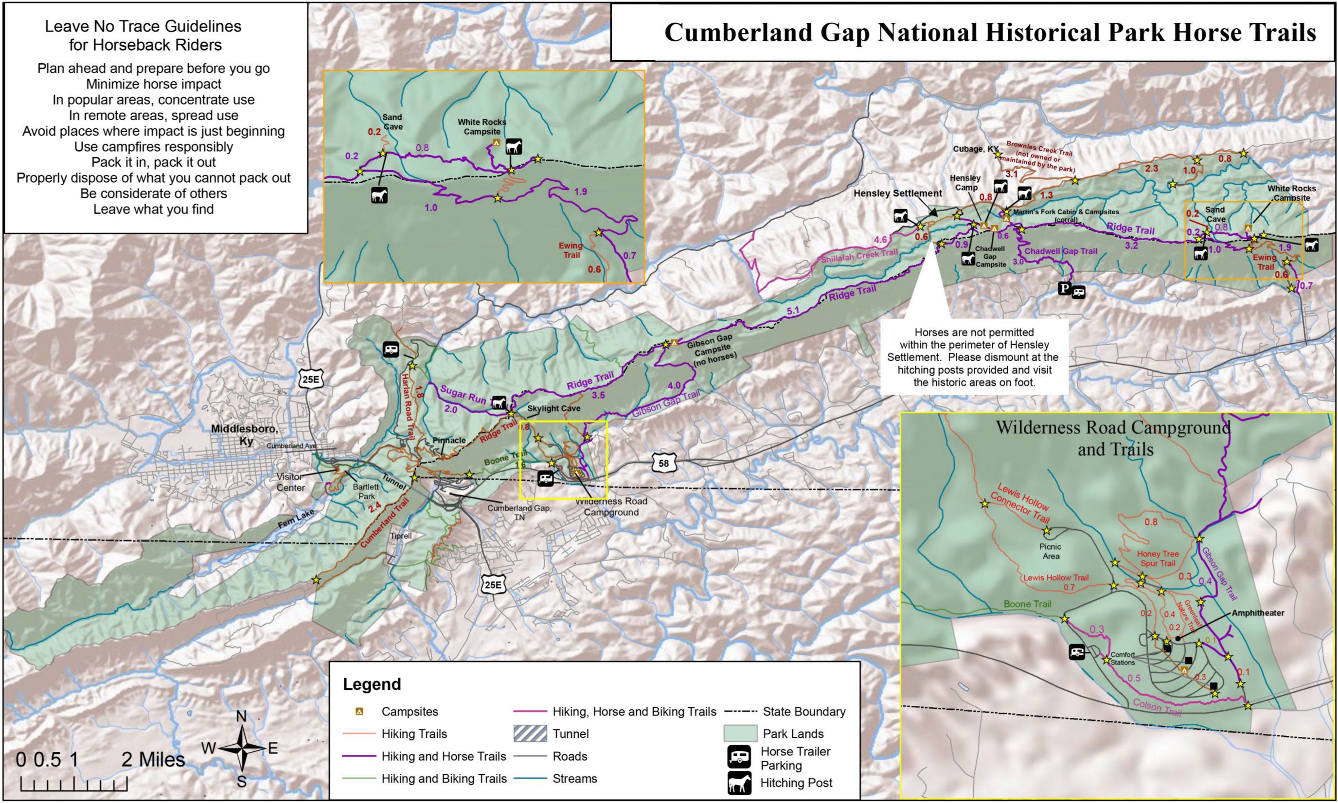 Here’s a Cumberland Gap horse trail map, similar to the one above but instead focusing on features relevant to those riding horseback (e.g., campsites they’re permitted and forbidden).
Cumberland Gap lodging map
 For staying nearby Cumberland Gap National Historical Park, you’ll likely choose Middlesboro, KY (although Cumberland Gap, TN is also an option). To the right you can see an Expedia interactive lodging map showing these choices. For more options, including some larger towns that may be a bit further away, browse Expedia’s top-rated Cumberland Gap area lodging to compare prices, photos, and guest reviews.
Various Cumberland Gap maps
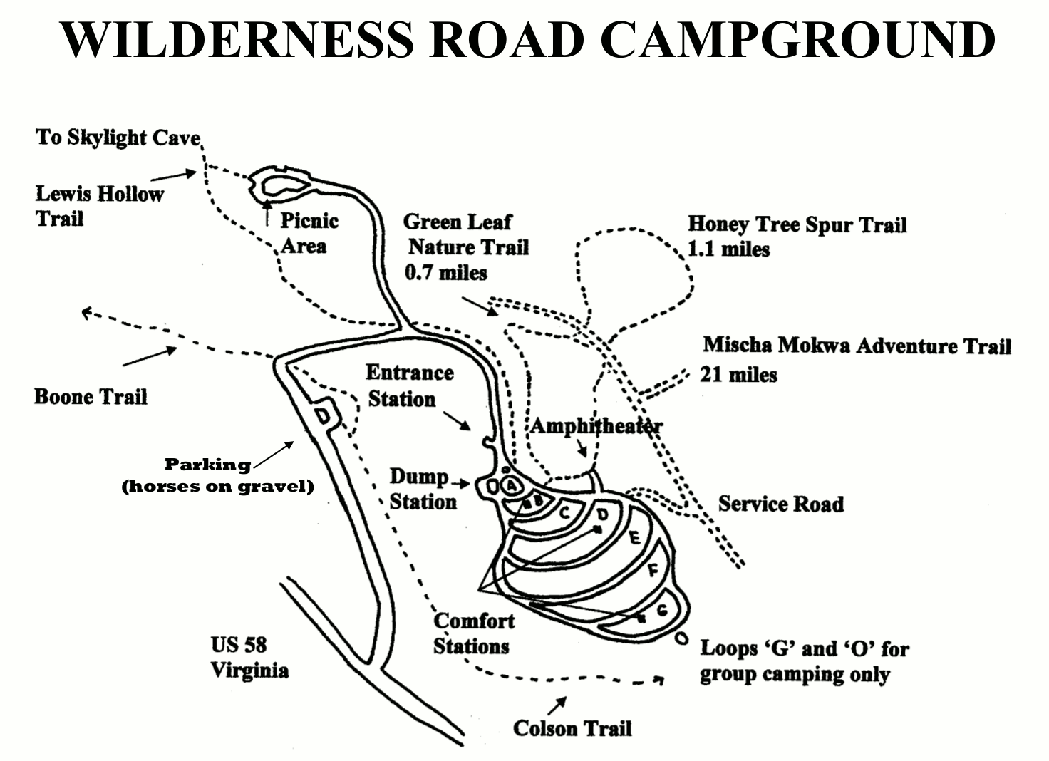 This is a Wilderness Road campground map, showing the park’s drive-in campground featuring 160 first-come first-served campsites. Hiking trails and campground facilities are also included.
 Here’s a historical Wilderness Road map, showing the path of the famous road used by settlers to reach Kentucky via the Great Valley Road. Click the image to view a full size map or download the PDF.
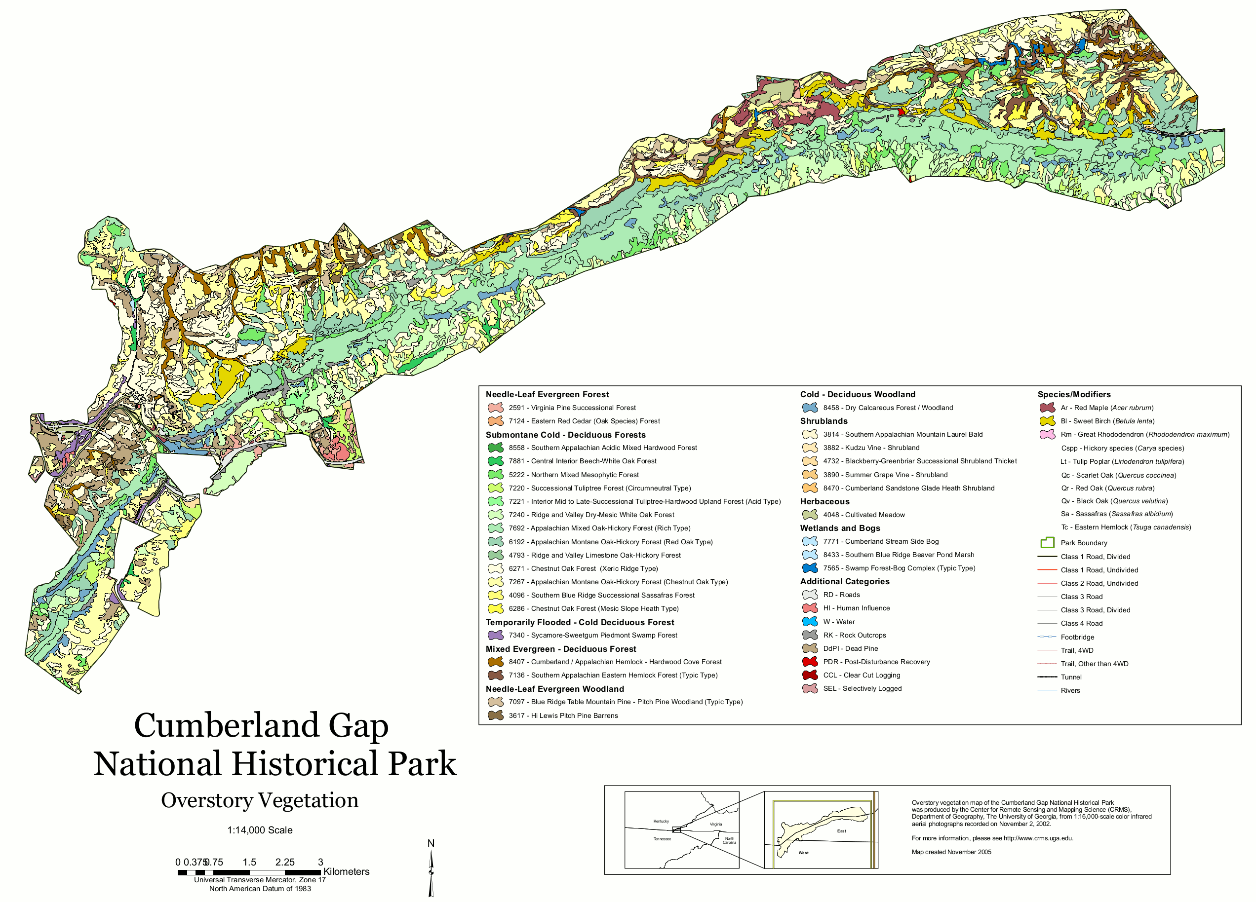 This Cumberland Gap vegetation map shows the different type of woodlands, shrublands, forests, wetlands, and bogs across the park lands in Kentucky, Tennessee, and Virginia.
Cumberland Gap geologic maps
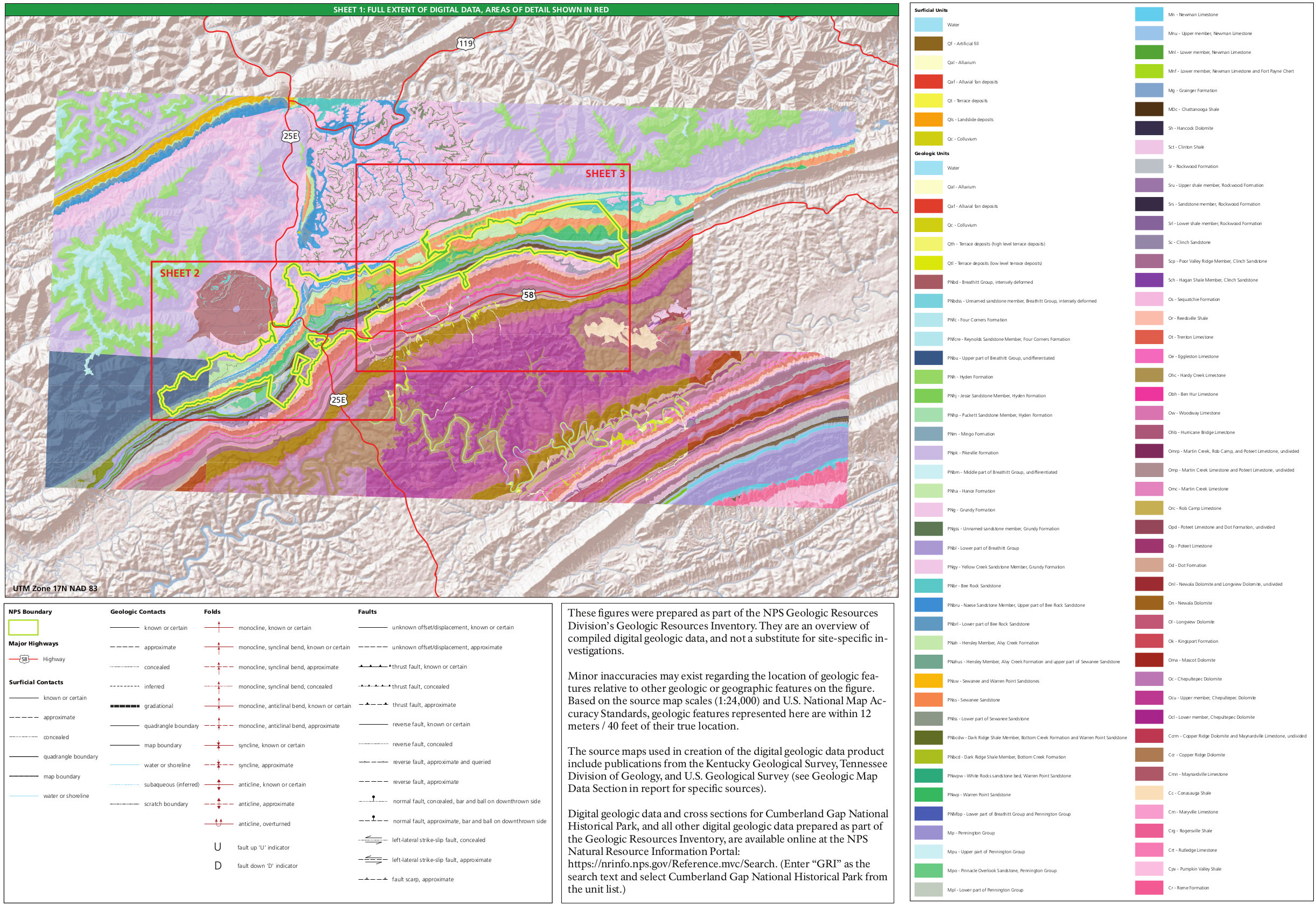 Here’s a geologic map of Cumberland Gap, showing an overview map and legend identifying the rock layers you’ll find in the two maps below which divide Cumberland Gap into an east and west half.
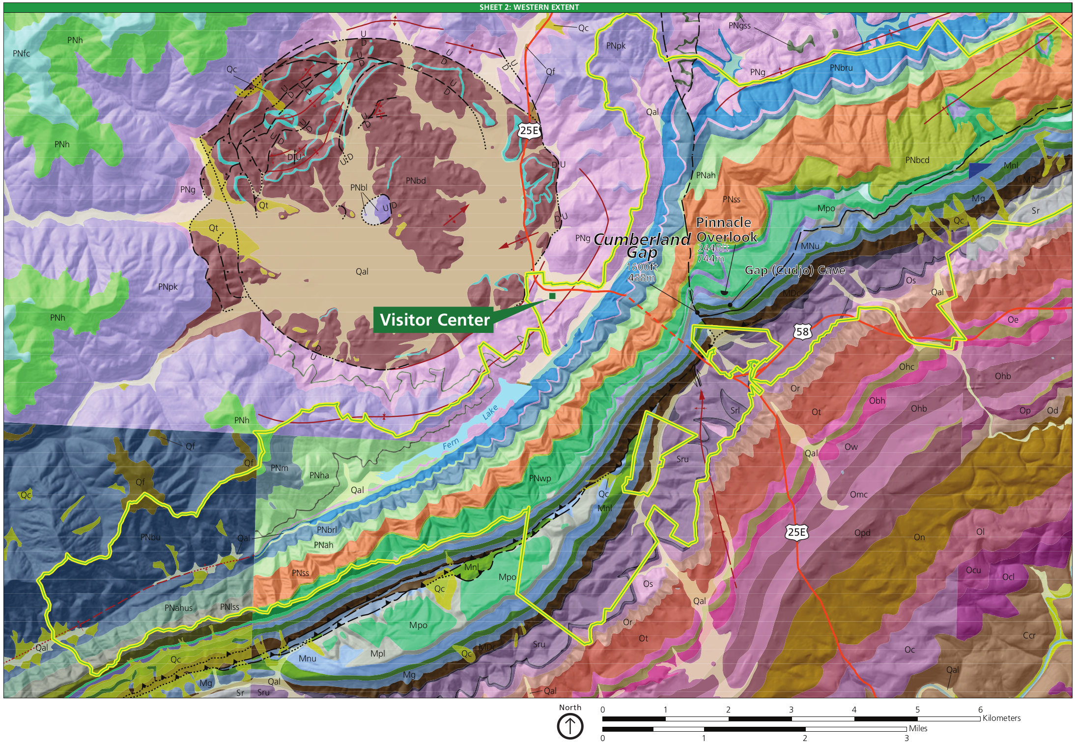 The west Cumberland Gap geologic map shows the unique geology of the park in the area surrounding the visitor center off Highway 25E. You can view a legend on the map above.
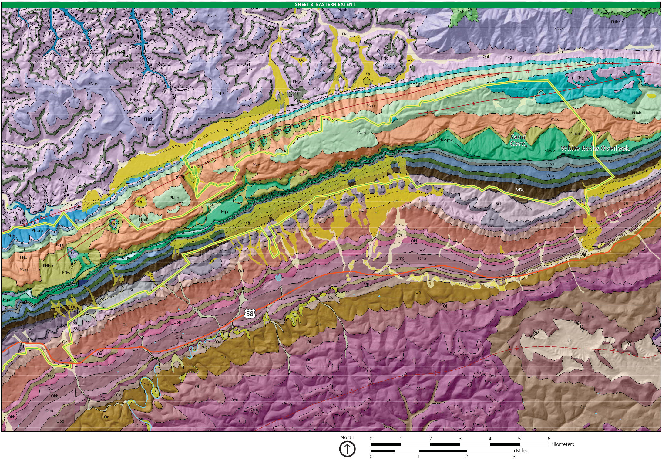 This east Cumberland Gap geologic map really shows the folds that make up the Appalachian spine north of Highway 58. You’ll find a legend on the overview geologic map above.
…and more!
< Return to National Park Maps home
< Return to Park List
< Return to List by State