Saguaro map from the park brochures
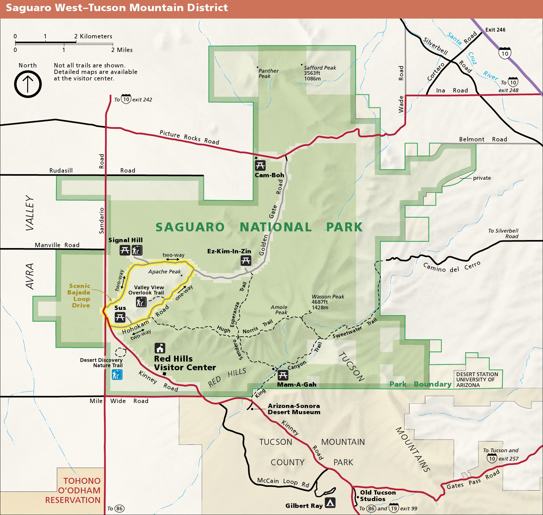 This is a Tucson Mountain district map of Saguaro National Park, located west of Tucson near the Arizona-Sonora Desert Museum. Click the image to view a full size map or download a PDF.
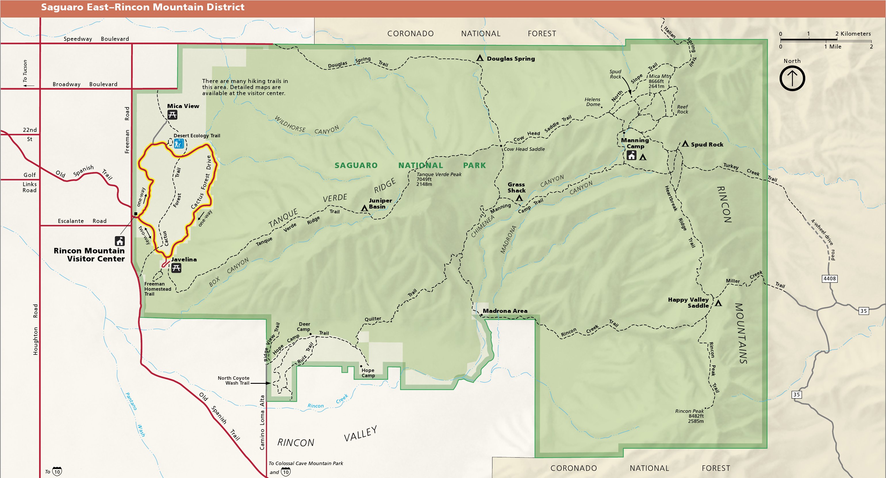 This is a Rincon Mountain district map of Saguaro, located east of Tucson. (This is the more “wildernessy” district.) Click the image to view a full size map or download a PDF.
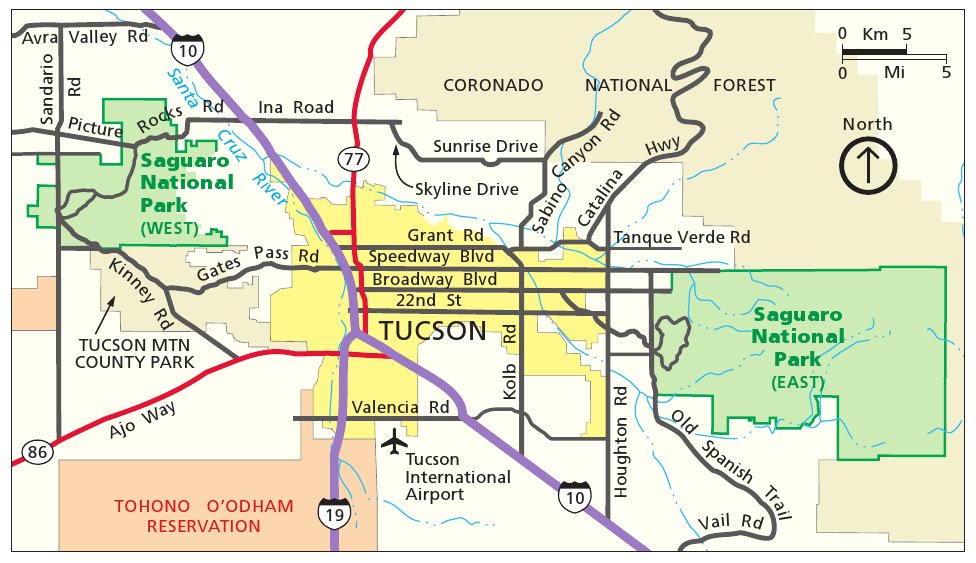 This is a regional Saguaro National Park map, showing both the Tucson Mountain district (west) and Rincon Mountain district (east). Click the image to view a full size map or download a PDF.
Saguaro trail maps
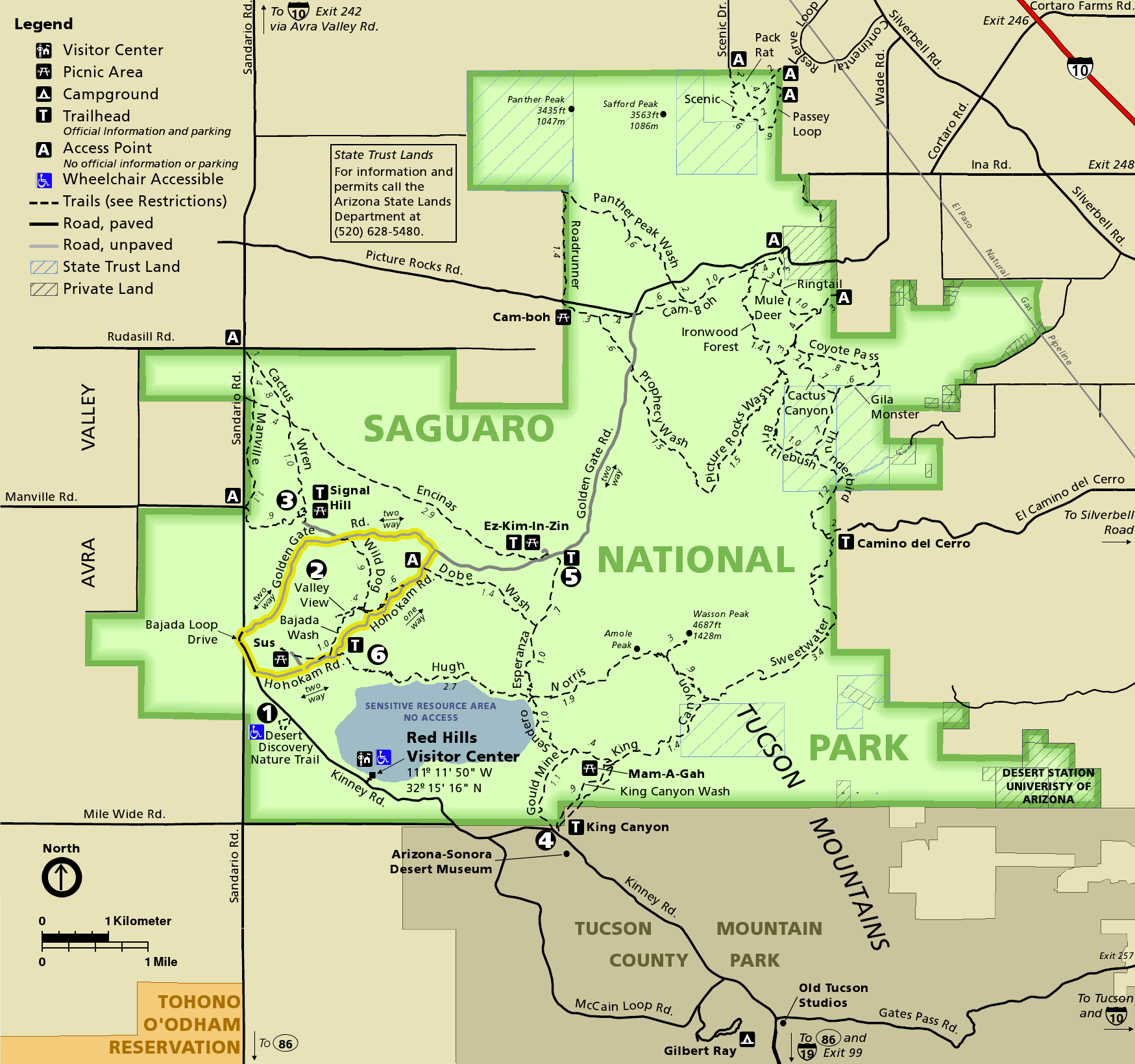 This is a trail map of the Tucson Mountain district, located west of Tucson. It shows trails, roads, picnic areas, and other features. Click the image to view a full size map or download the PDF.
 This is also a Tucson Mountain district trail map, but it is formatted better for printing as it’s only in grayscale and won’t use up as much printer ink as the map above.
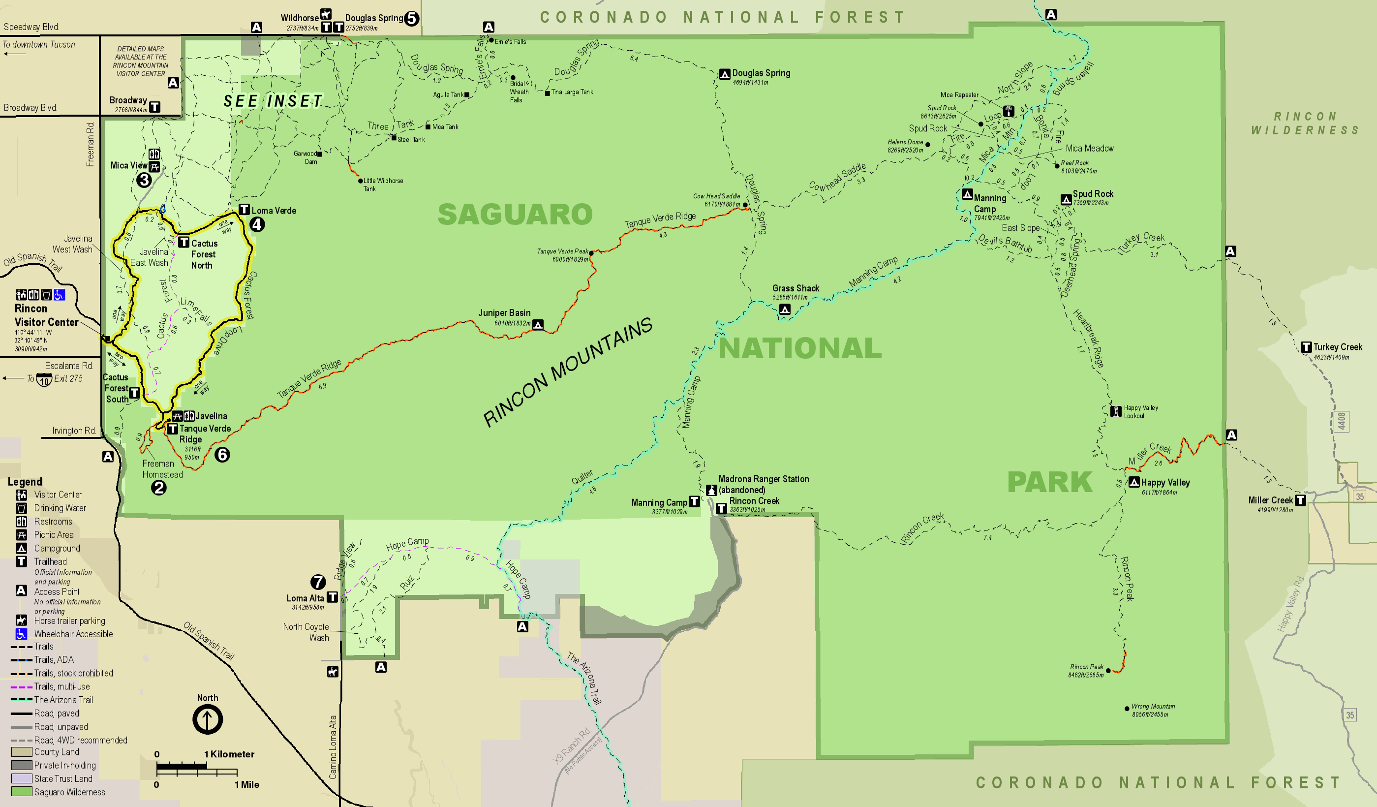 This is a Rincon Mountain district trail map, which includes Manning Camp and other backcountry wilderness campsites. Click the image to view a full size map or download the PDF.
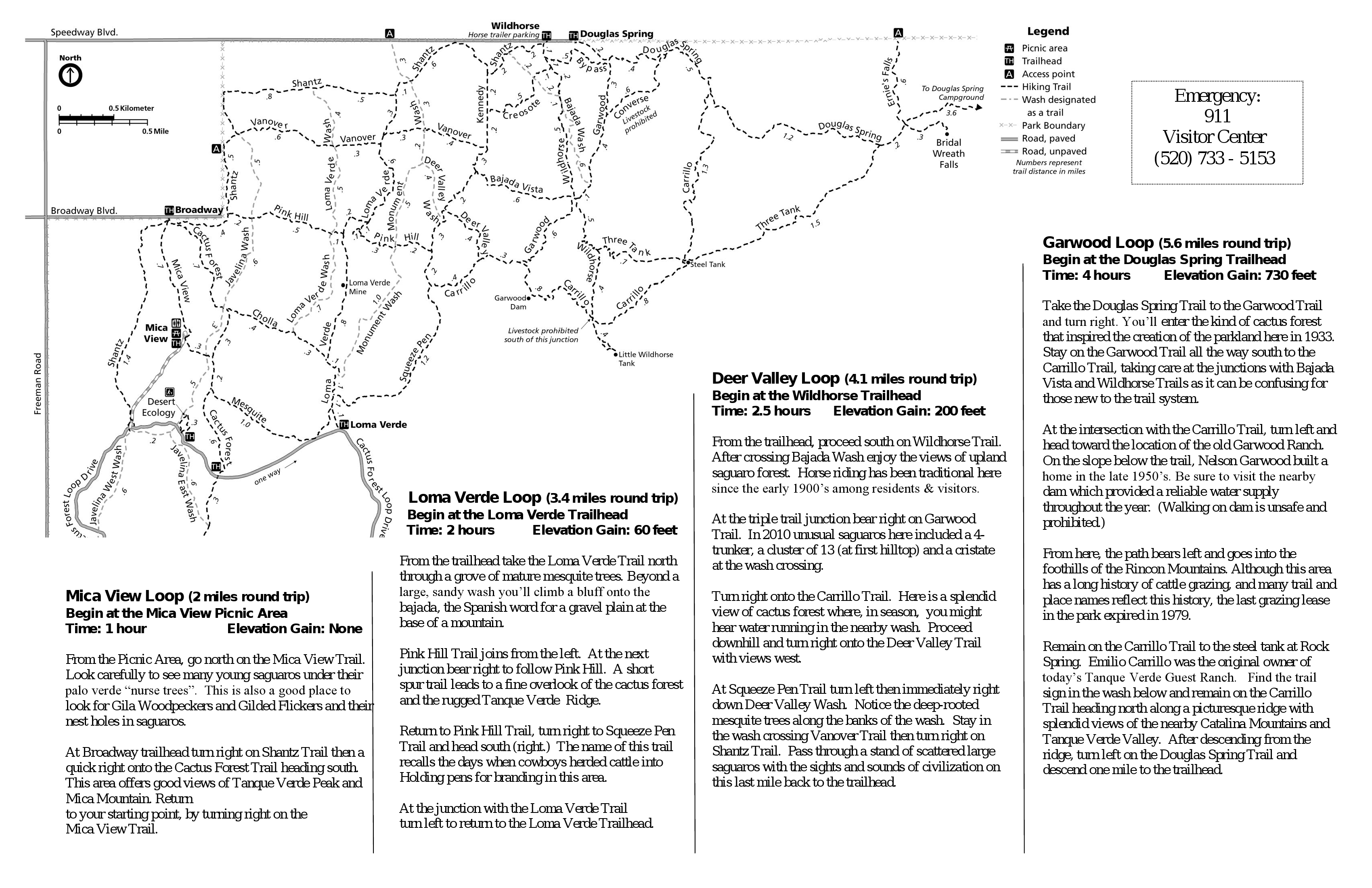 This is an inset map of Cactus Forest hiking trails in Saguaro’s Rincon Mountain district, featuring trail descriptions. Click the image to view a full size map or download the PDF.
 Like with most parks, the waterproof National Geographic Trails Illustrated map is your best choice if you’re looking for a single detailed Saguaro National Park trail map with topographic lines, trail mileages, and wilderness campsites. The maps above are great for trip planning, but you’ll want this one to take into the wilderness with you. If you’re mostly just driving though the park, however, this one is probably overkill.
Saguaro geologic maps
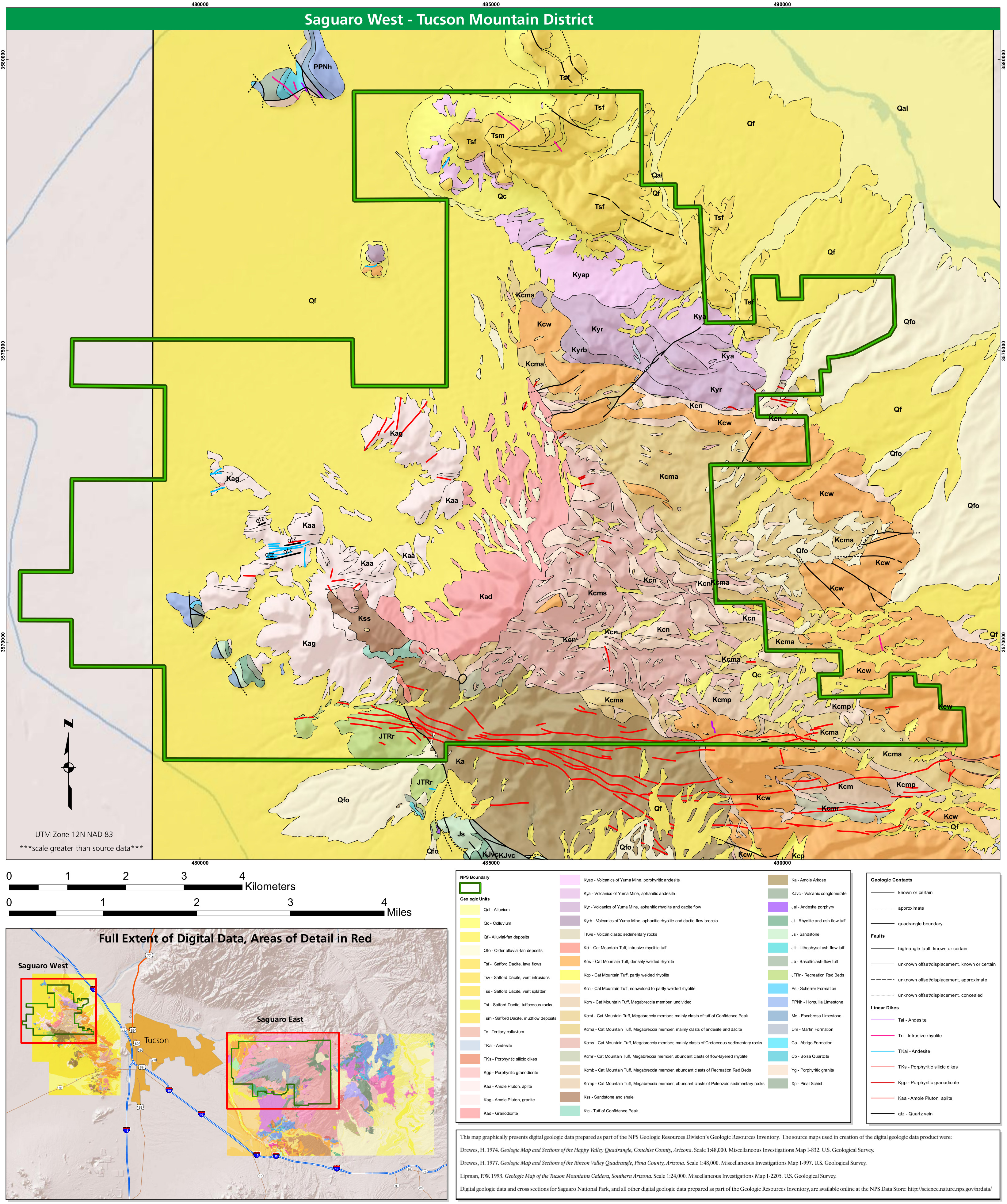 Here’s a west Saguaro geologic map, showing the dikes and largely-Cretaceous rock layers of the more heavily-visited Tucson Mountain district located to the west of Tucson.
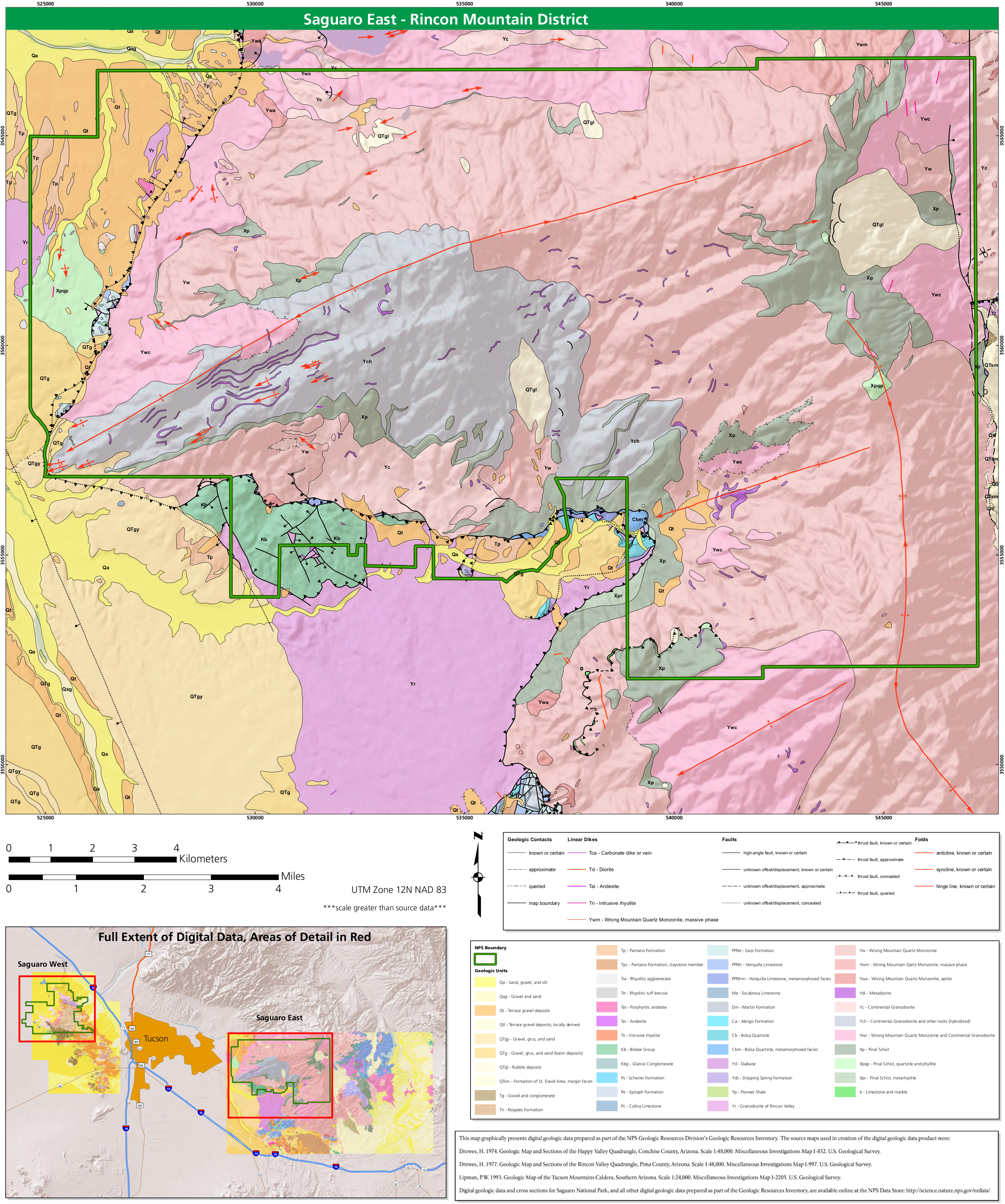 This is an east Saguaro geologic map, which shows rock types, folds, and faults in the less-crowded, more-wildernessy Rincon Mountain district, east of the main part of Tucson.
Saguaro lodging map
 Saguaro National Park has both an eastern and western unit separated by the city of Tucson, so it’s only logical to look at Tucson for a place to stay. To the right, you can open an Expedia interactive Tucson lodging map, where you can filter by location and price. It may seem overwhelming, so I like to start by looking at the top-rated Tucson lodging to narrow it down based on price, reviews, location, and photos.
…and more!
< Return to National Park Maps home
< Return to Park List
< Return to List by State