This page currently offers 4 free Rainbow Bridge National Monument maps for you to view or download: NPS brochure maps, topographic maps, geologic maps, and more. In addition to the free Rainbow Bridge maps, I include external affiliate links that help cover my costs and allow me to keep this site ad-free. These links have shaded backgrounds (like this example) so you can easily recognize or skip past them: Browse the best-selling Utah maps and books on Amazon.
Rainbow Bridge map from the park brochure
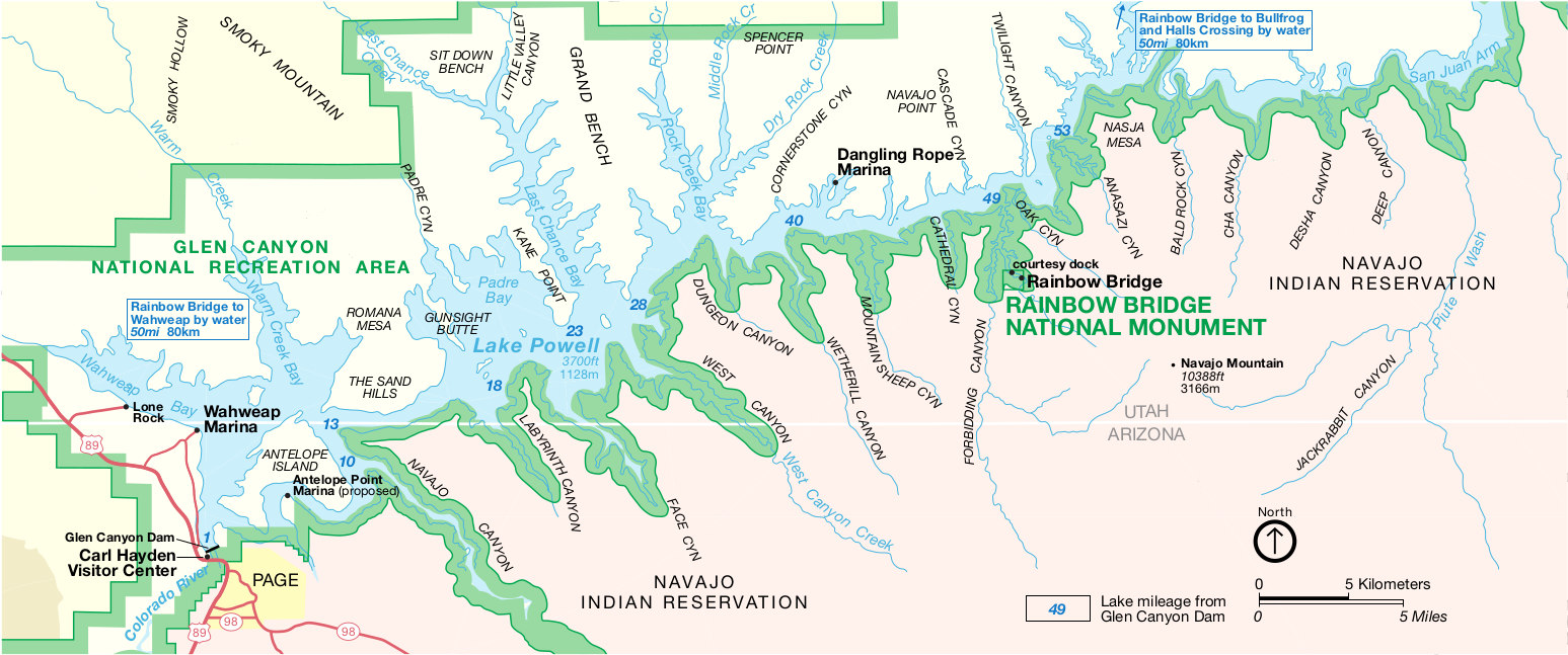 This is the official National Park Service Rainbow Bridge map, showing the monument’s location near Lake Powell and Glen Canyon. Click the image to view a full size map or download the PDF.
Rainbow Bridge topographic map
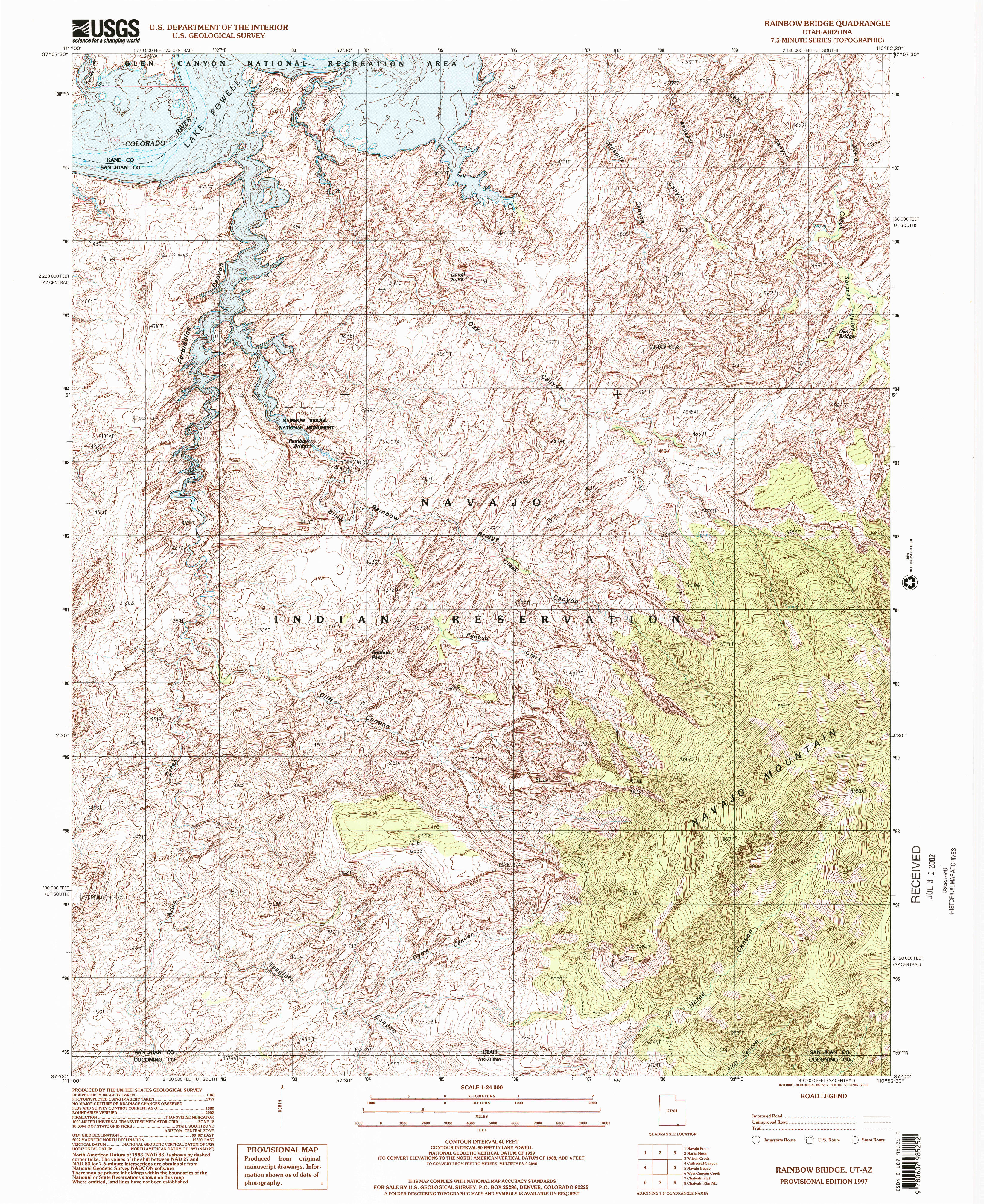 Here’s a Rainbow Bridge topo map, which zooms in to show the elevation contours. Note that the current lake level might be quite a bit different than this map – Lake Powell can fluctuate substantially.
Rainbow Bridge geologic map
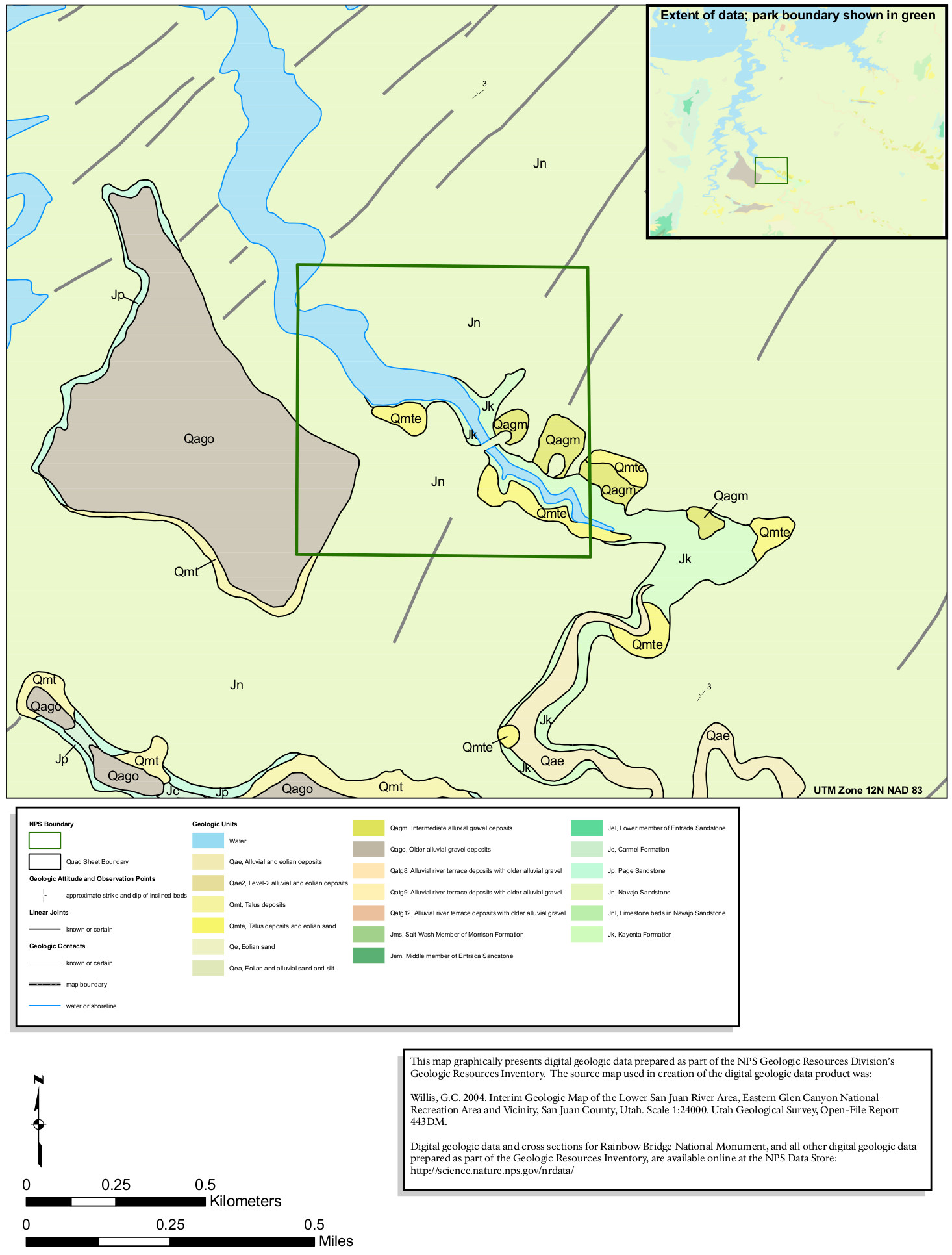 This Rainbow Bridge geologic map shows the more recent surficial deposits that are found overlaid on an endless field of Navajo Sandstone – the classic rock layer found in many Utah national parks.
…and more!
< Return to National Park Maps home
< Return to Park List
< Return to List by State
Need more help? Browse Amazon’s best-selling Utah guidebooks.