This page currently offers 4 free Natural Bridges National Monument maps for you to view or download: NPS brochure maps, trail maps, and more. In addition to the free Natural Bridges maps, I include external affiliate links that help cover my costs and allow me to keep this site ad-free. These links have shaded backgrounds (like this example) so you can easily recognize or skip past them: Browse the best-selling Utah maps and books on Amazon.
Natural Bridges brochure map
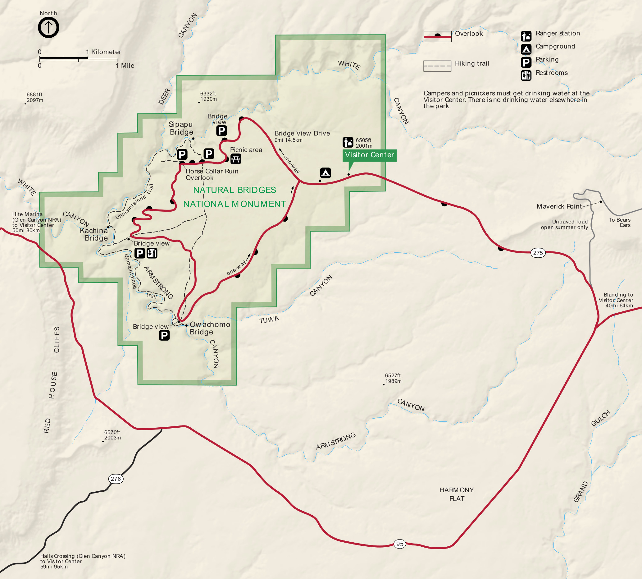 The official Natural Bridges map from the park brochure shows the visitor center, overlooks, and trails, and parking areas. Click the image to view a full size map or download the PDF.
Various Natural Bridges maps
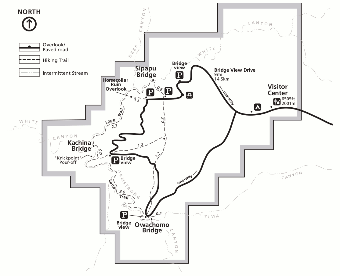 Here’s a Natural Bridges trail map, which shows the full park much like the map above. However, this map also shows additional trail details and includes distances between trail junctions.
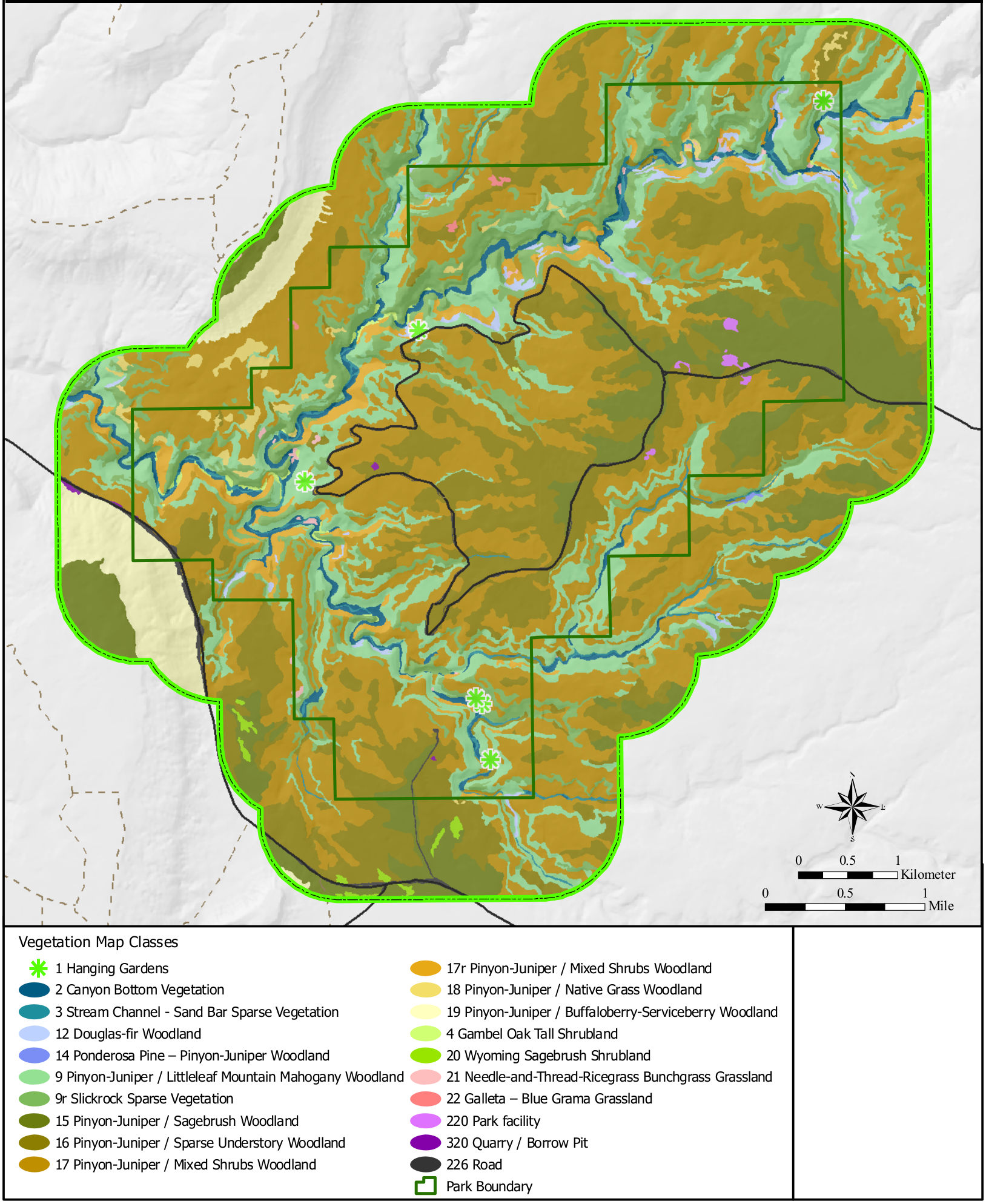 The Natural Bridges vegetation map shows the loop road and park boundary, color-coding the different types of vegetation: woodlands (mostly pinyon-juniper), grasslands, shrublands, and so on.
…and more!
< Return to National Park Maps home
< Return to Park List
< Return to List by State
Need more trip-planning help? Browse Amazon’s best-selling Utah maps and guidebooks.