Montezuma Castle brochure map
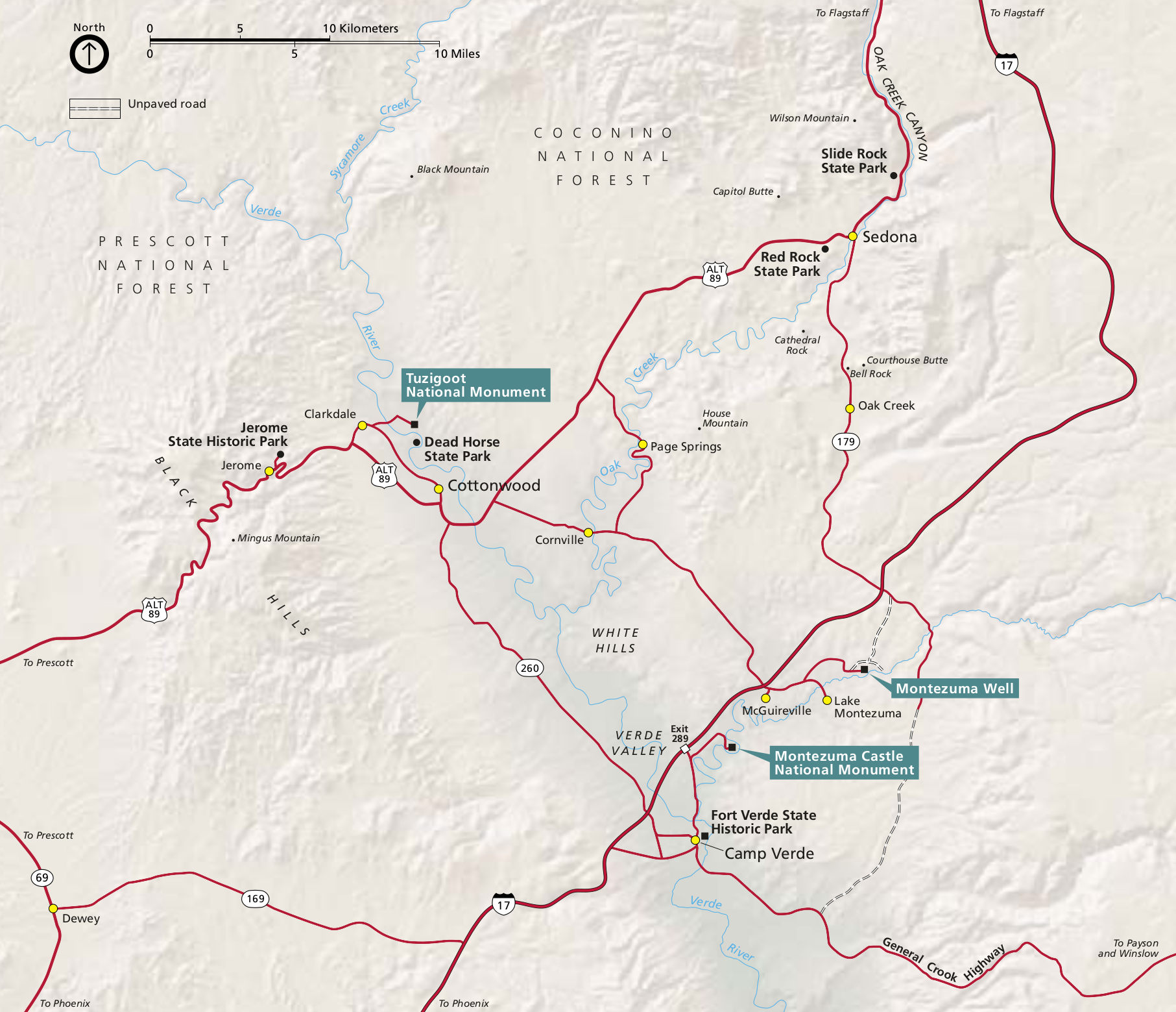 Here’s the official Montezuma Castle map, which also shows the location of Montezuma Well and Tuzigoot National Monument. Click the image to view a full size map or download the PDF.
Other Montezuma Castle maps
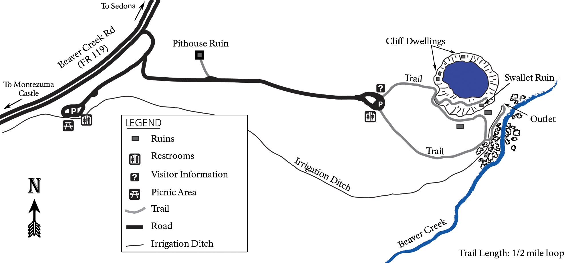 Here’s a Montezuma Well map. It’s still a part of Montezuma Castle National Monument, but you do have to drive 11 miles to get there. Make sure you check out this unique desert oasis!
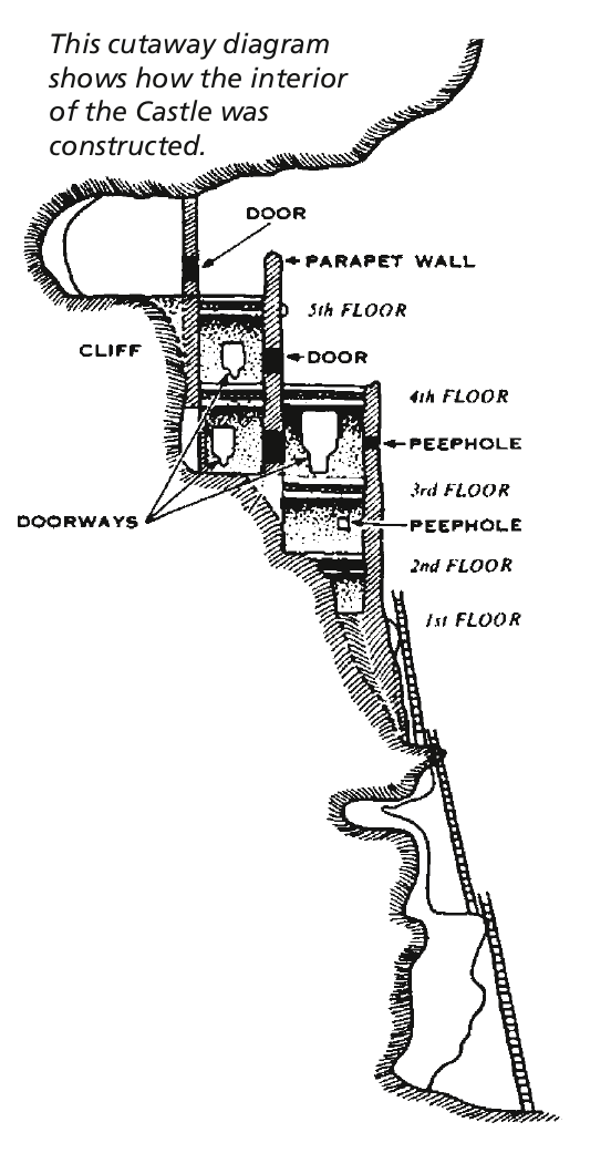 This is a Montezuma Castle cross-section, showing the layout of this incredibly well-preserved cliff dwelling that was constructed over a few centuries nearly 1,000 years ago.
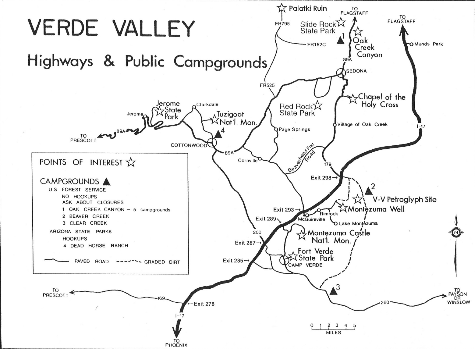 The Montezuma Castle regional map is hand-drawn and shows a lot of points of interest in the Verde Valley. You’ll find this handy if you’re going to a few sites nearby or in Sedona.
…and more!
< Return to National Park Maps home
< Return to Park List
< Return to List by State