Gulf Islands brochure maps
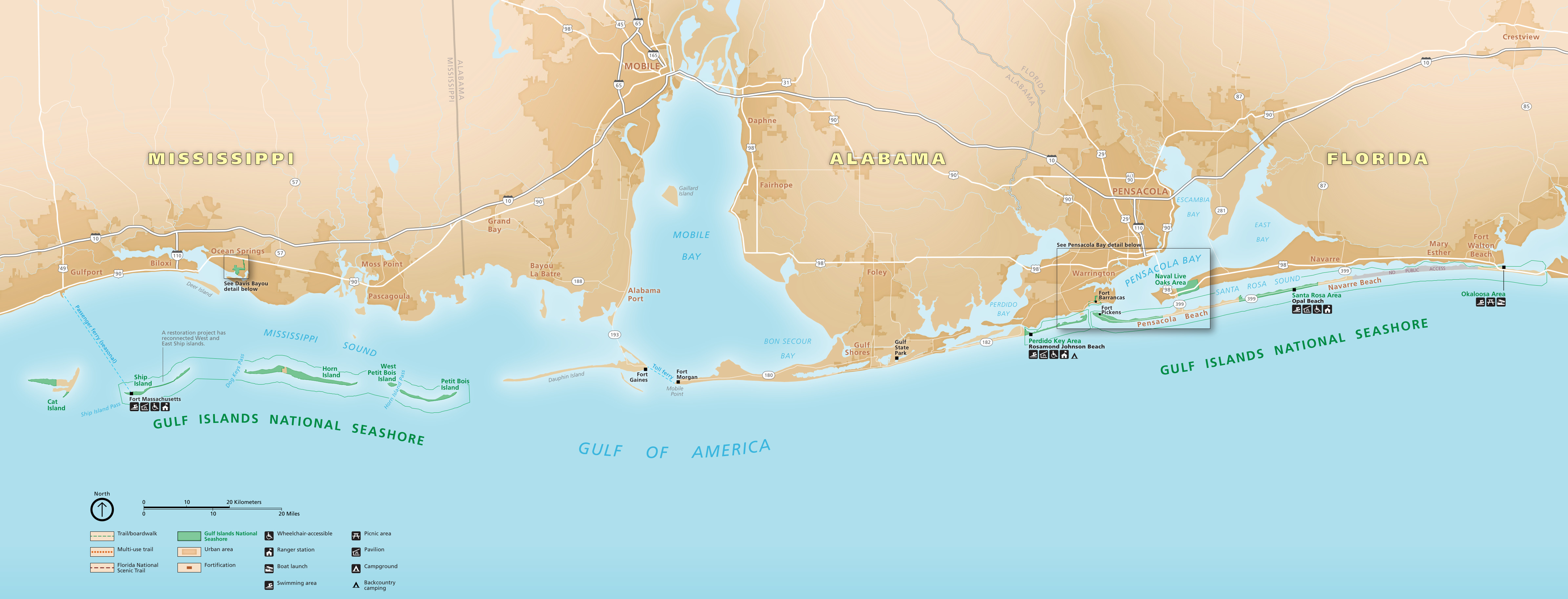 Here’s a Gulf Islands National Seashore map from the official park brochure, last updated in 2023. It shows the full expanse of the park from Mississippi to Florida. Inset maps zooming in on specific areas are below.
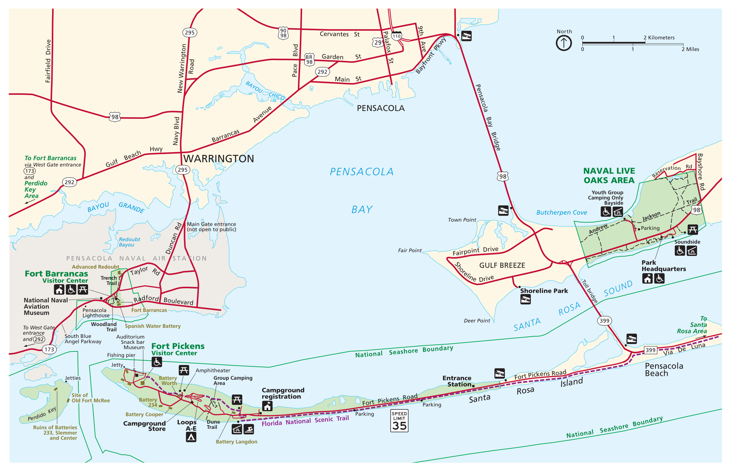
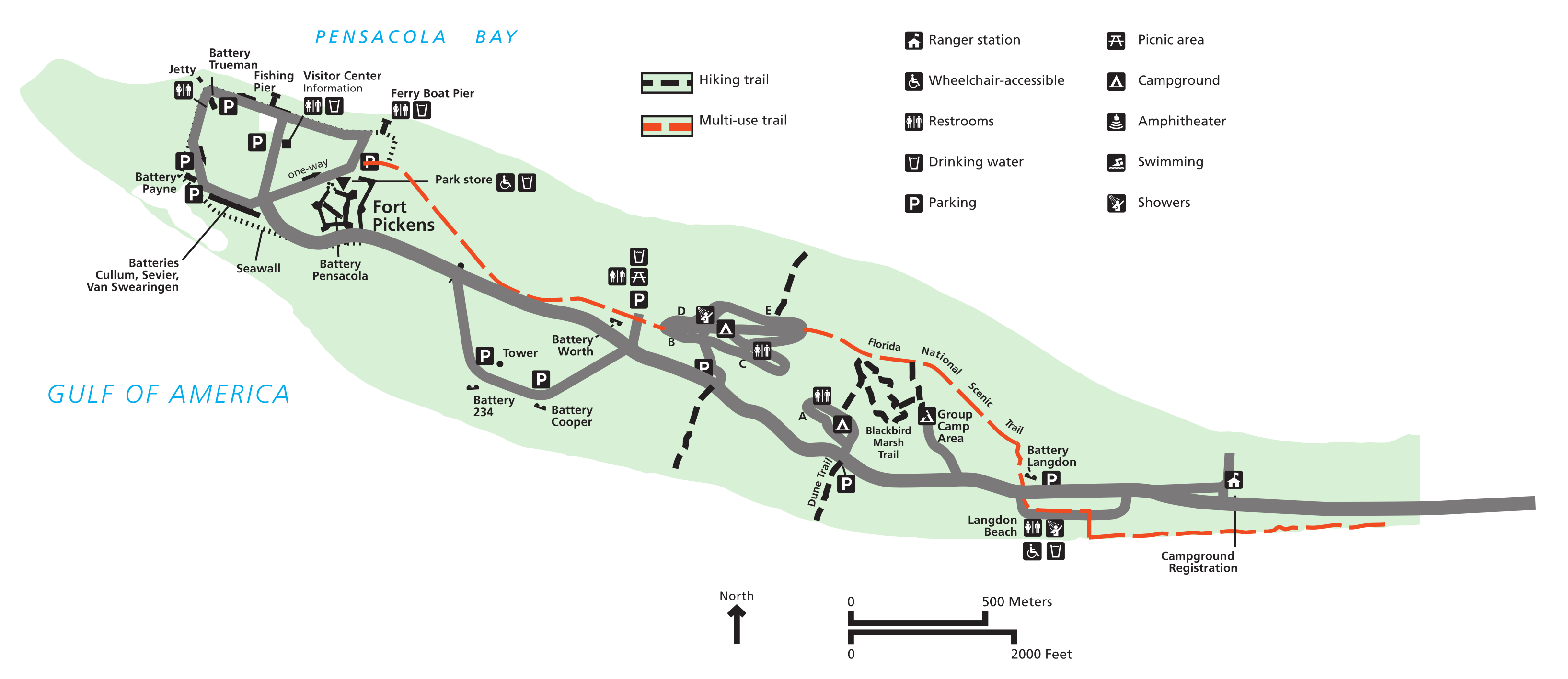
 This Pensacola Bay and Fort Pickens map zooms in on this most popular section of the park just outside Pensacola, FL. Click the image to view a full size map or download the PDF.
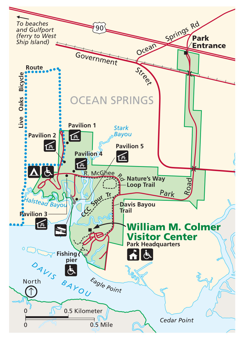
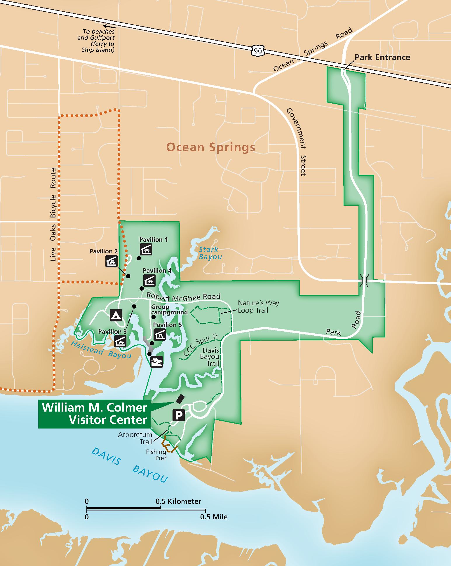 This is a Davis Bayou map, zooming in on this section of the park in Mississippi, just east of Biloxi in Ocean Springs. Click the image to view a full size map or download the PDF.
Gulf Islands printable maps
The maps in this section cover the same areas as the three maps above, but with more muted colors, making them a little easier to print and read.
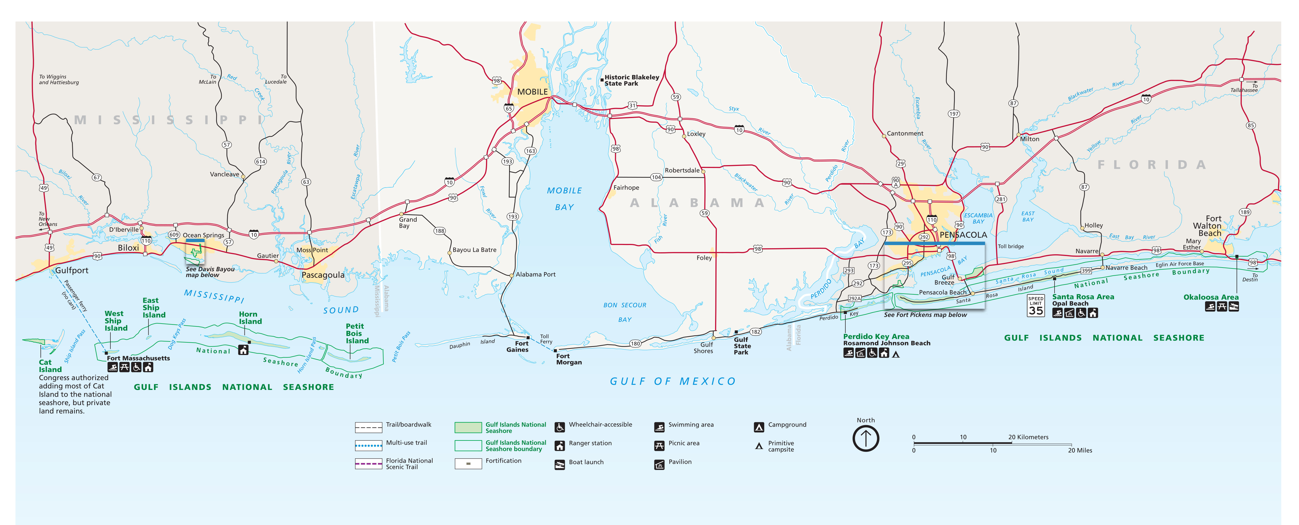 Here’s the printable Gulf Islands map, which was the official NPS brochure map before the 2023 update above. Click the image to view a full size map or download the PDF.
 The printable Fort Pickens and Pensacola Bay map is from the official National Park Service brochure pre-2023. Click the image to view a full size map or download the PDF.
 This printable Davis Bayou map feels easier to interpret than the post-2023 David Bayou map above (though it’s admittedly less colorful). Click the image to view a full size map or download the PDF.
Fort Pickens maps
 Here’s a Fort Pickens area map that zooms in on the park lands immediately surrounding the fort. It includes the visitor center and various batteries, beaches, trails, facilities, and services.
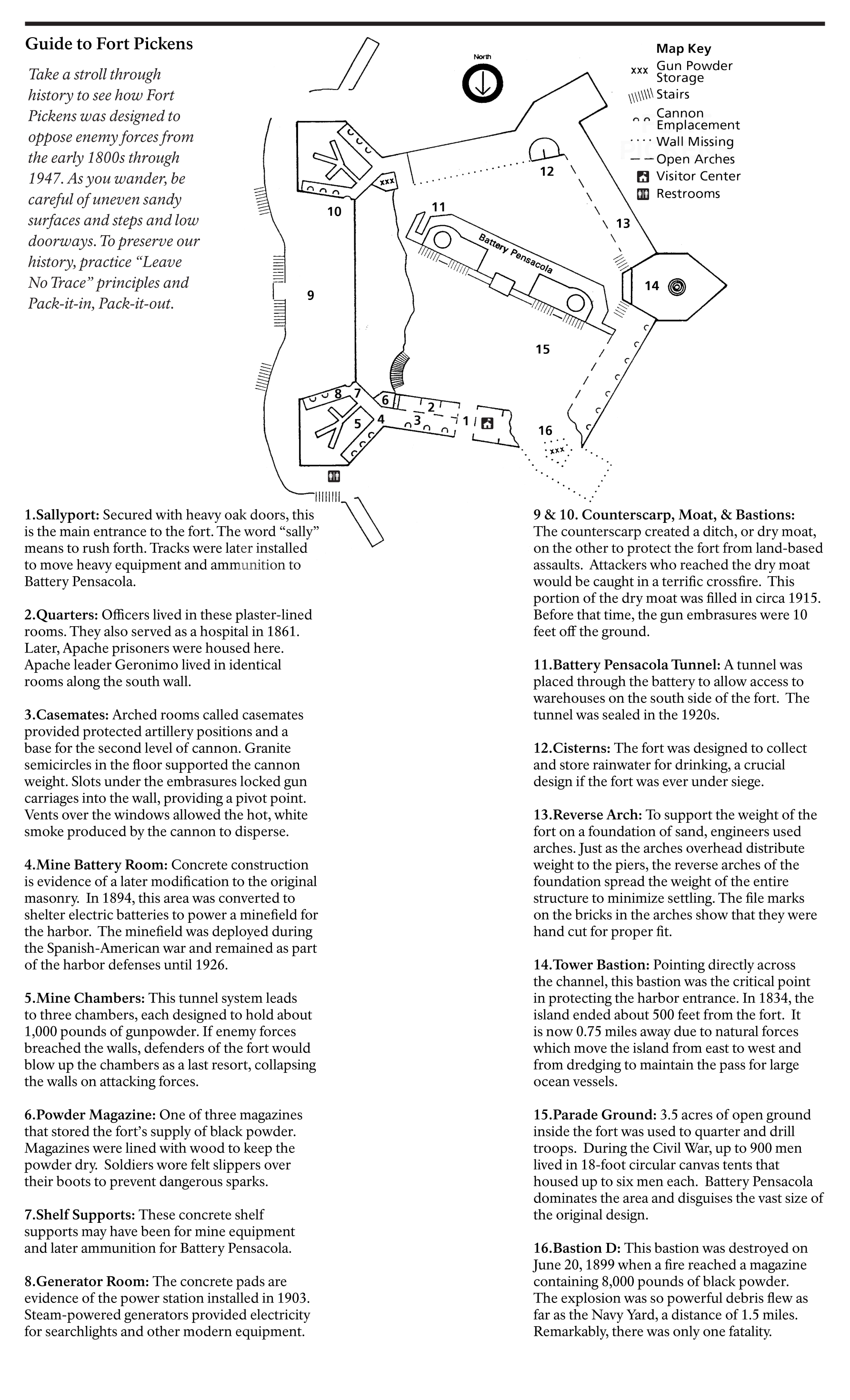 The Fort Pickens detail map and guide shows a diagram of the fort and labels sixteen different stops on a self-guided walking tour pointing out its features, history, and architecture.
Gulf Islands campground maps
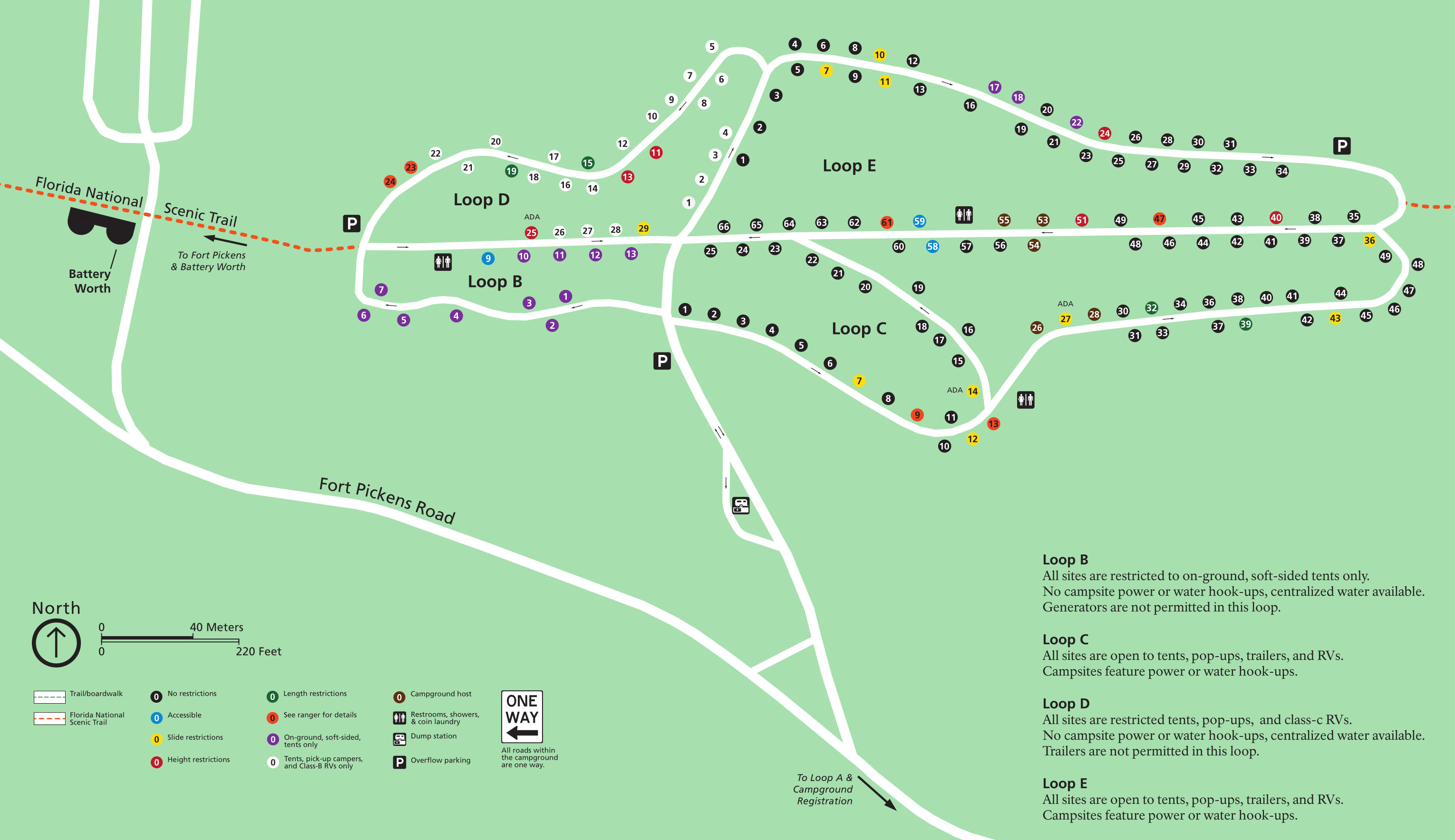 This Fort Pickens Campground map shows loops B through E. Sites are color-coded based on what sort of equipment they can accommodate, and if there are any length or height restrictions.
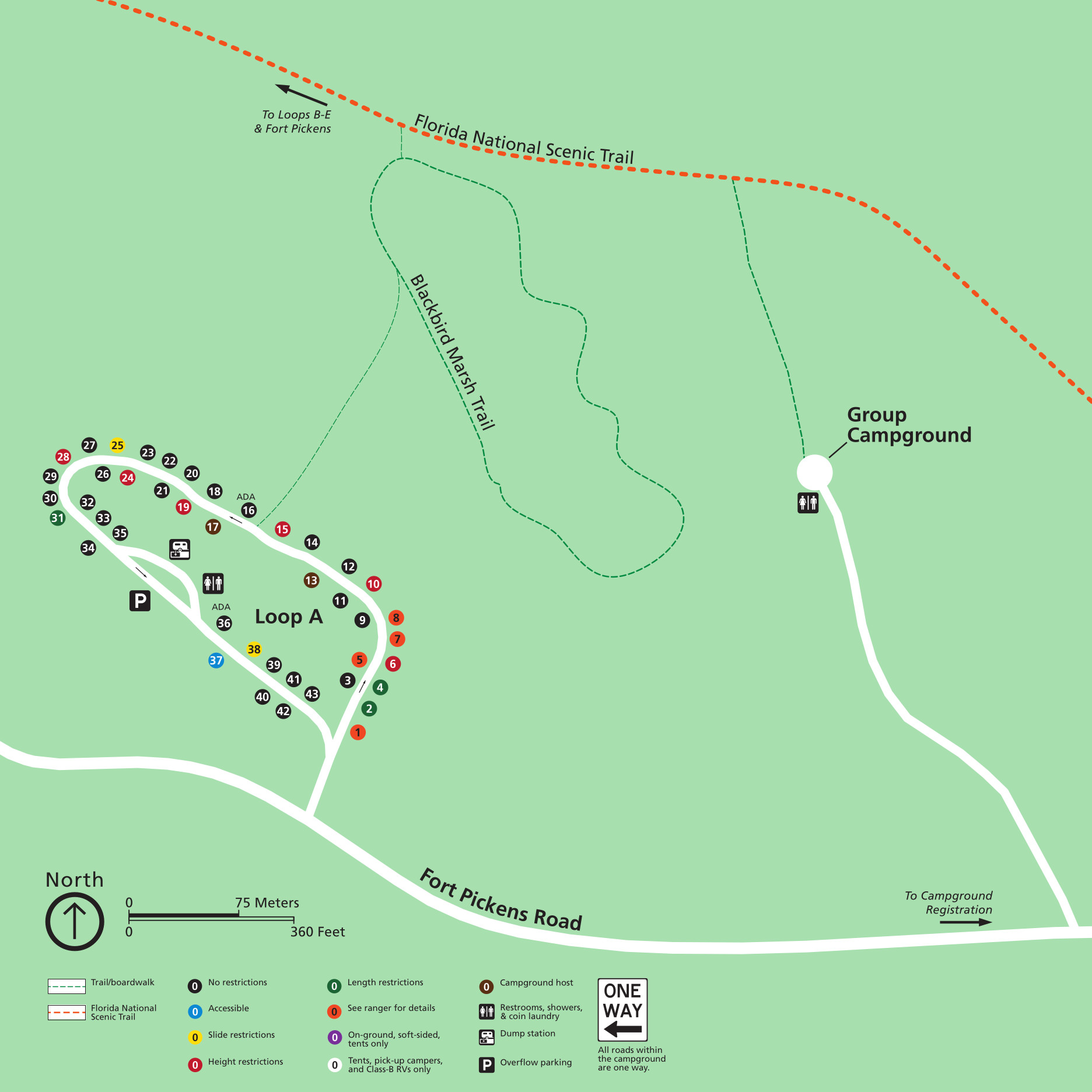 The Fort Pickens Campground Loop A map shows Loop A only, which is located east of the other loops. Like the map above, sites are color-coded based on any size restrictions. The group campground is also located here.
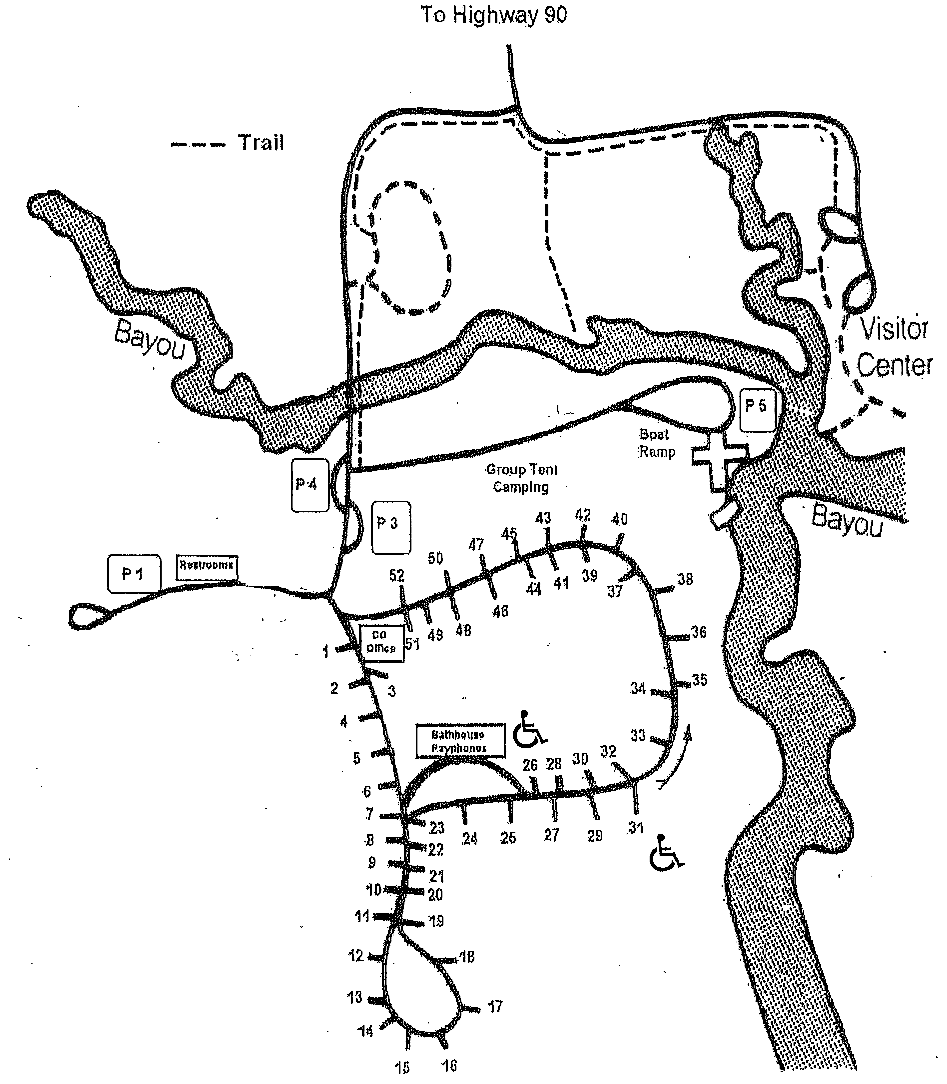 Here’s a Davis Bayou campground map. The 50+ sites in this campground are located in the quieter area of the park in Mississippi near Ocean Springs, at the end of the Robert McGhee road.
Fort Barrancas maps
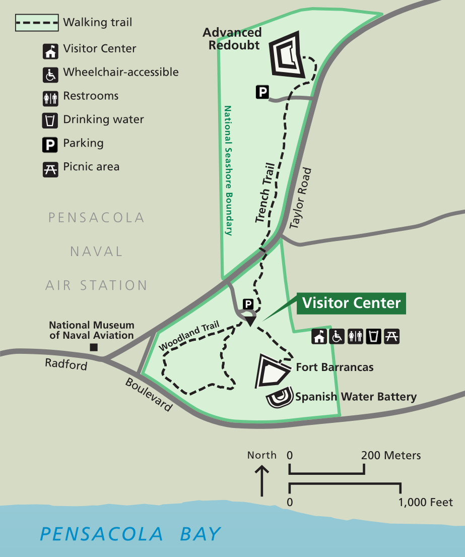 This Fort Barrancas area map shows the location of the fort, Advanced Redoubt, Fort Barrancas Visitor Center, trails, roads, parking, picnic area, and other features.
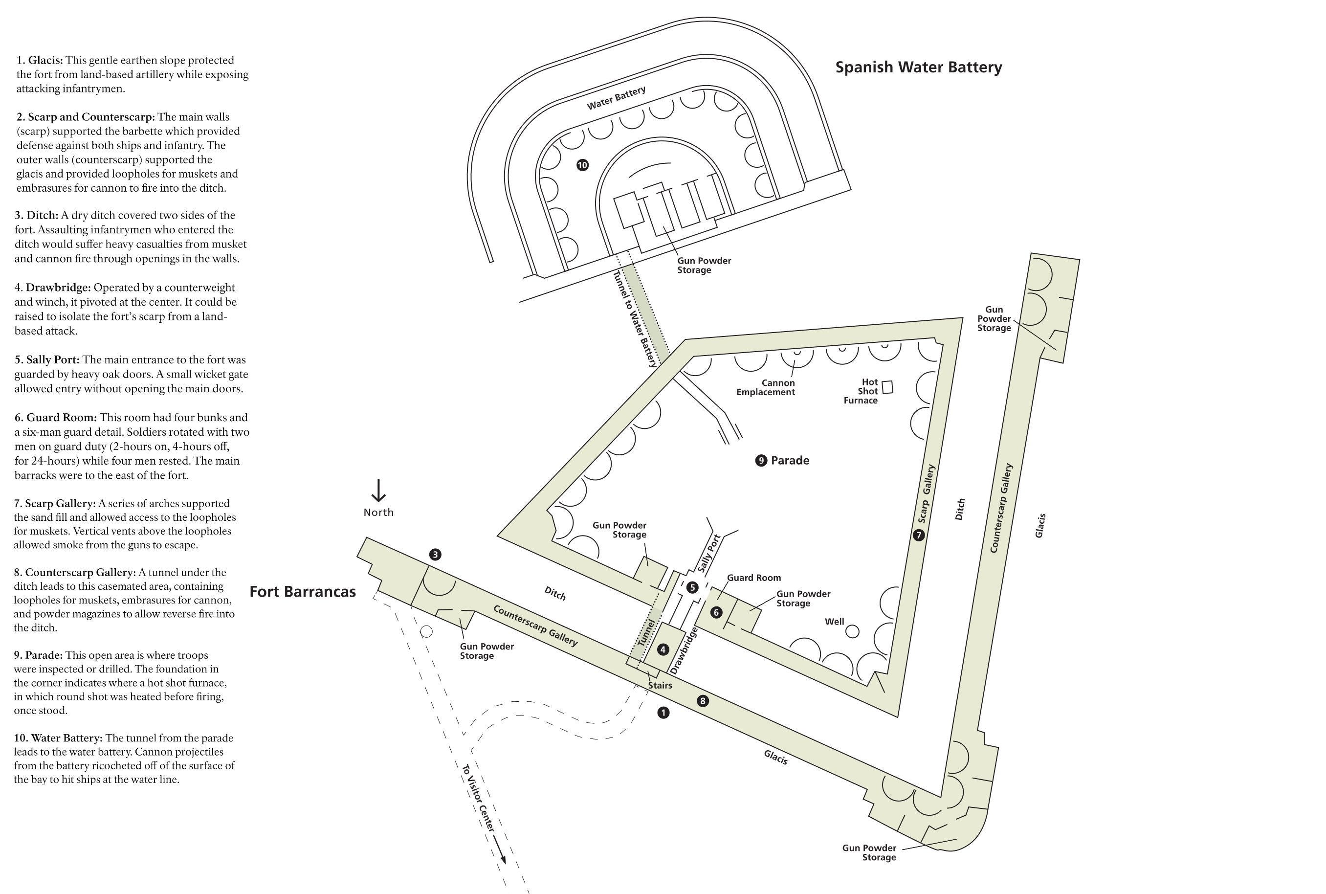 Here’s a map of Fort Barrancas itself. This map zooms in on the fort and not only labels various features, but includes a self-guided walking tour with labeled stops on the map.
 The Fort Barrancas Advanced Redoubt map zooms in on this inland fort’s details and includes a self-guided walking tour just like the Fort Barrancas map above.
Ship Island maps
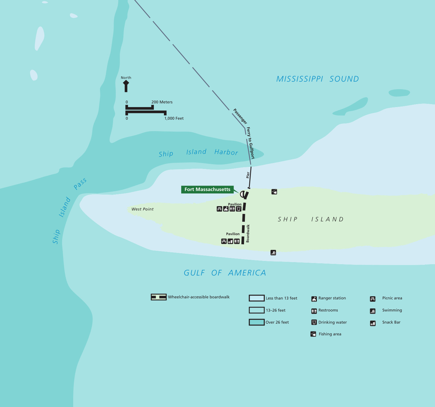 Here’s a Ship Island map, showing the passenger ferry route from Gulfport, MS to Fort Massachusetts, located on Ship Island. The map also shows amenities and features on the roadless island.
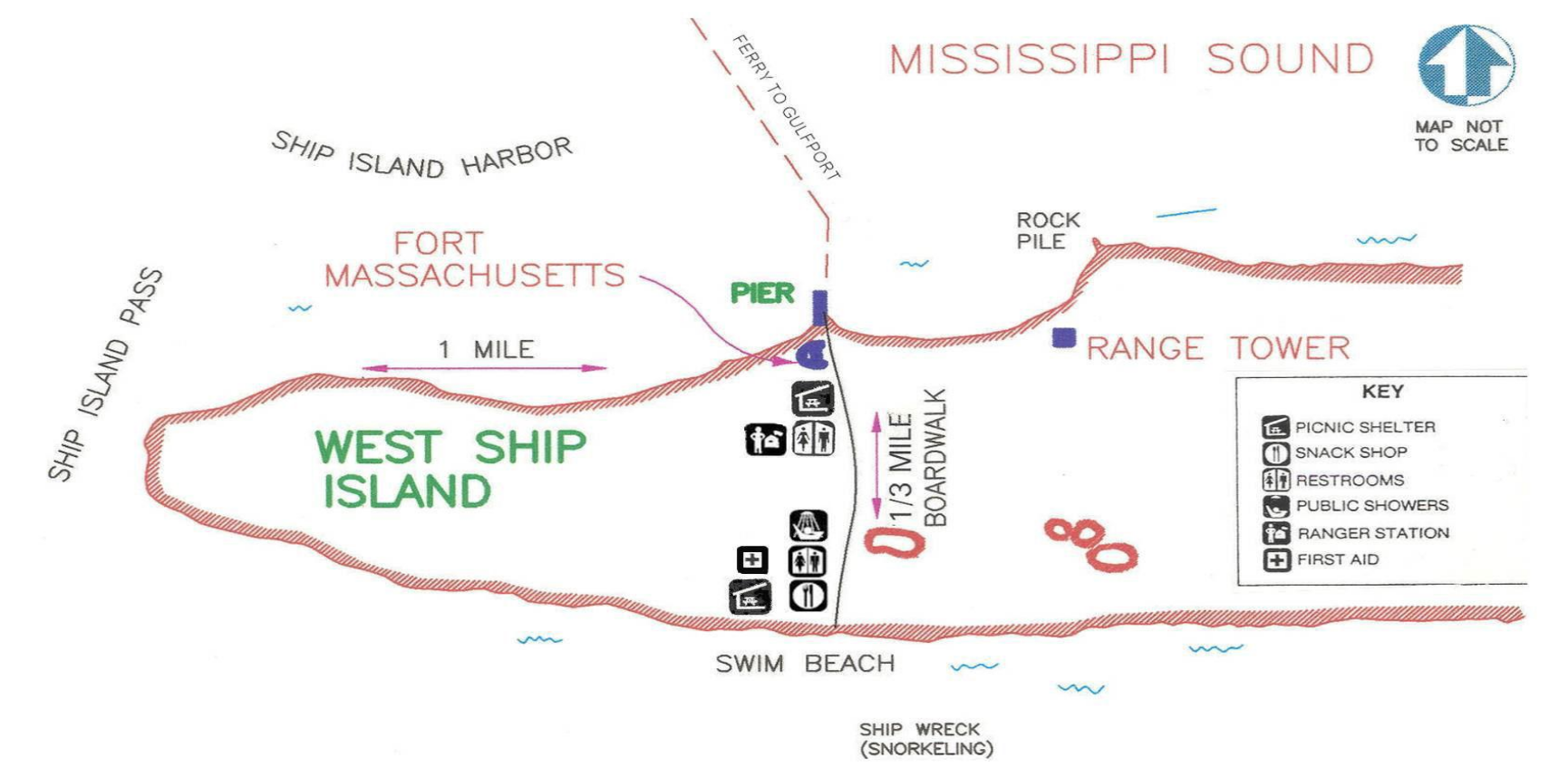 Here’s a printable Ship Island map. This map is older than the one above, but it’s fewer colors so it works better for printing. You’ll also notice this one still says “Gulf of Mexico” in contrast to the newer one above.
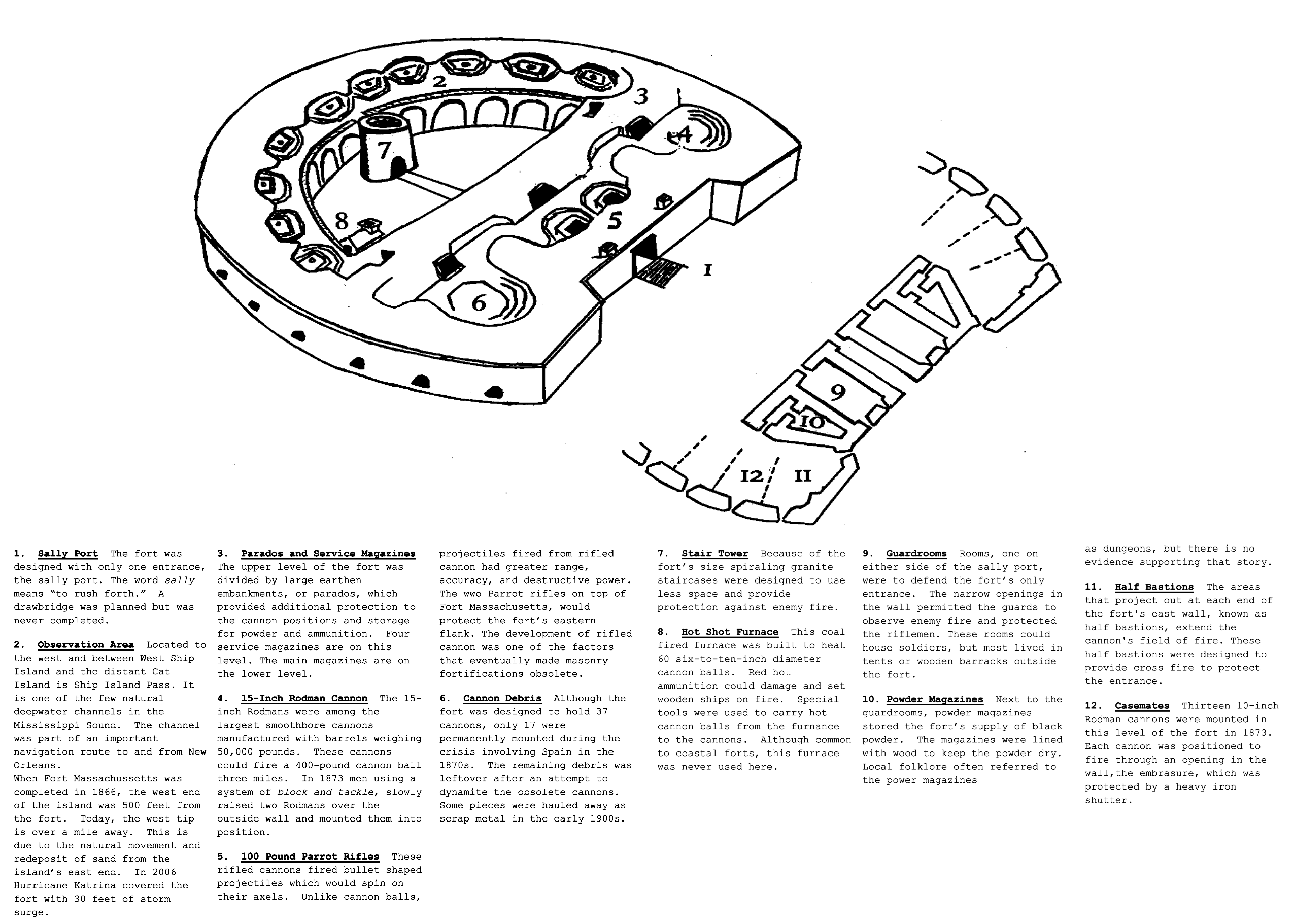 This Fort Massachusetts map zooms in on this fort on Ship Island and includes a self-guided walking tour. It features twelve stops focusing on history and architecture of the fort and labels them on the map.
Other Gulf Islands location maps
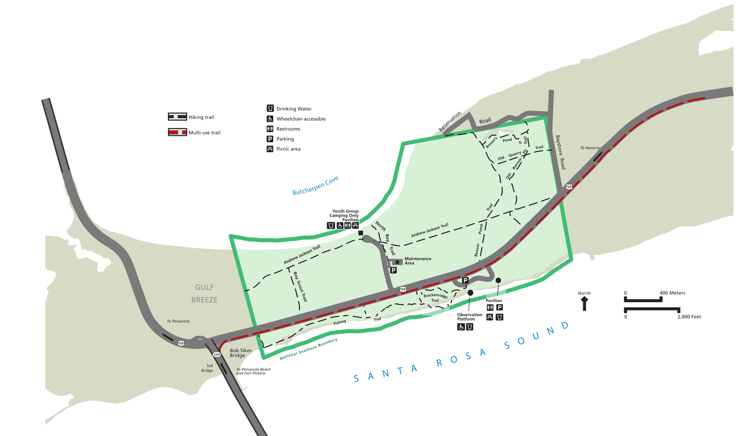 The Naval Live Oaks map focuses on the hiking trails, pavilions, observation platform, and other features in this forested area of Gulf Shores National Seashore.
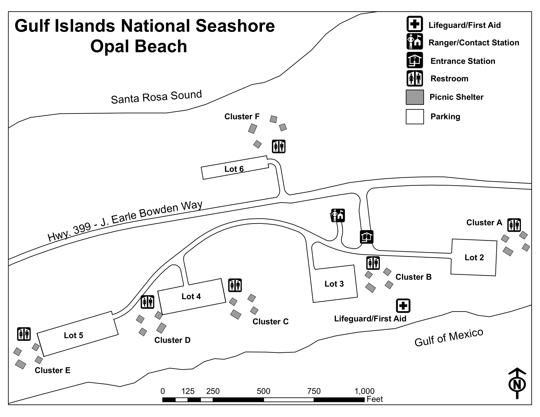 Here’s an Opal Beach map, showing the parking lots, picnic shelters, and restrooms near Opal Beach. This undeveloped beach is located east of Fort Pickens and Pensacola Beach.
Pensacola Harbor historical maps
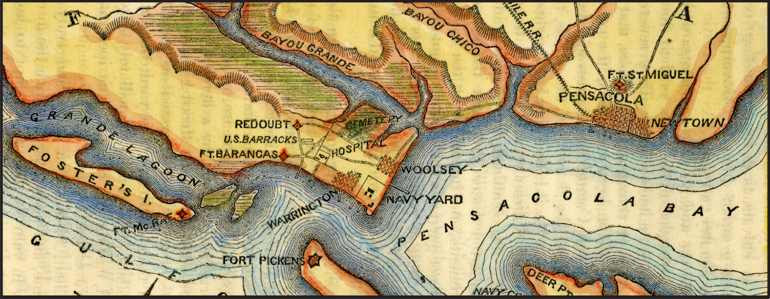 This beautiful historical map of Pensacola Harbor shows the location of Fort Barrancas, Fort Pickens, Fort McRae, and other structures from the 1860s.
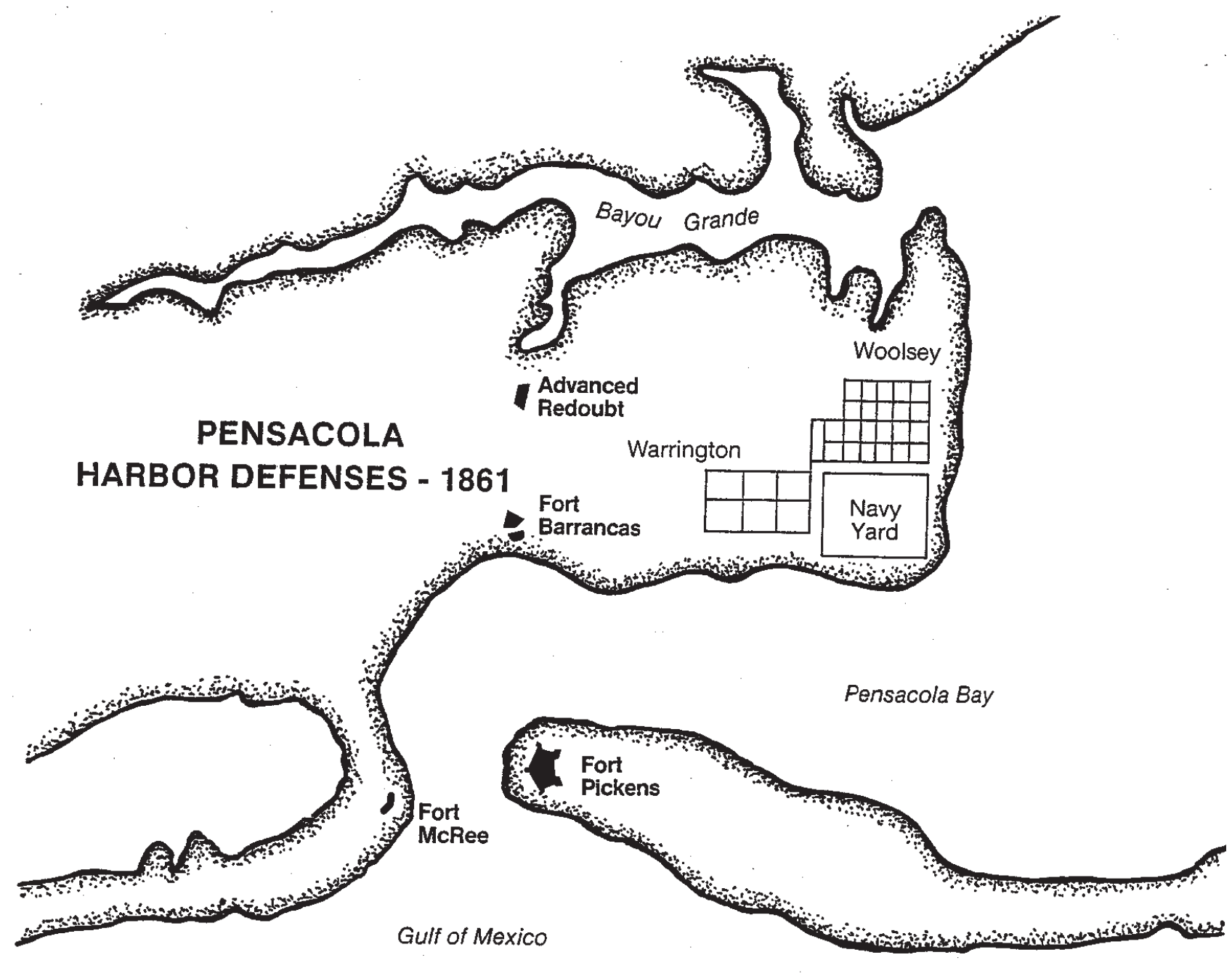 The printable historic map of Pensacola Harbor is less attractive but a bit easier to parse since it’s only in black-and-white, making it easier to see the relevant historic sites.
…and more!
< Return to National Park Maps home
< Return to Park List
< Return to List by State