Cumberland Island brochure maps
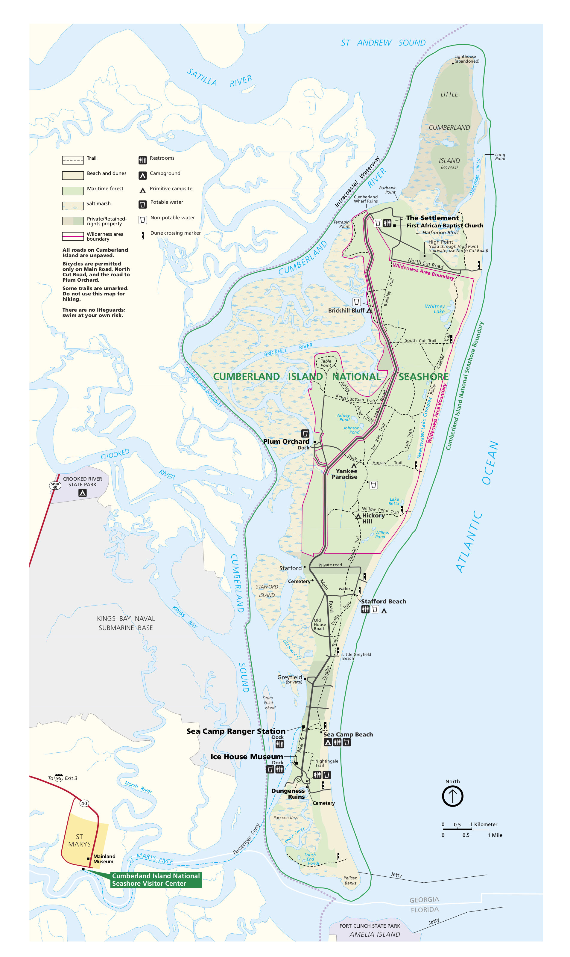
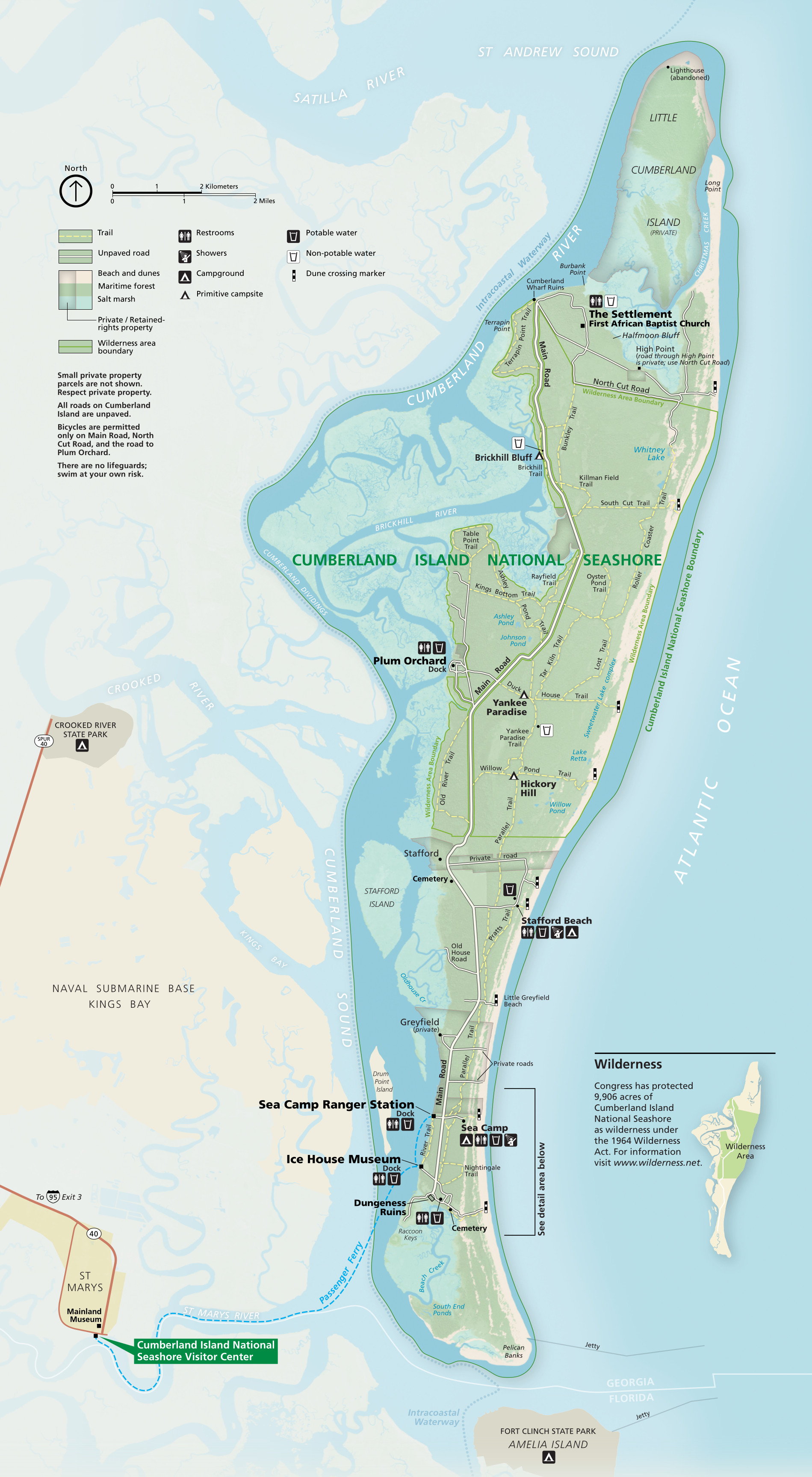 Here’s the official Cumberland Island map from the National Park Service brochure. It includes trails as well as the unpaved roads, and marks the Wilderness boundary and terrain types.
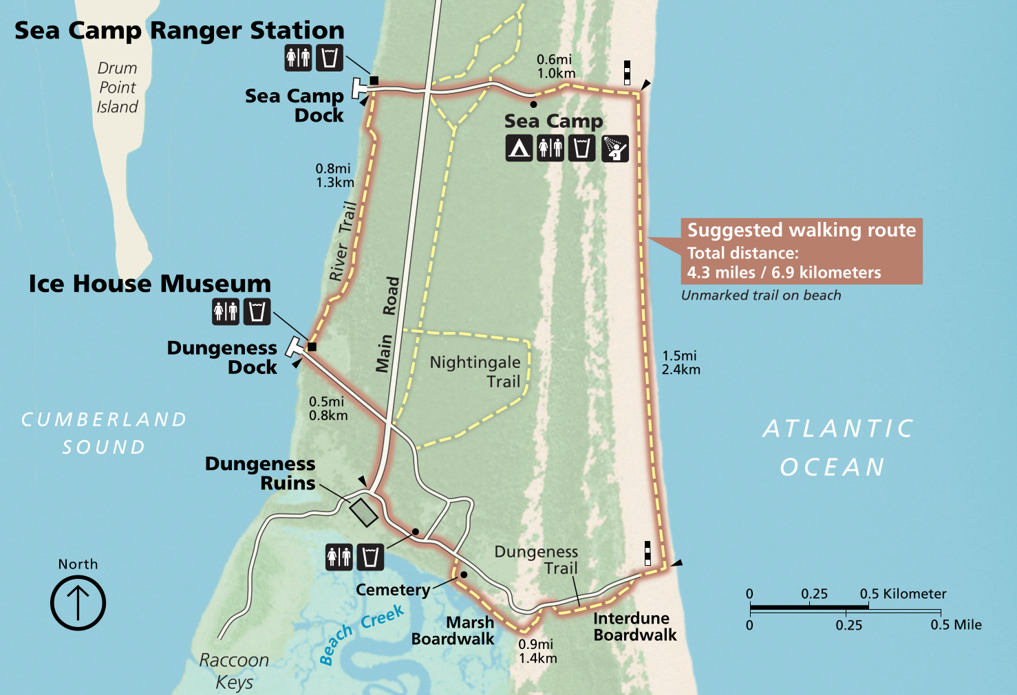 This is a South End trail map, which zooms in on the southern part of Cumberland Island to show the trail network. It includes a suggested loop of about four miles, accessible from the boat docks.
Cumberland Island camping maps
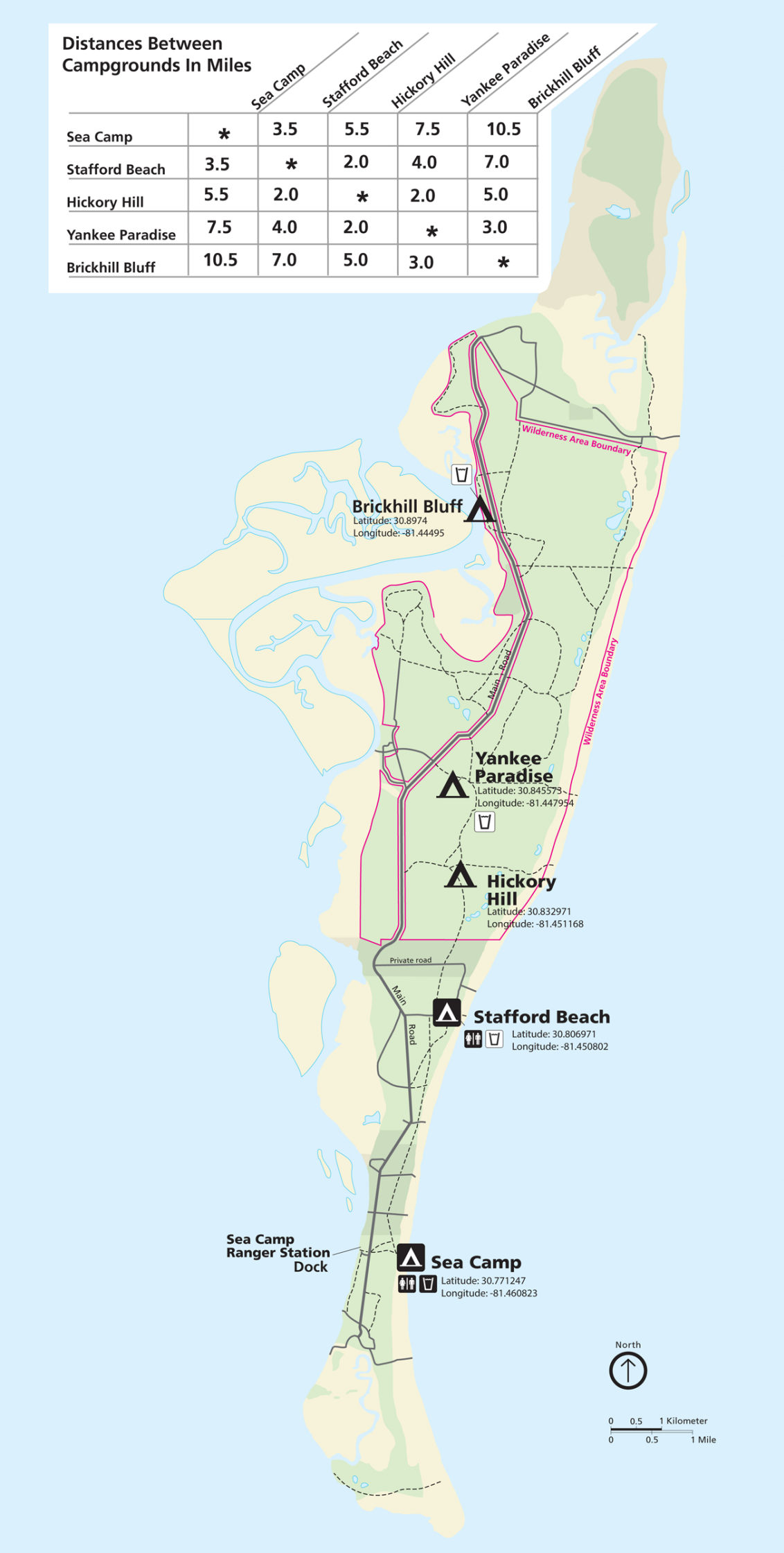 The Cumberland Island campground map shows the location of the two most popular developed campgrounds (to the south) as well as the three primitive campgrounds (to the north).
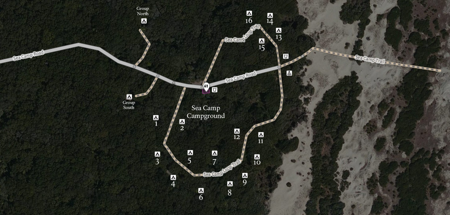 Here’s a Sea Camp campground map, showing the most popular of Cumberland Island’s campgrounds. It’s the largest campground and nearest to the Sea Camp dock and ranger station.
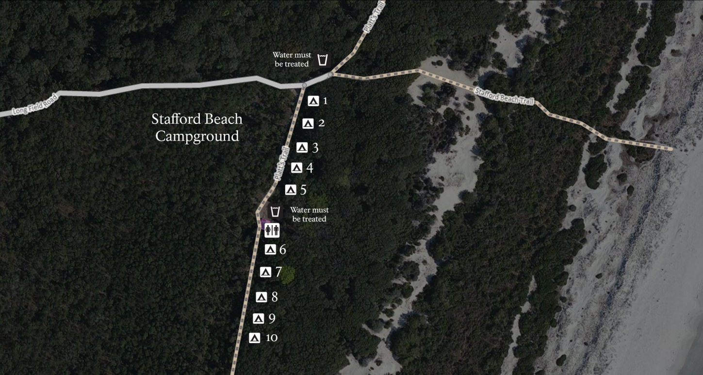 The Stafford Beach campground map focuses on the second most popular campground in the park, which has a few more amenities than the primitive campgrounds: fire rings, restrooms, and water.
Other Cumberland Island maps
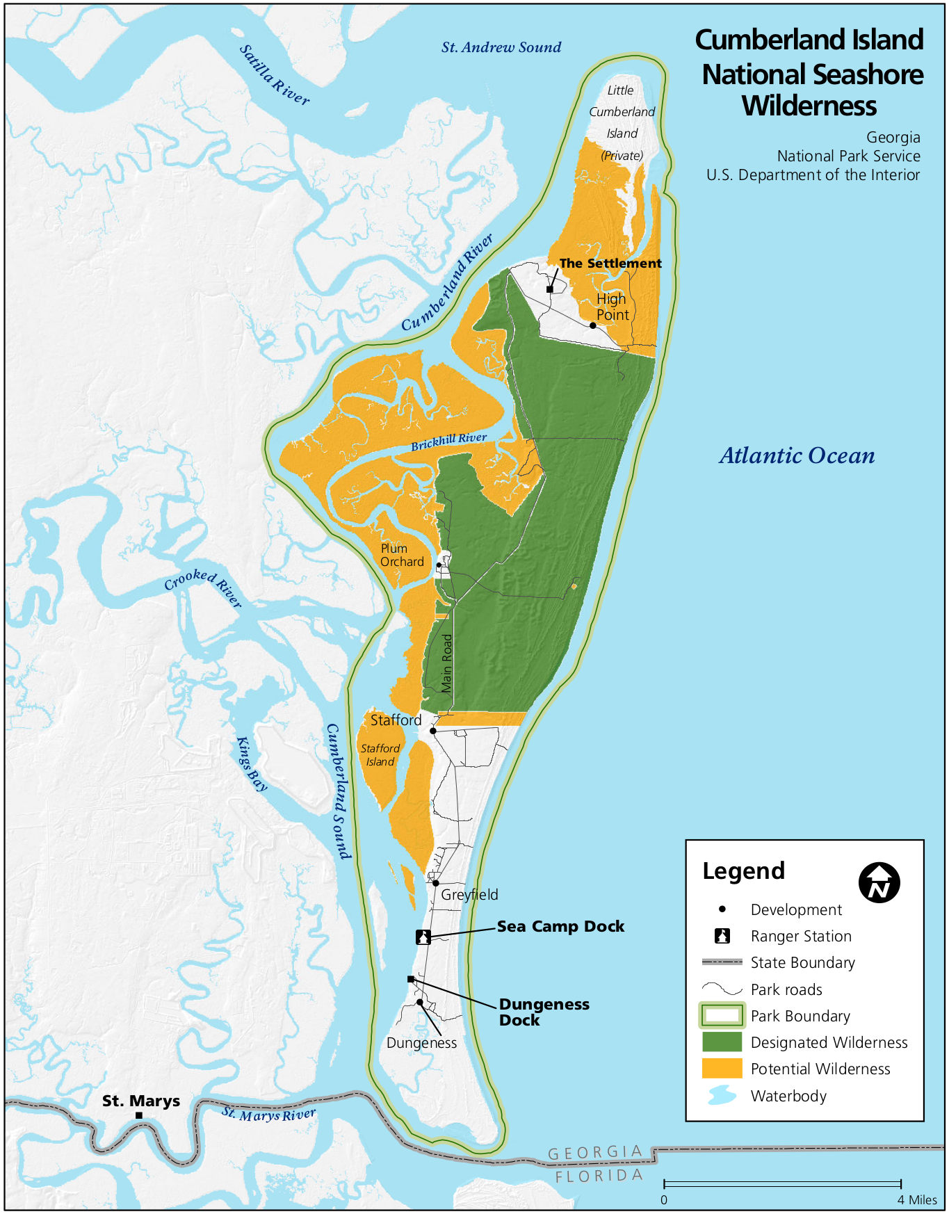 This is a Cumberland Island wilderness map, showing the park lands that are currently designated wilderness as well as those that are eligible for future wilderness designation.
 This is an older Cumberland Island National Seashore map from the NPS. It’s archived here to preserve any direct links from around the web. Click the image to view a full size map or download the PDF.
…and more!
< Return to National Park Maps home
< Return to Park List
< Return to List by State