Canaveral brochure maps
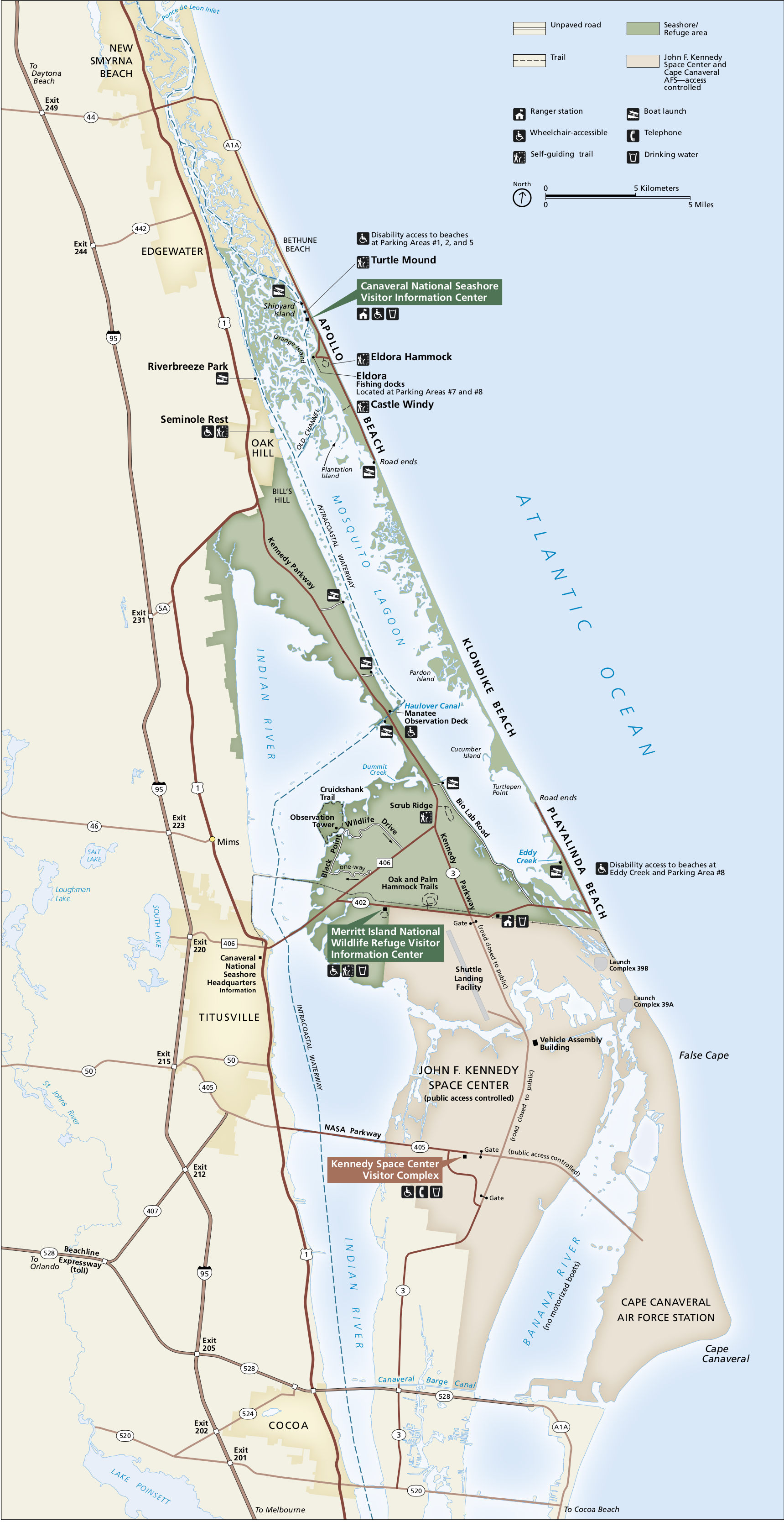 Here’s a Canaveral National Seashore map from the brochure, showing the park as well as nearby Kennedy Space Center. Click the image to view a full size map or download the PDF.
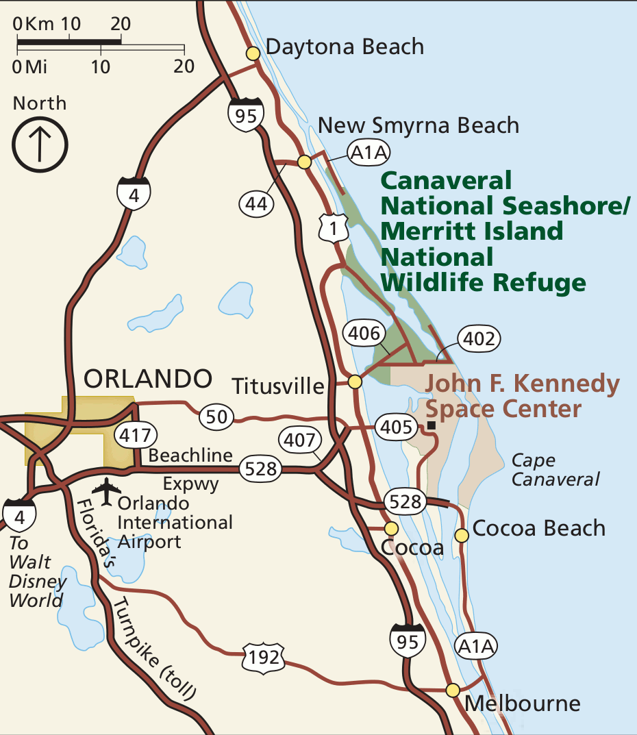 This is a regional Canaveral map, zooming out to show the roads and towns in central Florida, all the way out to Orlando. Click the image to view a full size map or download the PDF.
Detailed Canaveral maps
 Here’s a Canaveral camping map, showing each of the campsites and providing latitude and longitude coordinates to help you navigate to each with you canoe, kayak, or other watercraft.
 The Shipyard Island canoe trail map shows a canoe trail route that begins near the seashore visitor information center, across Mosquito Lagoon. Numbered markers are shown to help you navigate.
Other Canaveral maps
 This Florida regional map zooms out to show Canaveral National Seashore’s location along the Florida coast. Major highways from nearby states are drawn on the map so you can find your way there.
 The Canaveral land management map color codes the various areas nearby Canaveral National Seashore to show whether they’re managed by the NPS, NASA, or the Fish and Wildlife Service.
…and more!
< Return to National Park Maps home
< Return to Park List
< Return to List by State