Glacier maps from the park brochure
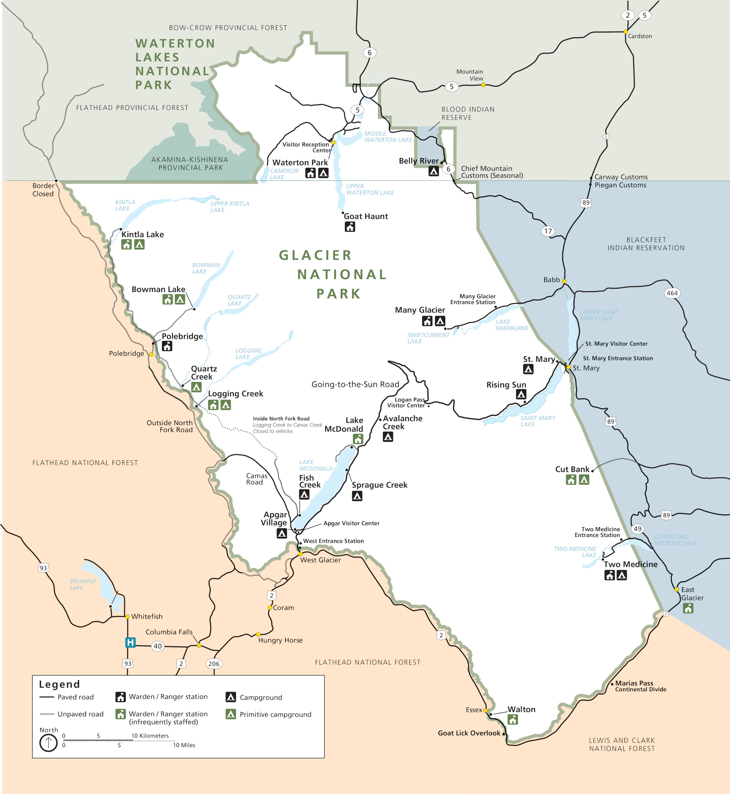
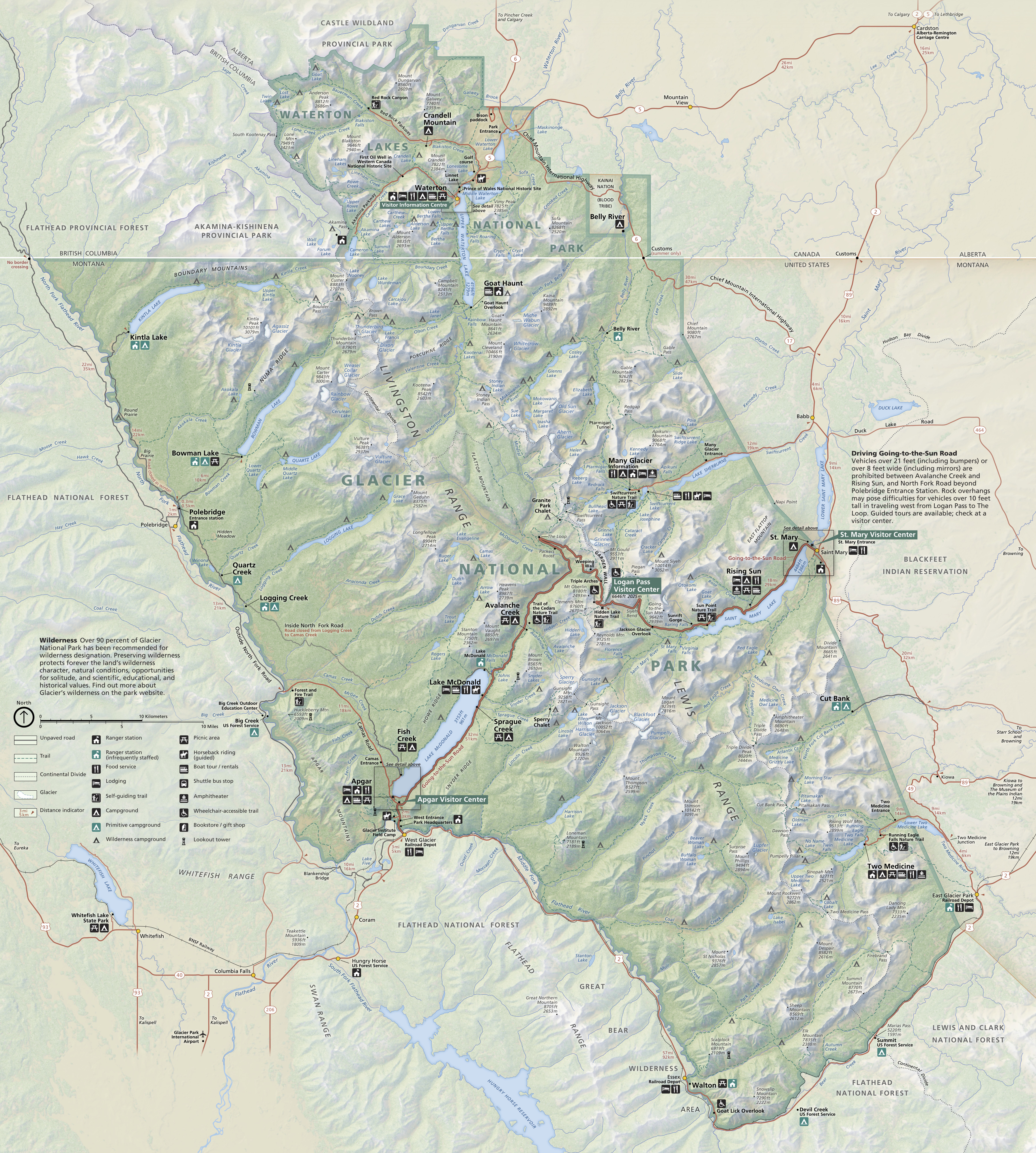 This is the official Glacier National Park map from the National Park Service brochure, and was last updated in 2022. It also includes Waterton Lakes National Park, across the border in Canada.
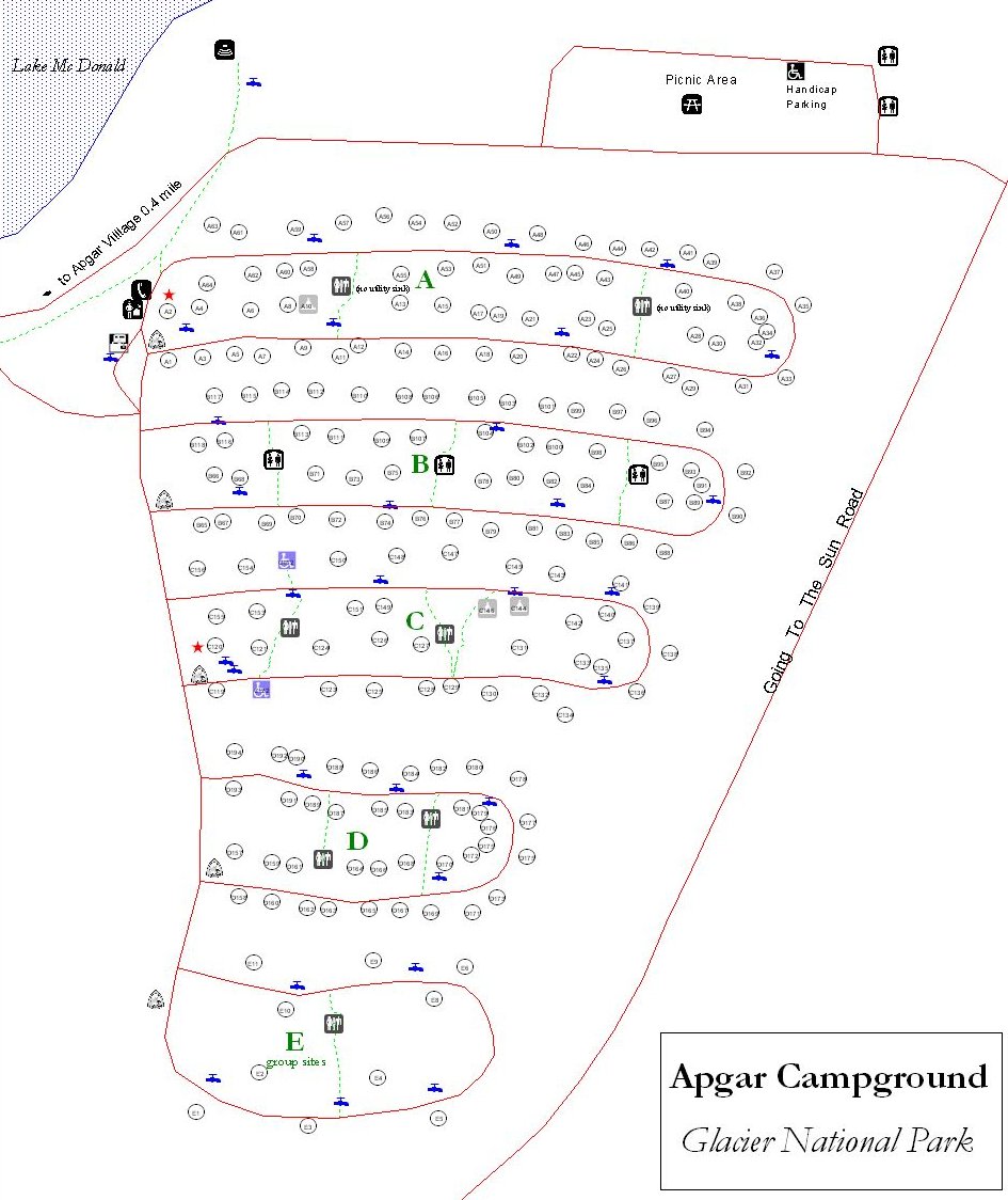
 Here’s an Apgar map, which zooms in on the southwestern shore of Lake McDonald to show Apgar Village, the visitor center, and a couple campgrounds. Click the image to view a full size map or download the PDF.
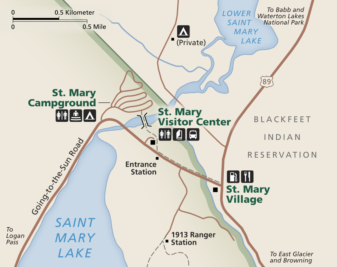 The St. Mary map shows St. Mary Village and nearby services at the east entrance of Glacier National Park, located nearby Saint Mary Lake. Click the image to view a full size map or download the PDF.
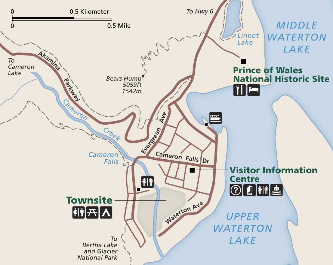 This Waterton map shows the town of Waterton on the Canadian side of what’s technically known as Waterton-Glacier International Peace Park. Click the image to view a full size map or download the PDF.
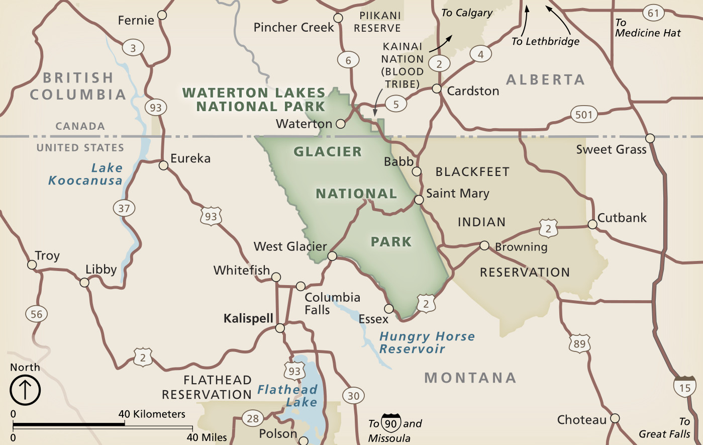 Here’s a Glacier and Waterton Lakes regional map, which zooms out to show highways and surrounding towns in Montana and Canada. Click the image to view a full size map or download the PDF.
Glacier trail maps
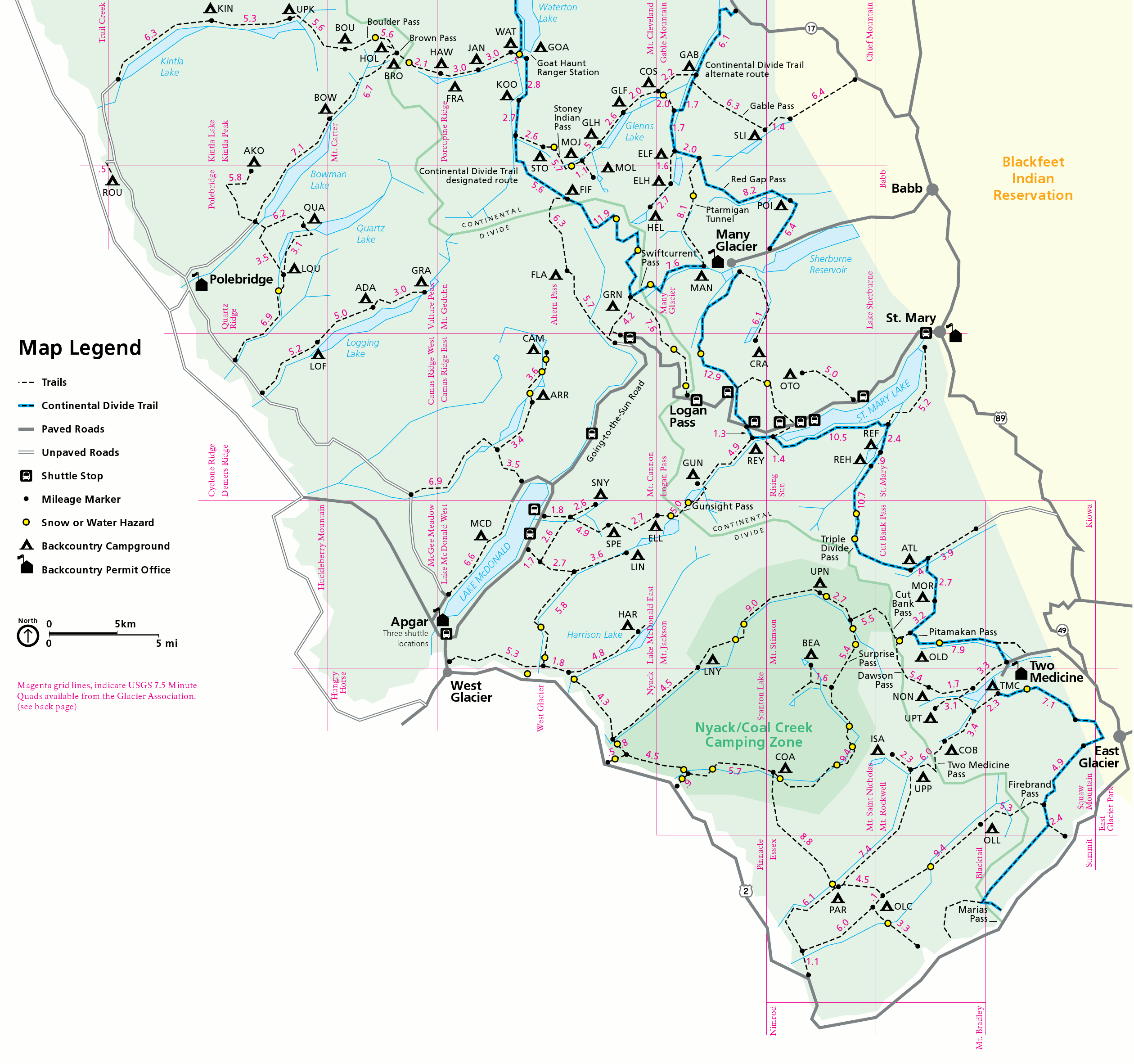
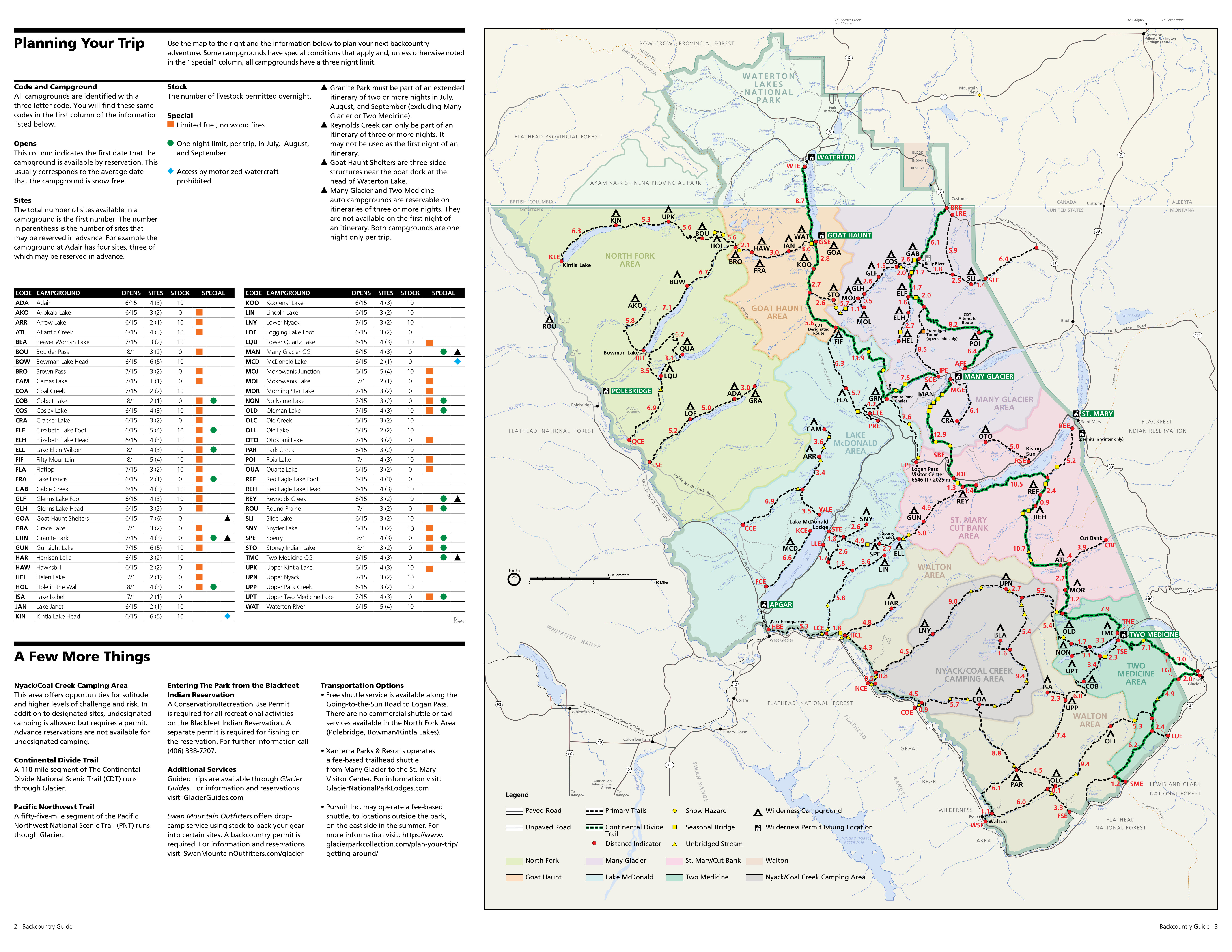 The Glacier National Park backcountry map focuses on wilderness campgrounds and has trail mileages and campsite information. Click the image to view a full size map or download the PDF.
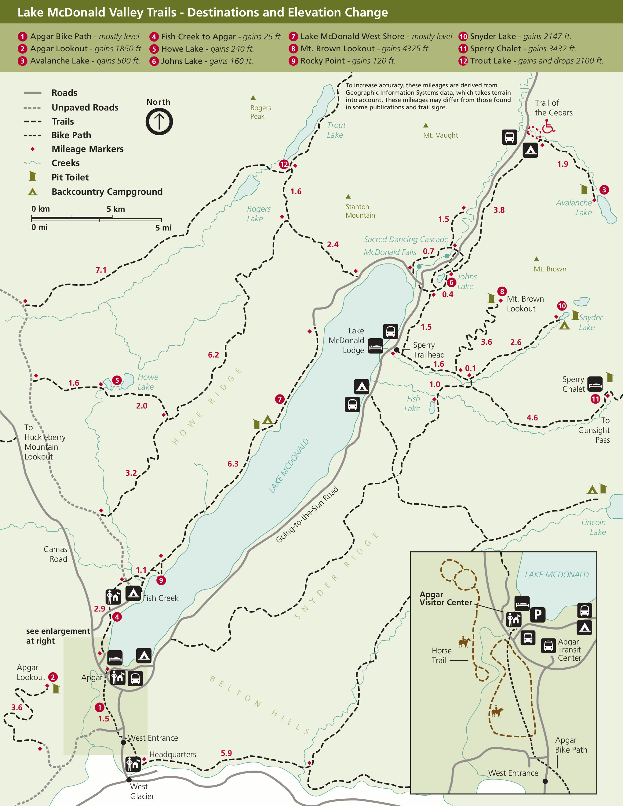 Here’s a Lake McDonald map that shows trails and points of interest all along the shore of Lake McDonald in western Glacier. Click the image to view a full size map or download the PDF.
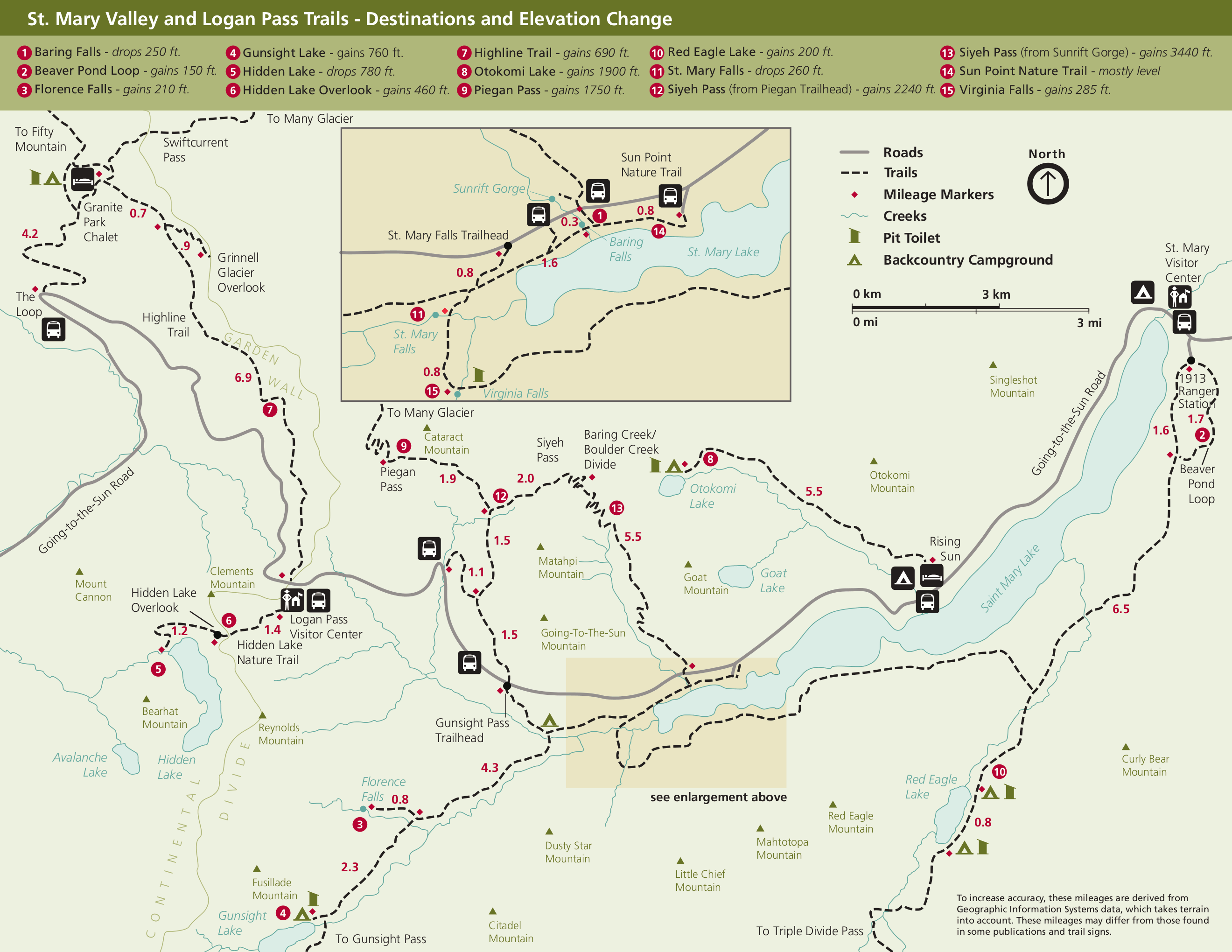 This St. Mary and Logan Pass map includes the trails on the eastern part of the Going-to-the-Sun Road including Logan Pass at St. Mary Lake. Click the image to view a full size map or download the PDF.
 The Many Glacier map zooms in on Many Glacier Valley and includes the trails starting near Swiftcurrent Lake, like the Grinnell Glacier trail. Click the image to view a full size map or download the PDF.
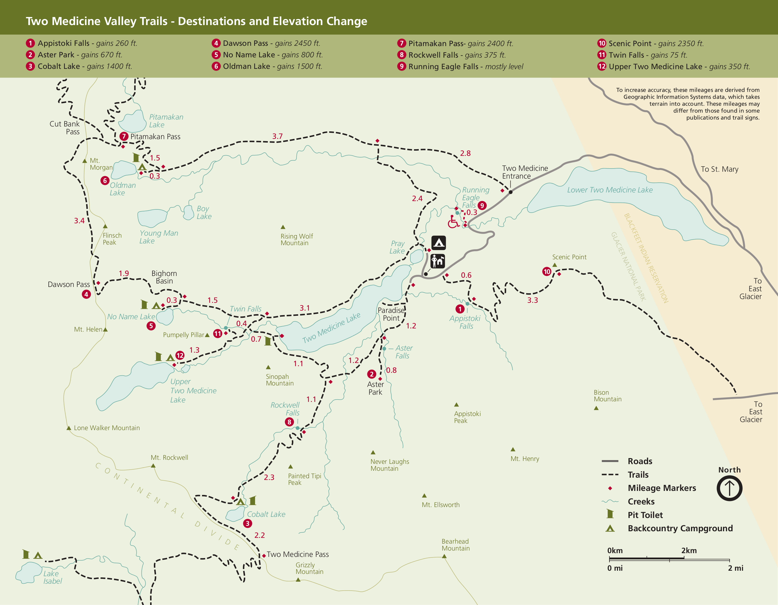 Here’s a Two Medicine map that shows the trails in the less-visited Two Medicine Valley, featuring plenty of lakes and waterfalls. Click the image to view a full size map or download the PDF.
 If you want a single waterproof trail map that covers the entire park, the National Geographic Trails Illustrated map is probably your top choice. This comprehensive map includes topo lines and the level of detail means it’ll be suitable for backcountry travel. There are also even more detailed trail maps available for purchase that focus on specific sections of Glacier: Many Glacier area, Two Medicine area, and the North Fork.
Following are more Glacier National Park trail maps of popular park locations. The main difference with these is that they’re a bit older, but most also include trail descriptions. You can download a single PDF file that contains most of the maps below, or instead click on each image to view each map separately.
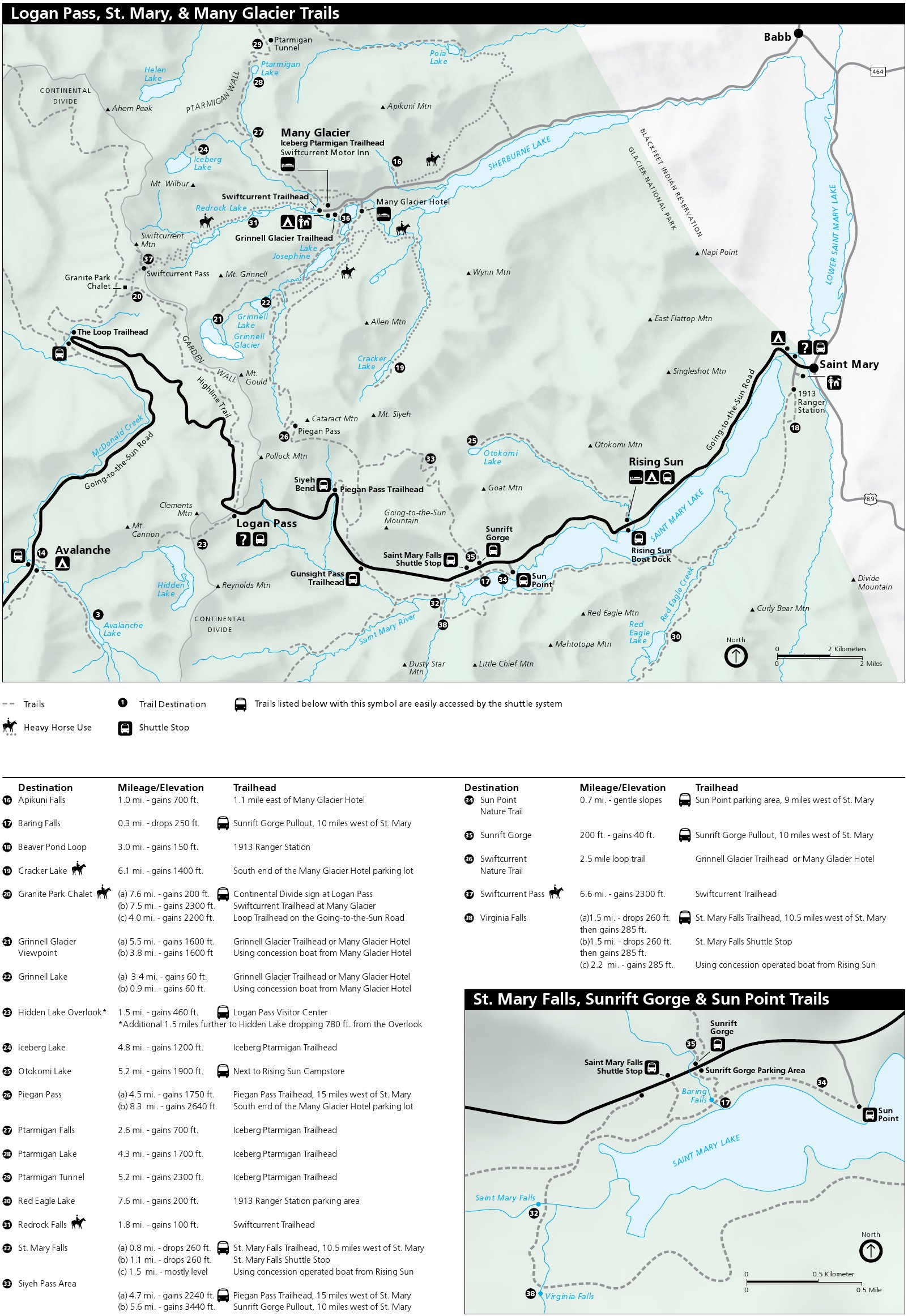 This trail map shows the hikes surrounding Logan Pass, St. Mary, and Many Glacier areas. This map shows shuttle stops on the Going-to-the-Sun Road and some of the most popular hiking trails in the park.
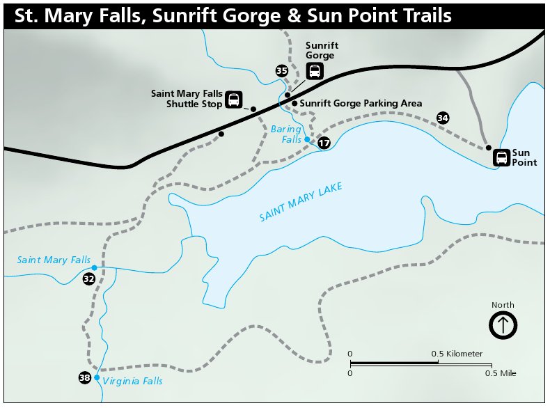 This is a St. Mary Falls inset map. The trail numbers correspond to the labels shown on the key of the previous map. Here you’ll find Sunrift Gorge and Sun Point trails on the west end of St. Mary Lake.
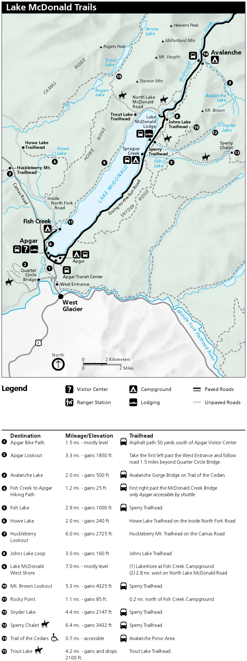 This is a Lake McDonald trail map, showing the hiking trails around Lake McDonald on the western end of the Going-to-the-Sun Road, near West Glacier, in a very popular area of Glacier National Park.
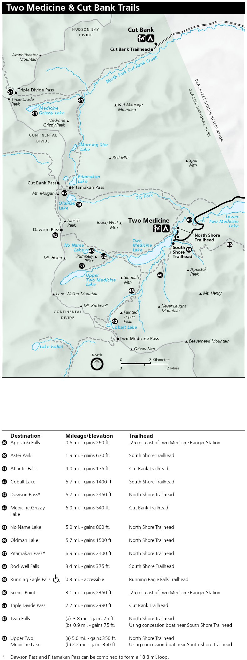 Here’s a Two Medicine trail map, in the southeast region of the park, showing the Two Medicine Lake hiking trails. It also shows the Cut Bank trailhead, which leads to Triple Divide Pass.
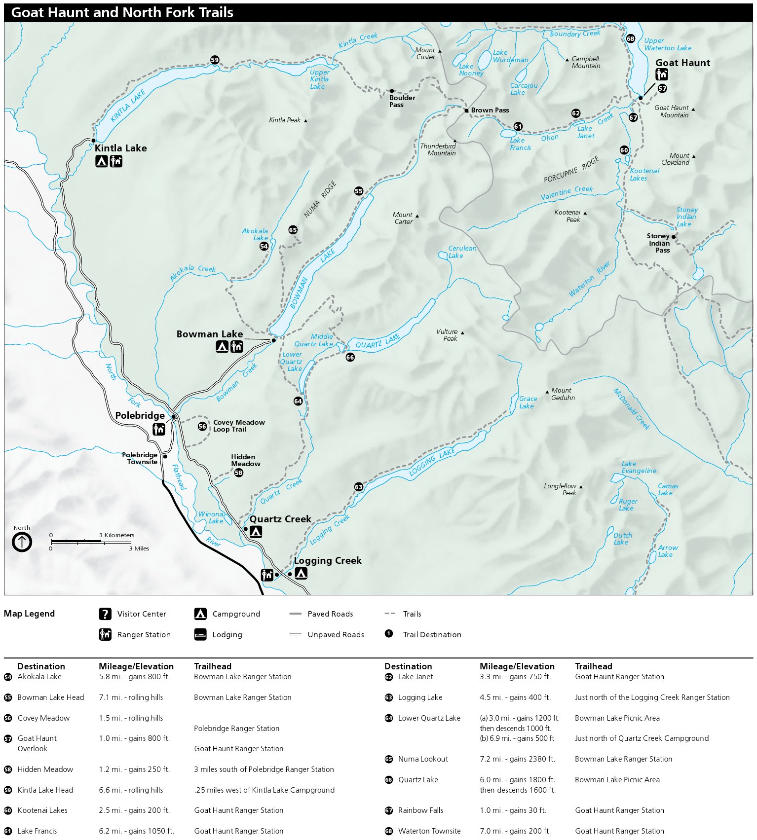 This North Fork trail map shows the remote, quiet northwest corner of the park. It includes trails around Goat Haunt on the southern end of Upper Waterton Lake and trailheads at Kintla and Bowman lakes.
Glacier shuttle and vehicle permit maps
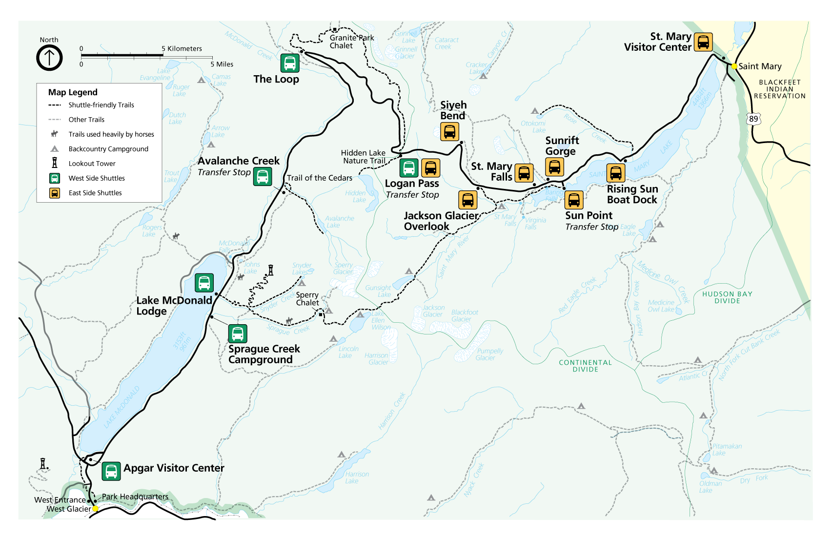 This Glacier shuttle bus map is from 2025 and shows the two shuttle routes. Note that there’s a West Side shuttle and East Side shuttle, and you must transfer at Logan Pass to continue to the other side of the park.
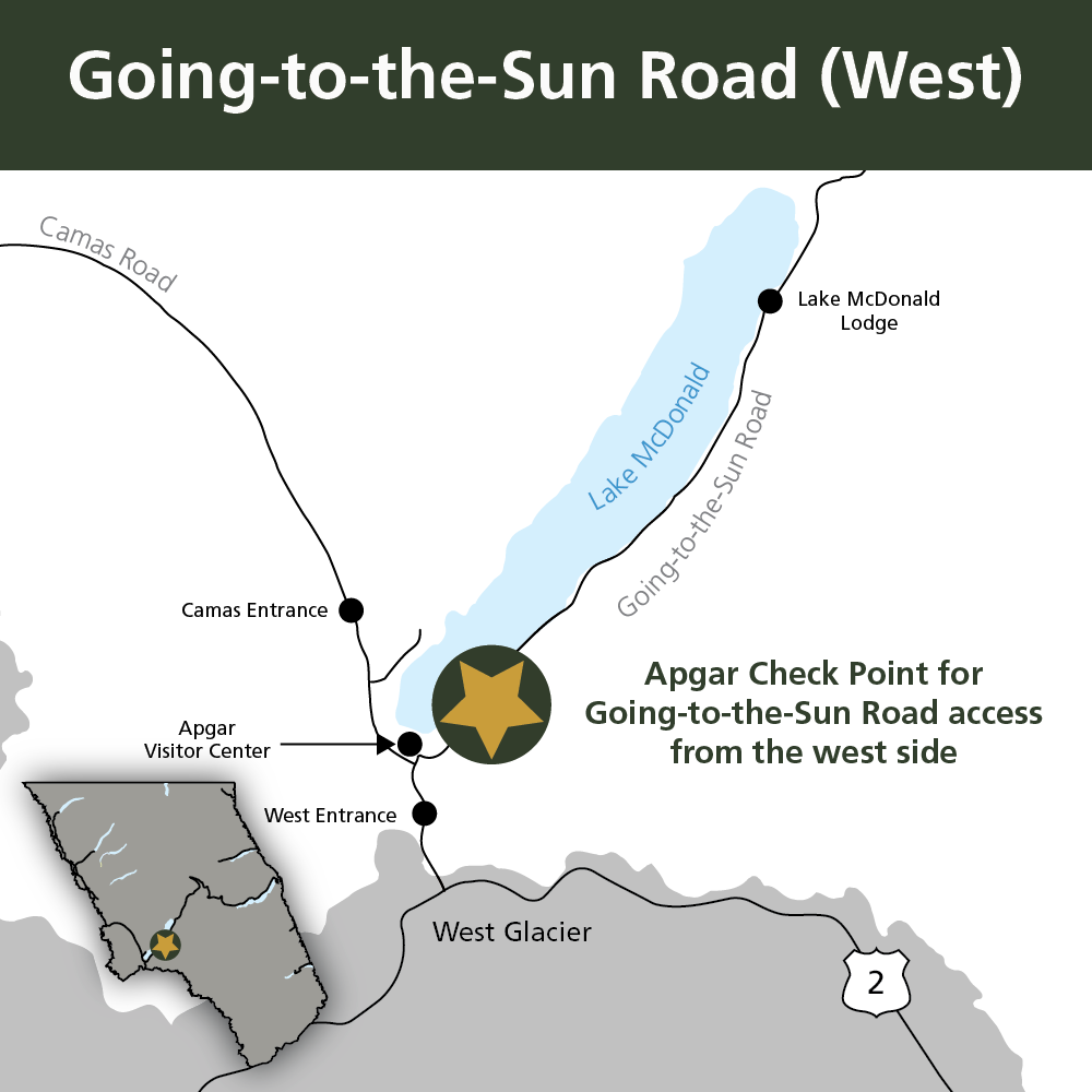 Here’s a Going-to-the-Sun Road permit map from 2025, showing the location of the Apgar checkpoint. To combat traffic and crowding, timed-entry vehicle reservations are needed beyond this point.
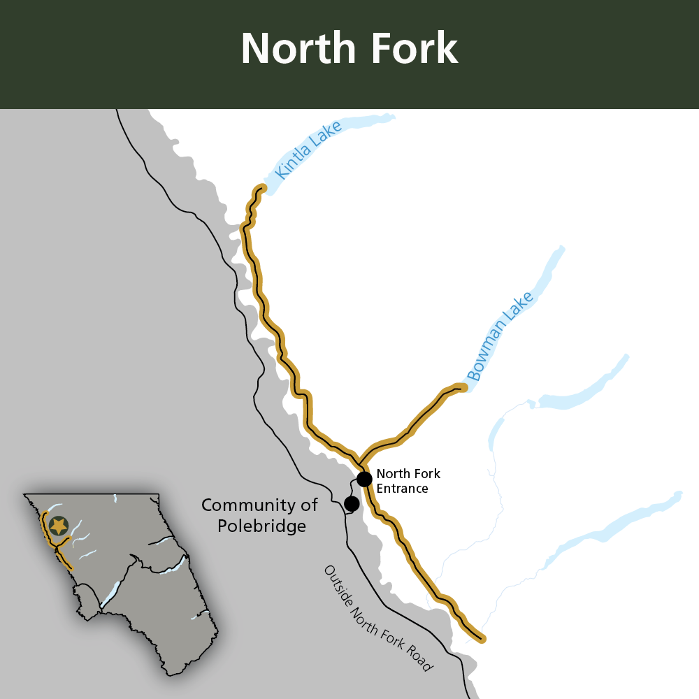 This is a North Fork permit map from 2025, showing where timed entry vehicle reservations are needed to access Bowman Lake, Kintla Lake, and other locations along the North Fork of the Flathead River.
Glacier lodging map
 The closest major town to Glacier is Kalispell, where you’ll find a huge variety of lodging options; to the right you can open an interactive Expedia Kalispell lodging map. But I encourage you to also zoom around and look at the other options near Whitefish and in the surrounding region. In fact, here you can see all the best-rated Glacier lodging, focusing on the area outside Glacier’s west entrance.
Glacier campground maps
 Here’s a Glacier National Park campground map. It shows the location of each of the park’s campgrounds, so it’s a handy reference as you look at the campground-specific maps below and decide where you want to stay.
 Here’s an Apgar Campground map, featuring the largest campground in Glacier National Park and the only westside campground open all year. It’s near the main West Glacier visitor services.
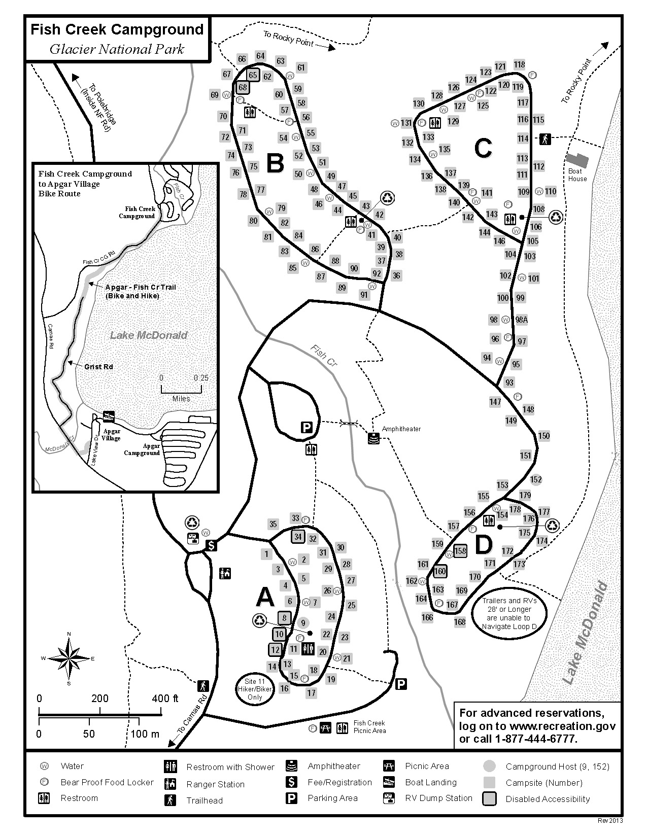 This Fish Creek Campground map shows the park’s second-largest campground, located on the west end of Lake McDonald (opposite the Going-to-the-Sun Road), near West Glacier and the Apgar Village area.
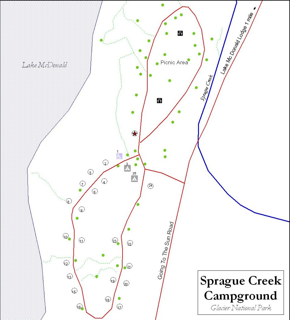
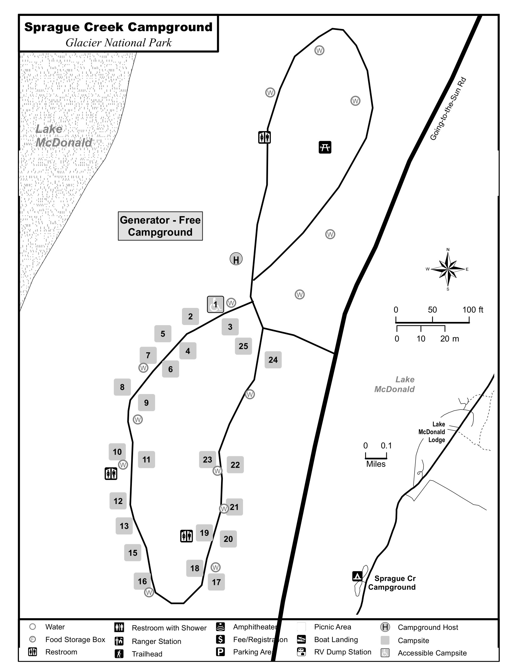 The Sprague Creek Campground map zooms in on this pretty small campground along Lake McDonald. Larger RVs and trailers won’t fit in this nicely forested campground.
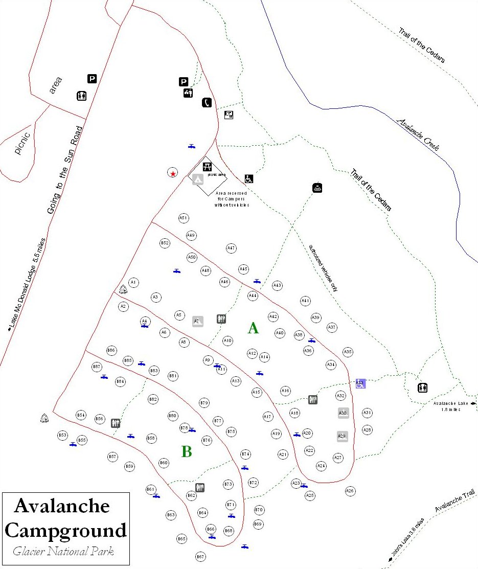 This Avalanche Campground map shows the layout of this campground – the nearest to Logan Pass of Glacier National Park’s westside campgrounds and a bit higher in elevation.
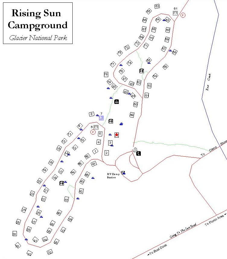 The Rising Sun Campground map shows this first-come, first-served campground located east of Logan Pass (and west of St. Mary) on the Going-to-the-Sun Road. No reservations are accepted here.
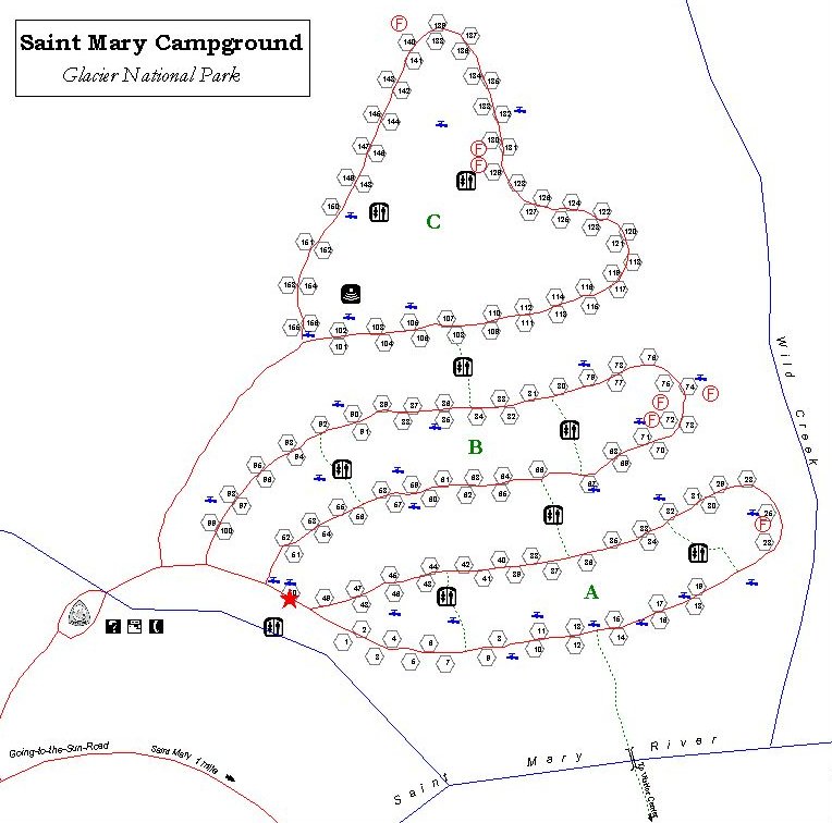 This St. Mary Campground map shows the largest campground east of Logan Pass and the only eastside campground open all year. It’s located near the St. Mary Visitor Center.
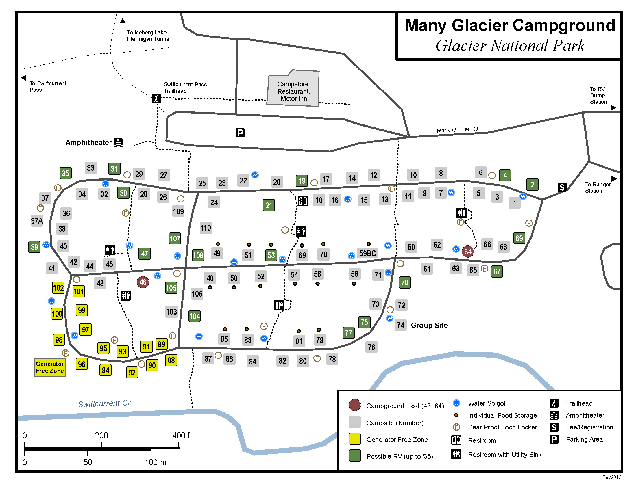 Here’s a Many Glacier Campground map showing the large (110 sites) and popular campground in the Many Glacier area. Get here early; there are many popular hikes and excursions to do from here!
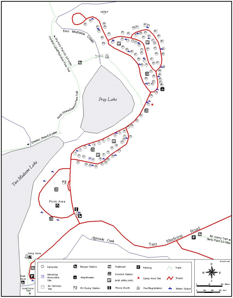 This Two Medicine Campground map shows the large campground on the east side of Glacier that tends not to fill as quickly since it is in a less-visited area (though still incredibly beautiful!).
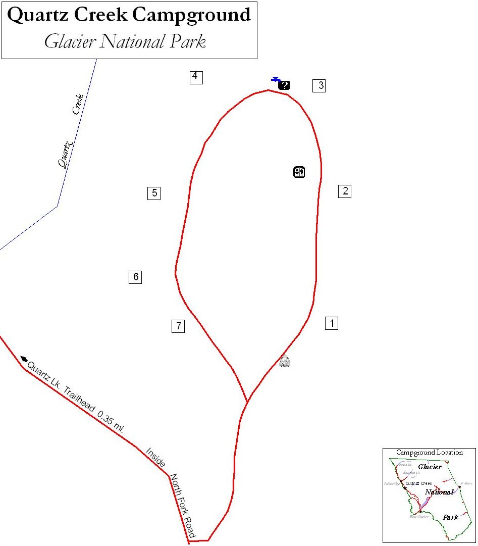 The Quartz Creek Campground map shows the tiny primitive campground in western Glacier located on the curvy Inside North Fork Road. A great place to go to escape the crowds.
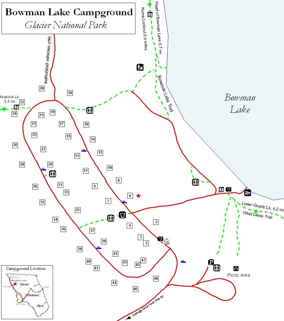 The Bowman Lake Campground map shows this remote campground on the southwest end of Bowman Lake, located in the quiet North Fork area in northwestern Glacier National Park.
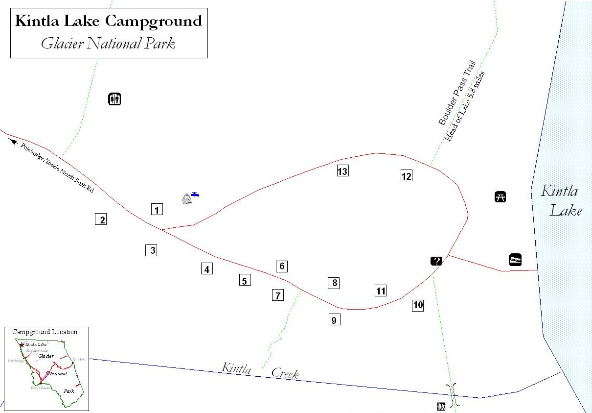 The Kintla Lake Campground map shows this very small campground located way up there in northwest Glacier, with very limited nearby services. You can’t go much further north or you’d be in Canada.
Assorted Glacier maps
 Here’s a Going-to-the-Sun Road terrain map, particularly useful for identifying the features you’ll see along the drive up and over Logan Pass. This map excels at labeling the geographic features you’ll see.
 This Glacier bike map shows a few unpaved roads where bicycles are allowed. The Inside North Fork Road is the highlight, as 28 miles are closed to vehicles but cycling is still allowed.
 This Glacier National Park geologic map is quite large – so please be patient with the download – and includes text explanations of the geology of each unique rock unit you’ll find in the park.
 This Glacier National Park vegetation map also includes Waterton Lakes National Park across the Canadian border, mapping the types of forest, grasslands, meadows, and other land cover.
Archived Glacier maps
I do my best to keep this page updated as new maps are released and old ones are revised. Rather than erasing old maps, I provide them here for archival purposes so users can see how things have changed in the park over time.
 This is a circa-2020 Glacier National Park map from the park brochure, which also includes Canada’s Waterton Lakes National Park across the border. Click the image to view a full size map.
 This is the older official Glacier National Park map, from the previous edition of the park brochure, published around 2013. Click the image to view a full size map or download the PDF.
 This old Glacier backcountry trail map is from the mid 2010s. Compare with the current map higher on this page to see how things have changed in Glacier’s wilderness over time.
 Here’s an old Glacier National Park campground map, showing the location of each campground in Glacier National Park. Campground maps are featured below, starting with the Going-to-the-Sun Road.
 The old Sprague Creek Campground map shows this smaller campground (25 sites) located alongside the Going-to-the-Sun Road west of Apgar along Lake McDonald. Still a convenient location, but quieter.
 This old shuttle bus map is from the mid-2010s and labels all the shuttle stops as they existed at the time. Note that there was just one route back then, as opposed to the two separate routes the park has run more recently.
Glacier map prints and gifts

 Printed high-resolution Glacier map posters and other products are available at the Glacier National Park Maps store. For prints, gift ideas, and souvenirs featuring other national parks, support this site and visit the National Park Maps store; you’ll find items to bring on vacation, keep at home for the memories, or give to your park-enthusiast friends and loved ones.
…and more!
< Return to National Park Maps home
< Return to Park List
< Return to List by State