Saguaro maps from the park brochure
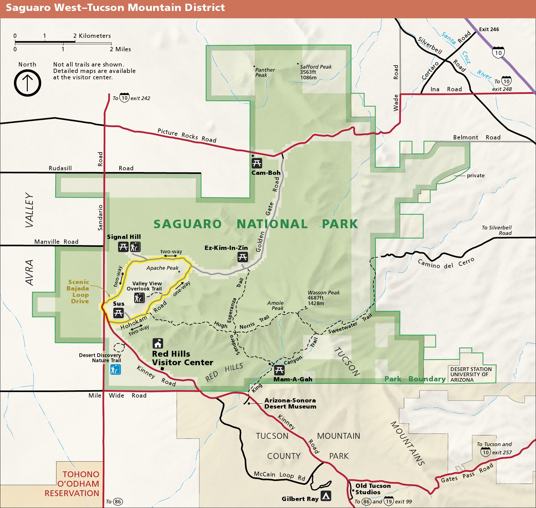
 Here’s a Saguaro National Park (West) map that focuses on the Tucson Mountain district, which includes the Bajada Scenic Loop and Red Hills Visitor Center. Click the image to view a full size map or download the PDF.
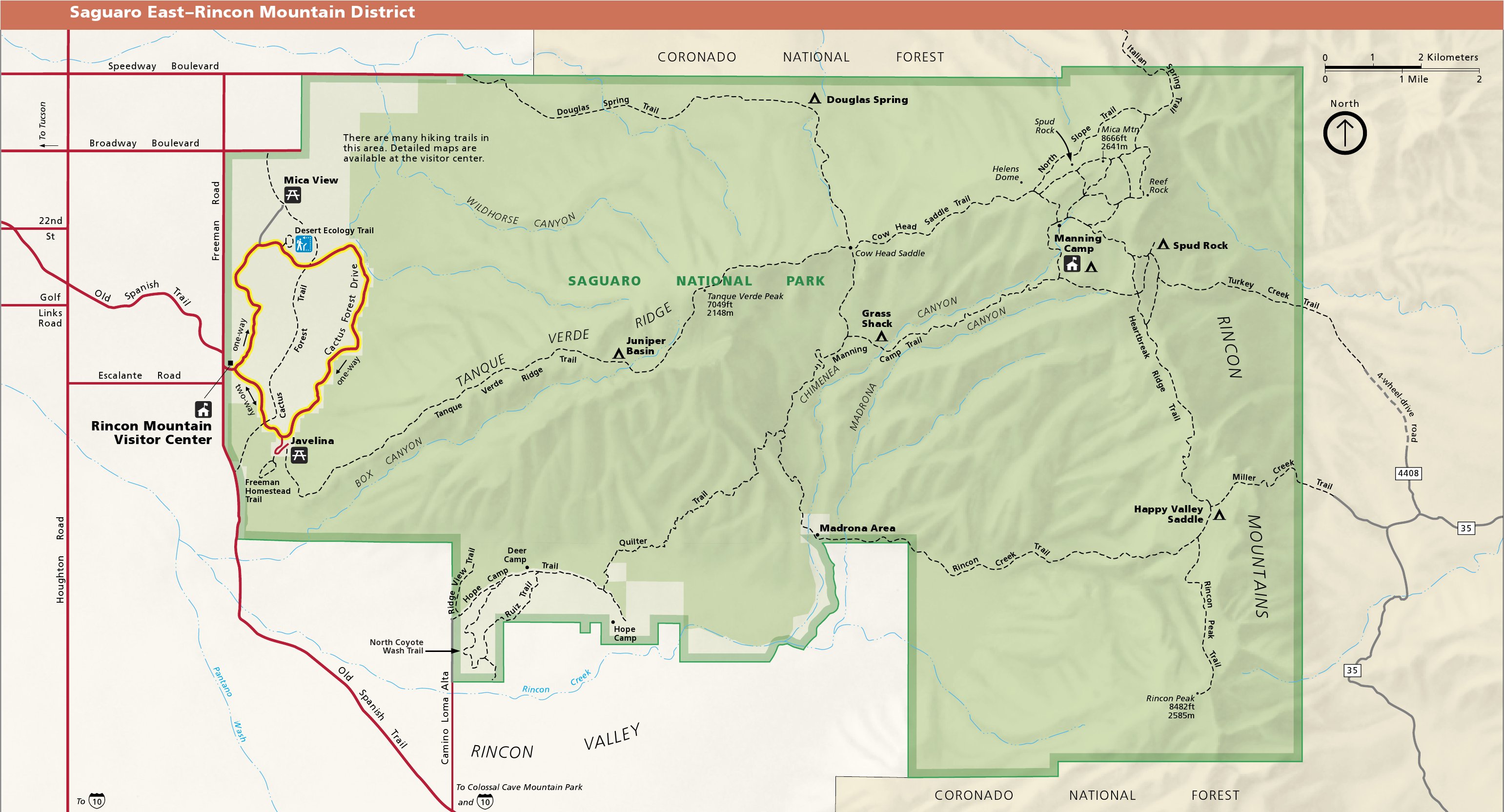
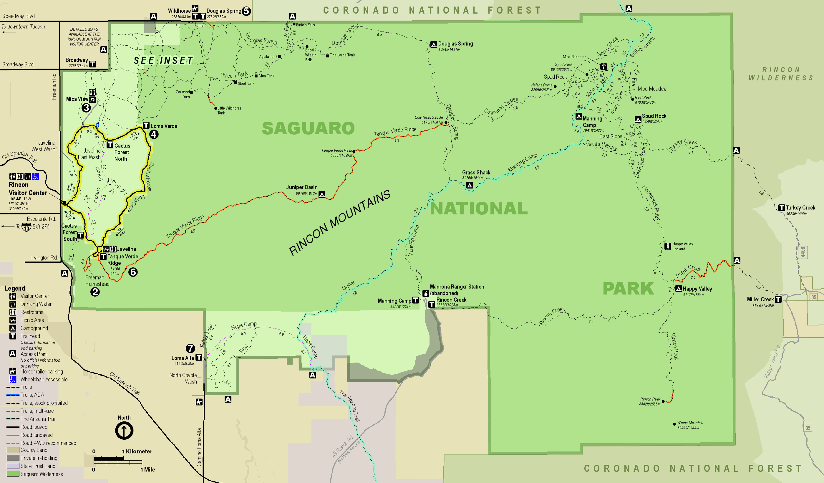
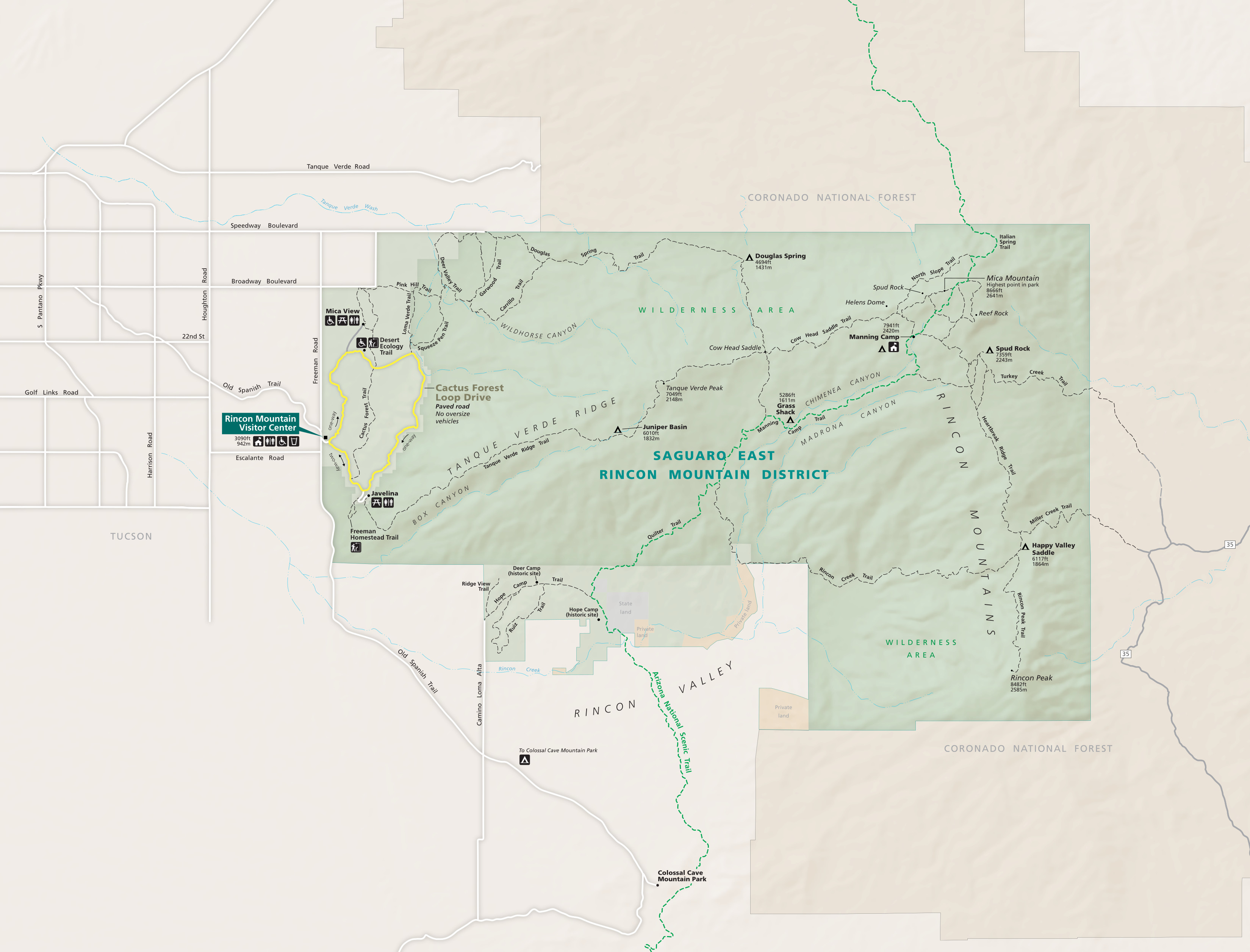 Here’s a Saguaro National Park (East) map, showing the Rincon Mountain Visitor Center, Cactus Forest Loop Drive, and the variety of hiking and backpacking trails. Click the image to view a full size map or download the PDF.
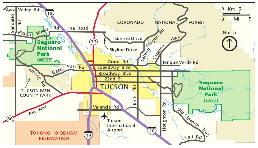
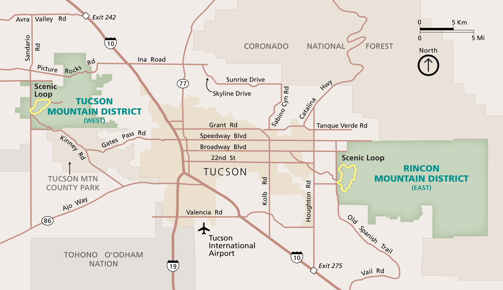 This is the Saguaro National Park regional map, which zooms out to show both districts, both scenic loops, and the relevant roads and highways needed to access the units from Tucson, Arizona.
Saguaro trail maps
 As with most parks, the waterproof National Geographic Trails Illustrated map is your best choice if you’re looking for a single Saguaro National Park trail map with topographic lines, mileages, and wilderness campsites. The maps below are great for trip planning, but you’ll want one with topo lines if you’re doing wilderness backpacking or long day hikes. Or maybe you’re like me, and you just love a detailed map for daydreaming about your next visit.
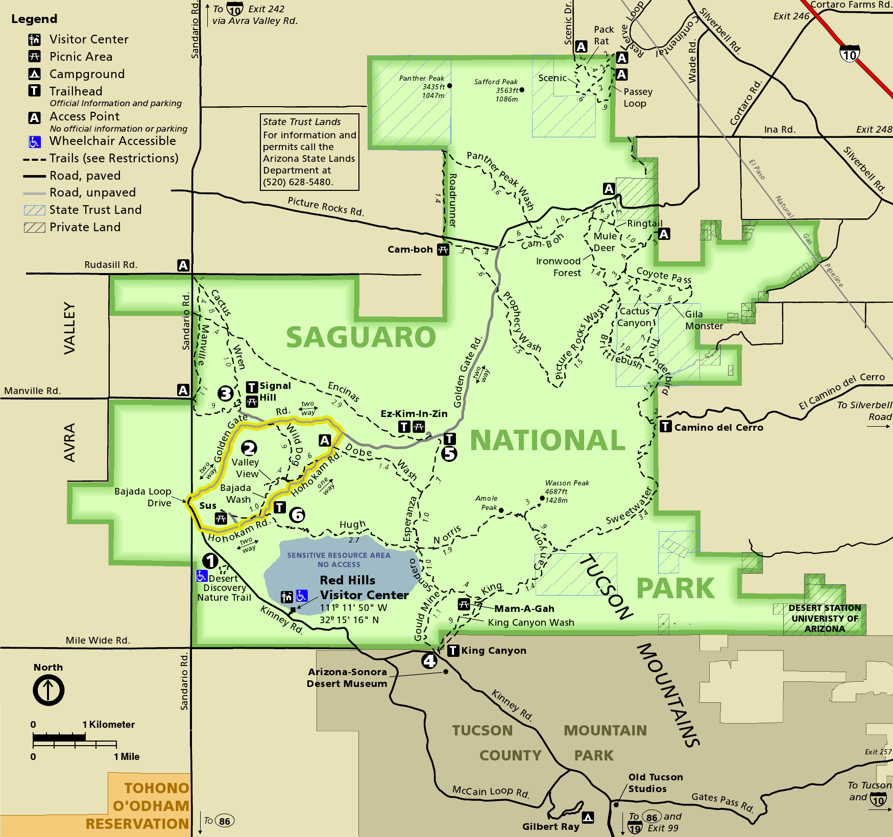
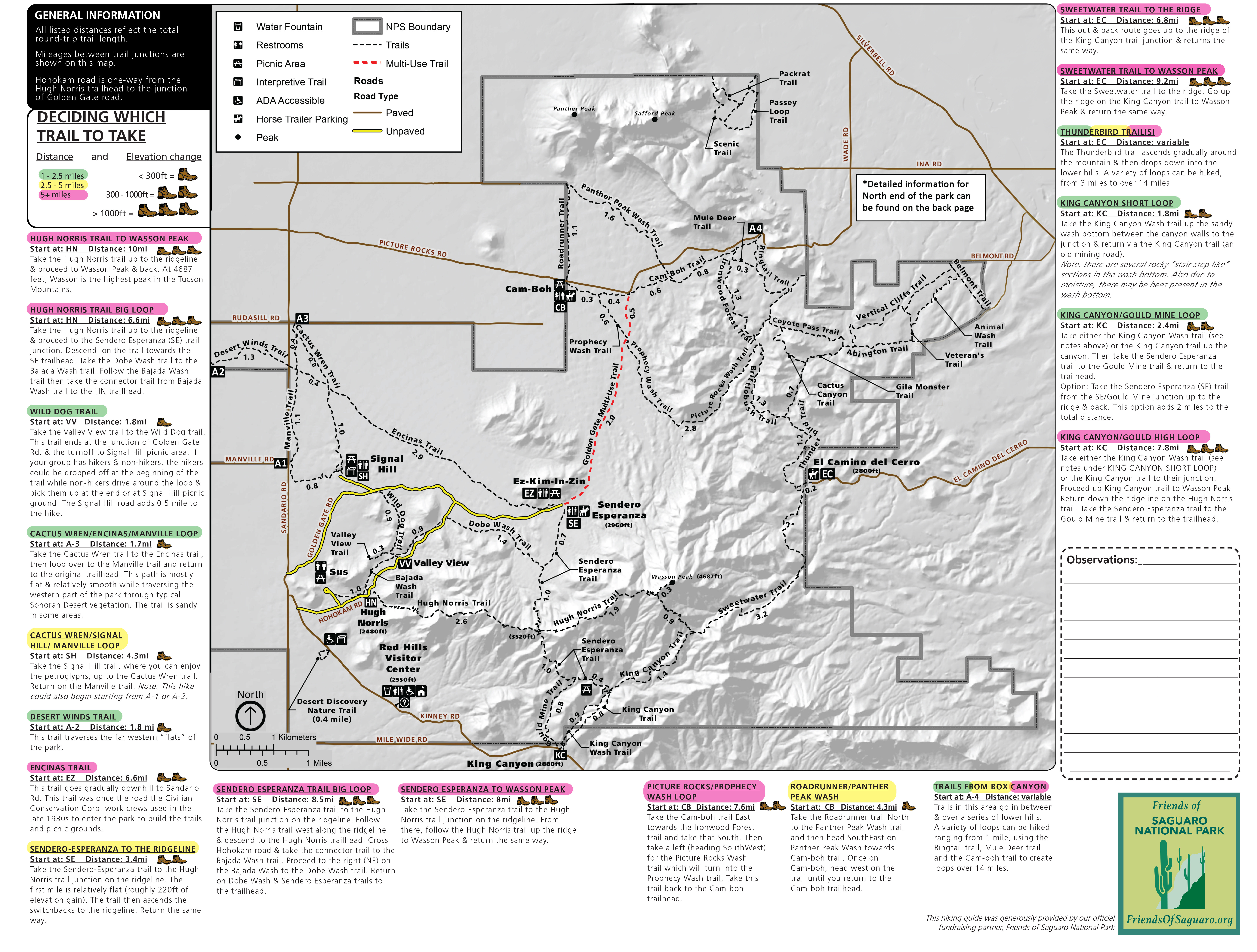 This is a Saguaro West trail map, also known as the Tucson Mountain District. Trails are color coded by distance and include information about elevation change. Mileages between junctions are labeled.
 Here are two Saguaro West trail maps that focus on the northern section of the Tucson Mountain District. These maps overlap with the one above but include extra details about distances and access points.
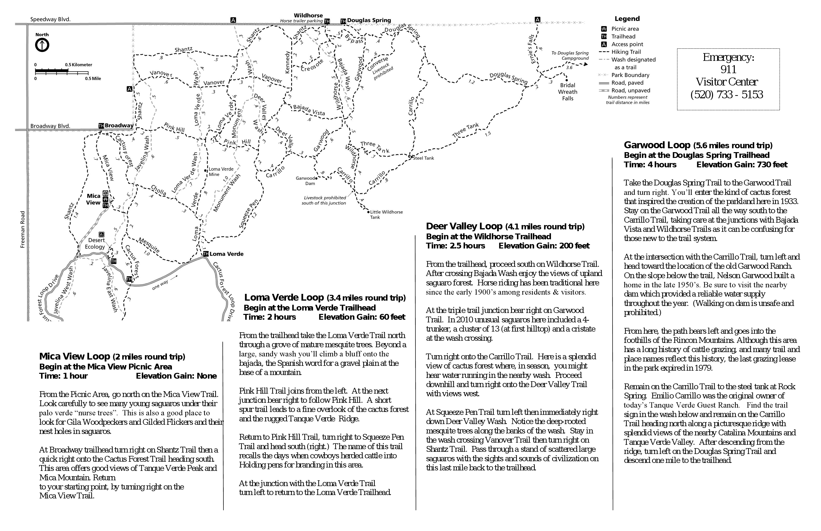
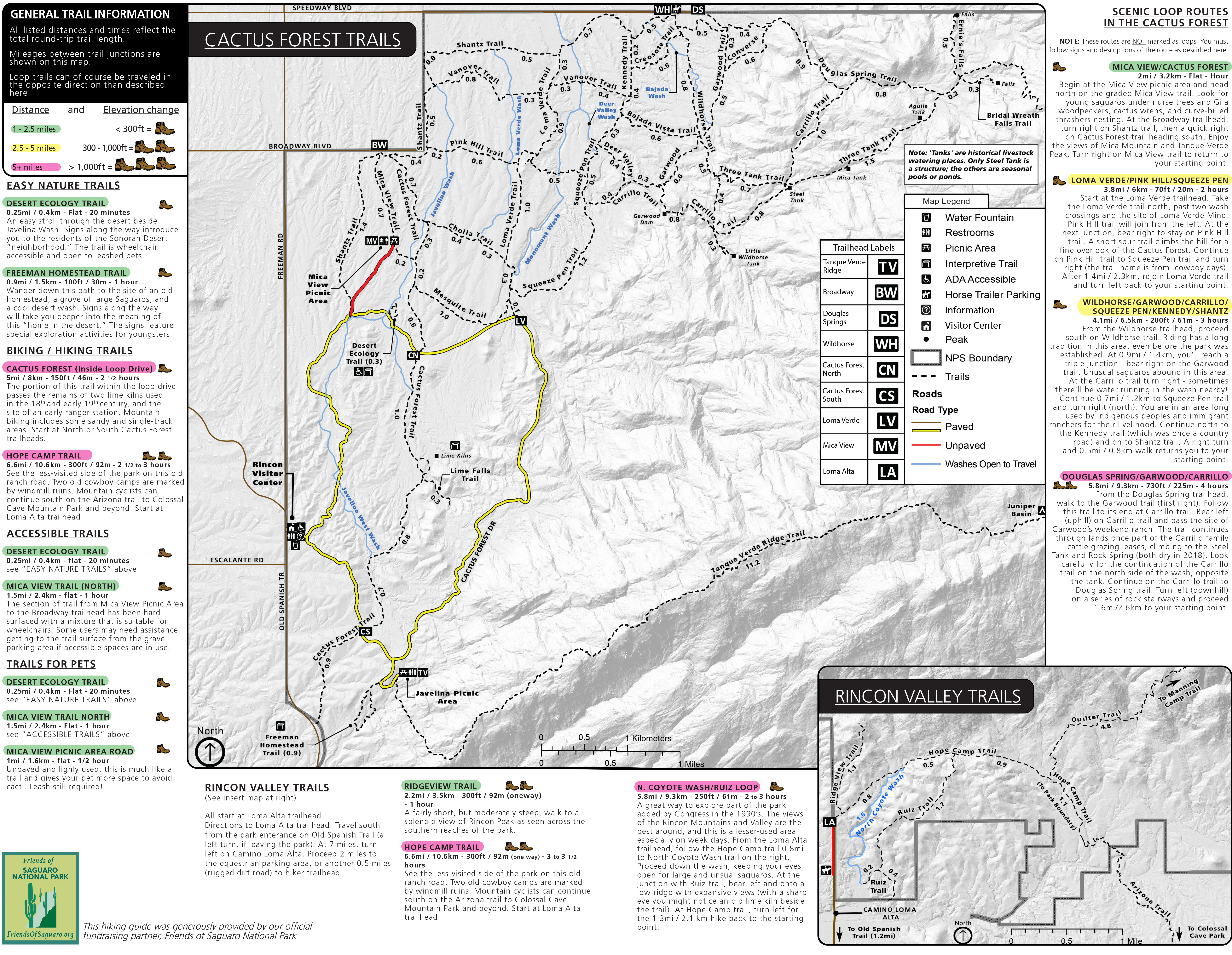 Here are two Saguaro East trail maps, also known as the Rincon Mountain District. The maps focus on the western portion of this district, including the trails off Cactus Forest Loop Drive as well as the Rincon Valley.
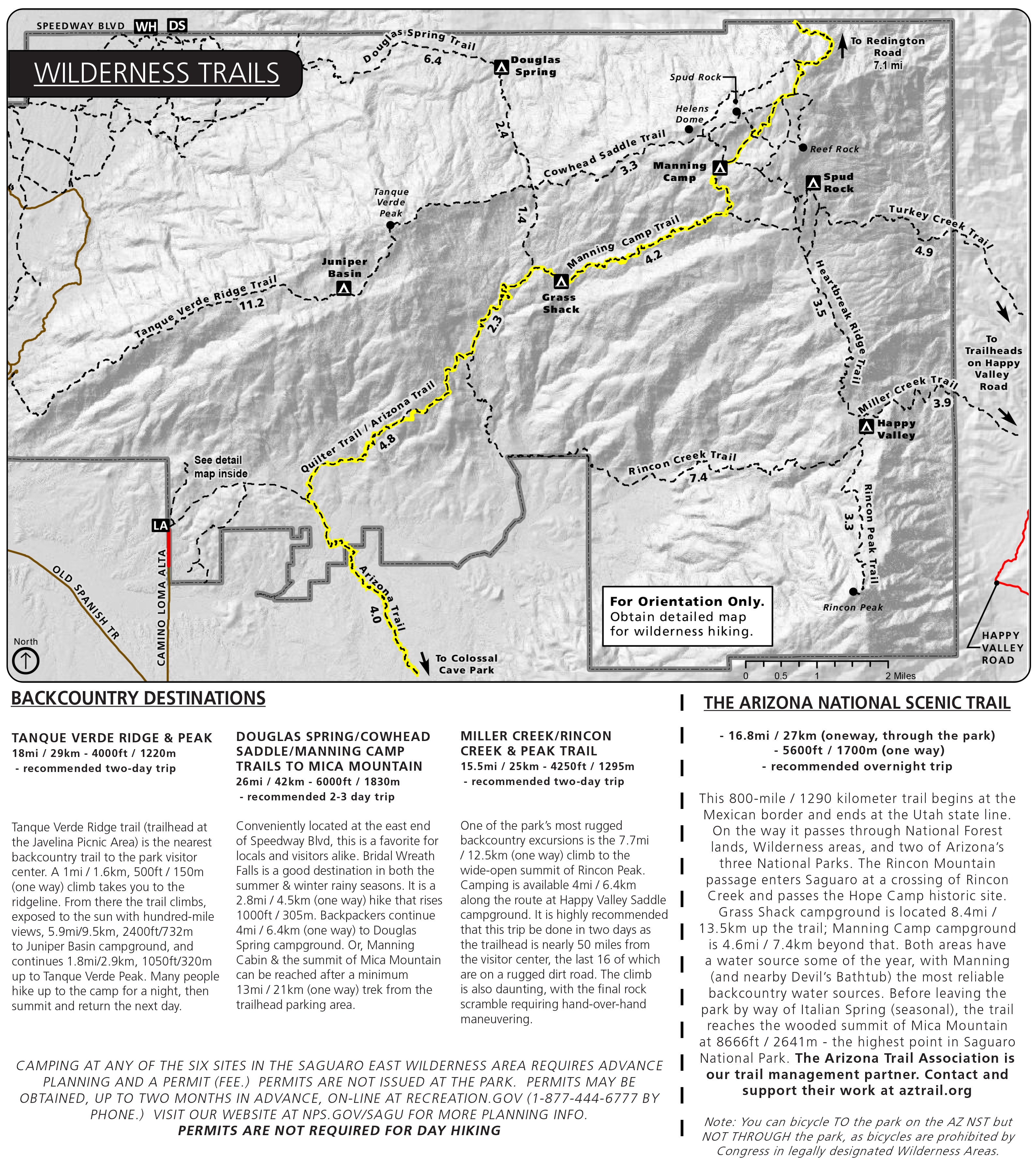 This Saguaro East trail map focuses on the eastern trails in the Rincon Mountain District, which are generally longer distance trails for backpacking. There’s a big network of trails around Manning Camp and the Arizona Trail.
Saguaro lodging map
 Saguaro National Park has both an eastern and western unit separated by the city of Tucson, so it’s only logical to look at Tucson for a place to stay. To the right, you can open an Expedia interactive Tucson lodging map, where you can filter by location and price. It may seem overwhelming, so I like to start by looking at the top-rated Tucson lodging to narrow it down based on price, reviews, location, and photos.
Saguaro geologic maps
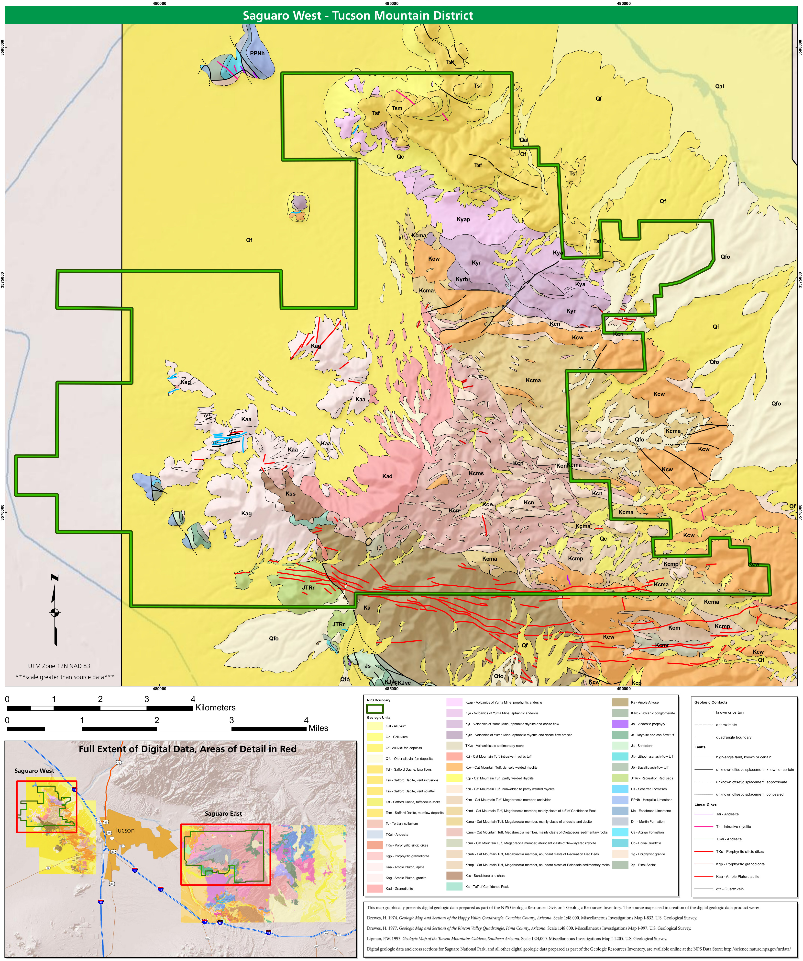 Here’s a Saguaro West geologic map, showing the dikes and largely Cretaceous rock layers of the more heavily-visited Tucson Mountain district located to the west of Tucson.
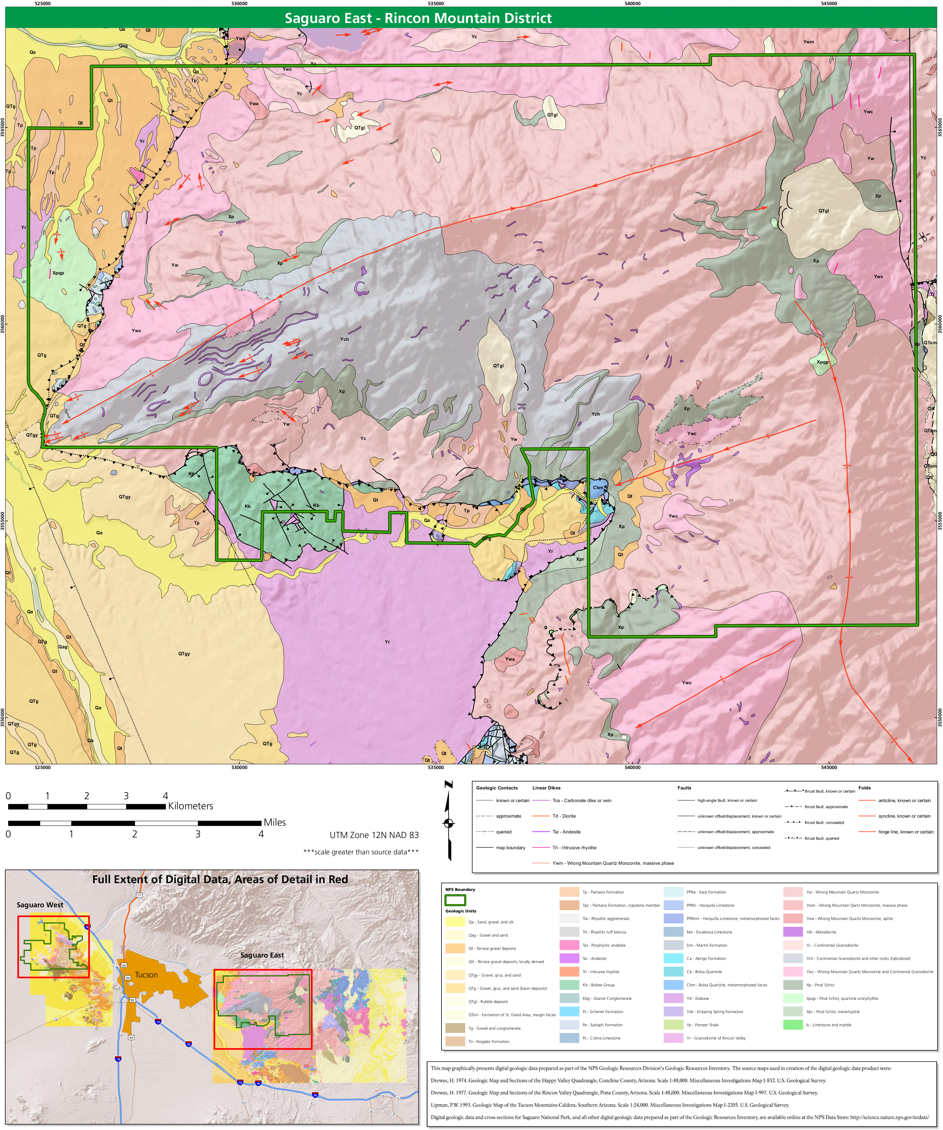 This is a Saguaro East geologic map, which shows rock types, folds, and faults in the less-crowded, more-wildernessy Rincon Mountain district, east of the main part of Tucson.
Saguaro vegetation maps
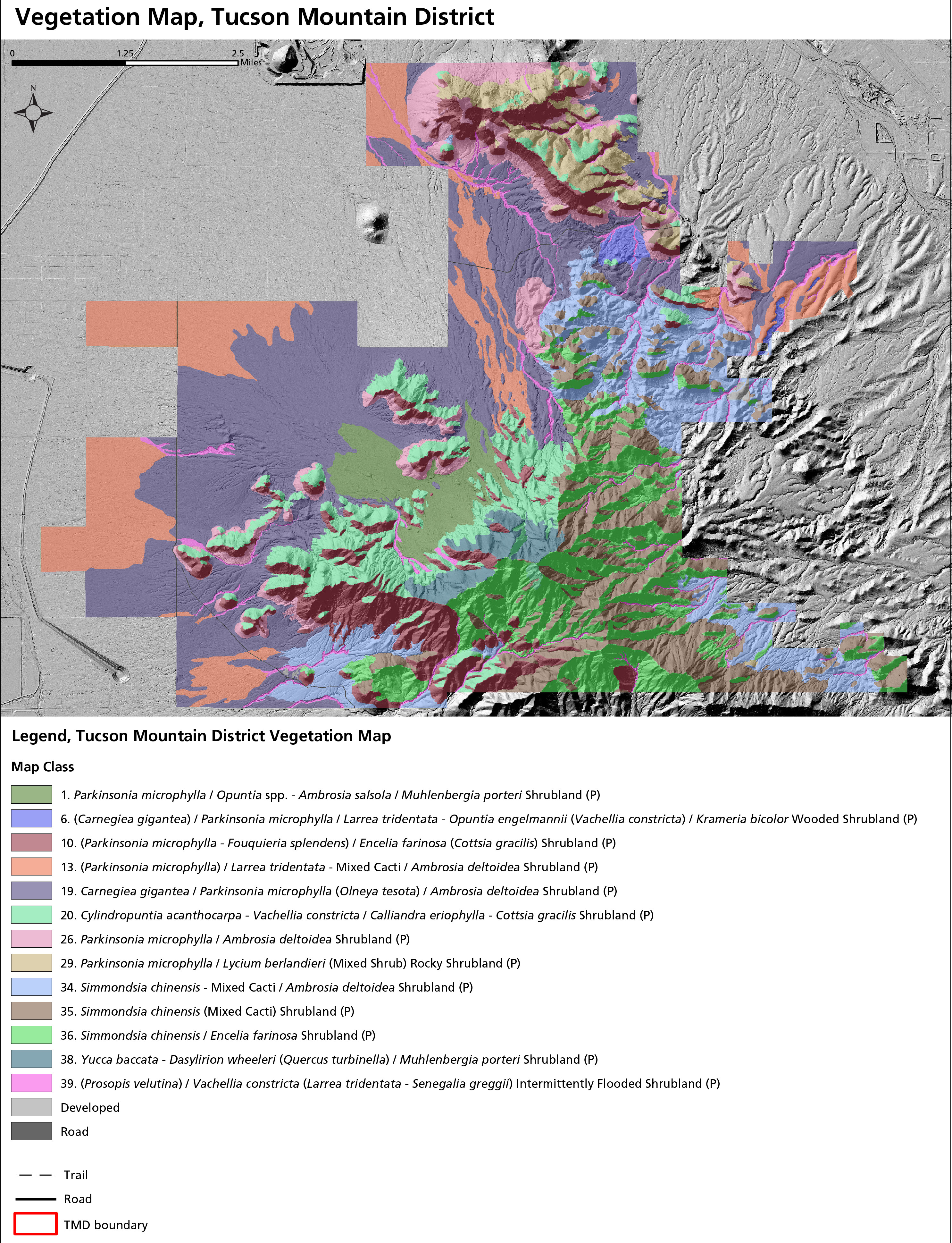 This is a Tucson Mountain district vegetation map. This map shows the vegetation types in the park’s busier western unit, which mostly consist of shrublands with some interspersed saguaro cactus.
 Here’s a Cactus Forest Loop Road vegetation map. This map shows the portion of the park’s eastern unit, the Rincon Mountain district. It zooms in on the Cactus Loop Road to show what you’ll see on the drive.
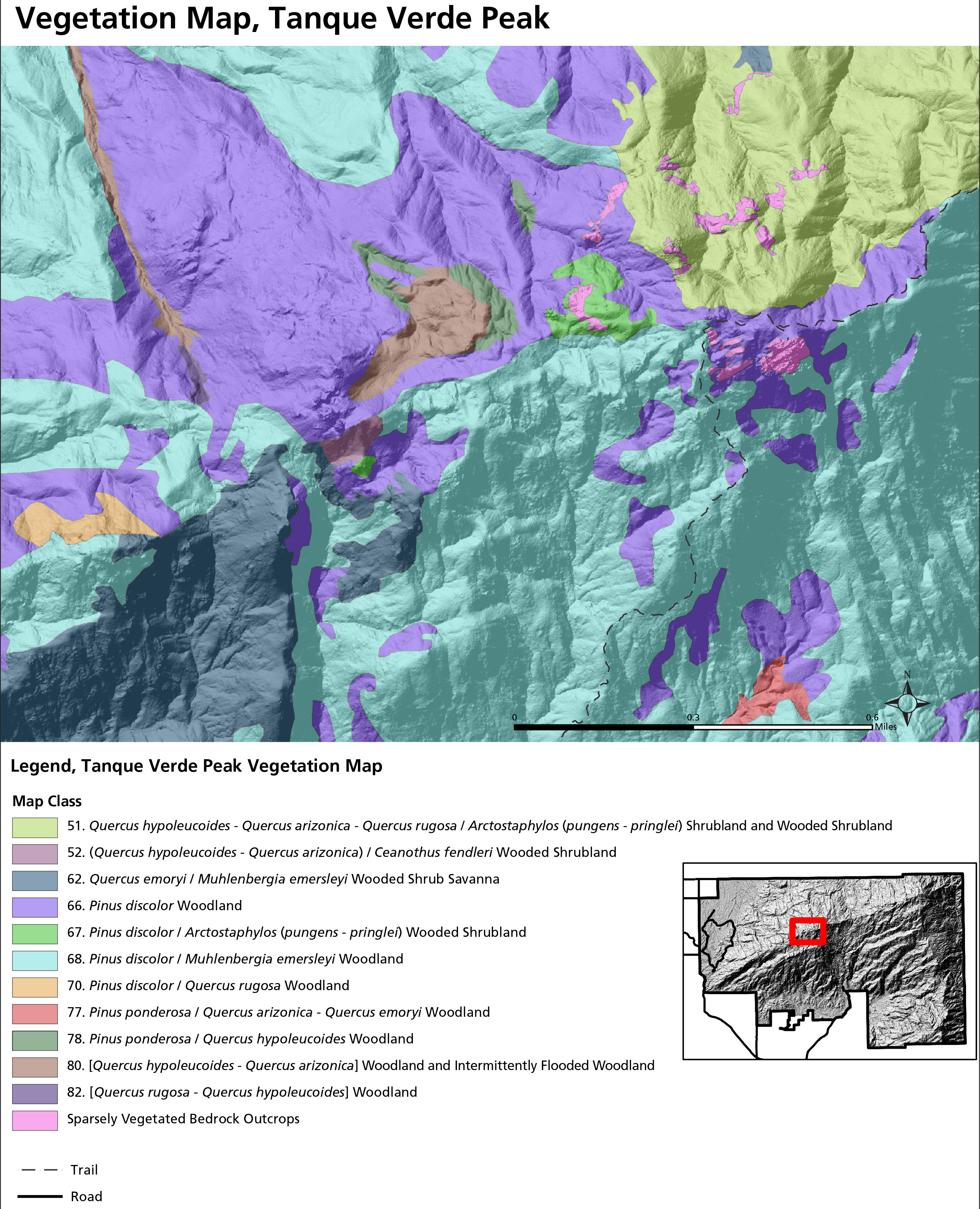 This is a Tanque Verde Peak vegetation map, zooming in on the summit of Tanque Verde Ridge. The Tanque Verde Ridge Trail traverses across the heart of this map.
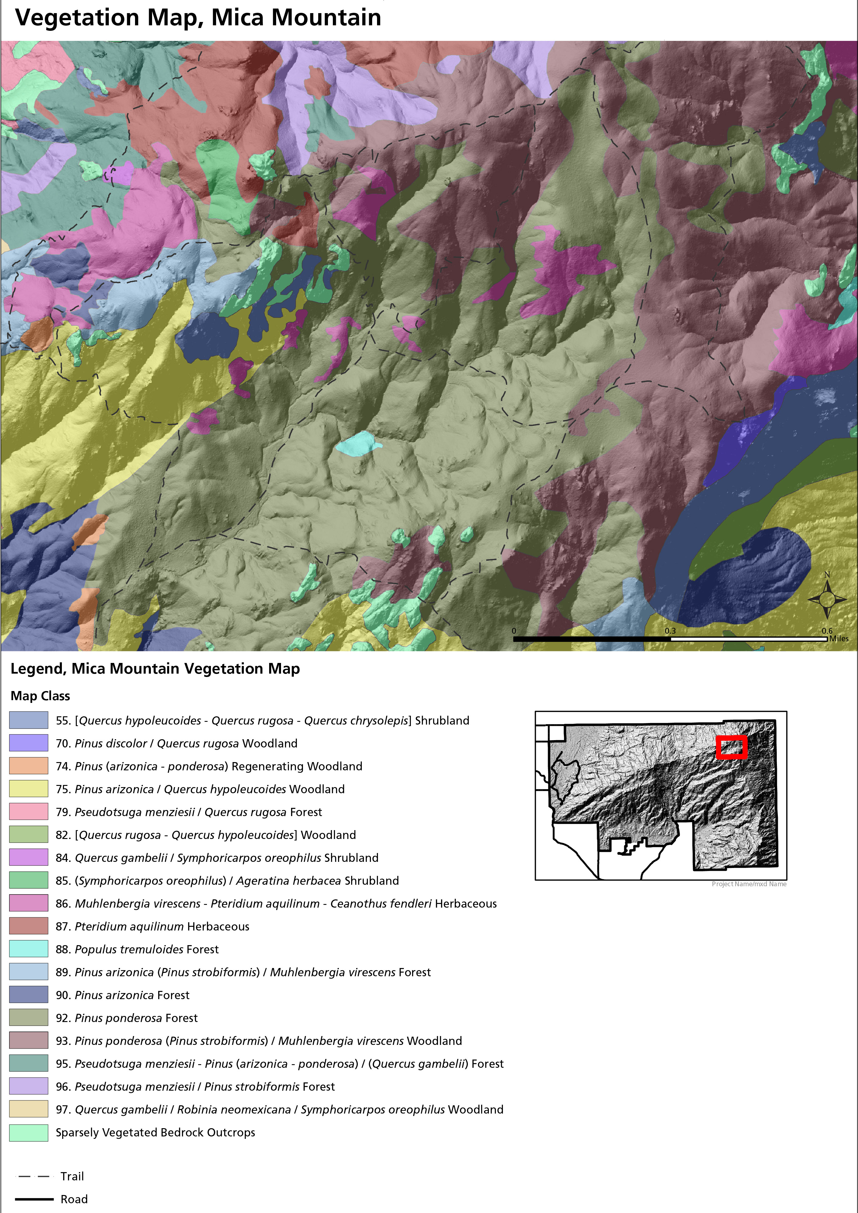 The Mica Mountain vegetation map shows the vegetation communities on the highest point in Saguaro National Park. This dense network of trails provides backcountry visitors with cool forested hikes.
 The Rincon Peak vegetation map shows the summit of Rincon Peak, in the far southeastern corner of the Rincon Mountain district in Saguaro National Park’s eastern unit.
Archived Saguaro maps
The National Park Service is continually updating maps and creating new ones, and I do my best to gather them on this page as I find them. But I don’t delete old maps, as I believe it’s important to archive files to see how things change over time. Below are some out-of-date maps that have been replaced by ones higher up this page.
 This is an old Tucson Mountain district map of Saguaro National Park from the mid-2010s. Compare with the updated maps above! Click the image to view a full size map or download a PDF.
 This is an old Rincon Mountain district map of Saguaro, located east of Tucson. This map is also from the mid-2010s and isn’t as attractive as the new maps above. Click the image to view a full size map or download a PDF.
 This is an old regional Saguaro National Park map, showing both the Tucson Mountain district (west) and Rincon Mountain district (east). Click the image to view a full size map or download a PDF.
 This is an old trail map of the Tucson Mountain district, located west of Tucson. It shows trails, roads, picnic areas, and other features. Click the image to view a full size map or download the PDF.
 This is also an old Tucson Mountain district trail map, but it is formatted better for printing as it’s only in grayscale and won’t use up as much printer ink as the map above.
 This is an old Rincon Mountain district trail map, which includes Manning Camp and other backcountry wilderness campsites. Click the image to view a full size map or download the PDF.
 This is an old inset map of Cactus Forest hiking trails in Saguaro’s Rincon Mountain district, featuring trail descriptions. Click the image to view a full size map or download the PDF.
…and more!
< Return to National Park Maps home
< Return to Park List
< Return to List by State