Zion map from the park brochures
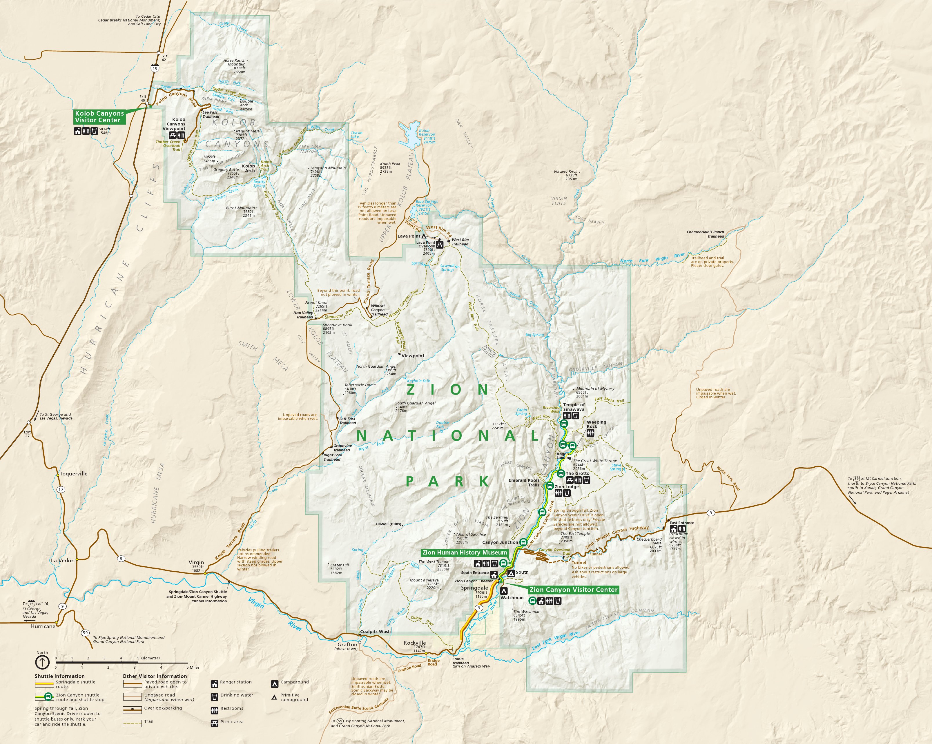 This is the main Zion National Park map, showing all entrances and both Zion Canyon and the Kolob Canyons sections of the park. Click the image to view a full size map or download the PDF.
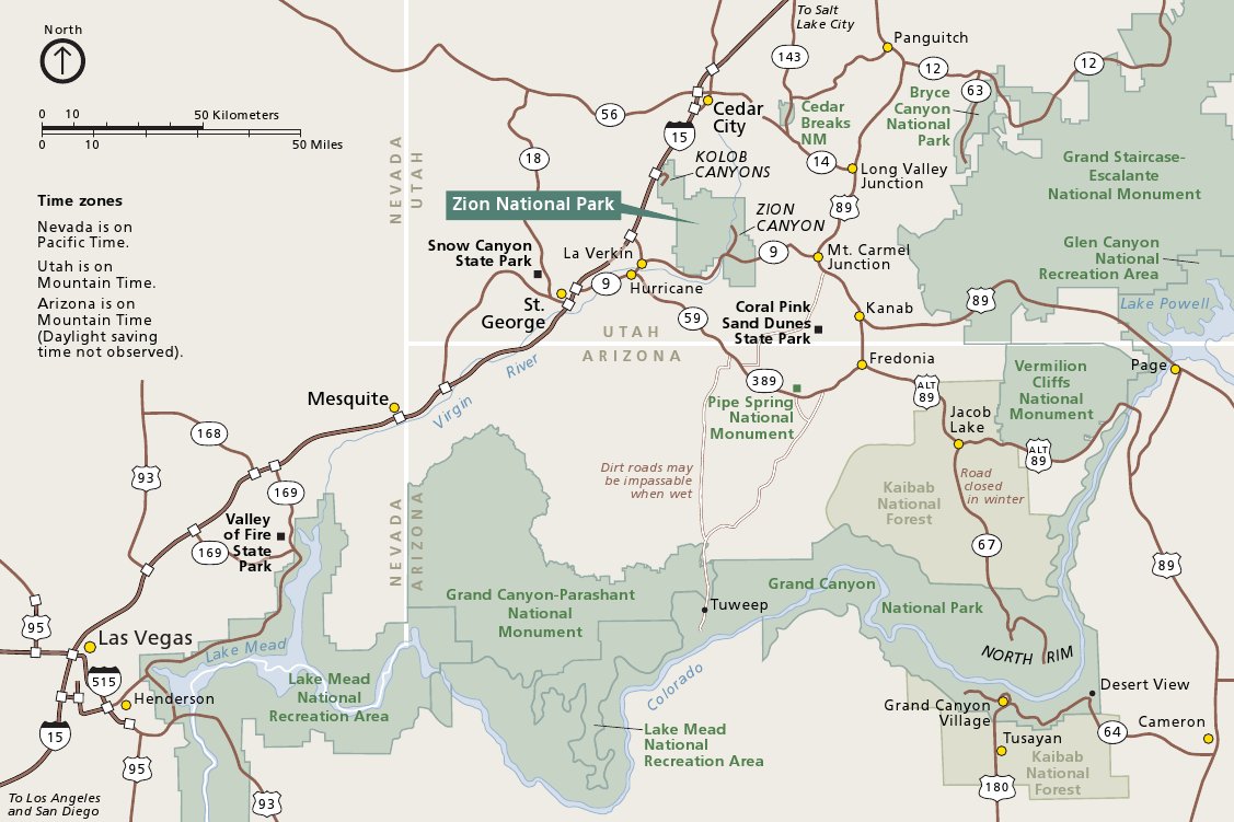 This is a Zion regional map, showing Zion National Park in relation to Bryce Canyon, Grand Canyon, Las Vegas, and other attractions. Click the image to view a full size map or download the PDF.
Zion Canyon maps
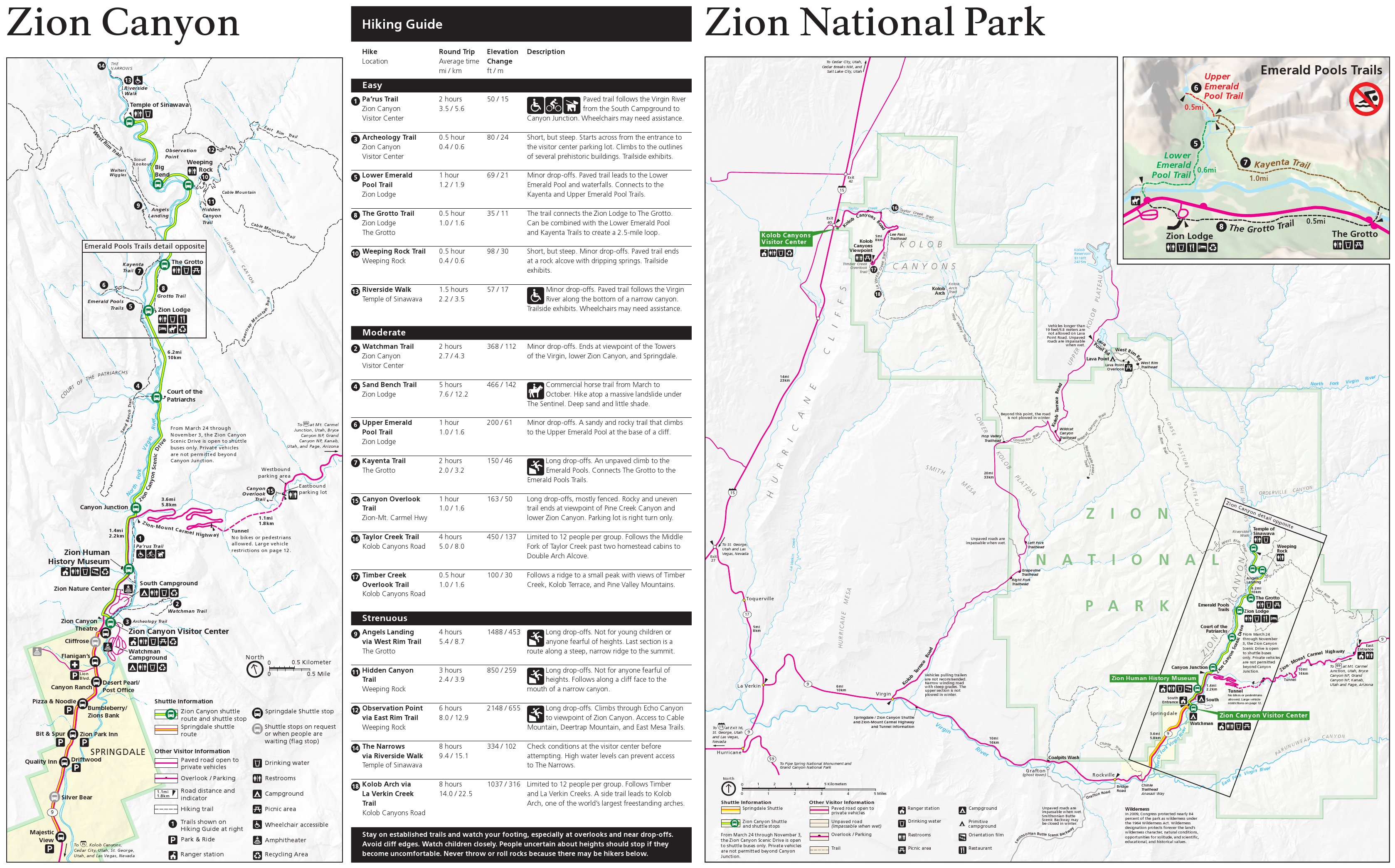
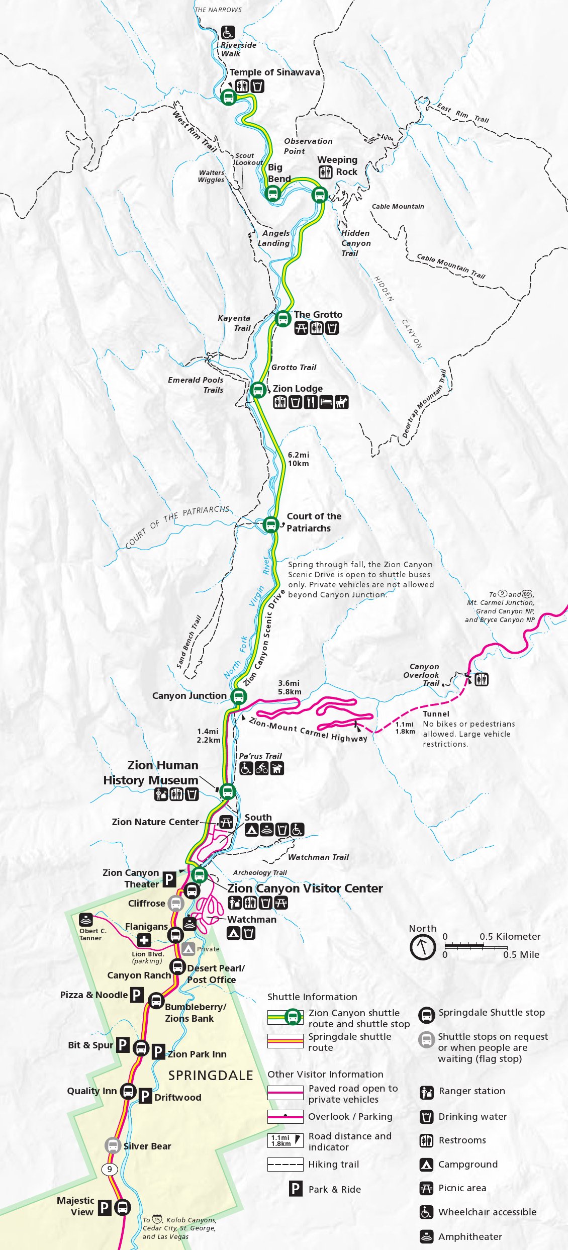
 Here’s a Zion Canyon map updated in 2025, zooming in on the most popular area of the park to show the shuttle bus routes and hiking trails, including Angels Landing, Emerald Pools, and the Narrows.
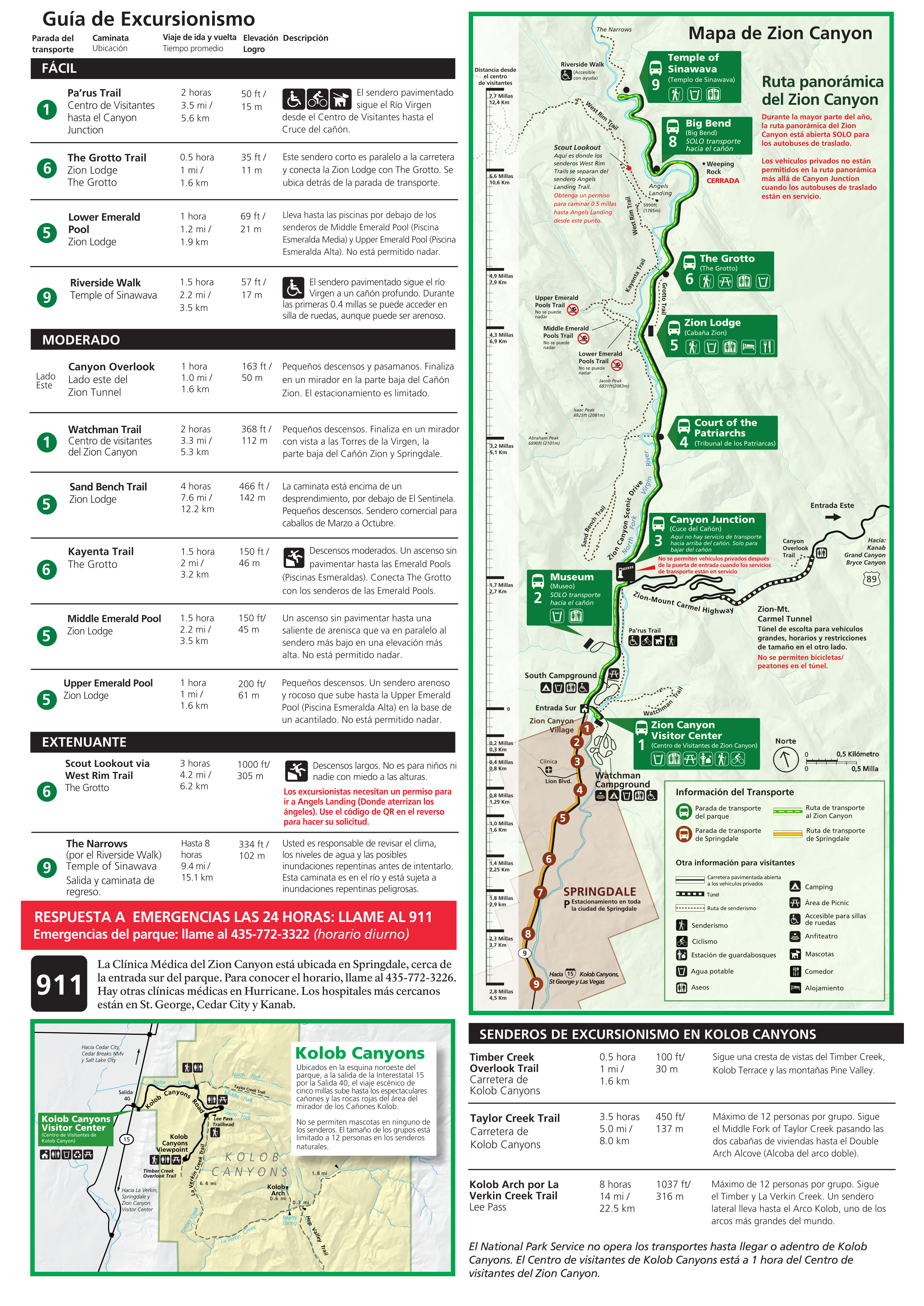
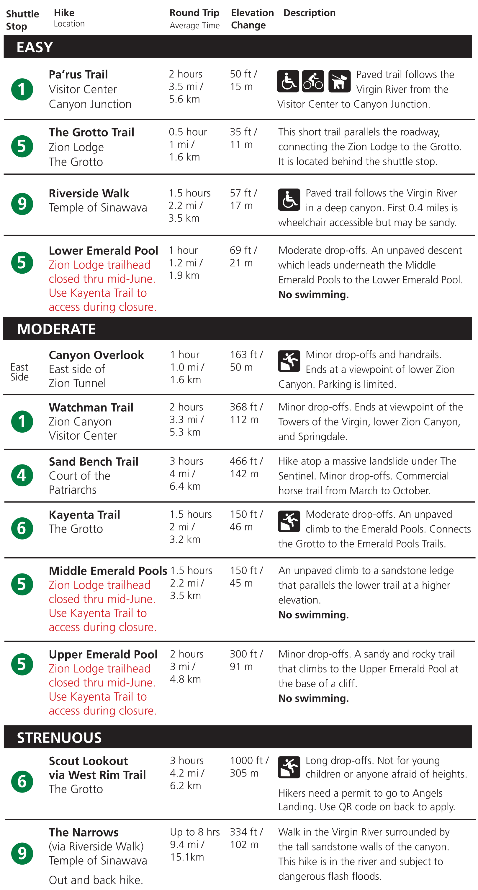 This is a Zion National Park trail guide that is meant to accompany the map above. It provides info on the length and difficulty of various hiking trails, as well as their respective shuttle stops.
 The Zion Narrows map from 2017 is focused on the backcountry campsites, showing site numbers and maximum group sizes, along with estimated hiking times from Chamberlain’s Ranch going downstream.
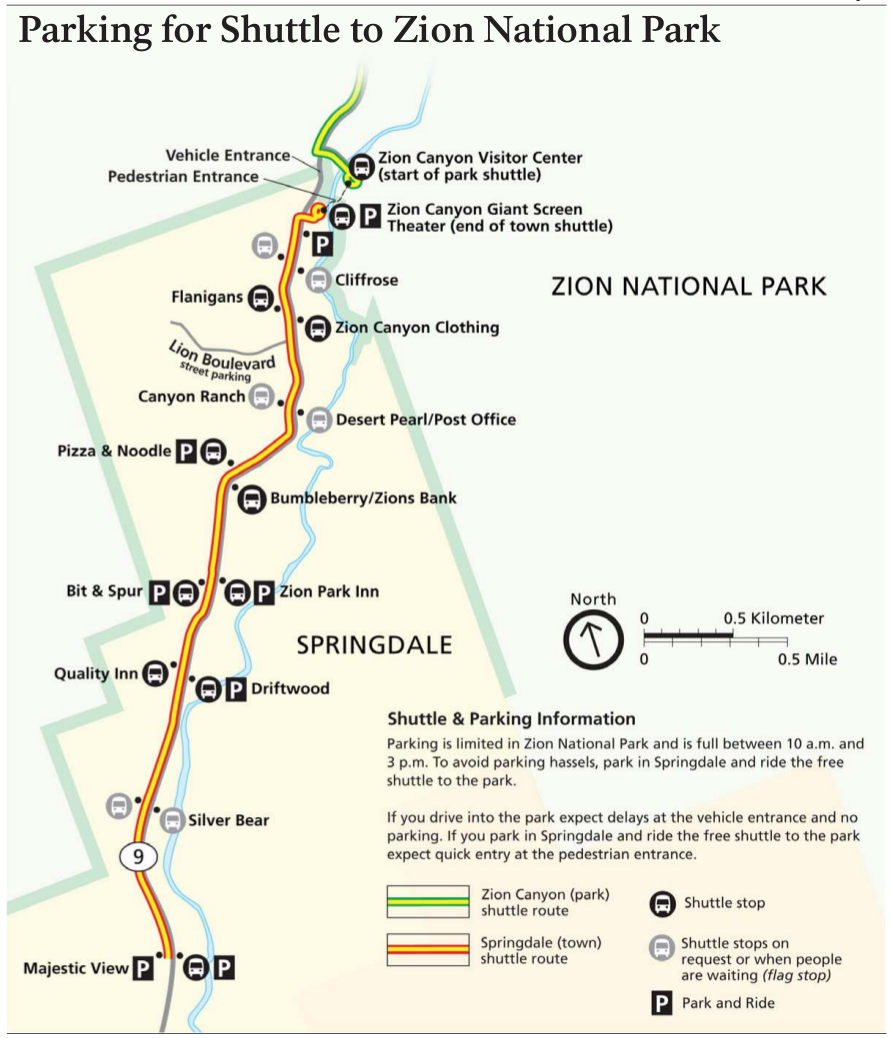
 Here’s a simple Zion shuttle map, which includes both the Zion Canyon line and Springdale Line. Note that things change yearly, so some stops (like Weeping Rock) may be out of service due to rockfall.
 This is the Zion pedestrian entrance map. If arriving by bicycle or on foot, the National Park Service does not want you entering via the main road; please take this route instead for your safety.
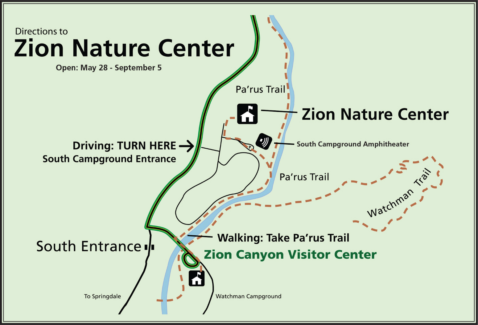 The Zion Nature Center map shows how to get to the nature center by car and foot. Note that in 2025, shuttle buses from the Zion Canyon Visitor Center only stop at the nature center on the return.
Zion trail maps
 The free maps above are probably fine if you’re mostly visiting Zion by car and bus. However, if you’re planning to do some considerable hiking or are going backpacking, then a National Geographic Trails Illustrated map is helpful (it shows backcountry campsites and topographic lines). The full Zion trail map below is good for general planning but not for navigation; you need one like this for backcountry travel or canyoneering.
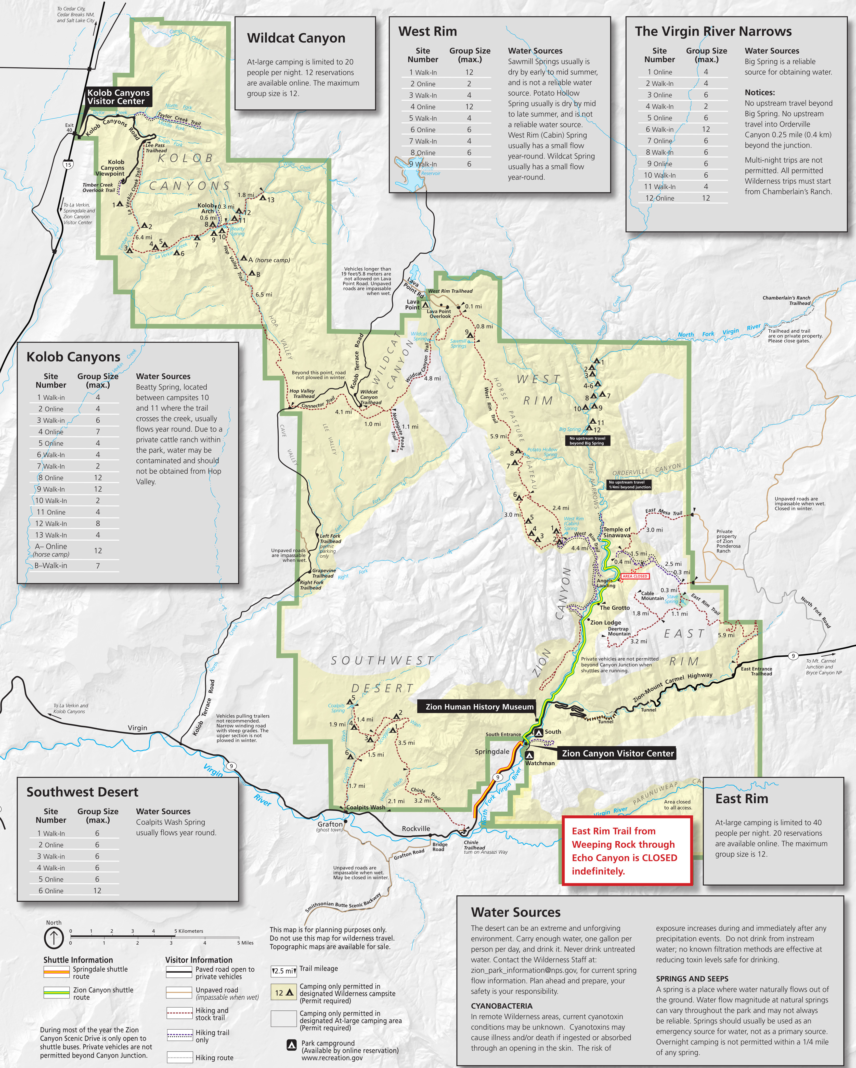 This Zion National Park trail map was last updated in 2021 and includes detailed information about backcountry campsites and water sources. This map is primarily meant for backpackers rather than day hikers.
 The Kolob Canyons trail map zooms in on this quieter section of the park located off I-15. It includes information on a few suggested hikes, such as Timber Creek Overlook, Taylor Creek, and Kolob Arch.
Zion campground maps
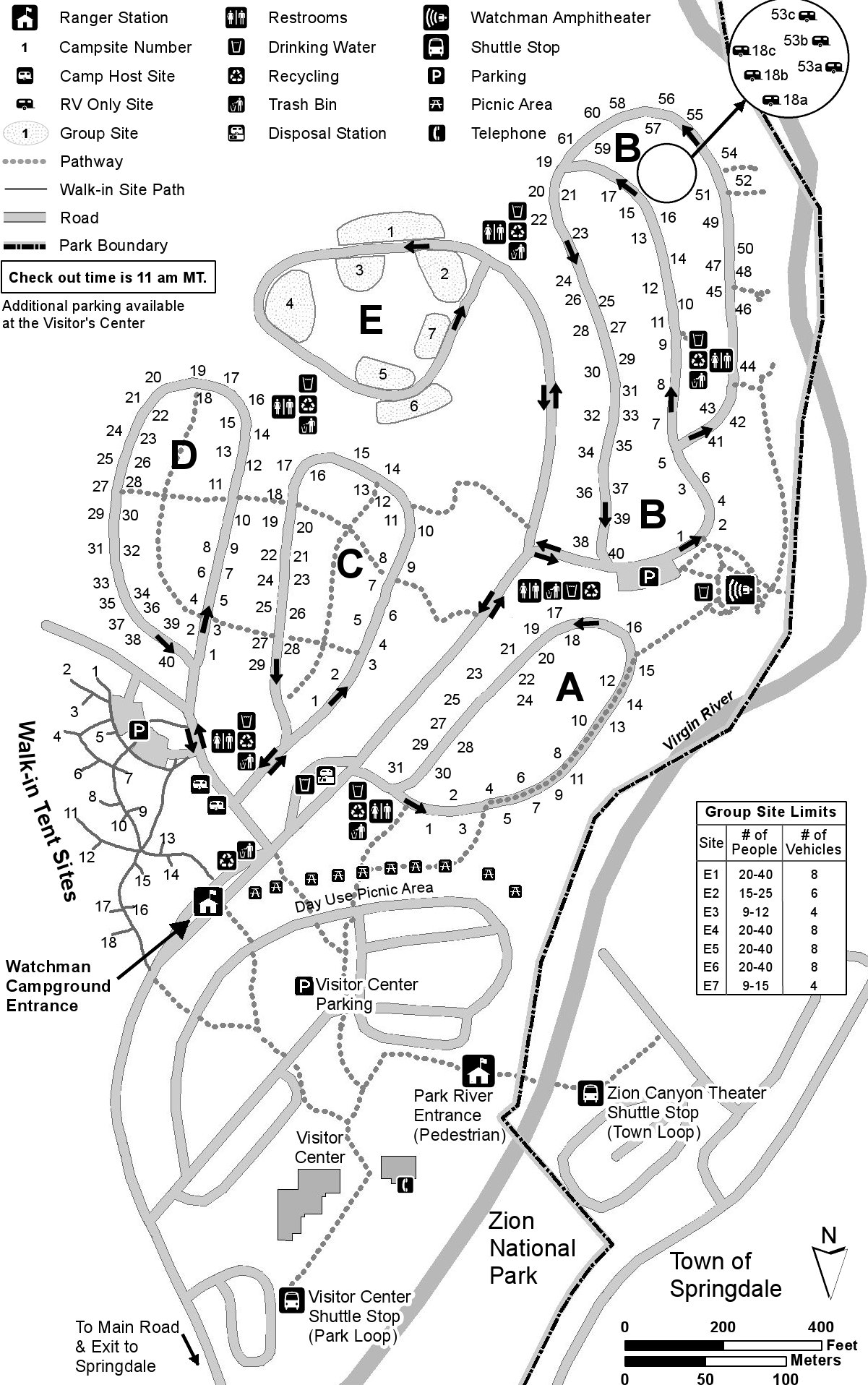
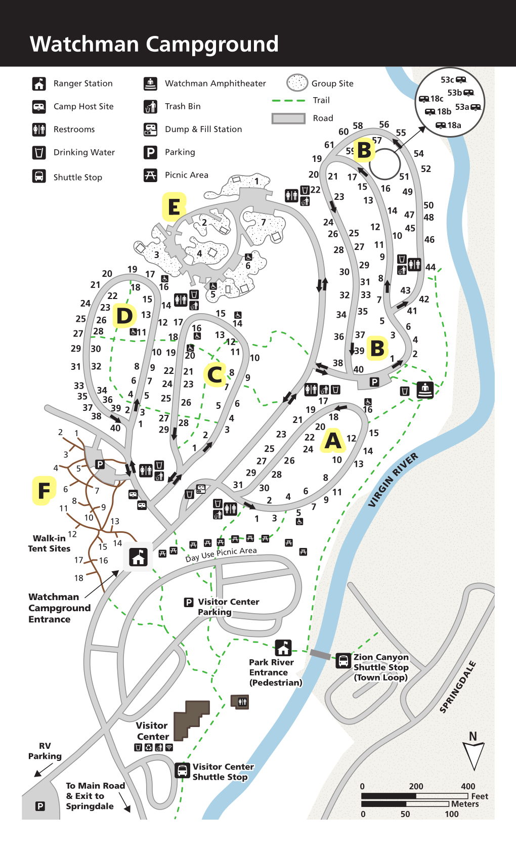 This is a Watchman Campground map, showing the most popular campground in the park. Take note: this map shows north facing down, so the Virgin River is on the right even though it’s west of the campground.
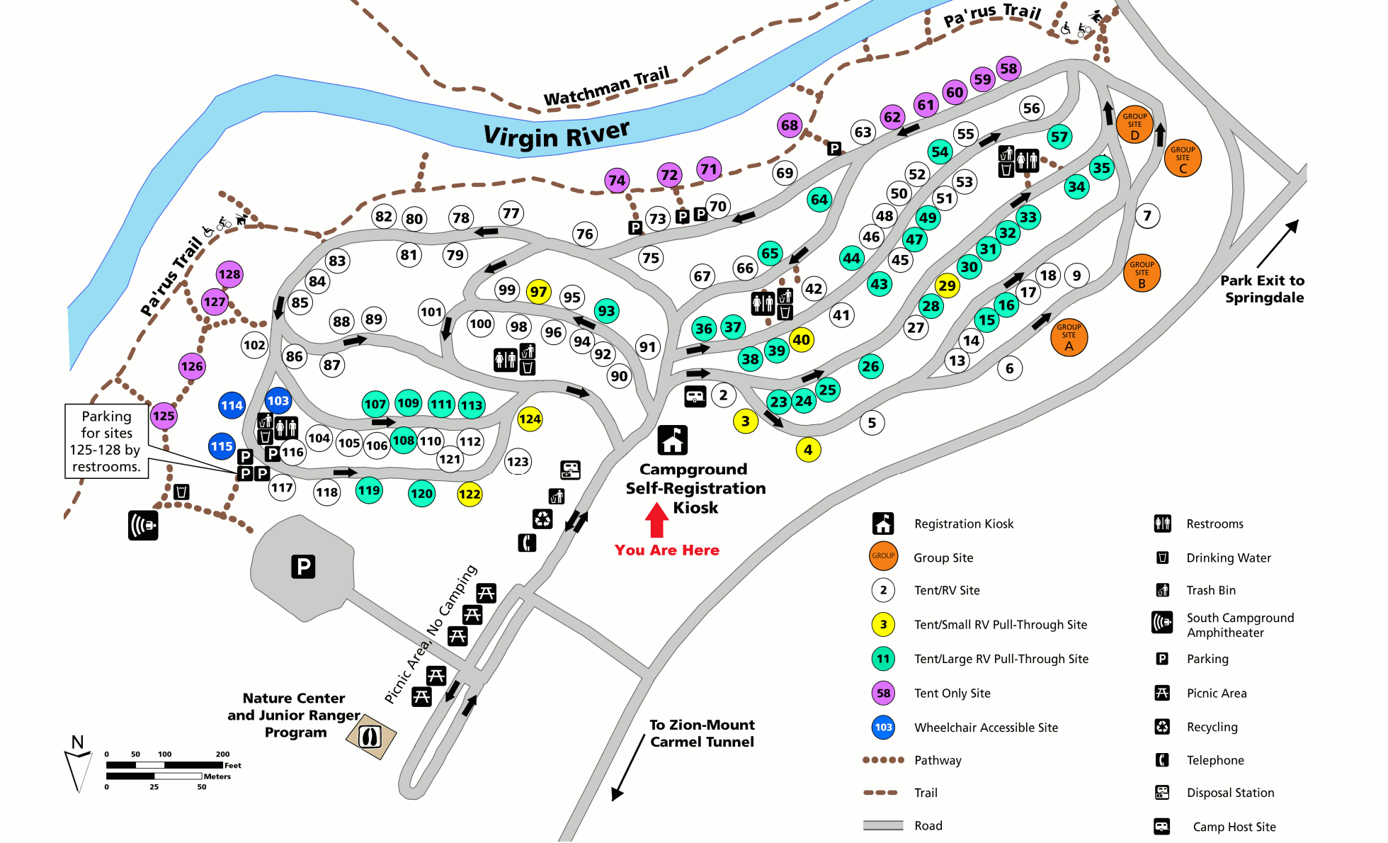 This is a South Campground map, which is located on the west side of the Virgin River. Note that for 2025, this campground is closed to improve drainage and remove hazard trees.
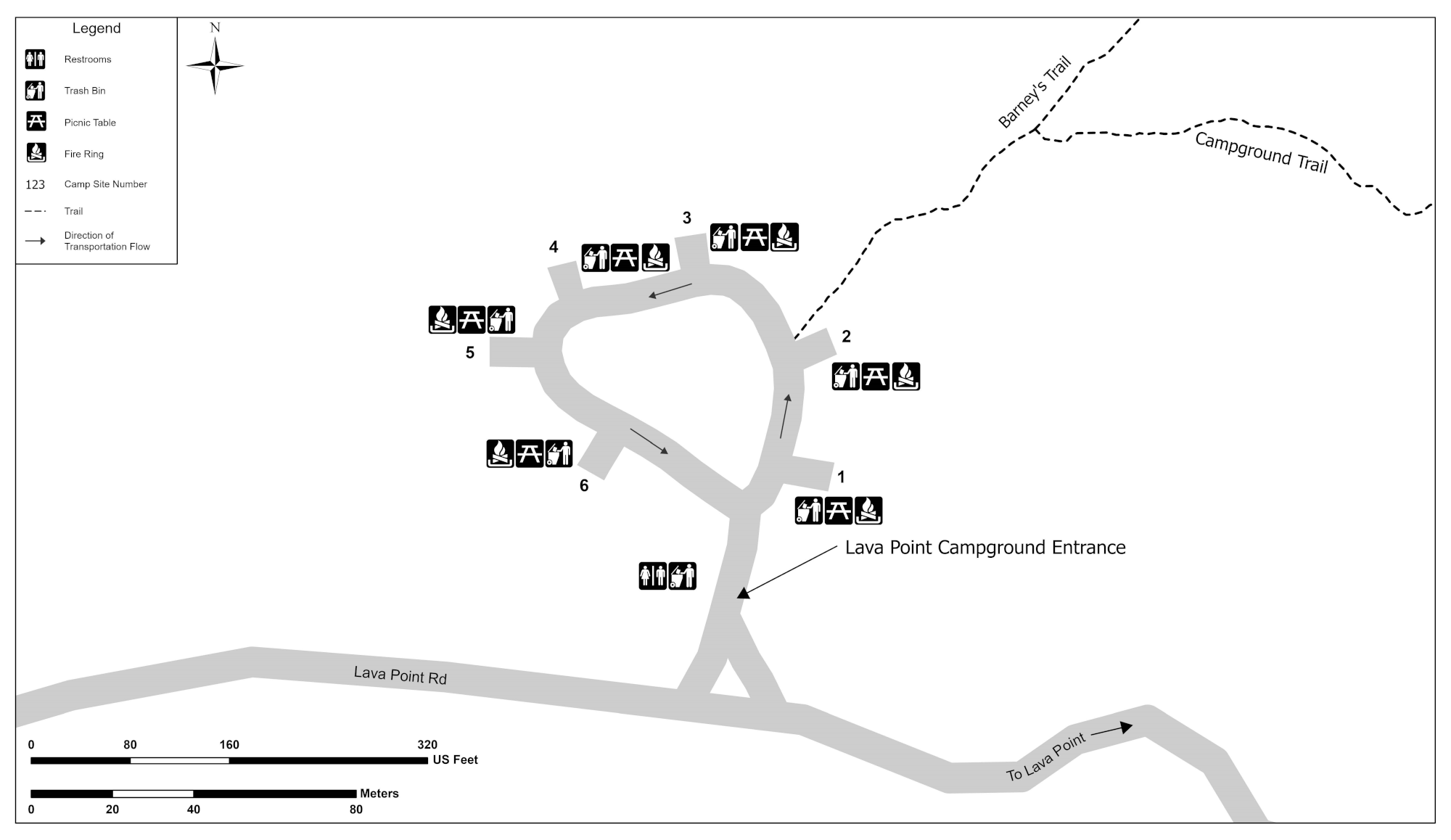 Here’s a Lava Point Campground map. Take note that this primitive campground is located on the Kolob Terrace Road, quite a distance from the main visitor attractions in Zion Canyon.
Zion lodging map
 Most Zion visitors choose to stay in Springdale, UT, just outside the park entrance. To the right, you can view an Expedia interactive Zion lodging map, showing the huge number of options there. Staying in Springdale will put you right on the shuttle bus line. Also consider browsing Expedia’s top-rated Zion lodging where you can compare prices, photos, location, reviews, and more.
Zion topographic maps
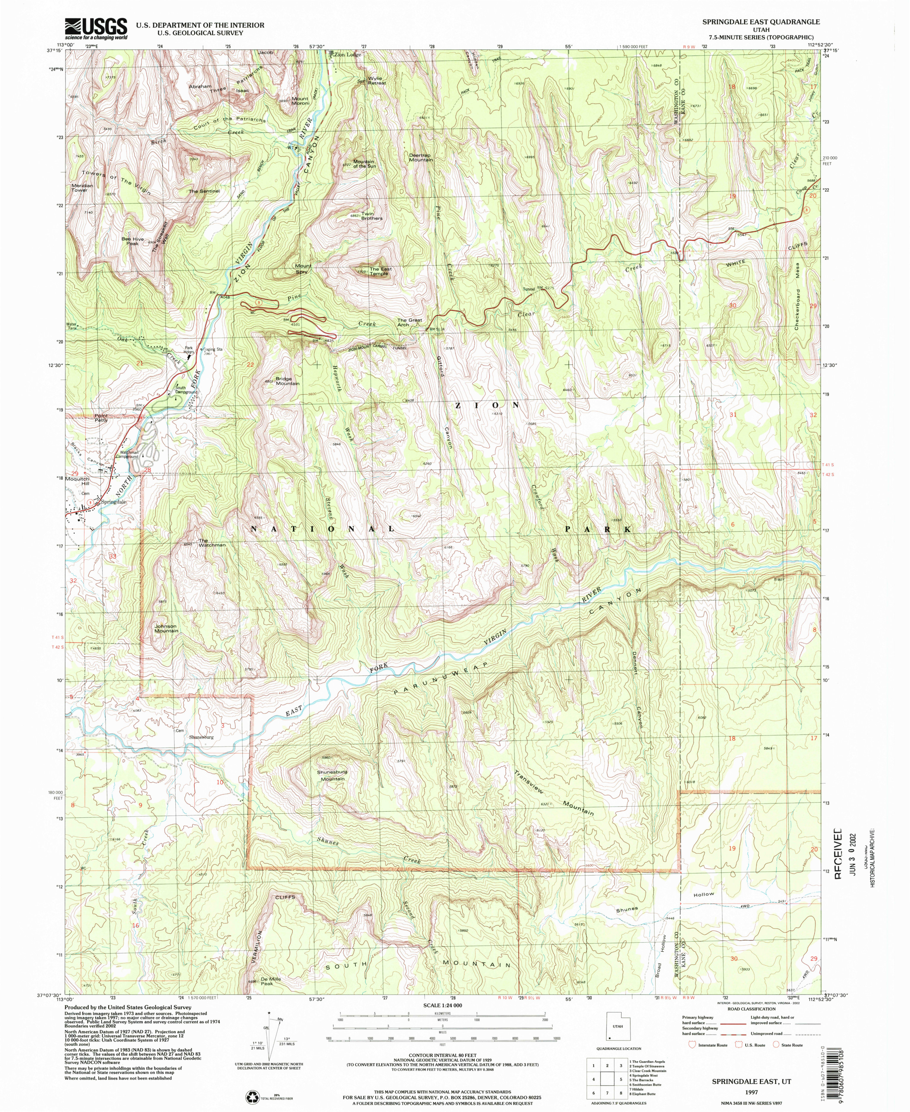 This Zion Canyon (south) topo map, focusing on the southern part of Zion Canyon as well as the east entrance road. Click the image to view a full size map or download the PDF.
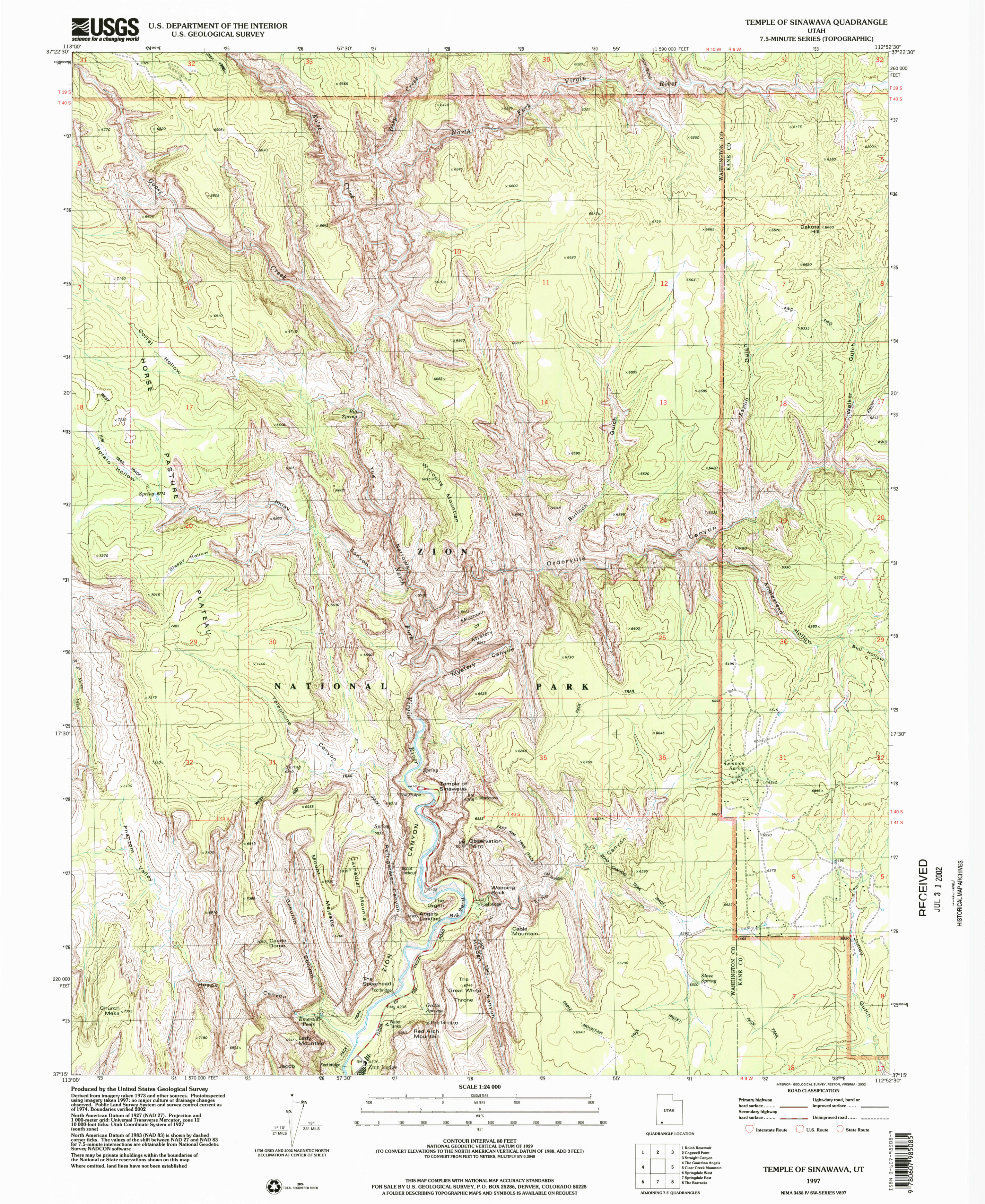 Here’s a Zion Canyon (north) topo map, which shows Angels Landing, the Narrows, and other popular trails. Click the image to view a full size map or download the PDF.
Zion science maps
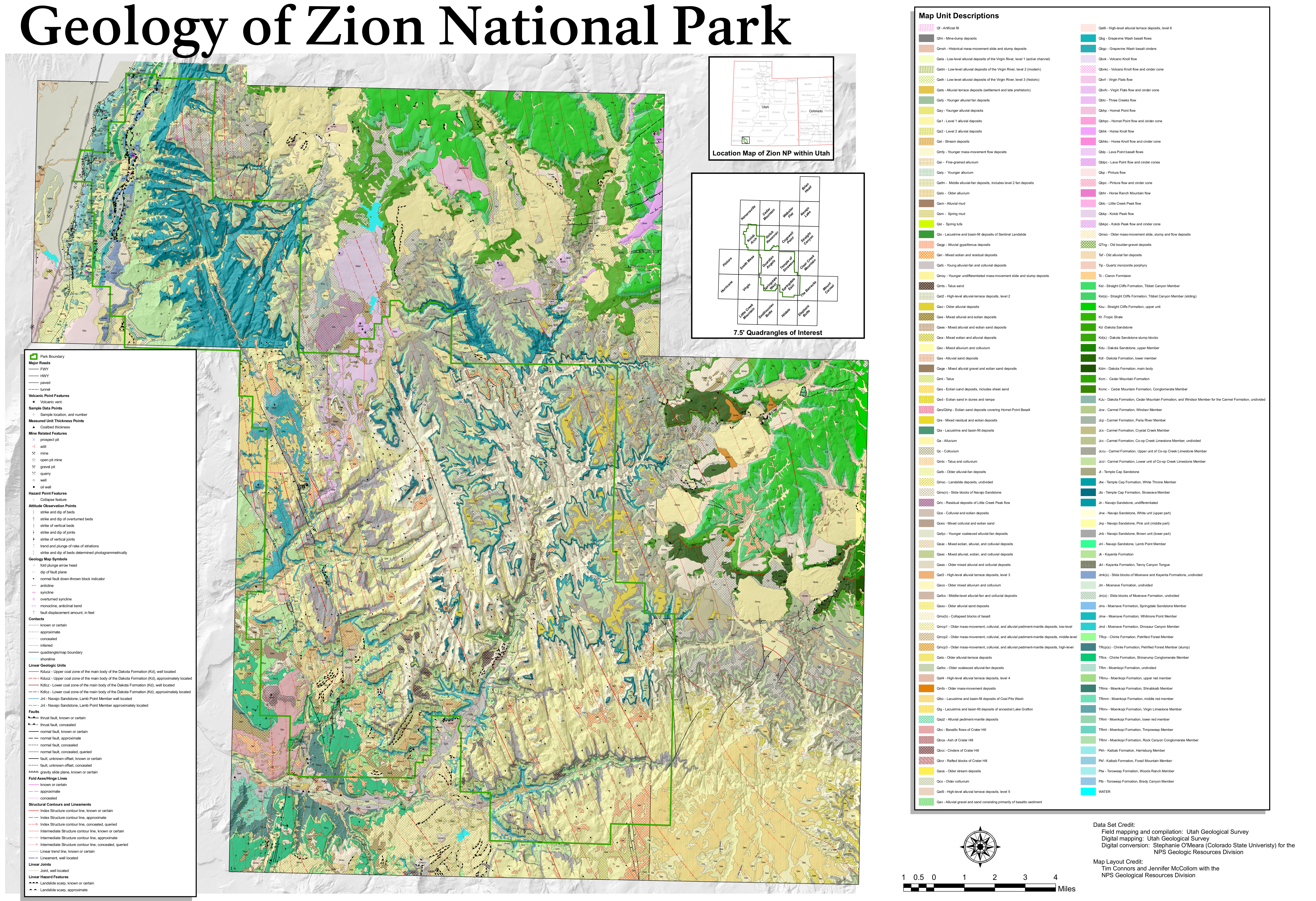 The geologic map of Zion has a large file size, but its incredible detail about the various rock types that make up Zion National Park is great to learn about the geology of Zion.
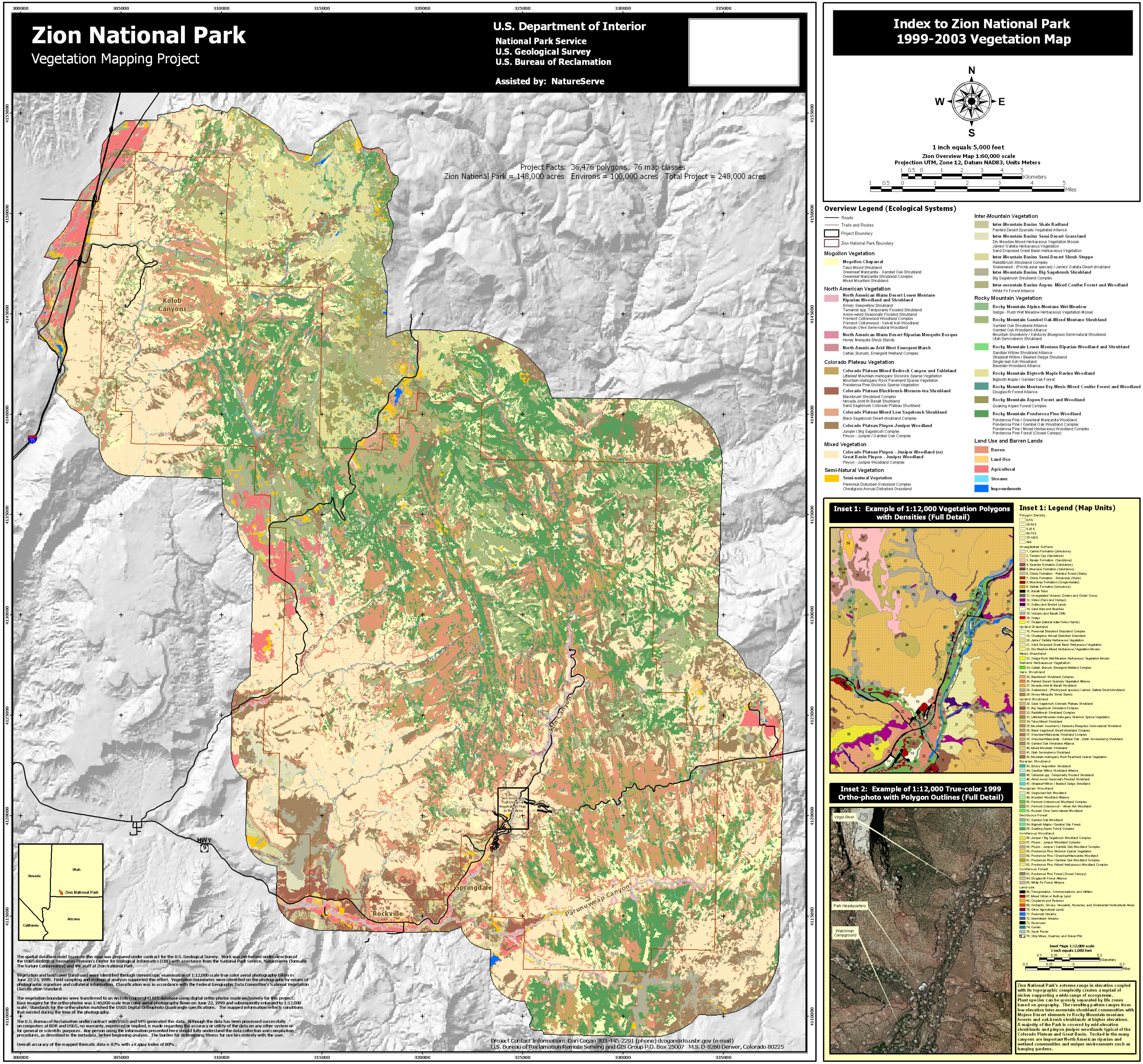 This is a vegetation map of Zion National Park, showing the different types of forests and brushland found within the park boundaries. It makes a good companion to the geologic map to learn about Zion.
Zion foreign language maps and guides
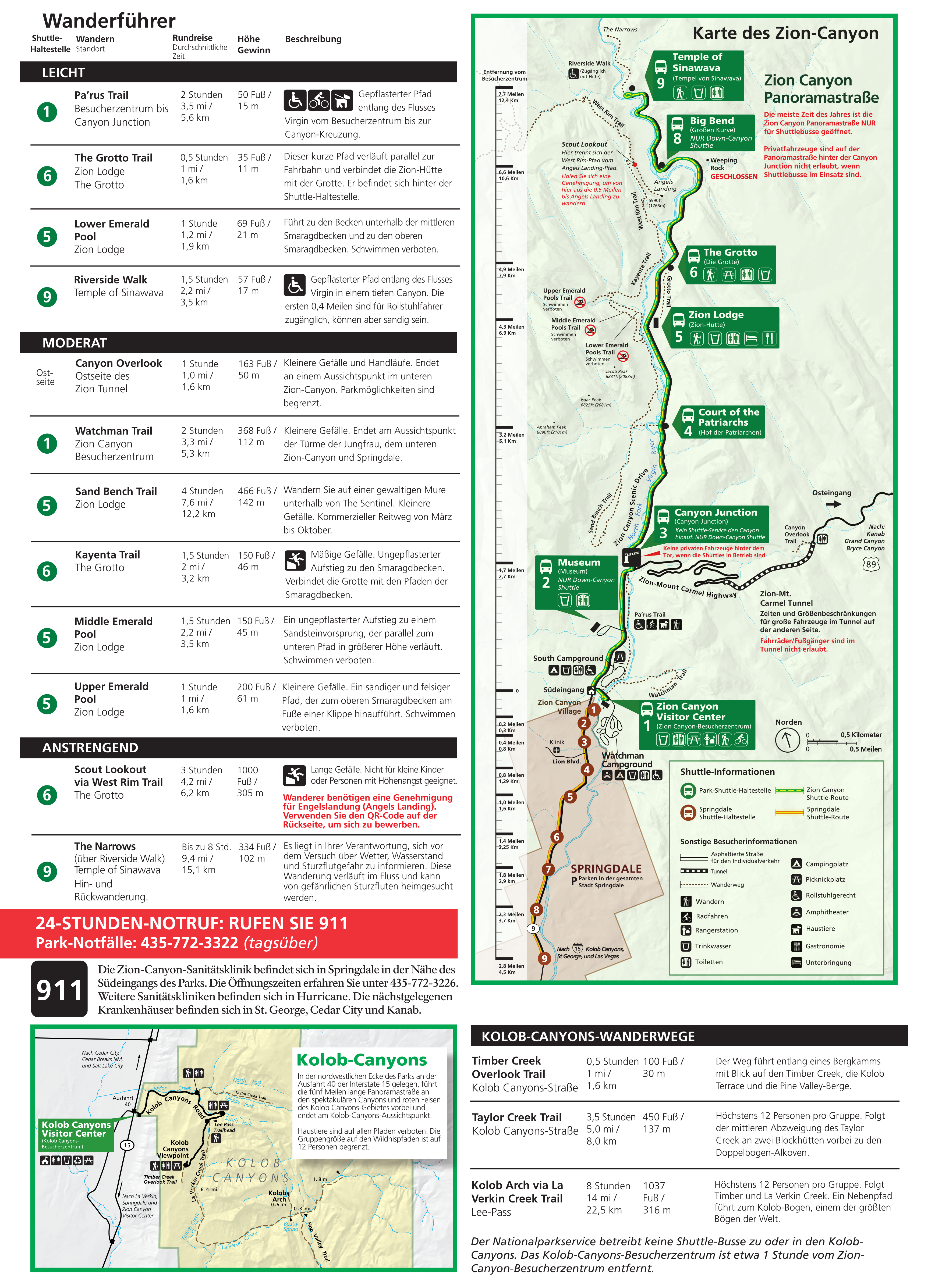
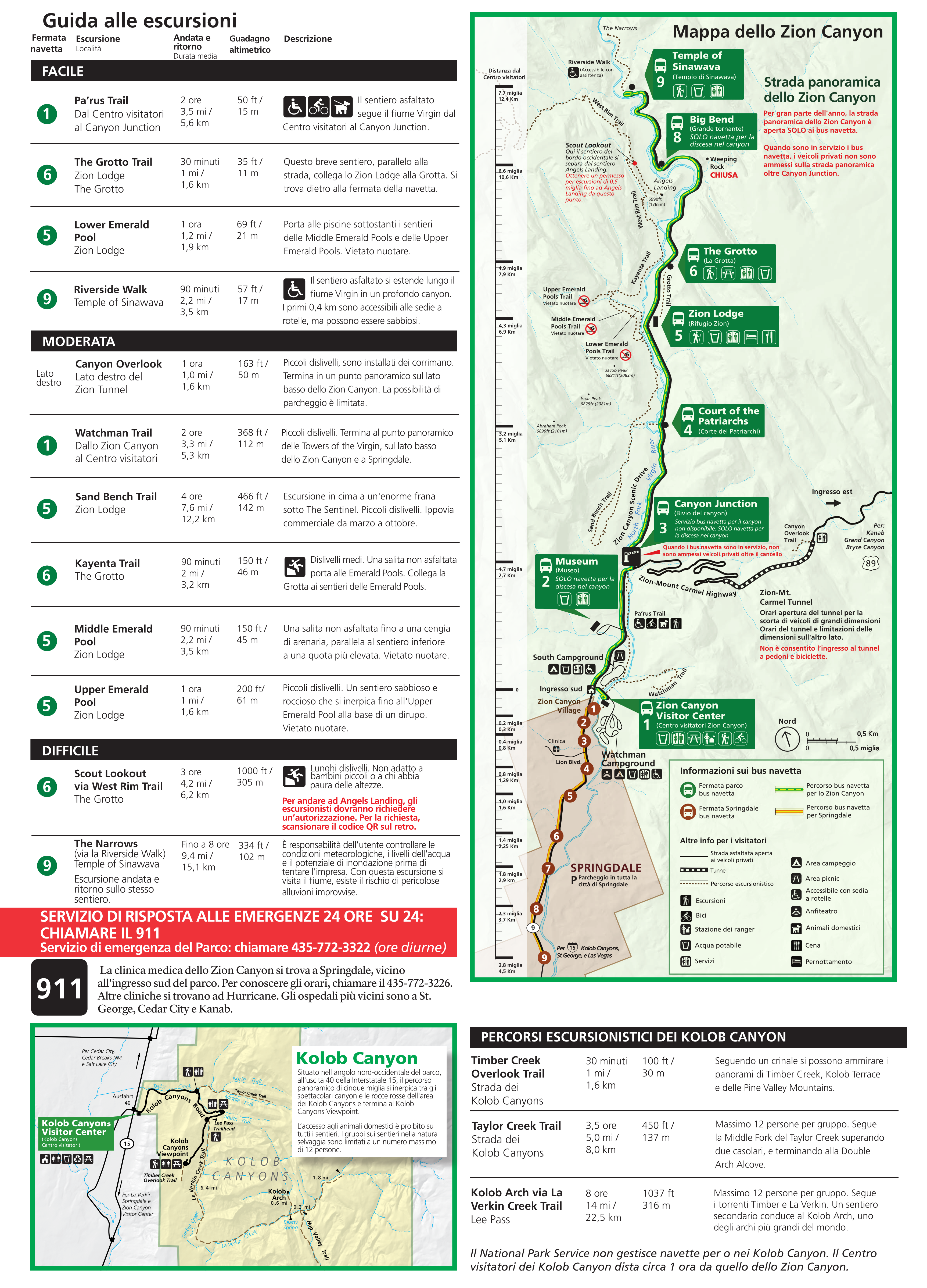
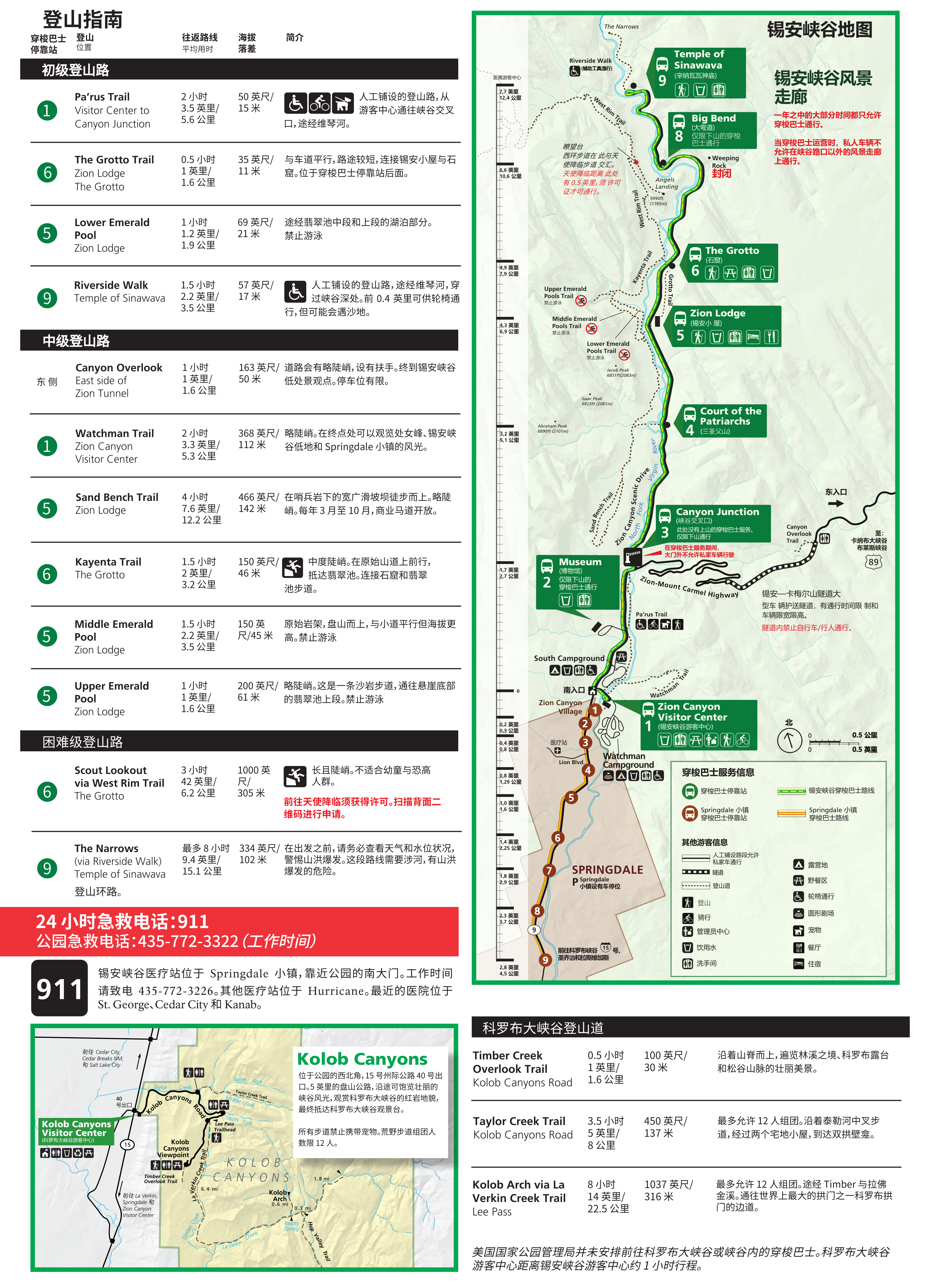
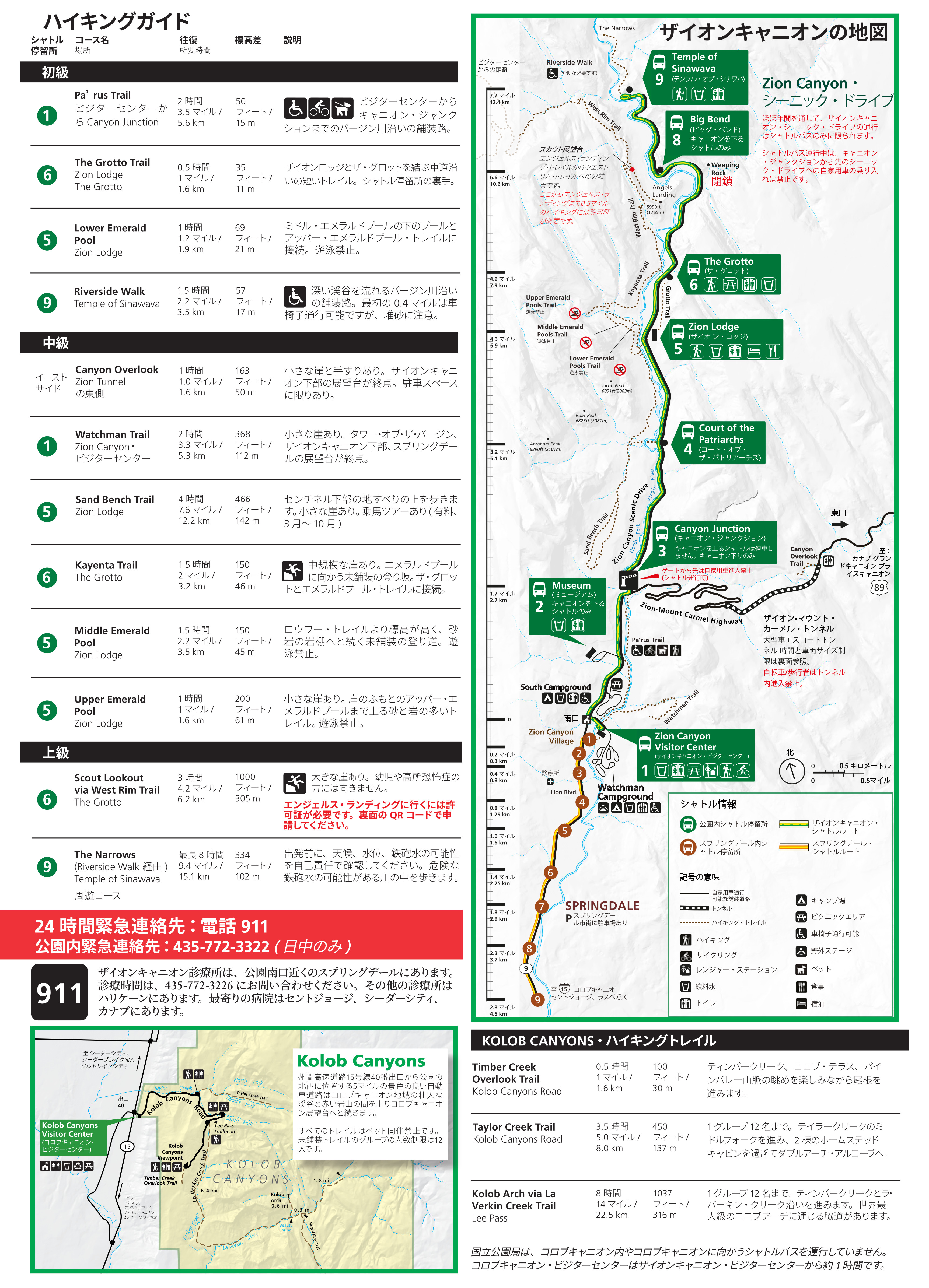
Each of the maps below are the same as the “Zion Canyon” map shown in the “Zion shuttle and trail maps” section above. Each of these files include the associated trail guide in its respective language, providing info on trail access, length, and difficulty.
- Zion National Park map in Spanish
- Zion National Park map in German
- Zion National Park map in French
- Zion National Park map in Italian
- Zion National Park map in Mandarin
- Zion National Park map in Japanese
Archived Zion maps
Below are several maps that are no longer current, and have since been replaced by newer maps above. I’m providing them here for archival purposes and to ensure any links to them from throughout the web can remain active and unbroken. They’re also nice to see info about now-closed trails, such as Weeping Rock and Observation Point.
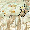
 This old set of three Zion trail maps includes information about trails to Weeping Rock and Observation Point, which are now closed due to rockfall. Click the image to view a full size map or download the PDF.
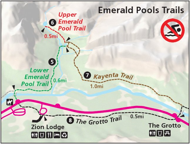 This is the old Emerald Pools trail map inset from the map above, which I had originally posted separately so users wouldn’t need to download the entire map if only needing the hiking trails to Emerald Pools.
 This map shows a mid-2010s zoomed-in view of Zion Canyon and its shuttle bus route, ranging from Springdale in the south to the Narrows in the north. Click the image to view a full size map or download the PDF.
 Here’s a Springdale shuttle map from the mid-2010s, showing the free route through the town of Springdale, just outside Zion Canyon. This one and the one below are interesting to compare with today’s.
 Here’s a Springdale shuttle map from 2017. It’s pretty much still current in the 2020s but some business names may have changed. Click the image to view a full size map or download the PDF.
 This is an old map of Watchman Campground, dating from the mid-2010s. Site numbers and campsite layouts have been updated since its publication, as you’ll notice if you compare with the current one above.
 This is an old Zion trails and backcountry campsites map, including trail mileages and water sources in both Zion and Kolob Canyons. This one doesn’t have more recent trail closures included.
…and more!
< Return to National Park Maps home
< Return to Park List
< Return to List by State