Buffalo River maps from the brochure
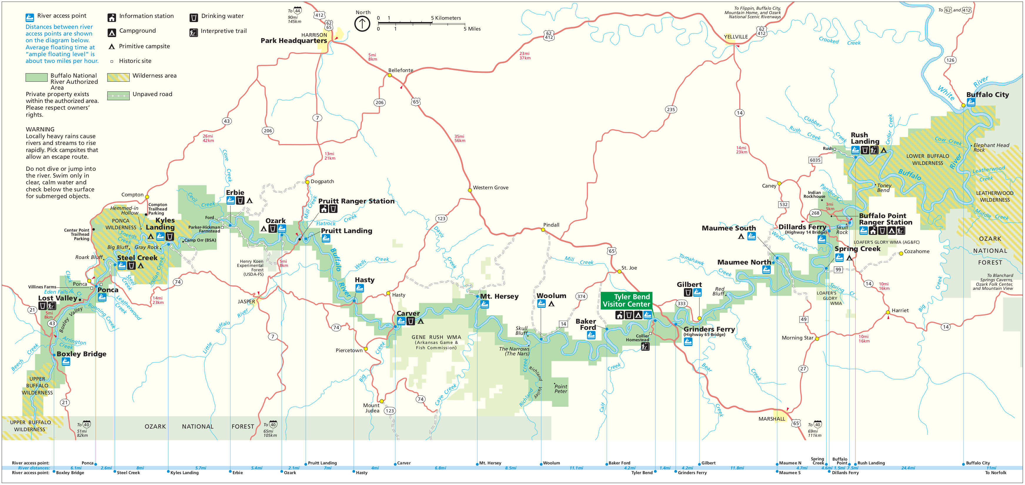
 Here is the main Buffalo National River map from the park brochure, showing all the river access points as well as the roads, campgrounds, landings, and other points of interest.
 Here is the Buffalo River map from the older brochure. The map above is the newest revision, but I’m keeping this here for historical purposes. Click the image to view a full size map or download the PDF.
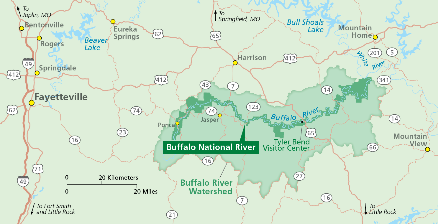 This is a Buffalo River regional map, outlining the Buffalo River watershed and showing nearby towns such as Fayetteville. Click the image to view a full size map or download the PDF.
Buffalo River trail maps
 Below you’ll find many trail maps of varying quality covering different parts of Buffalo National River. If you’d like a more comprehensive map, I’d recommend the National Geographic Trails Illustrated maps of Buffalo River, available both as Buffalo River West and Buffalo River East. These maps include trail mileages and topographic lines, and are suitable for long-distance wilderness travel. Plus, it’s just way nicer to see all the trails in the park at once.
Buffalo River Trail: Western section
The following six maps show the Western section of the Buffalo River Trail. The map segments are arranged from west to east.
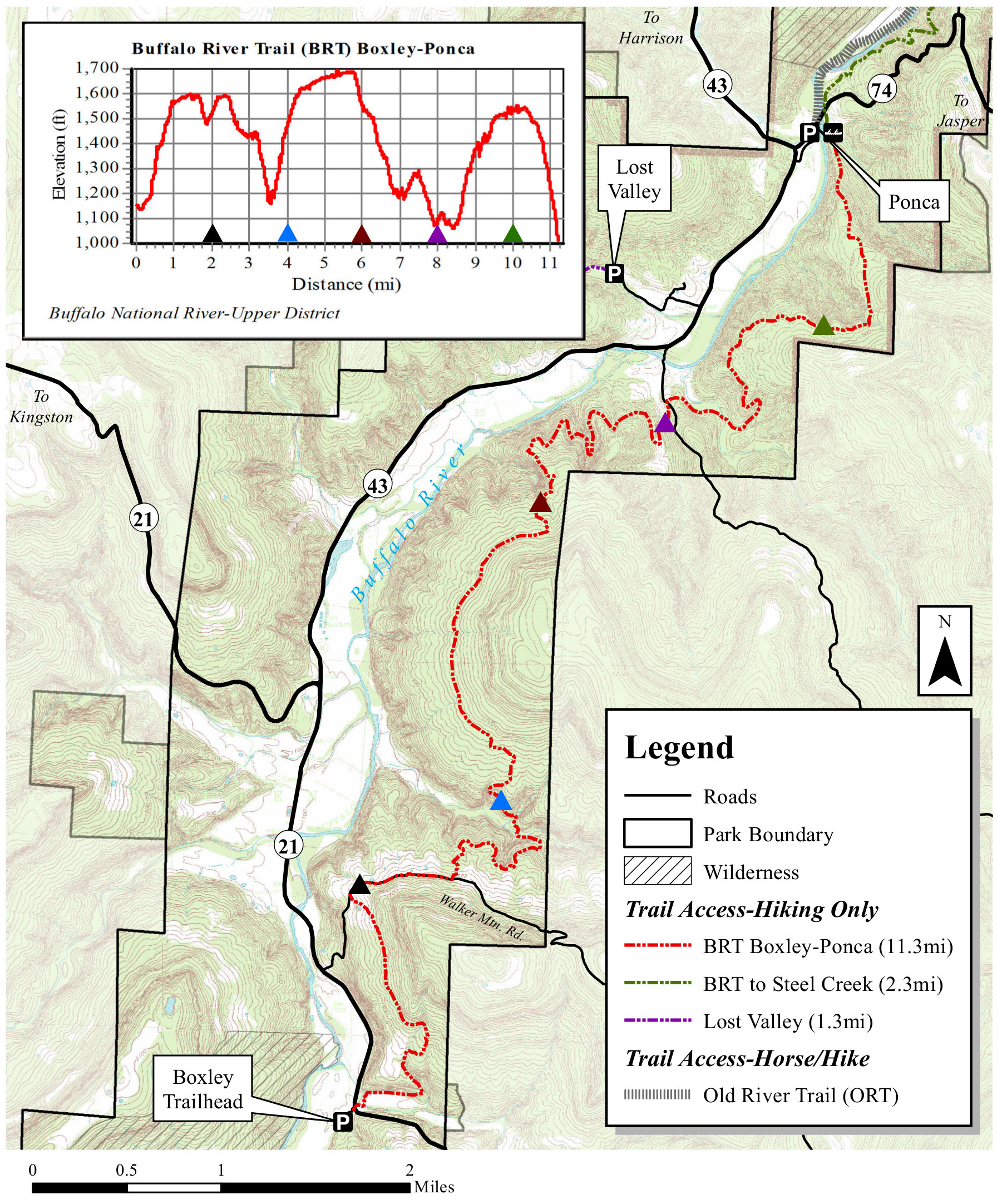 The Boxley to Ponca map shows the westernmost segment of the Buffalo River Trail, starting just south of Boxley Bridge and dropping into two valleys before arriving at Ponca.
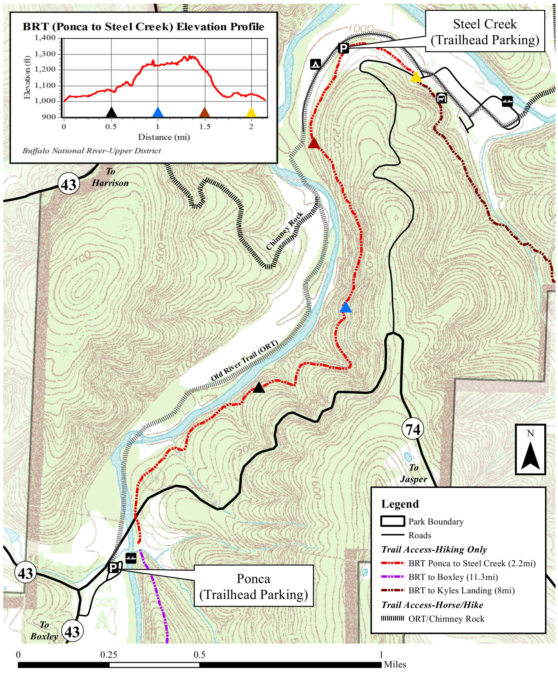 This Ponca to Steel Creek map shows the Buffalo River Trail running mostly north, paralleling the eastern shore of the river. This section has fewer up-and-downs than the previous segment.
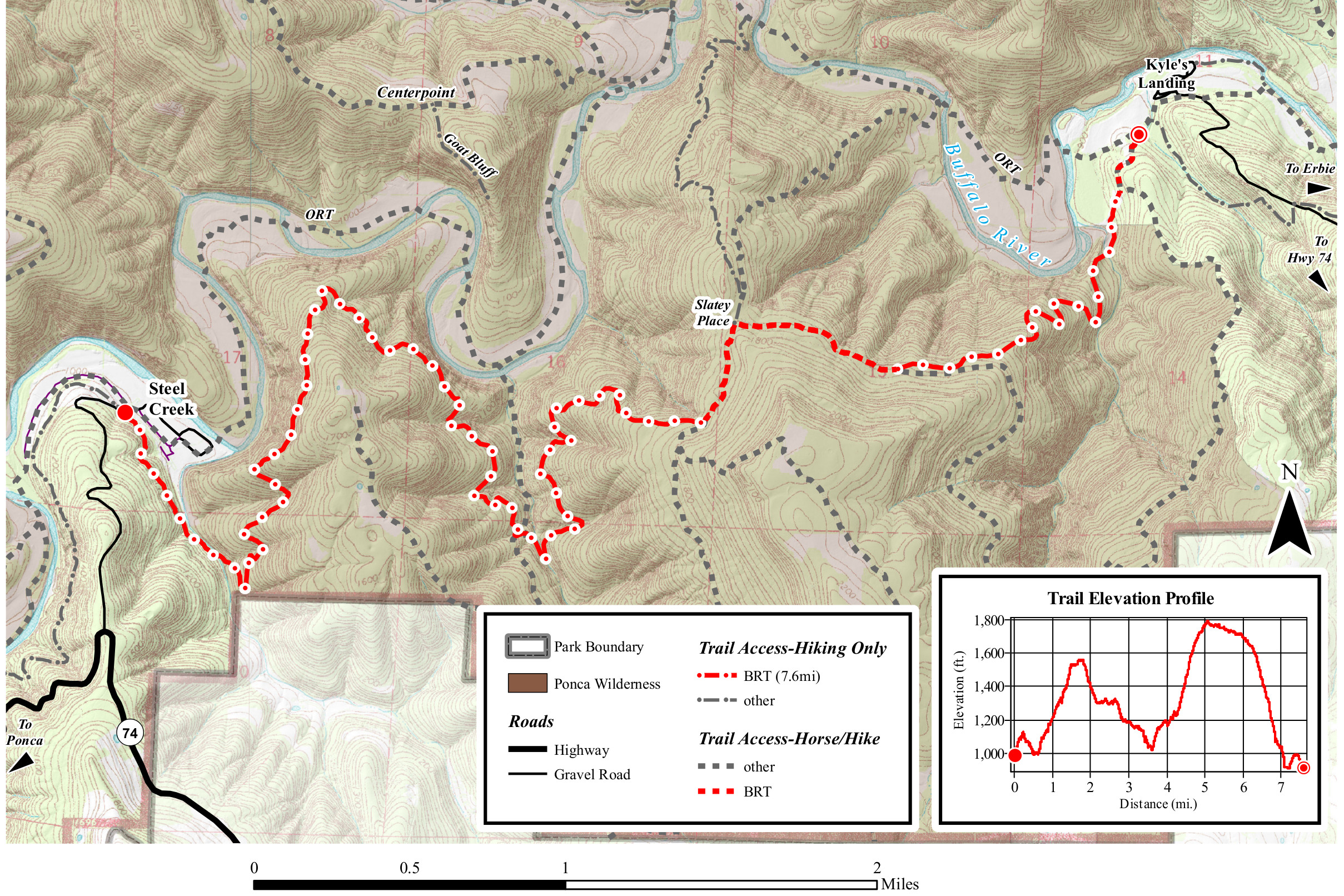 The Steel Creek to Kyle’s Landing map covers the trail’s route through the Ponca Wilderness; this segment is nearly 8 miles and involves ascending a couple hills before the descent to Kyle’s Landing.
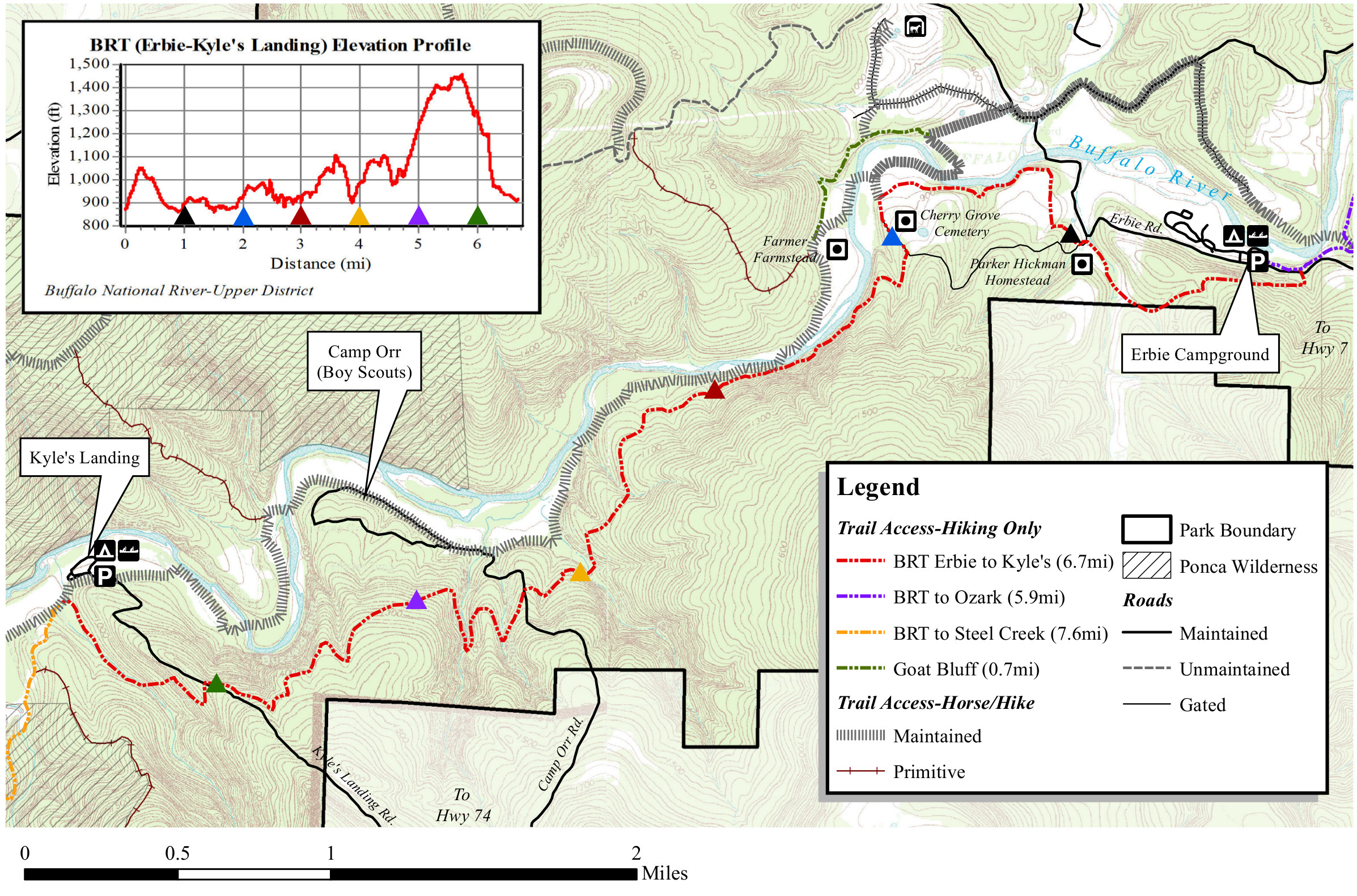 Here’s a Kyle’s Landing to Erbie map, showing the immediate climb out of Kyle’s Landing before dropping back down near the Buffalo. Note the trail profile is the opposite direction as the map.
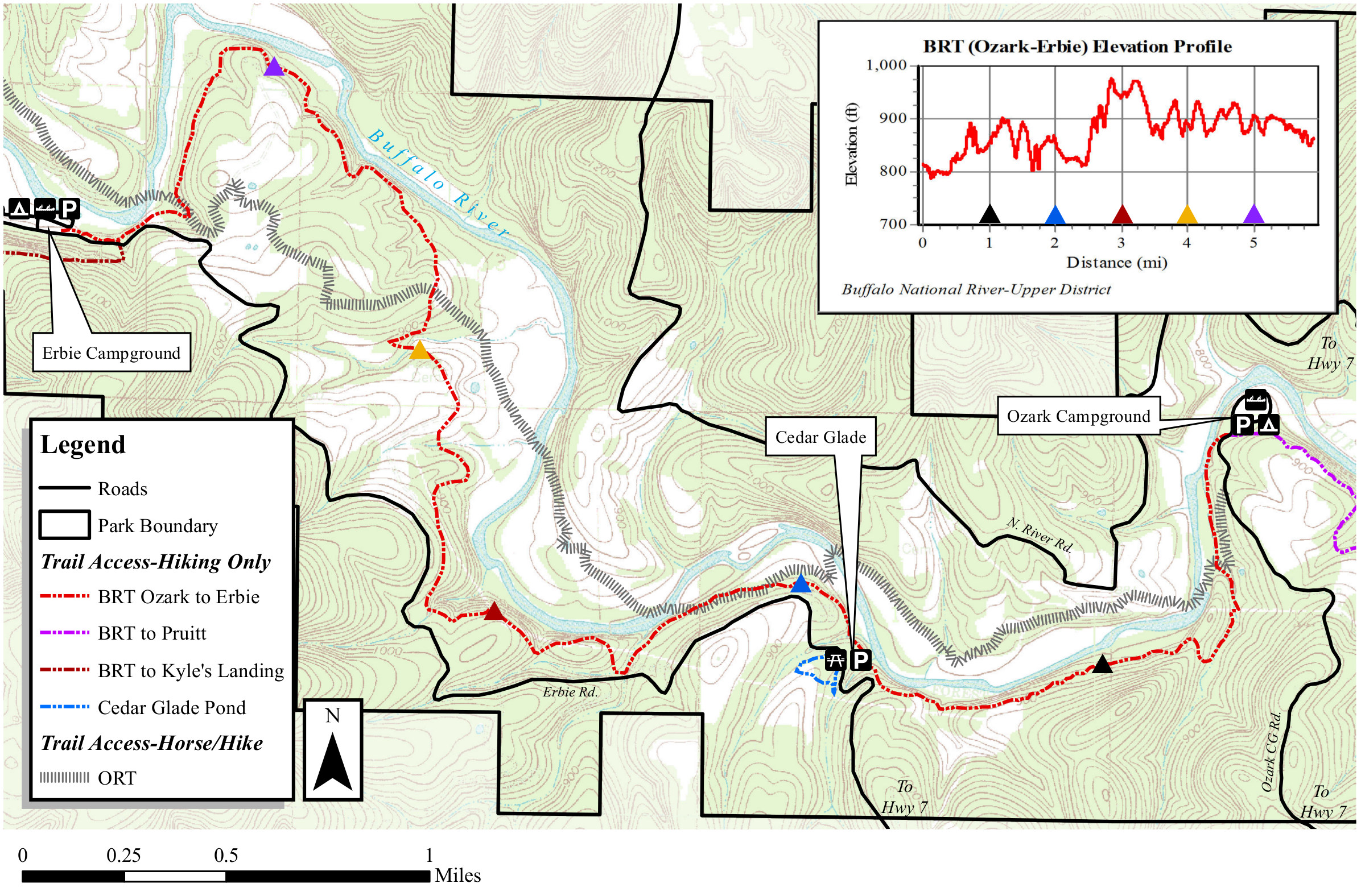 This Erbie to Ozark map shows this segment of the trail from Erbie Campground to Ozark Campground, via Cedar Glade. This is a pretty flat stretch, with only minor up-and-downs and no major hills.
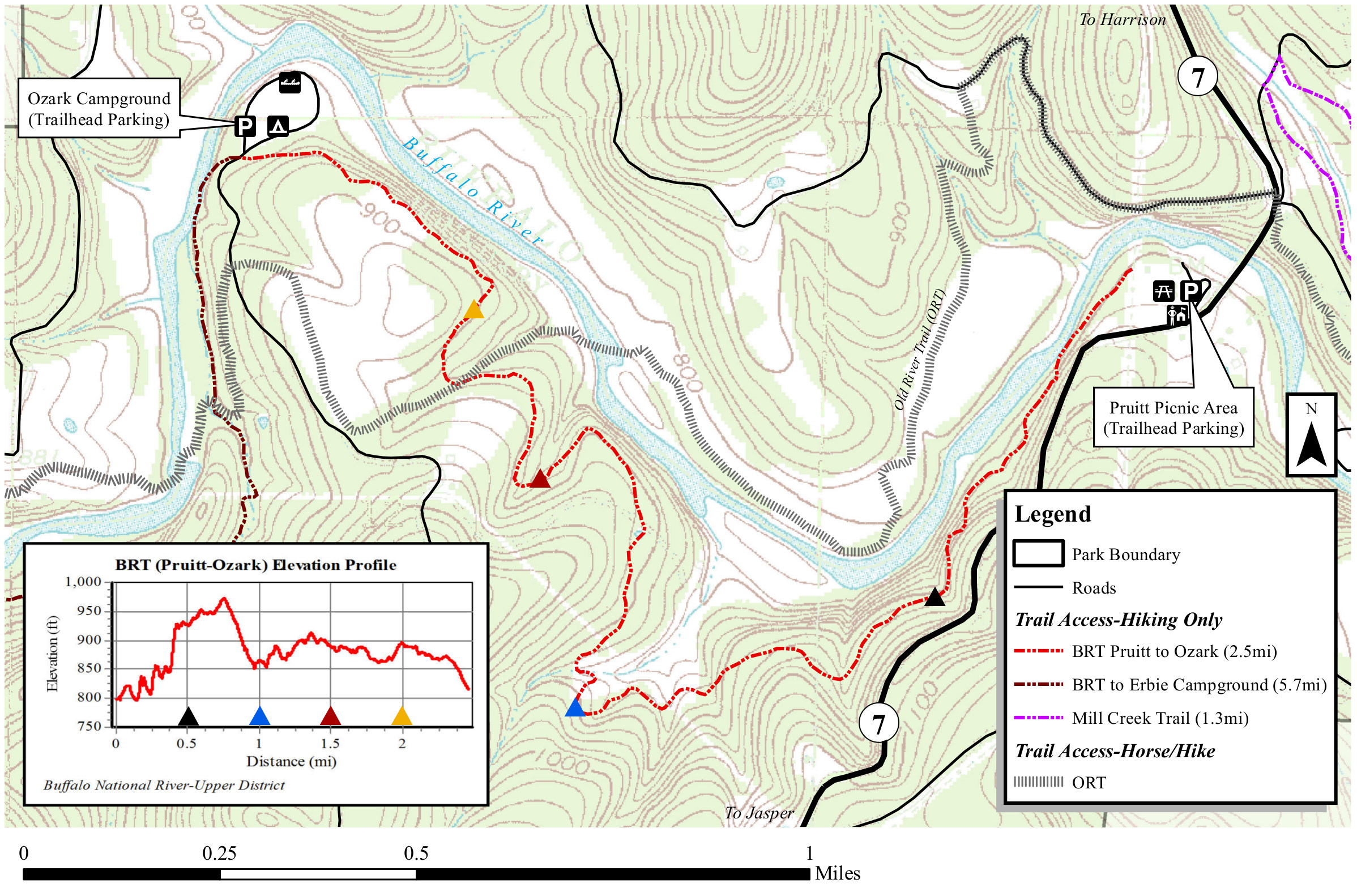 This Ozark to Pruitt map covers a very short segment of the eastern end of the Buffalo River Trail — about two-and-a-half miles from the Ozark Campground to the Pruitt Picnic Area.
Buffalo River Trail: Eastern section
The following three maps show the Eastern section of the Buffalo River Trail, and they’re also arranged west to east.
 The Buffalo River Trail eastern section map shows an overview of this 42-mile stretch that runs from Woolum to Dillards Ferry. The two maps below zoom in on two specific segments of this trail.
 The Woolum to Tyler Bend BRT trail map shows this 12.4 mile stretch of the BRT. An elevation profile is provided to help you better visualize the ups and downs as you climb up and back down to the river.
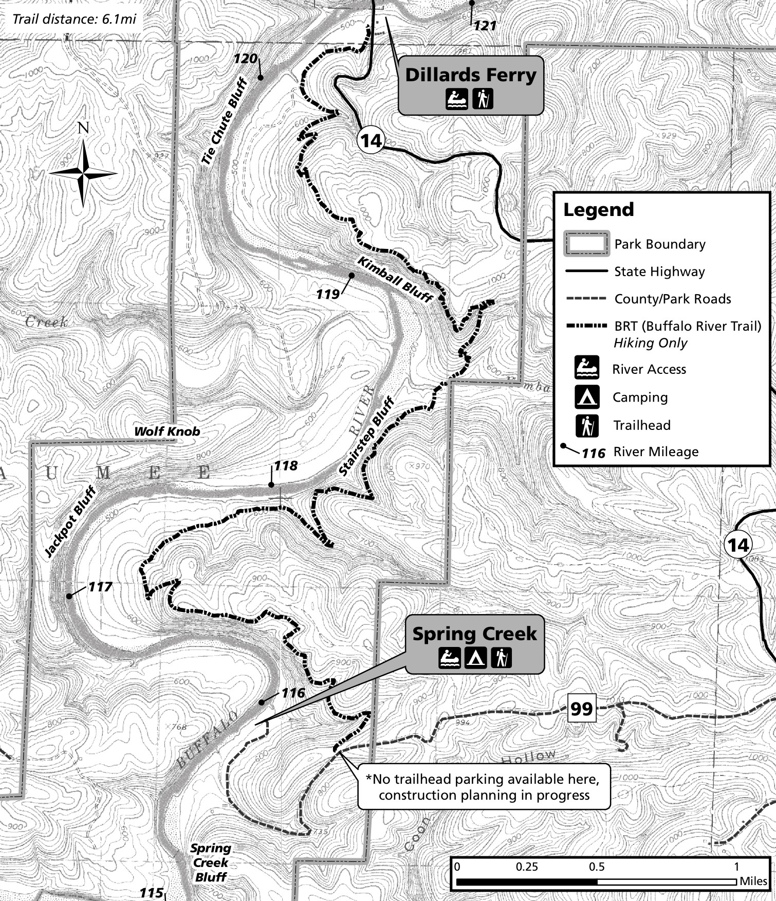 The Spring Creek to Dillards Ferry BRT trail map shows this six-mile segment of the BRT. If you’re able, leaving a car at each end makes this an easier day hike than doing it as a 12-mile round trip.
Other trails
The following maps show some of the other trails in Buffalo National River, presented here roughly from west to east.
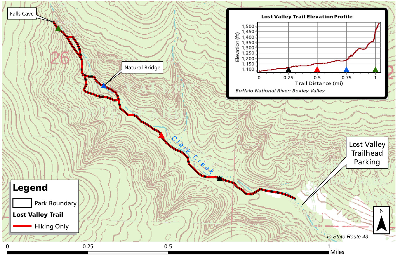 This Lost Valley trail map shows this very popular short uphill trail that passes a natural bridge as well as Eden Falls. You’ll get to Falls Cave after about a mile of hiking (one way).
 Here’s a Ponca to Erbie map, zoomed out to show the context of a few of the maps below. It includes both the Buffalo River Trail as well as several other horse trails and hiking trail.
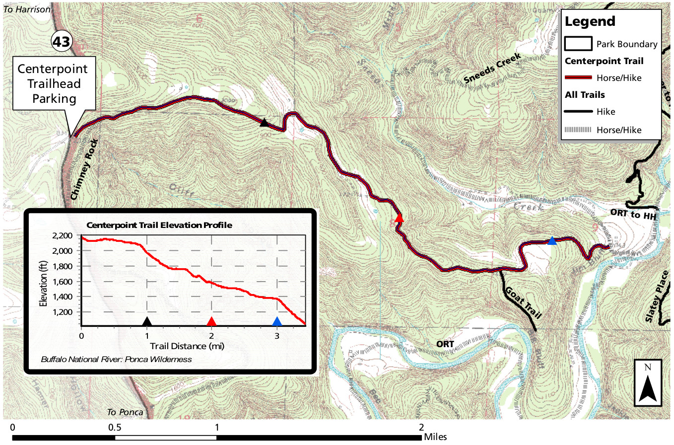 Here’s a Centerpoint trail map that shows this route that leads through the Ponca Wilderness and descends 1300 feet to the Buffalo River. It’s quite strenuous on the return as you have to climb it all back!
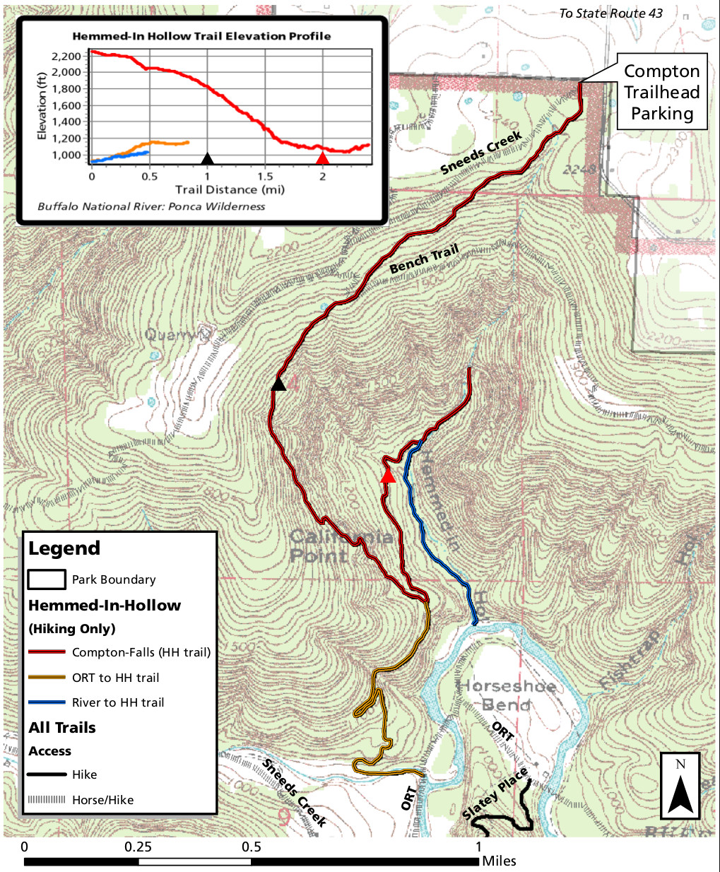 The Hemmed-in Hollow trail map shows this strenuous trail that leads down toward the bluffs of the Buffalo, descending over 1300 feet. This is another trail much more difficult on the return.
 This is a Kyle’s Landing to Pruitt map, which has a much more zoomed out perspective than the other maps in this section to show a larger area, including both the BRT and other hiking and horse trails.
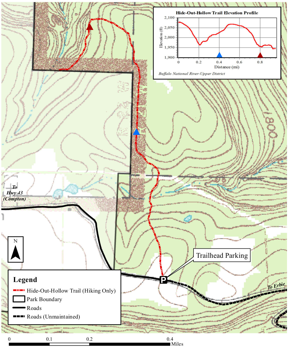 The Hideout Hollow trail map shows this relatively easy trail that includes views of the Cecil Cove valley and some waterfalls. This trail is less than a mile, one way.
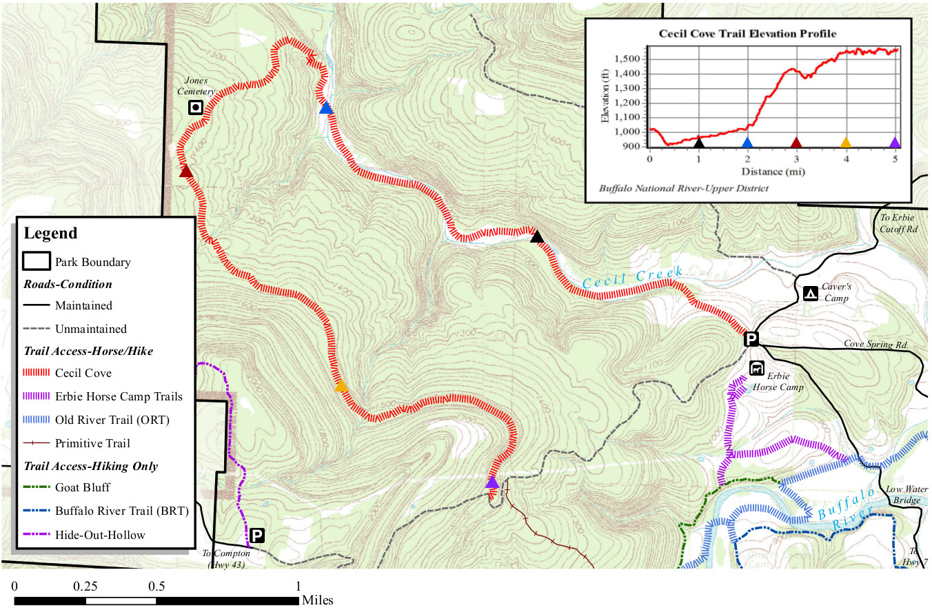 This Cecil Cove trail map shows this route that crosses Cecil Creek several times and passes historic sites and homesteads. You’ll find the trailhead near Caver’s Camp and Erbie Horse Camp.
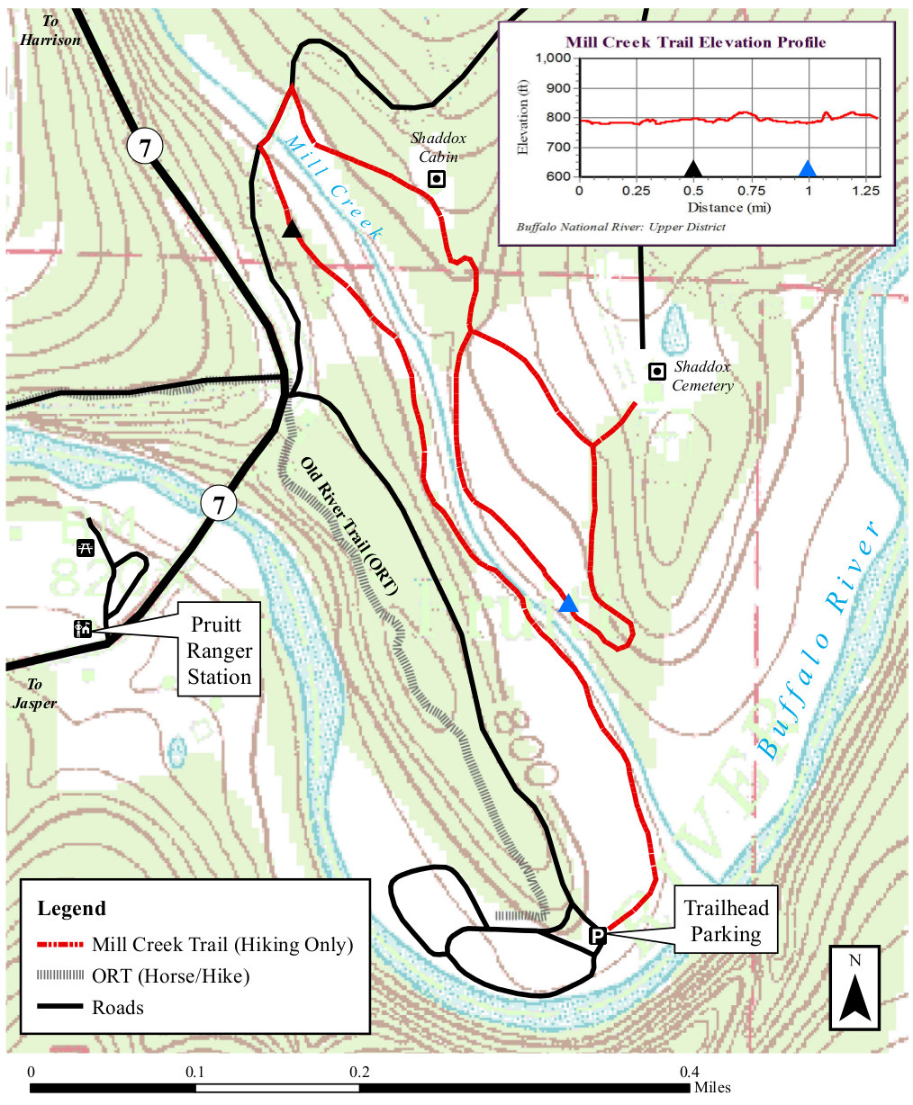 Here’s a Mill Creek trail map that includes a few loop options from the Pruitt launch area, none of which are too strenuous. The Shaddox Cabin and cemetery are both labeled.
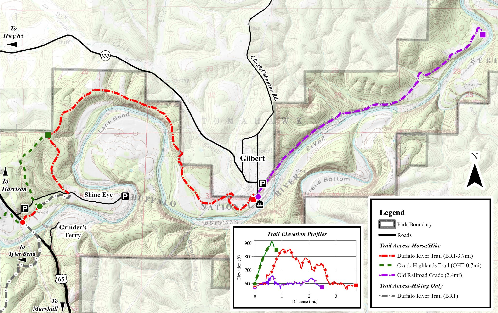 The Gilbert trail map covers the region near the tiny hub of Gilbert in the Lower District of Buffalo National River. Trails for hikers only as well as horses are included on this map.
Buffalo River campground maps
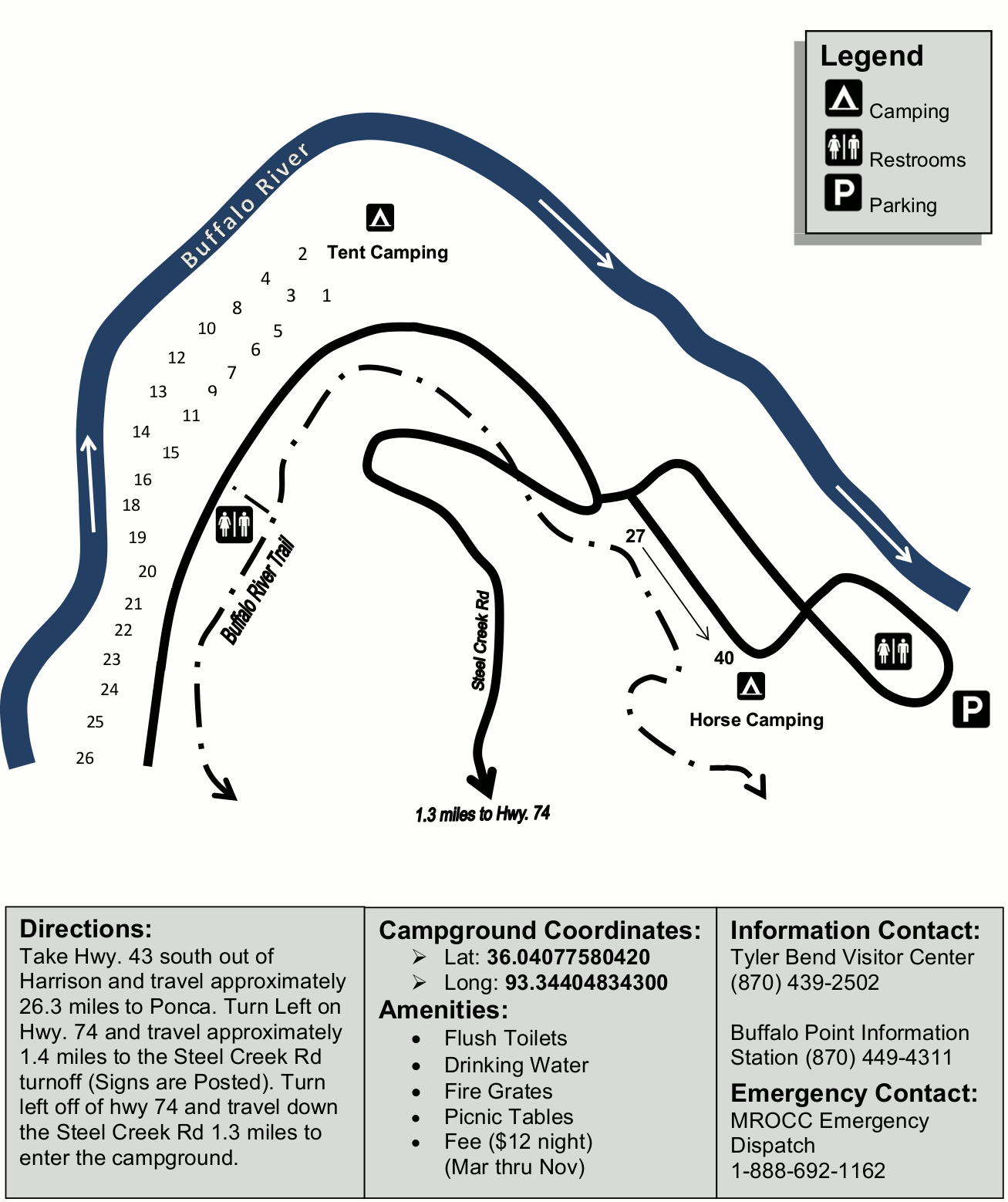 This Steel Creek Campground map shows the westernmost campground in the national park; it has both tent and horse sites (in separate areas) and is open all year.
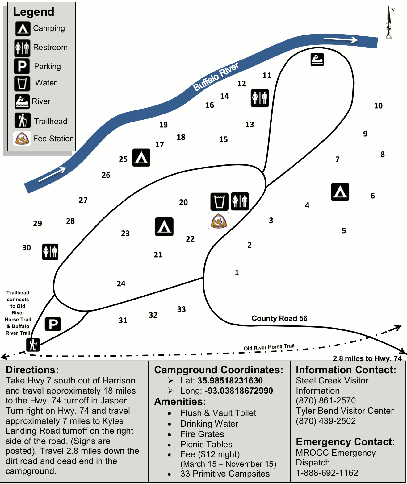 The Kyle’s Landing Campground map shows this tent campground on the south shore of the Buffalo River accessible by a very rough gravel road. Directions and GPS coordinates are provided.
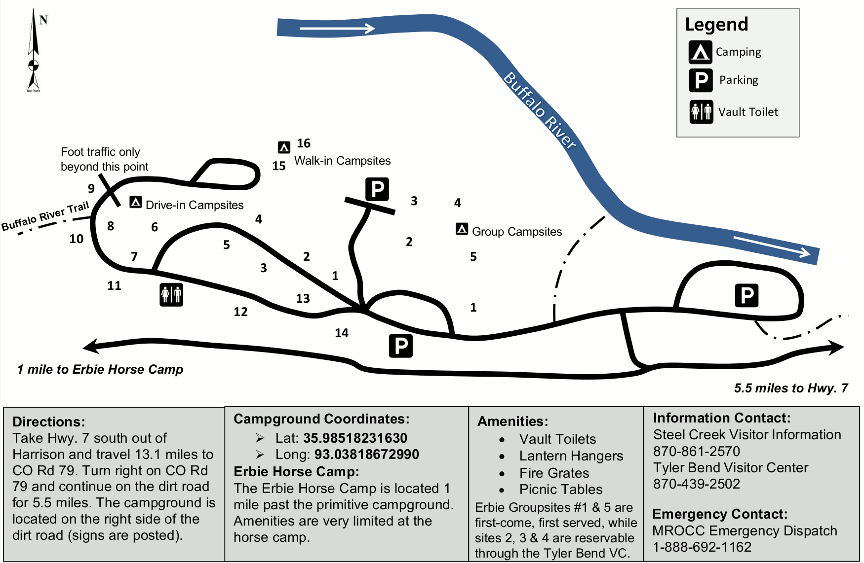 Here’s an Erbie Campground map that focuses on this remote campground that can accommodate RVs, although there are no hookups nor is there running water (which keeps a lot of RVers away).
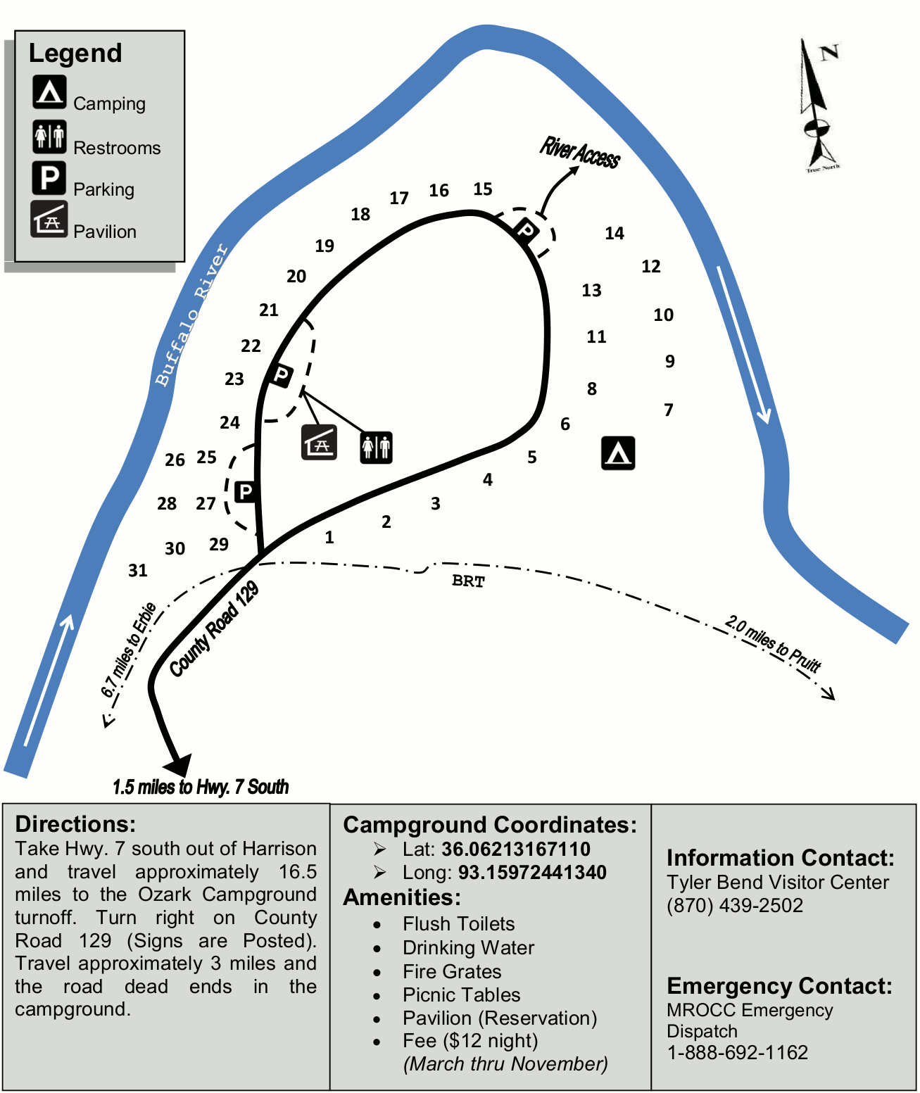 This Ozark Campground map shows the campground’s single loop; running water is available during the peak season only, which is mid-March through mid-November here.
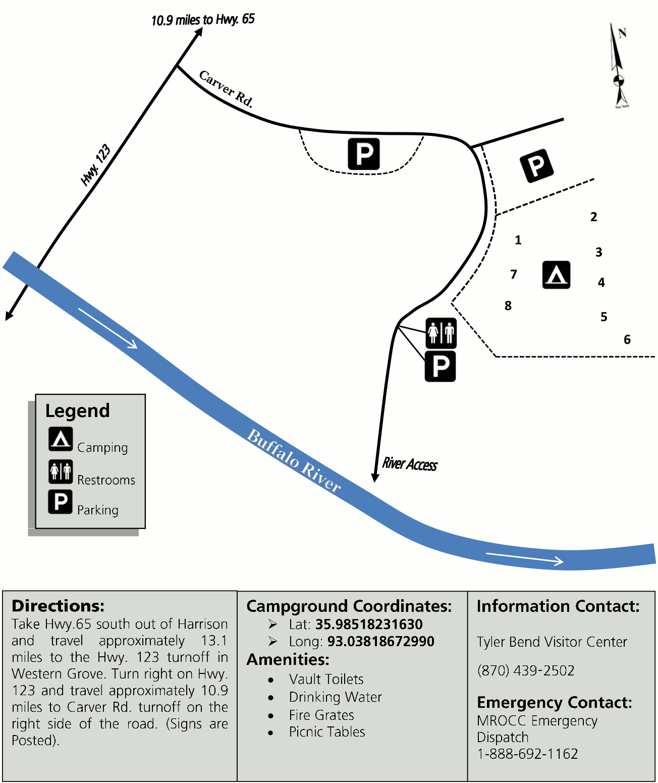 This Carver Campground map shows this very small campground that is located right off Highway 123. There is no trash service here, so please pack it all out to leave your campsite better than you found it.
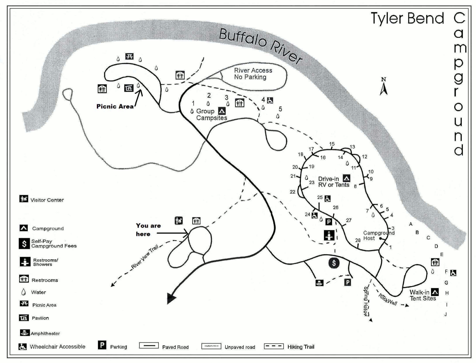 The Tyler Bend Campground map includes not just the campground, but the whole area surrounding it, such as the Tyler Bend Visitor Center, picnic area, river access, and restrooms.
 Here’s a Spring Creek Campground map. This tent-only campground has twelve sites that include a picnic table and fire ring. However, there’s no water nor flush toilets, and you’ll need to pack out all trash.
 The Buffalo Point Campground map shows the only campground in the park with full RV hookups; sites here can be reserved in advance. The map labels campground amenities as well as trails.
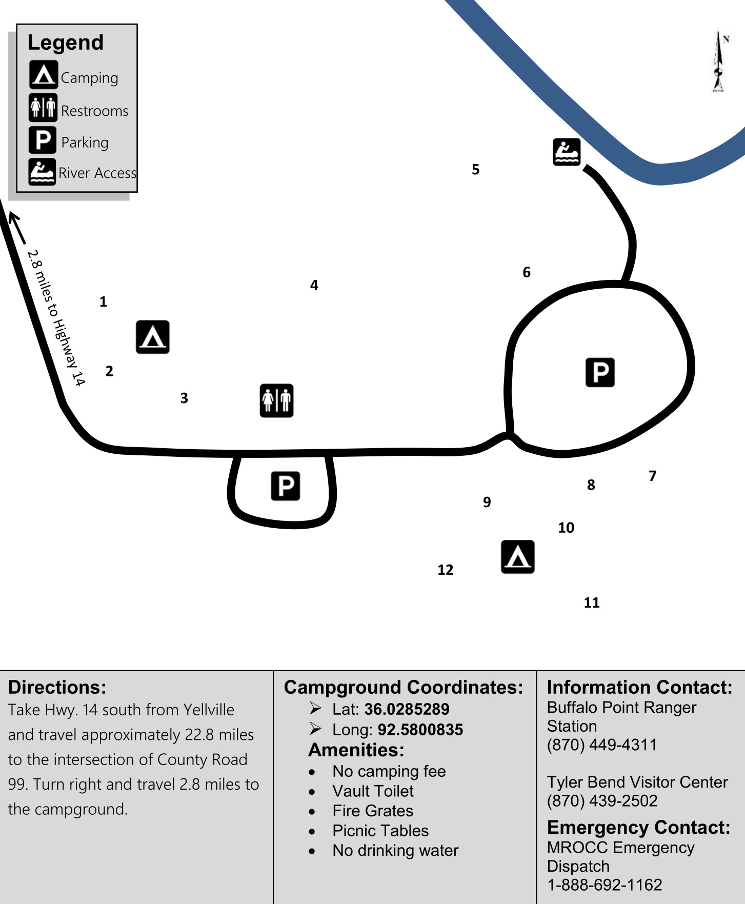
 This Rush Campground map shows the park’s easternmost campground. Note that during times of high water, the campground may not be accessible due to Rush Creek water flows.
Assorted Buffalo River maps
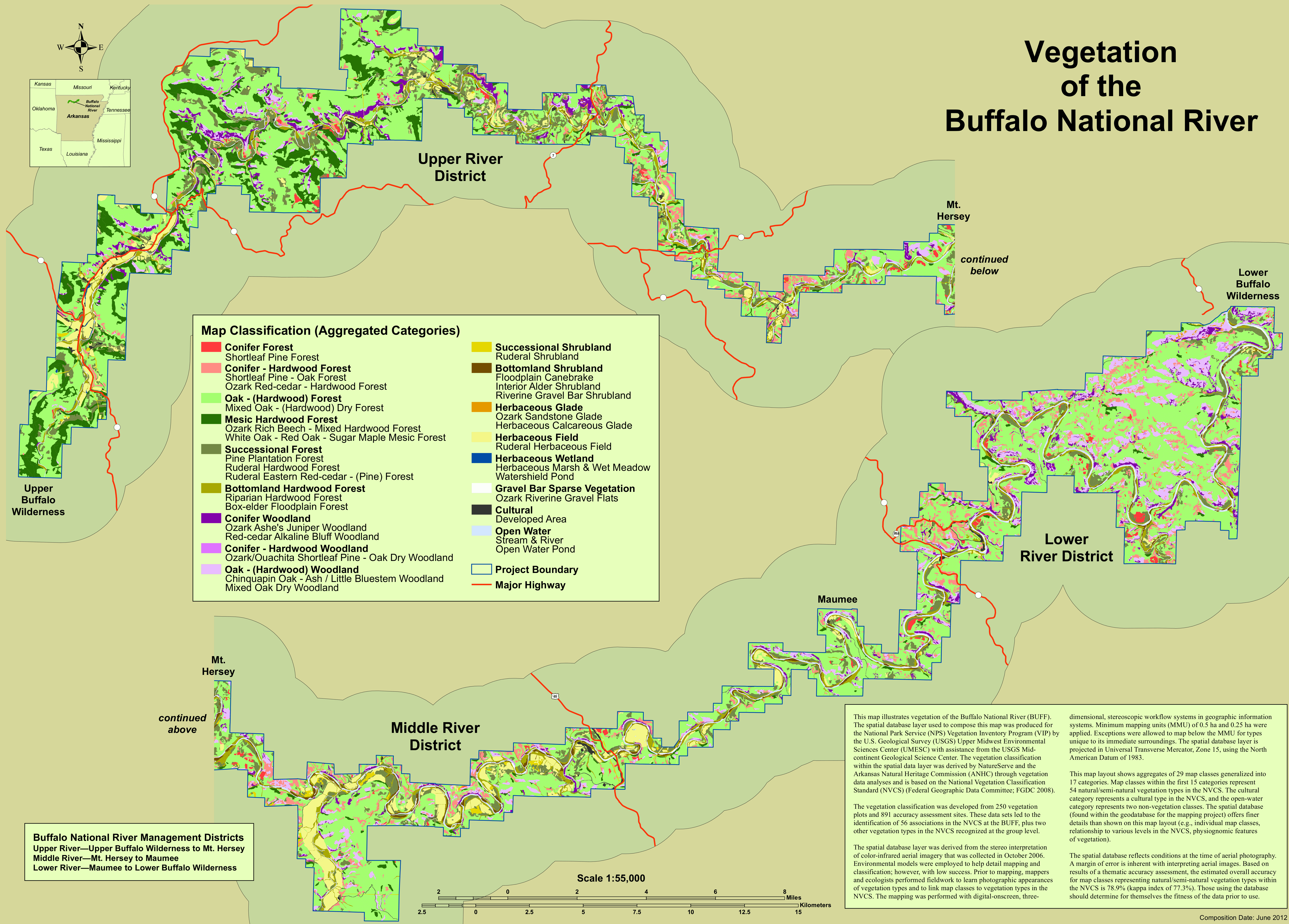 Here’s a vegetation map of Buffalo National River, showing the locations of different plant communities in the park, including hardwood forests, woodlands, shrublands, glades, and wetlands.
…and more!
< Return to National Park Maps home
< Return to Park List
< Return to List by State