Alcatraz map from the park brochure
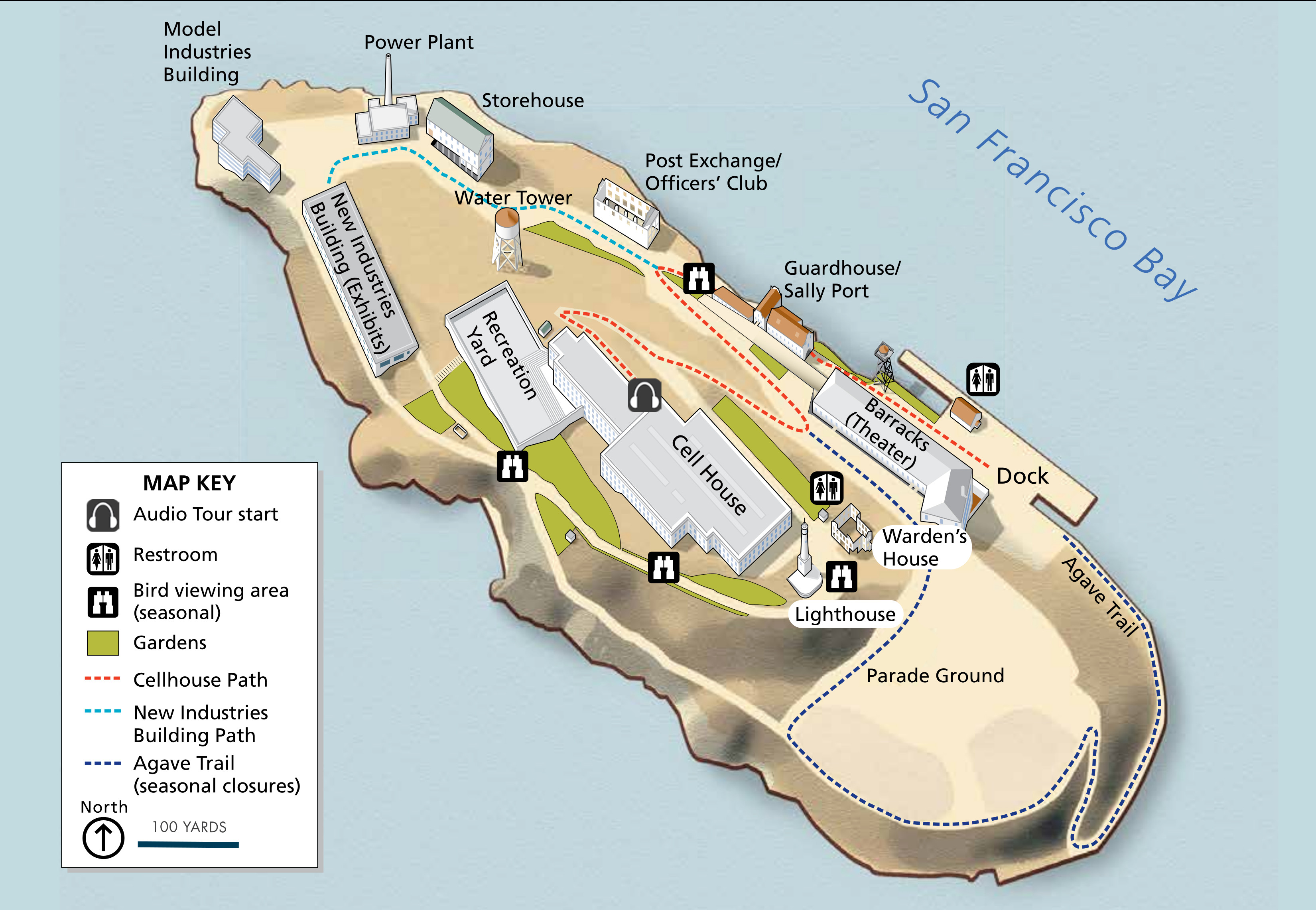 This is the official Alcatraz map, directly from the National Park Service brochure. A few paths and trails are marked, and buildings are labeled including the cell house, recreation yard, barracks, and lighthouse.
Assorted Alcatraz maps
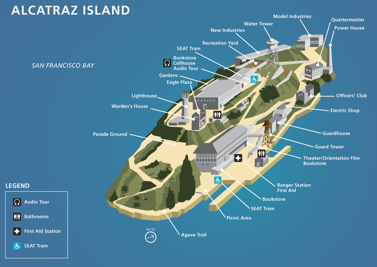 Here is the old Alcatraz brochure map from the mid-2010s, labeling the points of interest and showing the location of where to begin the cellhouse audio tour and other visitor facilities.
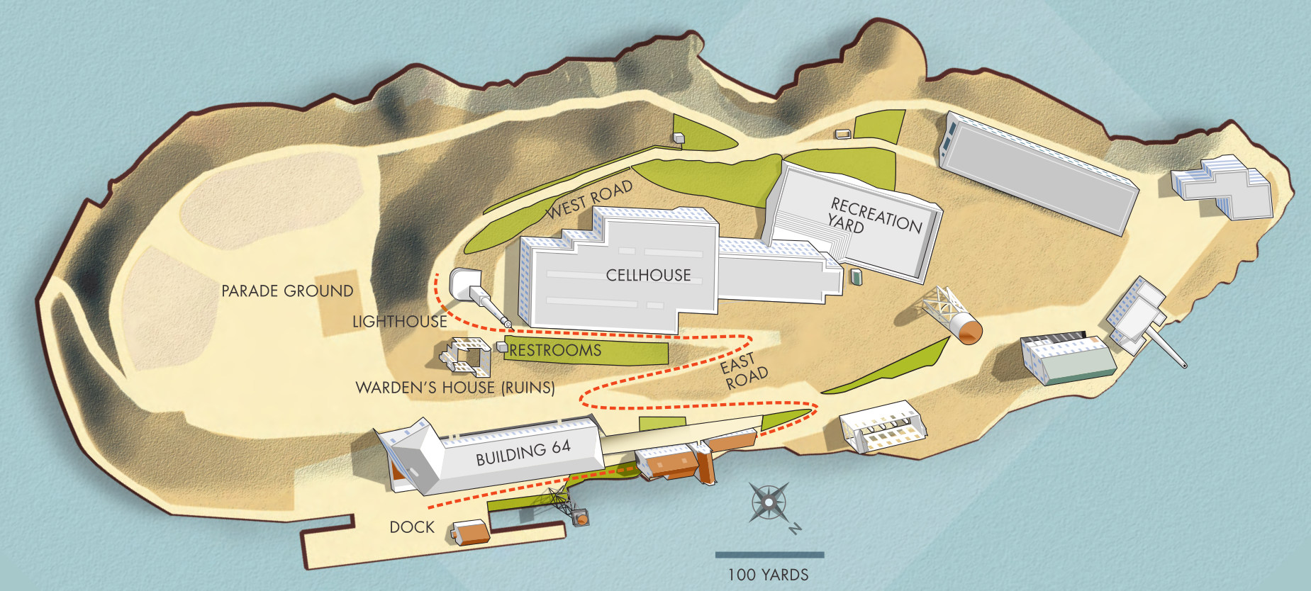 This is an overhead Alcatraz Island map, showing the island from a top-down view including the route from the ferry dock to the cellhouse and lighthouse on top of the island.
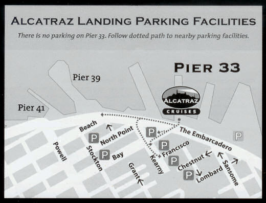 The Alcatraz parking map shows the ferry location on Pier 33 and labels several different San Francisco parking lots most convenient to the pier. The National Park Service provided this map in 2025 and things can change.
Alcatraz cellhouse map
 Here’s an Alcatraz cellhouse map, focusing on cellblocks A-D and labeling other features such as the mess hall, kitchen, library, visiting room, and other prison features.
Alcatraz lodging map
 If you’re looking for a place to stay near Alcatraz on your San Francisco visit, you might want to check out the Expedia interactive lodging map to the right. You can filter lodging by price, neighborhood, and rating. Fisherman’s Wharf is a popular place to stay for out-of-towners and is an easy 10-minute walk along the waterfront to the Alcatraz ferry. Here you’ll find Expedia’s top-rated lodging within walking distance of the Alcatraz ferry.
Historical Alcatraz maps
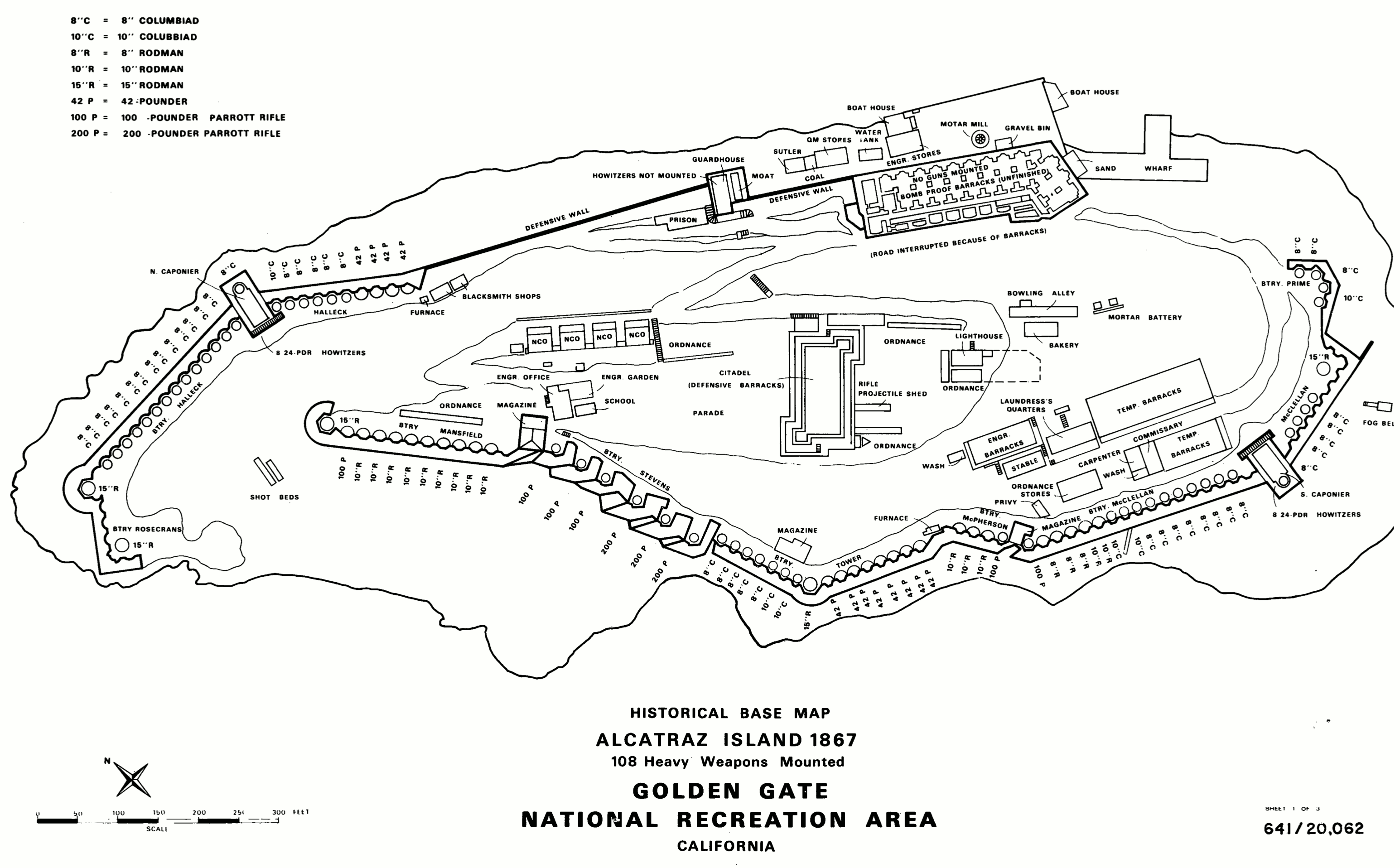 Here’s an 1867 map of Alcatraz Island. You can see that in this era, it wasn’t yet a prison but a military fort. The defensive barracks shown in the center would later become the citadel and first prison.
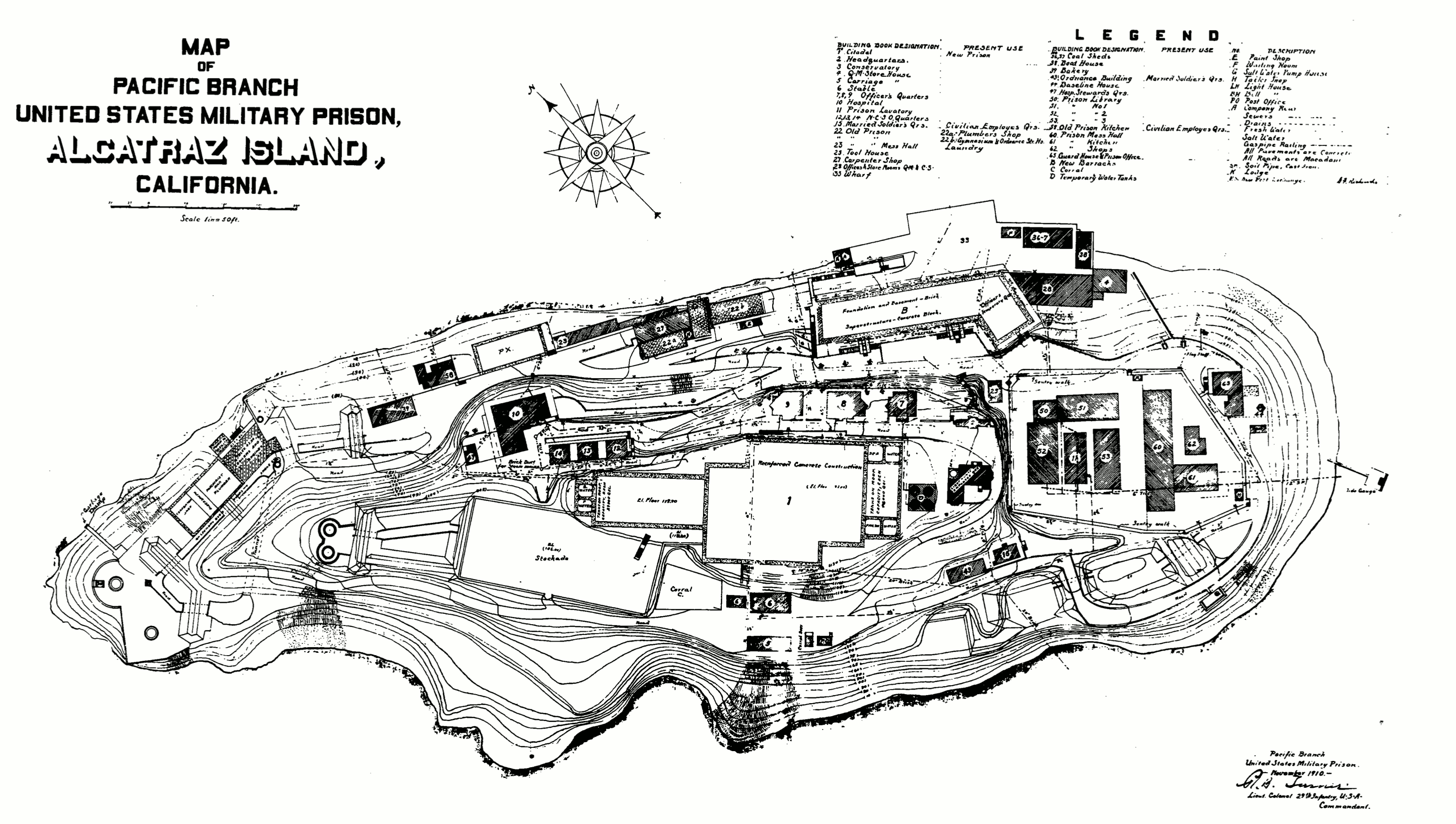 The 1910 Alcatraz Island plans map is a little hard to read but includes a legend that labels the various proposed buildings to be built. Note how these facility plans preview the current island layout.
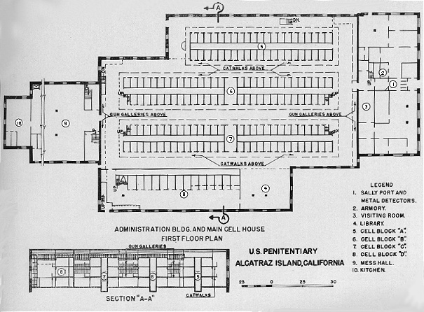
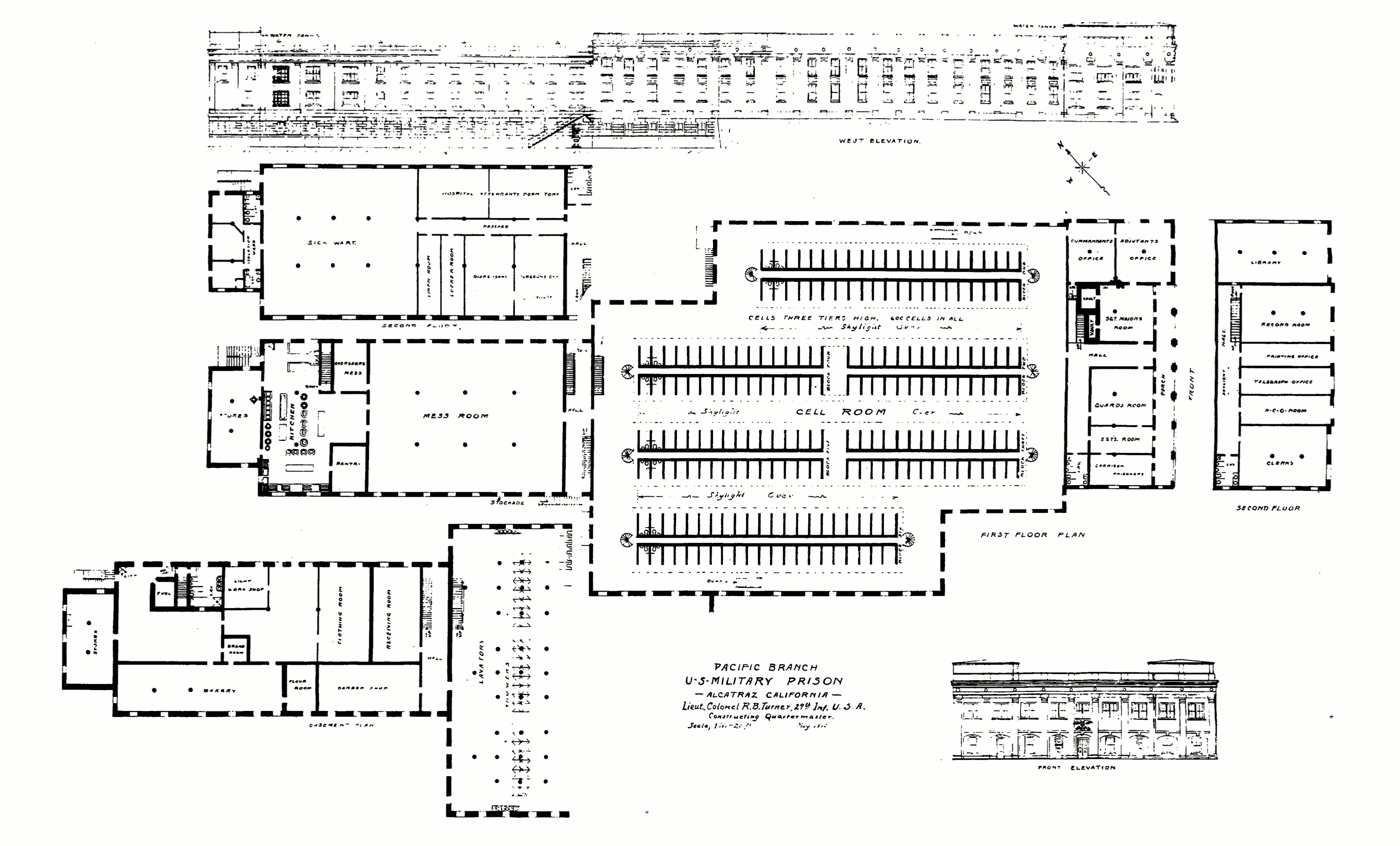 This 1910 Alcatraz prison map shows the proposed interior of the main prison building as Colonel Taylor envisioned it. You’ll see that the actual prison was built pretty closely to these plans.
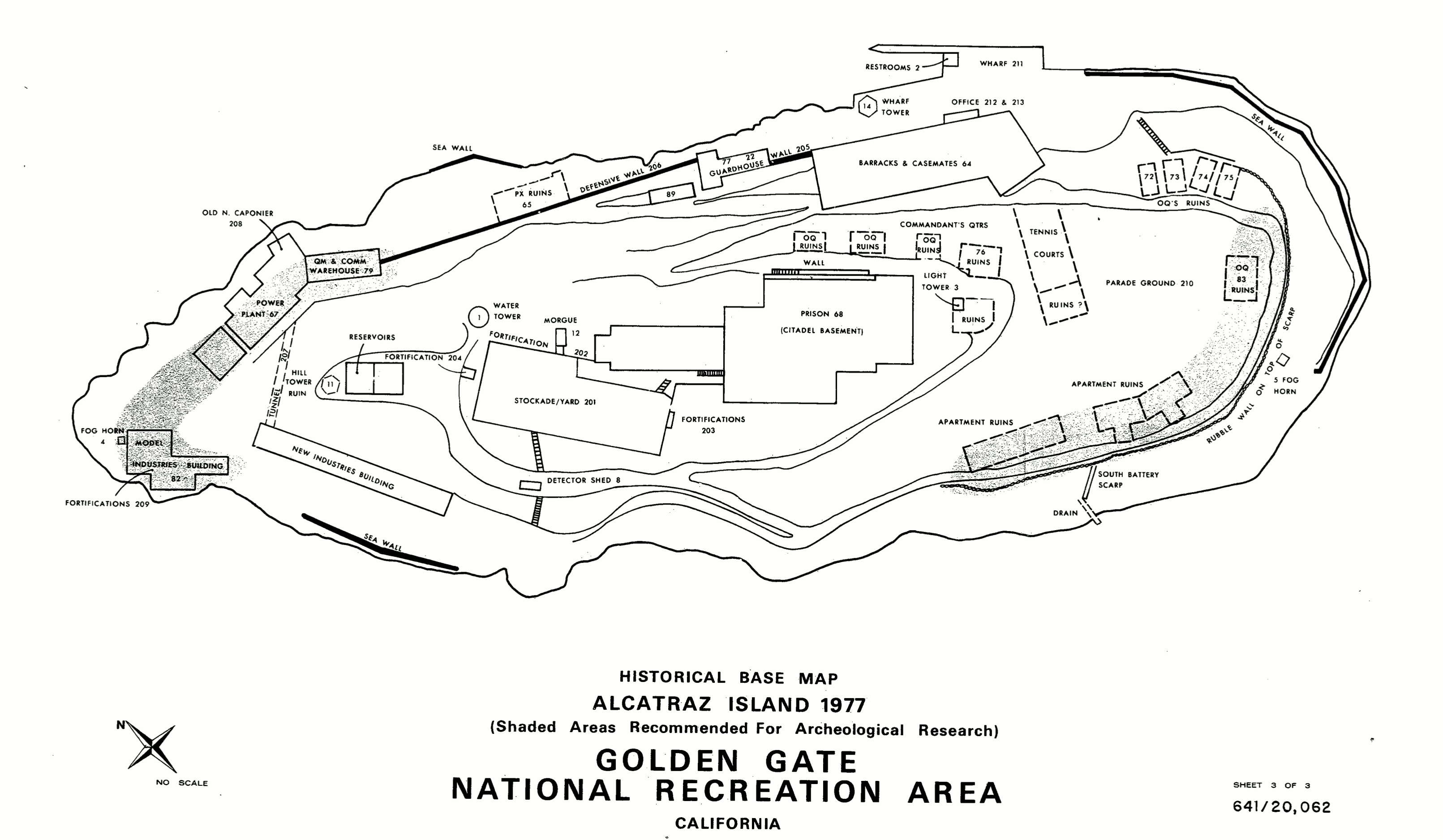 The 1977 Alcatraz map portrays Alcatraz Island as it was in 1977 after it was decommissioned as a prison. Compare the “ruins” on this map with the buildings found on the ones above!
…and more!
< Return to National Park Maps home
< Return to Park List
< Return to List by State