Jewel Cave maps from the official brochure
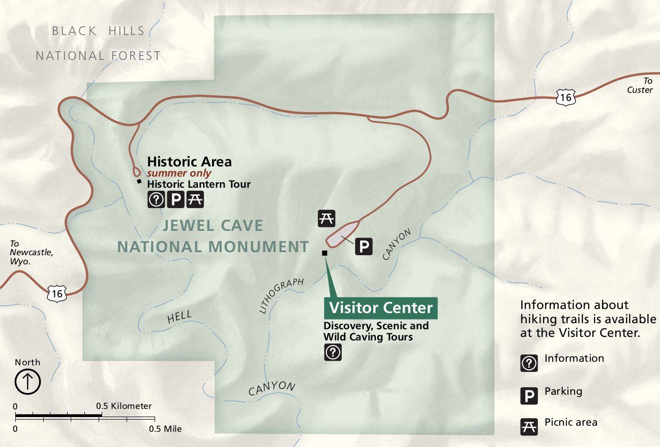
 Here is the official Jewel Cave National Monument map from the NPS brochure. It shows the visitor center, trails, and routes of the popular cave tours. Click the image to view a full size map or download the PDF.
 This is an older Jewel Cave map, which has less detail but will be easier to read when printed out on a black-and-white printer. Click the image to view a full size map or download the PDF.
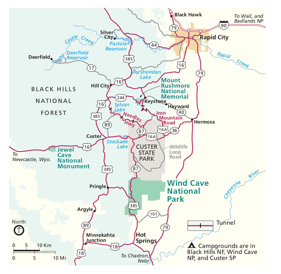 Here’s a regional map of Jewel Cave, showing the park relative to Mount Rushmore, Wind Cave, Rapid City, and local highways. Click the image to view a full size map or download the PDF.
Jewel Cave layout maps
 This is a Jewel Cave underground map, showing the passageways, tunnels, and chambers that make up the Jewel Cave complex. Click the image to view a full size map or download the PDF.
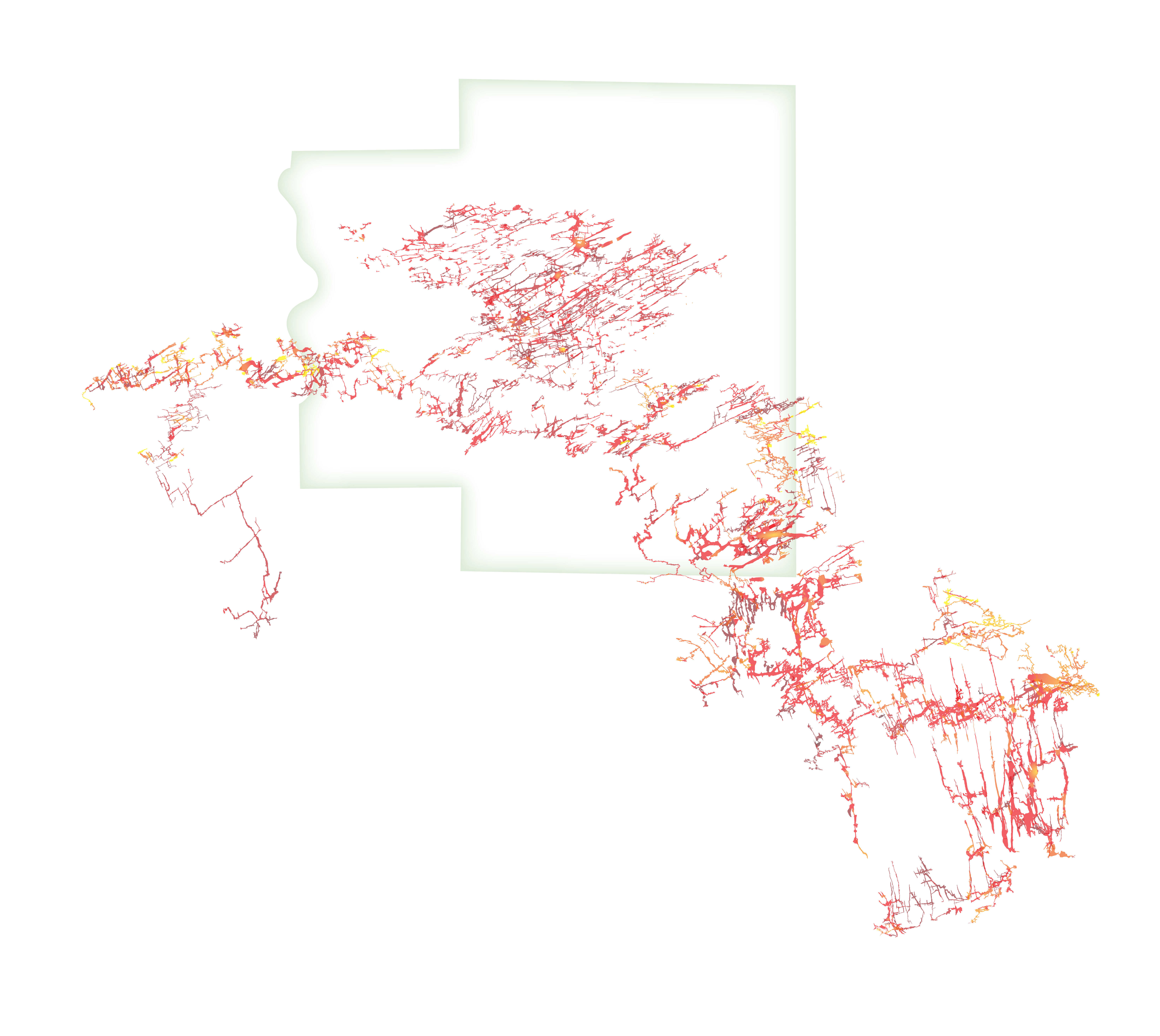 Here’s the large version of the underground map. This map doesn’t include points of interest like the one above, but the higher resolution shows more cave details and layout.
Jewel Cave science maps
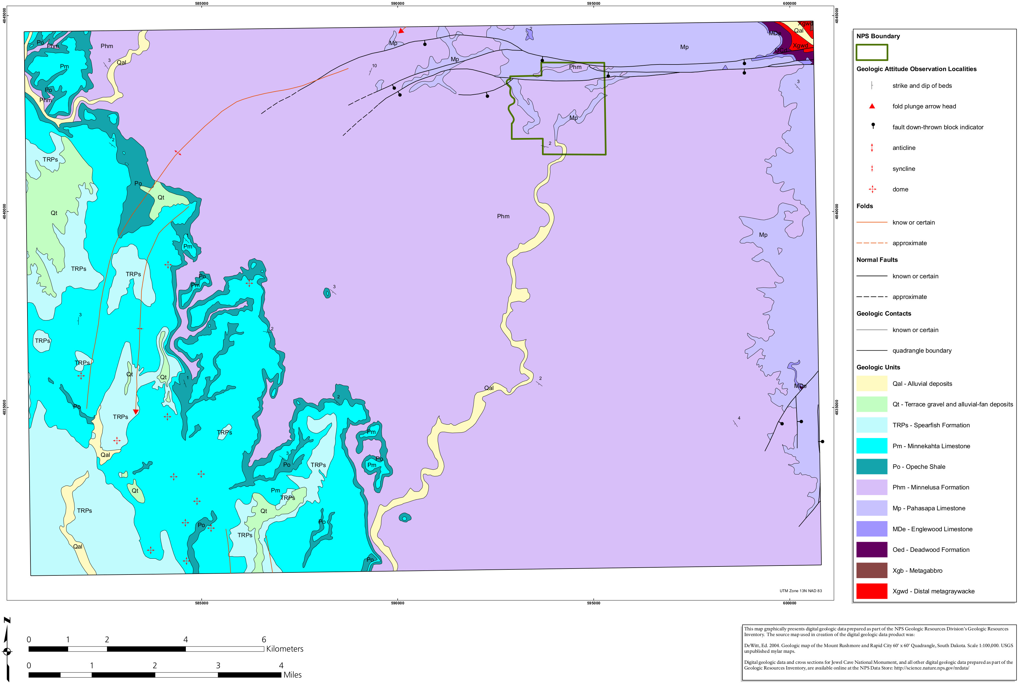 The Jewel Cave geologic map may not be quite as exciting as you were hoping for: it’s just some patches of limestone surrounded by a large field of Minnelusa Formation. (Caves are so often in limestone.)
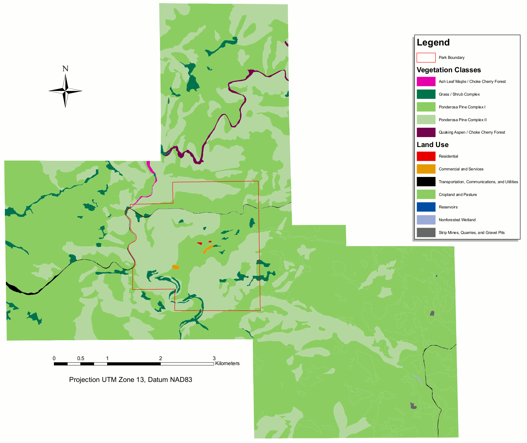 This vegetation map of Jewel Cave shows the park’s mix of forest types. You’ll mostly find ponderosa pine forest cover, along with some aspen, maple, chokecherry, and grasslands.
…and more!
< Return to National Park Maps home
< Return to Park List
< Return to List by State