Gates of the Arctic map from the park brochure
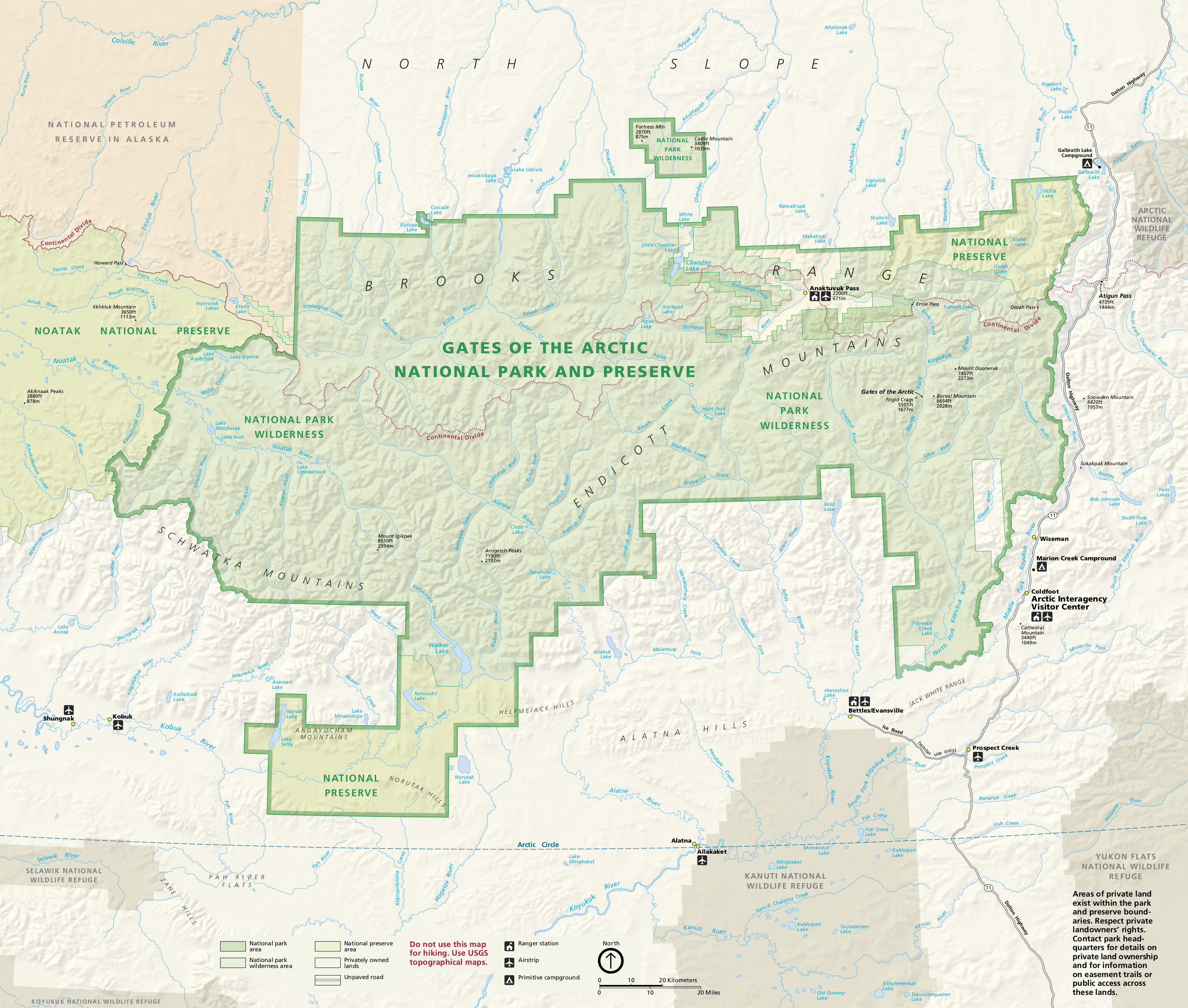
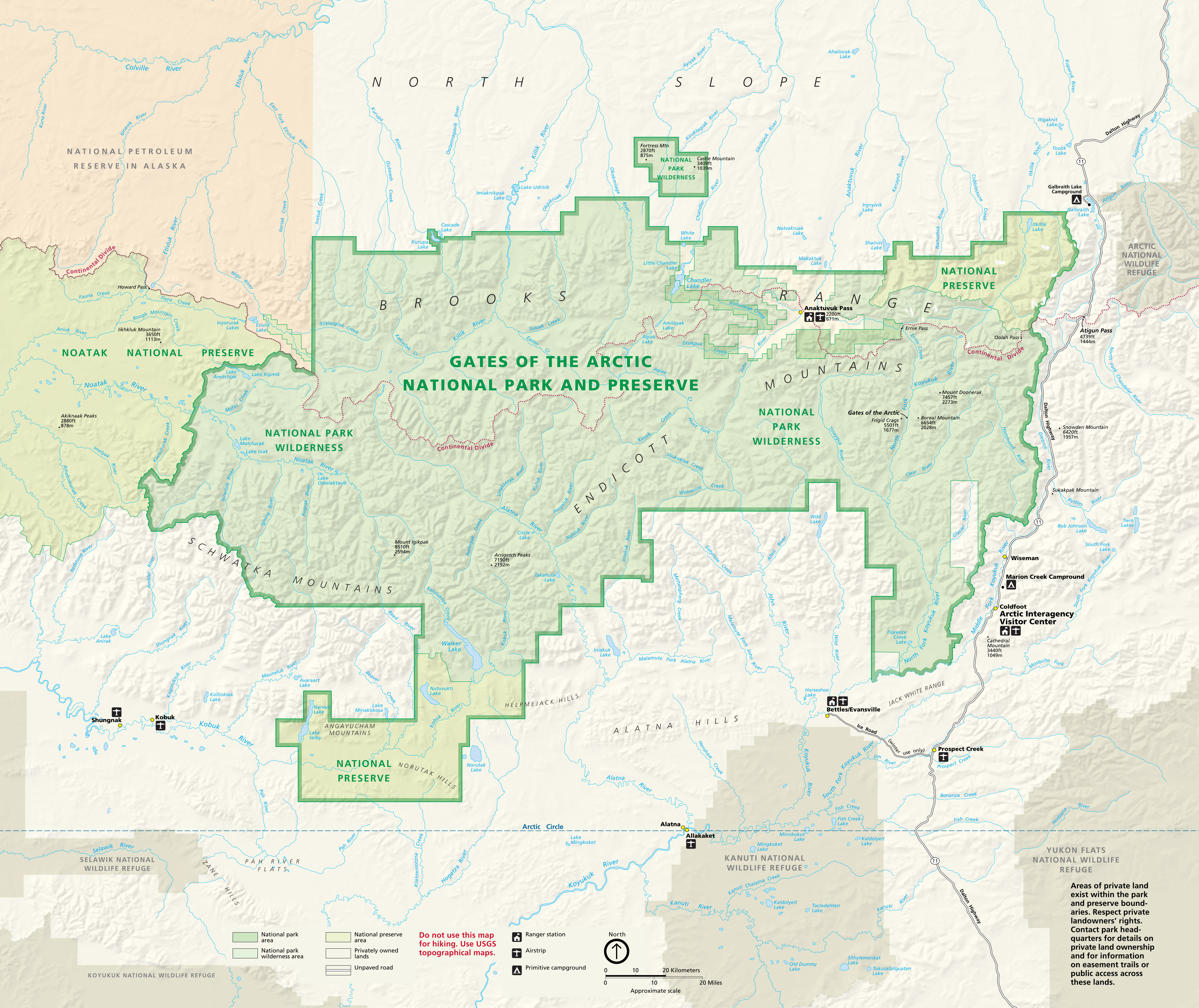 The official Gates of the Arctic National Park map is from the NPS brochure and was last updated in 2018 to more clearly label rivers, lakes, and water features than the previous editions.
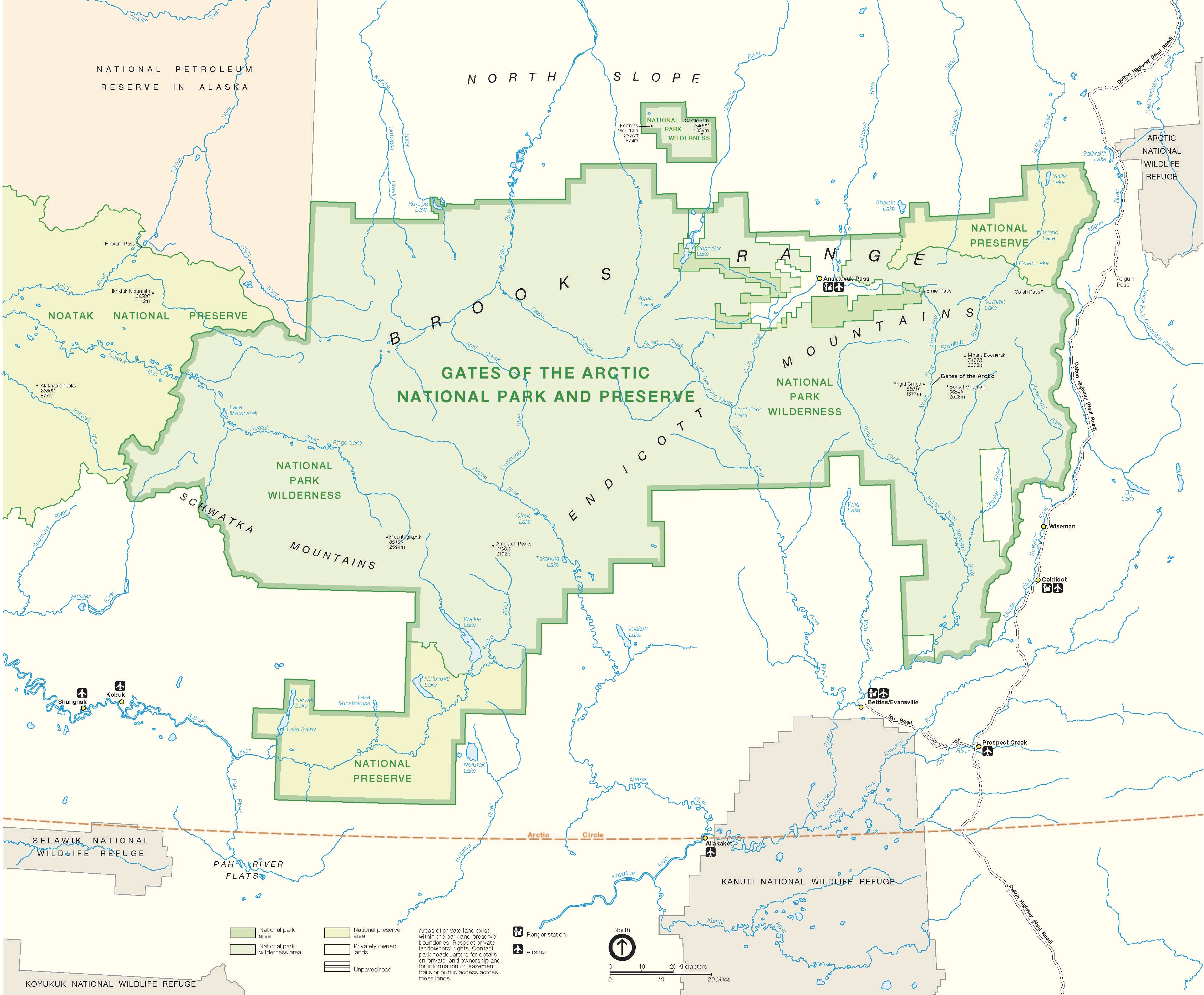
Gates of the Arctic detail map
 Unfortunately, there isn’t a good free map of Gates of the Arctic National Park and Preserve available from the National Park Service. If you want a map to actually show you details in the park, you’ll probably want to grab a National Geographic Trails Illustrated map. I wouldn’t count on it for solo multiday navigation or anything, but otherwise it does provide a great overview with labeled features and topographic lines.
Assorted Gates of the Arctic maps
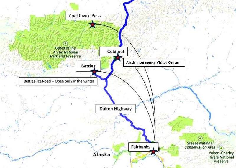 This is a Gates of the Arctic flight map, showing common routes into the park and surrounding region from Fairbanks. Since no roads enter the park, most access the park by air taxi and landing on lakes or tundra.
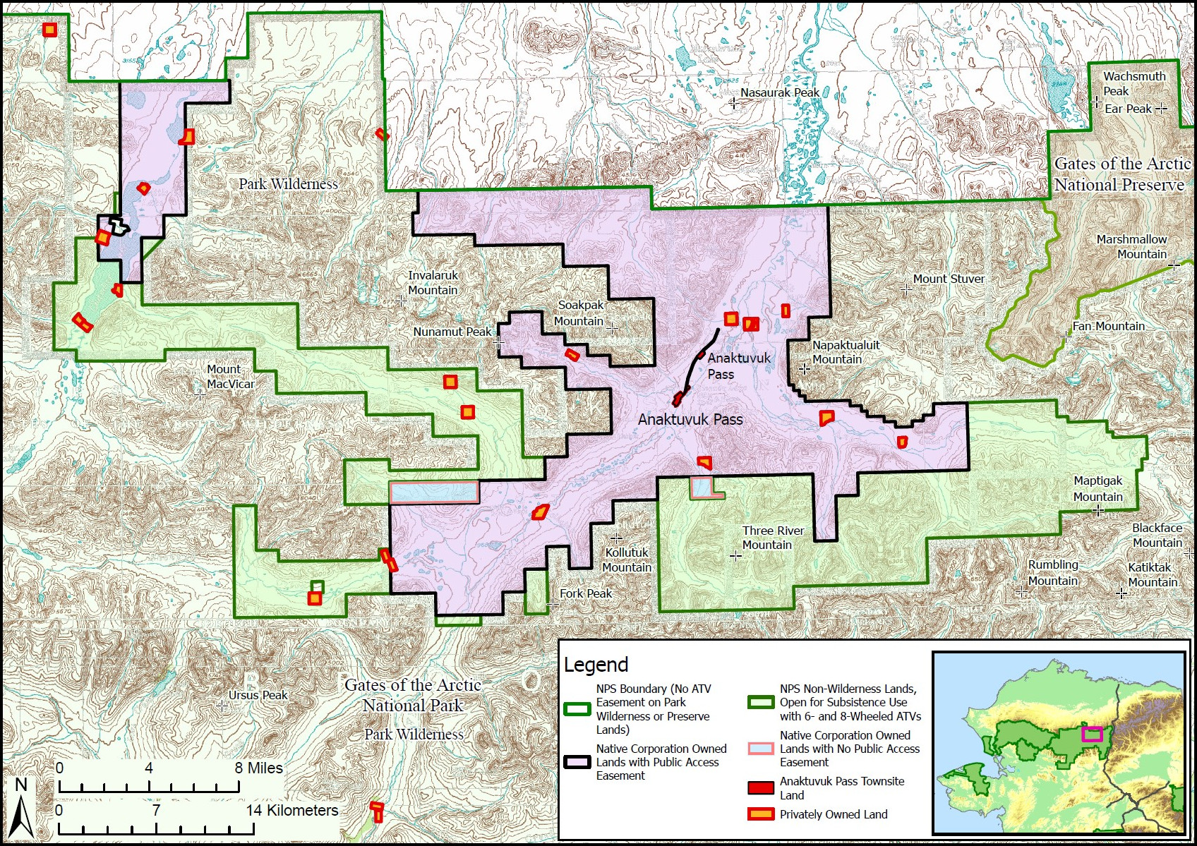 Here’s an Anaktuvuk Pass map. This village is located within the Gates of the Arctic boundaries and is accessible from Fairbanks by commercial air service. This map shows boundaries specifying land status.
 This Gates of the Arctic geologic map highlights the various rock types that make up this part of the Brooks Range, including the granite of the Arrigetch Peaks and surrounding metamorphic and sedimentary deposits.
Dalton Highway maps
Gates of the Arctic National Park and Preserve has no roads, but the Dalton Highway provides the nearest access as it parallels the eastern boundary on its way from Fairbanks to Deadhorse, near Prudhoe Bay. You can download the Bureau of Land Management’s Dalton Highway Visitor Guide PDF (updated in 2024) or view the maps below for more information.
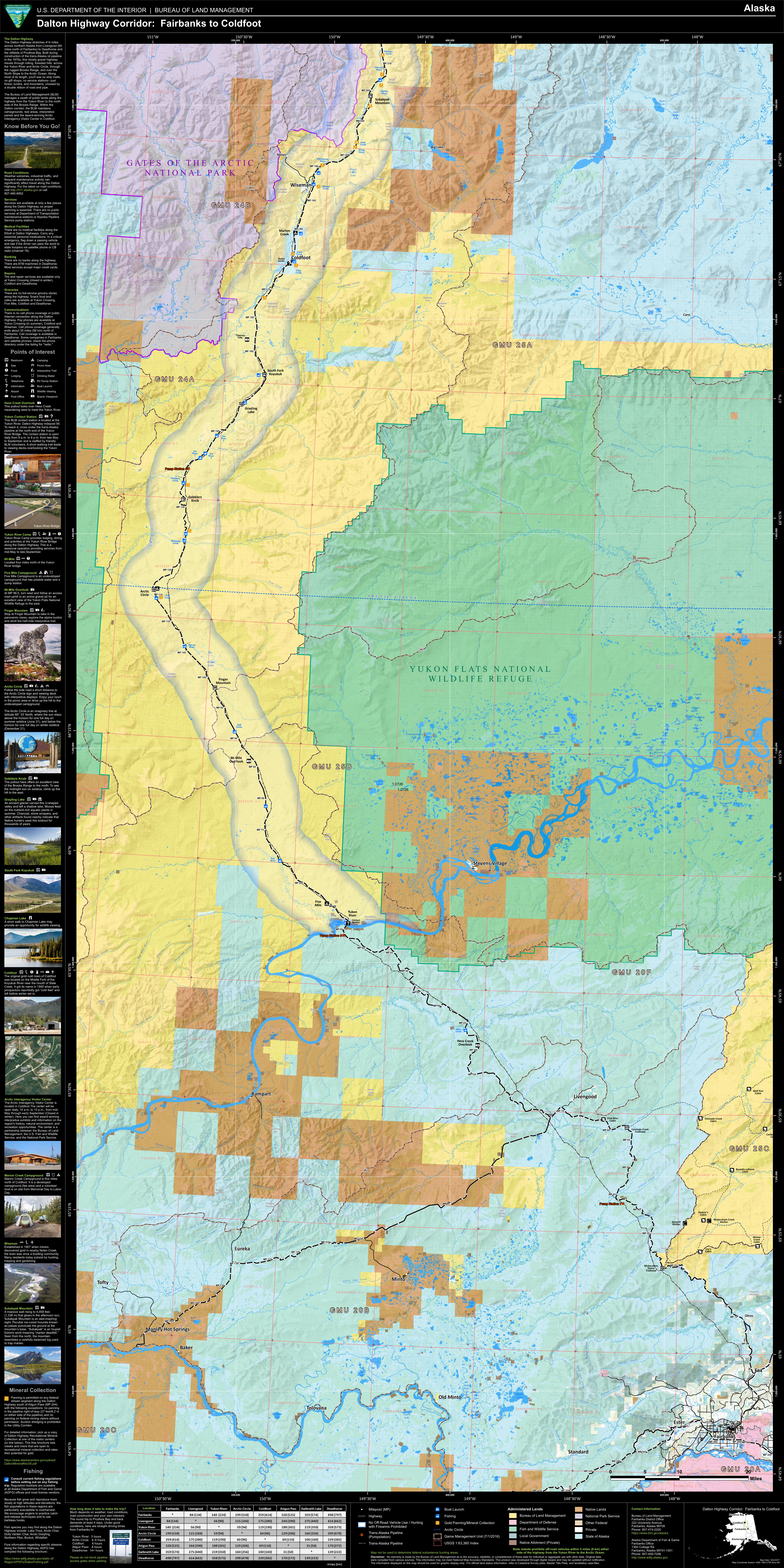
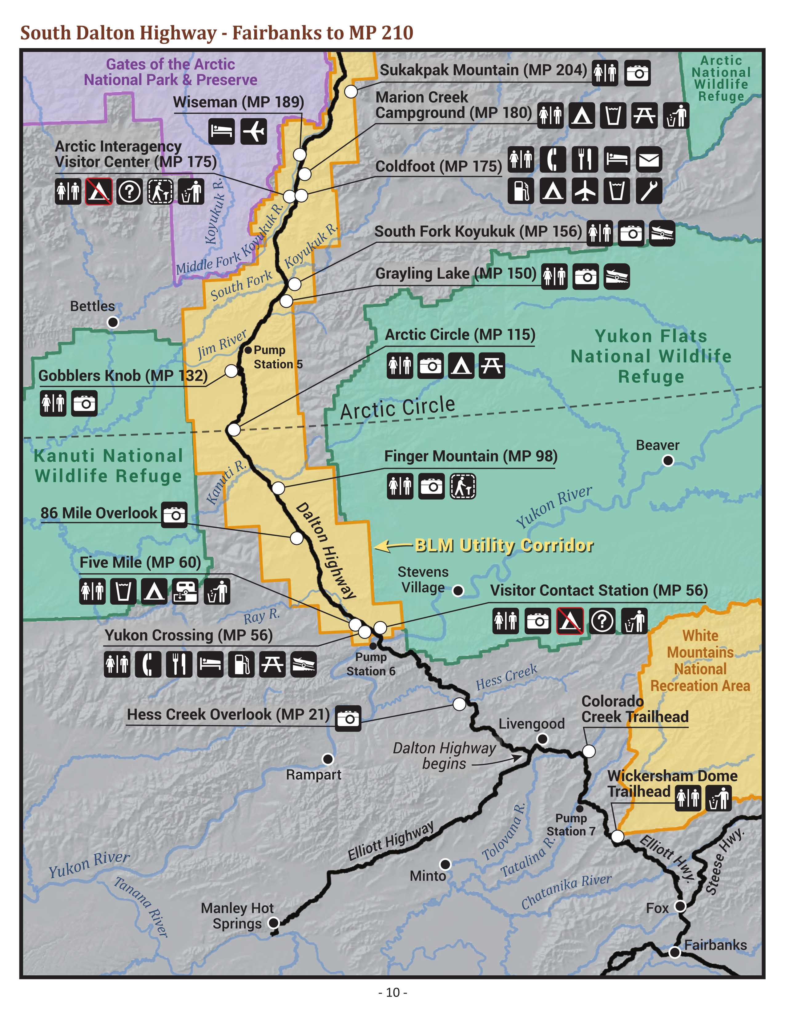 Here’s a Dalton Highway (south) map, cropped from the visitor guide above to show the road from where it begins north of Fairbanks to the Coldfoot/Wiseman area. A key for the icons is included on the map below.
 The Dalton Highway (north) map picks up where the map above leaves off, showing the rest of the route to Deadhorse as it travels in between Gates of the Arctic National Park and the Arctic National Wildlife Refuge.
 Here’s a much more detailed south Dalton Highway map, also published by the Bureau of Land Management. This very large map will take a bit longer to download and shows roads from Fairbanks to Coldfoot.
 This much more detailed north Dalton Highway map continues north from the map above, showing the highway over Atigun Pass as it makes the long descent to Deadhorse and Prudhoe Bay.
Regional Gates of the Arctic map
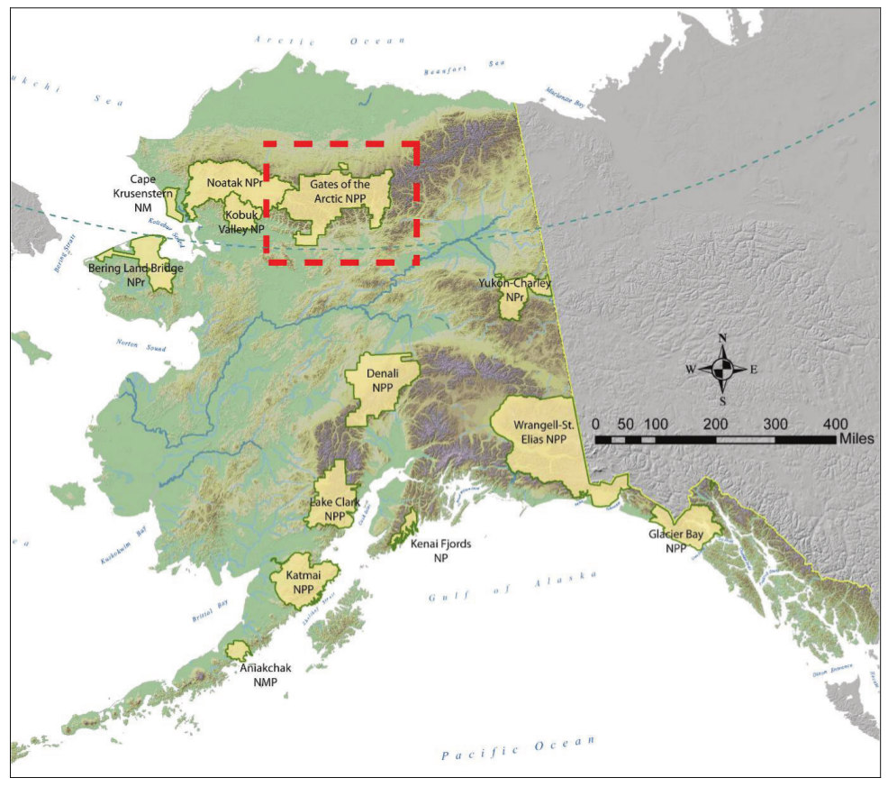 This regional Alaska map shows the location of Gates of the Arctic National Park compared to other national parks and preserves in Alaska. It maps elevation as well, showing Alaska’s mountain ranges.
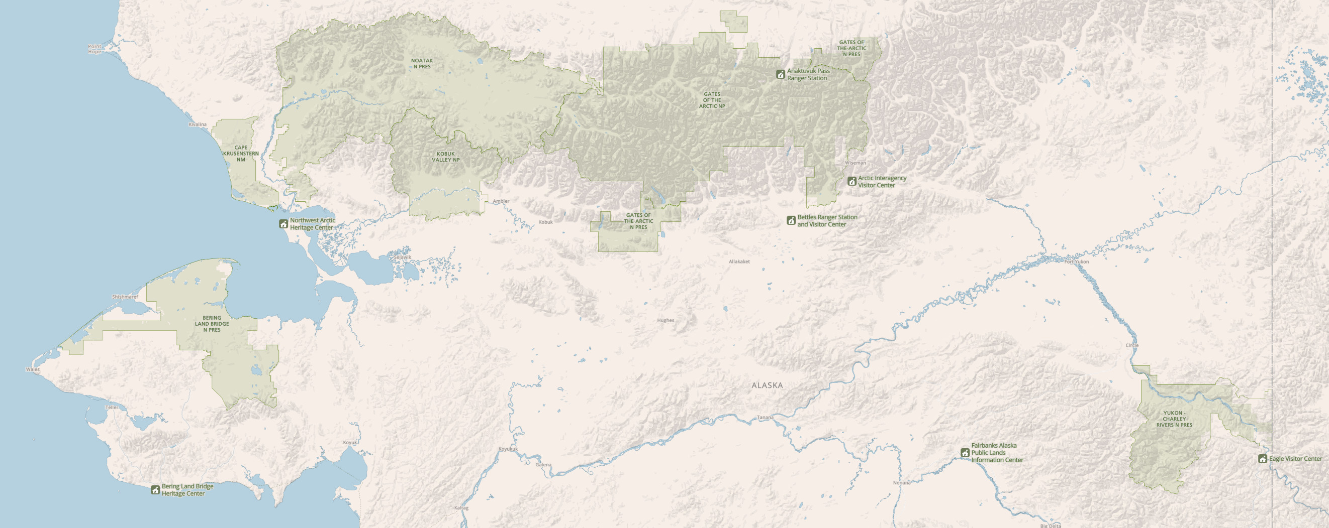 The northern Alaska map zooms in on Alaska national park lands located north of Fairbanks: Gates of the Arctic (naturally), Bering Land Bridge, Cape Krusenstern, Kobuk Valley, Noatak, and Yukon-Charley Rivers.
Gates of the Arctic river maps
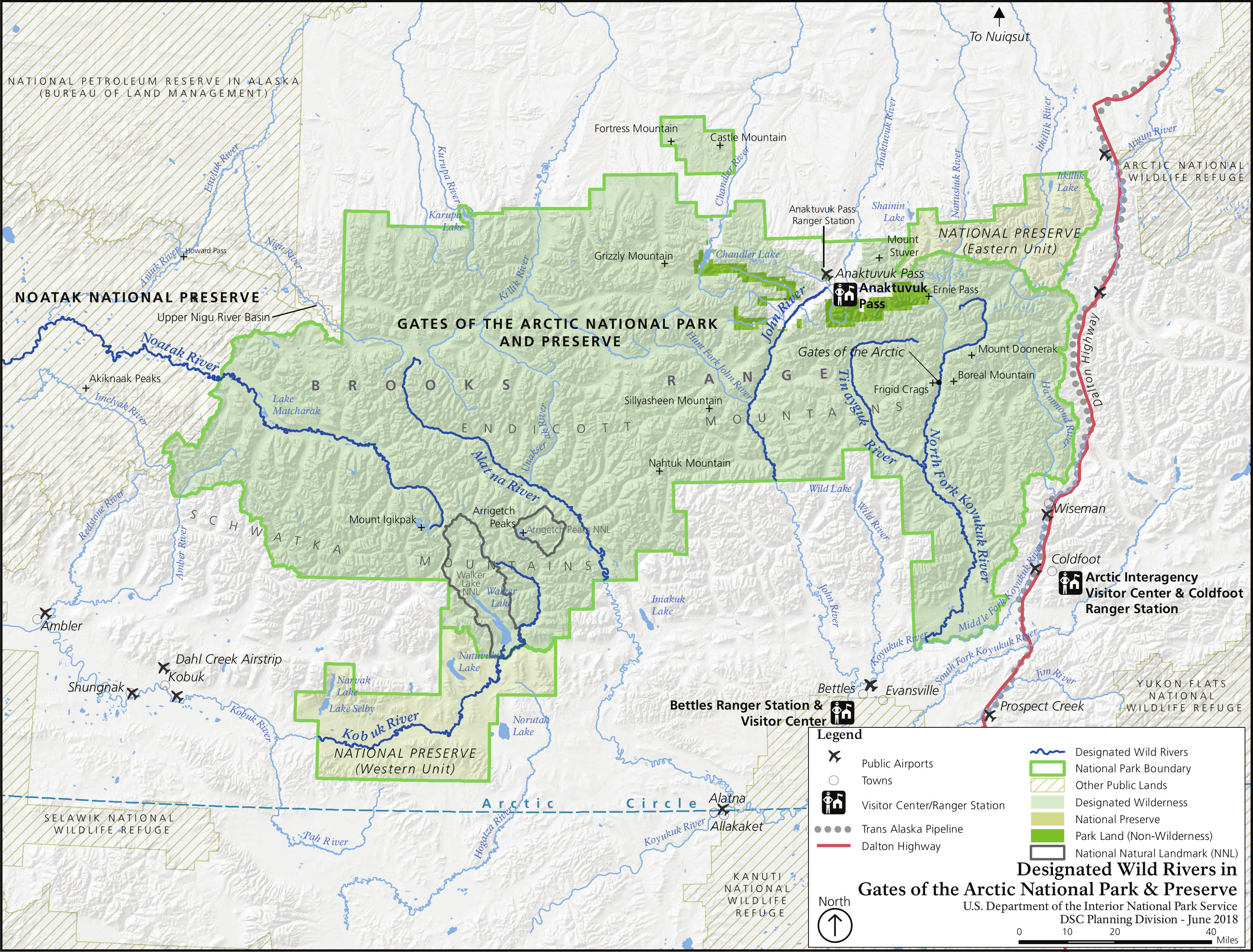 Here’s a Wild and Scenic Rivers map, showcasing the six designated Wild Rivers in Gates of the Arctic: the John River, Noatak River, Kobuk River, Alatna River, Tinayguk River, and the North Fork of the Koyukuk River.
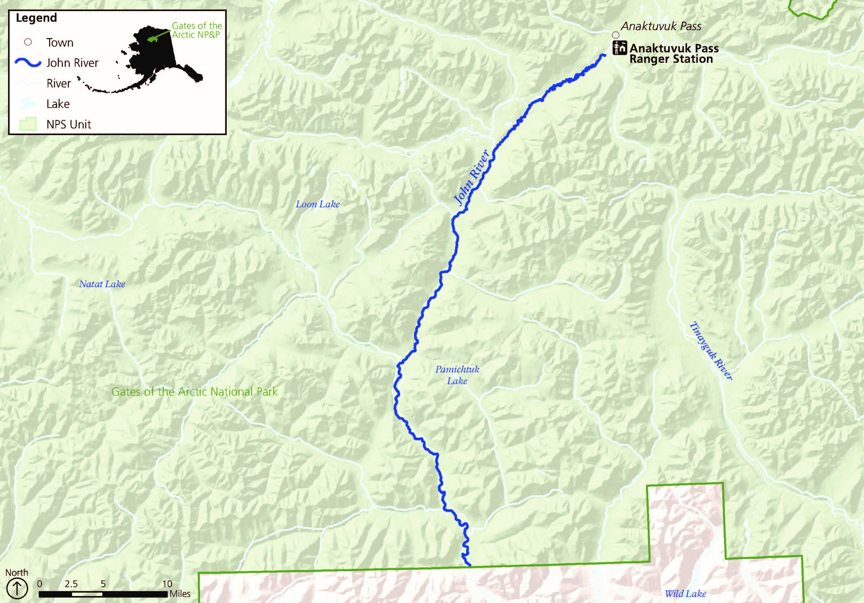 The John River map shows the section of this river that flows through Gates of the Arctic National Park and Preserve. This is the park’s closest river to Anaktuvuk Pass and flows south to the Koyukuk River.
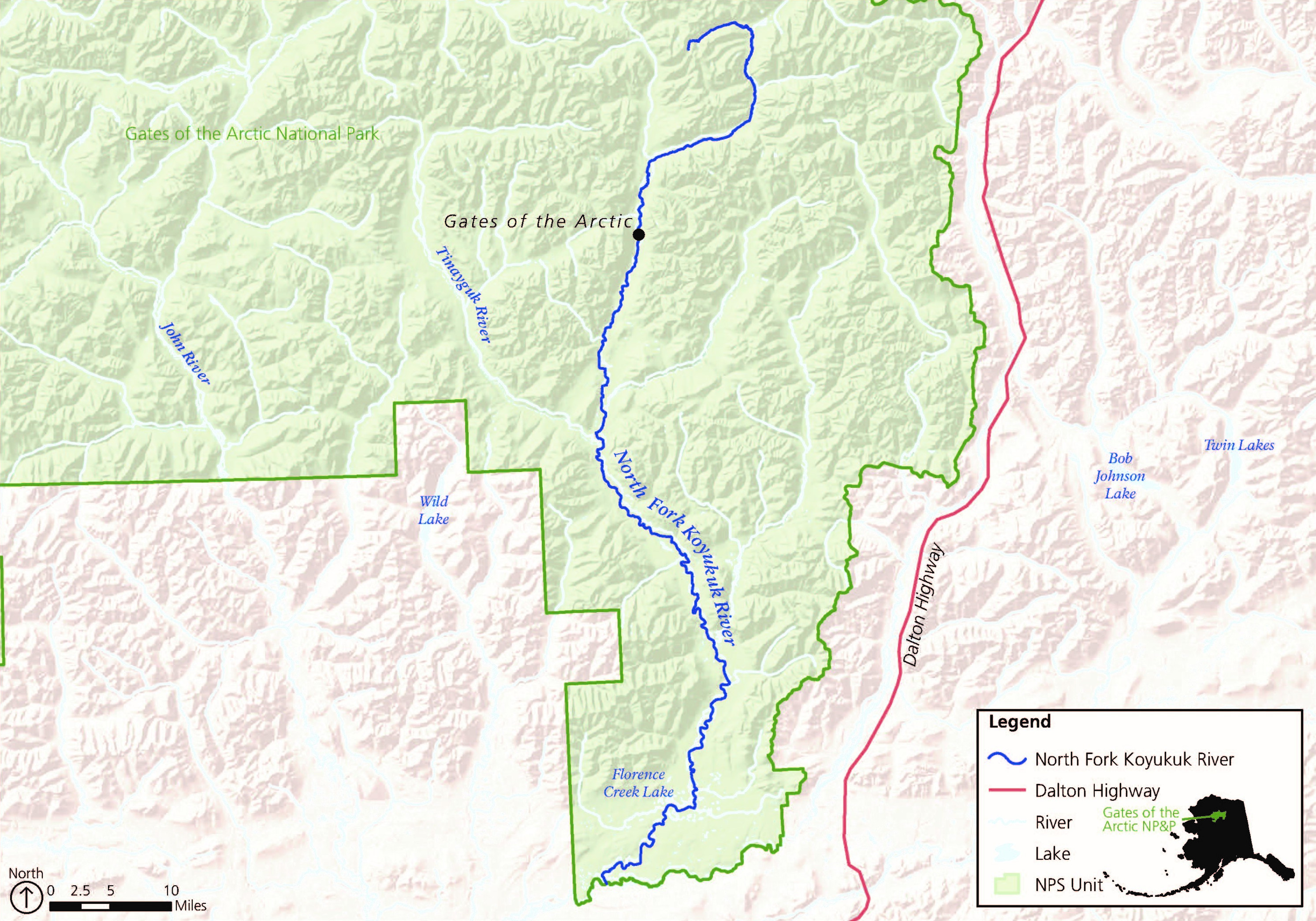 This Koyukuk River map shows the North Fork Koyukuk River, flowing 102 miles through the Endicott Mountains to the Middle Fork Koyukuk River. It runs through the iconic “Gates of the Arctic” that lends the park its name.
 This Tinayguk River map shows the section that flows 45 miles to its confluence with the North Fork Koyukuk River. This river is much more difficult to access than the North Fork, making for a truly wild experience.
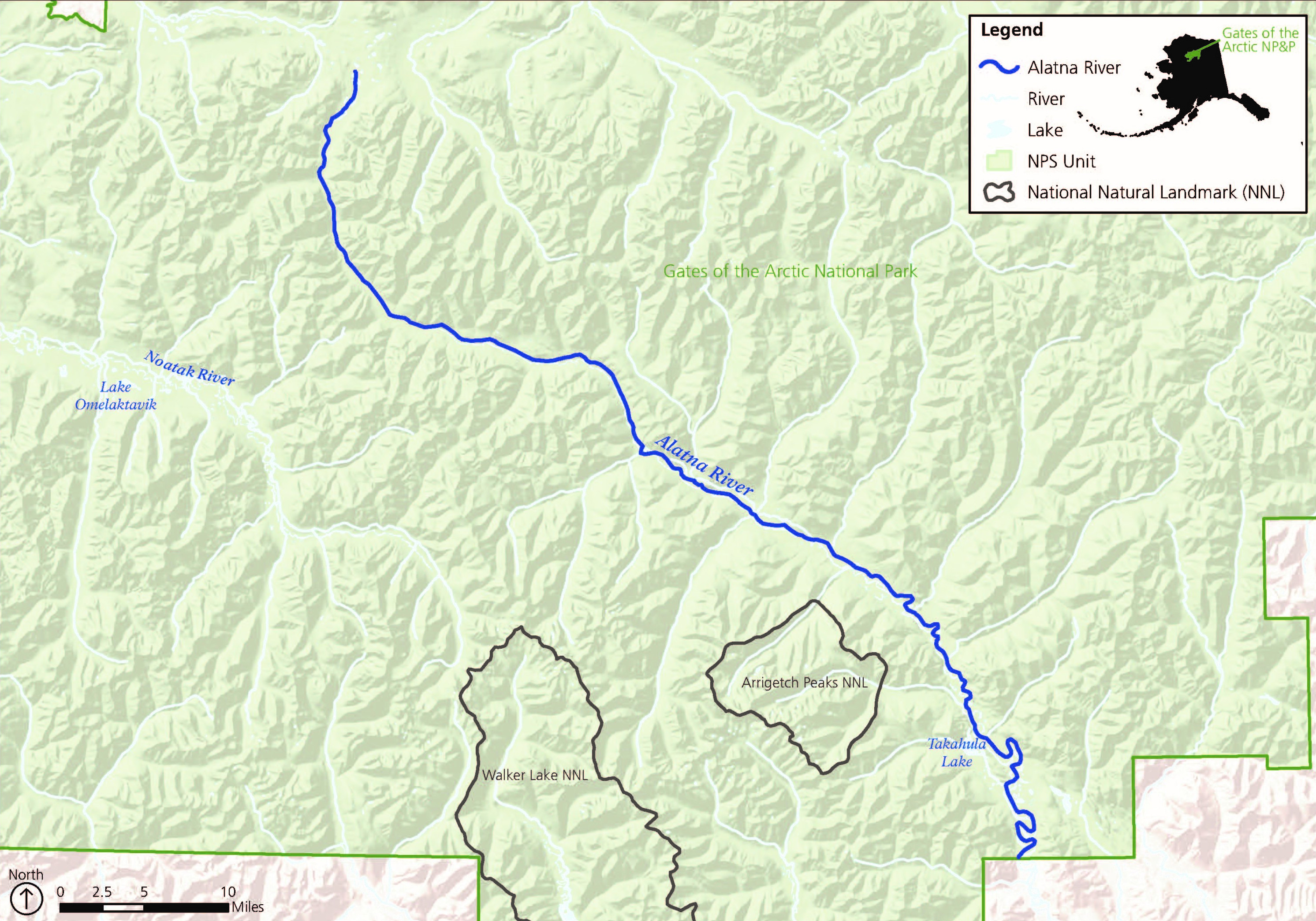 This is an Alatna River map that shows the southeast flow of this 145-mile segment through Gates of the Arctic, draining the central Brooks Range toward Alatna and the Koyukuk River.
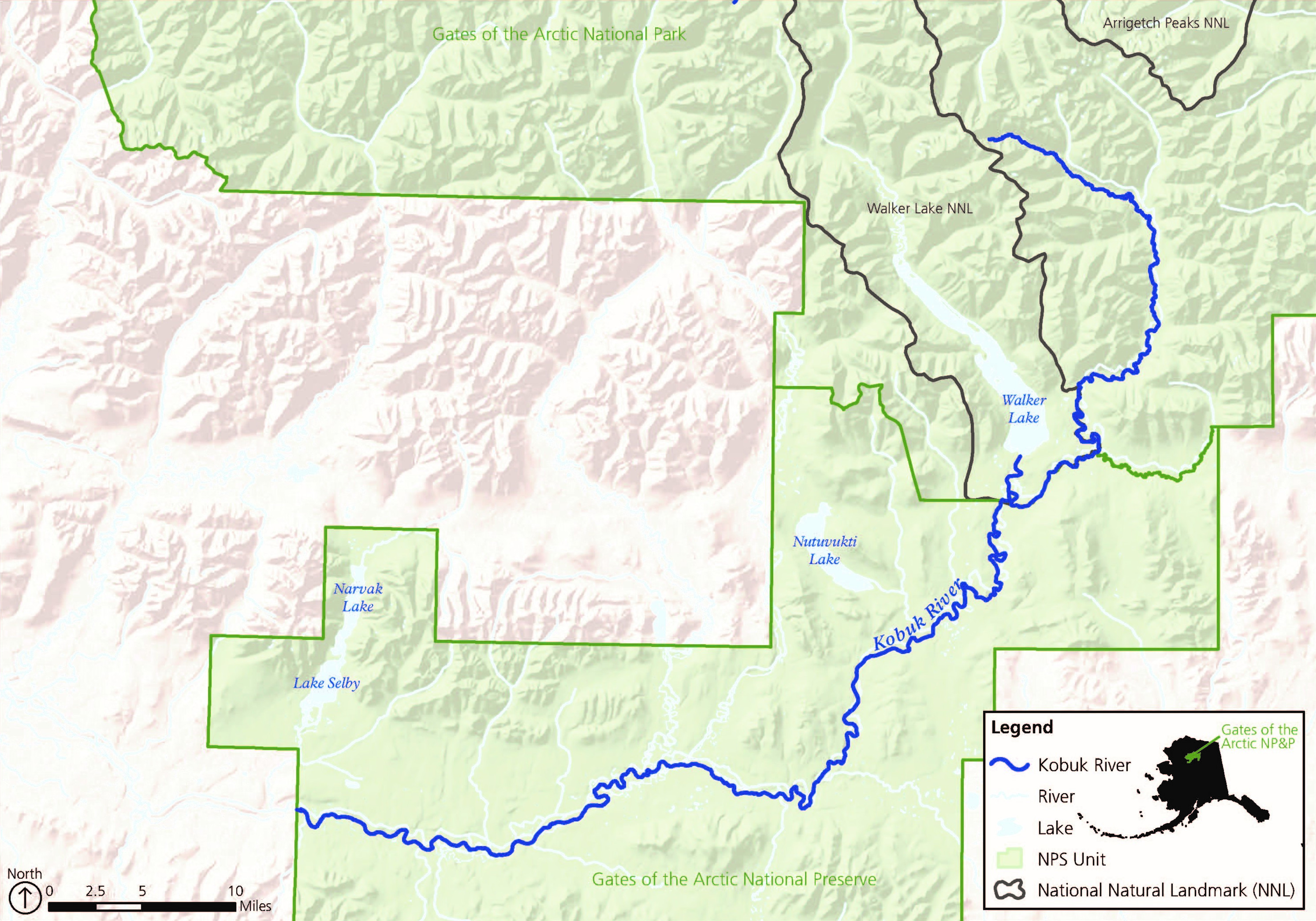 Here’s a Kobuk River map showing the Gates of the Arctic segment of this 380-mile Kobuk River that eventually flows through Kobuk Valley National Park to Kotzebue Sound.
Archived Gates of the Arctic maps
The National Park Service frequently releases new maps and updates old ones, and I do my best to include the newest ones on this page. As older maps get replaced, I move them down to this section. I never delete maps as I think it’s important for people to see how parks change over time, but keep in mind the ones down here have newer versions above.
 Here’s the old Gates of the Arctic map from the official mid-2010s brochure, showing the layout of the park and some of the surrounding Alaska region. Click the image to view a full size map or download the PDF.
 This is an early 2010s Gates of the Arctic map, similar to the one above but without all the shaded relief and topography. It’s easier to interpret at a quick glance but doesn’t communicate the park features as well.
…and more!
< Return to National Park Maps home
< Return to Park List
< Return to List by State