Lake Powell map from the park brochure
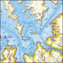
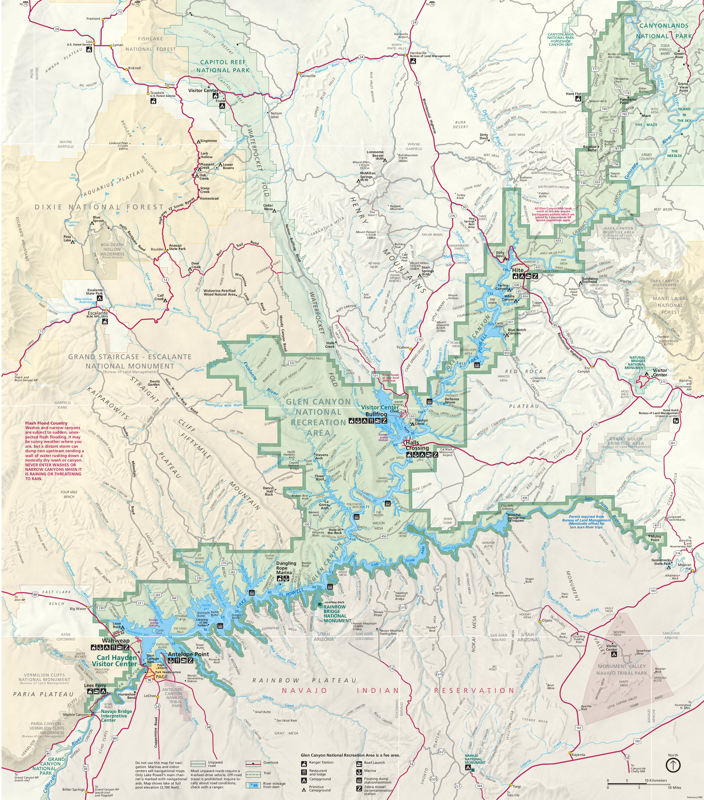
 Here’s the official National Park Service Lake Powell map. This map is identical to the one in the Glen Canyon National Recreation Area brochure. (Many Lake Powell visitors have no idea they’re in a national park unit.)
 This beautiful Colorado River watershed map highlights the full drainage basin of the Colorado River and points out Lake Powell’s central location on the Colorado Plateau.
Lake Powell detail maps
 The maps on this page work well for very general trip planning, but they’re not going to help you for navigating on Lake Powell. For that, you’d want something like this waterproof National Geographic Trails Illustrated map, which shows Lake Powell in extra detail as well as the surrounding topography and hiking trails in Glen Canyon National Recreation Area and Rainbow Bridge National Monument.
Here are some maps of the various developed areas around Lake Powell (within Glen Canyon National Recreation Area), arranged roughly south to north. Please note that the availability of services is greatly dependent on Lake Powell water levels, so exact layouts may be different during your visit.
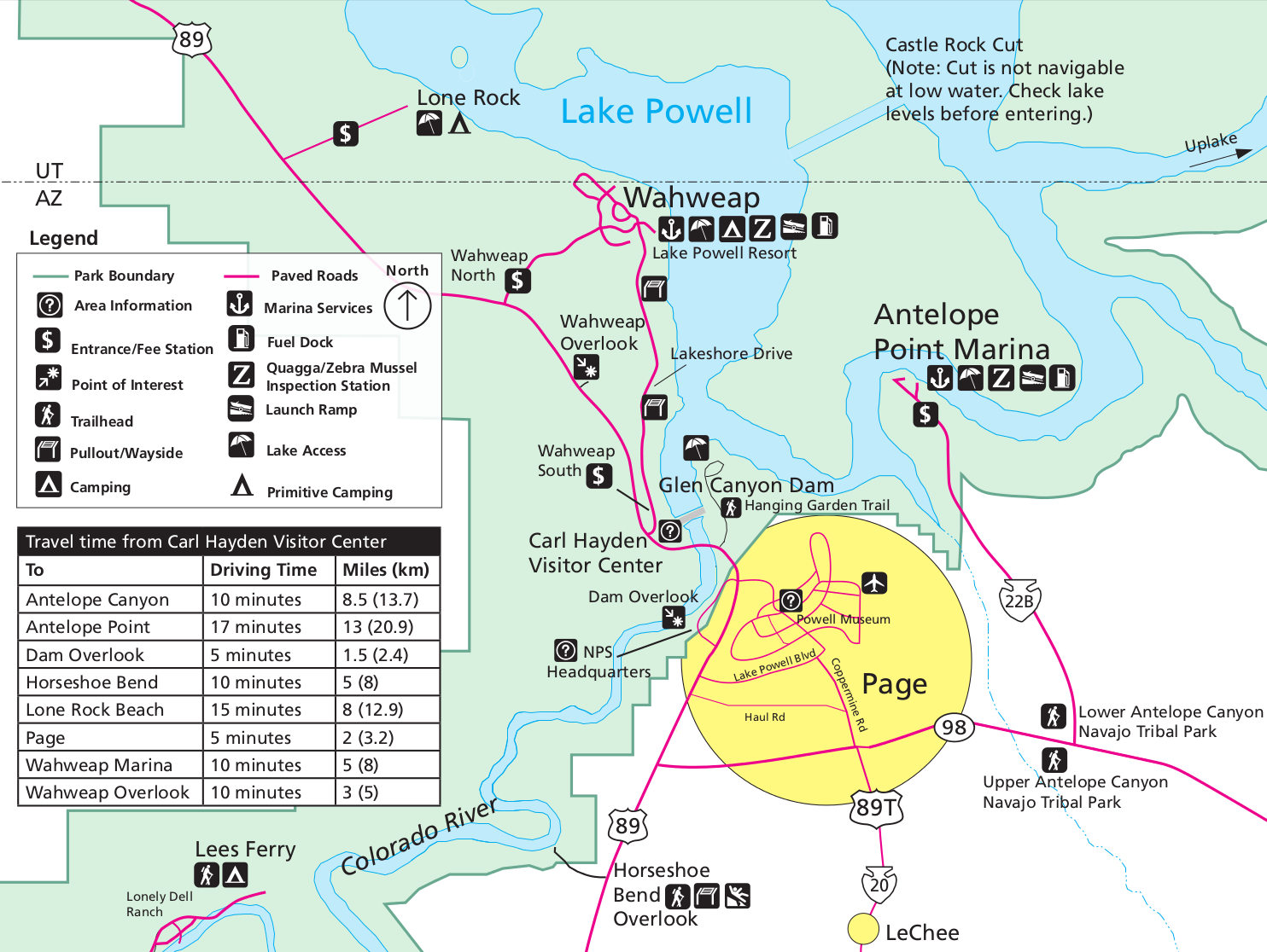 This overview map of Page and Wahweap shows the busy marinas and tourist areas near the Glen Canyon Dam and Carl Hayden Visitor Center around the town of Page, AZ. This is the heartbeat of the park.
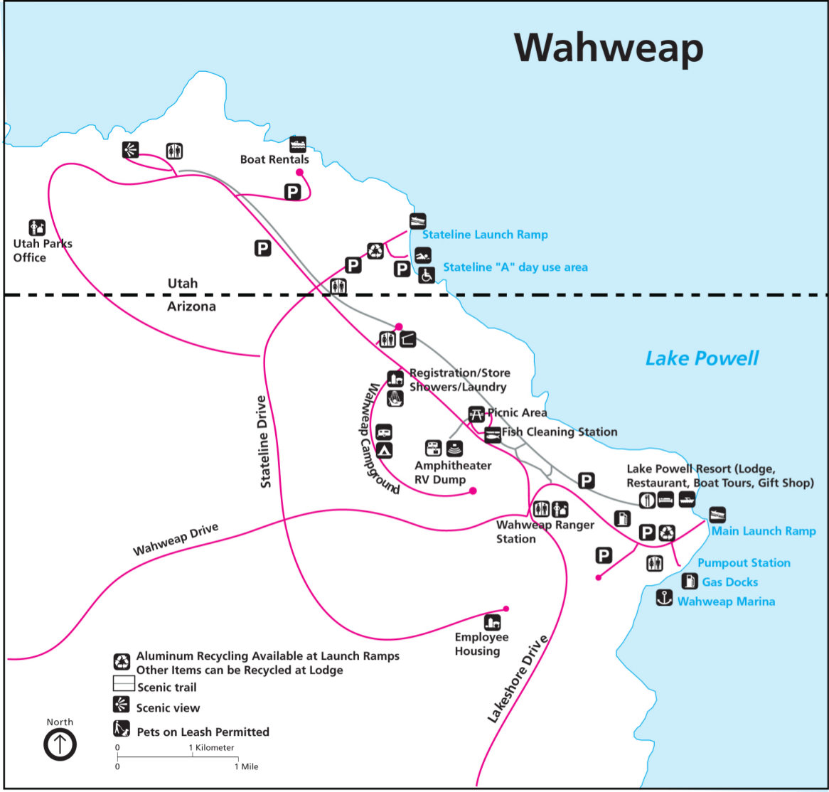 Here’s a detailed Wahweap map, which is a busy location on Lake Powell and features a resort, campground, picnic area, docks, and multiple launch ramps on the Utah/Arizona border.
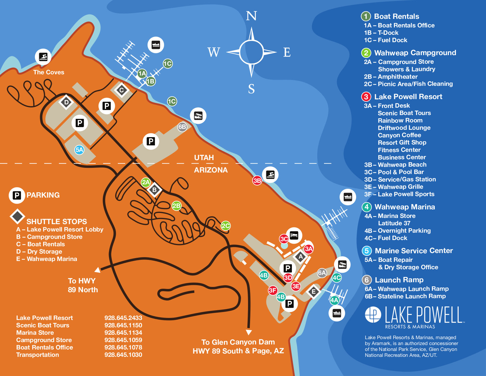 Alternatively, this color Wahweap map looks a bit nicer to view on screen, although it’s going to use more ink if you print it. It also shows the layout of the marina vicinity in more detail than the map above.
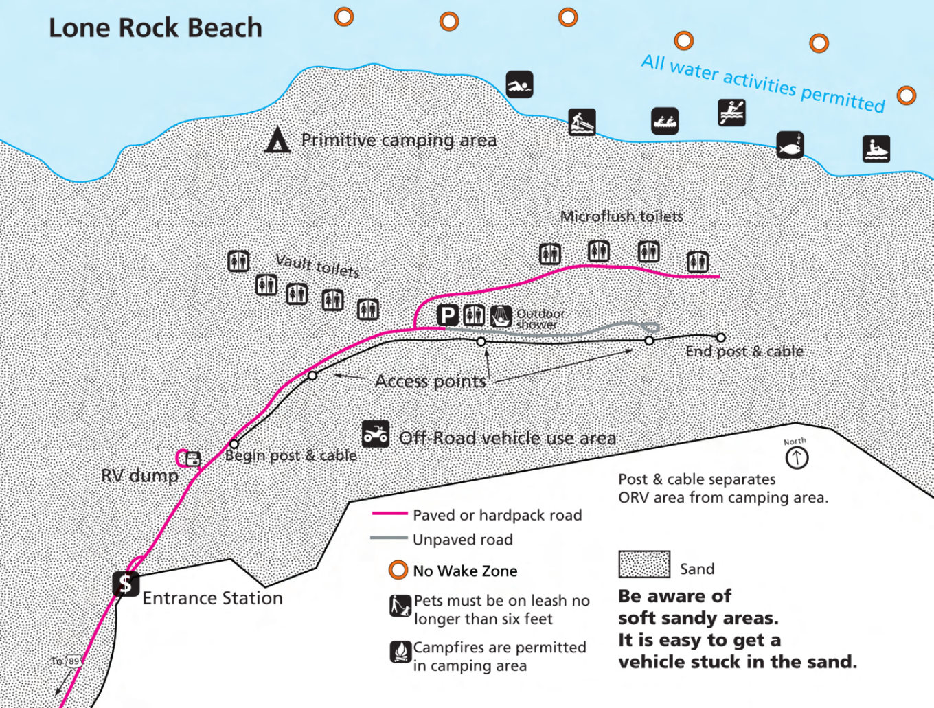 Here’s a Lone Rock Beach map, which is a primitive tent-only campground northwest of the busy Wahweap area. This map includes the showers, toilets, and camping area.
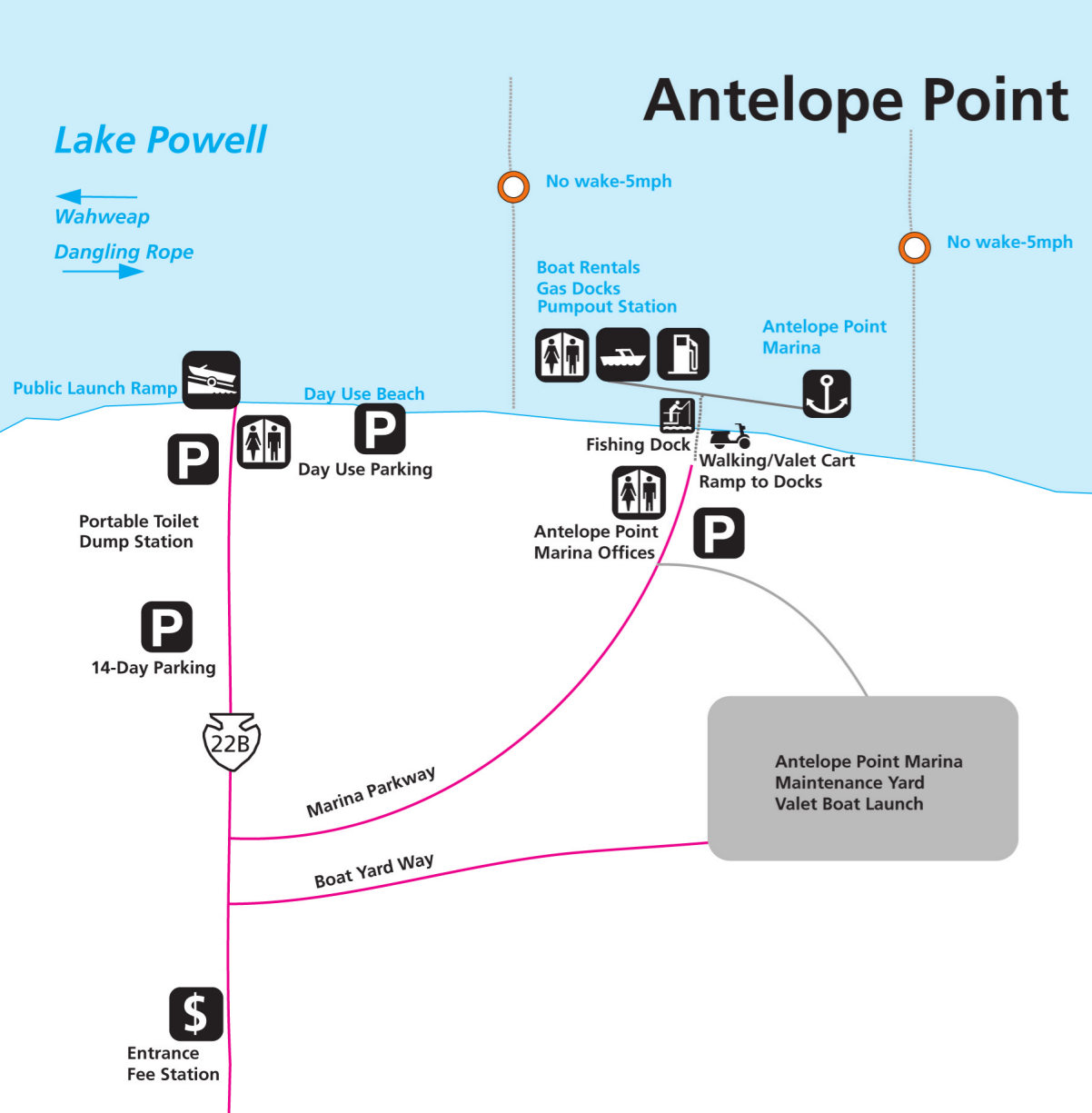 The Antelope Point map includes the parking lots and launch ramps at this marina located a bit northeast of the town of Page. It also labels some lake restrictions, such as no-wake zones.
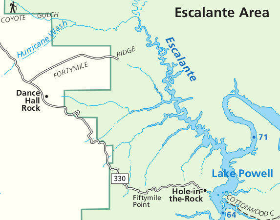 This is an Escalante map, which shows the road coming into the park from the west toward Hole-in-the-Rock and Escalante River access points. This is a very wild and remote part of Utah here.
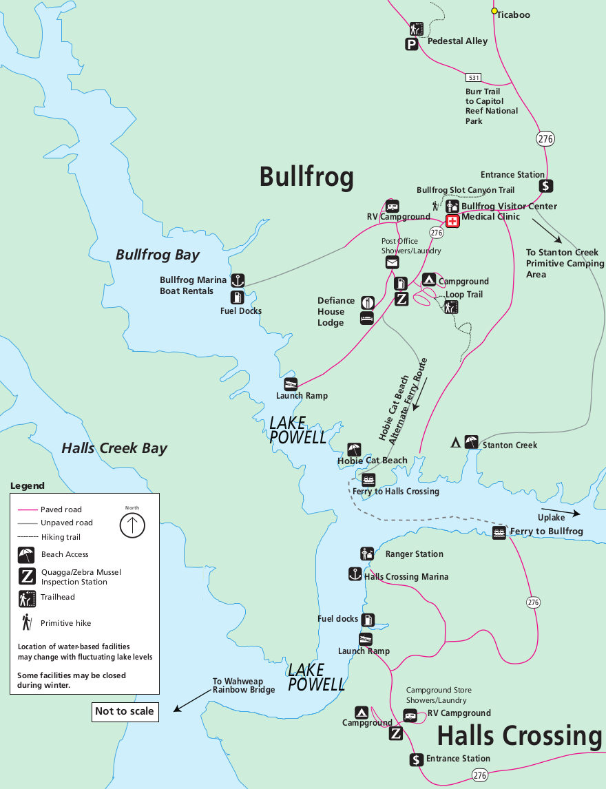 Here’s a Bullfrog and Halls Crossing map, showing an overview of these two hubs across Lake Powell from each other. There’s a ferry route that may be operating, though it often doesn’t run due to low water levels.
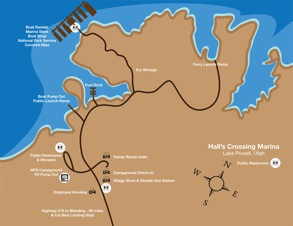 This is a Halls Crossing map, featuring points of interest such as the campground, boat ramps, ferry dock, stores, boat rentals, showers, restrooms, gas station, and more.
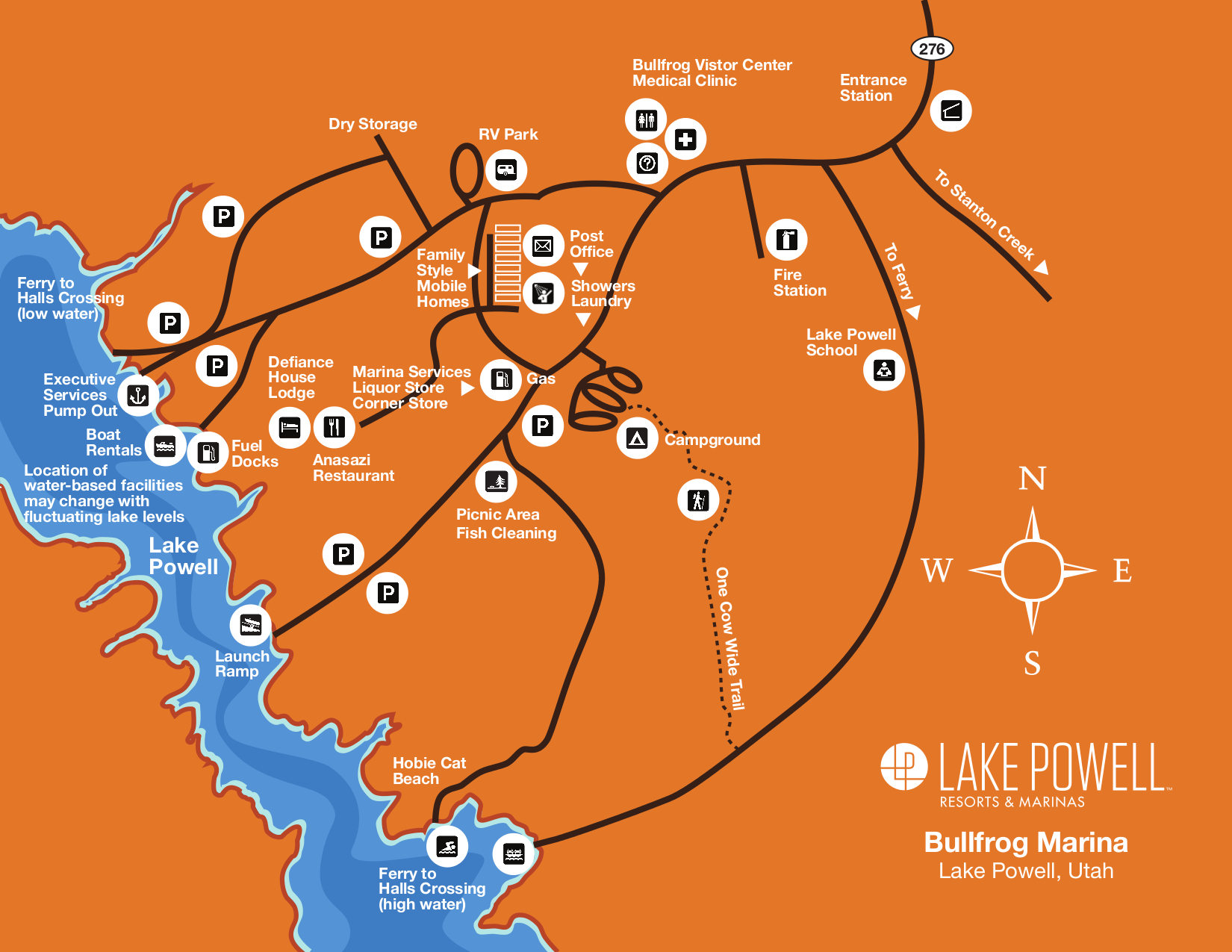 This Bullfrog Marina map zooms in to show this major mid-lake location in great detail—stores, rentals, ferry dock, campground, picnic area, visitor center, and so on.
Lake Powell lodging map
 Almost without exception, anyone who stays overnight when visiting Lake Powell is staying in Page, AZ, which is the only real town near Glen Canyon and the reservoir. (Or you’re staying on a houseboat!) To the right you can open an Expedia interactive lodging map of Page to compare the locations of your choices. You may also want to browse the top-rated Page lodging on Expedia to compare prices, reviews, and photos.
Assorted Lake Powell maps
 This Burr Trail map shows this incredibly scenic and rugged road that traverses across the desert through Capitol Reef National Park to the town of Boulder, UT. Here you can download the NPS Burr Trail Guide in PDF format.
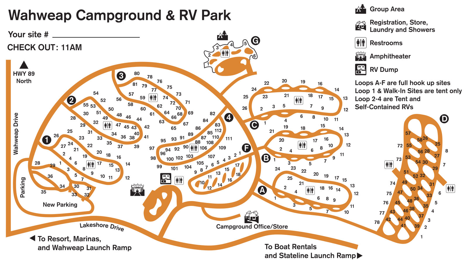 Here’s a Wahweap Campground map, showing the basic layout of the tent sites and RV loops as well as the restrooms, showers, laundry, amphitheater, and campground store.
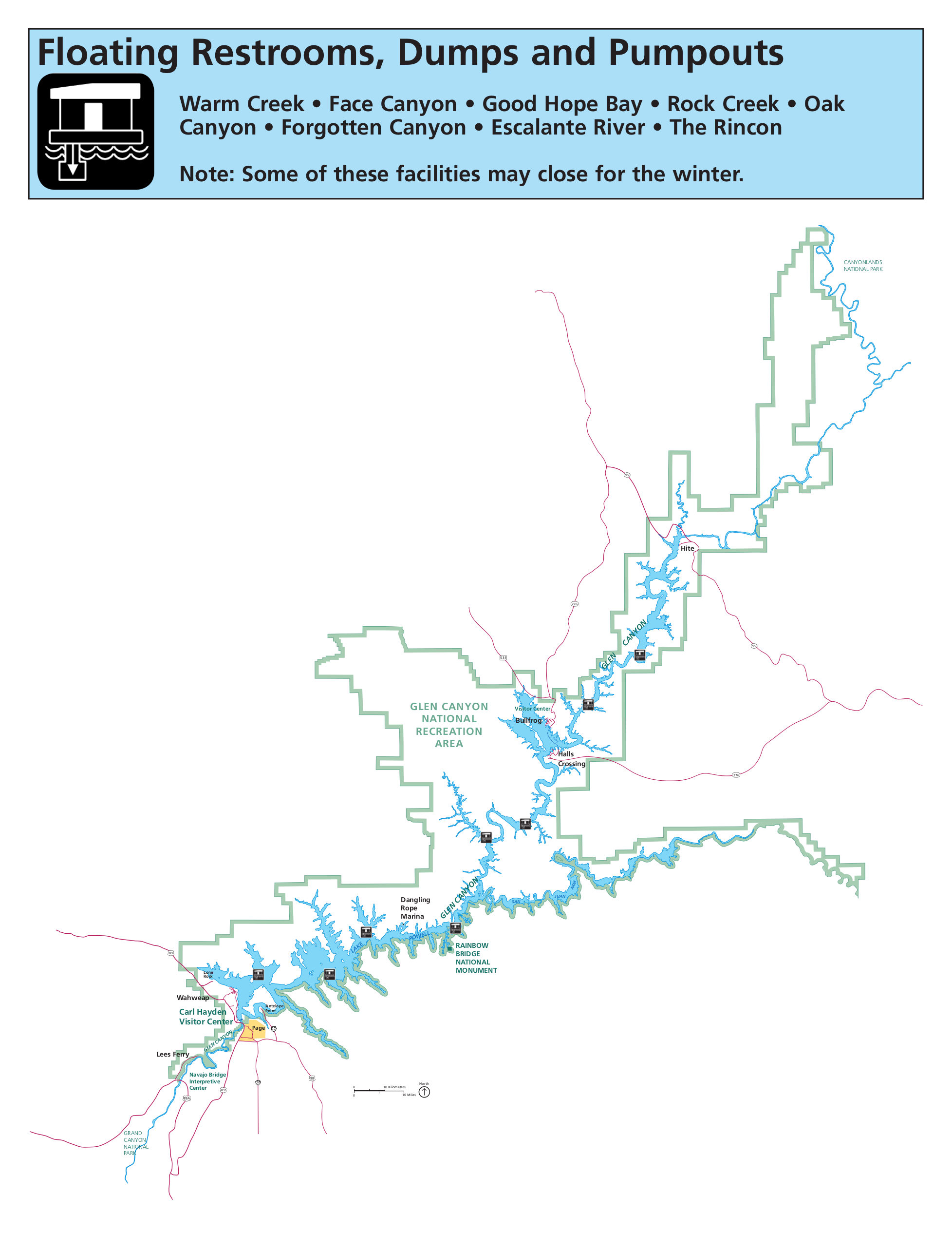 The Lake Powell restrooms map has a funny name but is really quite helpful to locate the floating restrooms and waste dumps while you’re out and about on the reservoir.
Rainbow Bridge maps
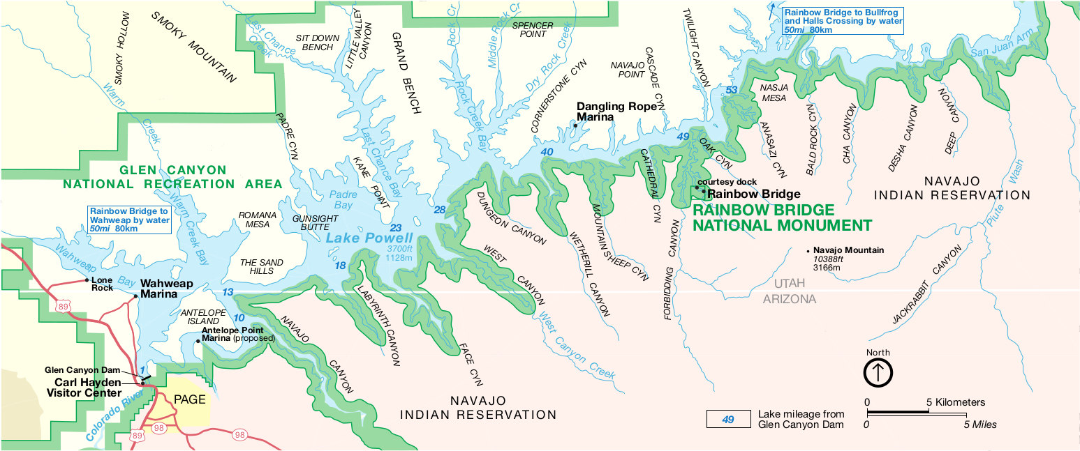 This is the official National Park Service Rainbow Bridge map, showing the monument’s location along Lake Powell and Glen Canyon. Click the image to view a full size map or download the PDF.
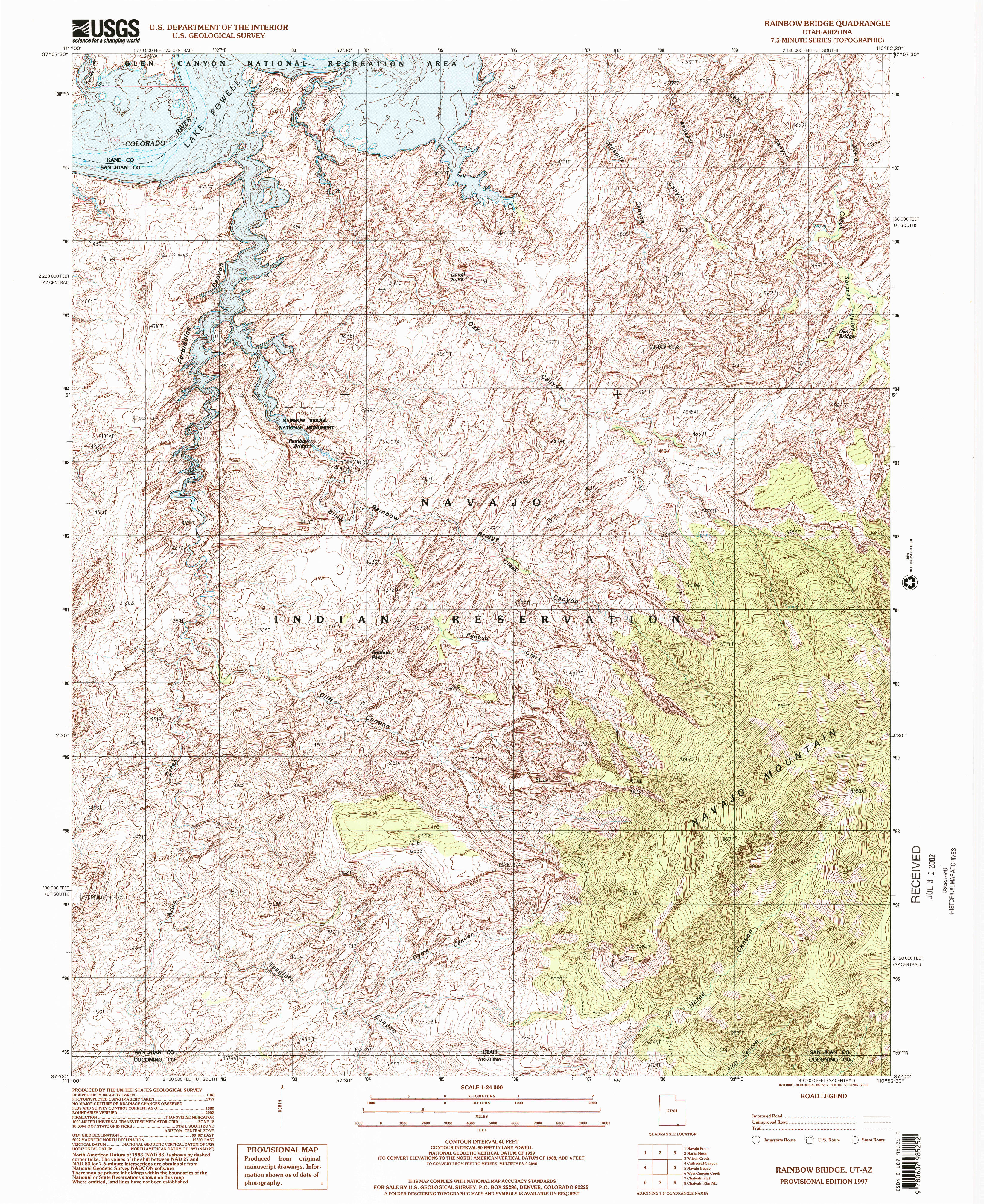 Here’s a Rainbow Bridge topo map, which zooms in to show the elevation contours. Note that current Lake Powell water levels may look quite different from what’s shown on this map.
Lees Ferry maps
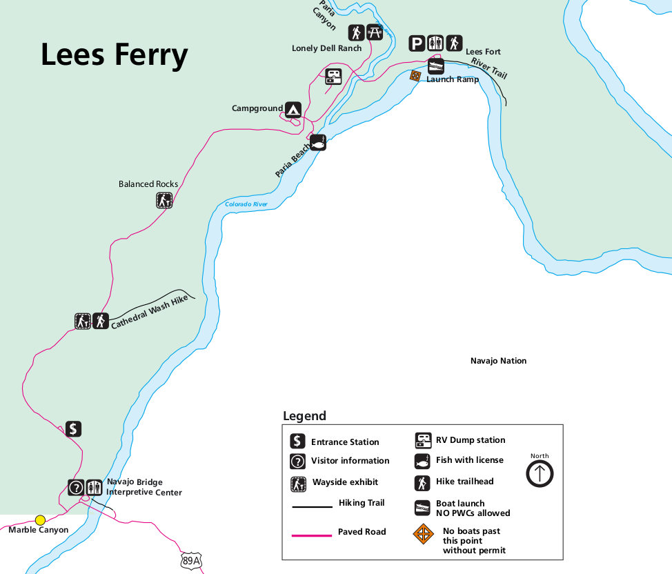 Here’s a Lees Ferry map, which is a bit downstream of the Glen Canyon Dam and is the starting point for many Grand Canyon rafting trips. This shows the campground, launch point, and trails.
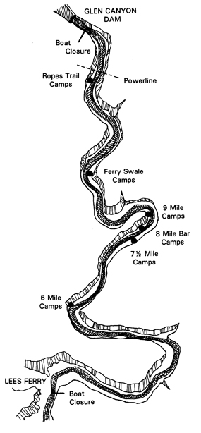 This is a Lees Ferry area camping map, showing the Colorado River campsites accessible by river travelers, located between the Glen Canyon Dam and Lees Ferry.
Lake Powell geologic maps
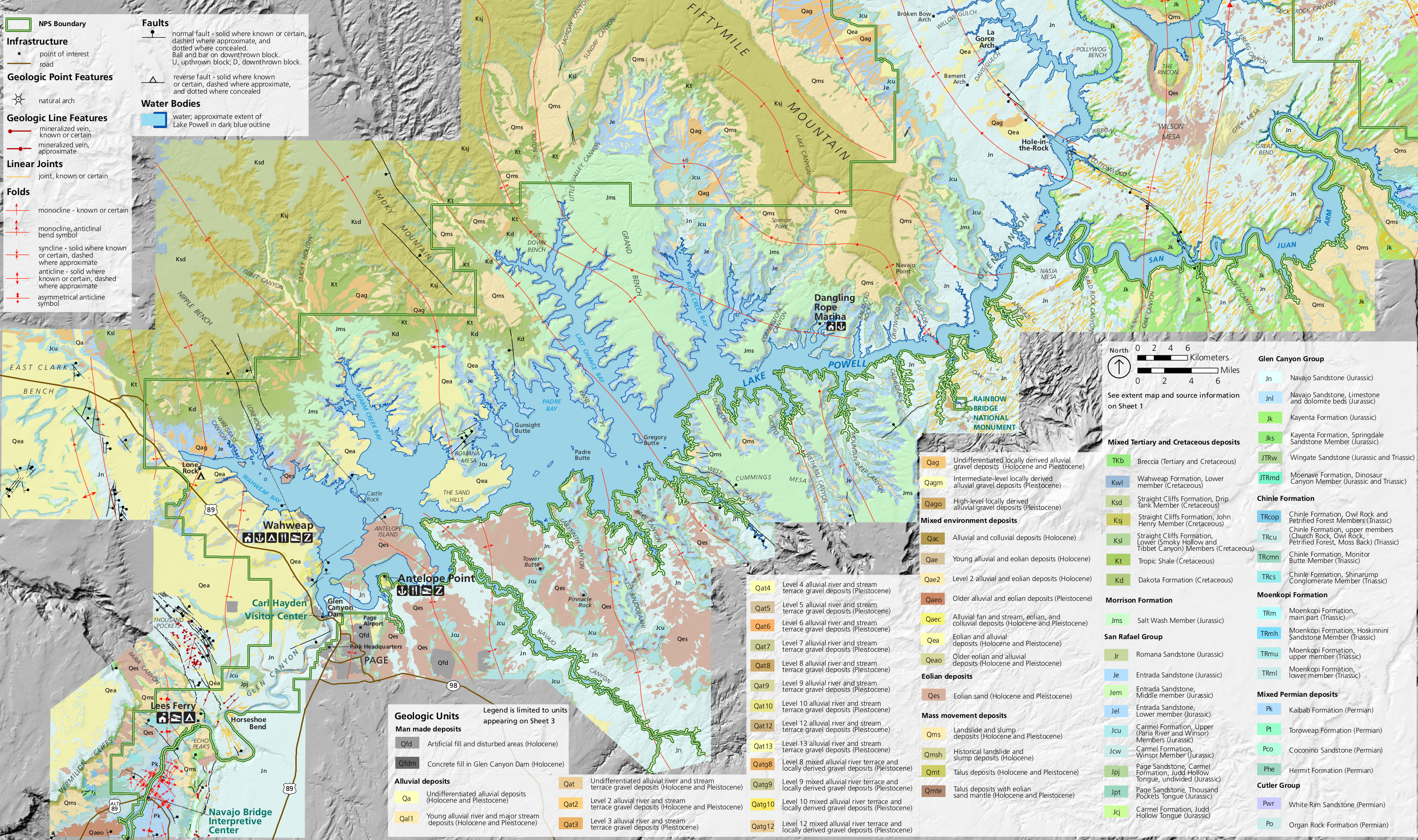 This is the south Lake Powell geologic map, focusing on the area around Glen Canyon Dam and the southernmost marinas on Lake Powell like Wahweap and Antelope Point.
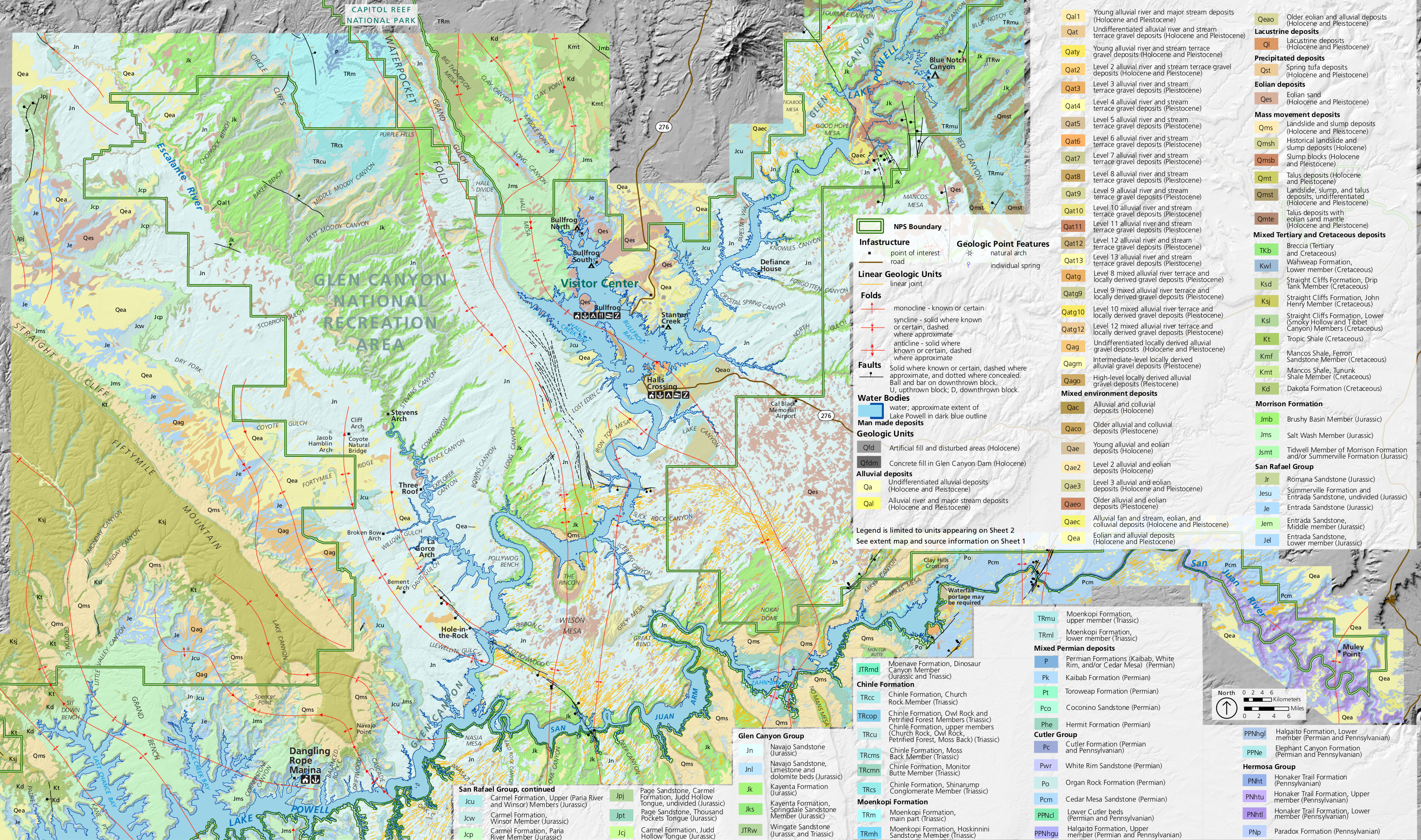 Here’s a central geologic map of Lake Powell, showing the central part of the lake, including Halls Crossing and Dangling Rope marinas and the San Juan Arm near the center of the recreation area.
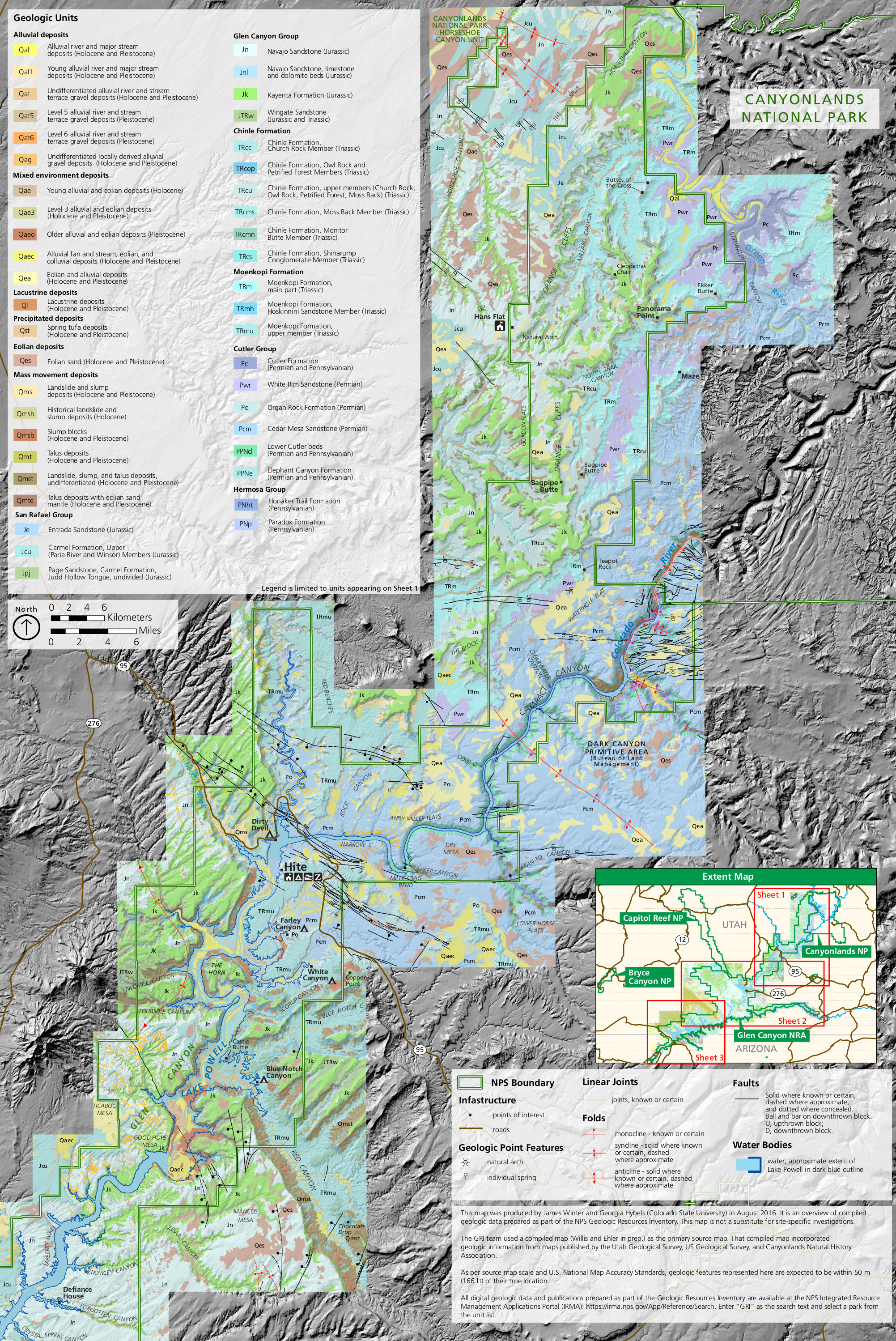 This north Lake Powell geologic map shows Hite and the rest of Glen Canyon National Recreation area to the north, including Cataract Canyon and the Colorado River.
Archived Lake Powell maps
 This was the official Lake Powell map for Glen Canyon National Recreation Area from 2018. It had more accurate, lower water levels than the previous editions of the map, but even this map seems optimistic now.
 Here’s an old Lake Powell map from the official brochure, dating from the mid-2010s. Looking at this map might make one nostalgic for higher lake levels. Click the image to view a full size map or download the PDF.
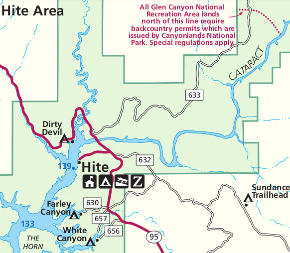 Here’s an old Hite map, showing the only place a bridge crosses Lake Powell in the entirety of Glen Canyon National Recreation Area. Lake Powell no longer reaches Hite due to a lack of water.
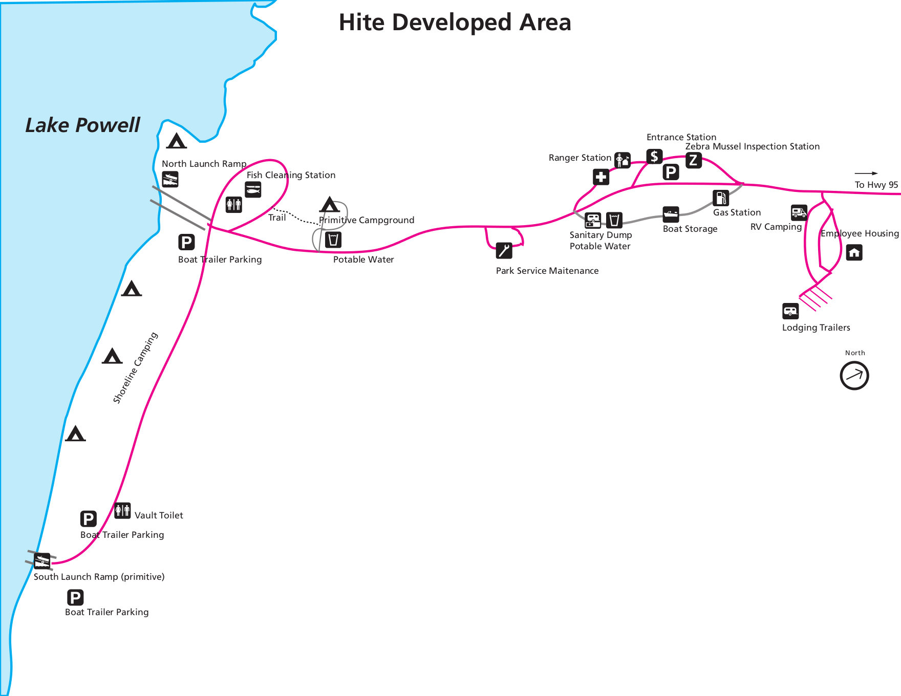 This former map of Hite focused on the developed facilities, including the visitor center, shoreline camping, campground, and launch ramps. This is all closed due to low water levels and it’s uncertain if it’ll ever return.
…and more!
< Return to National Park Maps home
< Return to Park List
< Return to List by State