Boston Harbor map from the park brochures
 Here is the official Boston Harbor Islands map from the park brochure, showing the lighthouses, docks, and visitor centers on the various islands in Boston Harbor that make up the park.
Boston Harbor Islands topo map
 If you want one single map to cover the entire park and to have enough detail for all your hiking, camping, and navigation, you should go with the National Geographic Trails Illustrated map. This is consistently the best map series for visiting national parks, especially for those who plan to get out of the car. And at a park like Boston Harbor, yep, you’ll be leaving the car! This single map is one-size-fits-all and will have everything you need.
Boston Harbor Island maps
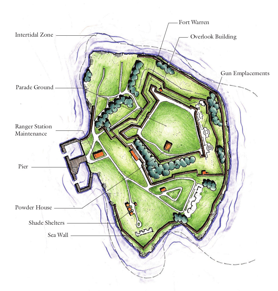 This is a Georges Island map, showing details of Fort Warren and the surrounding facilities and landscape such as the pier, intertidal zone, sea walls, shade shelters, and so on.
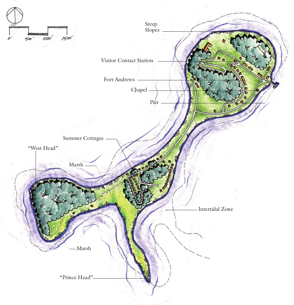 Here’s the Peddocks Island map, which has Fort Andrews, the visitor contact station, chapel, marsh, and the summer cottages strewn about this narrow island.
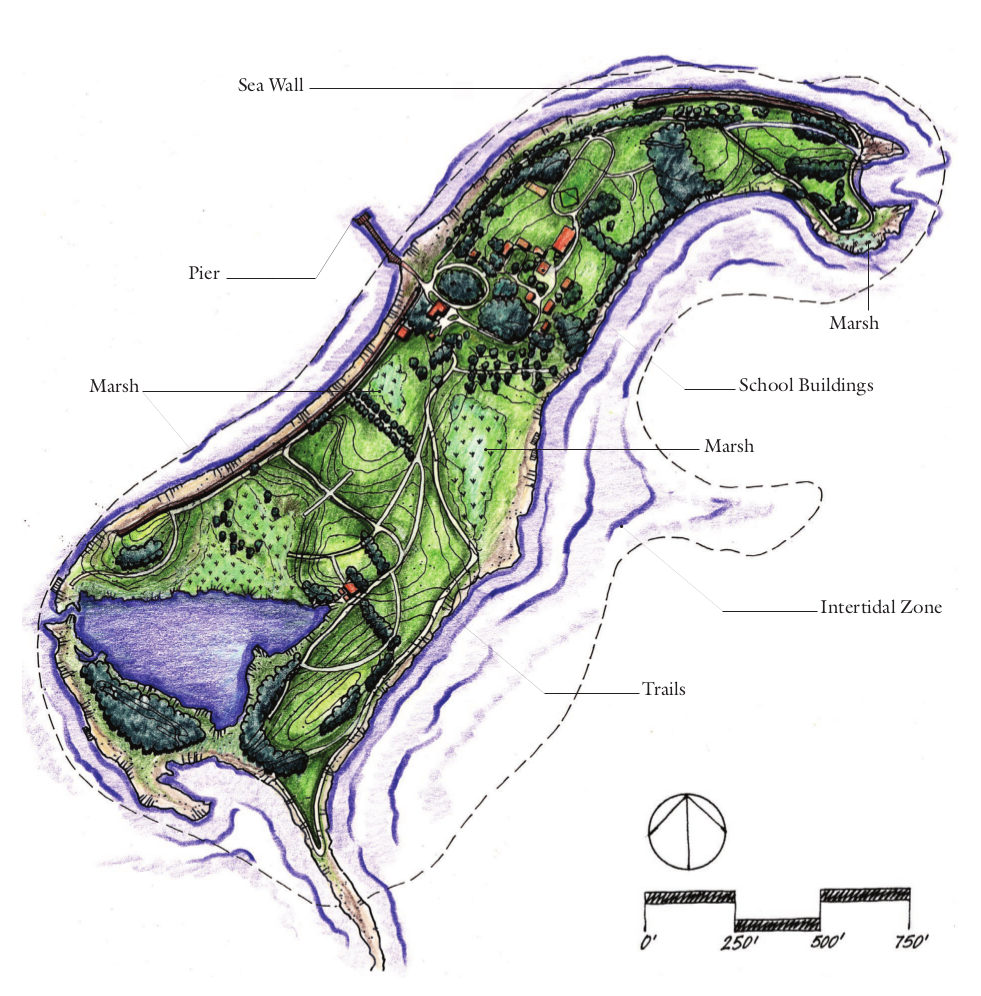 This Thompson Island map shows the Outward Bound Education Center along with the trails, vegetation, and ecosystems on the island. Thompson Island has a relatively large intertidal zone.
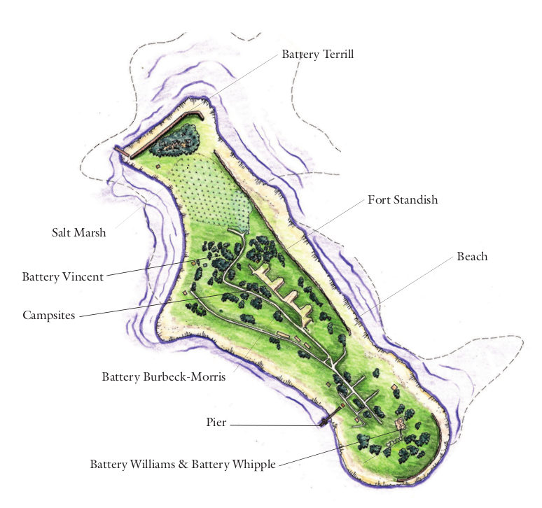 Here’s a Lovells Island map, showing beaches, campsites, piers, trees, salt marsh, batteries, and Fort Standish, including the various batteries: Williams, Whipple, Burbeck-Morris, Vincent, Terrill.
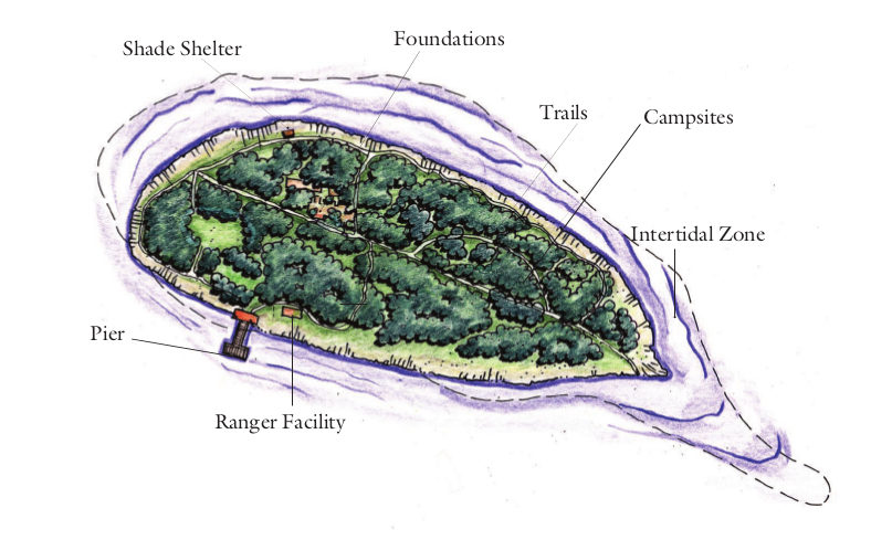 The Bumpkin Island map labels the campsites, trails, ranger facility, pier, and landscape on this small primitive island. It also labels the intertidal zone which may or may not be underwater on your visit.
Boston Harbor Islands lodging map
 If you’re staying overnight somewhere before visiting Boston Harbor Islands, it’s a pretty sure bet that you’ll be staying in Boston itself. To the right, you can open an Expedia interactive Boston lodging map, where you can filter by location and price. It may seem overwhelming, so I normally like to start by looking at the top-rated Boston lodging to narrow it down based on price, reviews, location, and photos.
Boston Harbor nautical chart
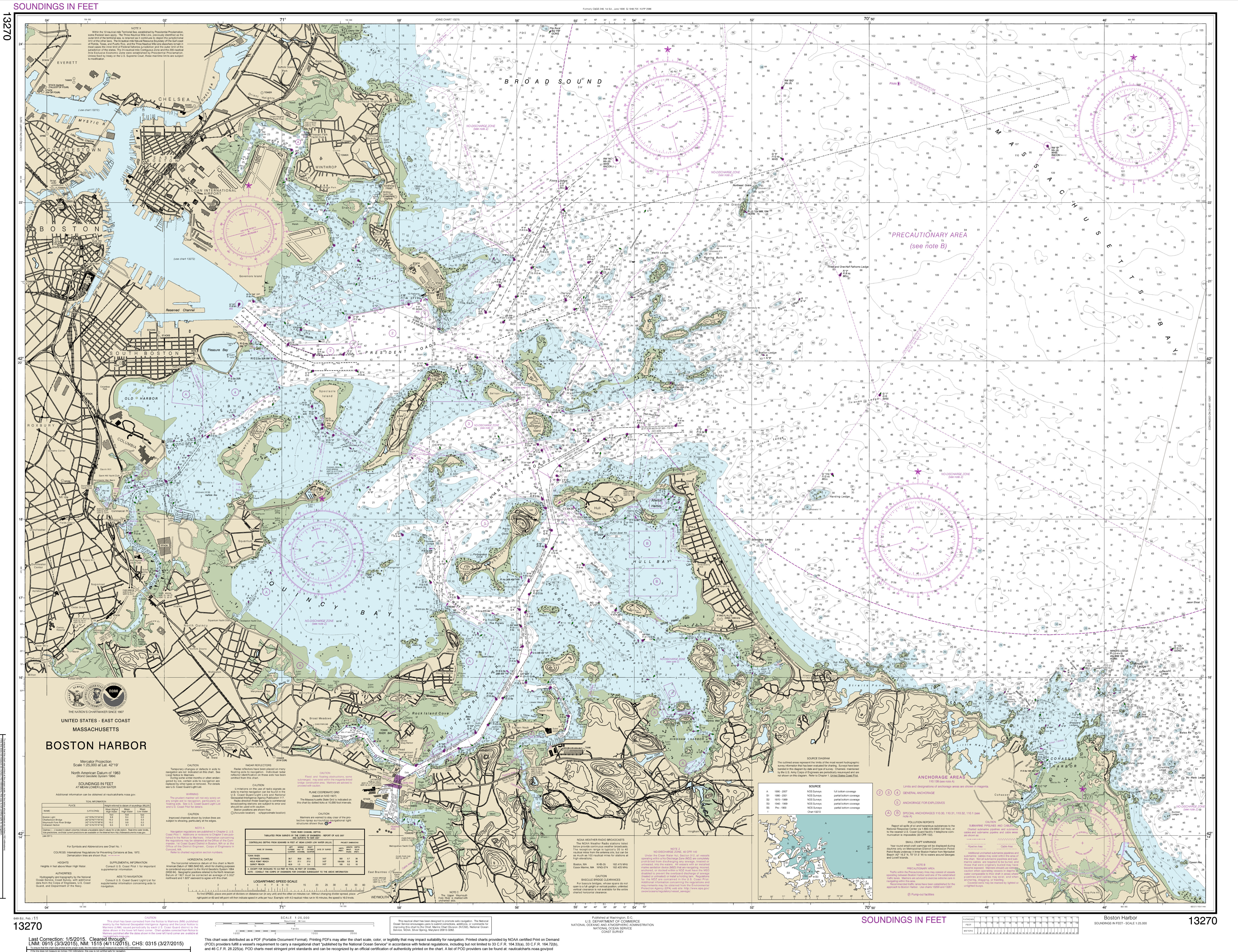 The Boston Harbor nautical chart from NOAA is the only map here that can be used for boat navigation since it shows harbor depths. Click the image to view a full size map or download the PDF.
…and more!
< Return to National Park Maps home
< Return to Park List
< Return to List by State