Craters of the Moon maps from the park brochure
 This is the official Craters of the Moon map, identical to the one handed out at the park by National Park Service staff. It was last updated in 2022. Click the image to view a full size map or download the PDF.
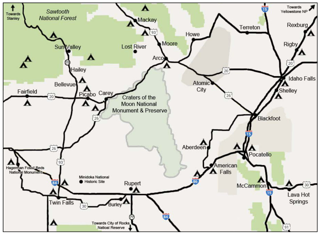
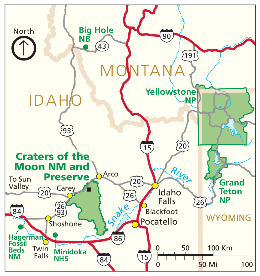 This is a regional Craters of the Moon National Monument map, showing the rest of the park and the nearby towns and roads. Click the image to view a full size map or download the PDF.
 Here’s an alternate regional map that focuses on the nearby national park units and the roads you’d take to get to them: Minidoka, Hagerman Fossil Beds, City of Rocks, Grand Teton, and Yellowstone.
Craters of the Moon trail maps
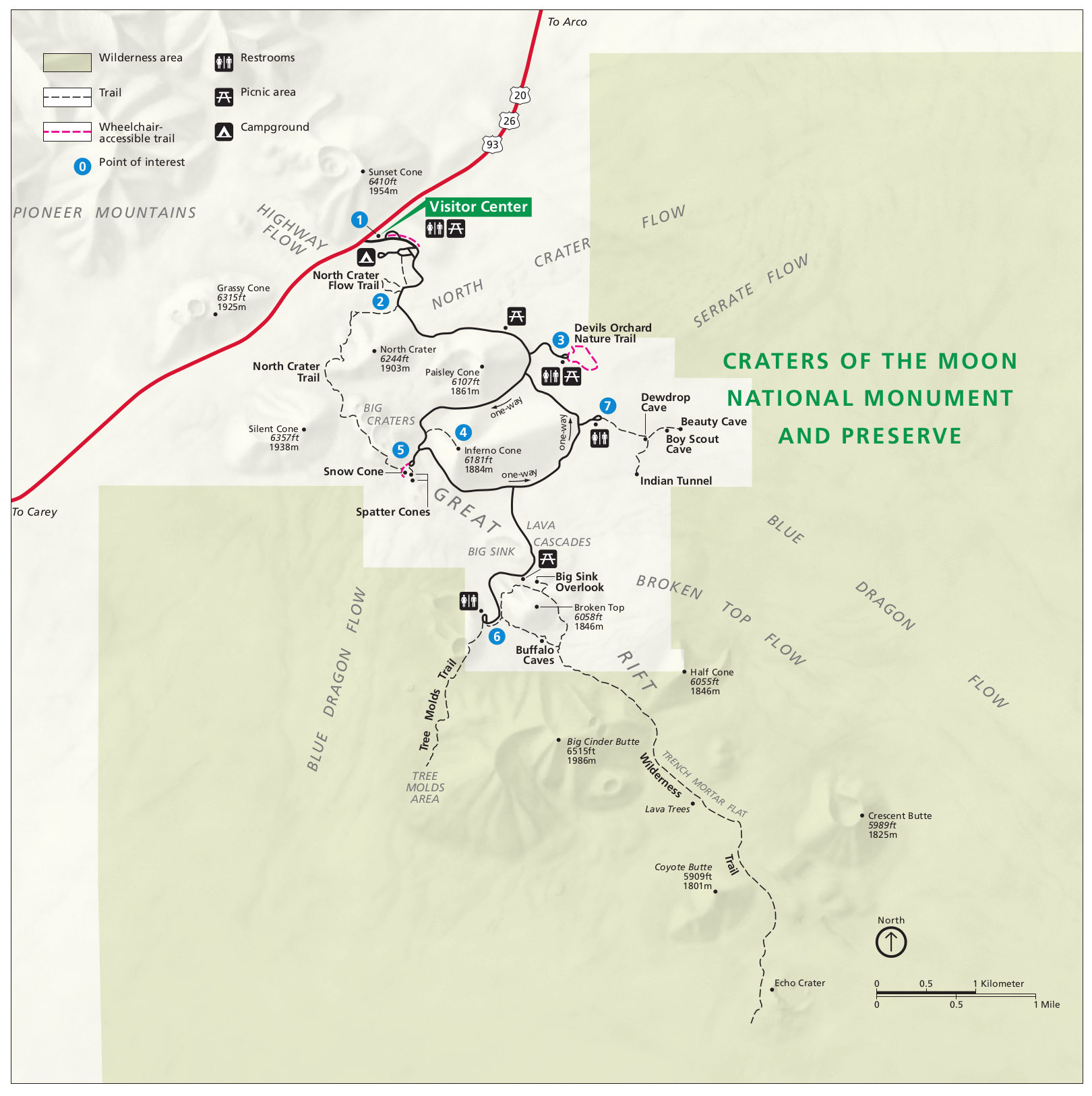
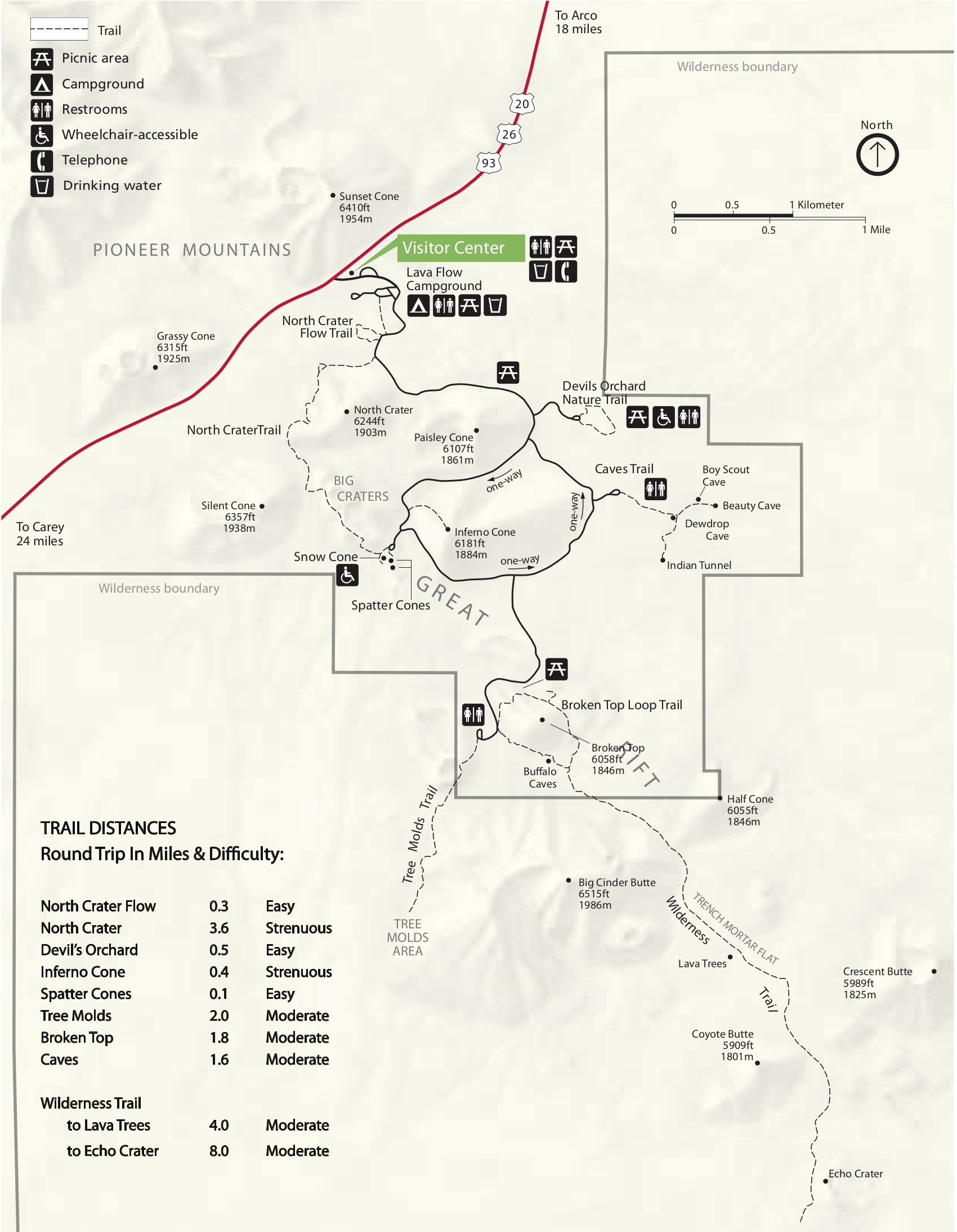 The Craters of the Moon trail map includes all the trails in the park, including ones accessed from the main park road that go into designated wilderness, such as the Trench Mortar Flat Trail and Tree Molds Trail.
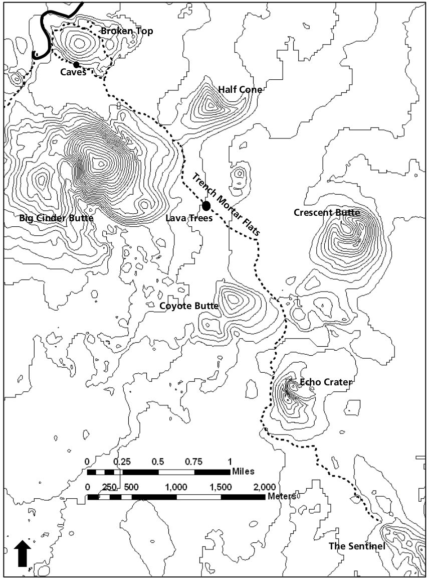 Here’s a Craters of the Moon topographic trail map, showing the main backpacking route into the Craters of the Moon wilderness. The map isn’t quite as easy on the eyes, but the topo lines are helpful.
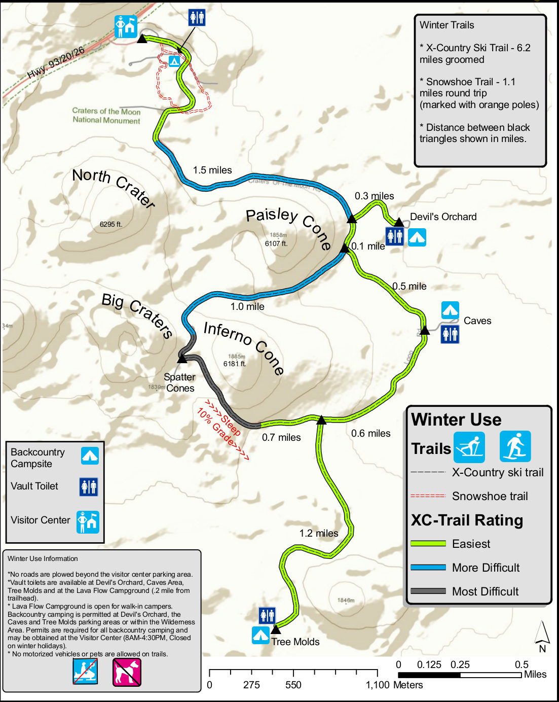 This is a Craters of the Moon winter trails map, showing the various snowshoe and cross-country ski routes and labeling them with their approximate difficulty level.
Craters of the Moon campground maps
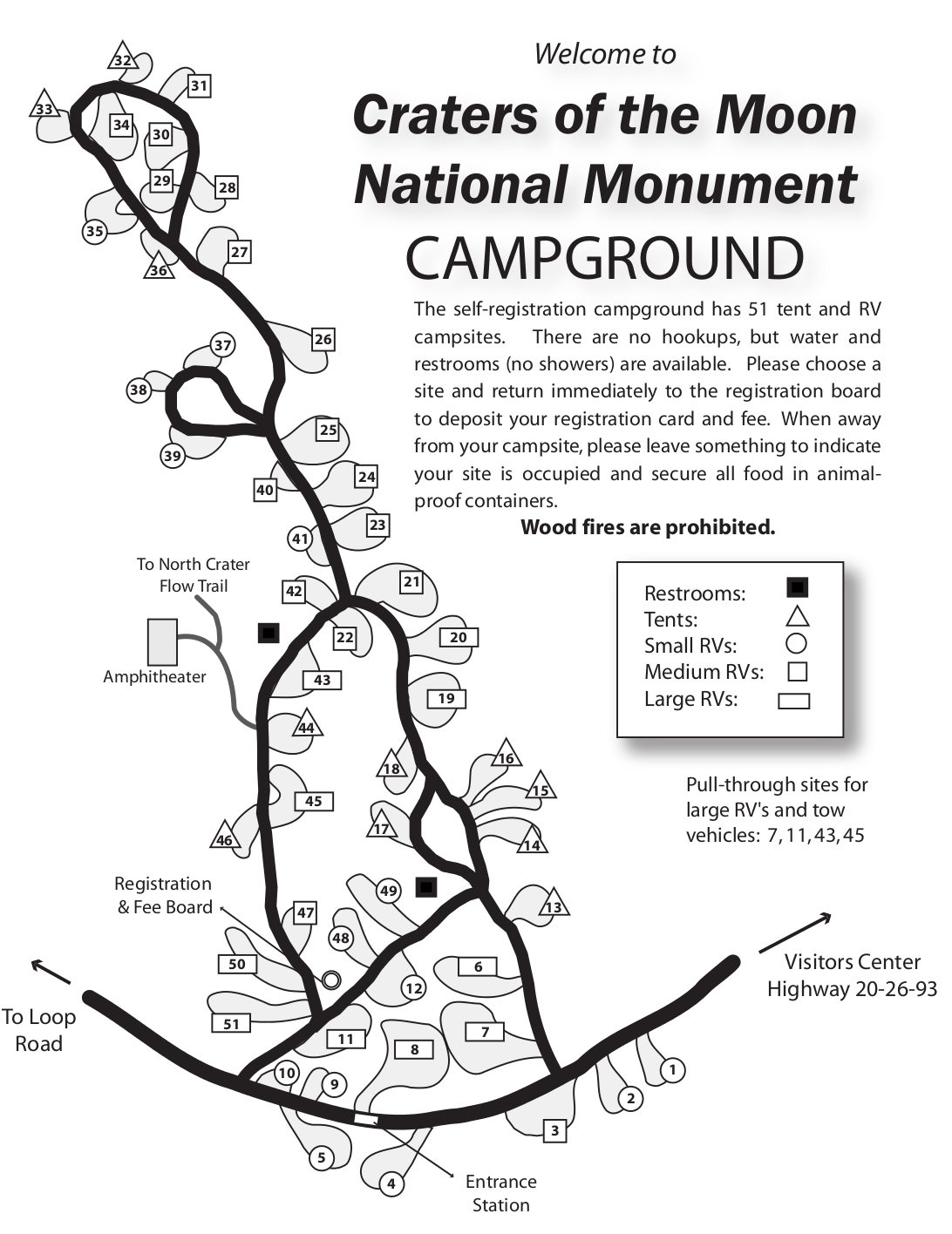 Here’s the Craters of the Moon campground map with the various sites, water spigots, and restrooms labeled. Click the image to view a full size map or download the PDF.
 Here’s a map of the regional campgrounds near Craters of the Moon, showing the campgrounds in Sawtooth National Forest and along other roads and highways in this part of Idaho.
Craters of the Moon lava flow maps
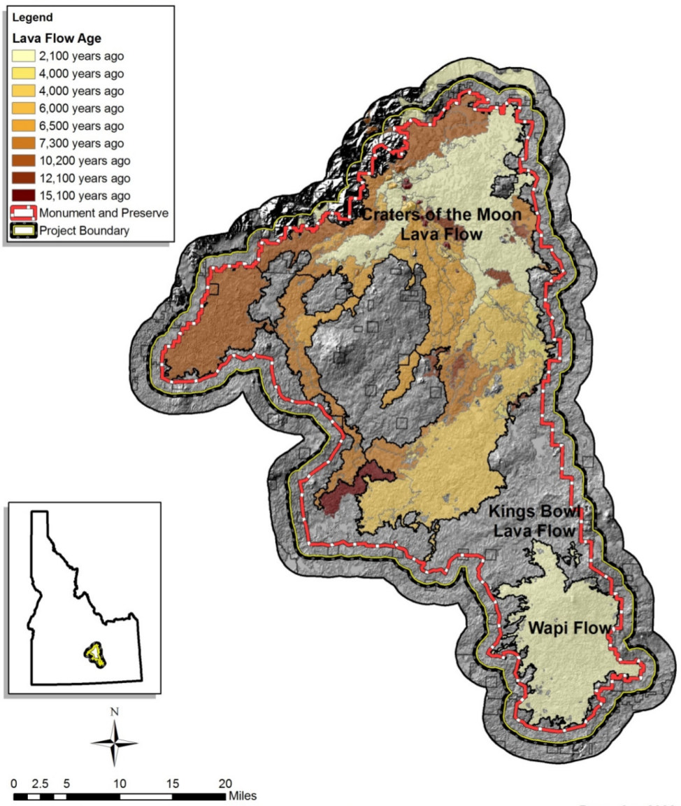 Here’s a map of lava flows at Craters of the Moon, showing the range of major flows from 2,100 years ago to 15,100 years ago. Each flow is mapped with a different color: the lighter, the younger.
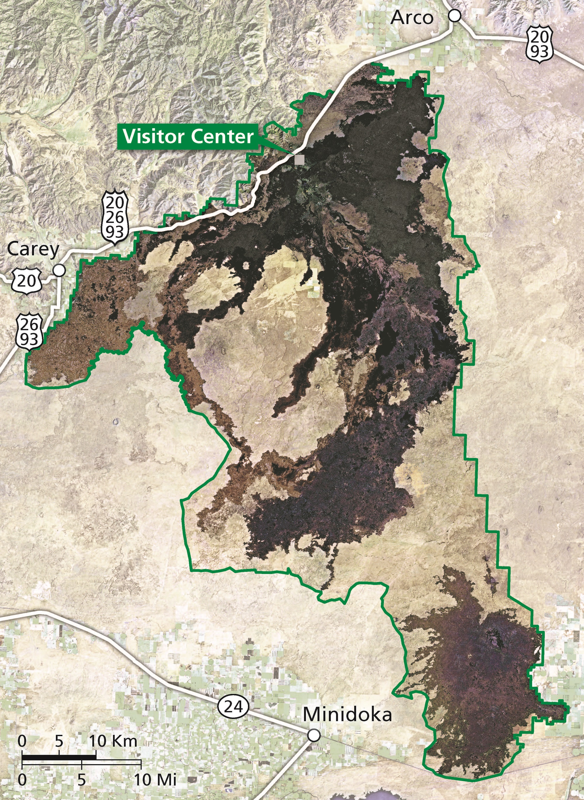 This alternative Craters of the Moon lava map uses true-color satellite imagery to show the stark difference in the appearance of the landscape that was covered by lava flows.
Assorted Craters of the Moon maps
 This is a highly detailed map of the Craters of the Moon region, showing all the roads and trails in the area. Click the image to view a full size map or download the PDF.
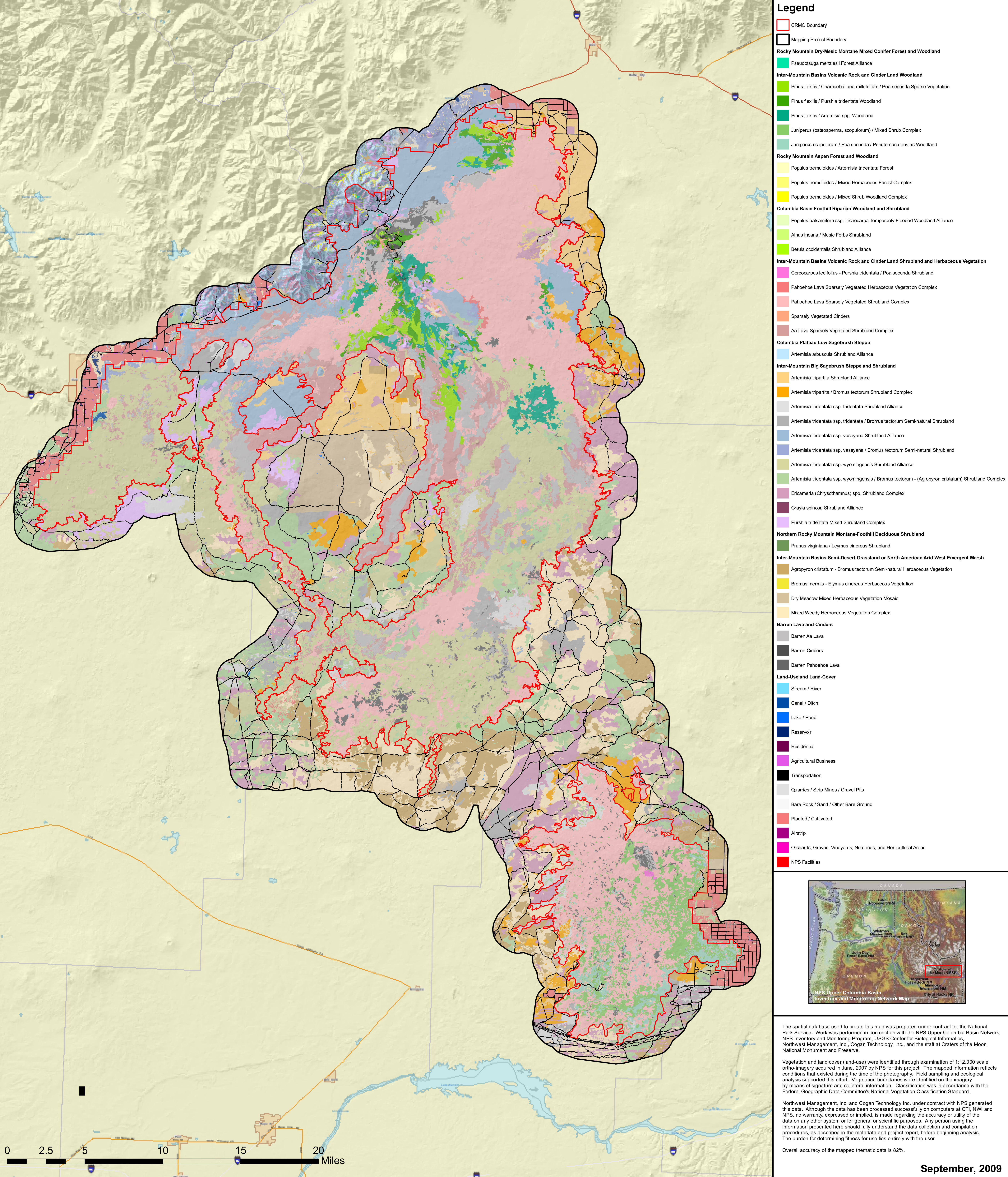 This Craters of the Moon vegetation map shows the huge variety of plant communities in the park, ranging from barren lava flows to forests, woodlands, shrubs, and grasslands.
 Here is the old official Craters of the Moon map from the mid-2010s, showing the part of the park that’s accessible to visitors. Click the image to view a full size map or download the PDF.
…and more!
< Return to National Park Maps home
< Return to Park List
< Return to List by State