Muir Woods map from the park brochure
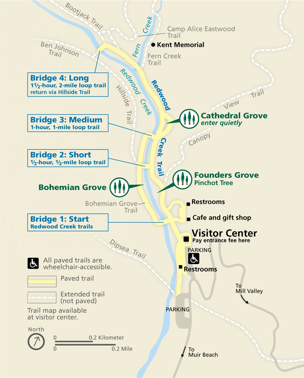 This is the official Muir Woods map from the brochure, showing different trails from the visitor center to the Cathedral Grove, Founders Grove, and Bohemian Grove. Click the image to view a full size map.
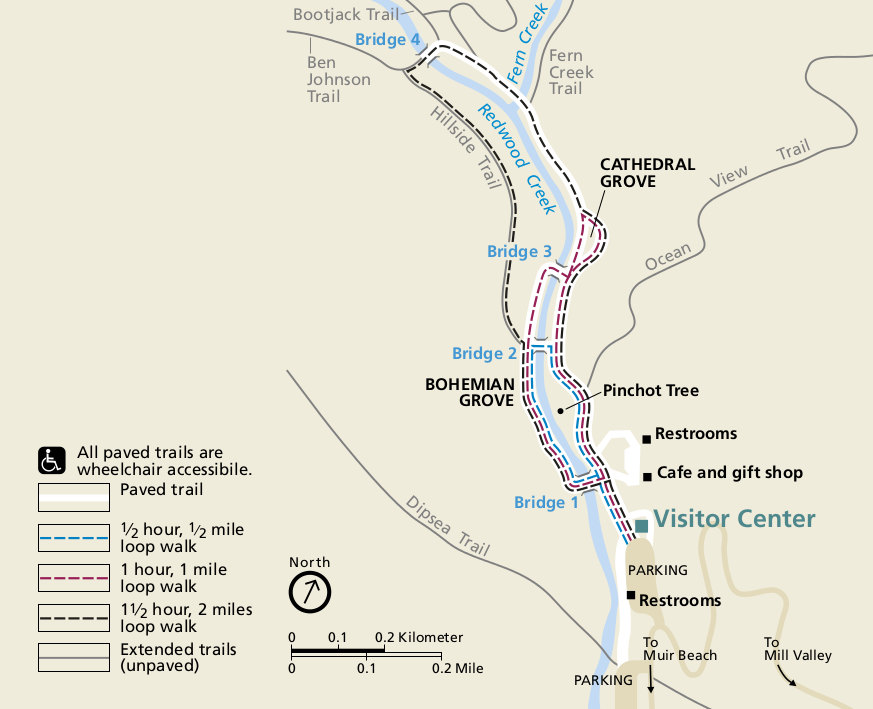 This is the old Muir Woods National Monument map. I think the new one above looks better, but maybe you’ll find this more to your liking. Click the image to view a full size map or download the PDF.
Muir Woods trail maps
 Muir Woods is a relatively small park, and if you’re doing just a short hike around the redwoods, the free maps below will suffice. However, if you’re planning on doing more hikes in the surrounding area, such as Point Reyes National Seashore or Mount Tam, you’ll want the National Geographic Trails Illustrated map. It covers the entire region and includes topographic lines and trail mileages for the whole area.
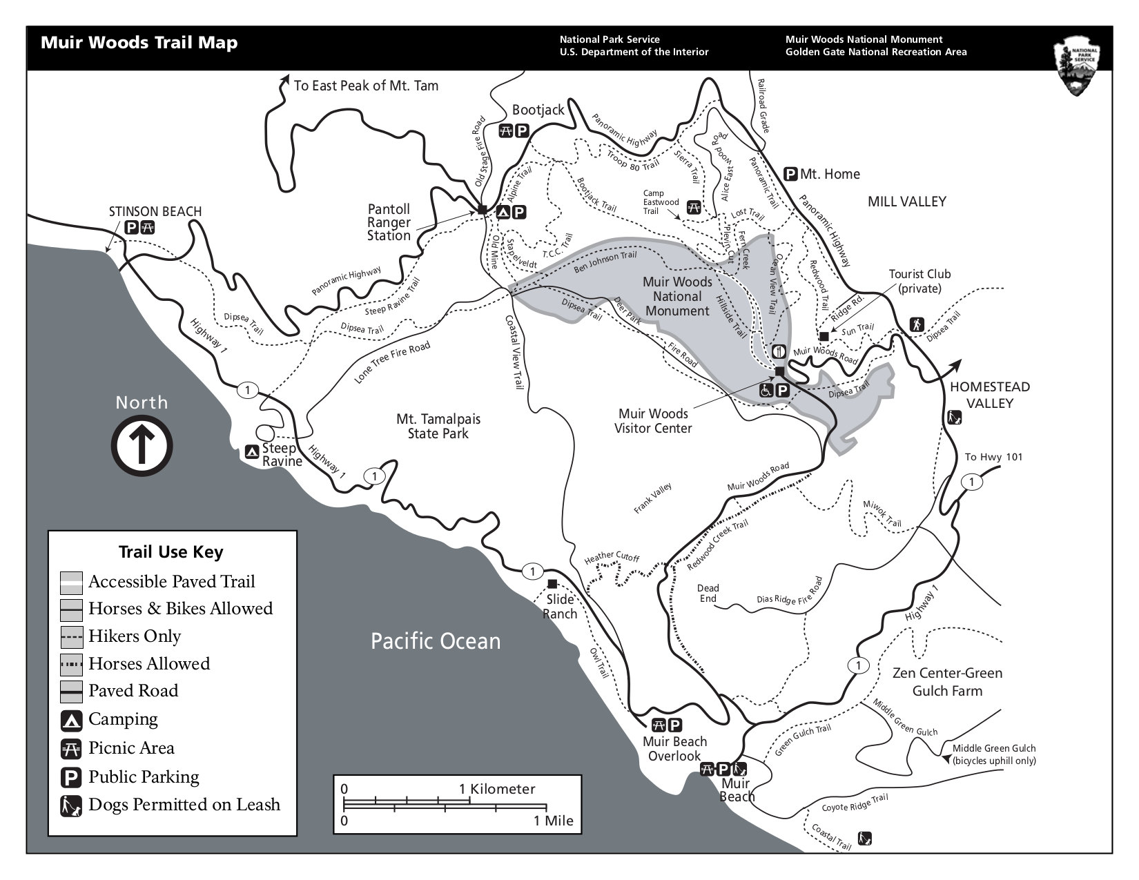 Here is a Muir Woods trail map that shows the hiking trails within Muir Woods National Monument as well as the surrounding area. Click the image to view a full size map or download the PDF.
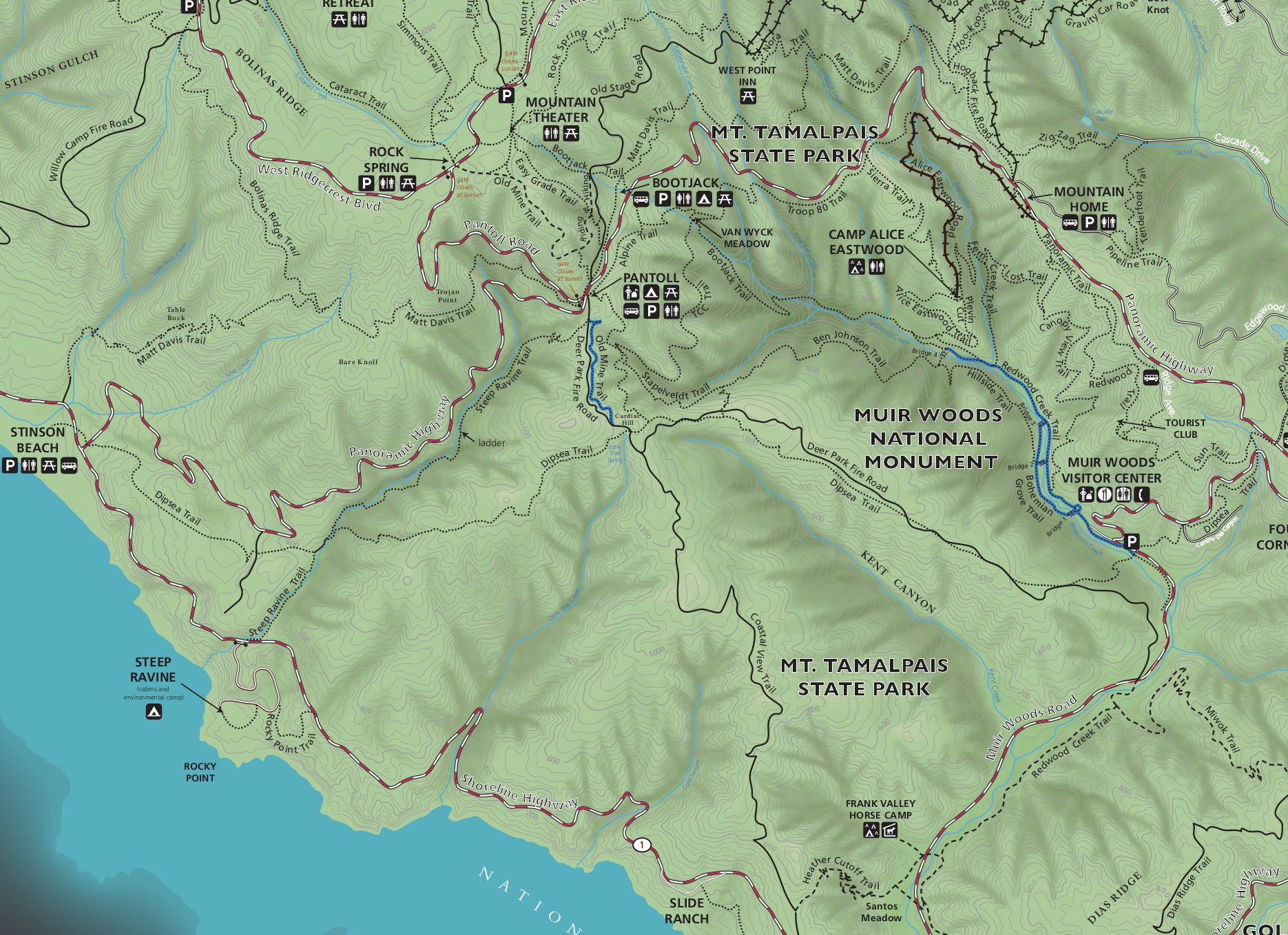 This Muir Woods trail map is full color and shows topographic lines for the entire region, including Muir Woods and Mount Tamalpais. Click the image to view a full size map or download the PDF.
Muir Woods lodging map
 Most out-of-town visitors to Muir Woods include it as part of their trip to San Francisco. So to the right I’ve included an Expedia interactive San Francisco lodging map. You can scroll the map around to areas north of the Golden Gate Bridge if you’re looking for something closer to Muir Woods. Or view Expedia’s top-rated San Francisco lodging so you can narrow things down based on photos, reviews, or prices.
…and more!
< Return to National Park Maps home
< Return to Park List
< Return to List by State