Hawaii Volcanoes maps from the park brochure
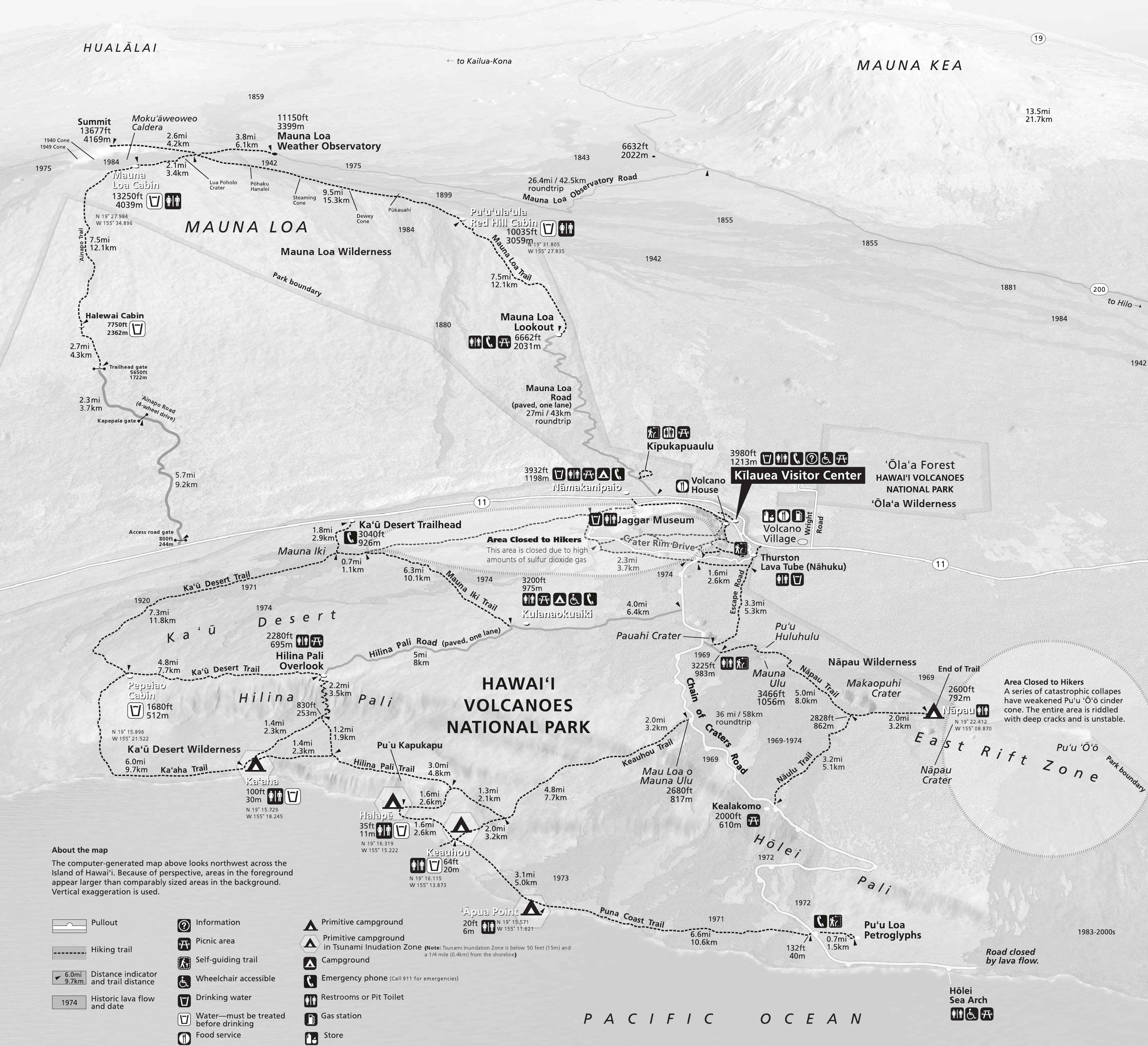
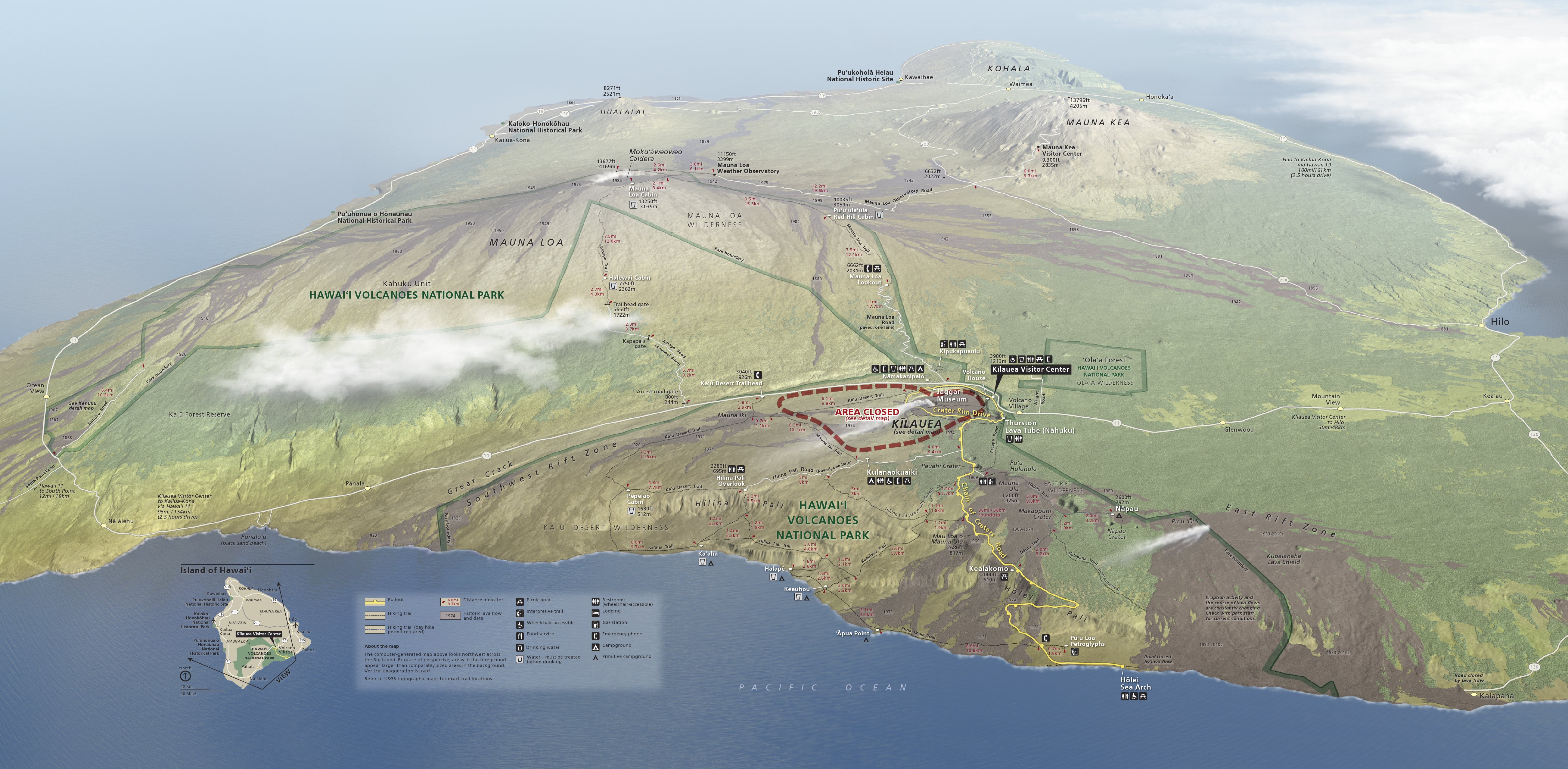
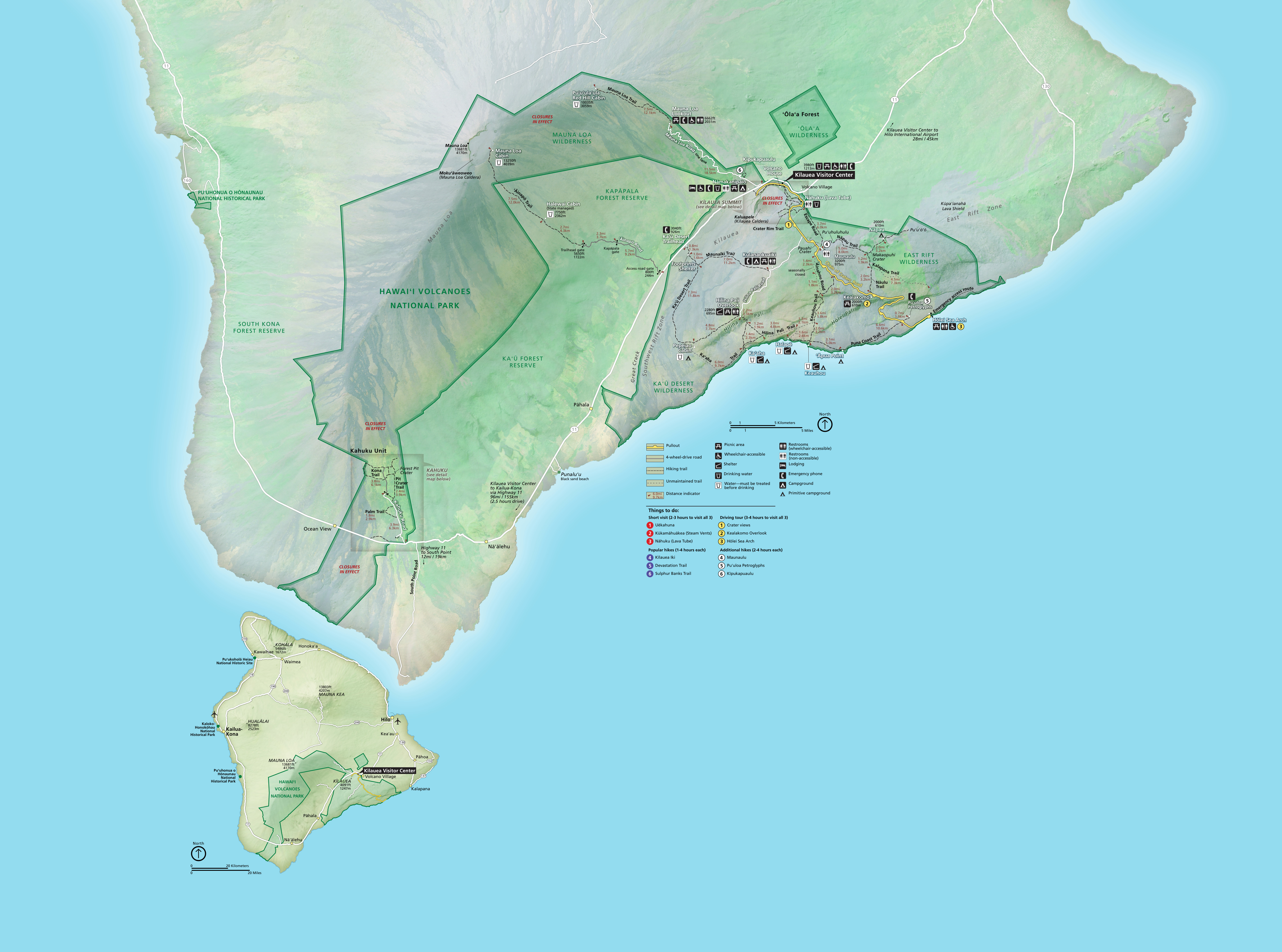 This is the main Hawaii Volcanoes National Park map, showing all of the park lands on Mauna Loa and Kilauea on the southern side of the Big Island. Hiking trails and distances are also included.
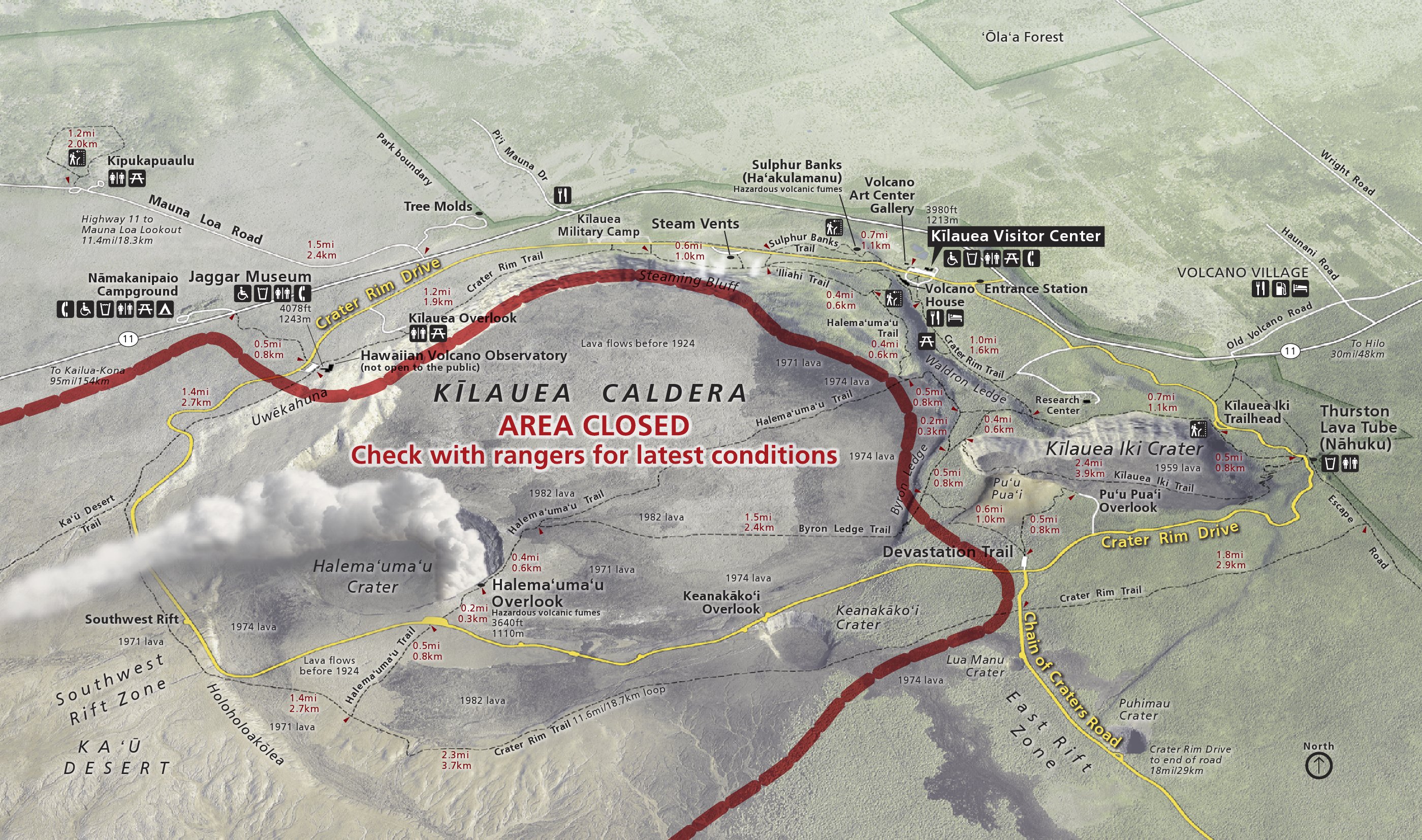
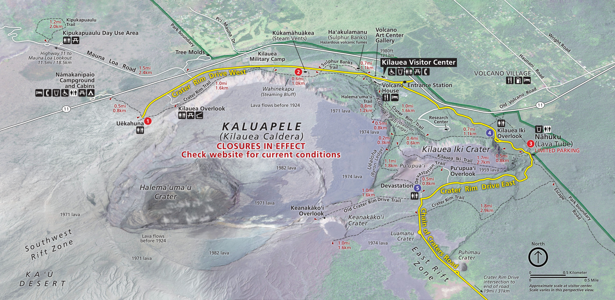 This is the Kilauea map, the most visited section of Hawaii Volcanoes. Road and trail closures here can happen suddenly depending on Kilauea’s activity. Click the image to view a full size map or download the PDF.
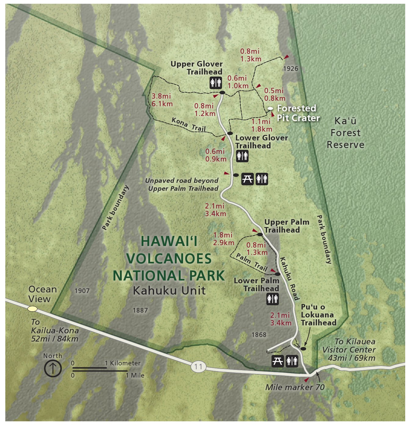
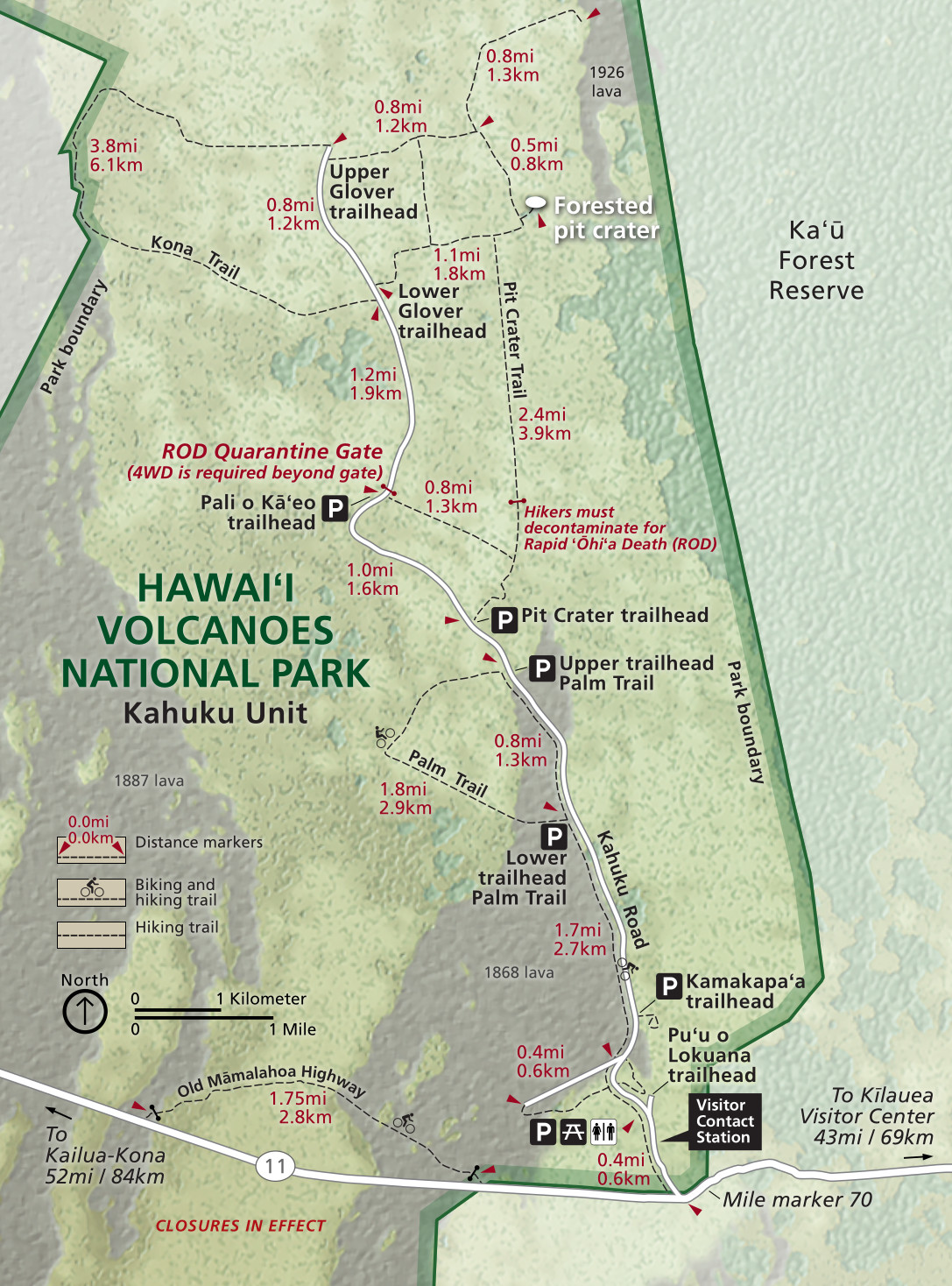 This is the Kahuku Unit map, labeling parking, trailheads, and trails. Take note of the quarantine zones and associated gates at the higher elevations. Click the image to view a full size map or download the PDF.
Hawaii Volcanoes trail maps
 If you’re just sticking to the main roads and walkways, you probably don’t need a full-fledged Hawaii Volcanoes hiking trail map. However, if you’re planning on longer full-day or overnight hikes, the National Geographic Trails Illustrated trail map is your best bet, since it has topographic lines and detail you won’t find on the free maps. This is also a must if you plan on venturing off established trails on backpacking trips.
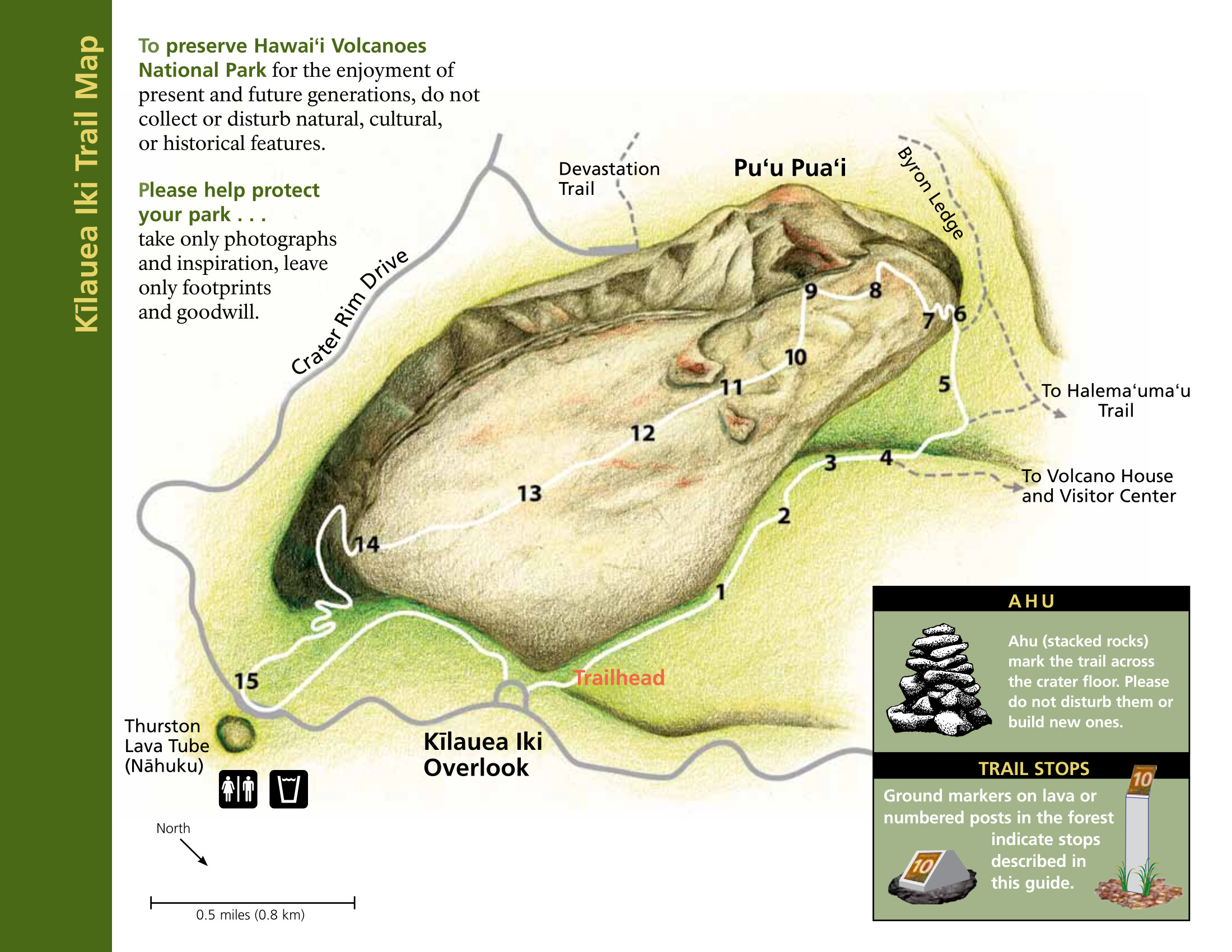 Here’s a Kilauea Iki trail map. It generally takes about 2-3 hours to cover the four miles of this very popular trail, located east of the main Kilauea caldera. You can also download the NPS Kilauea Iki trail guide (PDF).
 This Kahuku trail map includes 11 points of interest along this 2-1/2 mile loop hike in the Kahuku Unit on the slopes of Mauna Loa. Each point of interest is described in the NPS Kahuku Forest Trail Guide (PDF).
 This is the Hawaii Volcanoes backcountry map, showing trail mileages, cabins, water sources, and wilderness campsites along developed hiking trails on Mauna Loa and Kilauea.
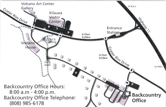 Here’s a backcountry office map, showing the location to pick up backcountry permits for those doing backpacking trips. Whether you reserve permits in advance or get them in person, you’ll need to pick them up here.
Big Island regional maps
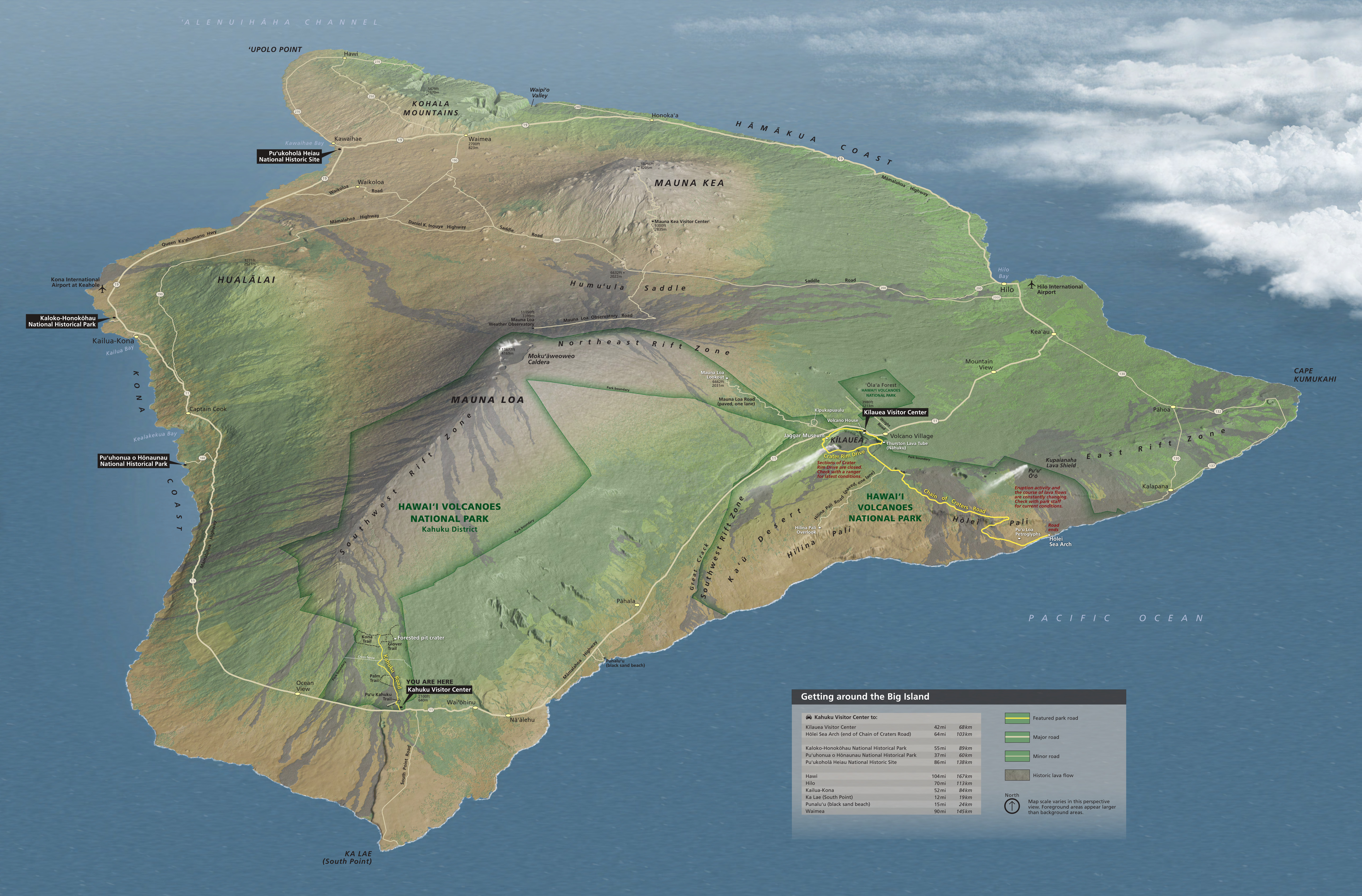 Here’s a Big Island of Hawaii map that zooms out to show the entire island. It includes the major cities and other national park units. A really spectacular map! Click the image to view a full size map or download the PDF.
 This is a map of Big Island national park sites. The western side of the island has a few sites of historic nature, and they’re certainly worth stopping in to visit if you’re staying in Kona or nearby.
 This Hawaii regional map shows the entire Big Island, highlighting the other national park units. It also includes major roads, towns, and a rough overview of land cover types (forest vs lava).
Hawaii Volcanoes lodging map
 The great thing about visiting Hawaii Volcanoes is that you have great lodging options just outside the park entrance. To the right is an Expedia interactive lodging map showing the locations of the many guesthouses, lodges, and cottages nearby. I also recommend taking a look at Expedia’s top-rated Hilo lodging to compare prices and reviews if you want to stay there and just go up to Kilauea as a day trip.
Lava flow maps
 This Kilauea eruption map shows all lava flows from about 1790 to 2018, color-coding them by year. It also has a Lava Flow Hazard Zone inset to show which areas are most at risk from future flows.
 The Mauna Loa eruption map shows flows from 1843 to 2018. Note how much larger the hazard zone map is than in the map above—a reflection of Mauna Loa’s incredible size.
Hawaii Volcanoes science maps
 Here’s a Big Island volcano map, which shows the five volcanoes that make up the island of Hawaii: Kilauea, Mauna Loa, Mauna Kea, Hualalai, and Kohala.
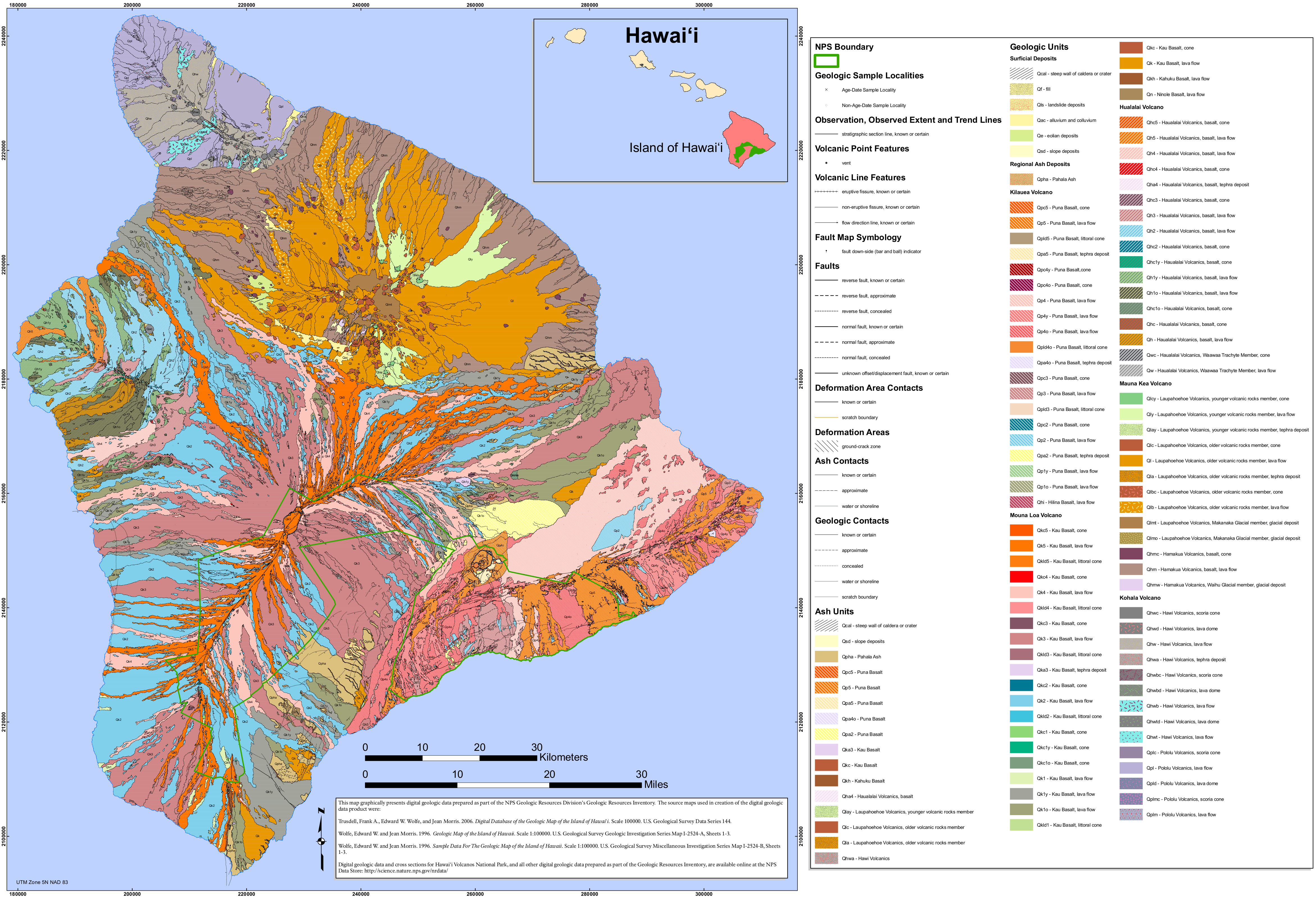 The Hawaii Volcanoes geologic map includes not just the lava flows and rock types on national park lands, but on the rest of the Big Island of Hawaii as well, including Kona and Hilo.
Archived Hawaii Volcanoes maps
These three maps used to be the official National Park Service brochure maps, but they’ve since been superseded by the ones on top of this page. I’ve preserved them here for archival purposes and to ensure any direct links to these maps from around the web remain active and unbroken. Keep in mind that closures at this park can change rapidly! So the information on these is no longer current.
 This was the main Hawaii Volcanoes National Park map, showing everything from Mauna Loa all the way to the coast. Click the image to view a full size map or download the PDF.
 This was the Kilauea Caldera map. Note the presence on this map of roads and trails that no longer exist, and/or are no longer open. Click the image to view a full size map or download the PDF.
 This was the Kahuku Unit map, showing a section of Hawaii Volcanoes to the southwest of the main developed areas around Kilauea. Click the image to view a full size map or download the PDF.
…and more!
< Return to National Park Maps home
< Return to Park List
< Return to List by State