Capitol Reef maps from the park brochure
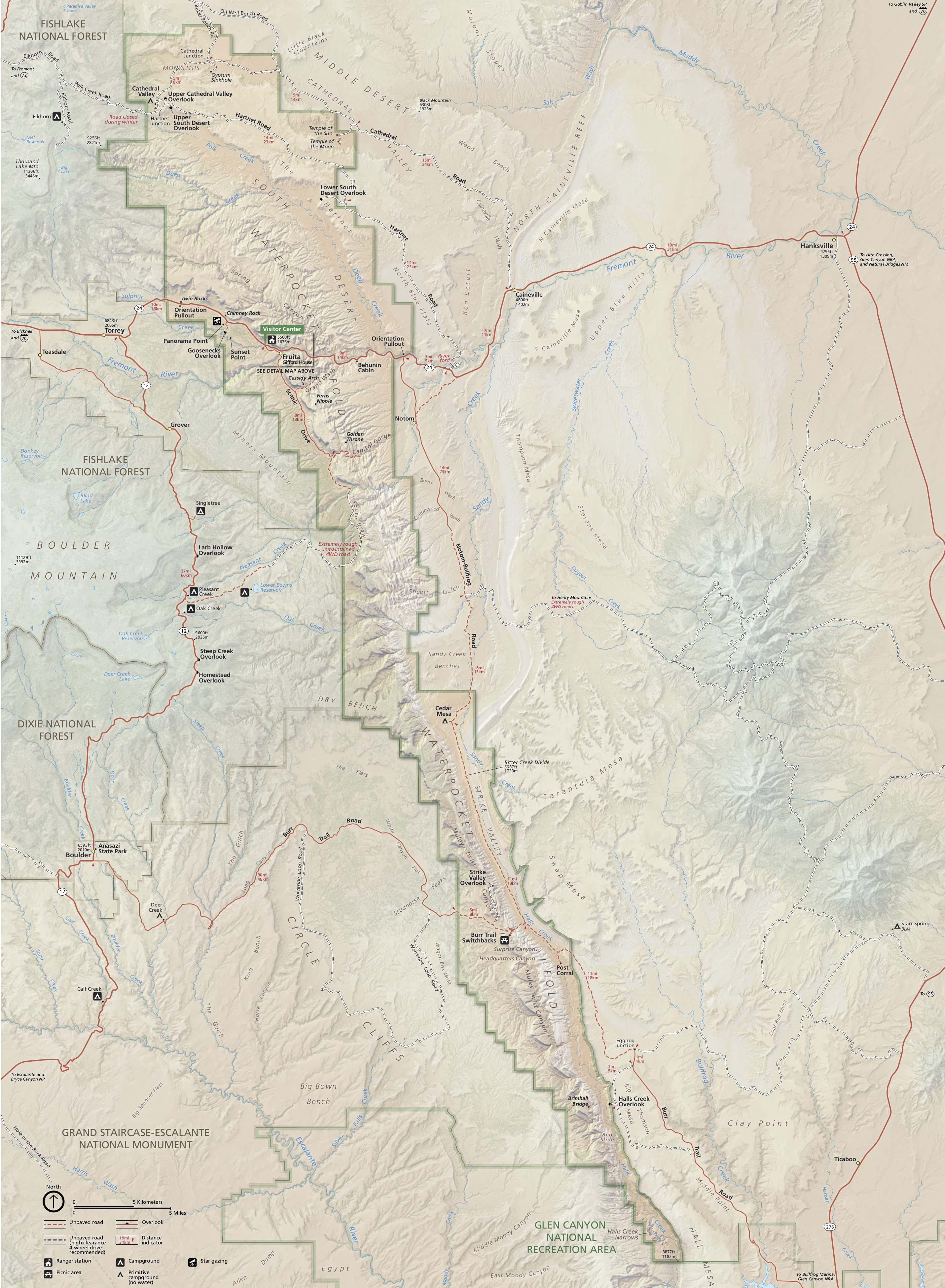 Here’s the official Capitol Reef National Park map, last updated in 2021. This map is identical to the brochure you receive from National Park Service staff when you arrive at the park entrance station.
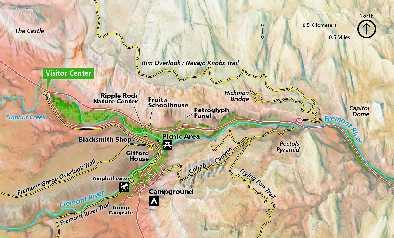 This is a Capitol Reef detail map, zooming in on the Fruita area, which is where most visitors focus. On this map you’ll see the campground, visitor center, and several trails including Cohab Canyon and the Frying Pan Trail.
Fruita maps
 The Fruita area hiking map shows only a small portion of Capitol Reef, but covers just about everything that most visitors usually see. You can also download the associated NPS Fruita hiking guide (PDF).
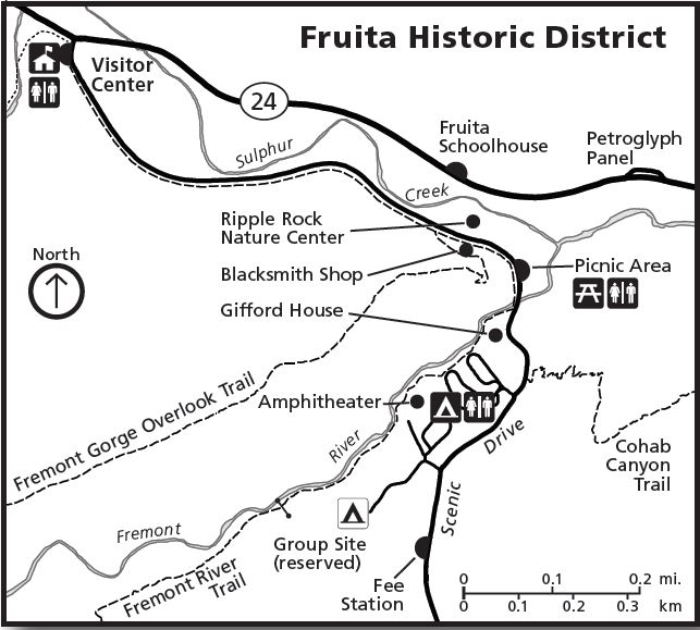 This Fruita map is actually the inset from the map above, zoomed in and cropped down to focus only on the Capitol Reef National Park’s main developed area with associated services.
 Here’s a Fruita Campground map, showing the park’s only developed campground. You can also download the NPS Fruita Campground guide (PDF), which includes each campsite’s size, including length for RVs.
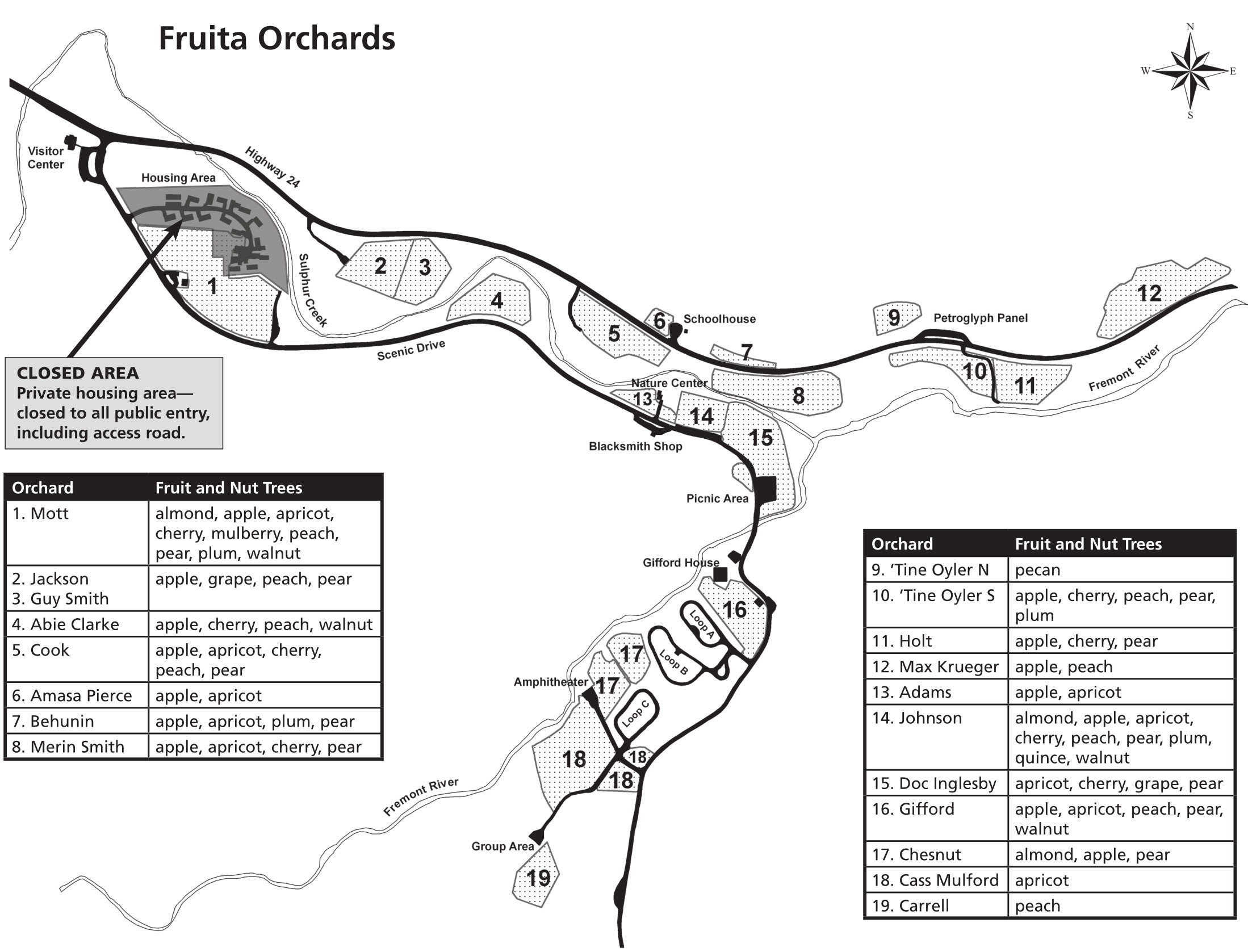 The Fruita orchard map shows the location of each orchard, as well as what is grown in each of the nineteen. Download the NPS Fruita Orchard guide (PDF) to learn more about this historic landscape.
Capitol Reef trail maps
 If you’re looking for a trail map to cover the entire park and show trail mileages and topo lines, you’ll want a National Geographic Trails Illustrated map. This is especially true at a park like Capitol Reef, where trails are not all well marked and require route-finding skills. Last time I was there I thought I could get away without a topo map; I ended up lost for about 20 minutes before finding cairns again. Don’t make my mistake! (In my defense, it was a snowy winter day.)
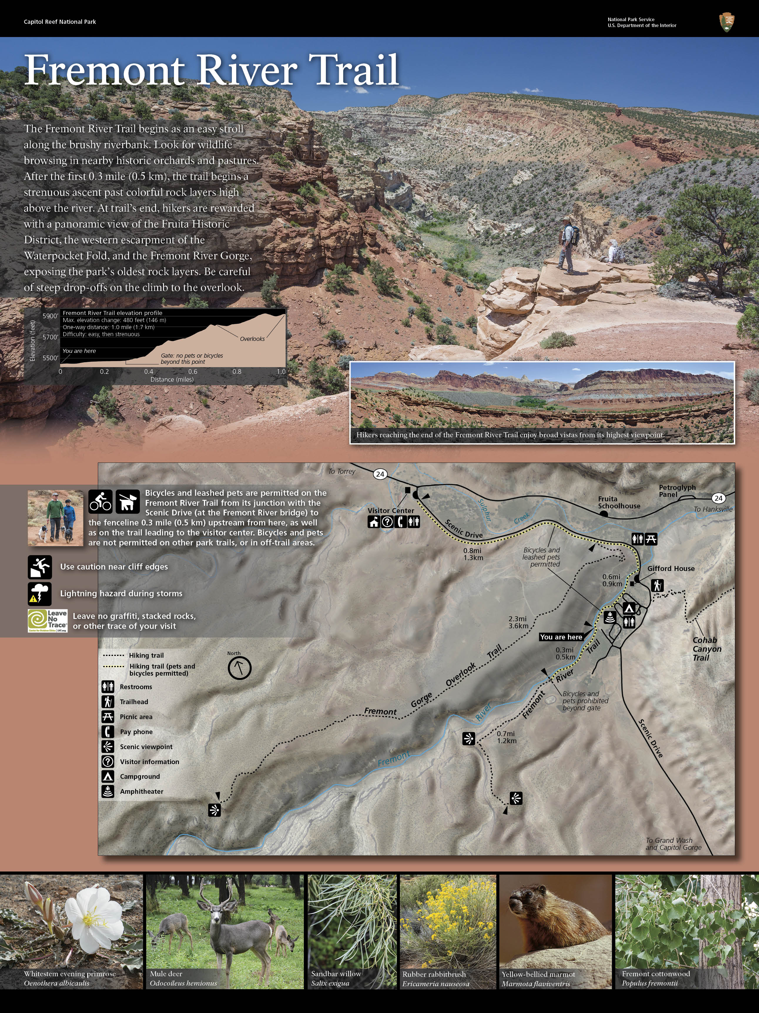
Each of the six maps in this section is taken from trailhead wayside exhibit signs that hikers view before heading out on their hike. For each trailhead, I’ve provided one file of the map only and one file of the entire exhibit sign. The full signs include trail elevation profiles, photos, and additional information describing each trail.
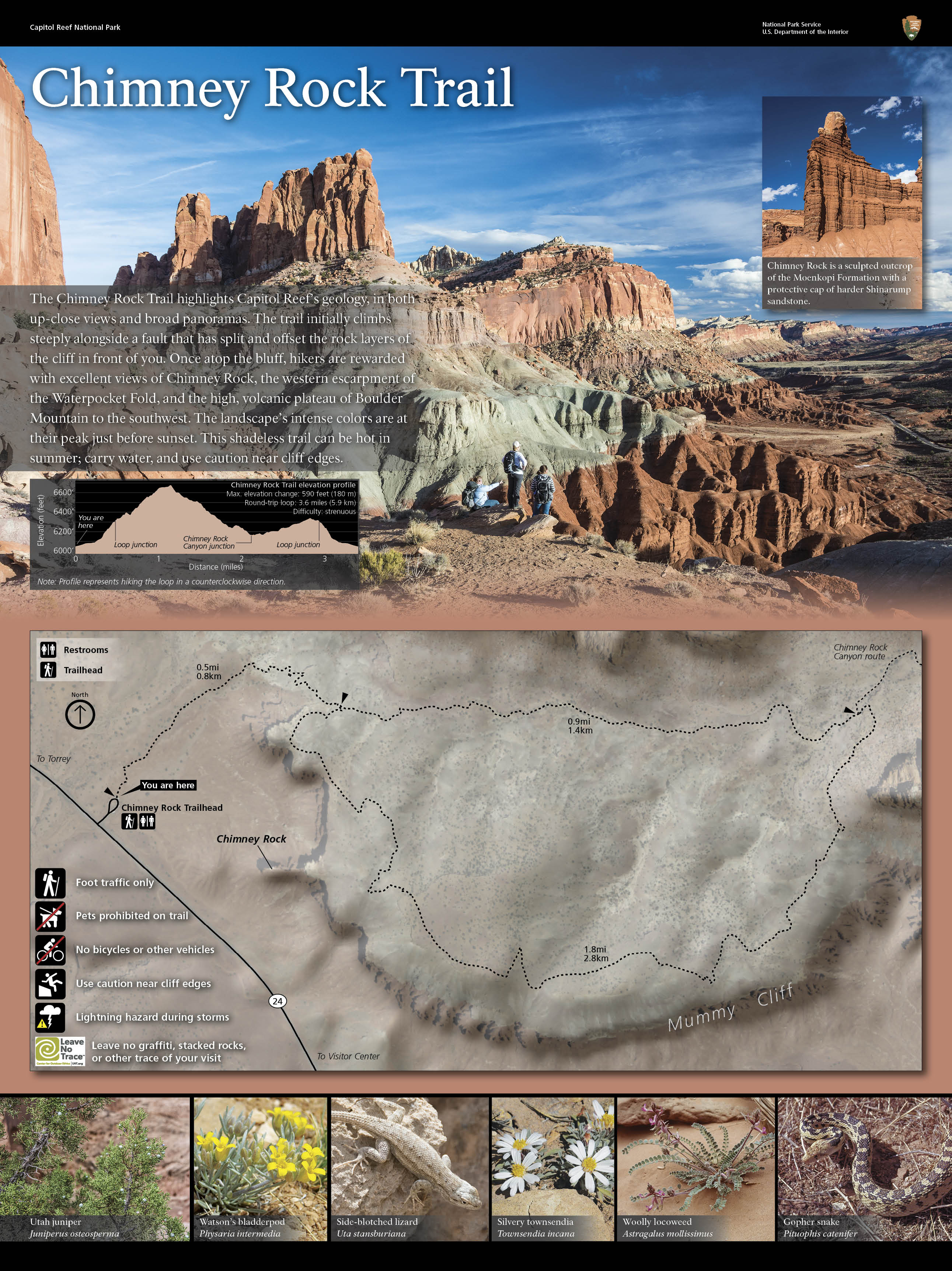
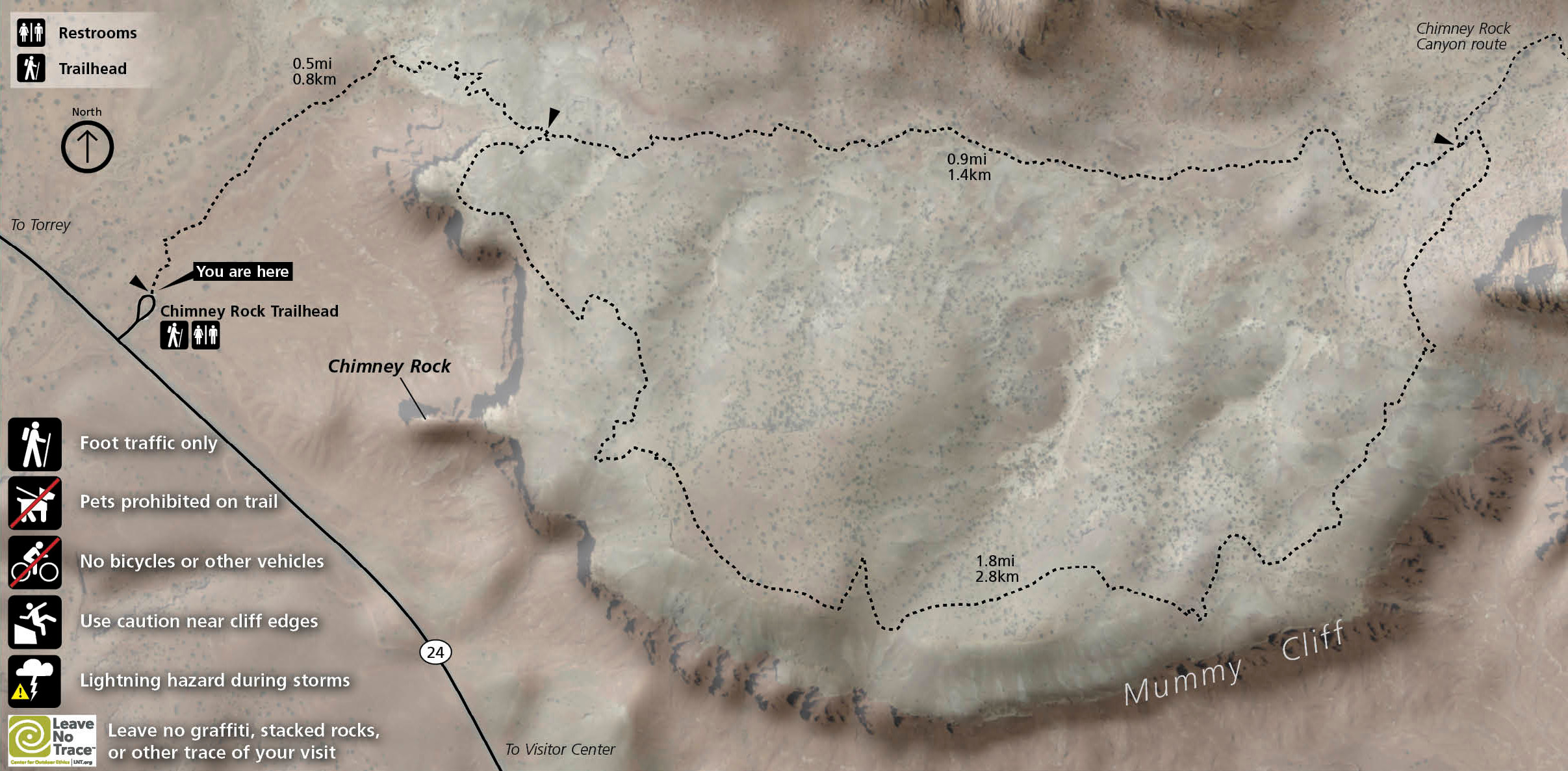 This Chimney Rock trail map shows this uphill route with views, located in between Torrey and the main visitor center in Fruita. Click the image to view a full size map or download the full NPS exhibit panel.
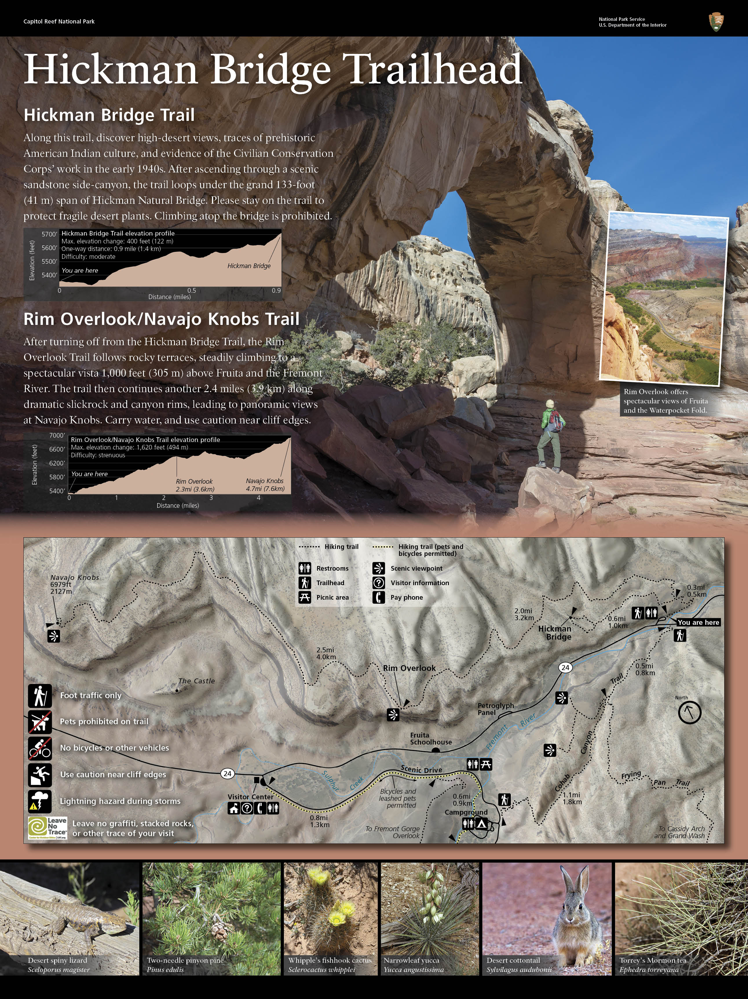
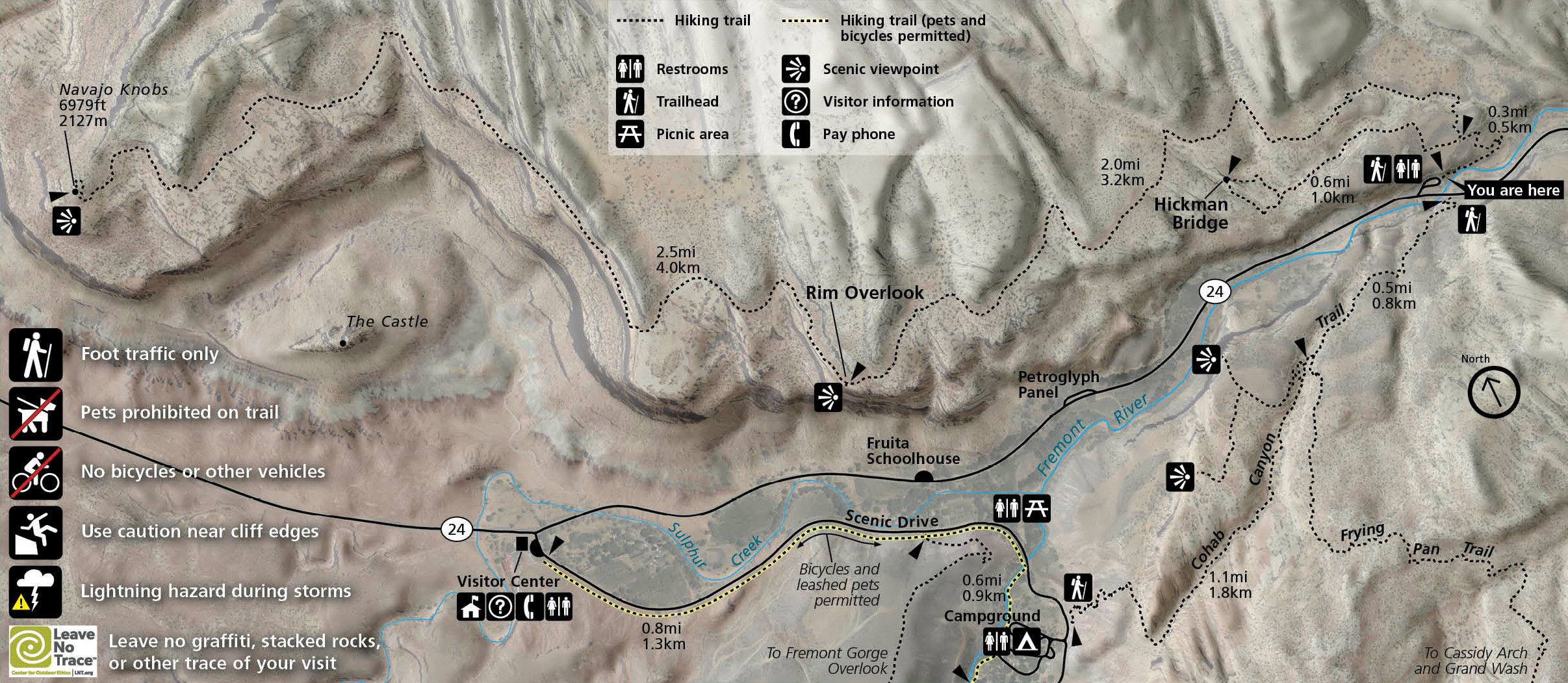 The Hickman Bridge trail map also includes the trail to the Rim Overlook, continuing on toward Navajo Knobs. Click the image to view a full size map or download the full NPS exhibit panel.
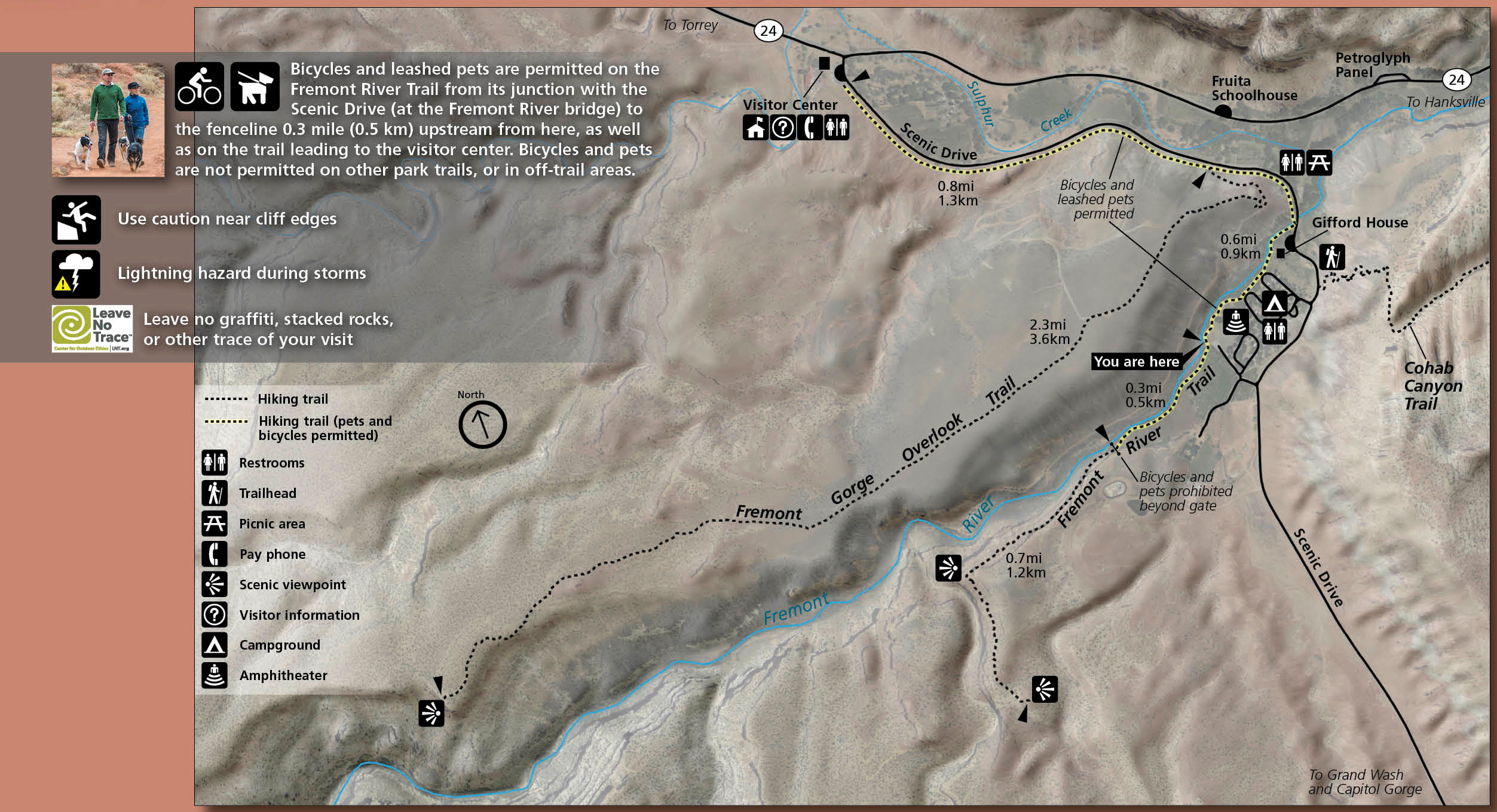 Here’s a Fremont River trail map that shows this route that starts flat before a strenuous climb to overlooks of the Fruita area. Click the image to view a full size map or download the full NPS exhibit panel.
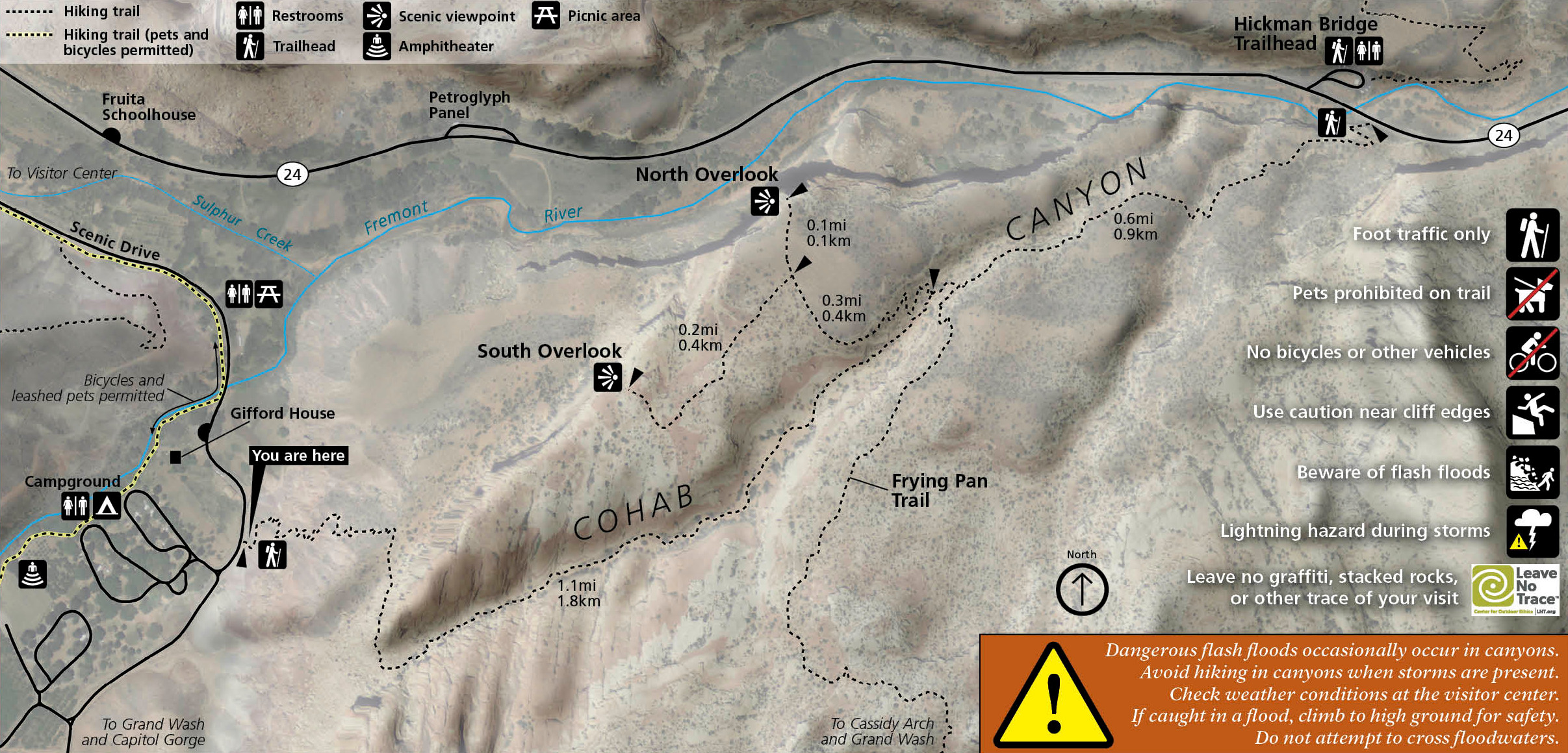 The Cohab Canyon trail map includes a few spurs to overlooks branching off from the main canyon route that leads to the Frying Pan Trail. Click the image to view a full size map or download the full NPS exhibit panel.

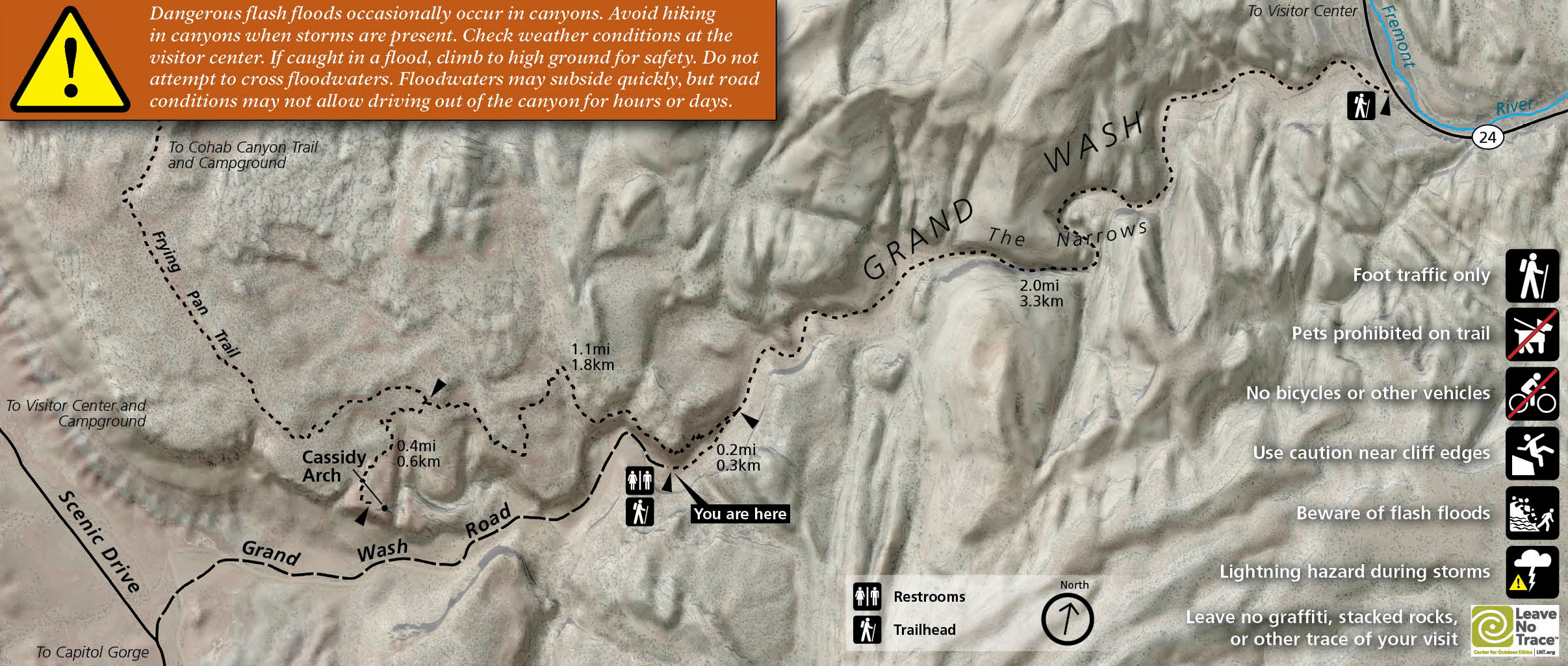 This is a Grand Wash and Cassidy Arch trail map. Stay low to hike in the wash or climb to the rim to see an arch named for Butch Cassidy himself. Click the image to view a full size map or download the full exhibit panel.

 This is a Capitol Gorge and Golden Throne trail map. Follow a dry streambed or climb to views of the Golden Throne sandstone monolith. Click the image to view a full size map or download the full exhibit panel.

Capitol Reef lodging map
 If you’re going to stay near Capitol Reef, the town of Torrey, UT is your only game in town. To the right you can open an Expedia interactive lodging map of the Torrey area, which is just a few minutes outside the park entrance. I also recommend browsing Expedia’s top-rated Capitol Reef hotels and lodging to compare reviews, prices, photos, features, and locations, finding the best place for you and your budget.
Capitol Reef route maps
The maps in this section are for more advanced routes than the trails above. Calling these “trails” might even be generous, as most are unmaintained canyoneering routes for advanced desert navigators. Following are two maps showing the general location of these routes, and nine maps providing details on each, in a roughly north-to-south order.
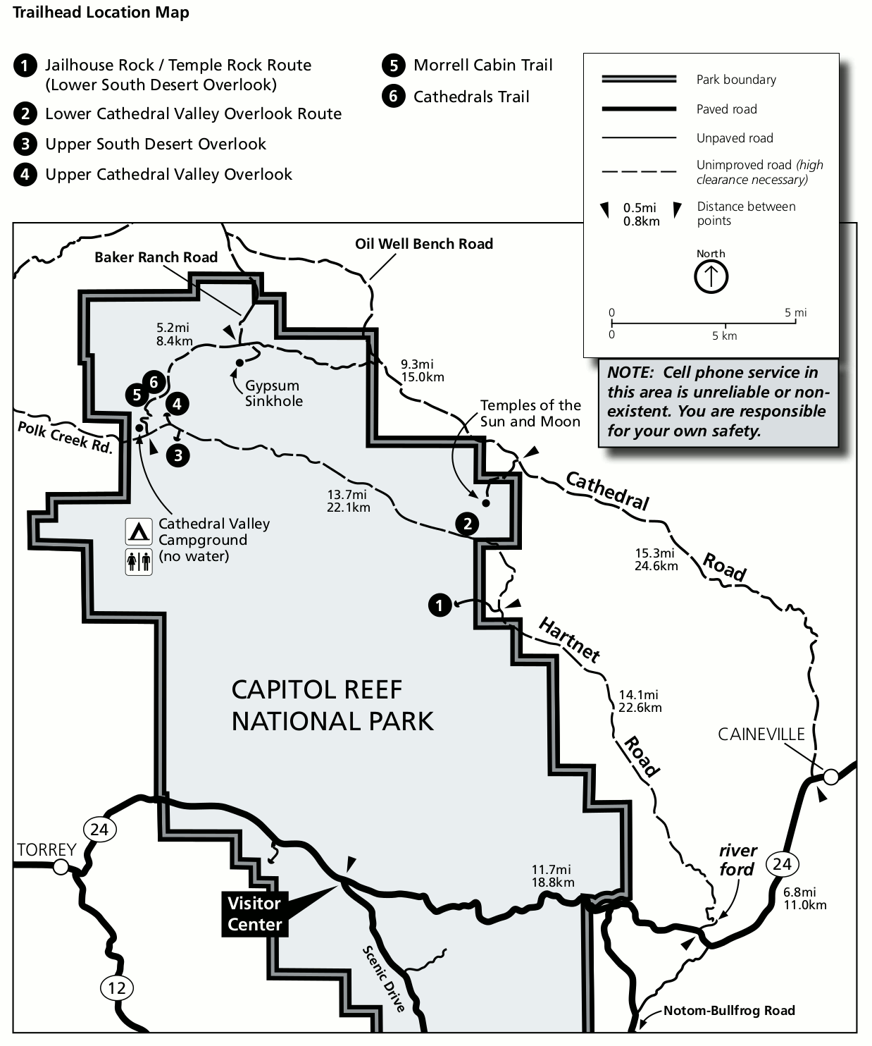 This is a Cathedral District trailhead map, which shows the trailheads accessed from the Cathedral Valley Campground area (and Cathedral Road and Hartnet Road) in the northern part of the park.
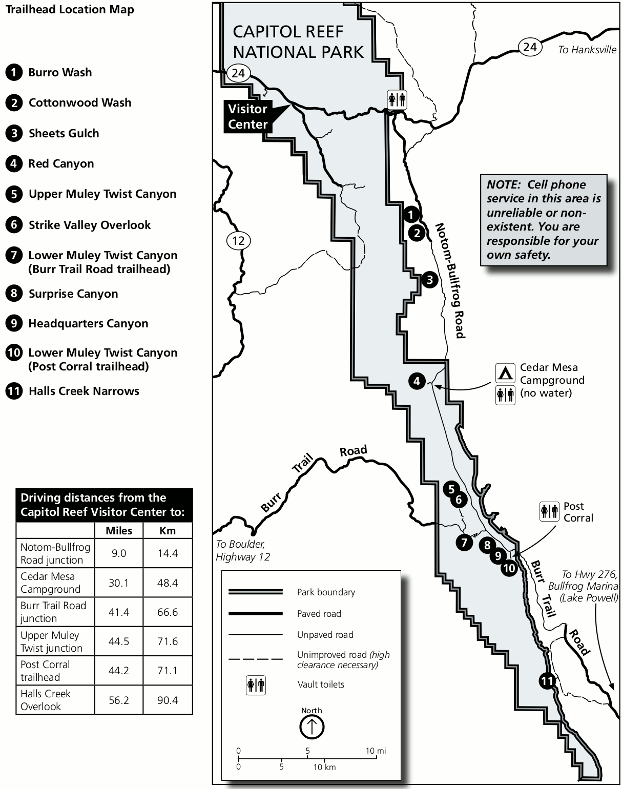 Here’s a Waterpocket District trailhead map, showing the location of each trailhead accessed off the Notom-Bullfrog Road and Burr Trail Road, further south in a remote area of Capitol Reef.
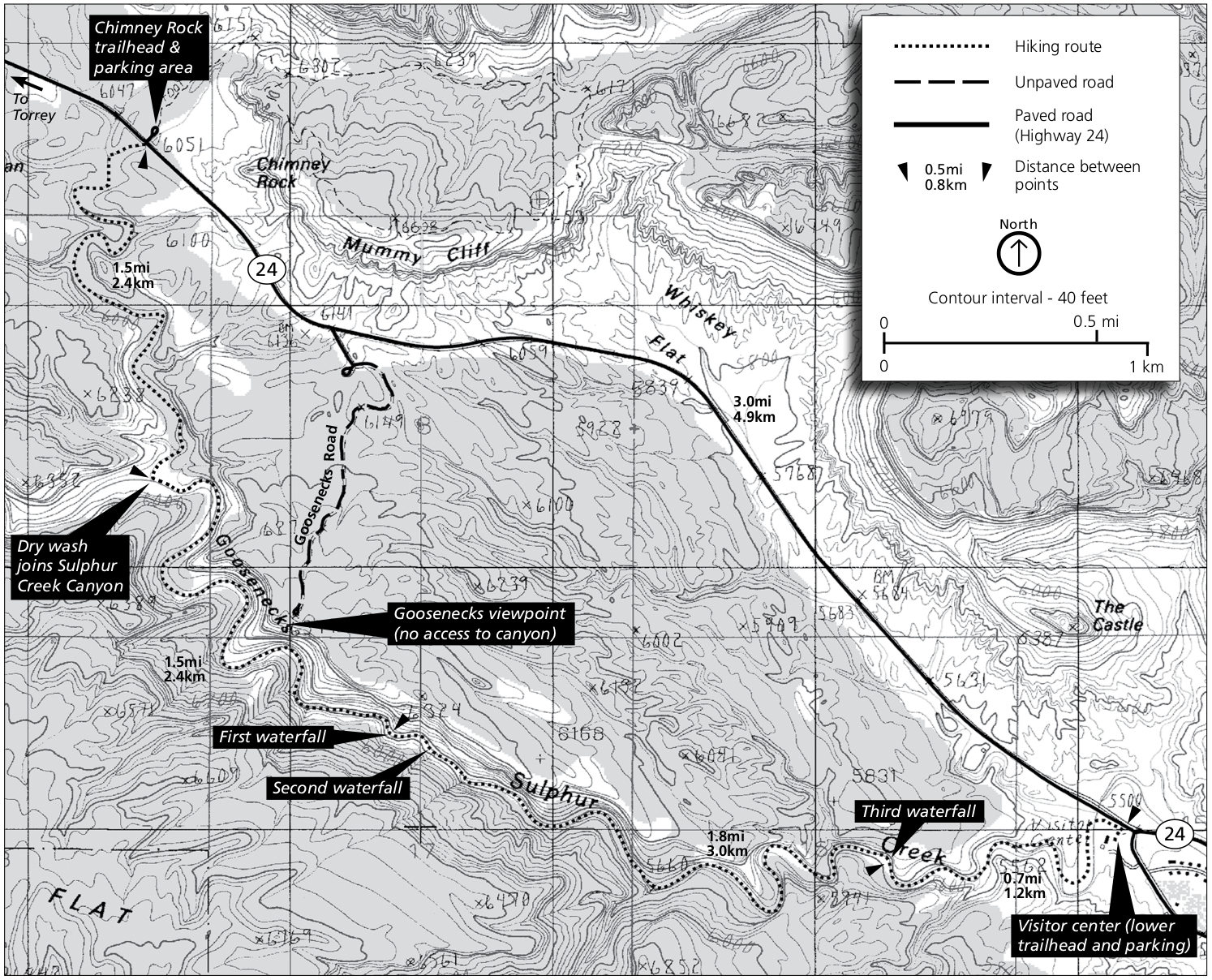 The Sulphur Creek trail map includes both the Chimney Rock and visitor center trailheads, with trails into Sulphur Creek (with some waterfalls) and the Goosenecks.
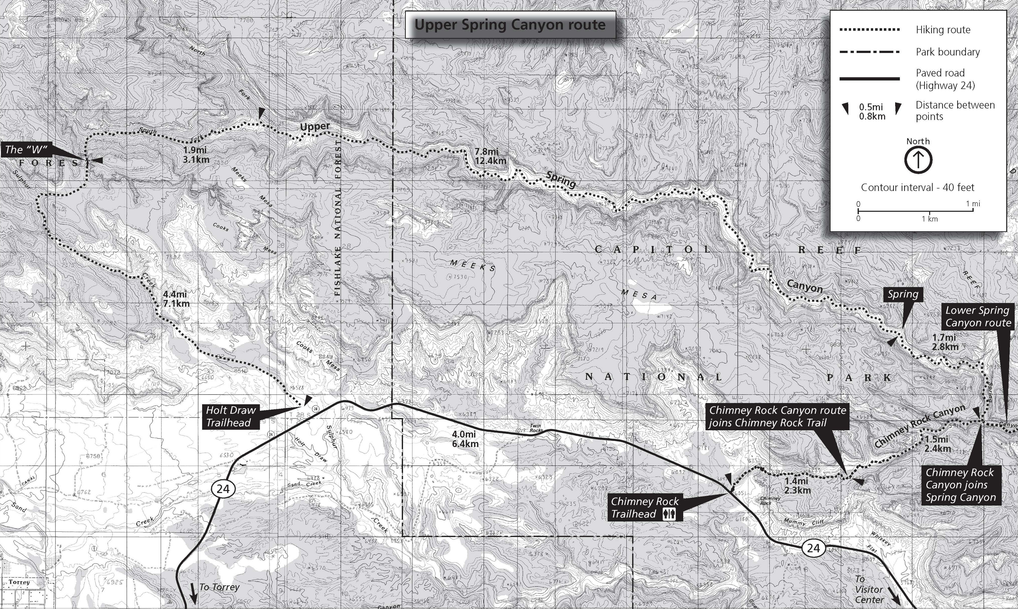 This Upper Spring Canyon trail map shows a one-way route of nearly 19 miles that connects the Holt Draw trailhead with Chimney Rock. You can continue downstream using the map below for an even longer hike.
 The Lower Spring Canyon trail map shows the rest of Spring Canyon, downstream (east) of the map above. You can do the full route over a few days, or skip Upper Spring Canyon by accessing from the Chimney Rock trailhead.
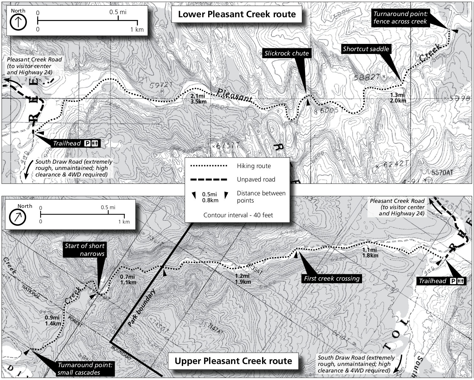 This Pleasant Creek trail map shows both the Upper and Lower Pleasant Creek routes, heading upstream and downstream from the trailhead into some narrow canyons.
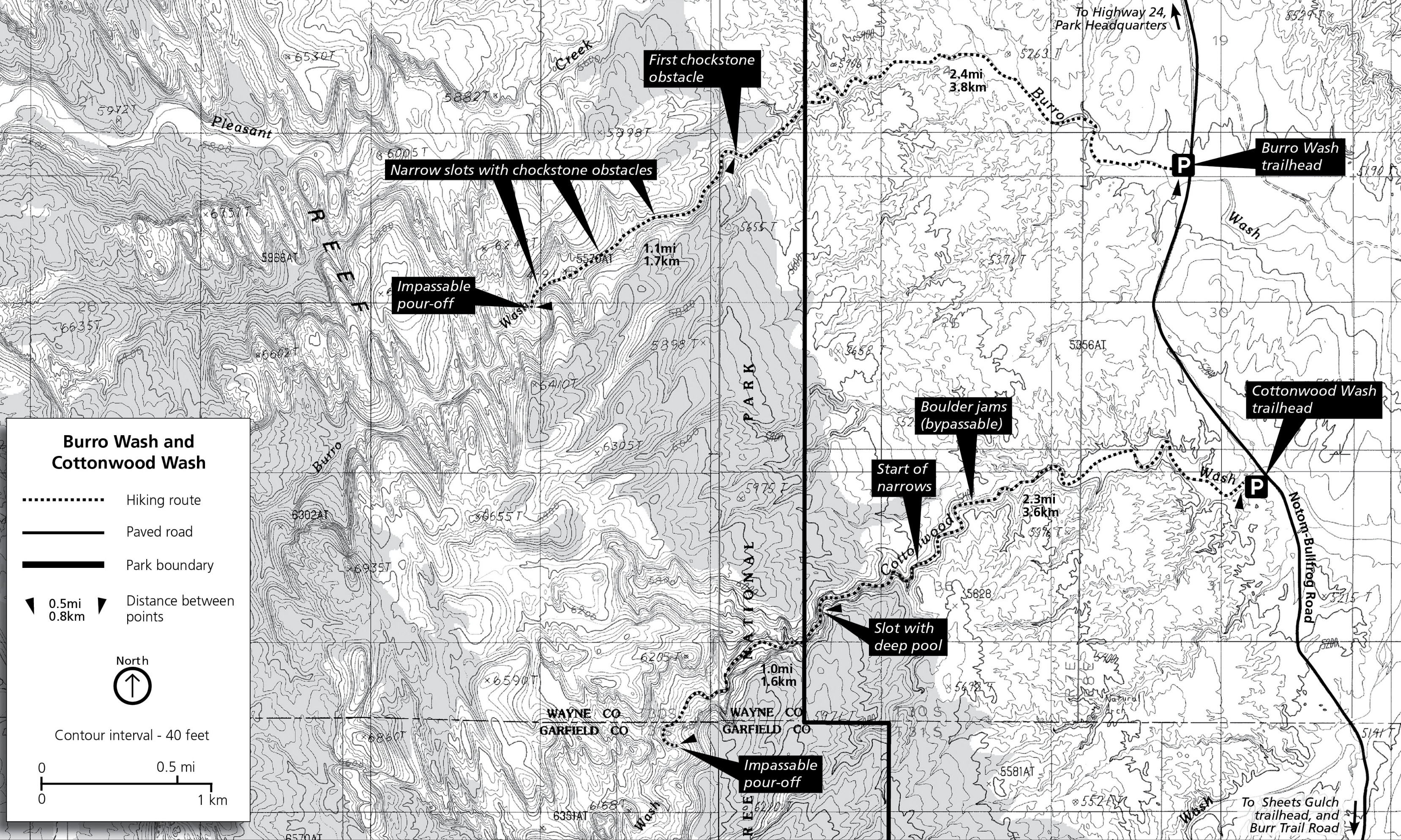 The Burro Wash trail map also includes Cottonwood Wash. These slot canyons should only be attempted by accomplished canyon hikers, as much climbing, wading, and swimming should be expected.
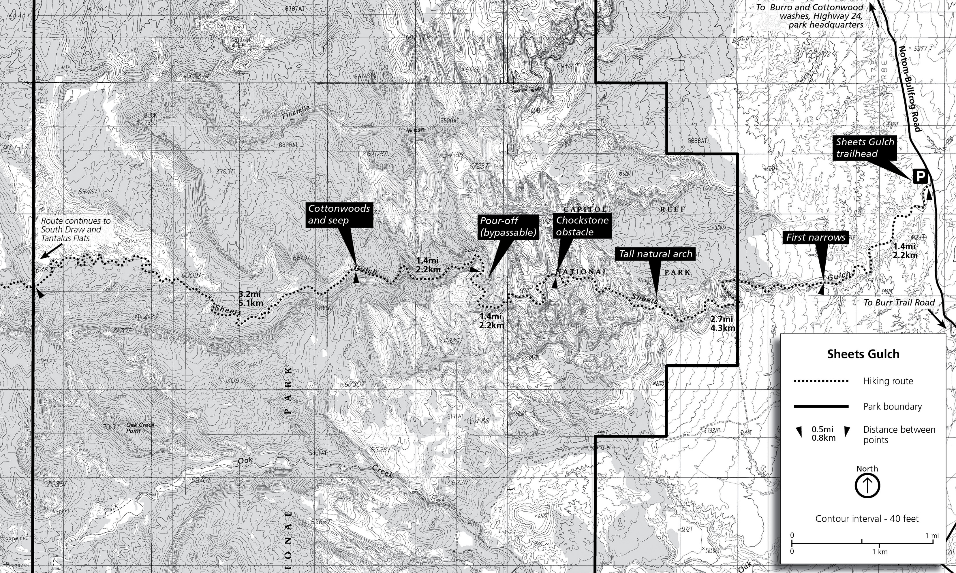 This Sheets Gulch trail map shows this region a bit south of Burro and Cottonwood Wash. Sheets Gulch is typically done as a day hike, but you can make it an overnighter by leaving a car on the very rough South Draw Road.
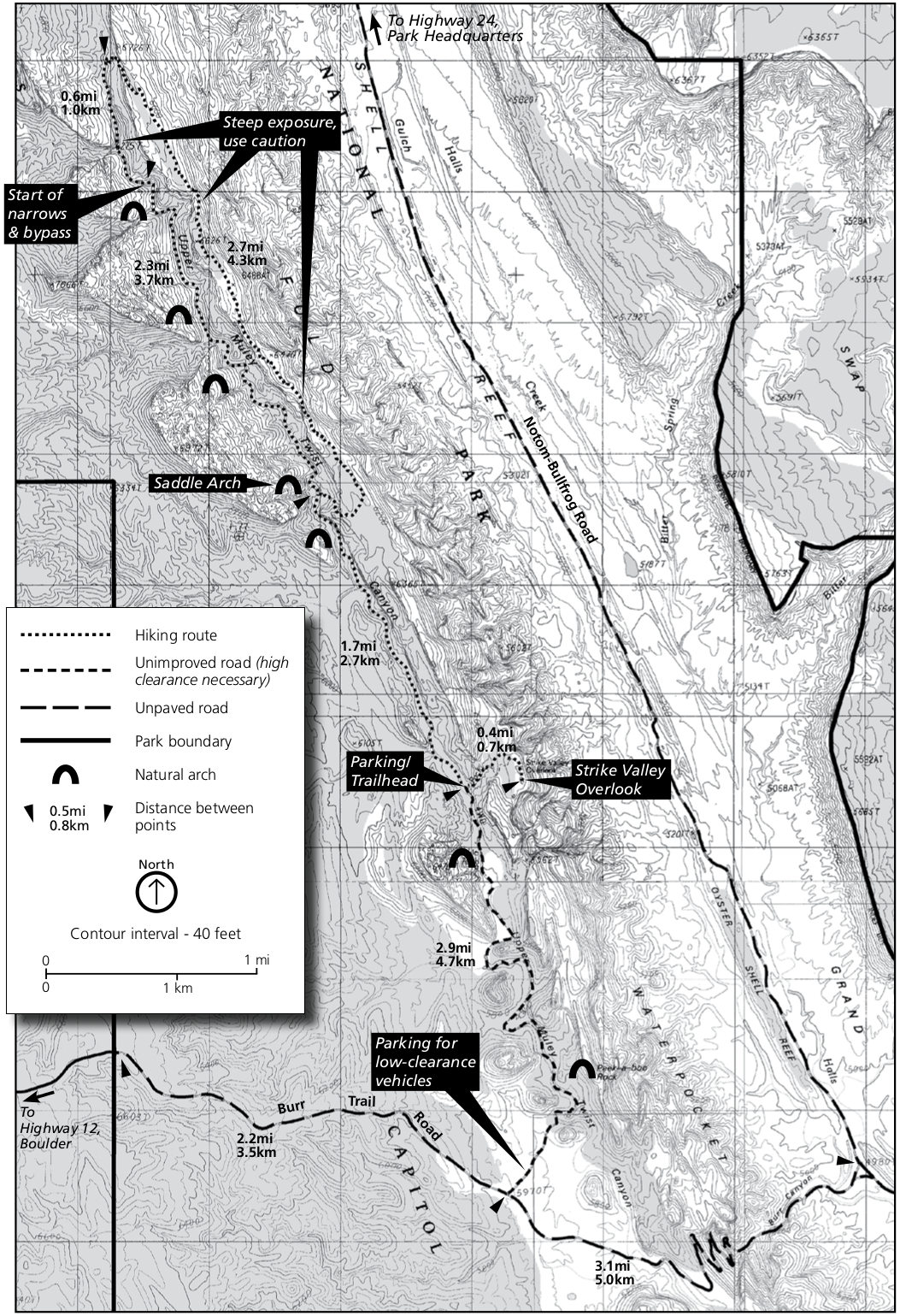 The Upper Muley Twist Canyon trail map shows the route from the Burr Trail Road and identifies grand viewpoints (Strike Valley Overlook) and the various arches along the way, such as the iconic Saddle Arch.
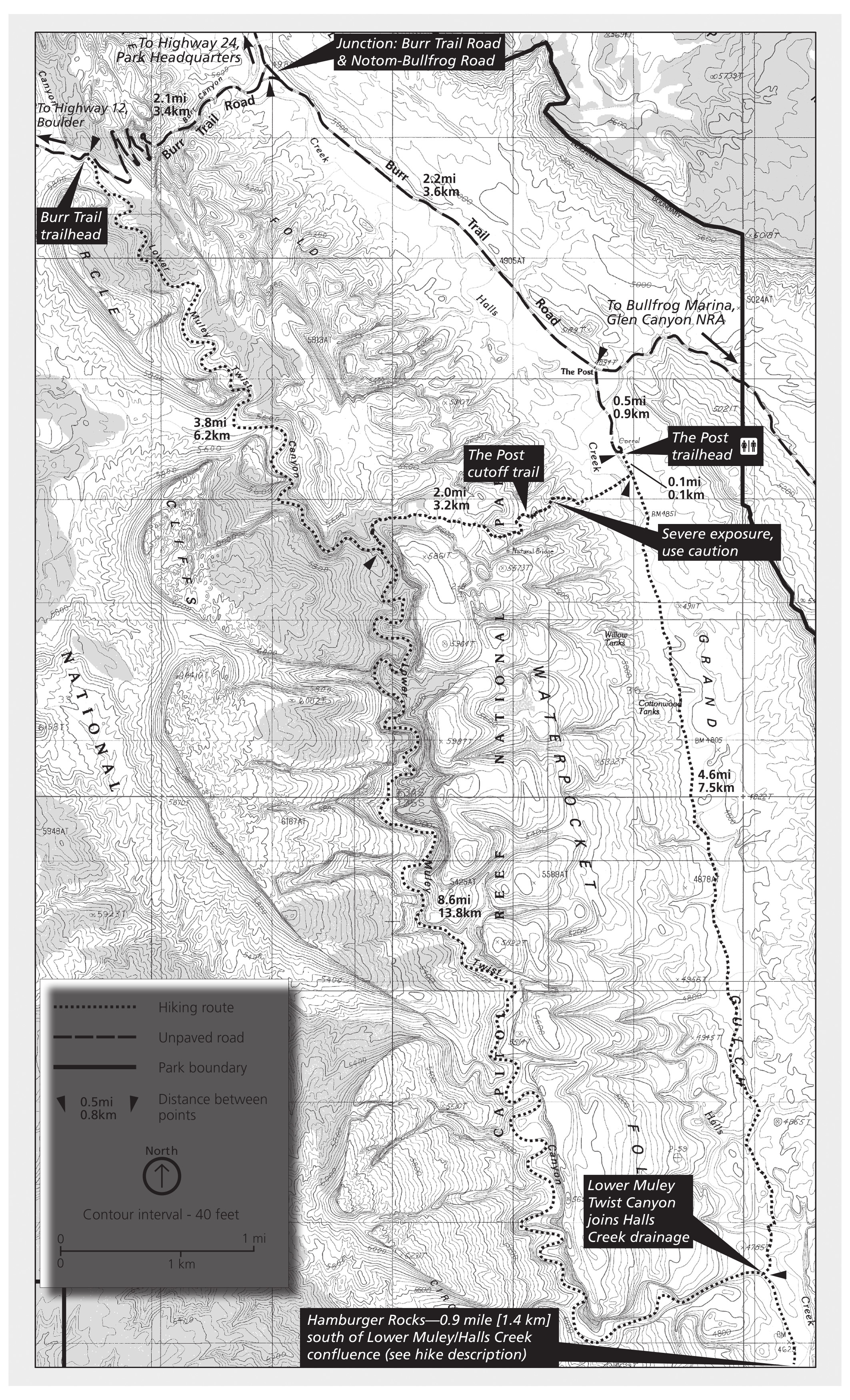 This is a Lower Muley Twist Canyon trail map, accessed from the Burr Trail. There are a few different options to make this an out-and-back or loop hike of one day or multiple days in length.
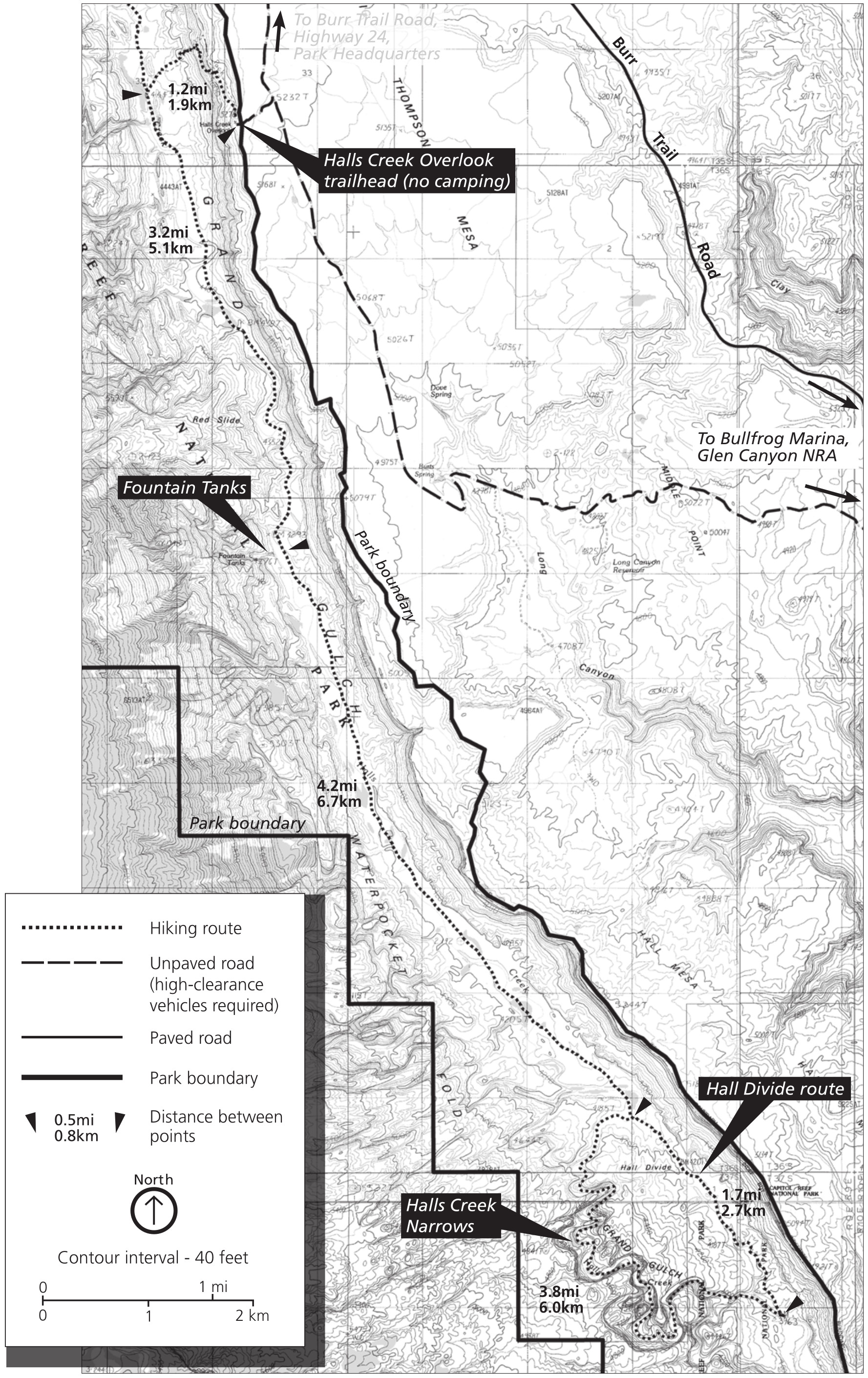 The Halls Creek Narrows trail map shows this largely unmarked route in the far southern part of Capitol Reef National Park. The Halls Creek Overlook is also shown on this map.
Assorted Capitol Reef maps
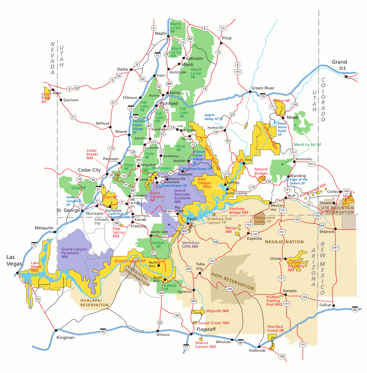 Here is a regional map of Capitol Reef, showing Capitol Reef as well as the surrounding parks and natural areas in southern Utah. Click the image to view a full size map or download the PDF.
 The Capitol Reef National Park campground map zooms out to show the surrounding region and where visitors can camp outside the park. Download the NPS Capitol Reef Campground guide (PDF).
 This Burr Trail map shows the incredibly scenic and rugged road that traverses Capitol Reef from the town of Boulder, UT to Glen Canyon National Recreation Area. Here you can download the NPS Burr Trail Guide (PDF).
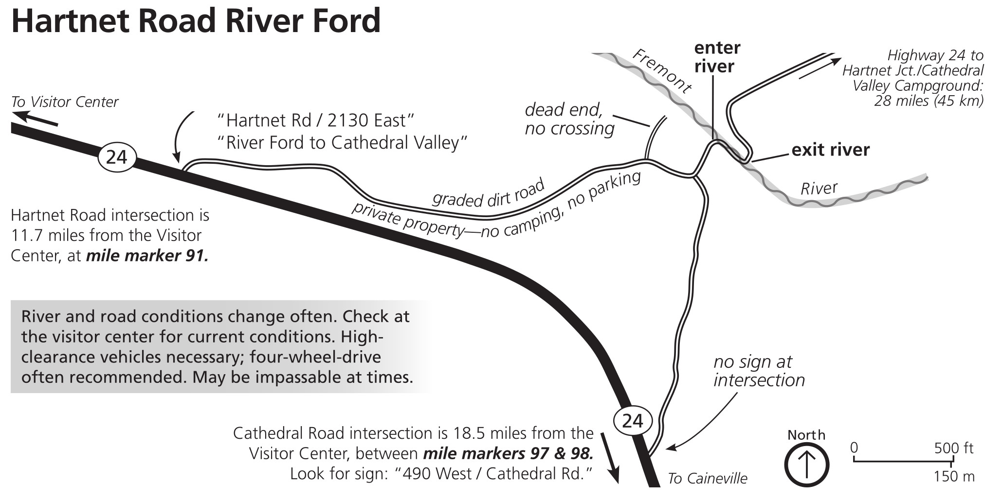 Here’s a Hartnet Road river ford map. There is no bridge here to cross the Fremont River, so if you take this primitive road, you will need to cross it yourself, preferably in a high-clearance vehicle with 4WD.
Capitol Reef science maps
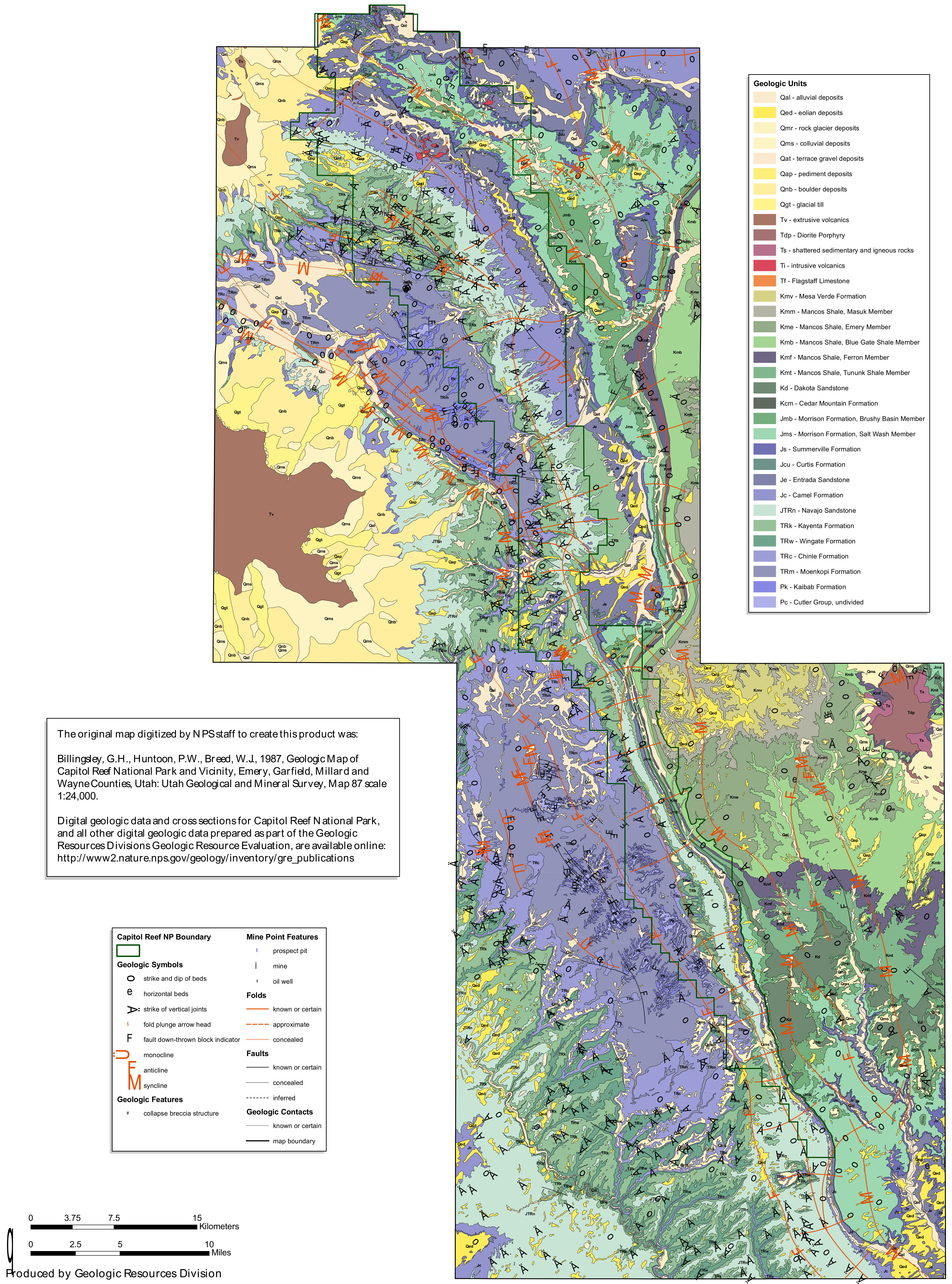 This Capitol Reef geologic map shows the folds and faults along the Waterpocket Fold, which makes up the backbone of Capitol Reef National Park. It’s more complicated than it looks in person, right?
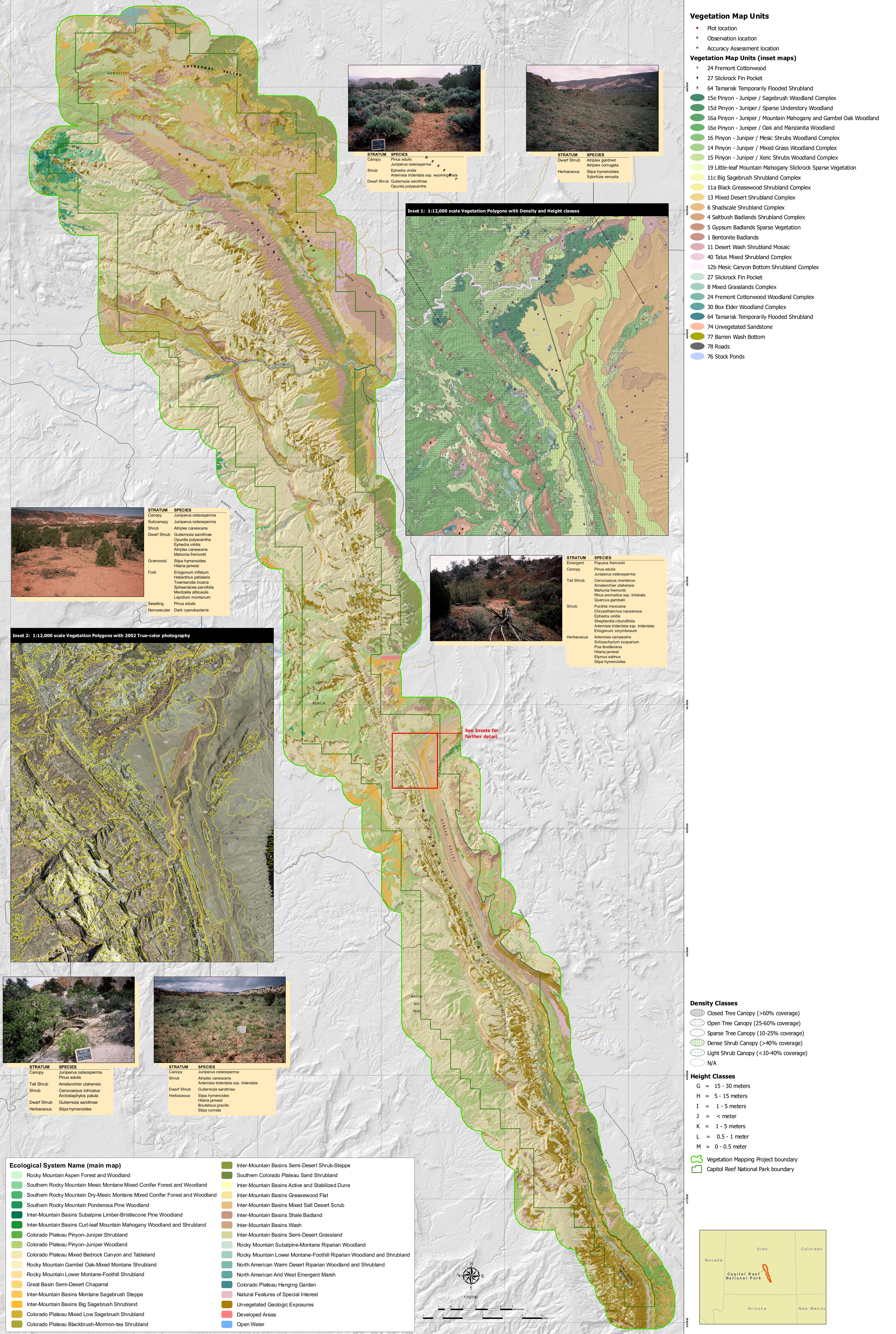 Here’s a Capitol Reef vegetation map, labeling the various plant and forest communities found within the boundaries of Capitol Reef National Park and in the surrounding landscape.
Archived Capitol Reef maps
The National Park Service is always updating maps and releasing new ones, and I do my best to find them and upload them to this page as frequently as possible. But rather than deleting old maps, I archive them here in this section, so you’re able to see how national parks change over time.
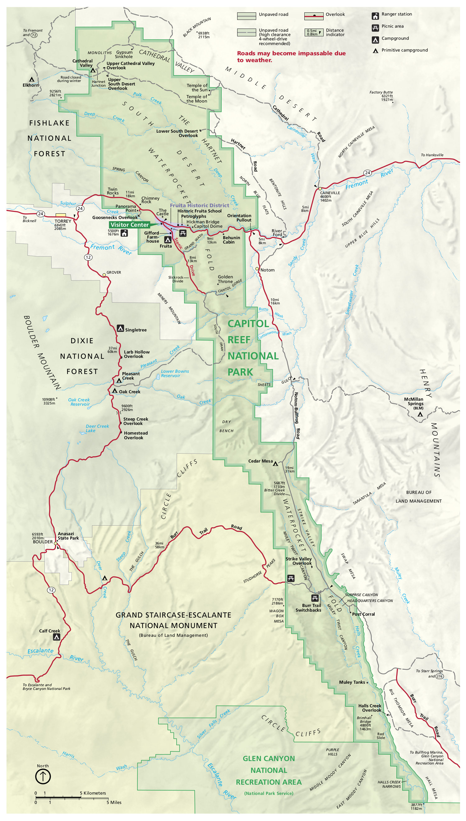 This is the older Capitol Reef brochure map from the mid-2010s, showing the roads, campgrounds, Fruita, and part of Dixie National Forest. Click the image to view a full size map or download the PDF.
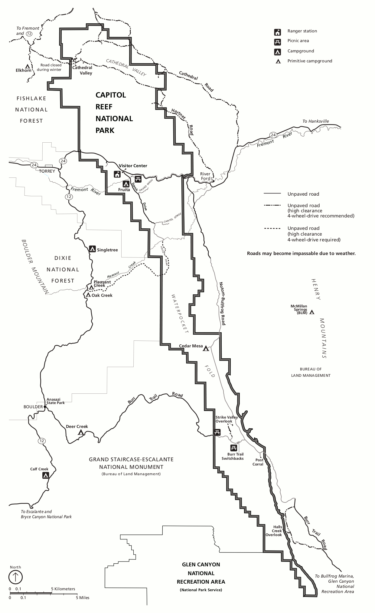 This is a printable Capitol Reef map, showing the same things as the map above but in black and white only, making it a bit easier to print legibly without using a bunch of your printer ink.
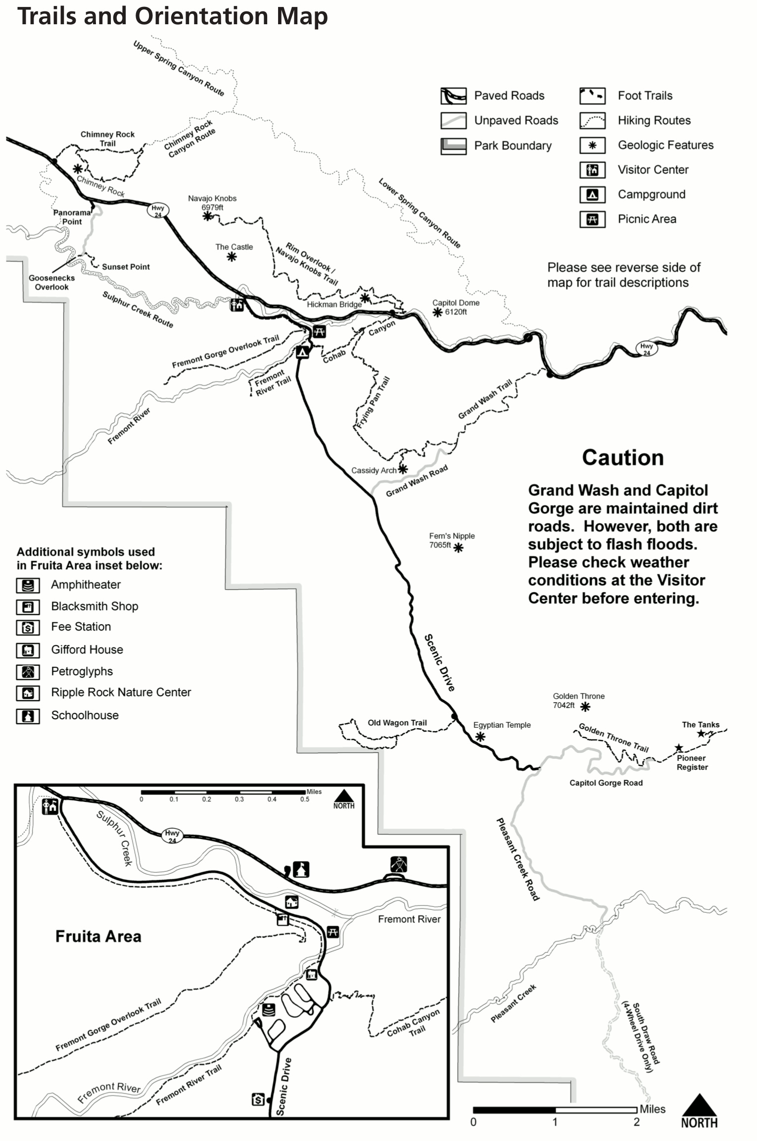 Here is an old Capitol Reef trail map, featuring the major trails in the main developed area of the park along the Scenic Drive, Highway 24, and near Fruita. This is probably the area you’ll be driving through.
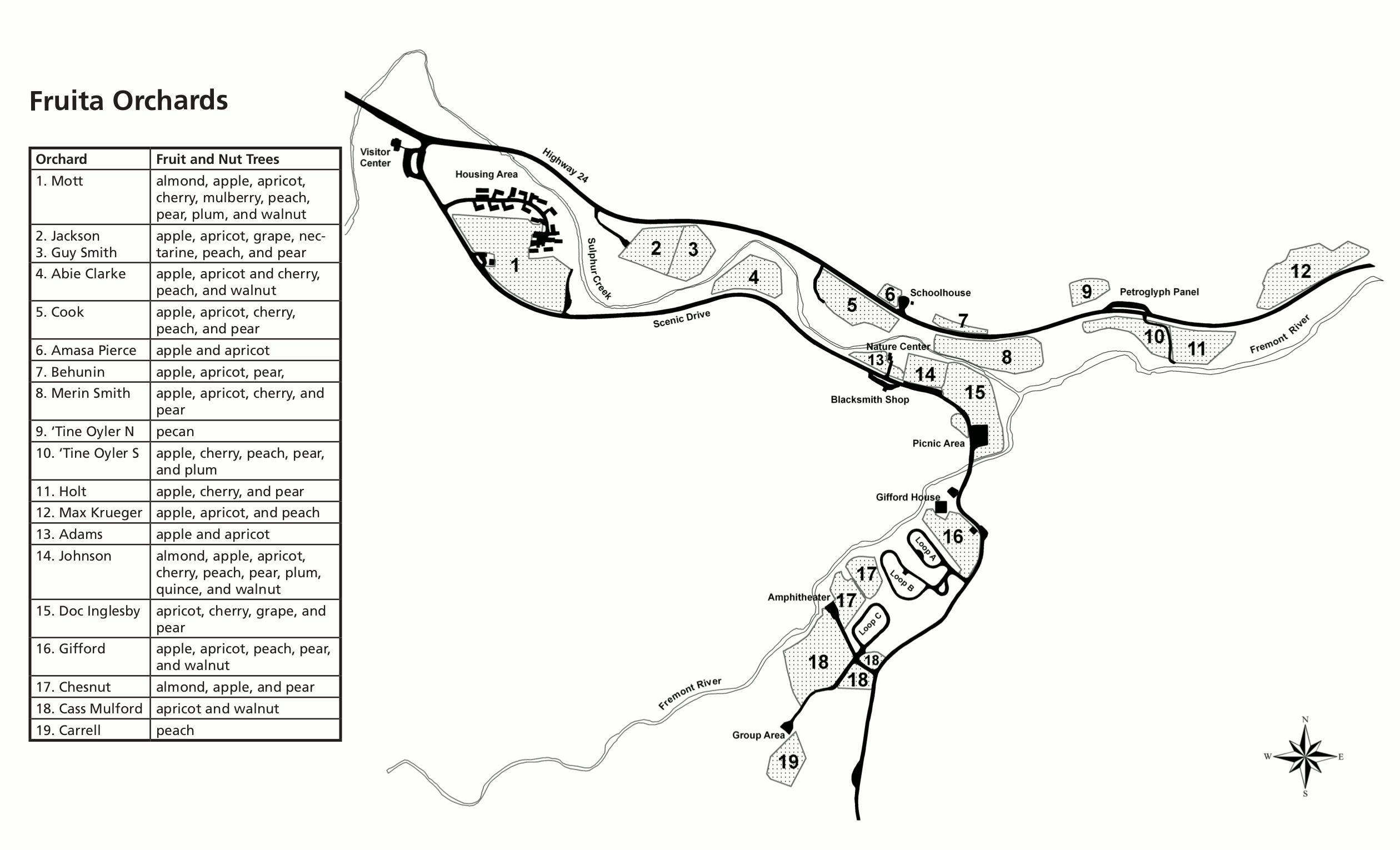 Here is the old Fruita Orchard map, showing each fruit orchard and what grows in it. It also shows the campground, picnic area, visitor center, and other sites in the main Fruita developed area.
…and more!
< Return to National Park Maps home
< Return to Park List
< Return to List by State