Pinnacles maps from the park brochure
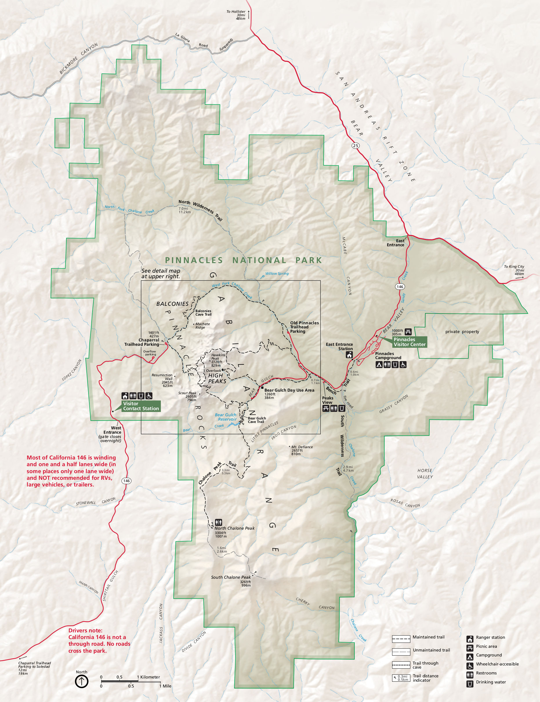
 This is the official Pinnacles National Park map from the NPS brochure. It was last updated in 2023 and shows a cool 3D perspective uncommon in NPS maps. Click the image to view a full size map or download the PDF.
 This is a detail map of Pinnacles National Park, showing the trails and features in the High Peaks area in the center of the park in greater detail. Click the image to view a full size map or download the PDF.
Pinnacles lodging map
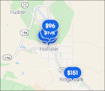 If you’re visiting Pinnacles National Park via the east entrance road (the most popular and developed section of the park), you’ll find there’s not any convenient lodging right near the park. You probably want to consider staying in Hollister, about 30 minutes away. To the right is an Expedia interactive lodging map that shows your options in relation to the park. Or browse the top-rated Hollister lodging to compare prices, photos, and guest reviews.
Assorted Pinnacles maps
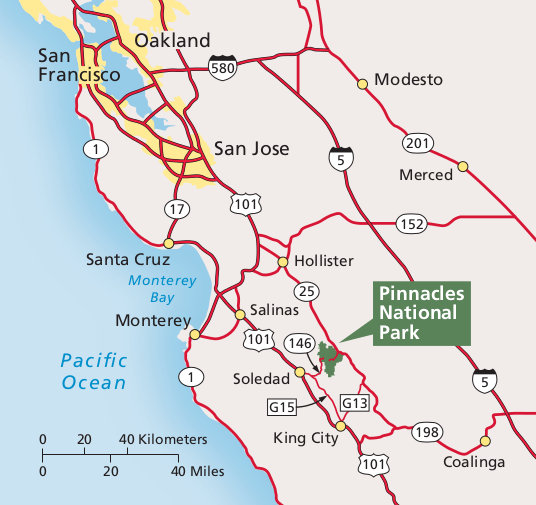 This is a regional map of Pinnacles, showing road access to the park from Monterey, Santa Cruz, San Jose, San Francisco, and more. Click the image to view a full size map or download the PDF.
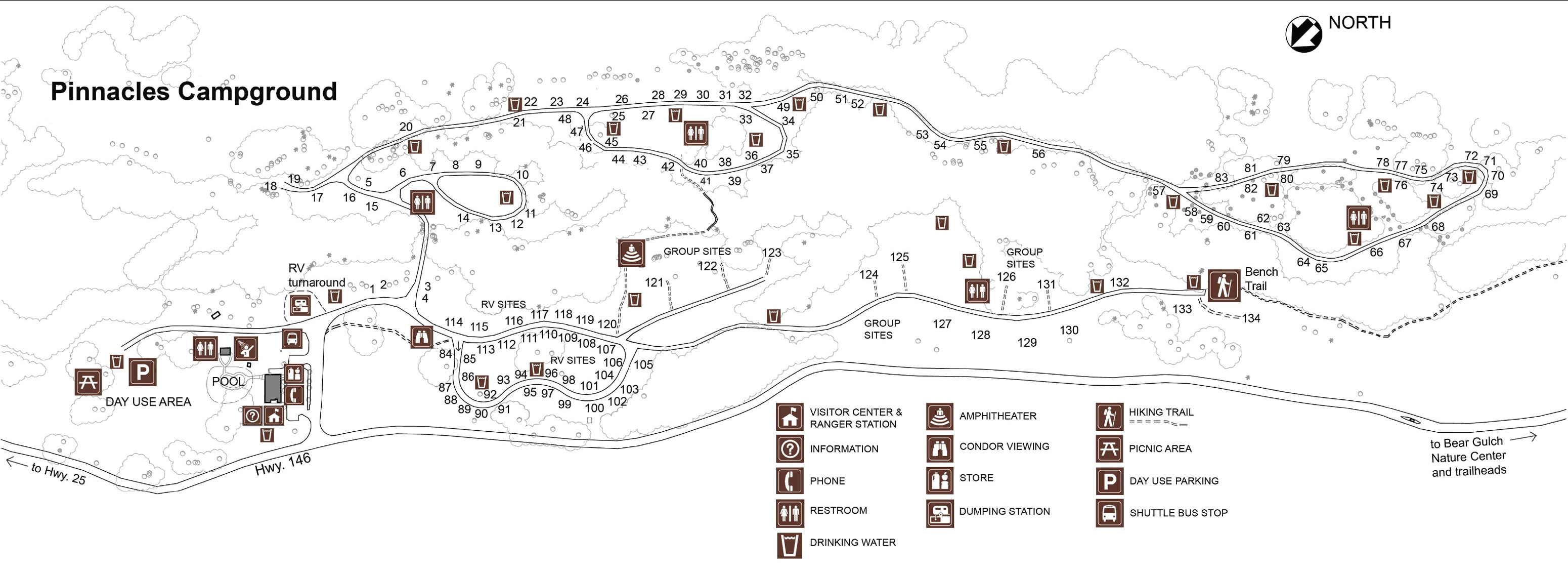
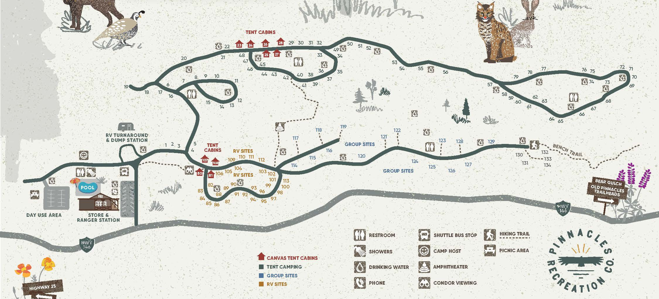 This is the Pinnacles Campground map, reflecting recent changes in site numbering. The campground includes tent cabins, RV sites, group sites, and tent-only sites, and has a store and pool onsite.
Pinnacles science maps
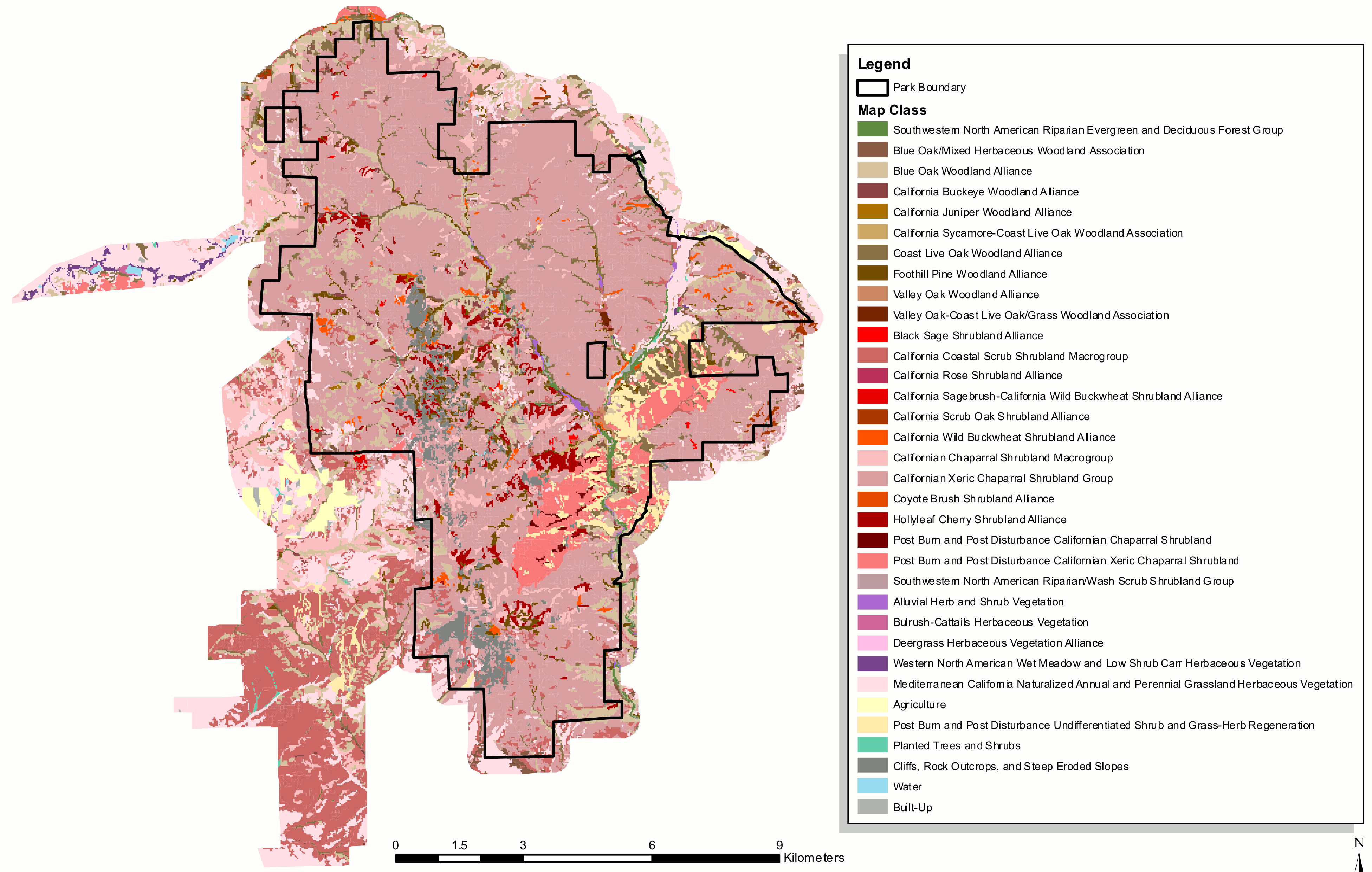 This vegetation map of Pinnacles National Park shows the different plant communities that live throughout the area – forests, woodlands, shrubland, grasslands, and more.
 Here’s a 3D Pinnacles vegetation map, showing similar land cover types as the map above but projected onto a park relief map making it a bit easier to read and compare to known landmarks.
Archived Pinnacles maps
The National Park Service frequently updates maps, and I do my best to include the newest Pinnacles map updates on this page. As maps get replaced, I move the older ones down to this section. Rather than deleting them, I feel it’s important to keep hosting the old maps so you can see how parks change over time.
 This is an old Pinnacles National Park map, published in the late-2010s. It shows roads, hiking trails, campgrounds, visitor centers, and points of interest. Click the image to view a full size map or download the PDF.
 This is the old Pinnacles Campground map, showing the campsites, restrooms, visitor center, water sources, picnic area, amphitheater, and hiking trails. The site numbering has changed since this map was published.
…and more!
< Return to National Park Maps home
< Return to Park List
< Return to List by State