Virgin Islands maps from the park brochure
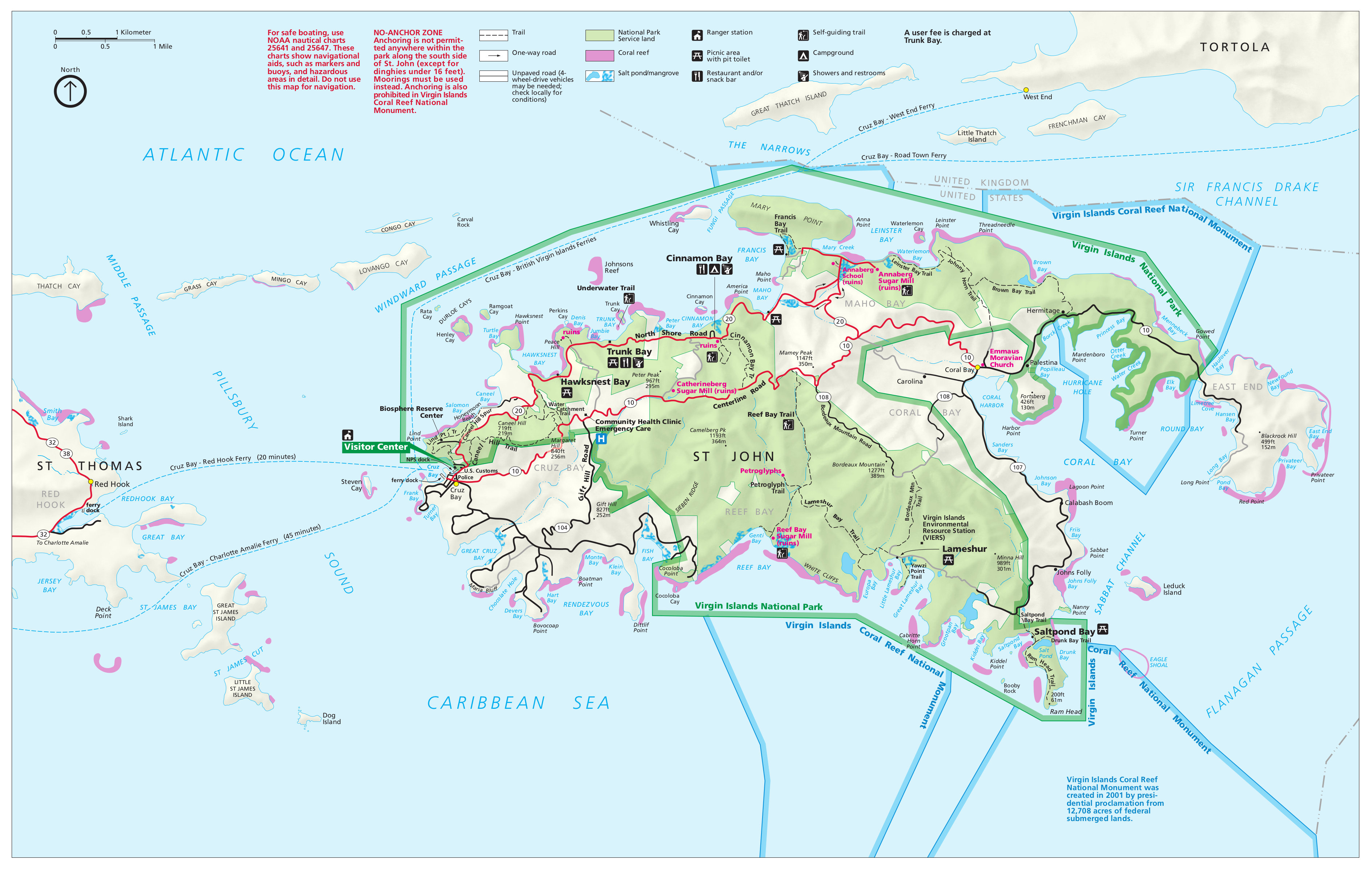
 Here is the official Virgin Islands National Park map from the NPS brochure. This map was last updated in 2022 and shows the entirety of St. John, though it only provides details of National Park Service lands.
 Here’s a Lind Point map, zooming in on the Cruz Bay area of St. John. Cruz Bay is the main population center of St. John and includes the Cruz Bay Visitor Center and several trails along Lind Point.
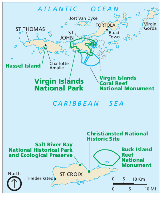 This is a regional map of the Virgin Islands, showing the national park locations on the various Virgin Islands. Click the image to view a full size map or download the PDF.
Virgin Islands trail map
 If you’re going to be spending a decent amount of time on St. John, you’re going to want the National Geographic Trails Illustrated map. It shows everything in much more detail than any free map, including topographic lines, hiking trails, beaches, and buoys. Since it has lots of detail for both the ocean and hiking trails, it makes for a good combo map that should suit you no matter how you spend your visit.
Virgin Islands landscape maps
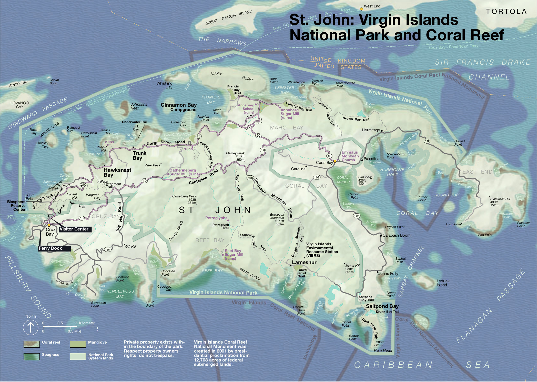 This detail map of St. John shows the sights in the main national park brochure map in much greater detail, including coral reefs, bays, islands, and other shoreline features.
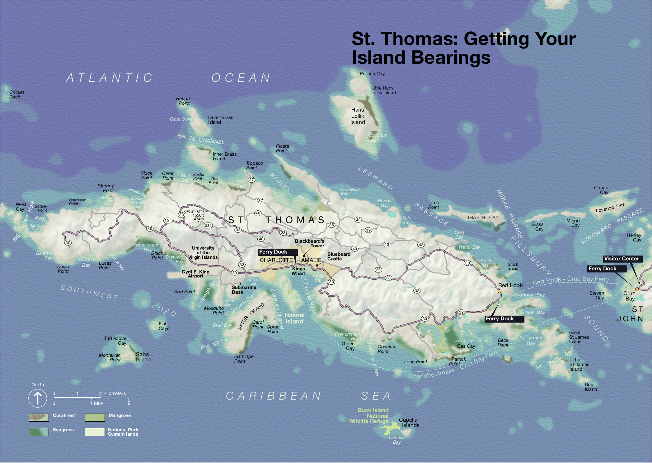 This is a map of St. Thomas, showing the roads, ferry routes to St. John, tourist attractions, wildlife refuges, points of interest, and islands on and around St. Thomas.
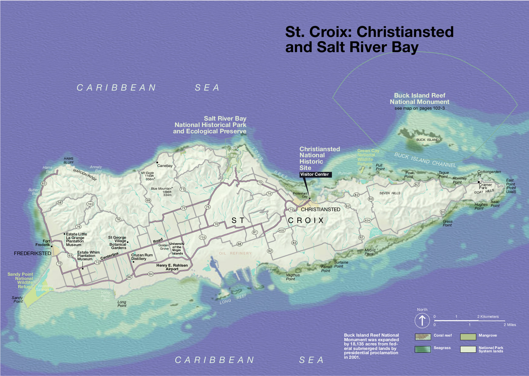 This is a map of St. Croix, showing Salt River Bay, Christiansted, towns, roads, reefs, bays, wildlife refuges, and the location of Buck Island Reef National Monument.
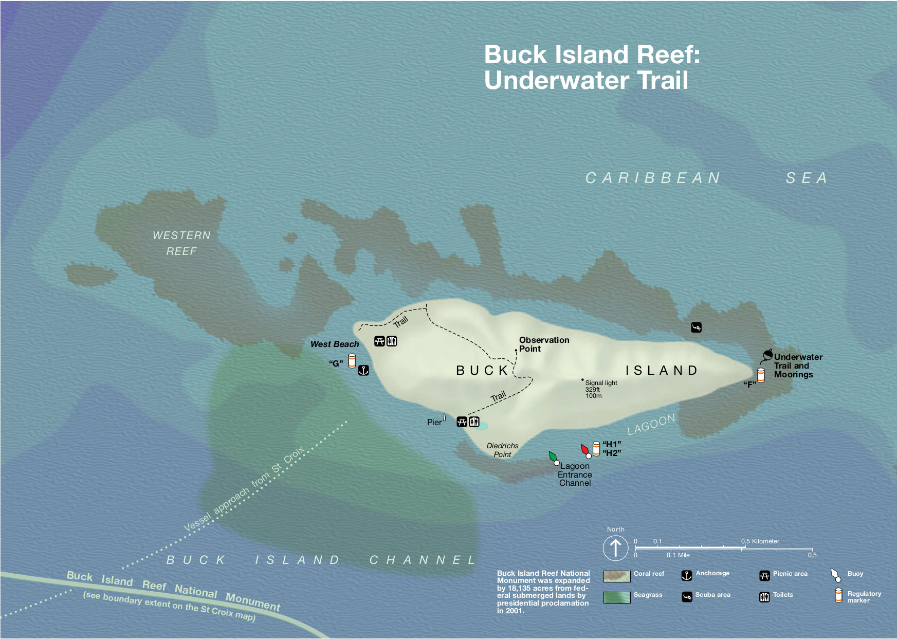 This is a map of Buck Island Reef National Monument, located just off St. Croix. It shows the island’s trails, reefs, moorings, and various navigation aids such as buoys and regulatory markers.
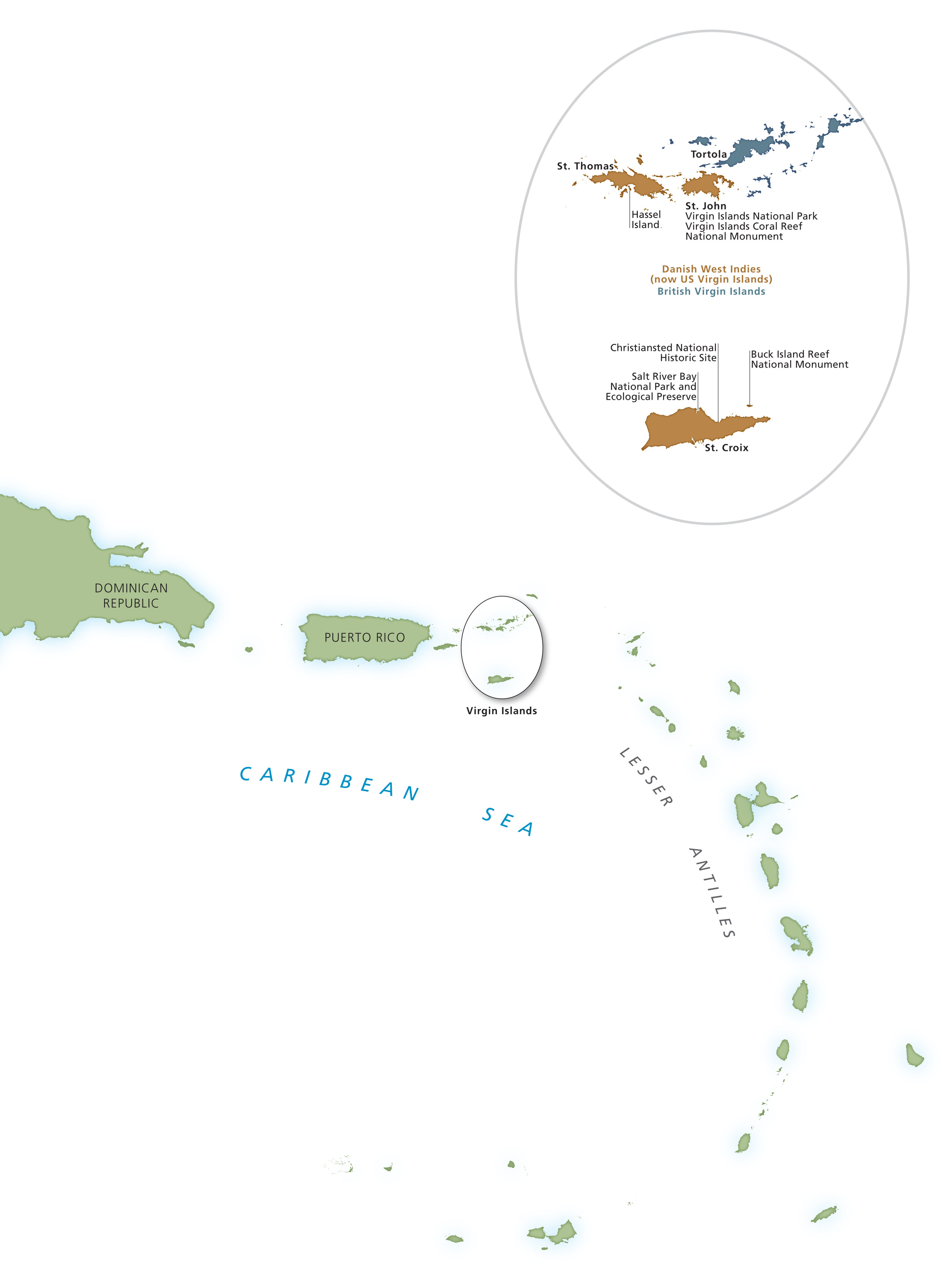
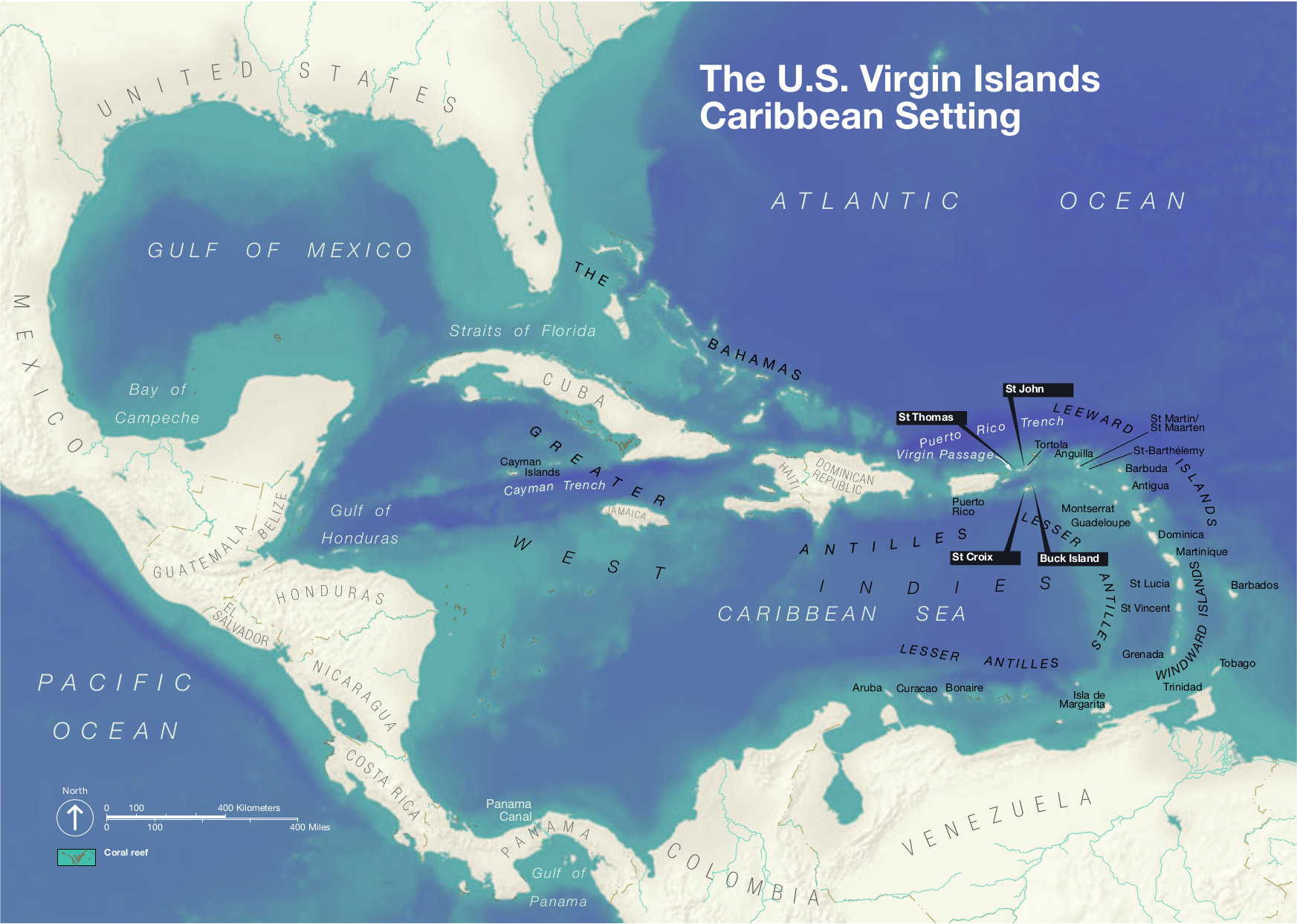 Here is a context map of the Virgin Islands, showing where they are in relation to Puerto Rico, the United States, South America, and the rest of the islands of the Caribbean Sea.
Virgin Islands lodging map
 For visiting Virgin Islands National Park, you’ll want to base yourself on St. John, where the park is located (rather than St. Thomas). To the right is an Expedia interactive lodging map centered on St. John; you can zoom in to compare locations of various hotels and resorts. Or start by browsing Expedia’s top-rated St. John lodging so you can compare guest reviews, prices, photos, location, and amenities.
Assorted Virgin Islands maps
 This is a simple “Where are the Virgin Islands?” map, zooming way out to show not just Virgin Islands National Park, but the surrounding region of the Caribbean Sea, including Puerto Rico and the Lesser Antilles.
 This is a Cruz Bay Visitor Center parking map. Note that parking is rather difficult here; there is a small lot that allows for one-hour parking, but other nearby areas are off-limits for park visitors.
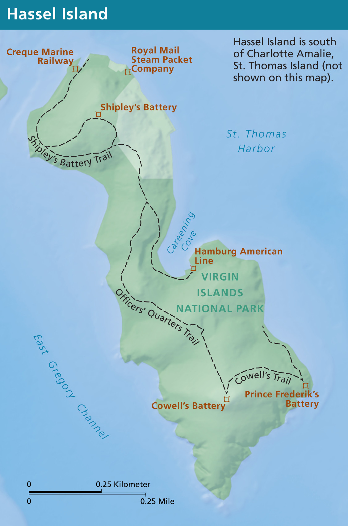 This Hassel Island map shows this very small island off St. Thomas that includes some land managed by the National Park Service. Note that it’s only accessible by boat tour from St. Thomas.
Virgin Islands geologic maps
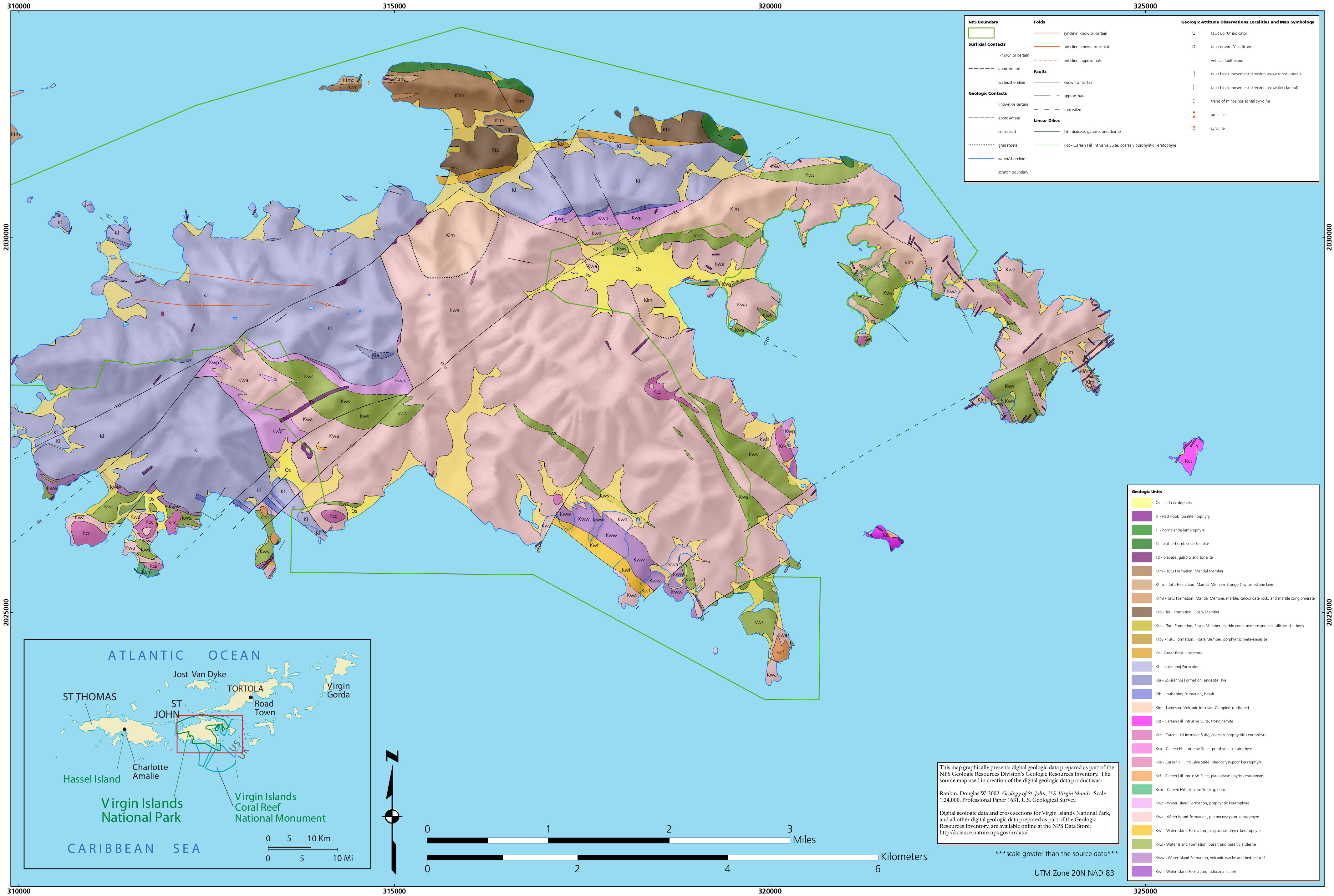 The Virgin Islands geologic map zooms in on St. John, showing the rock layers and geology inside the national park boundary and also in the surrounding area and nearby islands.
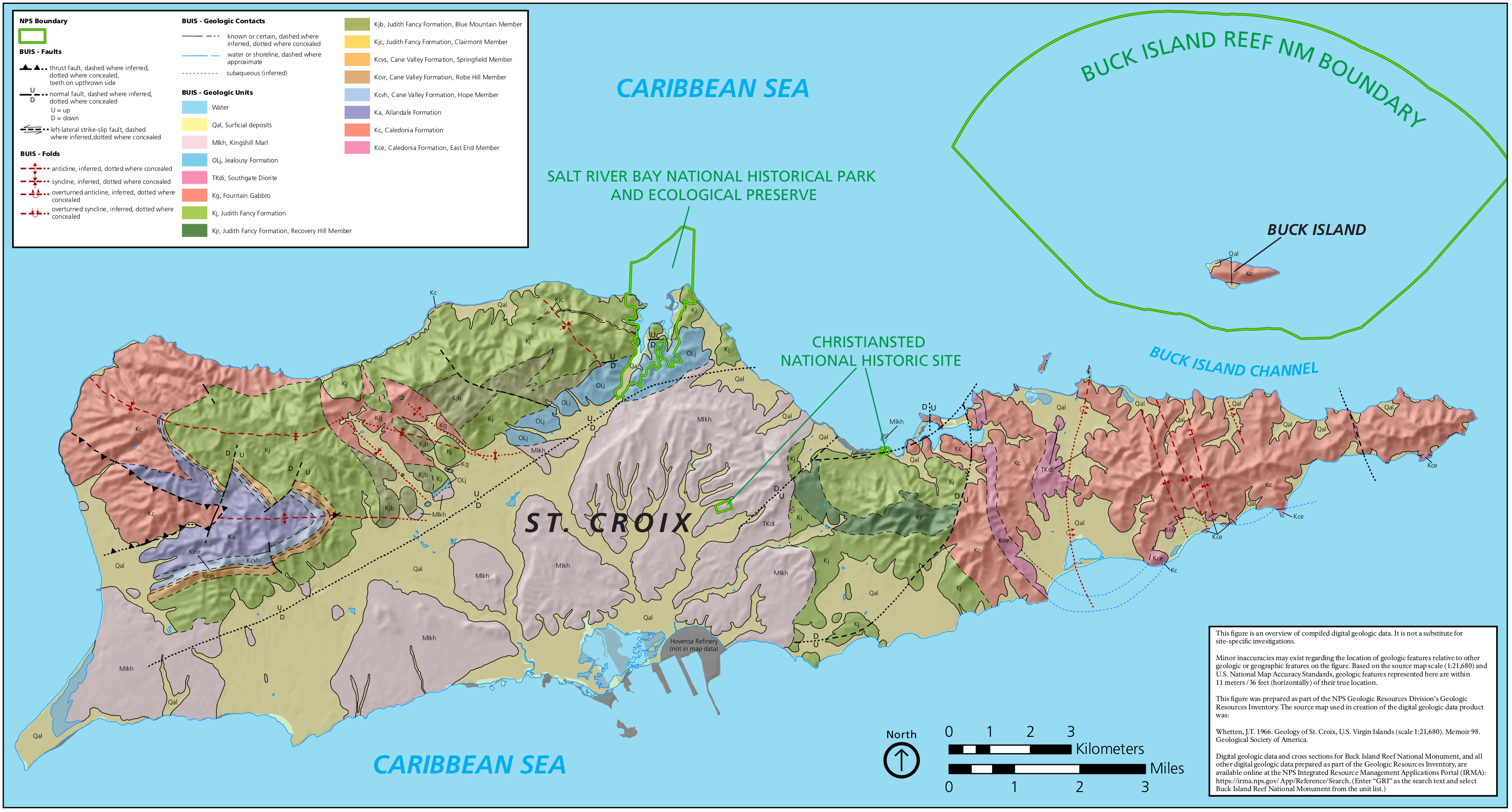 This St. Croix geologic map highlights the rock layers, folds, and fault lines on St. Croix as well as Buck Island, marking the boundaries of the various national park units.
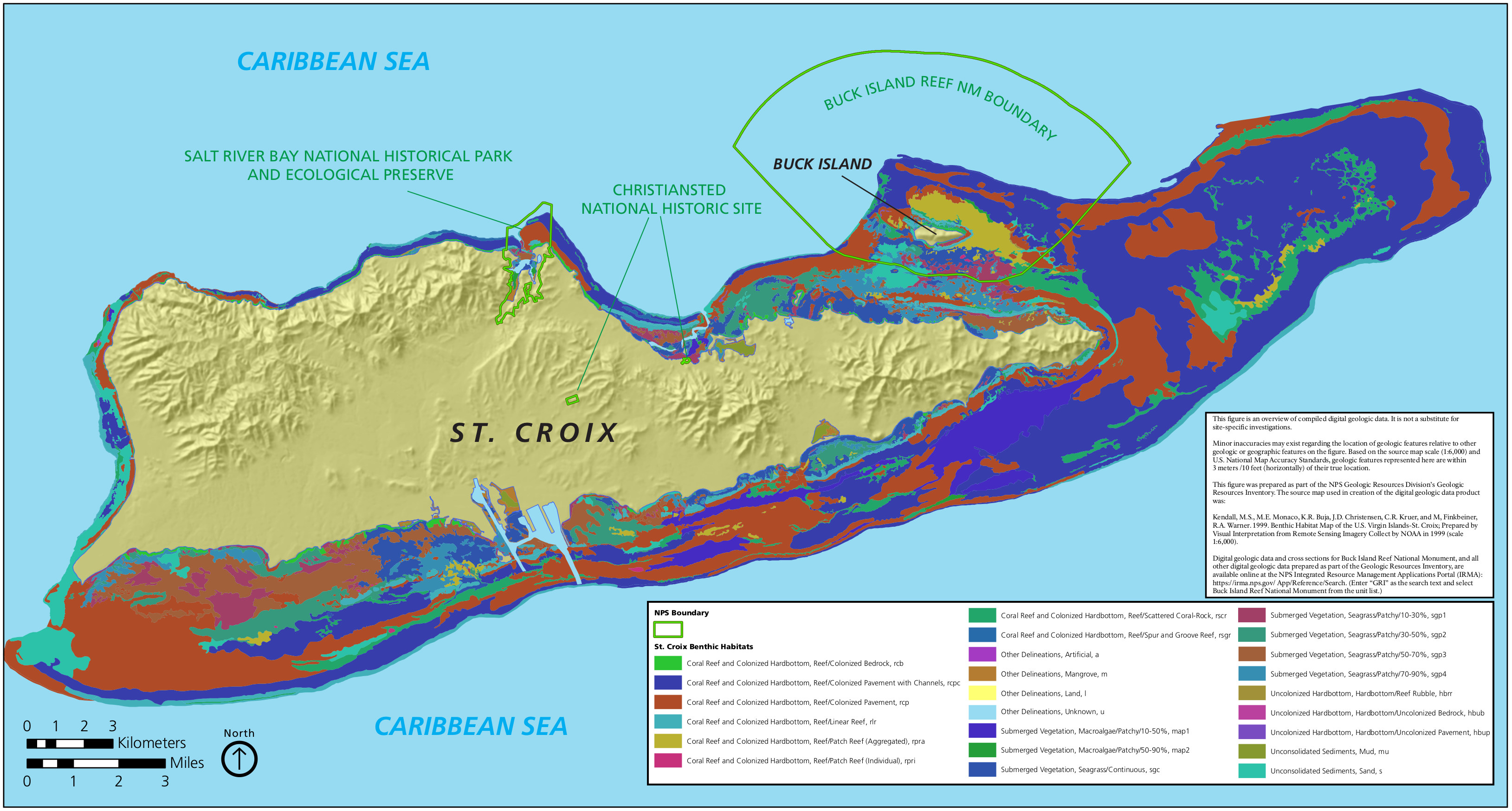 This St. Croix benthic map shows the shallow ocean bottom physical features, including coral reefs, vegetation (mangroves, seagrasses, etc.), and hardbottom.
Archived Virgin Islands maps
As the National Park Service releases new maps, I do my best to capture updates here. As maps get older and are replaced, I move the old ones down to this section. So take note that these are not the most recent maps, and they’re provided here simply for archival purposes.
 This is the old official map of Virgin Islands National Park from the mid-2010s, including Trunk Bay, Cinnamon Bay, and other locations on St. John. Click the image to view a full size map or download the PDF.
…and more!
< Return to National Park Maps home
< Return to Park List
< Return to List by State