Theodore Roosevelt brochure maps
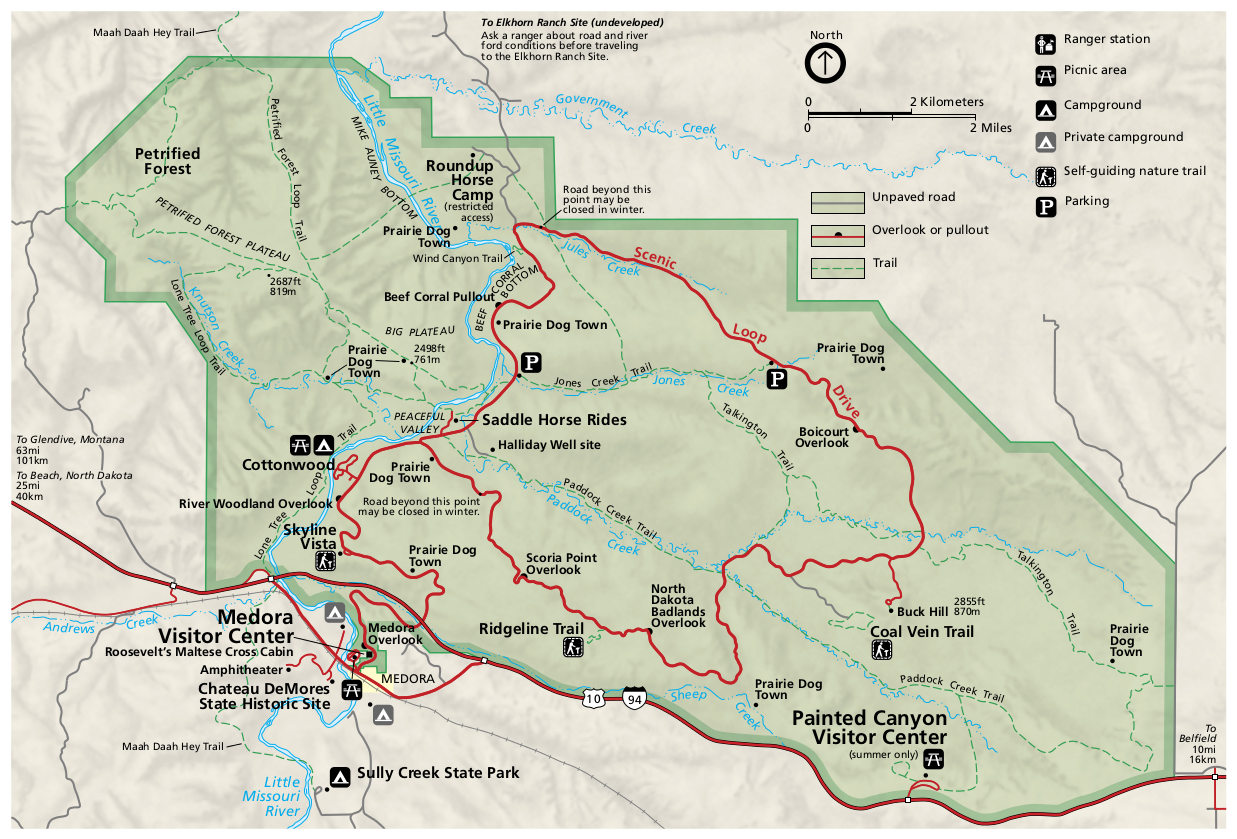
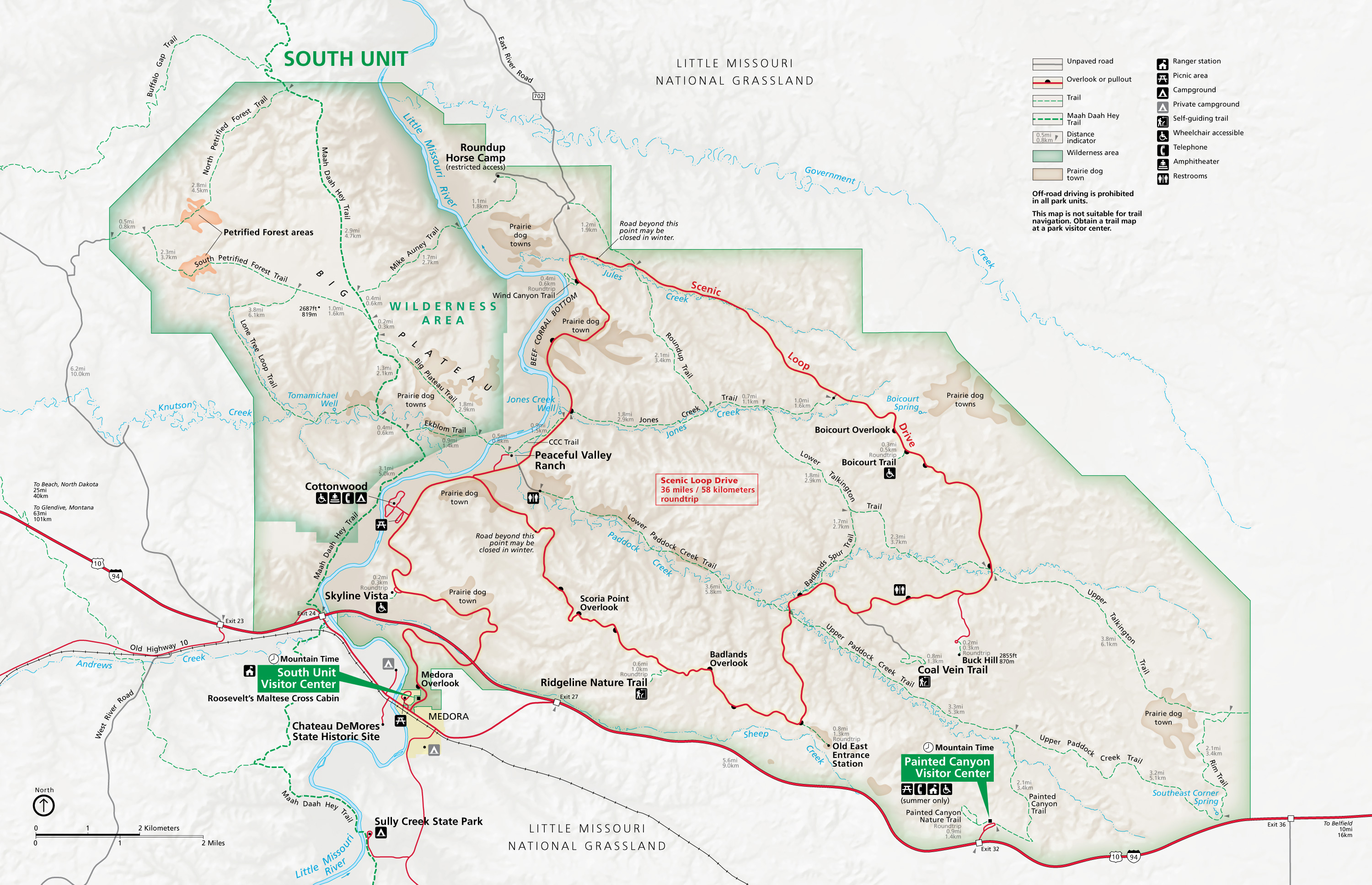 This is the official South Unit map of Theodore Roosevelt National Park, featuring the Scenic Loop Drive, complete with all overlooks and points of interest. Click the image to view a full size map.
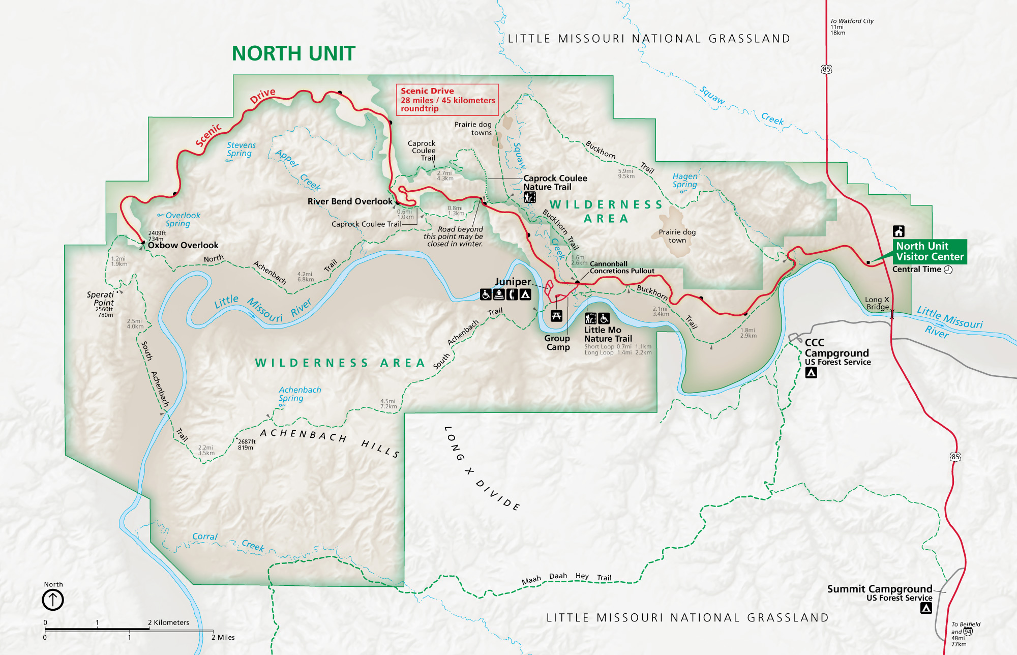 This is the official North Unit map of Theodore Roosevelt National Park, featuring its own scenic drive as well as visitor center, trails, and campgrounds. Click the image to view a full size map.
Theodore Roosevelt trail maps
 There are two units in Theodore Roosevelt National Park – the South Unit is near I-94 and the North Unit is, well, north. Most visitors are just passing through and don’t spend much time in Theodore Roosevelt, but if you’re planning on staying and hiking the park’s extensive trail networks, the National Geographic Trails Illustrated map is indispensible since it shows the topographic lines. A must-have if you’re out on the trails!
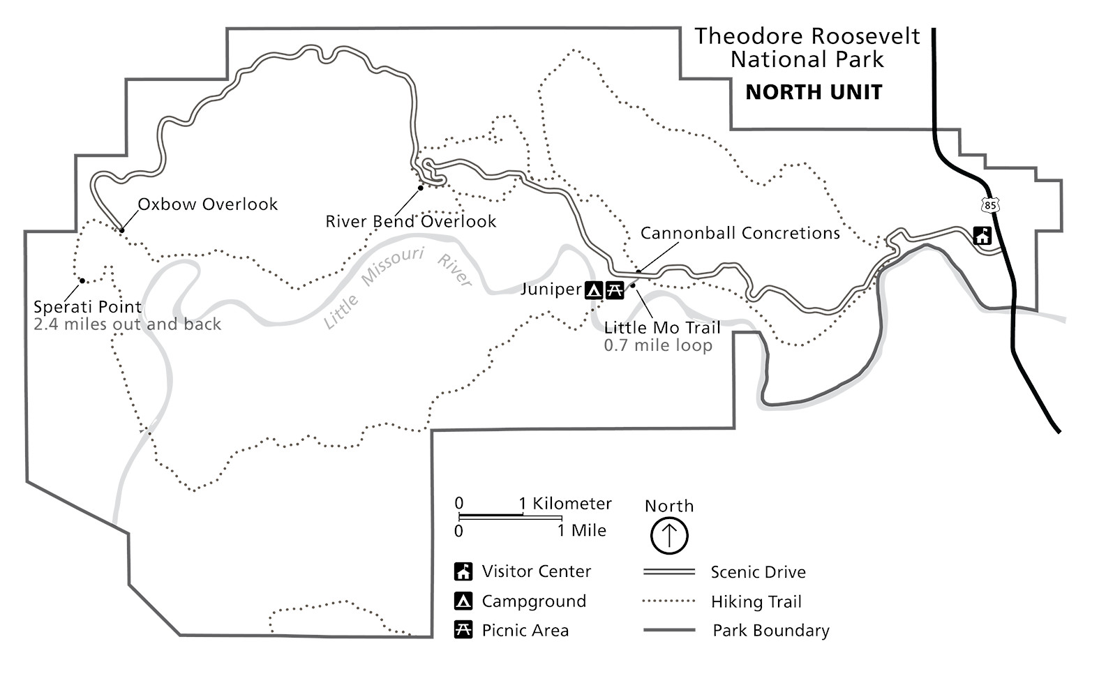
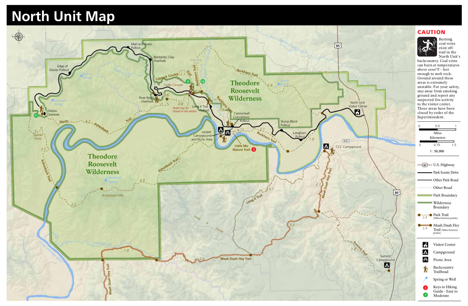 This is a Theodore Roosevelt hiking map of the park’s northern unit, featuring the trails and trail mileages near the Juniper Campground and picnic area, down the road from the North Unit Visitor Center.
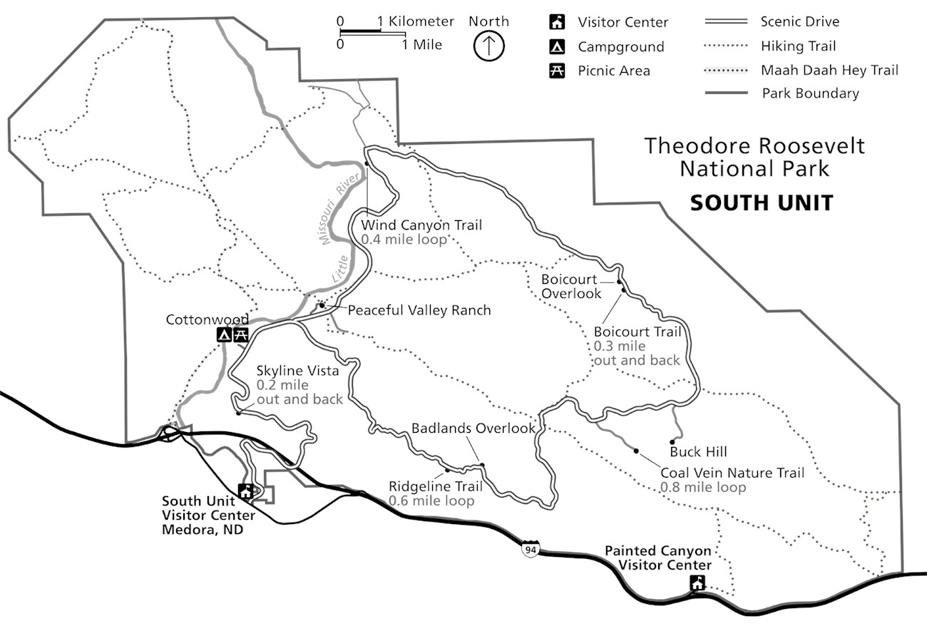
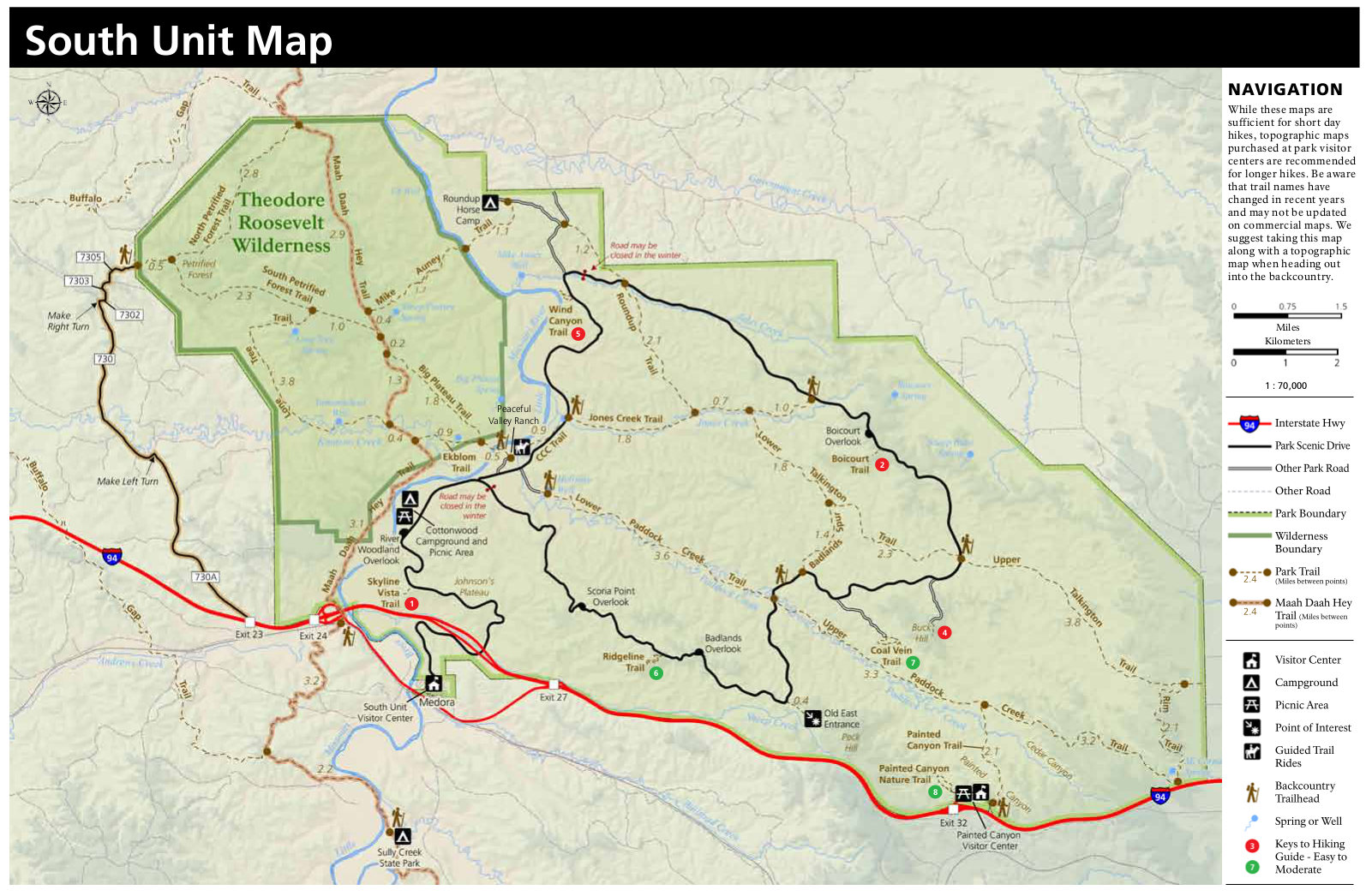 Here’s a Theodore Roosevelt hiking map of the south unit, located closest to I-94, the Painted Canyon area, and the town of Medora. This is the most-visited part of the national park.
Regional Teddy Roosevelt maps
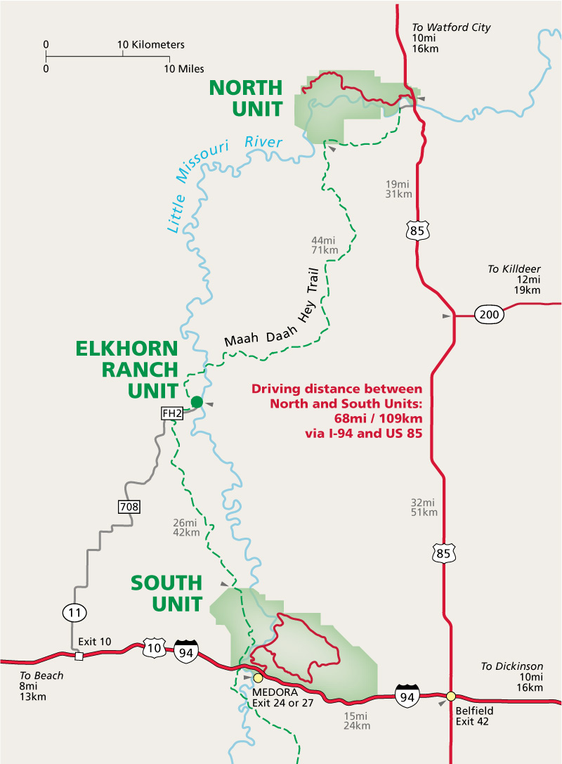 Here is a regional Theodore Roosevelt map, showing the units in relation to I-94 and Highway 85, as well as the most direct driving route between them. Click the image to view a full size map or download the PDF.
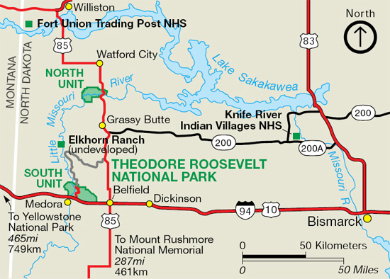
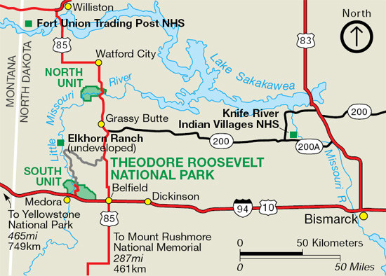 Here’s a North Dakota national parks map. It shows not just Teddy Roosevelt National Park, but also Knife River Indian Villages National Historic Site and Fort Union Trading Post National Historic Site.
Theodore Roosevelt lodging map
 This is probably not the most stunning revelation, but rural North Dakota tends not to have a huge variety of places to stay. The town of Medora has a few options, and if you use the Expedia interactive lodging map to the right, you’ll see that there’s just not much else around! You’ll find more options to the east in Dickinson. Browse Expedia’s top-rated Theodore Roosevelt area lodging to compare your options.
Theodore Roosevelt campground maps
 This Cottonwood Campground map shows the larger and busier of Theodore Roosevelt National Park’s campgrounds. It’s in the south unit, nearest Medora, and half the sites are available for reservation.
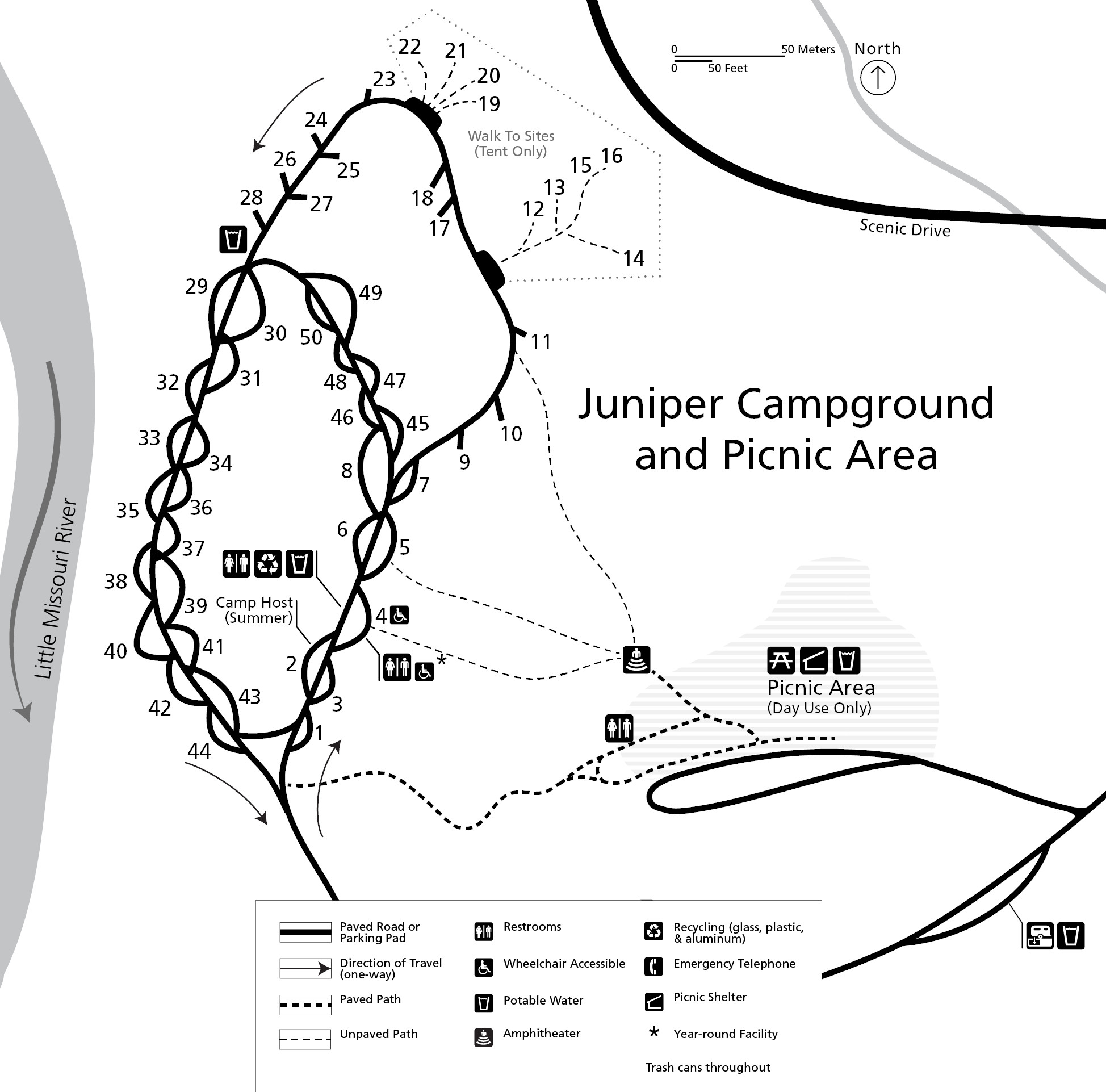 Here’s a Juniper Campground map. This campground is more remote, located in the wilder northern unit. These sites are all available only as first-come, first-serve; no reservations are accepted.
Printable Theodore Roosevelt maps
 Here’s a Theodore Roosevelt National Park south unit printable map. Unlike the full-color maps higher on this page, this is a simple black-and-white version for easy home printing and readability.
 Here’s a Theodore Roosevelt National Park north unit printable map. The north unit is much more remote and rugged than the south, and both are worth a visit if you can dedicate the time.
Elkhorn Ranch maps
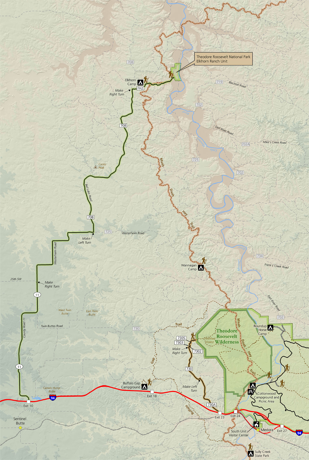 This is an Elkhorn Ranch map, which shows the Maah Daah Hey Trail and related campsites in this very remote, undeveloped section of the park. It includes driving directions, which you might need!
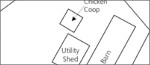 The Elkhorn Ranch building map shows what you’ll find today when you finally arrive after the long drive and 3/4-mile walk. This was Theodore Roosevelt’s “home ranch” in the Dakotas.
Theodore Roosevelt geologic maps
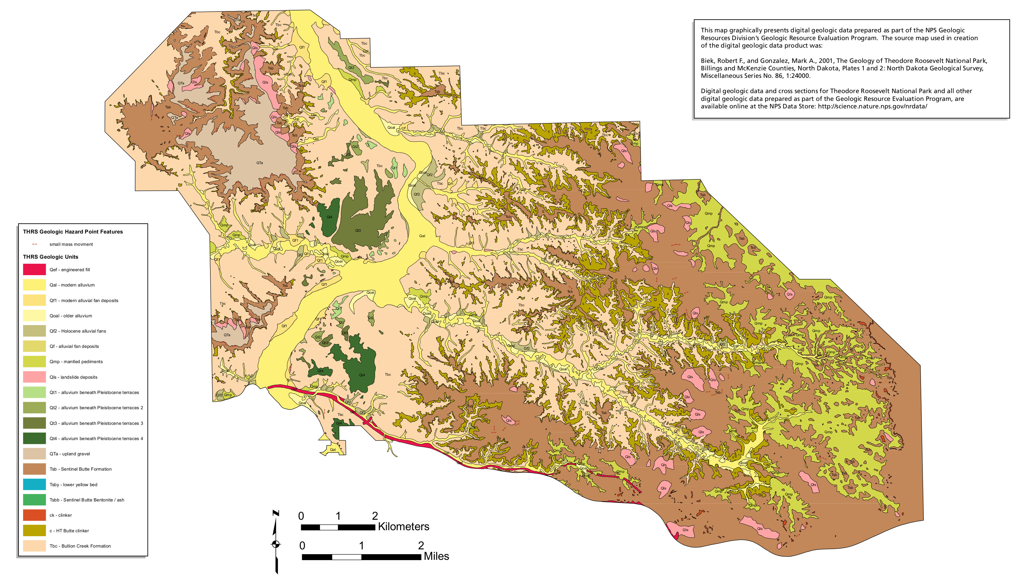 The Theodore Roosevelt geologic map of the south unit focuses on the most highly visited area of the park near the Medora Visitor Center and along I-94.
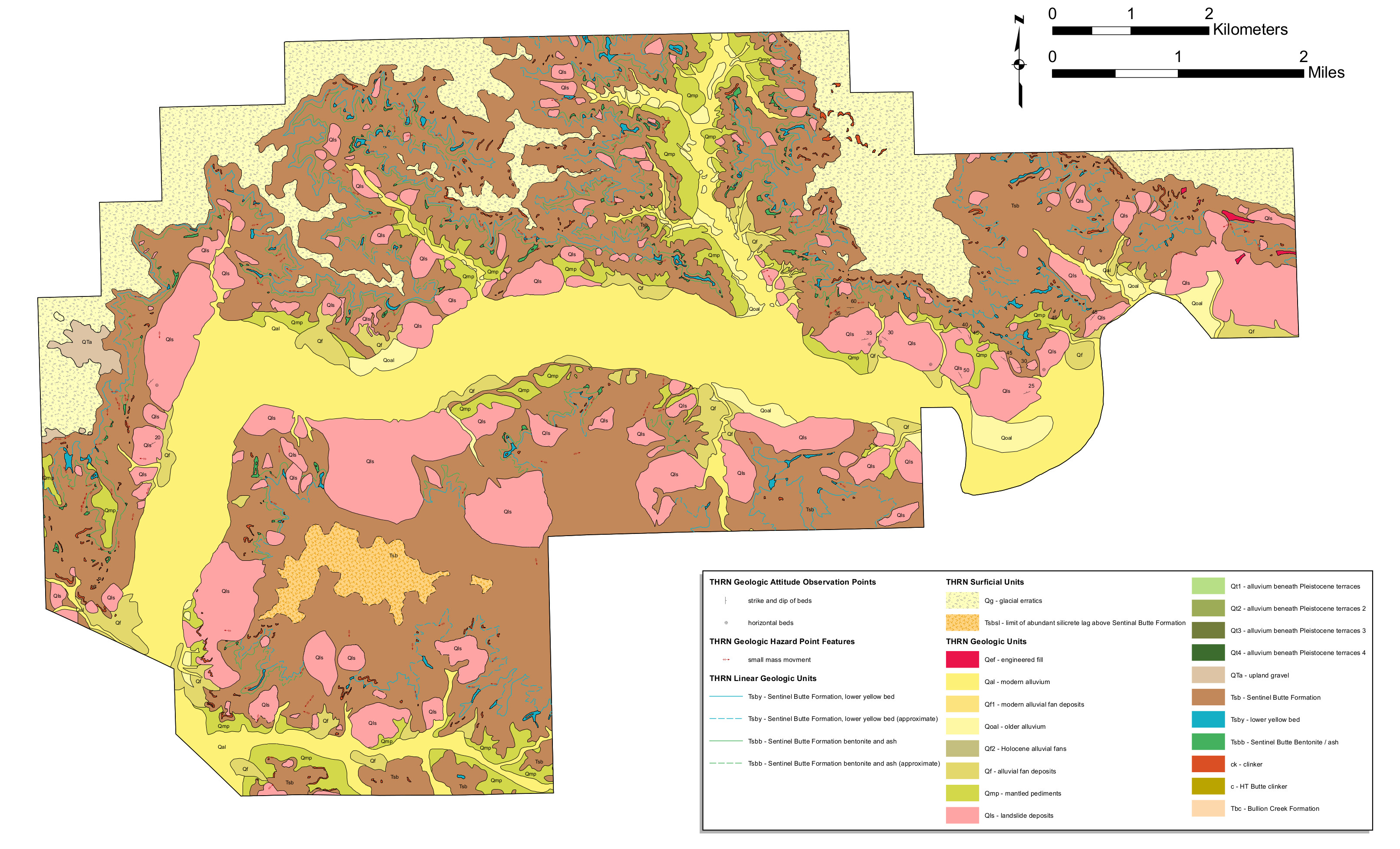 Here’s a north unit geologic map of Theodore Roosevelt, which in particular highlights the rock layers that surround the very obvious Little Missouri River channel.
Archived Teddy Roosevelt maps
The National Park Service is always updating old maps and releasing new ones. I do my best to add new Theodore Roosevelt National Park maps to this page, but I never delete old ones; I feel it’s important to preserve the story of how national parks change over time. Old maps that have been updated above are included in this section.
 This is the previous brochure map of the south unit of Theodore Roosevelt National Park, featuring the Medora Visitor Center and Painted Canyon area. Click the image to view a full size map or download the PDF.
 This is the previous map of the north unit of Theodore Roosevelt National Park, featuring the visitor center, campgrounds, and trails. Click the image to view a full size map or download the PDF.
 Here is the previous regional map of Theodore Roosevelt National Park, showing its location in reference to I-94, other major roads, other national park sites, and towns in this area of western North Dakota.
 Here’s an old map of Juniper Campground, the campground located along the Scenic Drive in the quieter, more isolated north unit of the park. You’ll find about 50 campsites along the Little Missouri.
 This is an old Cottonwood Campground map, located in the busier south unit of Theodore Roosevelt National Park along the Little Missouri River. It labels restrooms, water, and the different types of campsites.
…and more!
< Return to National Park Maps home
< Return to Park List
< Return to List by State