Cuyahoga Valley maps from the park brochure
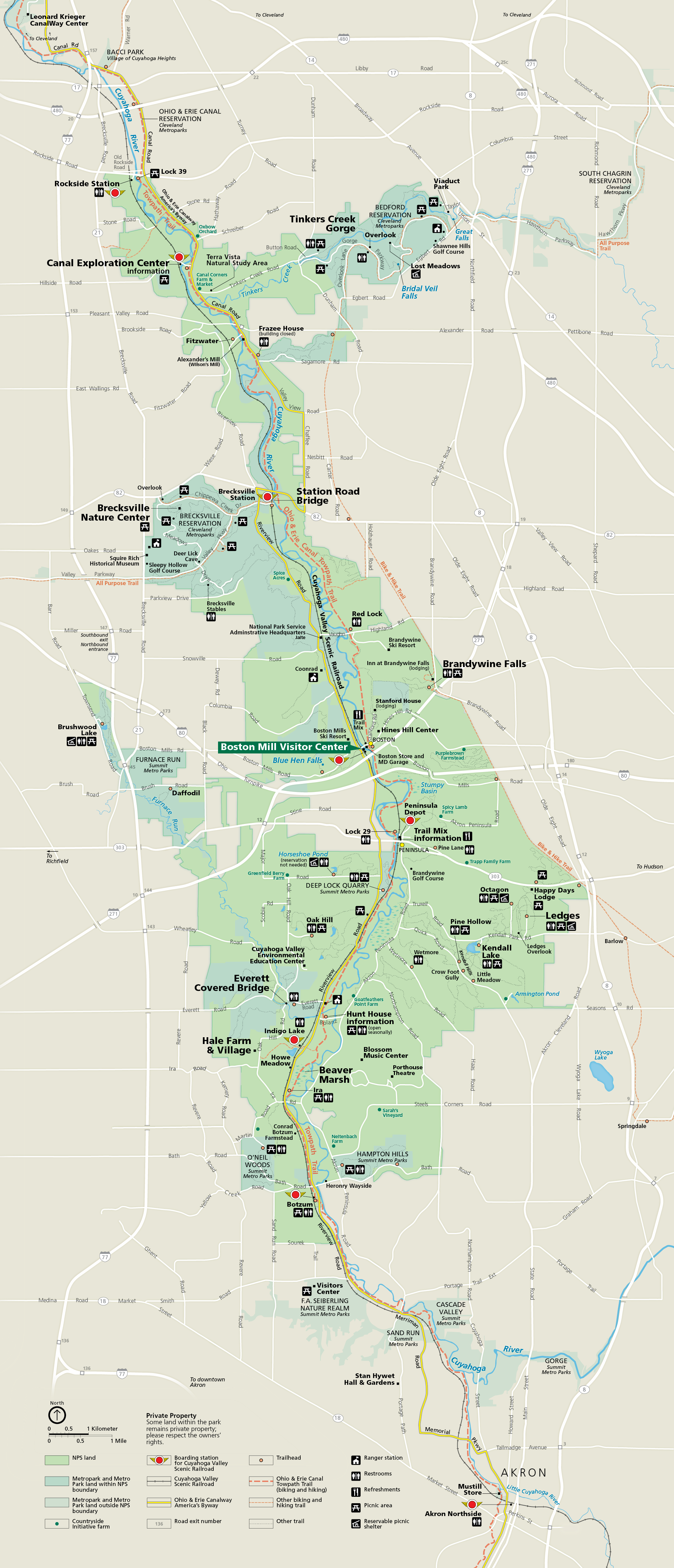 This is the complete Cuyahoga Valley map from the official brochure, showing all the trails, bike paths, roads, and points of interest. Click the image to view a full size map.
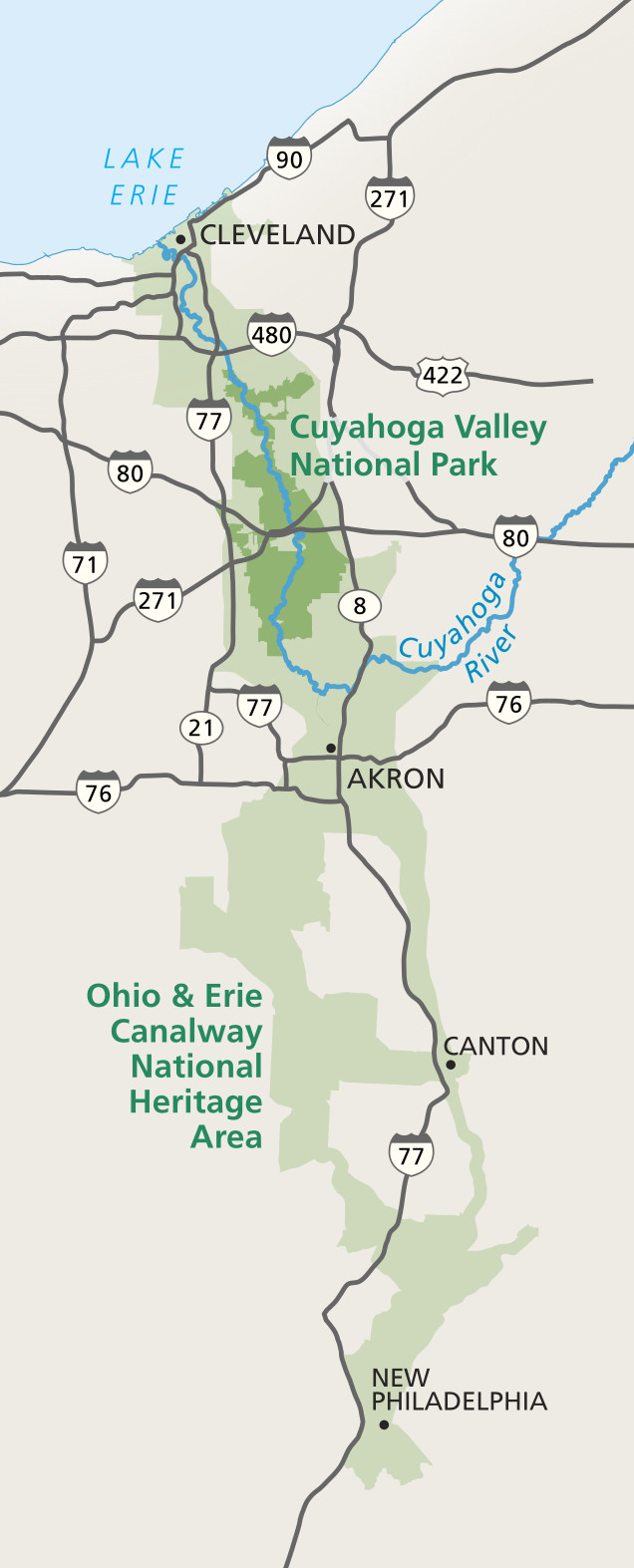 The Cuyahoga Valley National Park area map zooms out to show the regional context, including interstate highways and the cities of Cleveland, Akron, Canton, and New Philadelphia.
Cuyahoga Valley trail maps
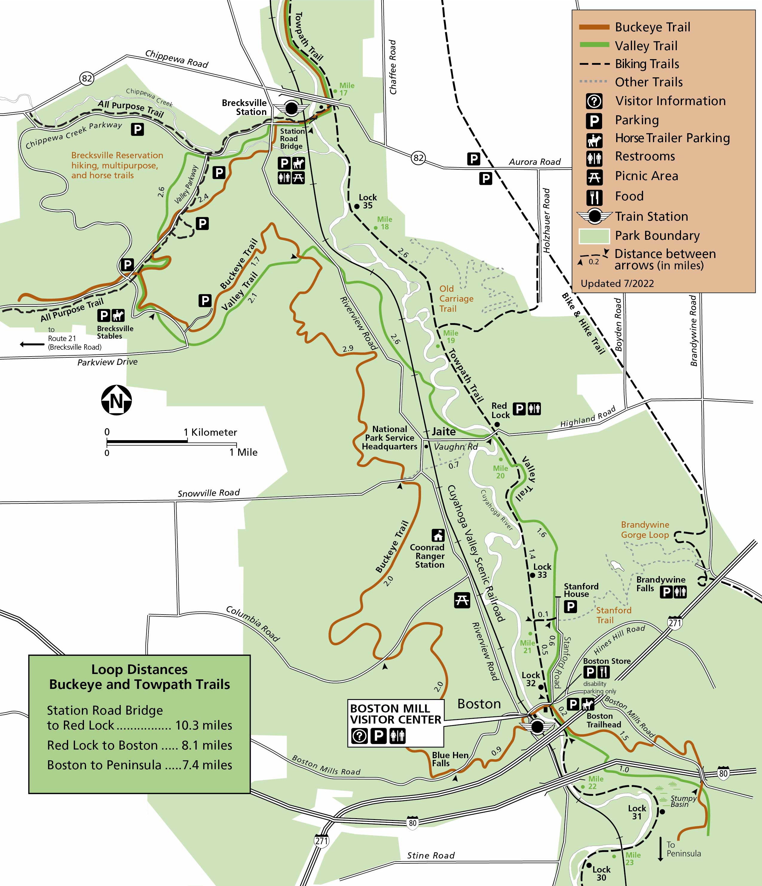 Here’s a Cuyahoga Valley (north) trail map, covering the area from Station Road Bridge (near Brecksville Station) to the Boston Mill Visitor Center area. Some suggested loops on the Buckeye and Towpath trails are indicated.
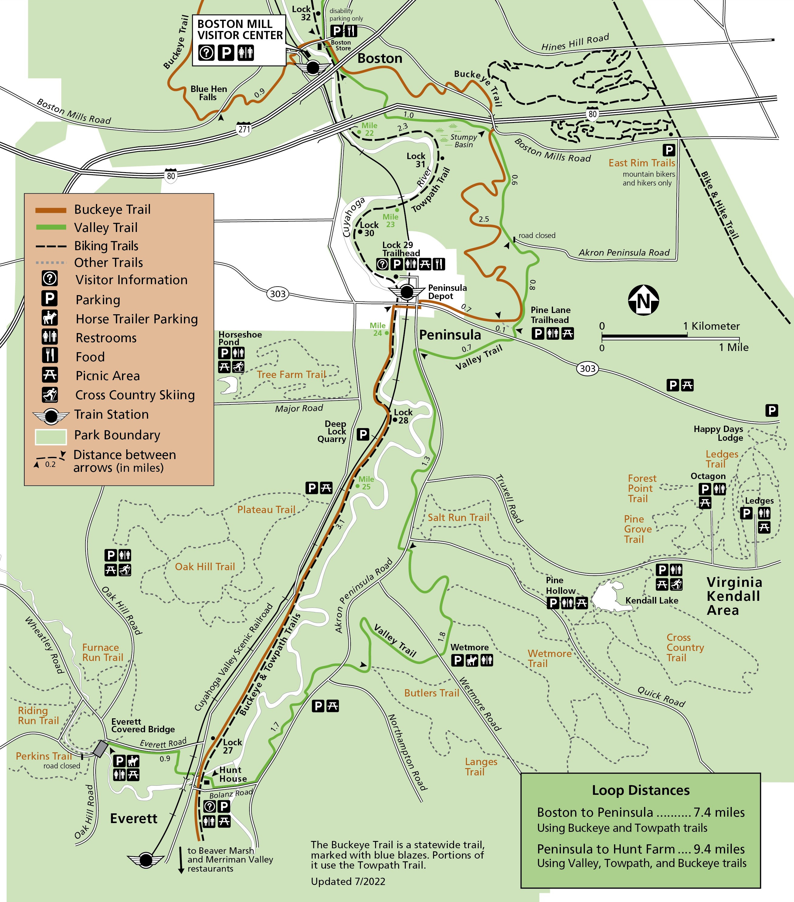 This is a Cuyahoga Valley (south) trail map. It shows the area immediately south of the map above, ranging from the Boston Mill Visitor Center to Everett. This map and the one above were last updated in 2022.
 The trail maps above provide a very zoomed-out view of the trail network in general, and the ones below zoom in to show specific hiking trails and include topo lines. I’ve arranged them in a north to south order. These maps are great for printing or download if you already know what hikes you want to do. If you need help choosing, the Trail Guide to Cuyahoga Valley National Park is your best bet for a guidebook, as it’s the official guide from the Cuyahoga Valley Trails Council, a local non-profit organization.
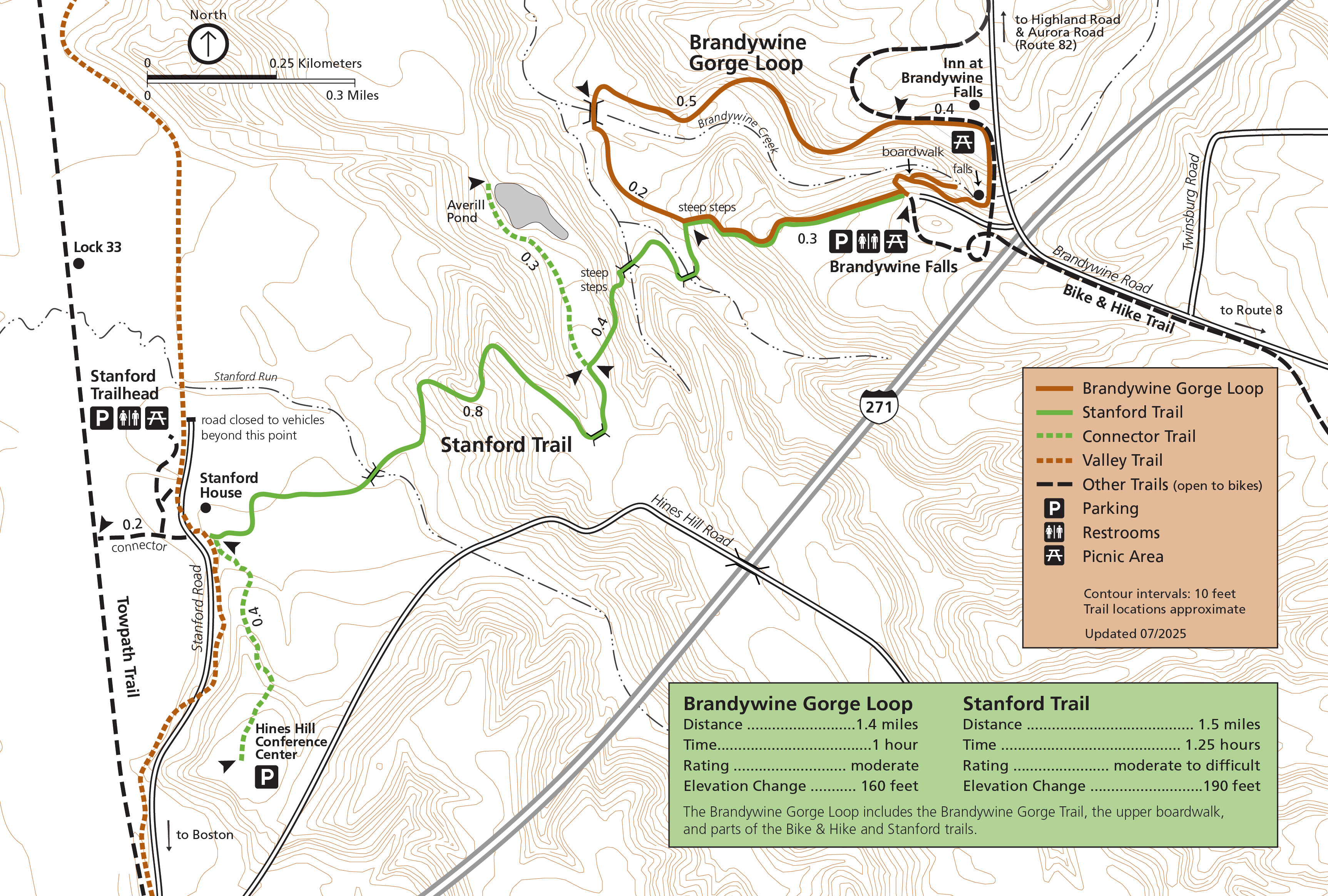 Here’s a Brandywine Falls trail map, showing the hiking routes near Brandywine Falls, the most iconic symbol of the park. The Brandywine Gorge Loop and Stanford Trail are both included.
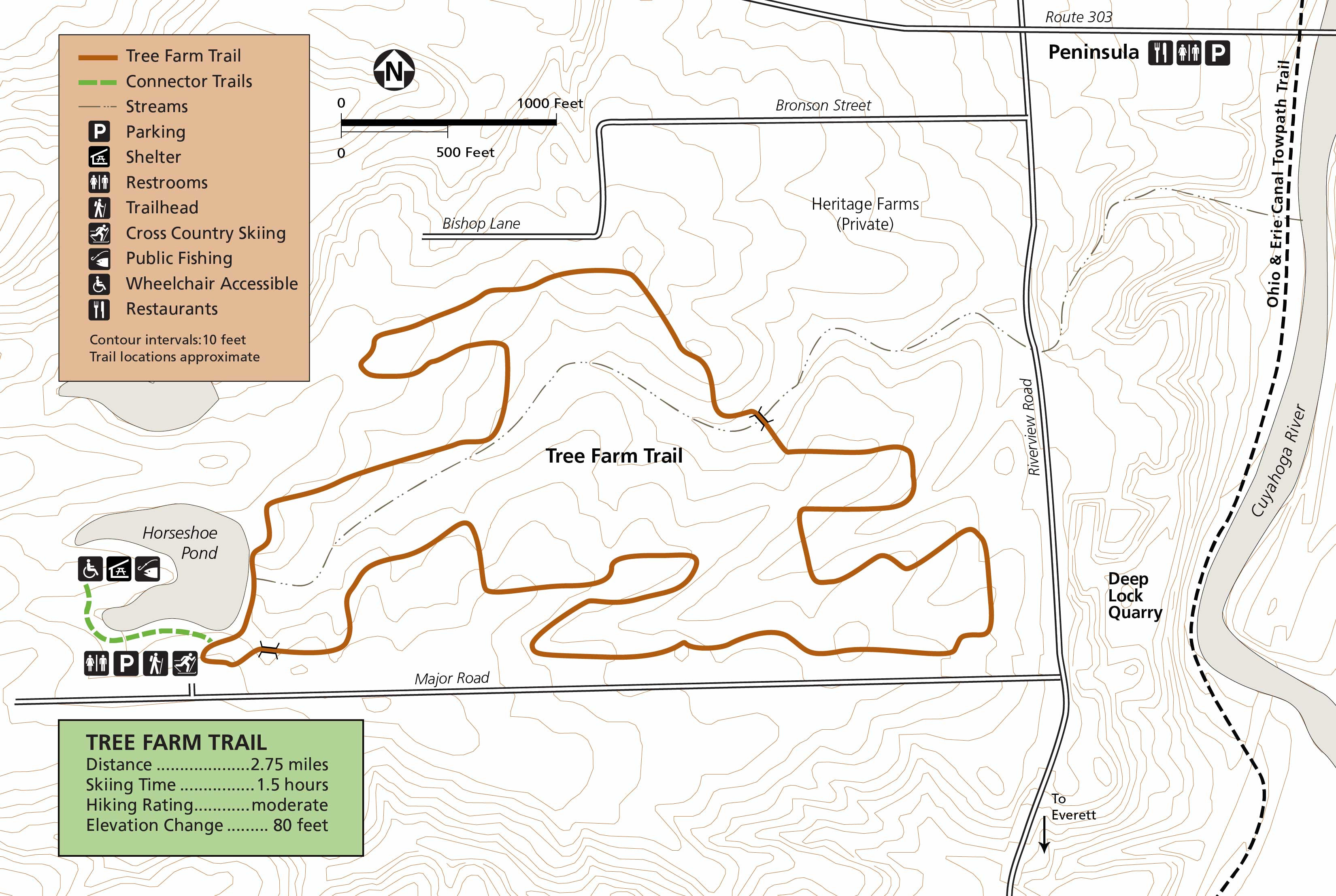 The Tree Farm trail map zooms in on just the one loop trail that departs from Horseshoe Pond. This is certainly a family-friendly hike, as it’s pretty flat throughout the gently rolling woodlands.
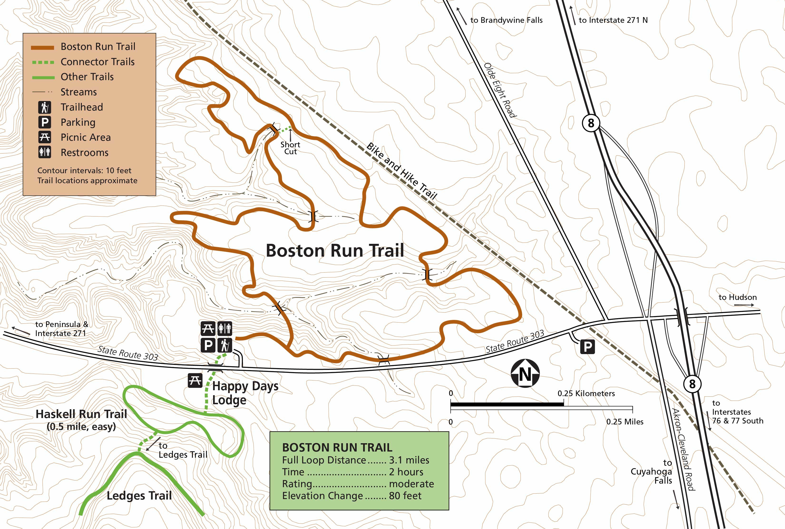 This is a Boston Run trail map. This three-mile loop trail generally takes at most two hours to complete. It begins from the Happy Days Lodge parking area, a historic Civilian Conservation Corps building.
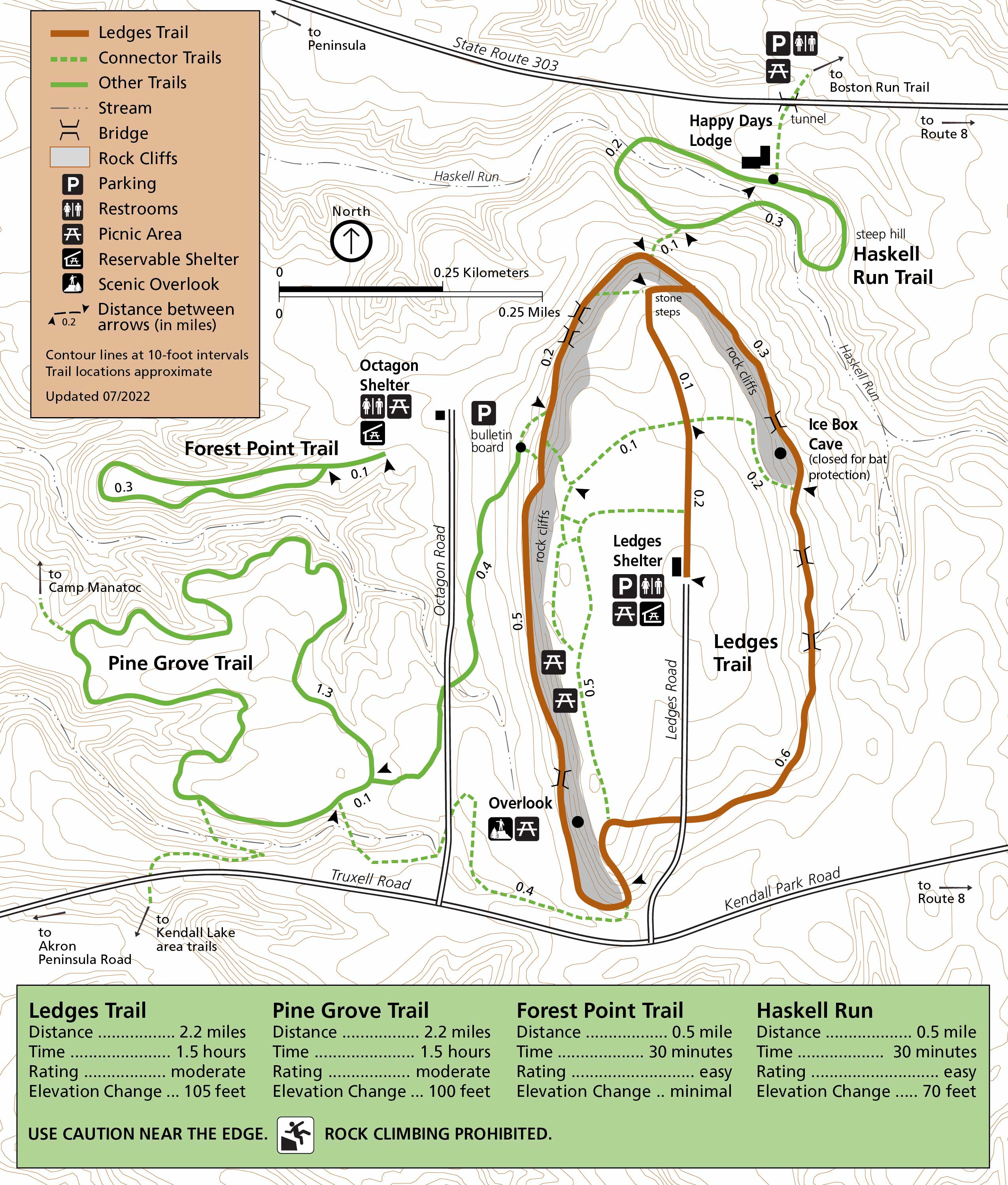 This Ledges trail map shows the very popular Ledges Trail, a loop featuring cliffs and rock formations. It’s located in the Virginia Kendall area, nearby Kendall Lake.
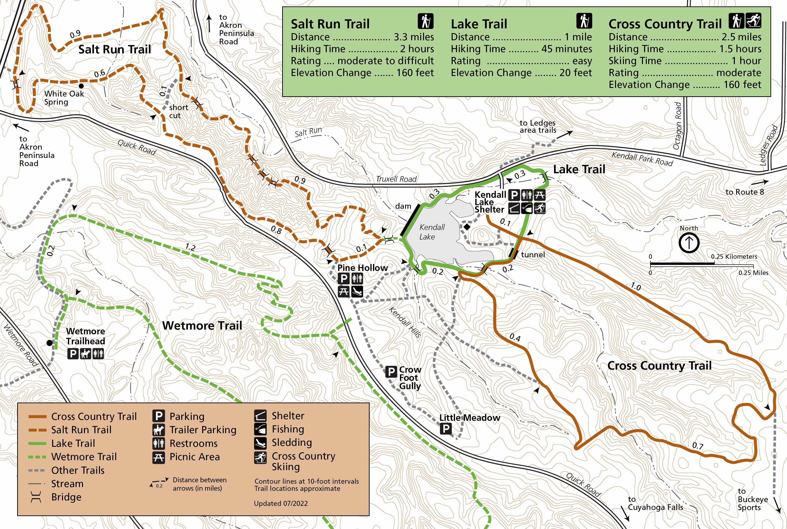 The Kendall Lake trail map naturally zooms in on Kendall Lake and the hiking trail network nearby: Salt Run Trail, Lake Trail, and Cross Country Trail. Note the Wetmore Trail, which gets its own map below.
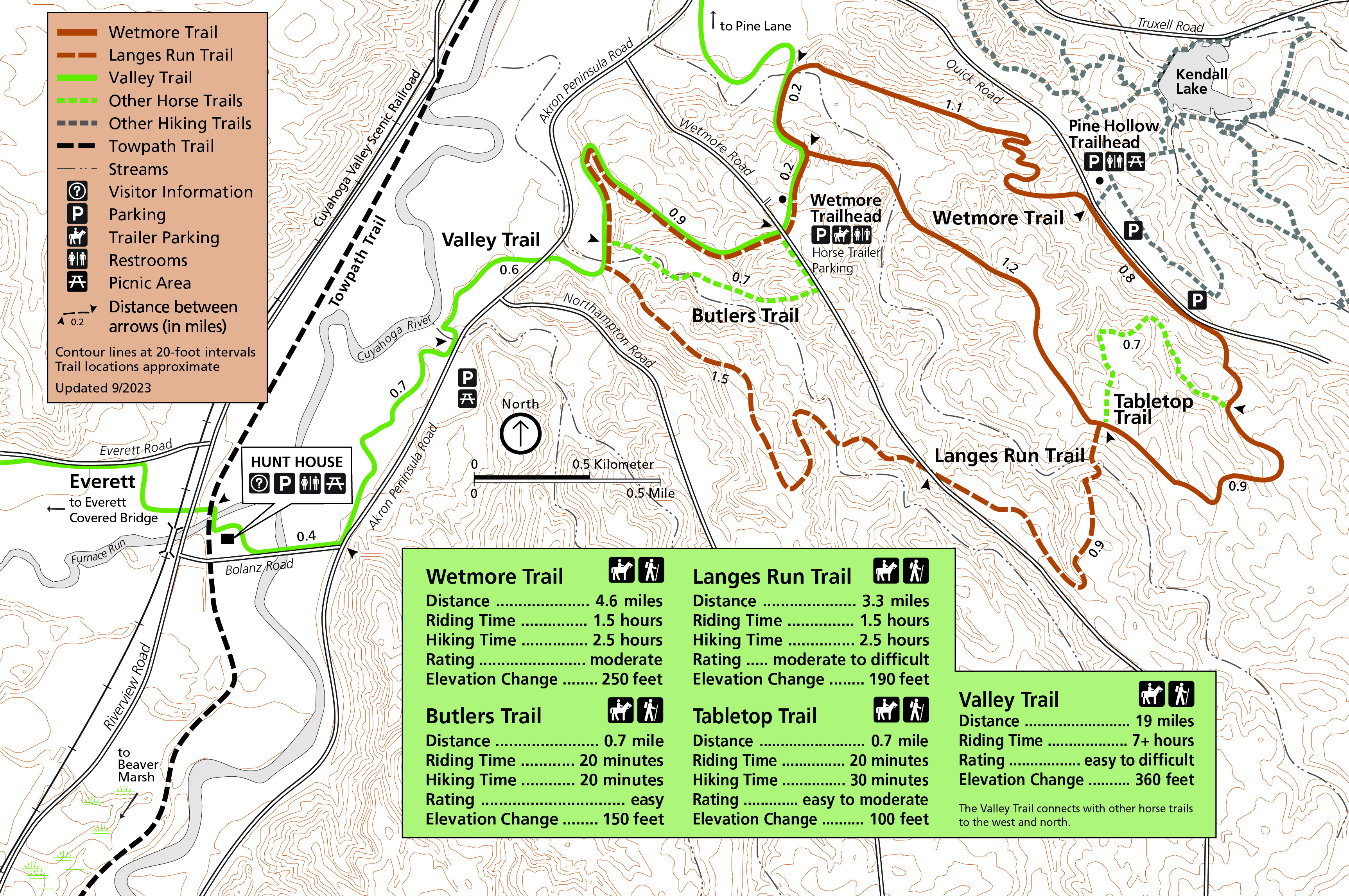 The Wetmore trail map shows the area immediately south of Kendall Lake and the Ledges. Many trails are included on this map: Wetmore, Butlers, Langes Run, Tabletop, and Valley.
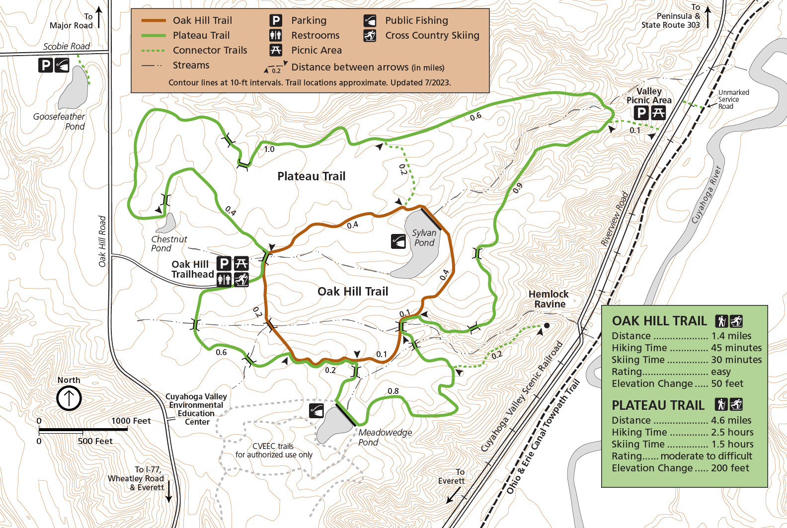 The Oak Hill and Plateau trails map shows these two loop routes, measuring 1-1/2 miles and 4-1/2 miles respectively. While the Oak Hill Trail is essentially flat, the Plateau Trail includes 200 feet of elevation change.
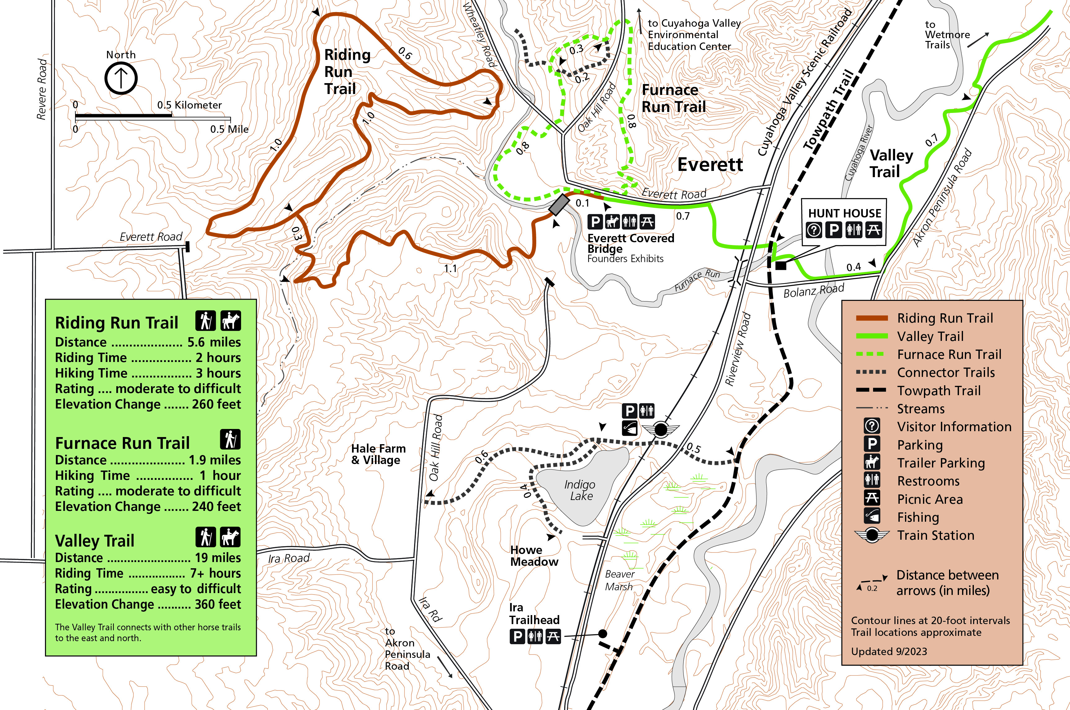 Here’s an Everett trail map. Three hiking routes are described here, including the Riding Run Trail, Furnace Run Trail, and Valley Trail. Additional attractions are labeled, including Hunt House and Everett Covered Bridge.
Cuyahoga Valley lodging map
 There are a variety of lodging options on your visit to Cuyahoga Valley, depending on where in the park you spend your time. To the right, I’ve included an Expedia interactive lodging map focused on Independence, outside the northwest corner of the park nearest Cleveland. You can also browse Expedia’s top-rated Cuyahoga Valley area lodging to compare locations, photos, and reviews.
Cuyahoga Valley towpath maps
 Here’s an Ohio and Erie Canal Towpath Trail map, presented out-of-scale like a transit-style or subway map. Click the image to view a full size map or download the PDF.
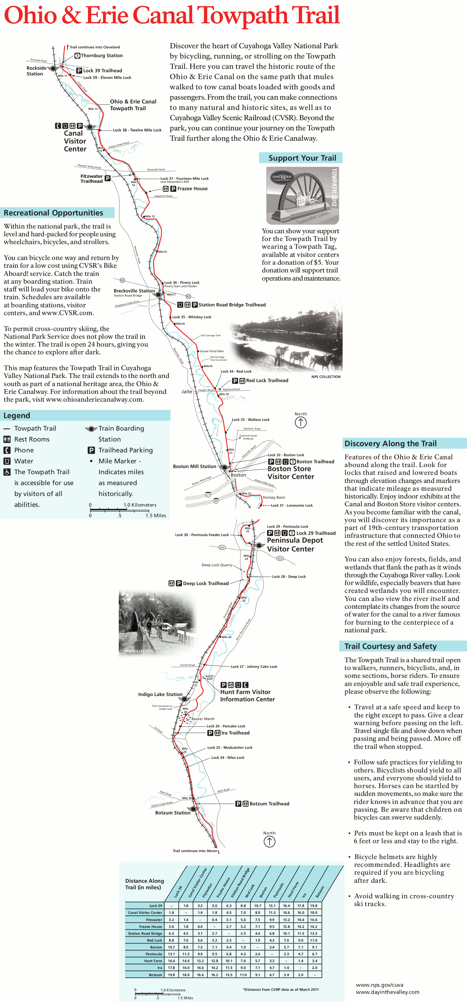 Here’s a Towpath Trail map that shows the trail to scale and labels points of interest such as visitor centers, locks, trailheads, mile markers, and more. A table showing distances is also provided.
Assorted Cuyahoga Valley maps
 Here’s a Cuyahoga Valley attractions map, covering the park from the Rockside railroad station in the north to Beaver Marsh in the south. It shows 15 points of interest and associated visitor facilities.
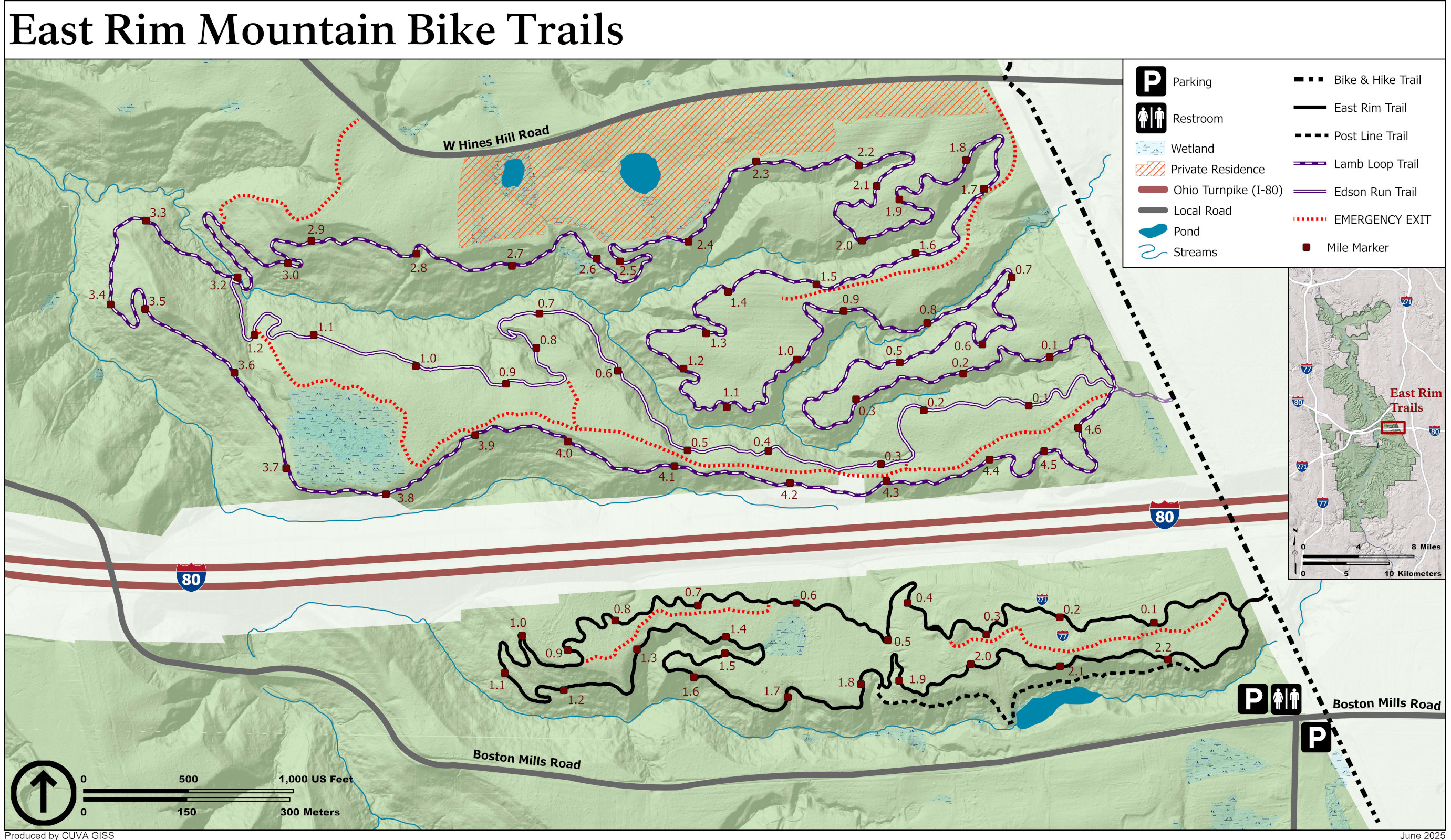 This is an East Rim mountain biking map. The East Rim trail system includes four mountain biking trails for intermediate bikers. Hikers and runners are welcome too, though you’ll need to yield to bikes.
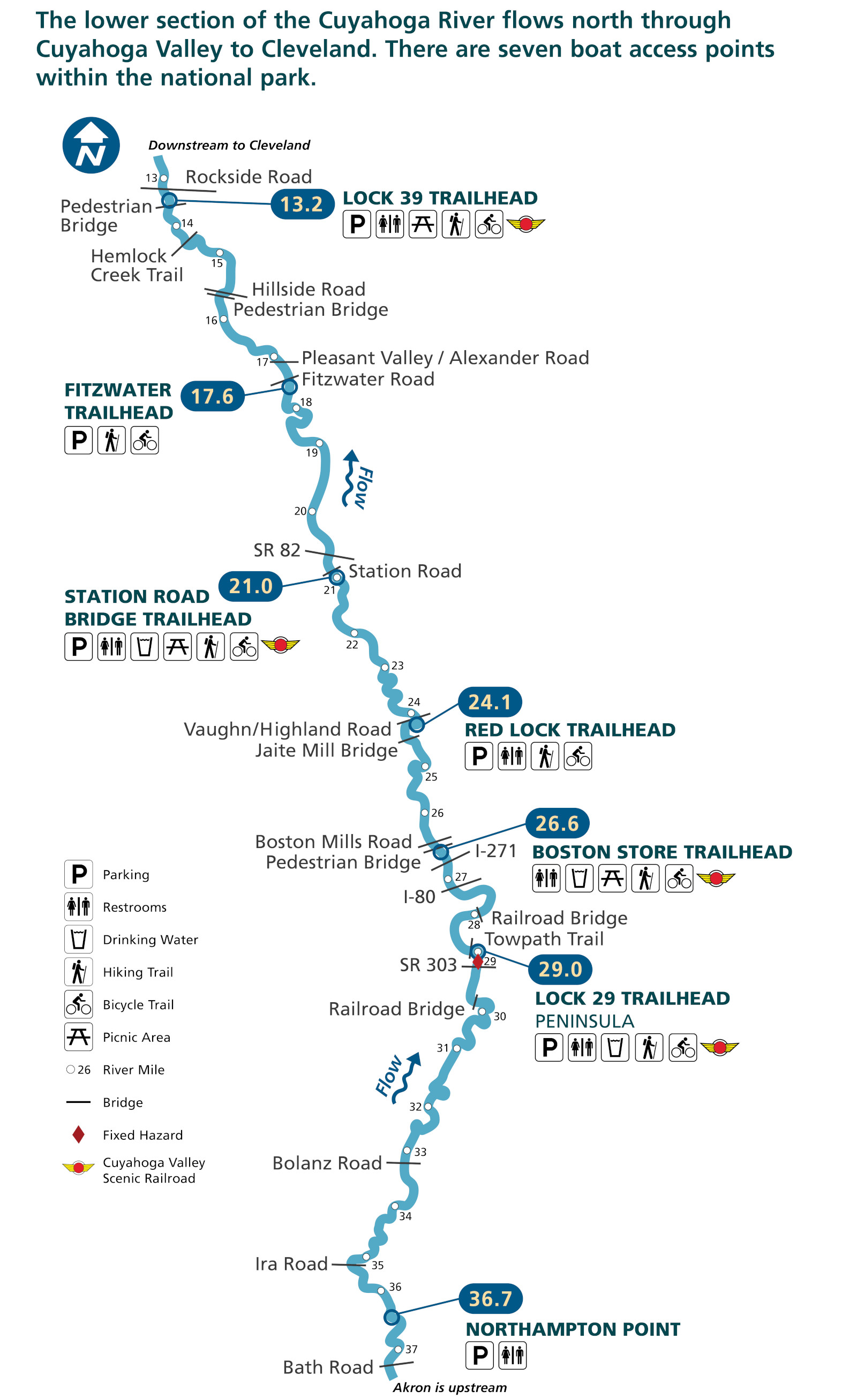 Here’s a Cuyahoga River access map, showing several points where paddlers can get on the Cuyahoga River water trail. This map covers about 25 miles of the river, from mile 13 to 37.
 Here’s a map of Cuyahoga Valley forests, showing the different forest types based on the dominant species: oak, hemlock, etc. It also shows wetlands, shrubs, and other types of vegetation.
Archived Cuyahoga Valley maps
The National Park Service updates maps frequently, and I do my best to capture the newest Cuyahoga Valley map updates and host them here on this page. But I never want to delete old maps, as I feel it’s important that users can see how things in a park change over time. So old maps are moved down to this section. Anything here has a newer map posted above.
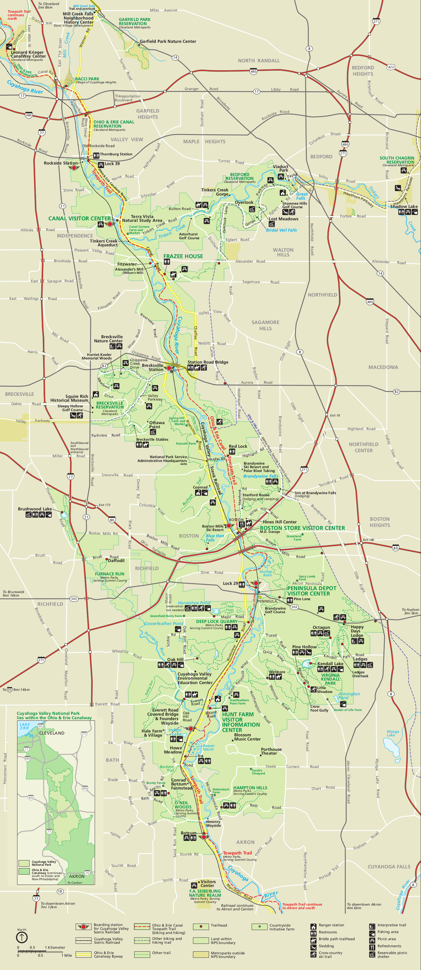 This is the old Cuyahoga Valley map from the early-2010s brochure, saved here for archival purposes. Click the image to view a full size map or download the PDF.
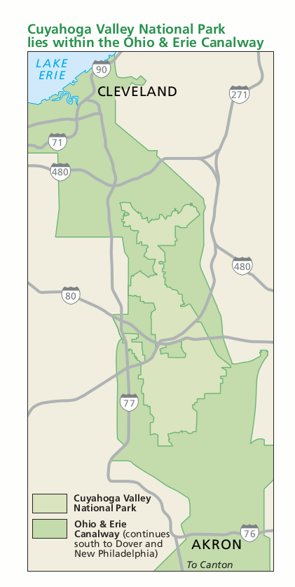 This is an old regional map of Cuyahoga Valley that shows highways and the park’s location relative to Cleveland and Akron. Click the image to view a full size map or download the PDF.
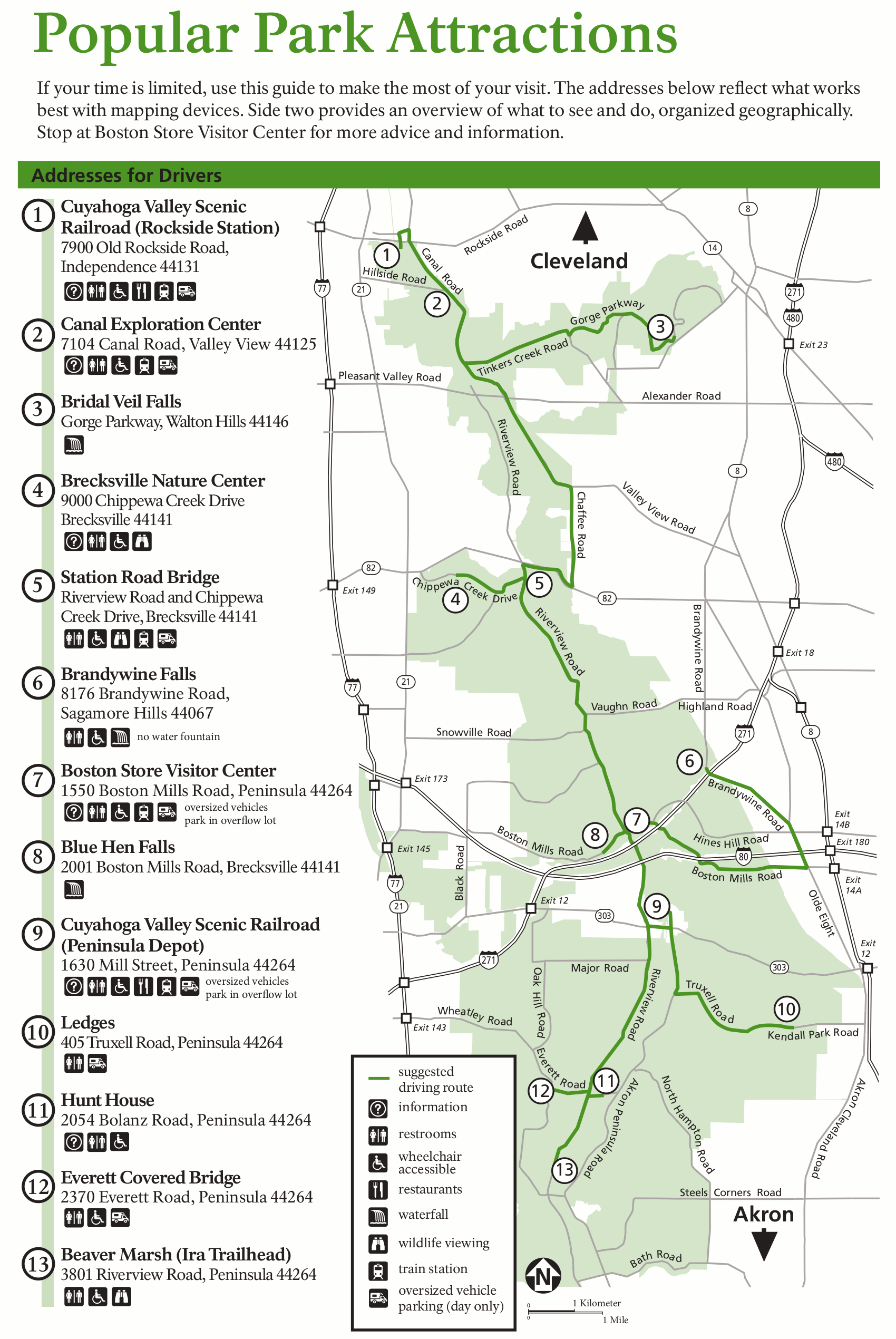 This old Cuyahoga Valley attractions map labels each of the major areas for visitors to stop and explore. This has since been replaced with a new one further up this page that includes additional points of interest.
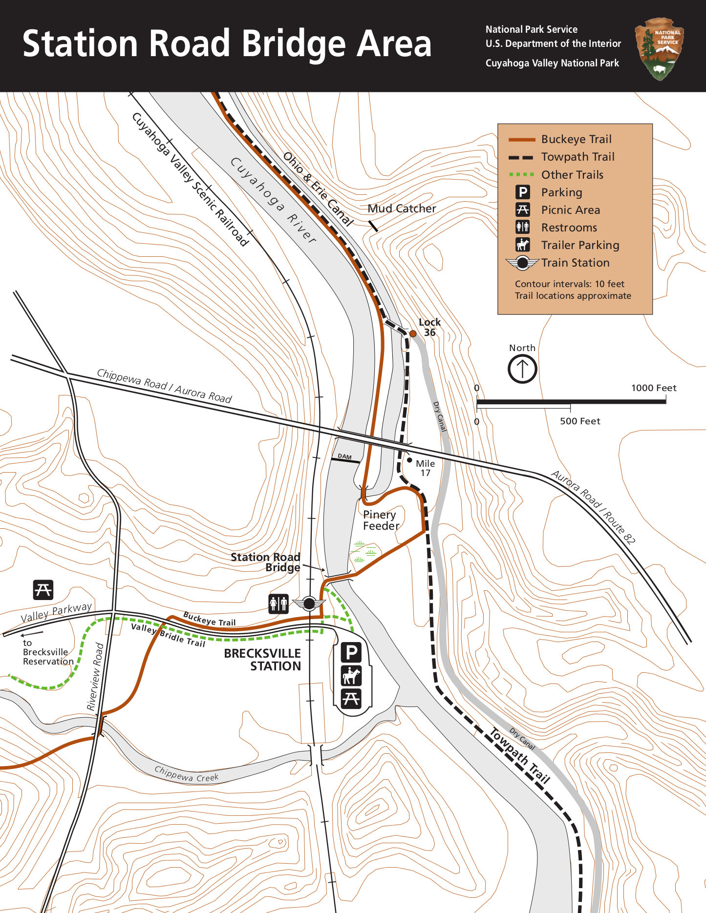 This old Station Road Bridge trail map shows the trails around Brecksville Station, including the Buckeye Trail and Towpath Trail. Click the image to view a full size map or download the PDF.
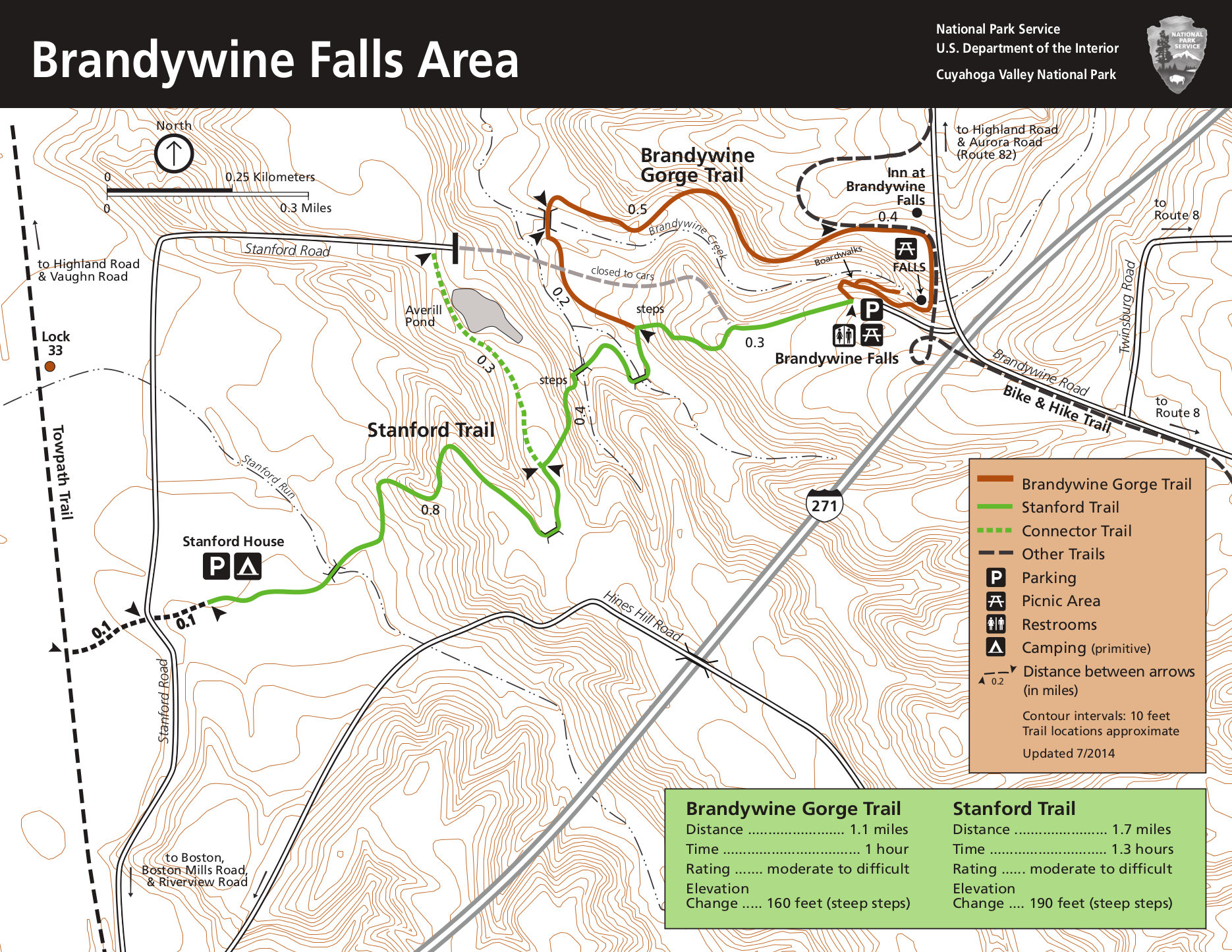 Here’s an old Brandywine Falls map, showing this very popular area of the park including the Brandywine Gorge trail. Click the image to view a full size map or download the PDF.
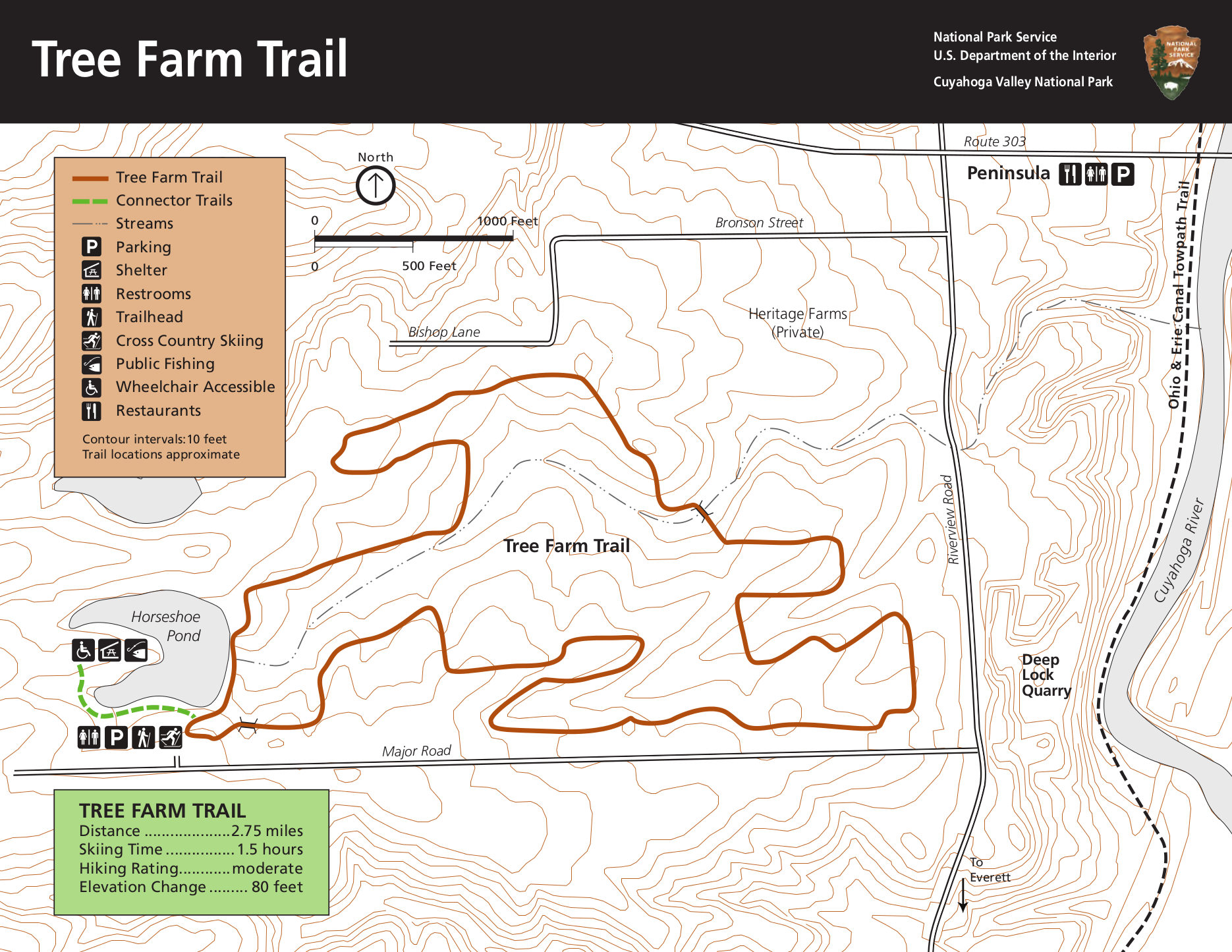 This is an old Tree Farm Trail map, located just west of the Cuyahoga River near Horseshoe Pond. Click the image to view a full size map or download the PDF.
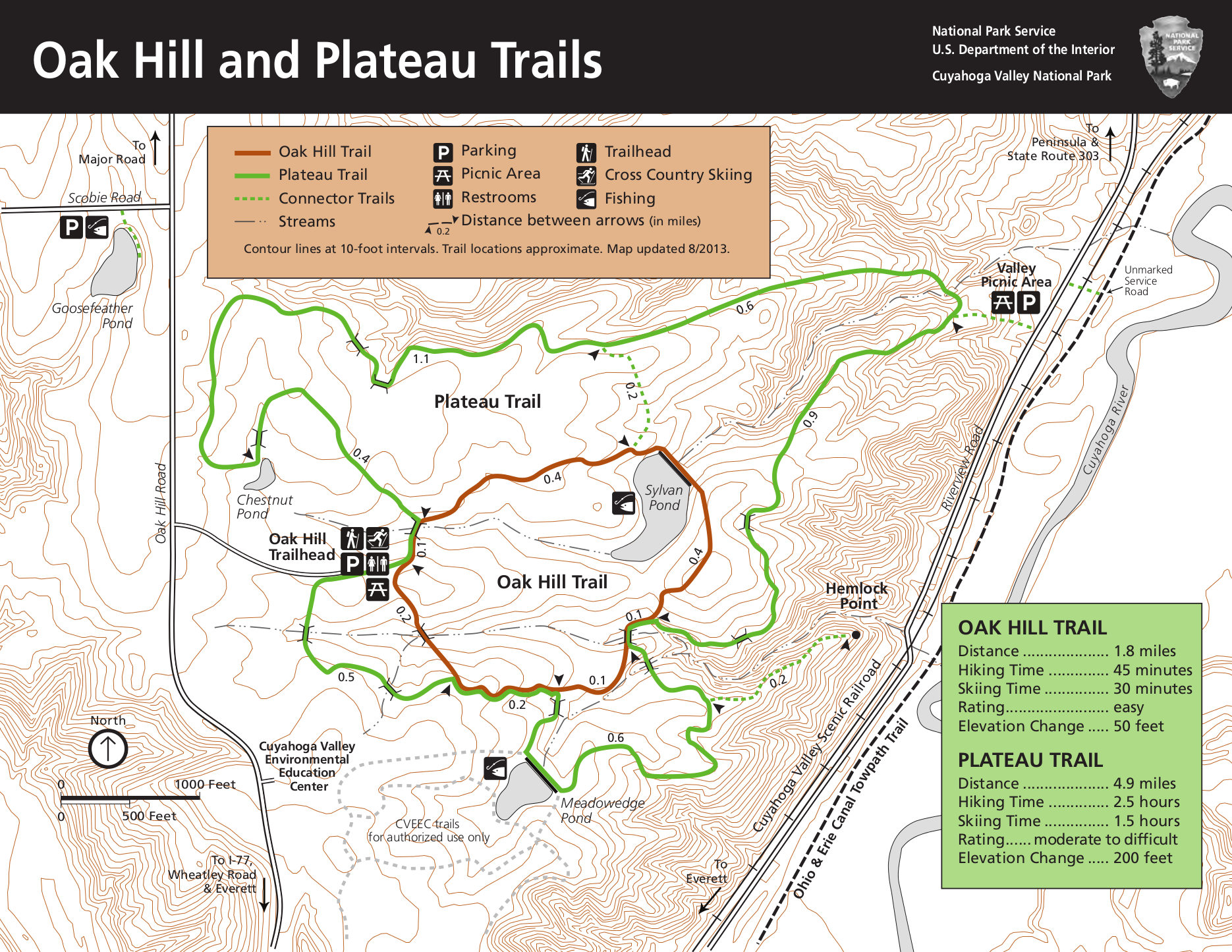 Here’s an old Oak Hill and Plateau Trail map, showing the two loops near Sylvan Pond accessed from the Oak Hill trailhead. Click the image to view a full size map or download the PDF.
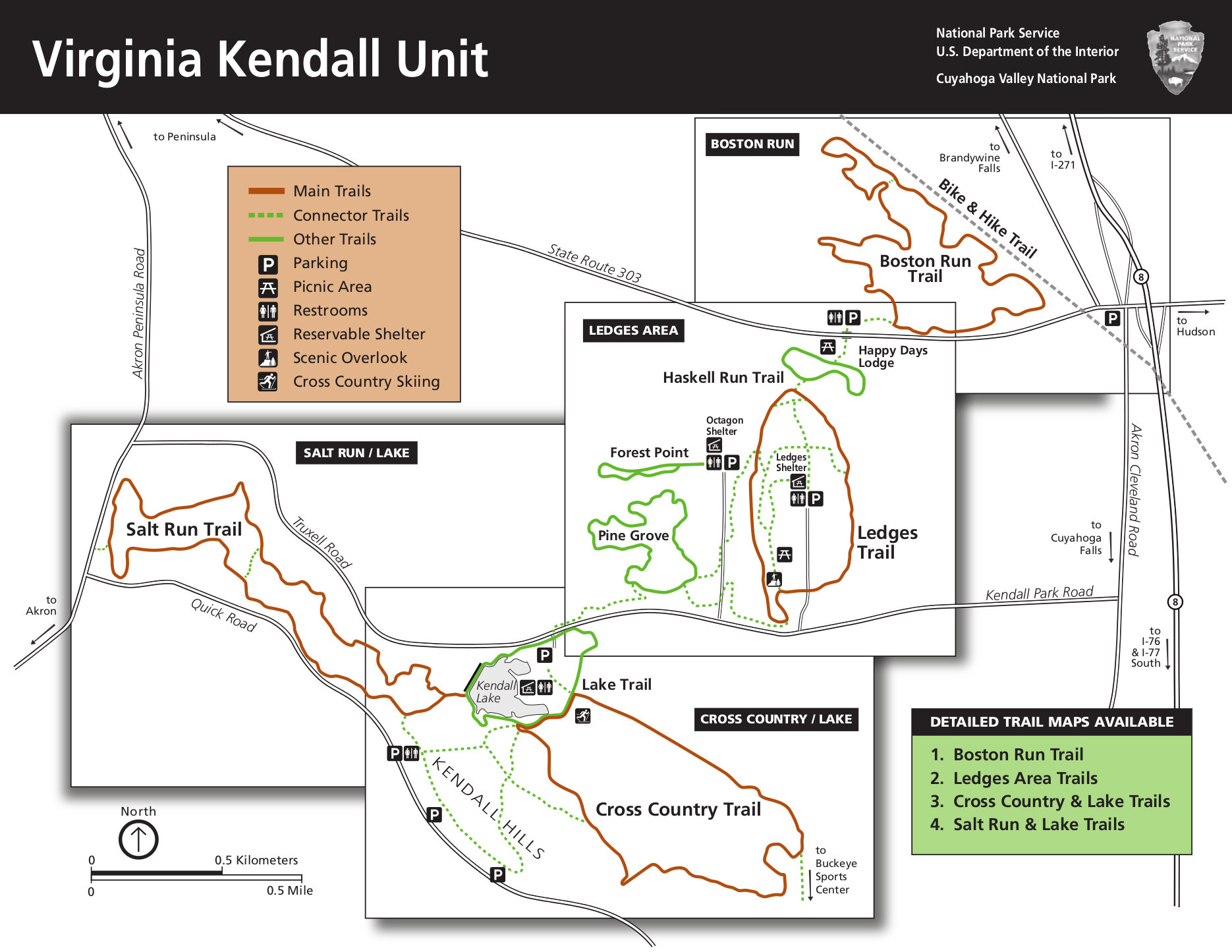 Here’s an old Virginia Kendall area overview map, showing the location of the following four trail maps. Click the image to view a full size map or download the PDF.
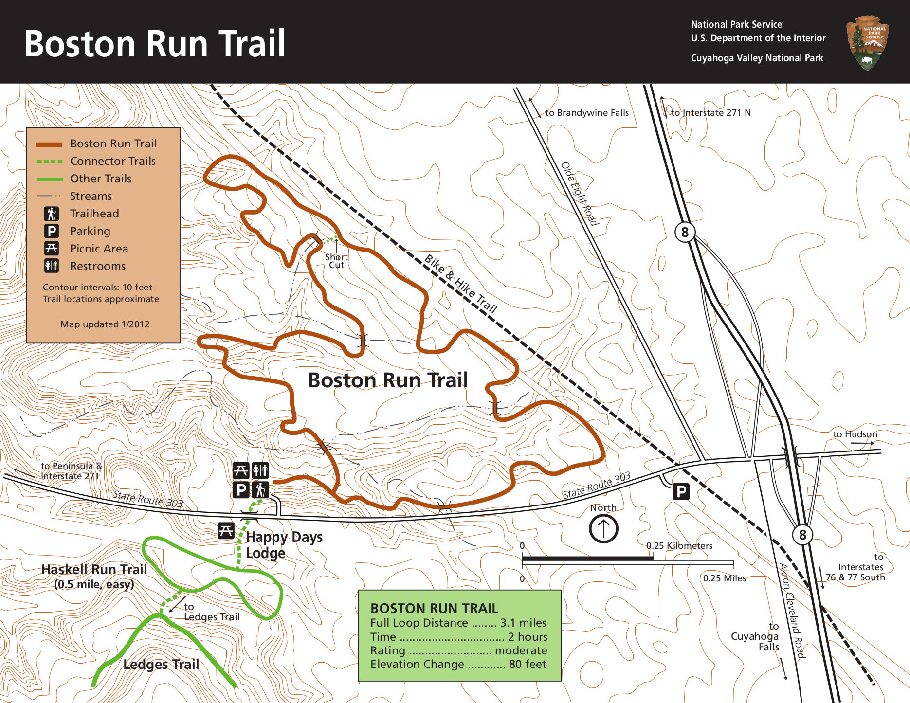 This old Boston Run Trail map focuses on the Boston Run Trail and includes access to the Ledges Trail from Happy Days Lodge. Click the image to view a full size map or download the PDF.
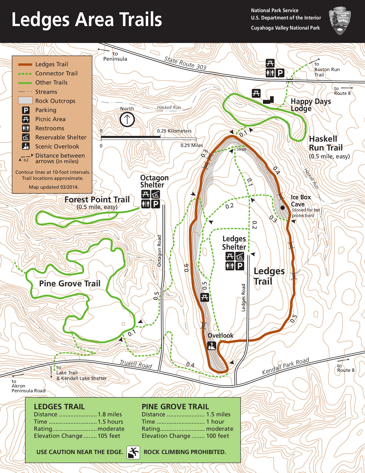 Here’s the old Ledges area trail map, which includes the Pine Grove Trail and a few other loops in the area. Click the image to view a full size map or download the PDF.
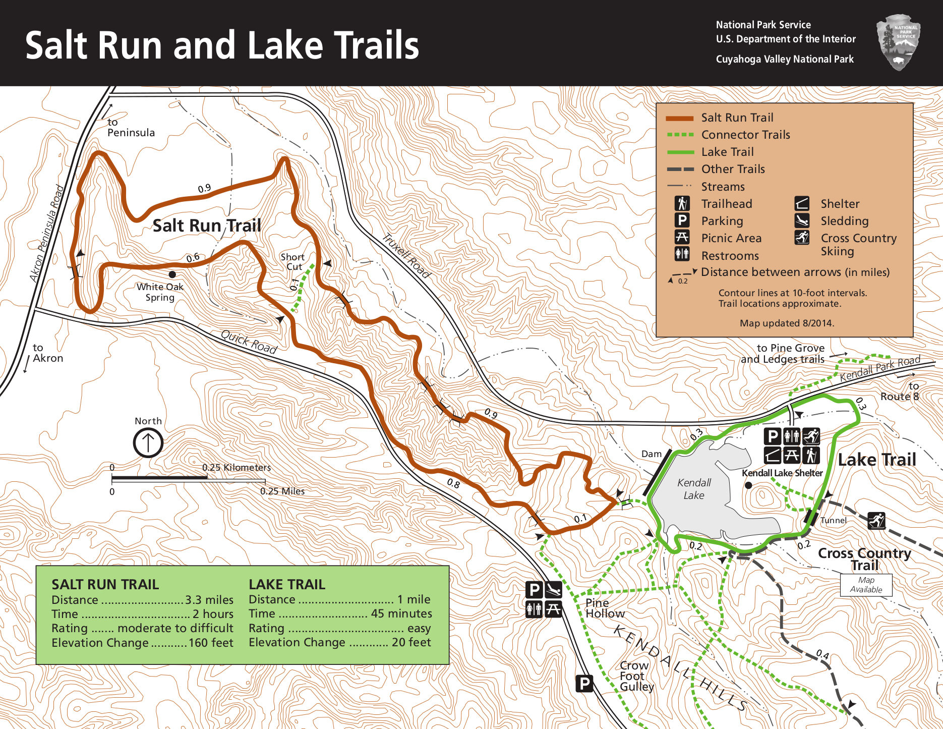 This old Salt Run and Lake Trail map shows both the Salt Run Trail and the Lake Trail (and their associated trail shelters). Click the image to view a full size map or download the PDF.
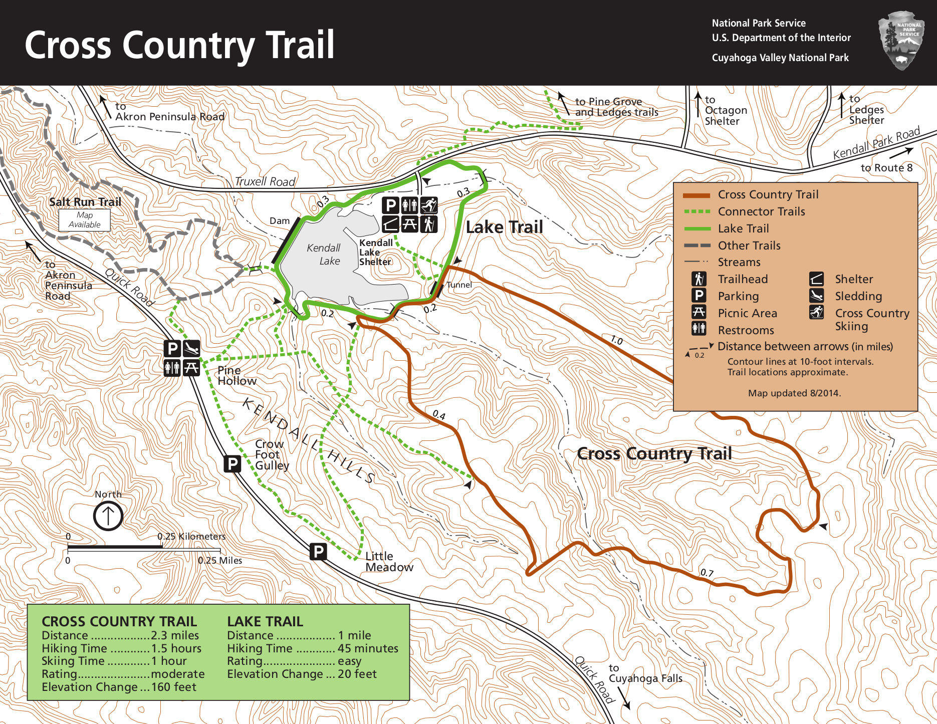 Here’s an old Cross Country Trail map, which also shows Kendall Hills and the area around Kendall Lake. Click the image to view a full size map or download the PDF.
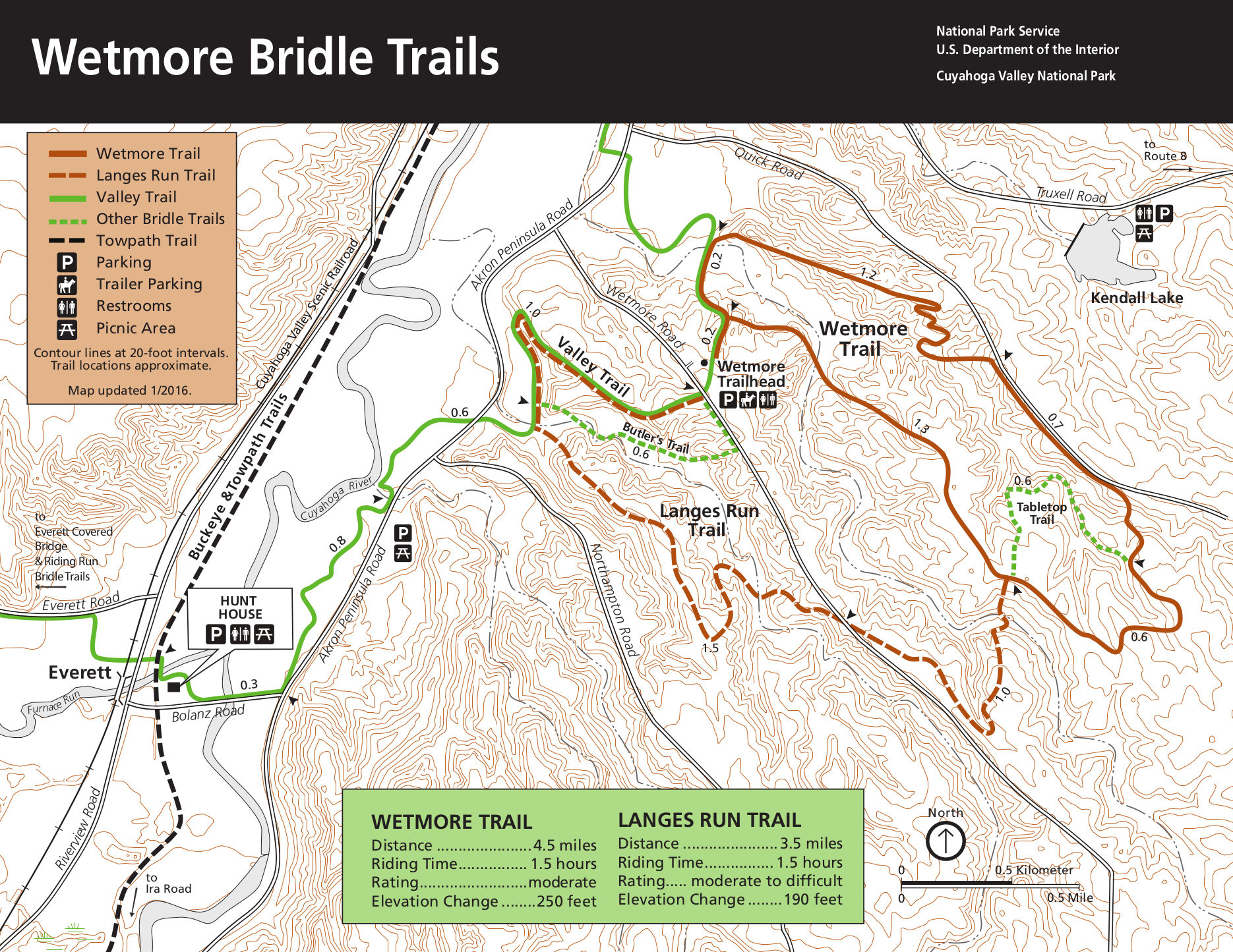 The old Wetmore Trail map shows the hiking and bridle trails including the Wetmore Trail and Langes Run Trail. Click the image to view a full size map or download the PDF.
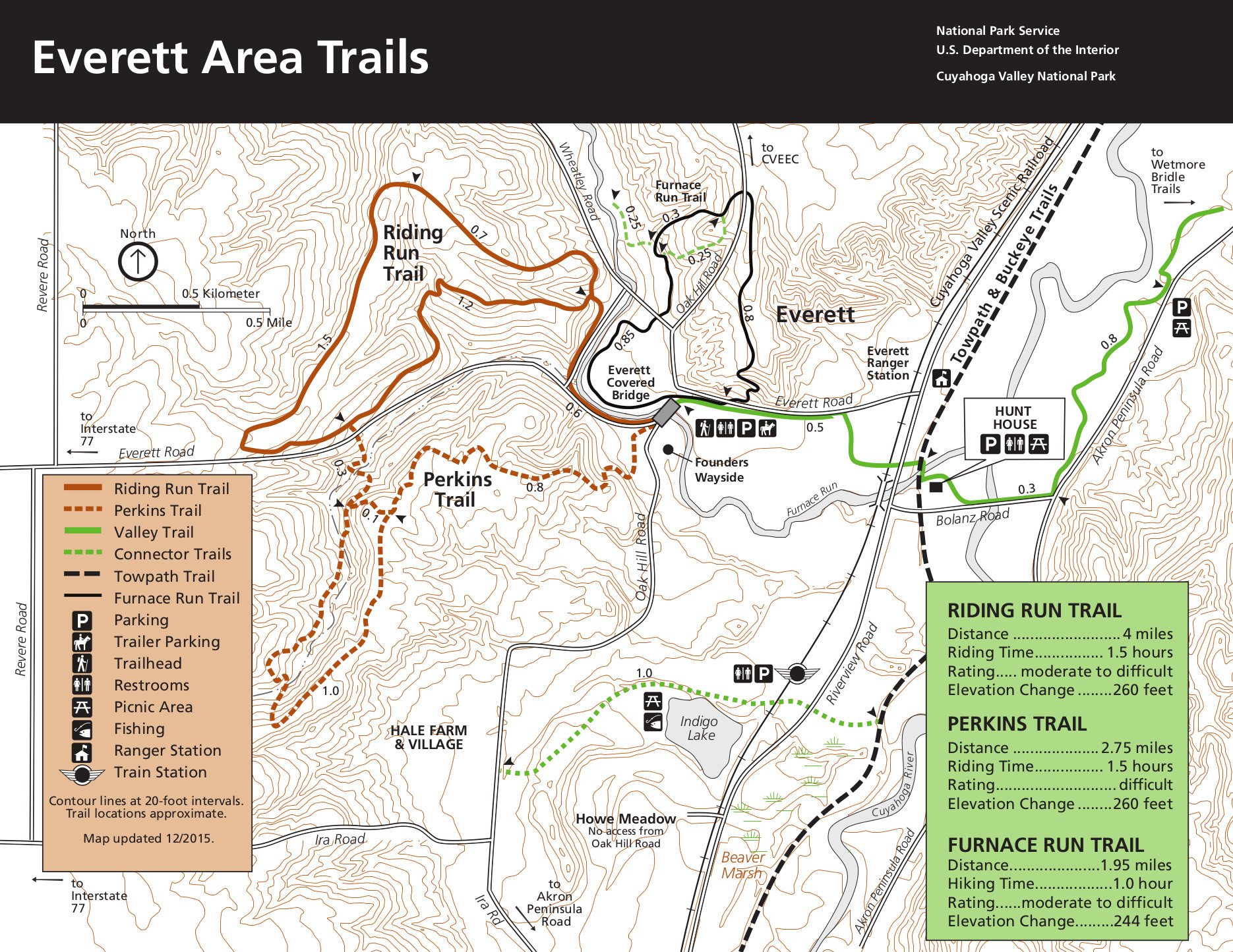 This old Everett area trail map zooms in on various trails such as Riding Run Trail, Perkins Trail, and more. Click the image to view a full size map or download the PDF.
 The old Hunt Farm trail map shows the area just east and south of Everett, focusing on the visitor center. Click the image to view a full size map or download the PDF.
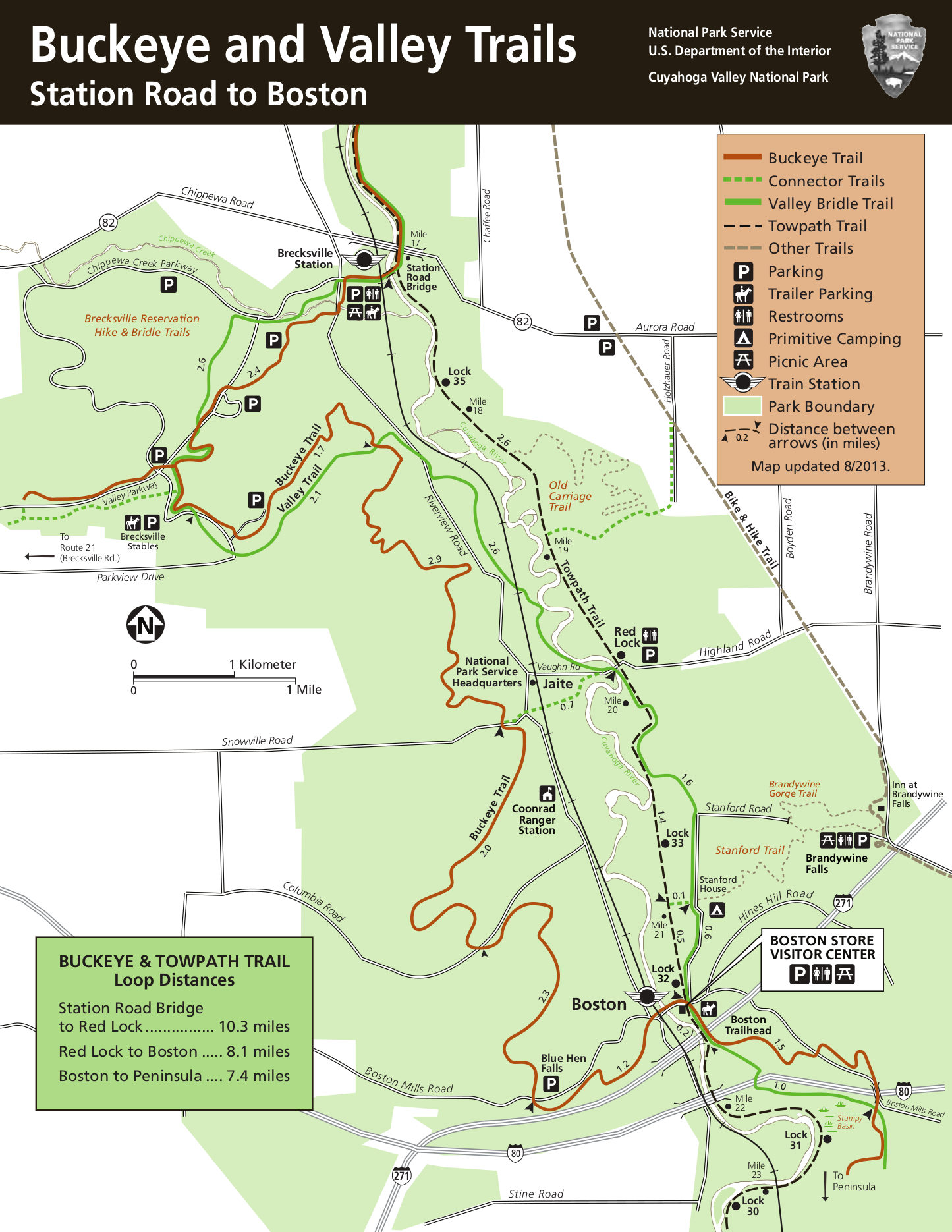 This map dates from the mid-2010s and shows the northern half of the Buckeye and Valley Trails, from Station Road Bridge to Boston. Click the image to view a full size map or download the PDF.
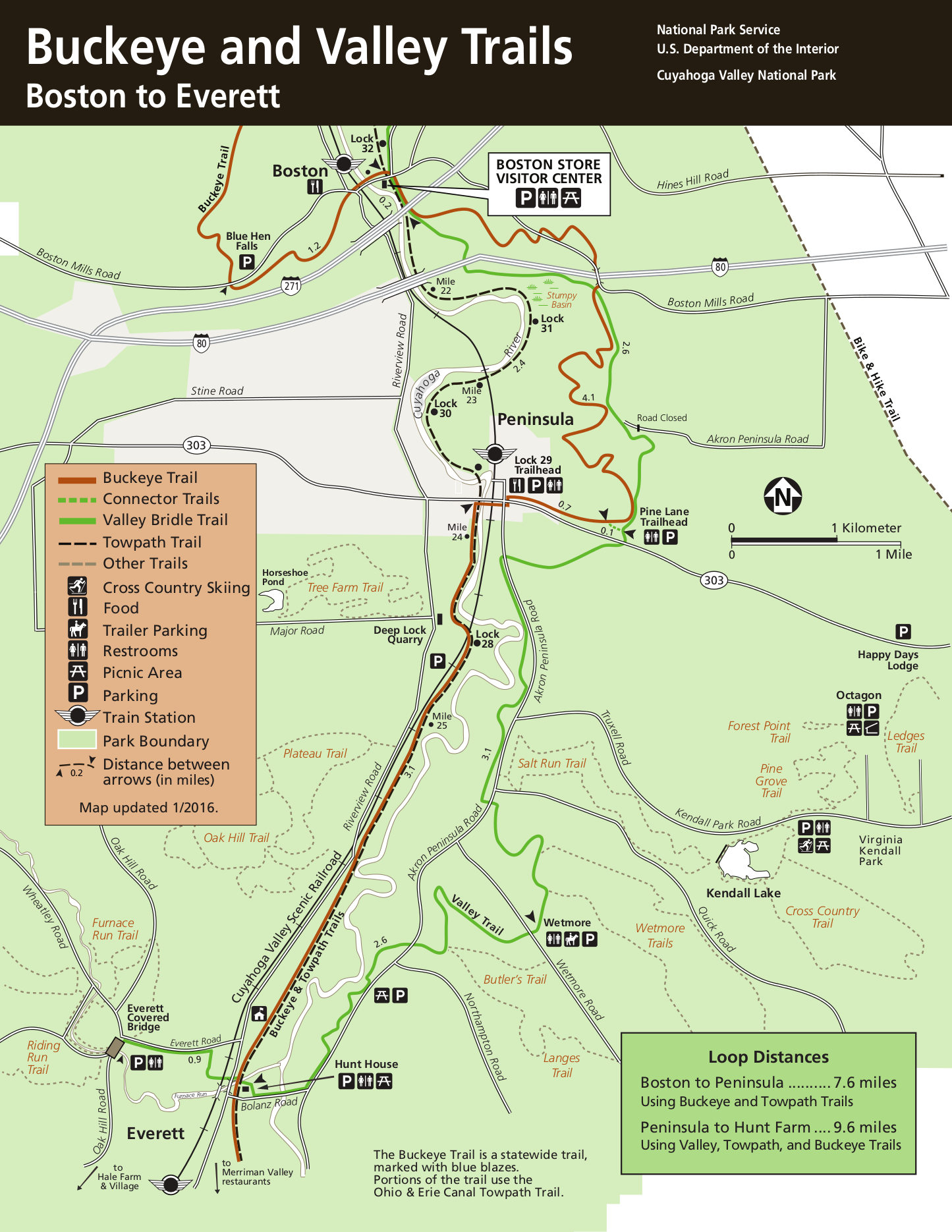 This map dates from the mid-2010s and shows details of the southern half of the Buckeye and Valley Trails, from Boston to Everett. Click the image to view a full size map or download the PDF.
…and more!
< Return to National Park Maps home
< Return to Park List
< Return to List by State