Canyonlands map from the park brochures
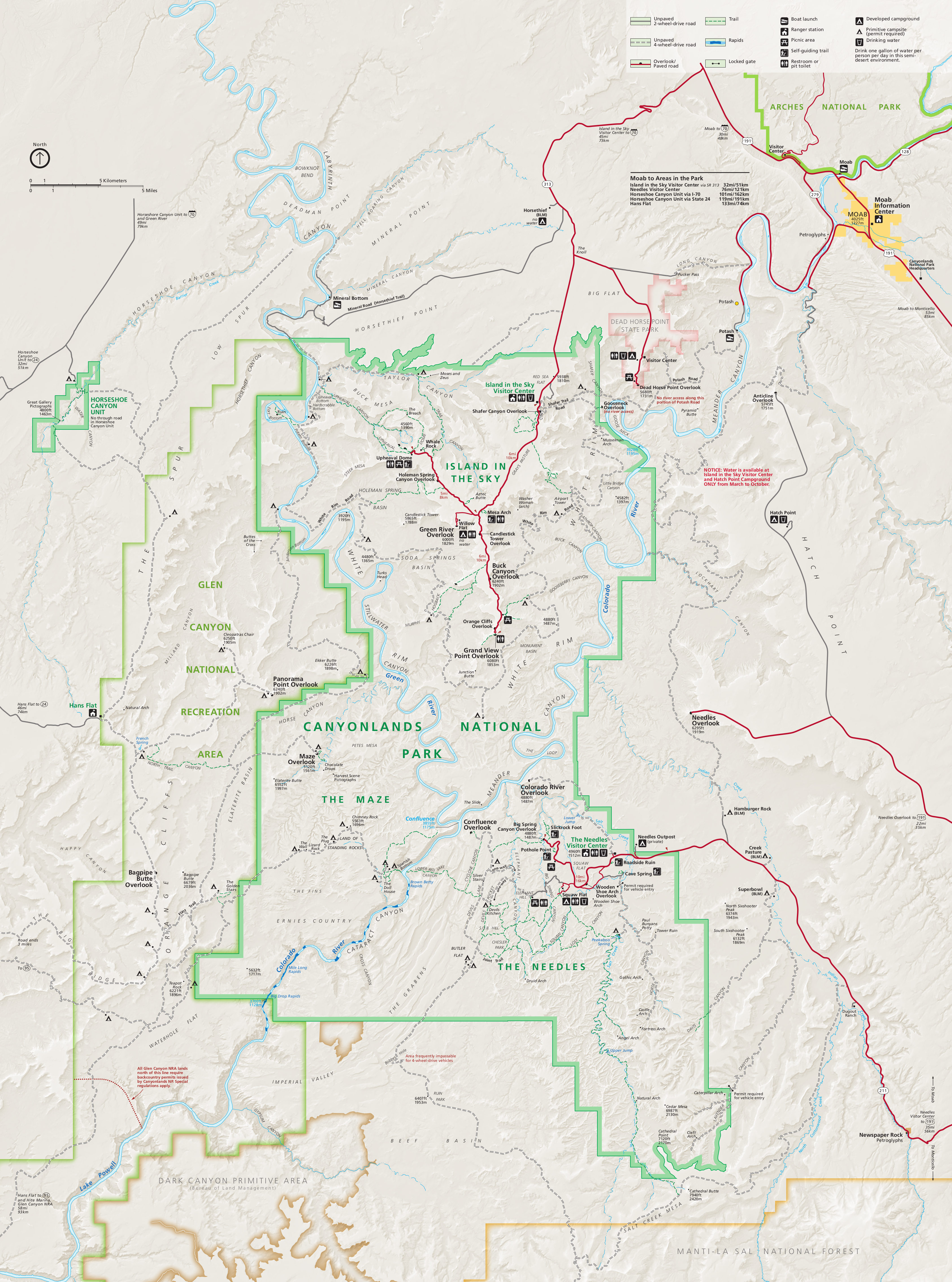
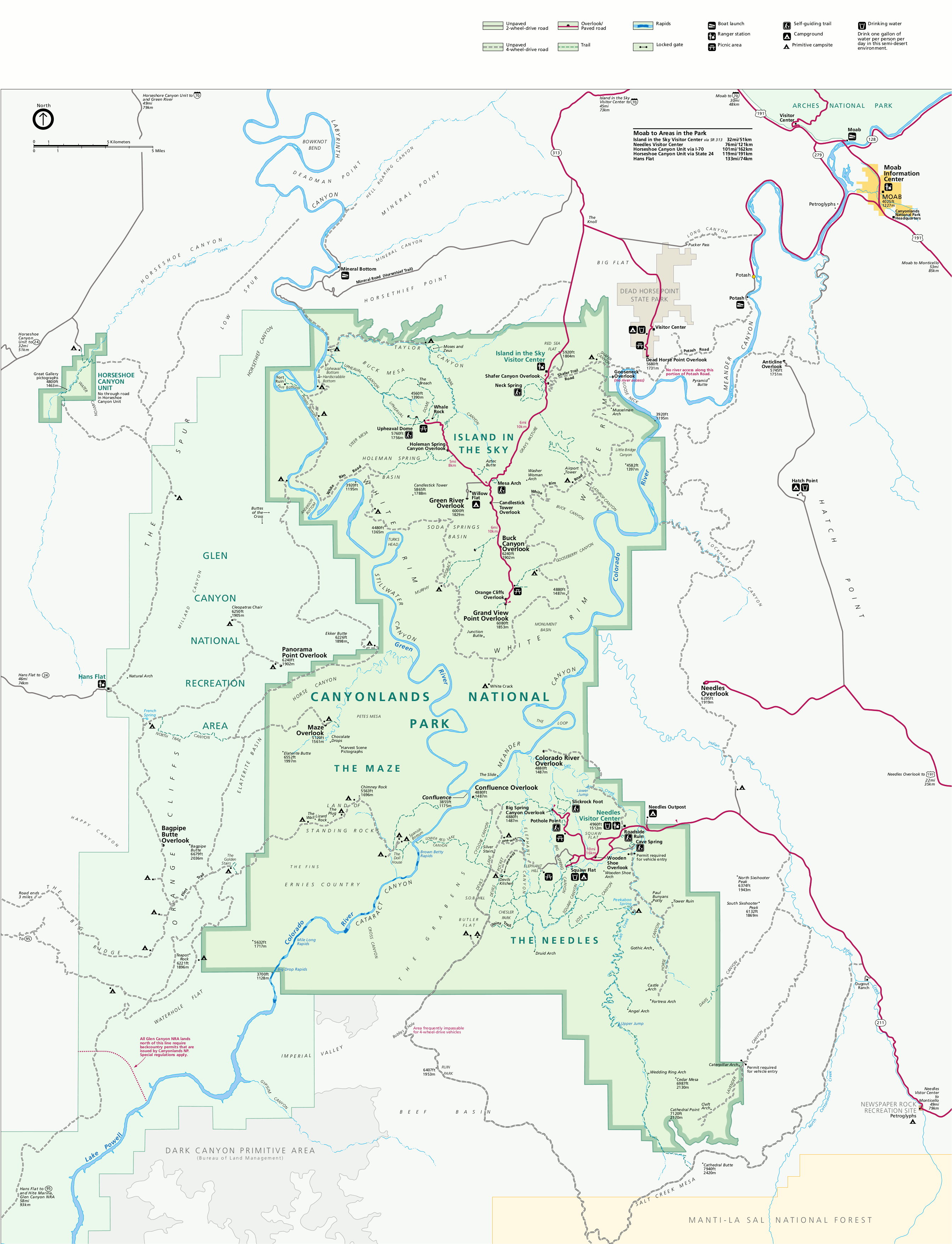
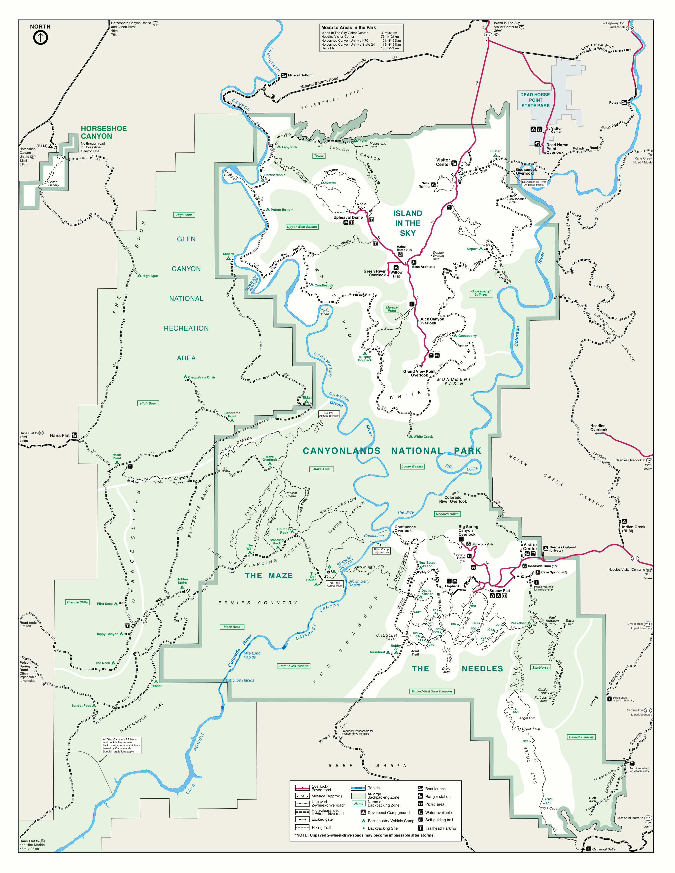
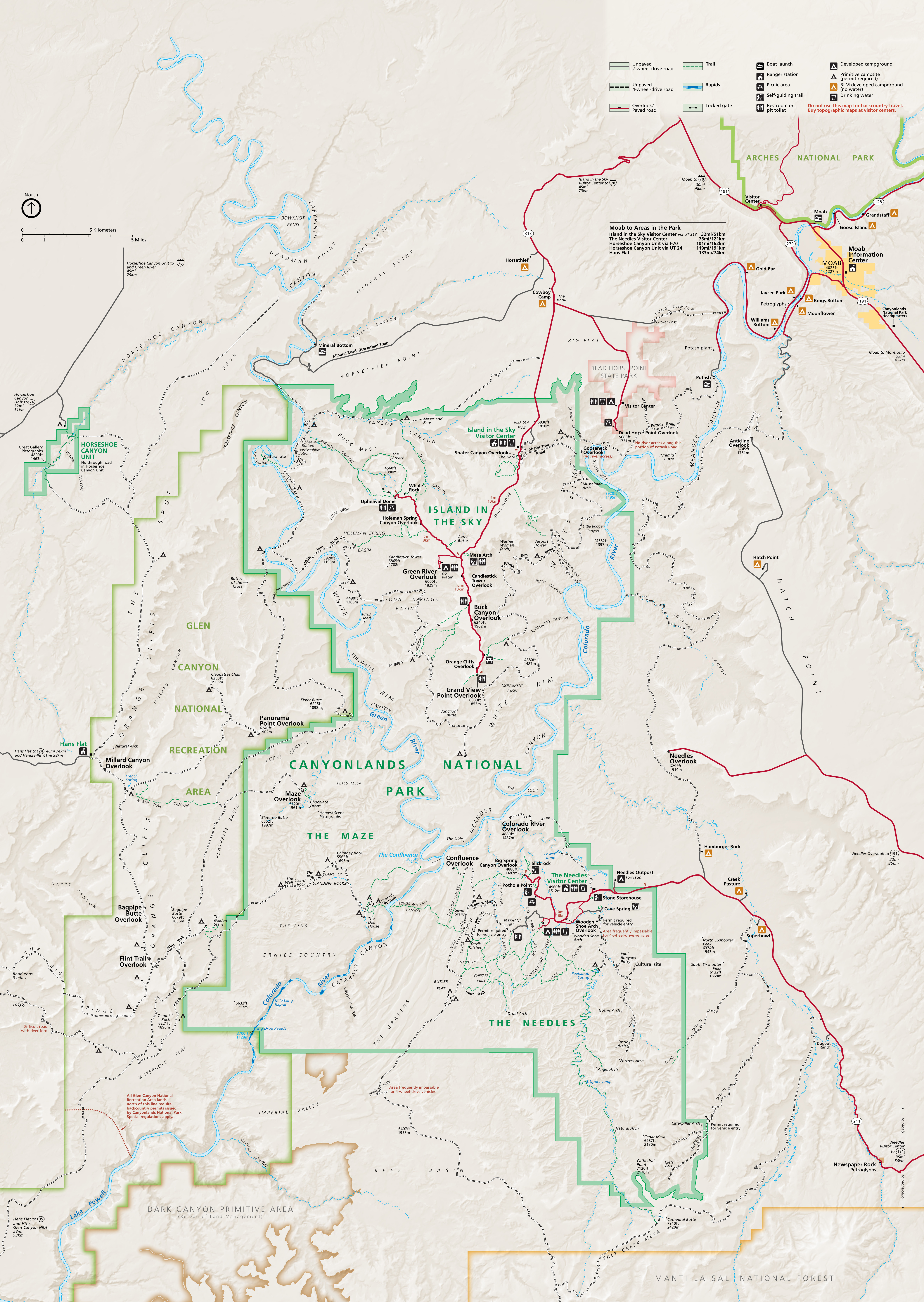 This is the NPS Canyonlands National Park map, from the official brochure you get at the entrance station. The map was last updated in 2024 and includes Island in the Sky, the Needles, the Maze, and Horseshoe Canyon.
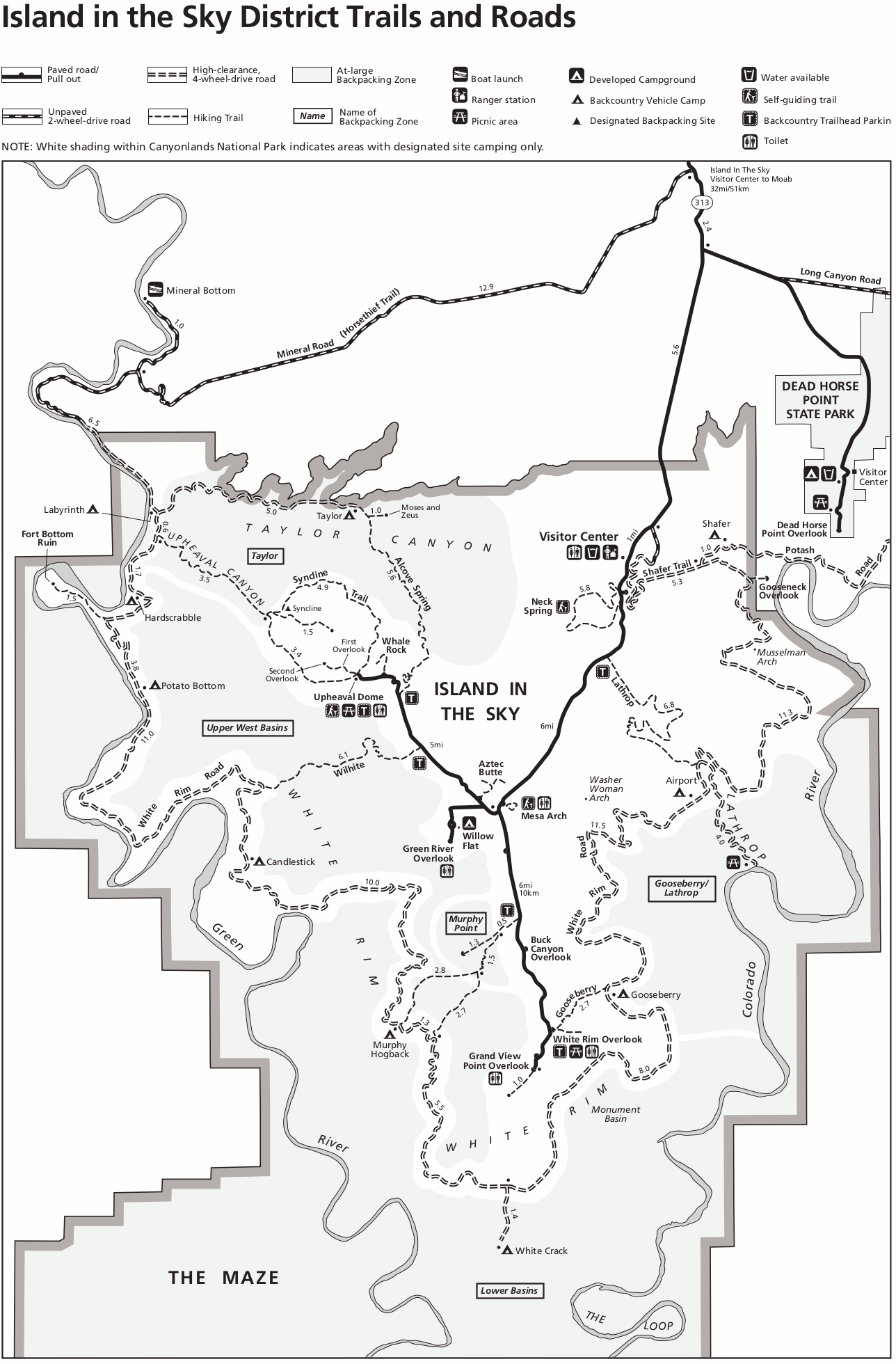
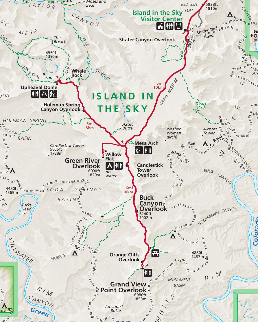 The Island in the Sky map crops the park map down to show only the Island in the Sky district, which is the most-visited district of Canyonlands and nearest to Moab. Here you’ll find short trails to amazing overlooks.
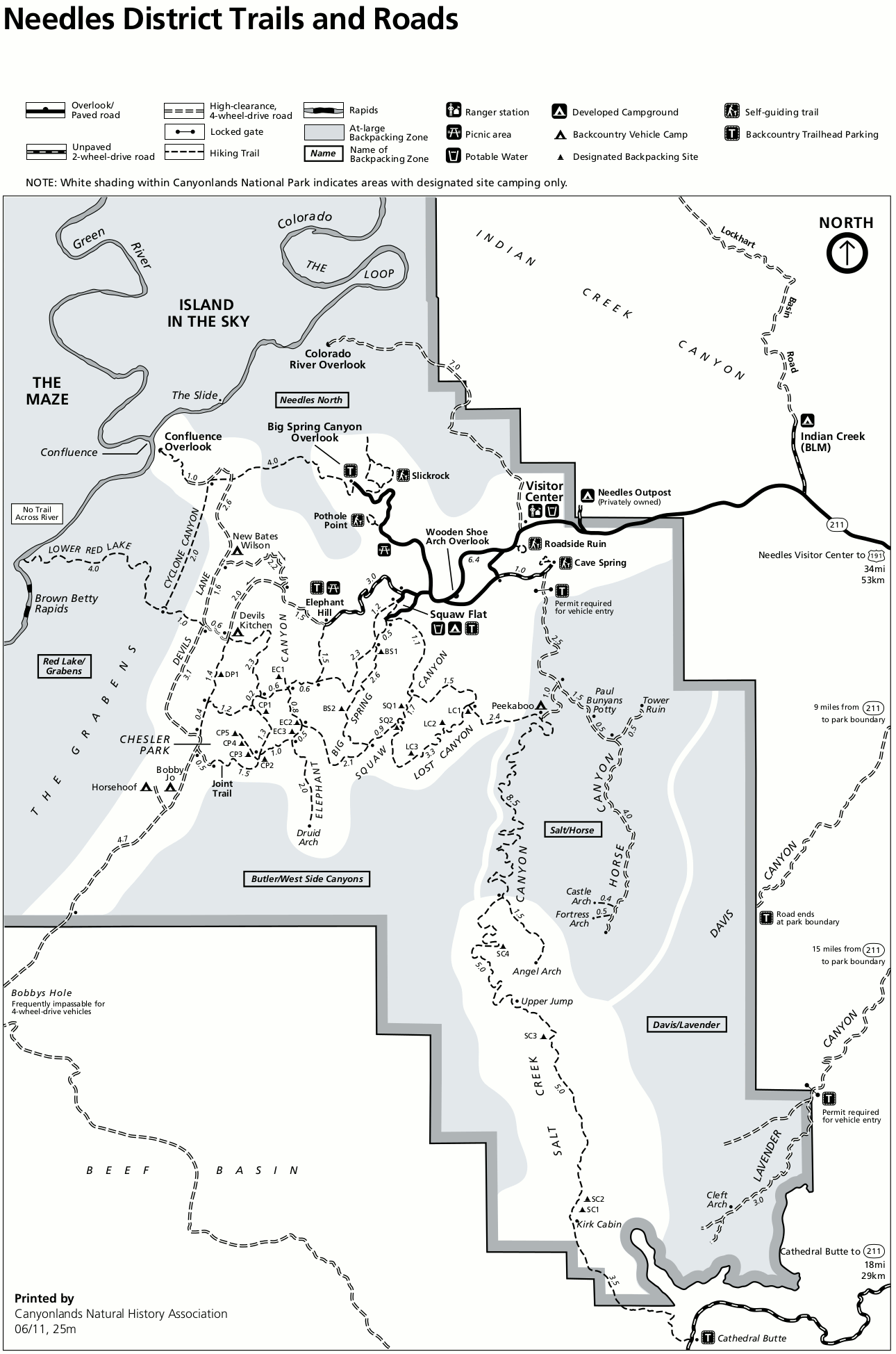
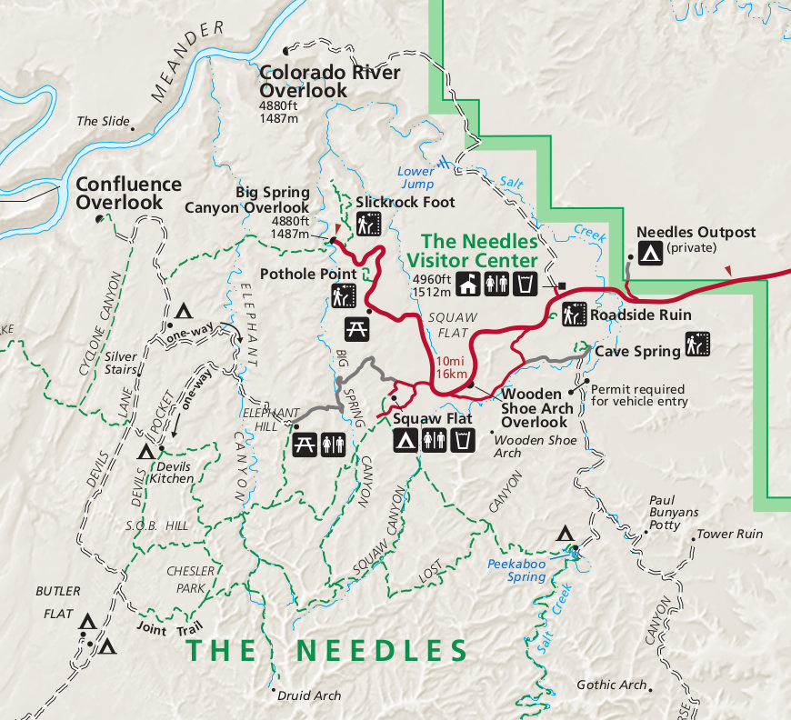 This Needles map shows only the Needles district of the park, which is more remote than Island in the Sky and has more hiking trail options. This district has a real wilderness feel with some great long hikes.
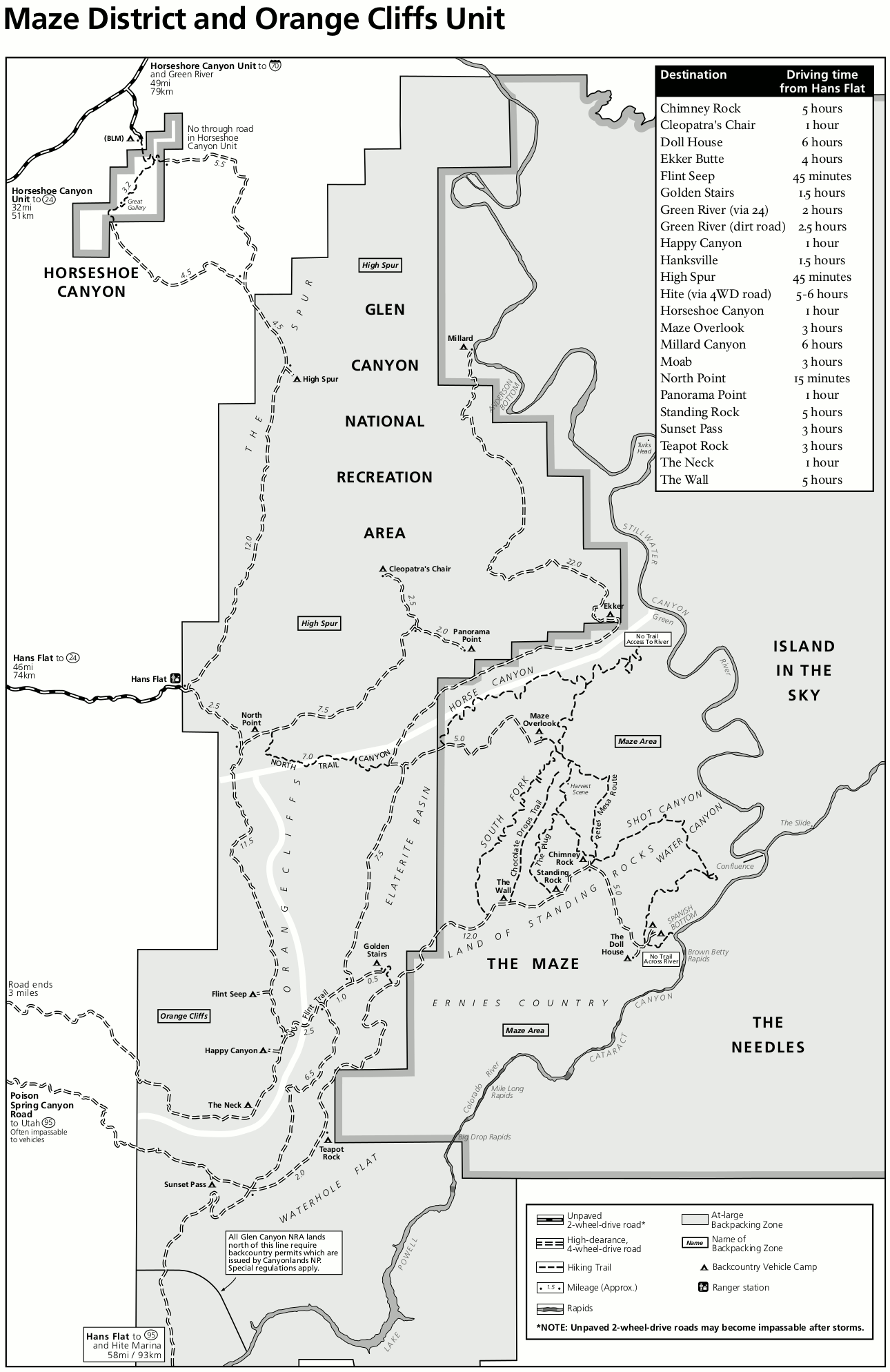
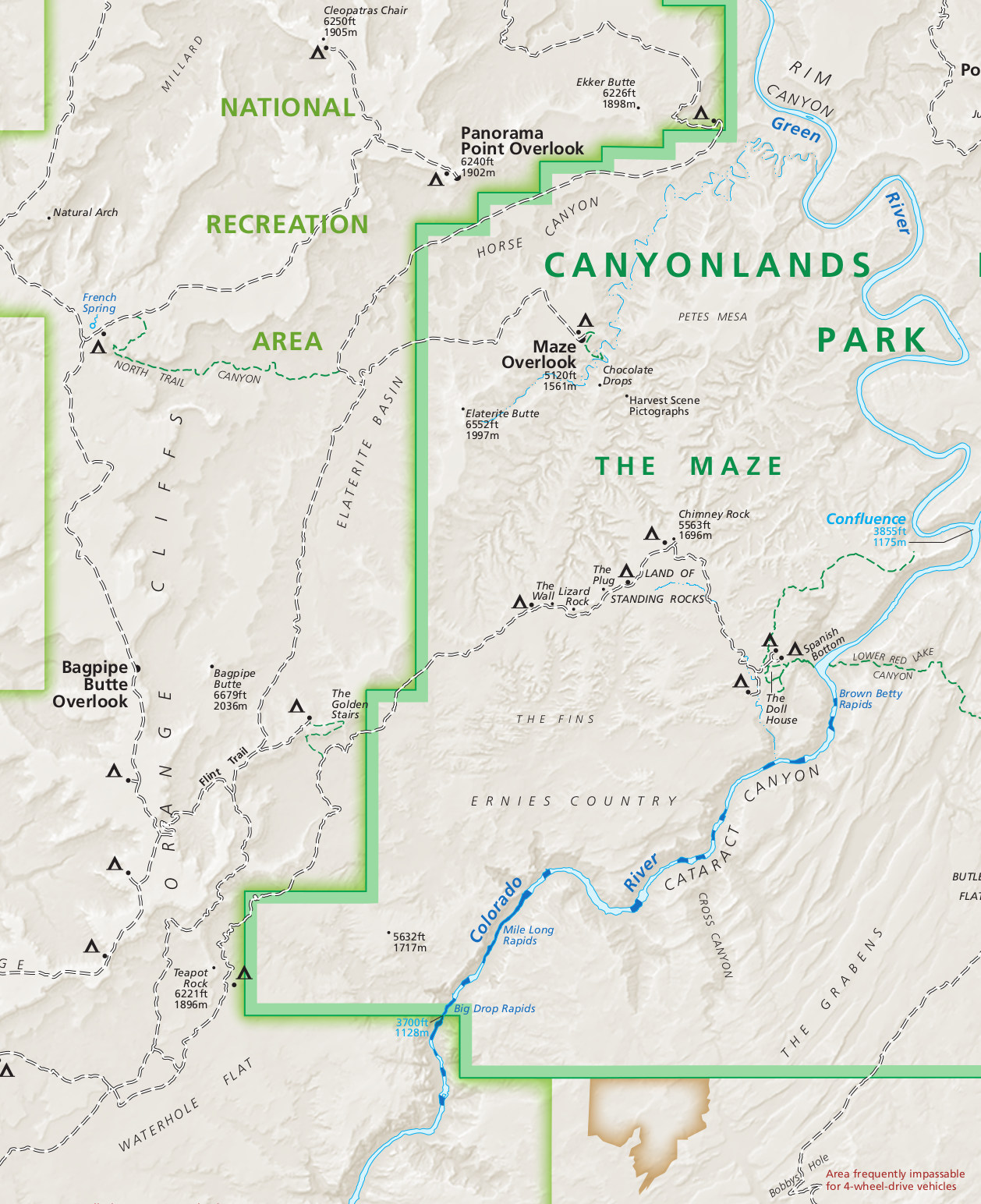 The Maze map shows only the very remote Maze district and the 4×4/Jeep roads required to reach this area from the west. It is not accessible by car from the east, though you could take a jet boat for overnight backpacking.
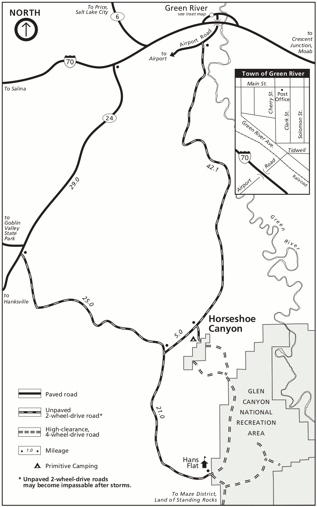 This is a Horseshoe Canyon map, which shows a completely separate unit of Canyonlands National Park (accessed from the west) that was established in recent times o protect its incredible pictographs.
Canyonlands trail maps
 The maps below are great for simple day hikes that stick close to the road, although they don’t show topographic lines or enough detail for more in-depth hikes. The National Geographic Trails Illustrated map shows the park in enough detail for these longer hikes and overnight trips. There are also detail maps for the Needles District and Maze District available, which are recommended for backpacking, cycling, and 4WD vehicle trips.
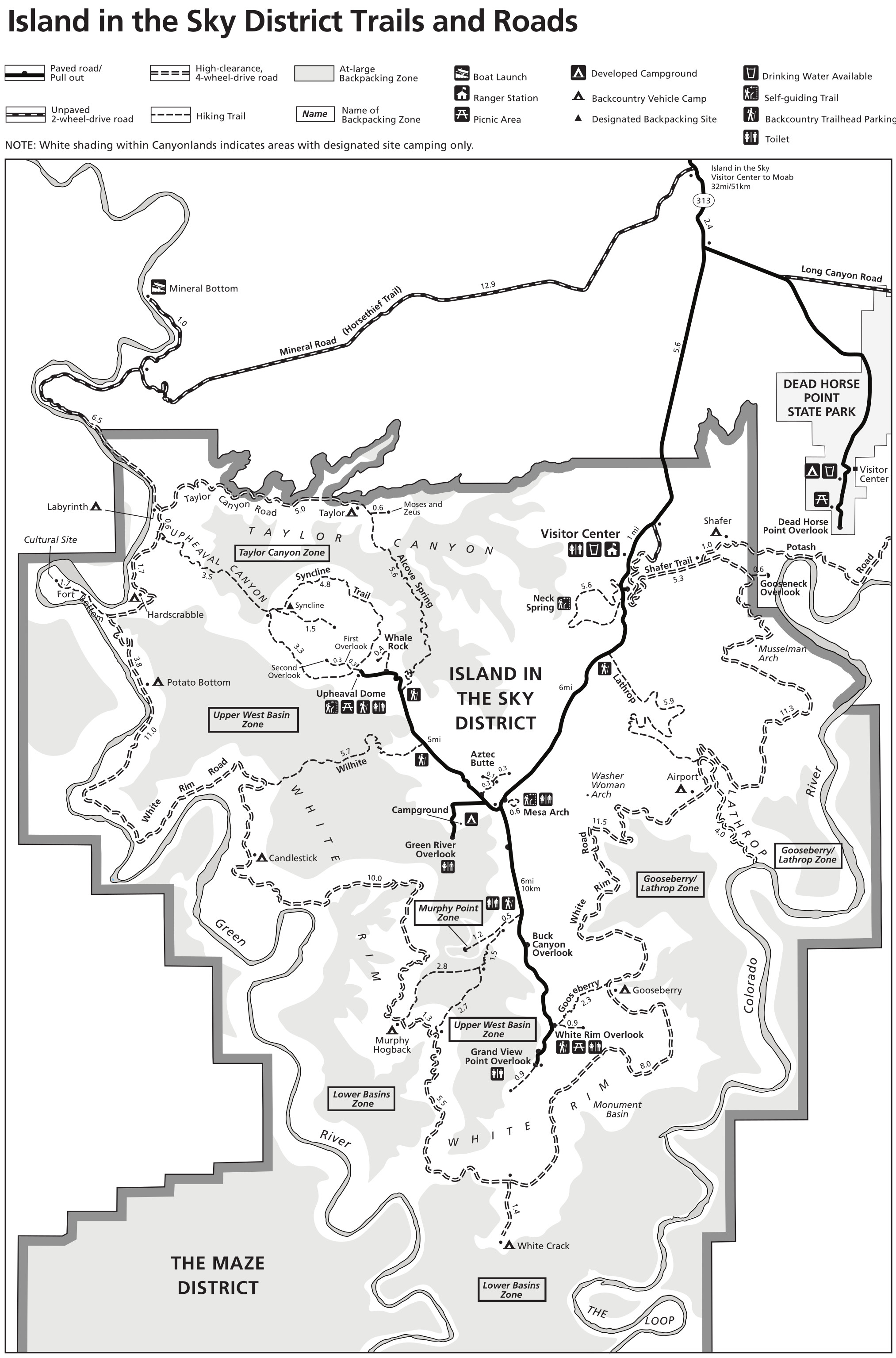 The Island in the Sky trail map was last updated in 2024. It includes all roads and trails in the frontcountry and backcountry, including the White Rim Road, Shafer Trail, and the various at-large backpacking zones.
 Here’s a Needles trail map, last updated in 2024. The Needles is your major accessible backpacking destination in Canyonlands, featuring a couple dozen backcountry campsites spread throughout the canyons.
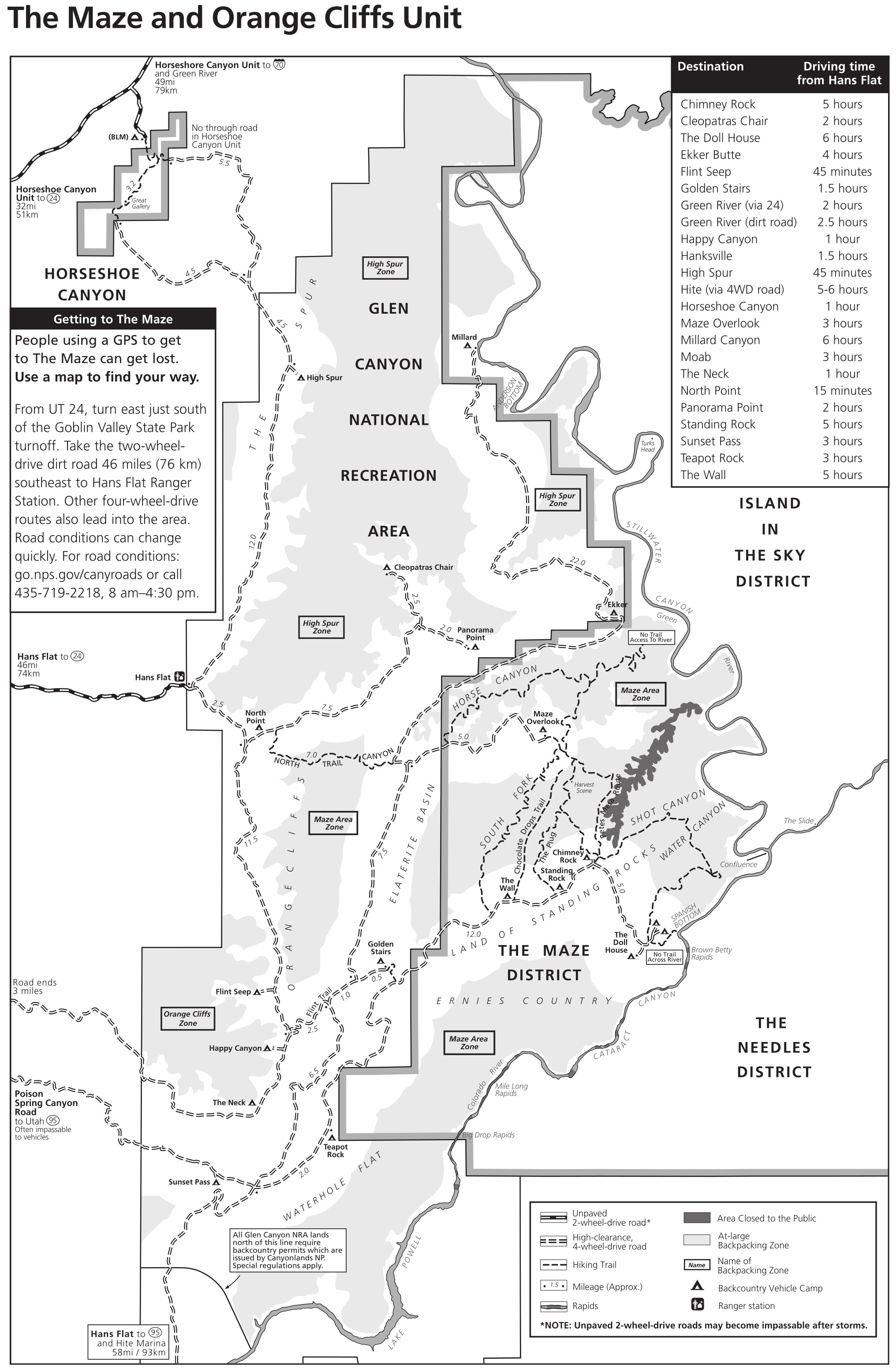 This Maze trail map was last updated in 2022 and showcases the most wild and remote part of Canyonlands National Park. Trips here are exclusively overnight and entail backcountry vehicle camping or at-large backpacking.
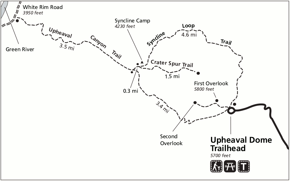 This is an Upheaval Dome map, showing the trails surrounding Upheaval Dome in the Island in the Sky district in northern Canyonlands National Park. You can do a short walk to the overlook or full-day hikes.
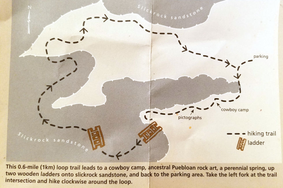 The Cave Spring trail map shows this short loop trail located in the Needles District that includes a couple ladders, pictographs, and an old cowboy camp. And, well, Cave Spring naturally.
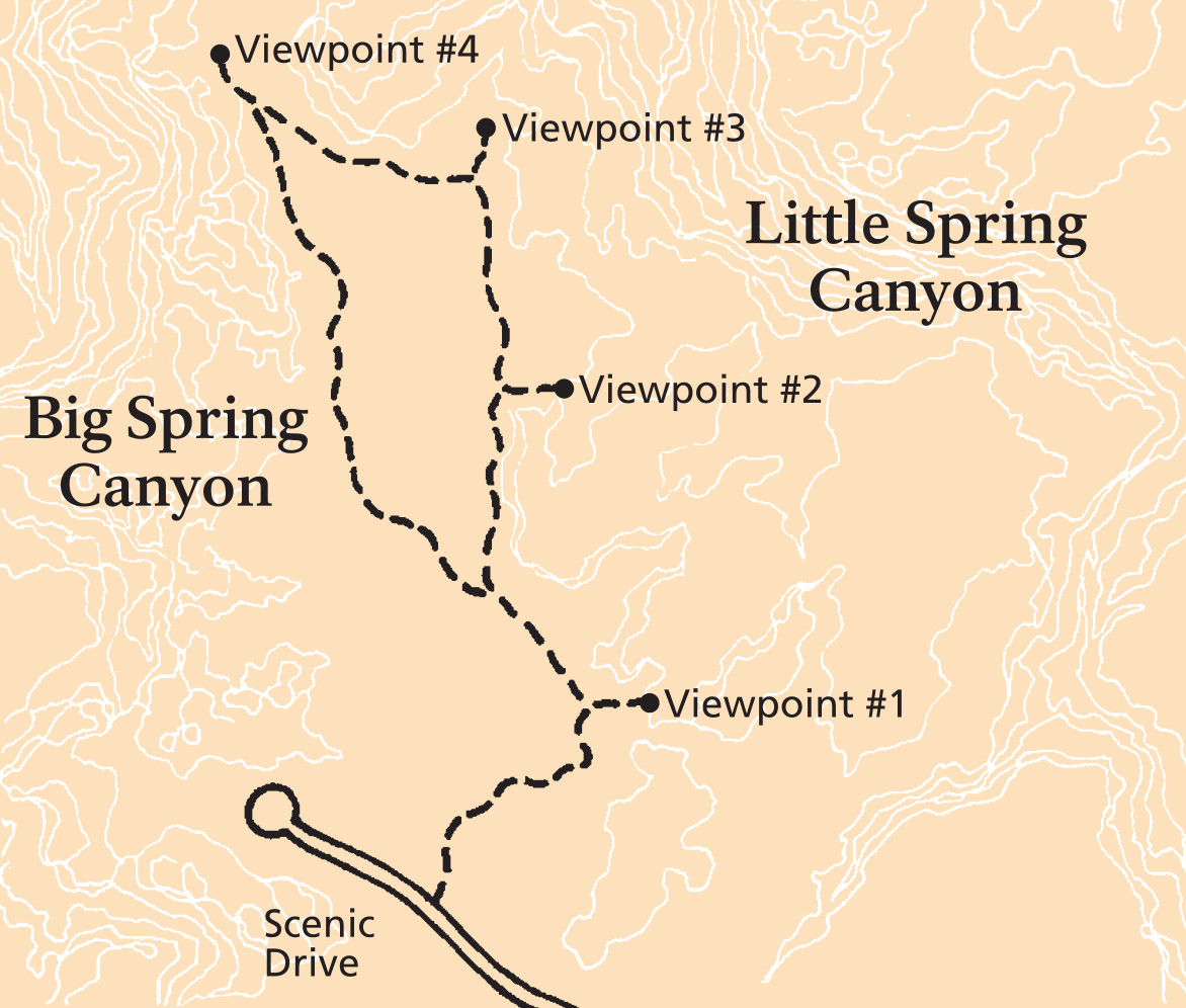 The Slickrock trail map focuses on this nice, relatively flat 2.5-mile loop hike near the end of the road in the Needles District. The trail provides views into Big Spring Canyon and Little Spring Canyon.
Canyonlands terrain map
 This amazing Canyonlands terrain map shows most of the Maze and Needles district in a very attractive (and large!) three-dimensional perspective. It’s a great map to plot out your hiking adventures.
Canyonlands lodging map
 To the right you can open up the Expedia interactive lodging map of Moab, which is definitely where you’ll want to stay for your Canyonlands visit, as it’s located between the Needles and Island in the Sky districts. Moab makes a great base camp for exploring both Canyonlands as well as Arches. You might also want to browse Expedia’s top-rated Moab lodging to compare prices, location, amenities, and reviews.
Canyonlands backcountry maps
 The Needles backcountry zone map shows the at-large camping zones in the Needles District, as well as designated backcountry campsites for backpackers and vehicle campsites for those in high-clearance vehicles.
 This is an Island in the Sky backcountry zone map, which includes designated backcountry vehicle campsites on the White Rim Road as well as at-large backpacking zones for those traveling on foot.
Canyonlands science maps
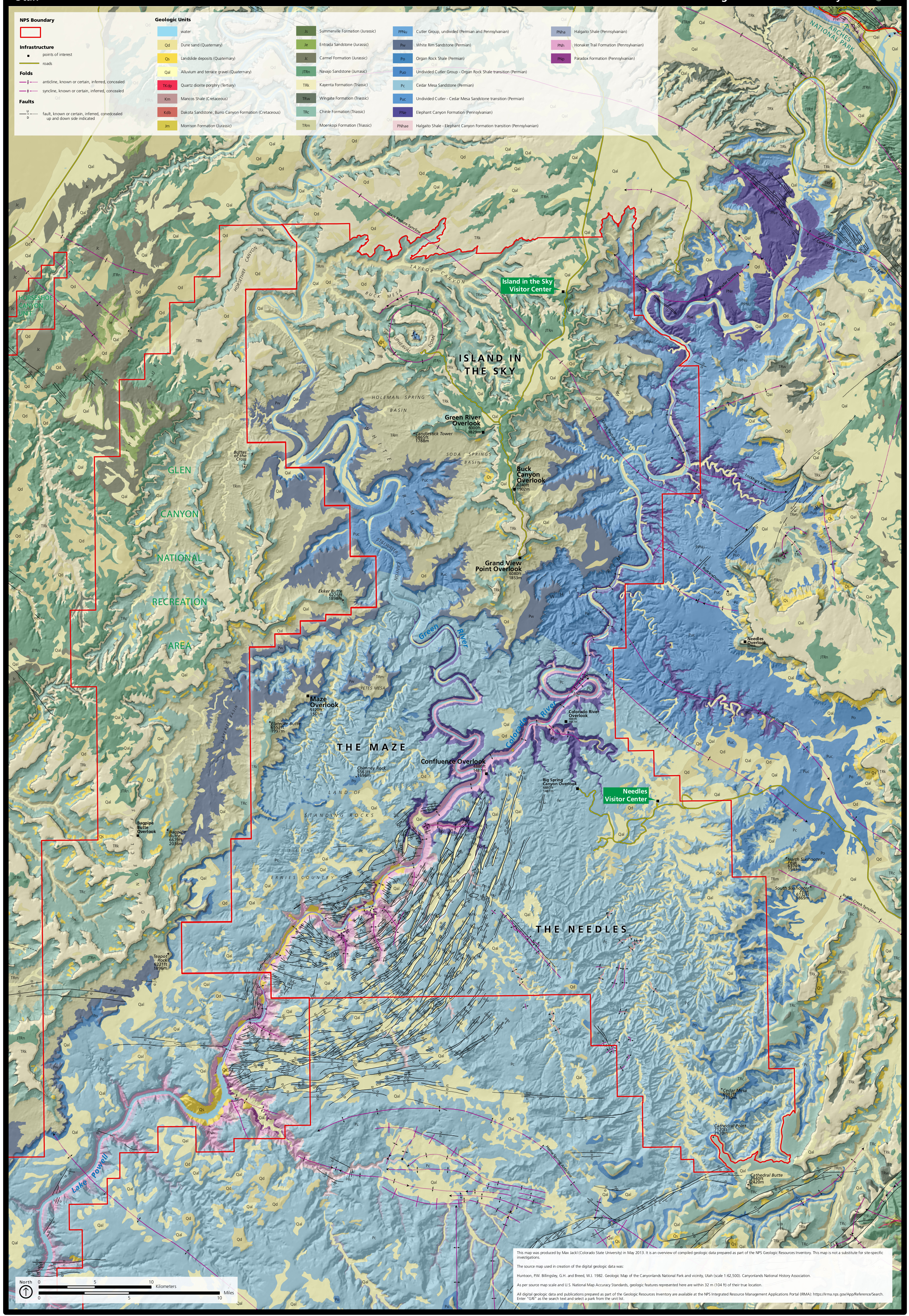 This Canyonlands geologic map plots the rock layers onto a park map that shows roads, points of interest, and topographic relief, making it easy to find rock types as you visit the park.
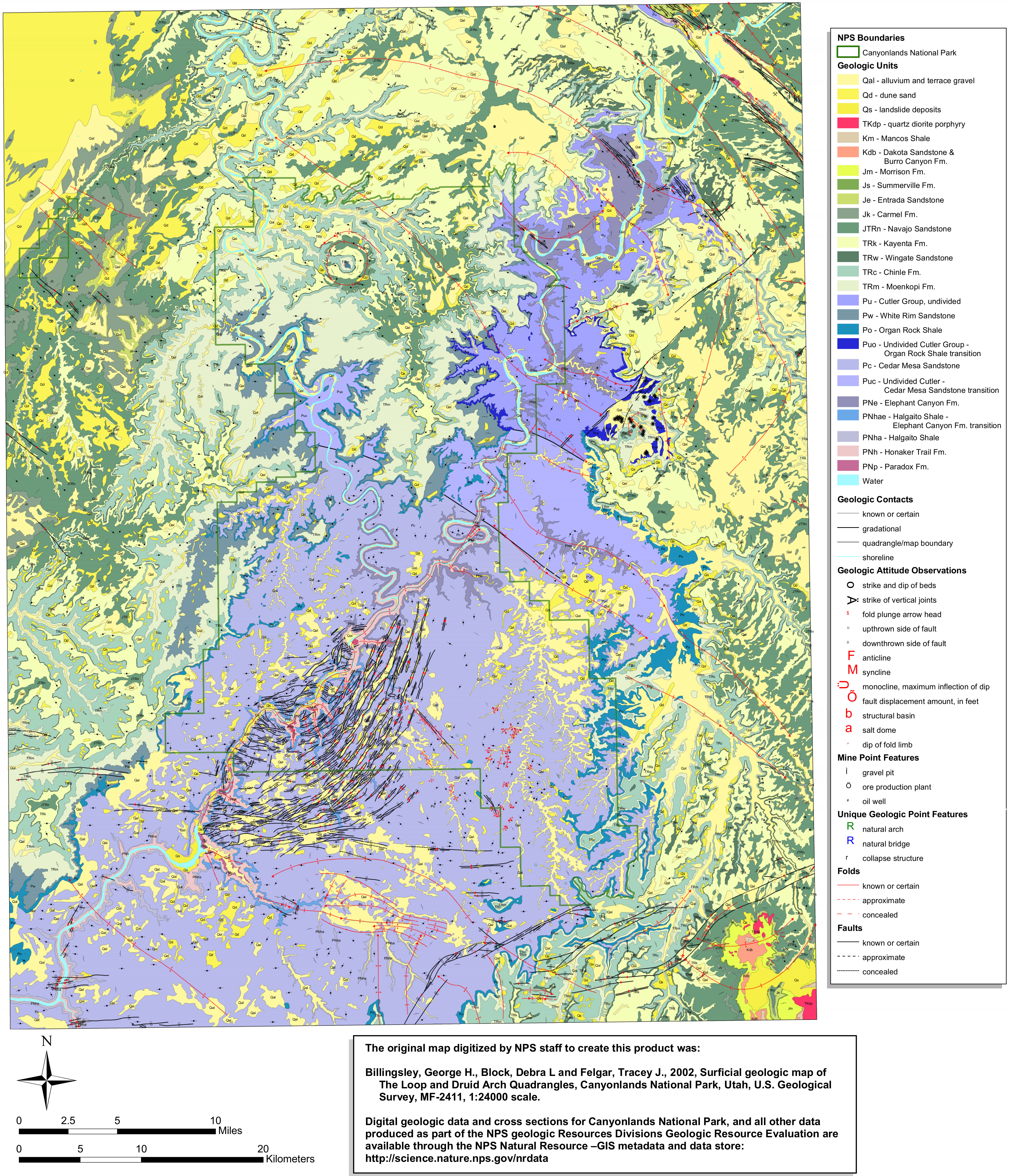 Here’s a geologic map of Canyonlands that shows just the rock layers, without the park landmarks and 3D effects like on the map above. This makes it slightly easier to pick out the contrasts in rock types.
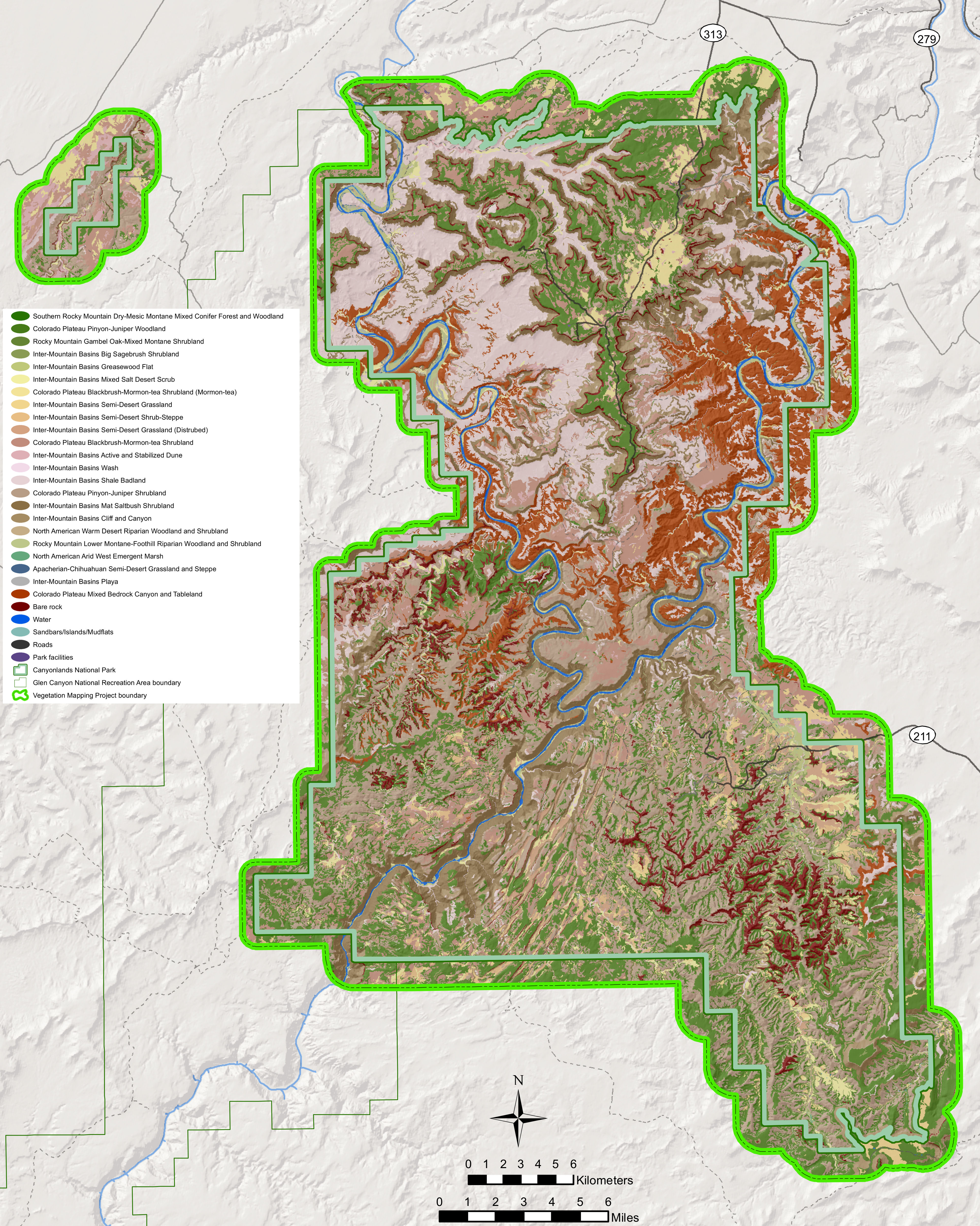 The Canyonlands vegetation map identifies the various types of vegetation communities within the park (lots of pinyon pine and juniper), as well as areas that are just bare rock.
Archived Canyonlands maps
 This is the official Canyonlands map from about 2020, which shows the park in much more topographic detail than the previous ones below. Click the image to view a full size map or download the PDF.
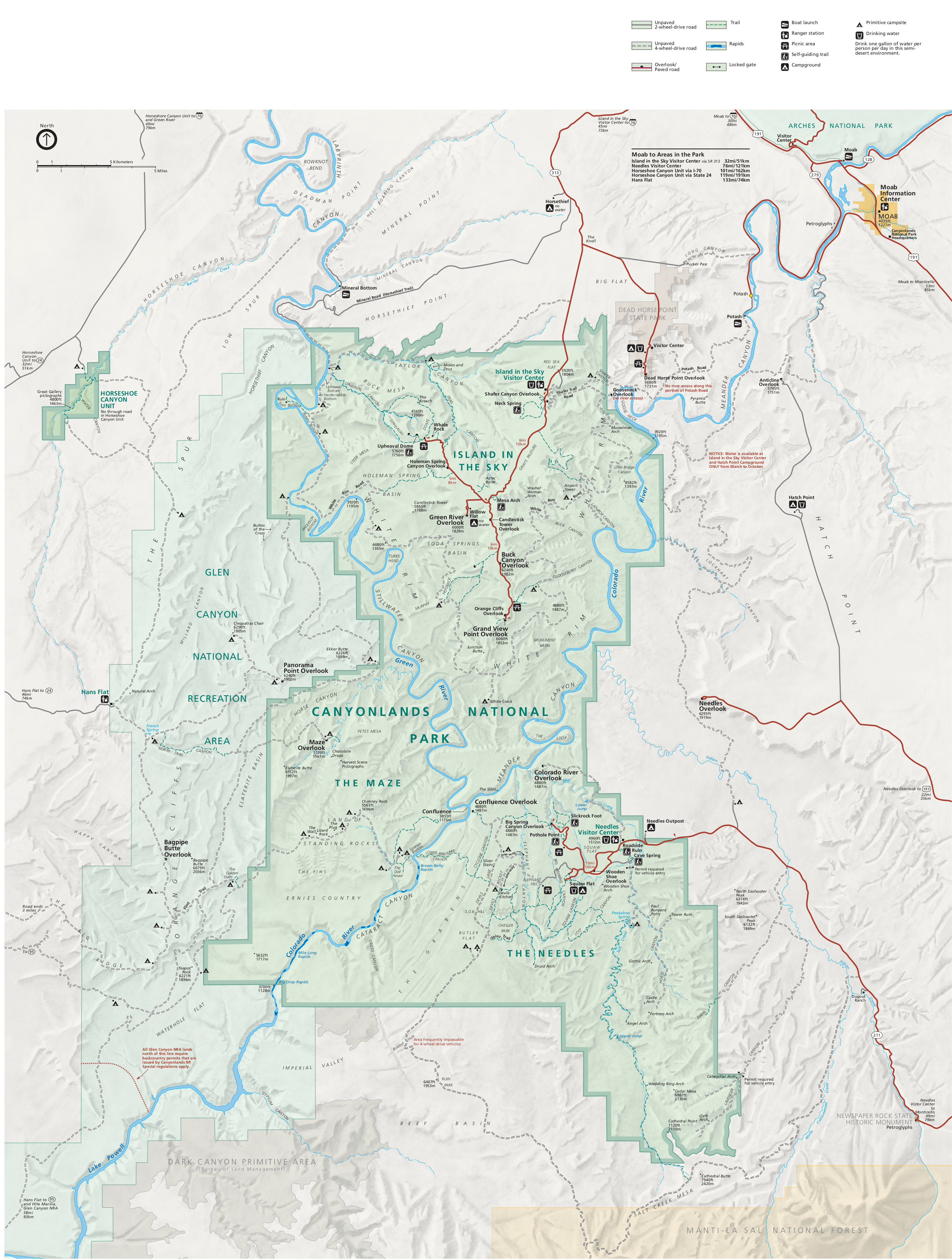 This is the previous Canyonlands National Park map from the mid-2010s, showing each area of the park: Island in the Sky, Needles, and the Maze. Click the image to view a full size map or download the PDF.
 This is the older version of the Canyonlands brochure map. It isn’t as nice looking as the ones above, but it prints out nicer. Click the image to view a full size map or download the PDF.
 This map of Canyonlands trails shows the Island in the Sky district, nearest to Moab. This is the area of Canyonlands most easily visited by car; this map shows what you’ll find at the viewpoints.
 This is an old map of the Needles district, a hiker’s paradise. You’ll find that this map contains some derogatory place names that are no longer in use today, as they are now correctly recognized as slurs.
 This is an old map of the Maze, Canyonlands’ most remote and wild district. It’s a pain in the neck to get to and for experienced hikers and jeep drivers only, but has incredible rugged scenery.
 This is a full Canyonlands trail map, showing each of the three maps above combined onto a single large map. Click the image to view a full size map or download the PDF.
…and more!
< Return to National Park Maps home
< Return to Park List
< Return to List by State