Petrified Forest maps from the park brochure
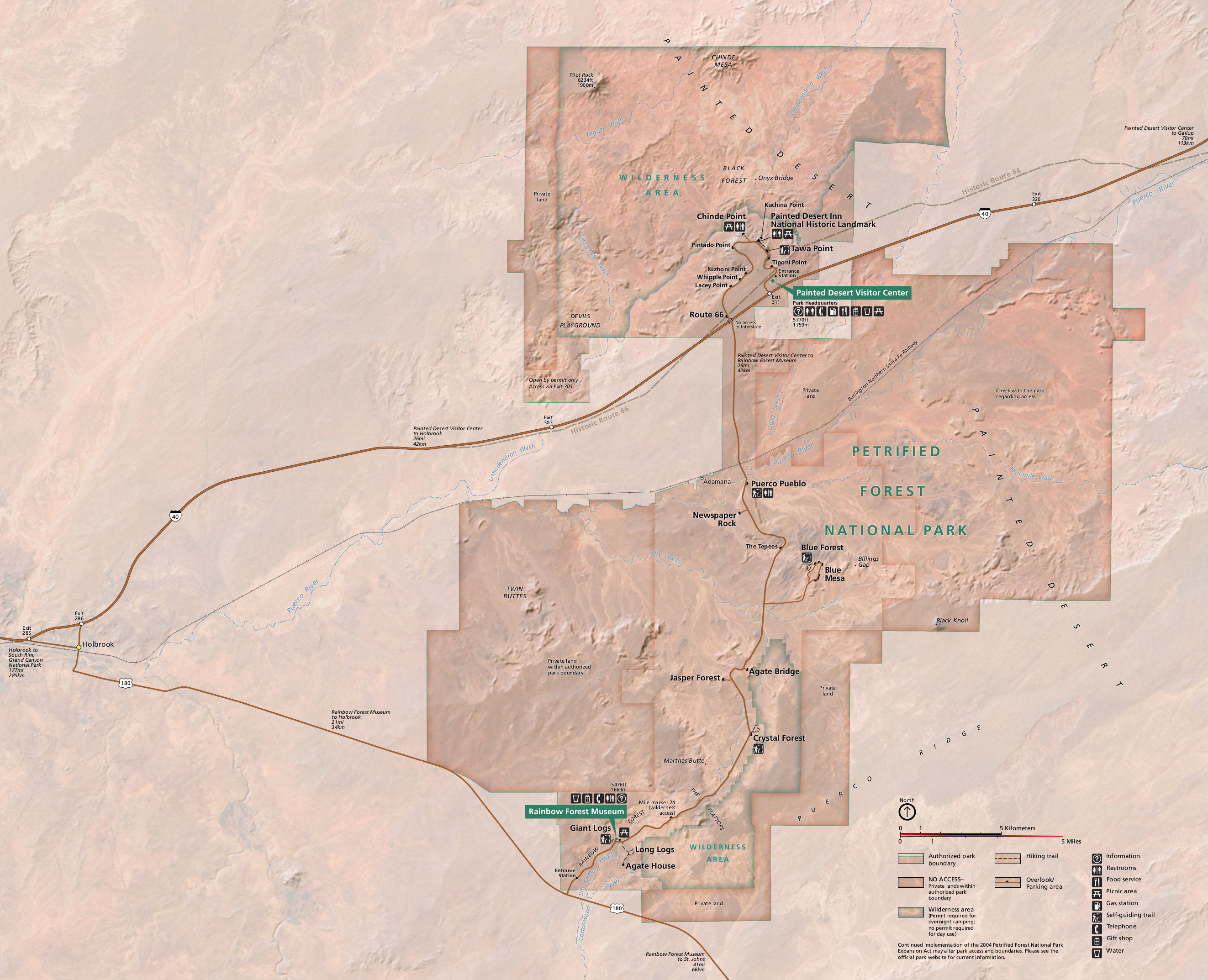 Here’s the official Petrified Forest National Park map, which is identical to the map from the official brochure you receive at the park. Click the image to view a full size map or download the PDF.
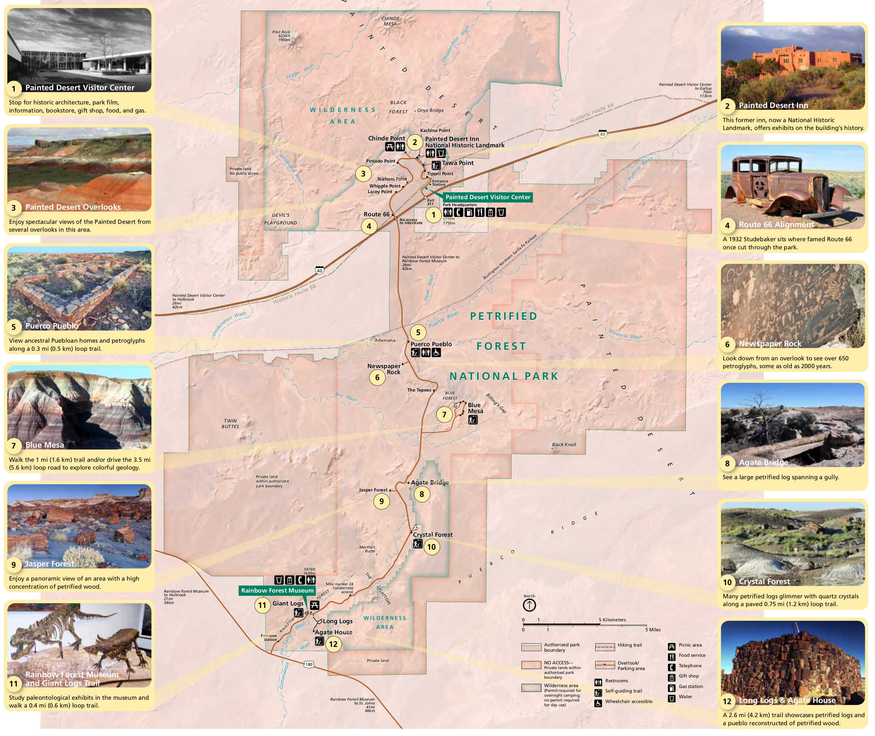 Here’s an annotated map of Petrified Forest, similar to the map above but with particular points of interest labeled and accompanied by photos and descriptions of each attraction.
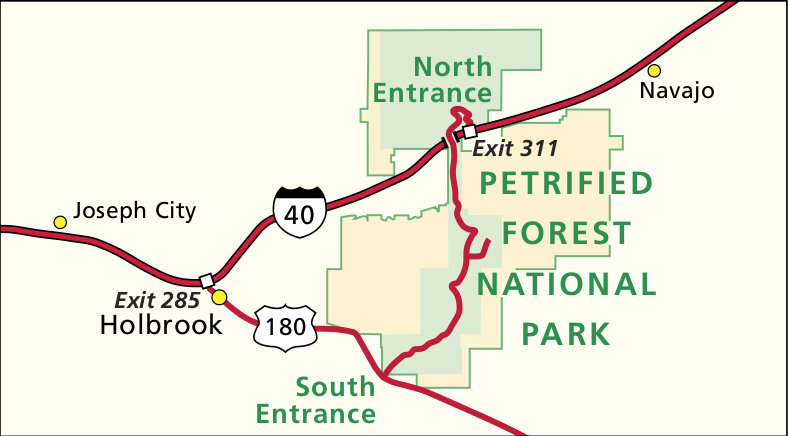 This is a regional map of Petrified Forest, showing nearby highways, towns, and both the north and south entrances. Click the image to view a full size map or download the PDF.
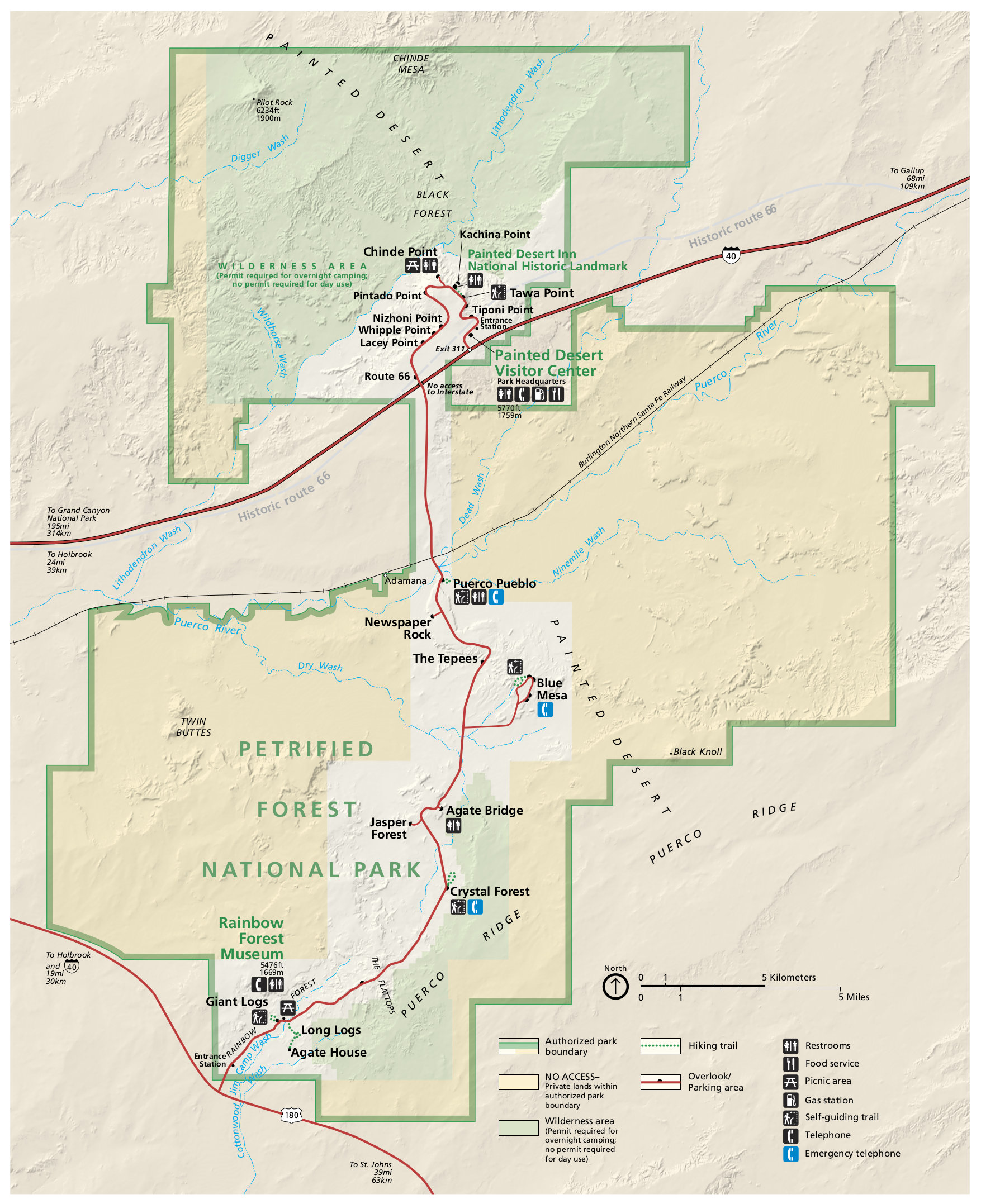 This is the old Petrified Forest map from the brochure, with roads, viewpoints, and facilities throughout the park and Painted Desert. Click the image to view a full size map or download the PDF.
Petrified Forest lodging map
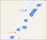 Your closest home base when visiting Petrified Forest National Park is Holbrook, AZ. To the right you’ll find an Expedia interactive lodging map for Holbrook, where you’ll see the customary interstate town layout with hotels lining an I-40 arterial. You may also find it easier to compare your options with an Expedia list of top-rated Holbrook lodging to view photos, reviews, and prices.
Petrified Forest science maps
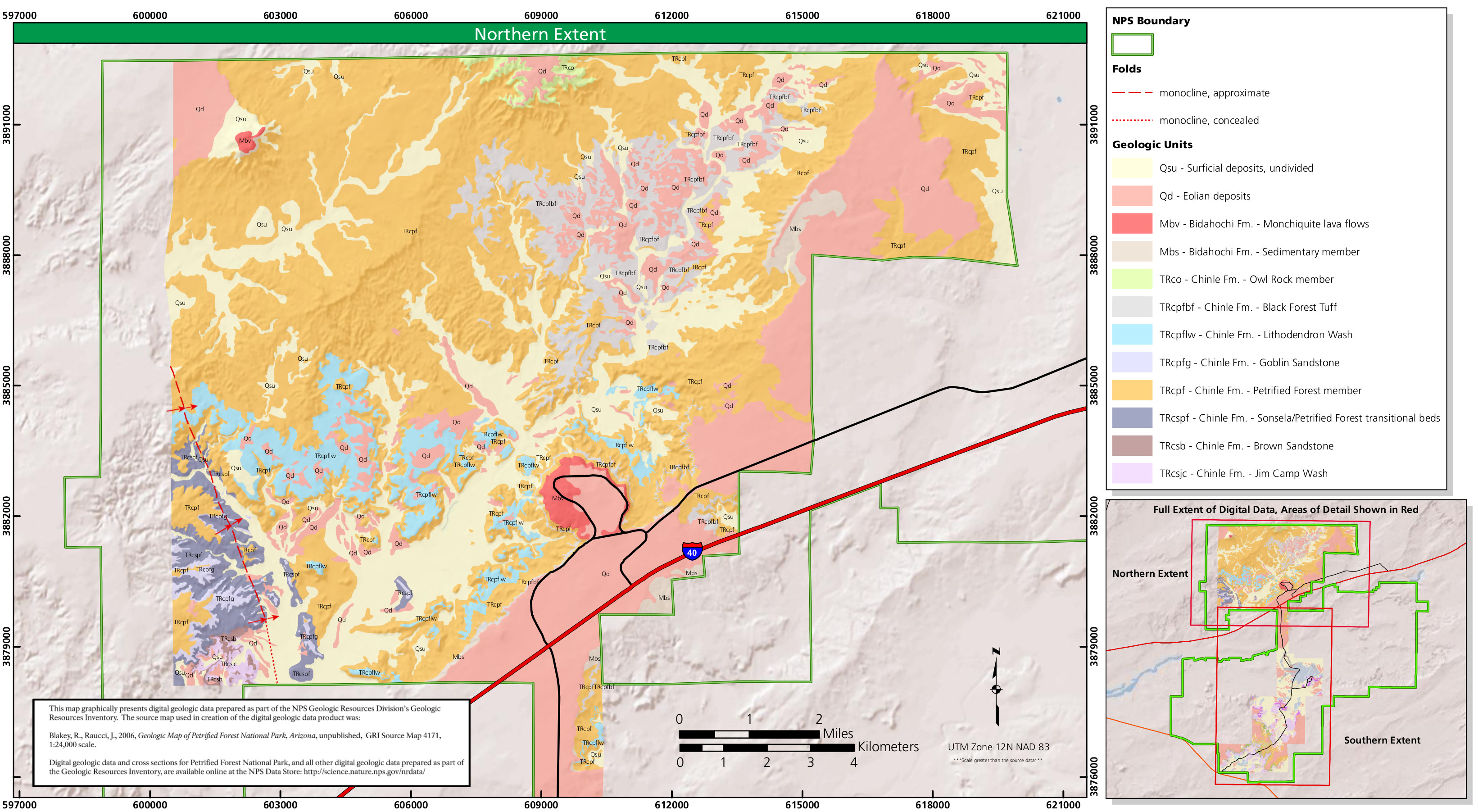 This geologic map of Petrified Forest North features a whole lot of Chinle Formation! This map shows the northern part of the park, located just off I-40. See the map below for more of the park.
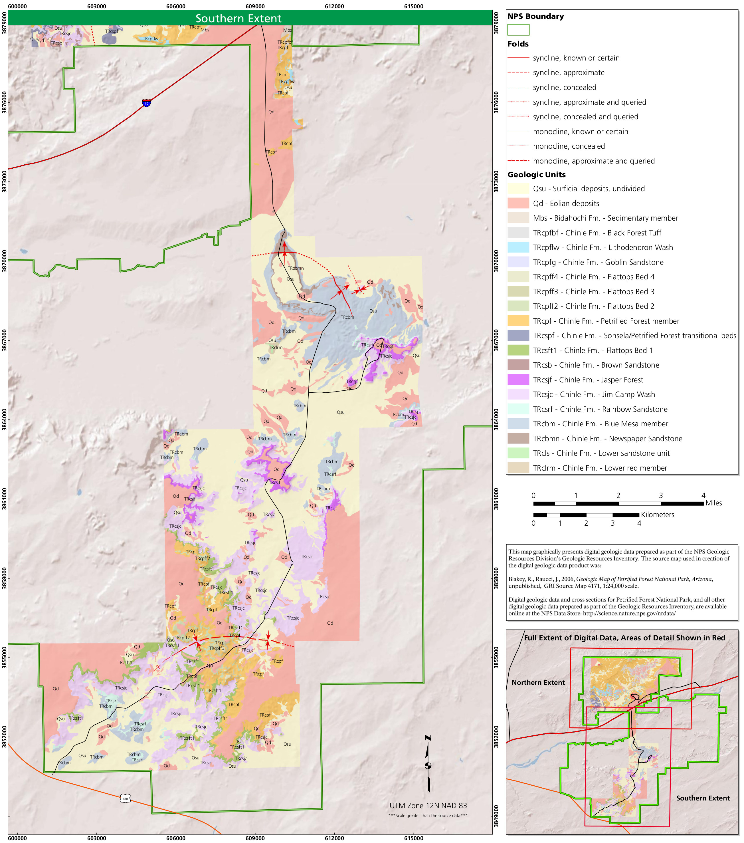 Here’s a Petrified Forest South geologic map that has a bit more variety than the northern unit map above, as it is a little less dominated by the Chinle Formation since it has more surficial deposits.
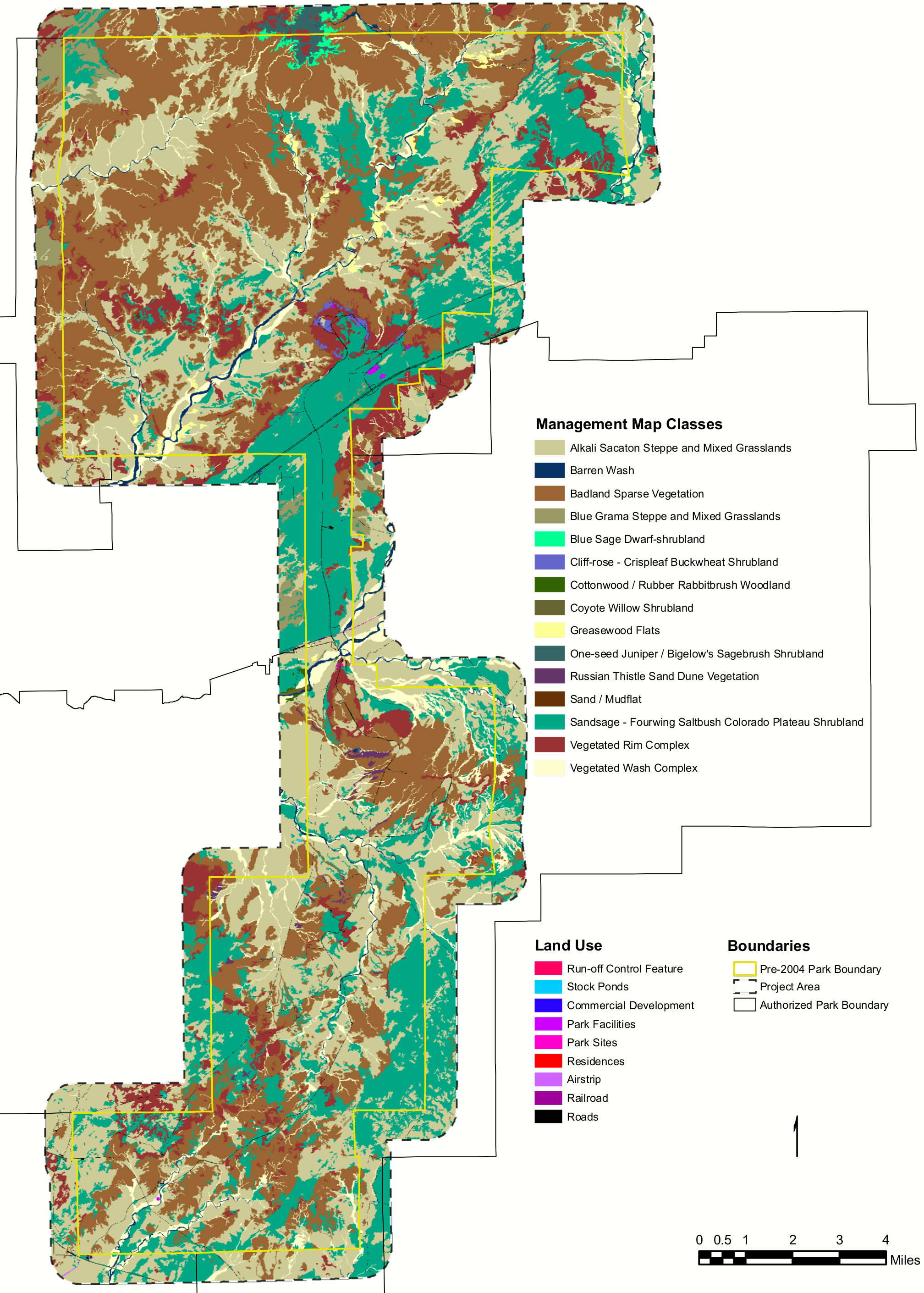 The Petrified Forest vegetation map shows the various plant communities that make up the core of the park. Note that this doesn’t include the recent park expansion, which is shown in the map outline.
…and more!
< Return to National Park Maps home
< Return to Park List
< Return to List by State