Crater Lake maps from park brochures
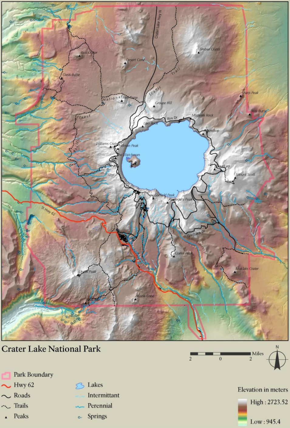
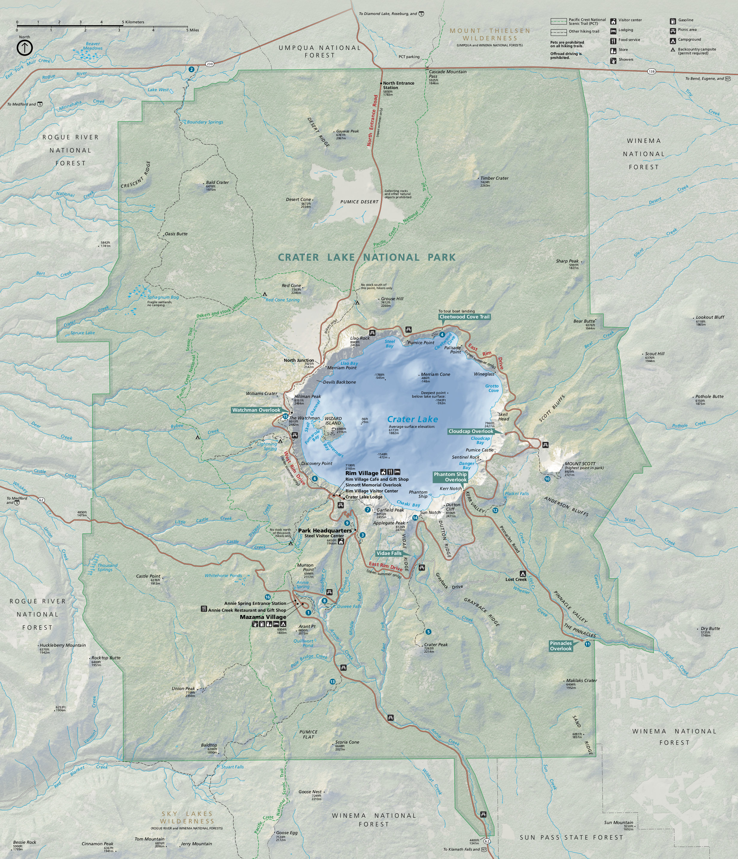 This is the official Crater Lake map from the park brochure, showing roads, trails, campgrounds, and points of interest. Click the image to view a full size map or download the PDF.
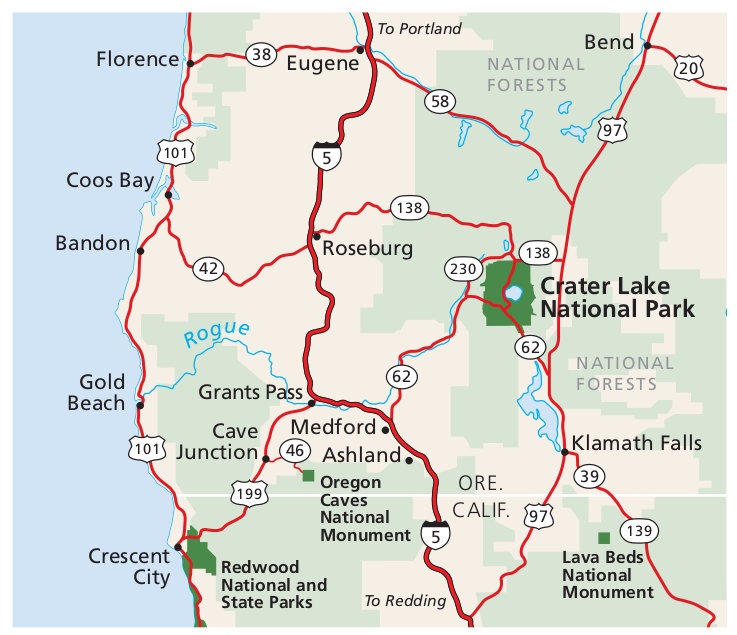 This is a Crater Lake regional map, showing roads, highways, and towns surrounding the park and driving routes from I-5. Click the image to view a full size map or download the PDF.
Crater Lake trail maps
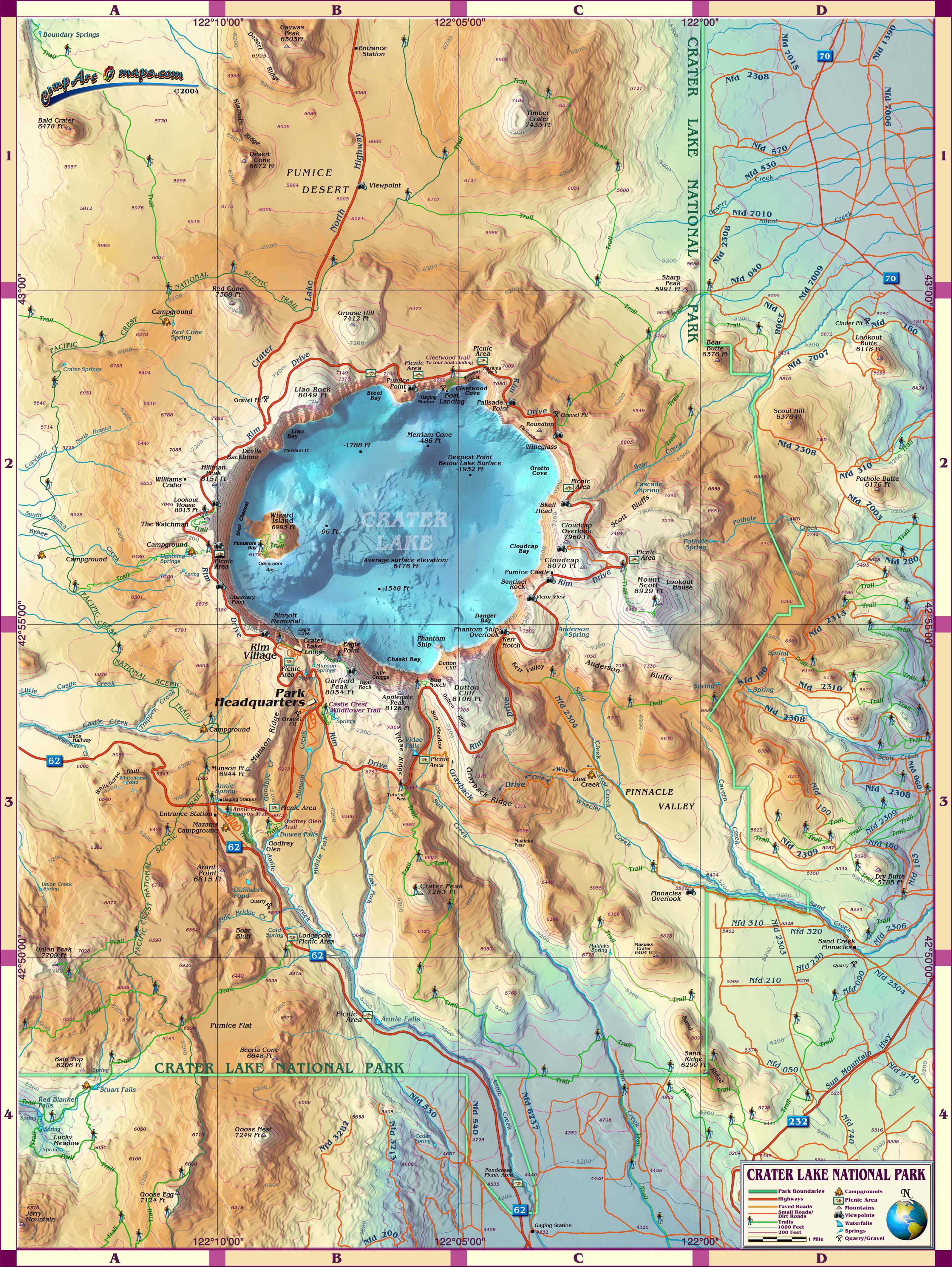
 Crater Lake National Park has a lot of backcountry trails worth exploring, including the Pacific Crest Trail. If you plan to do a lot of hiking or any overnight trips, you’ll want a detailed trail map like the National Geographic Trails Illustrated map, which will include topographic lines and GPS coordinates. And I love that it even includes water depths of Crater Lake! It’s definitely worthwhile purchase if you’re spending time on the trails.
 Here’s a Garfield Peak trail map, showing the route up Garfield Peak that departs from the south rim of Crater Lake at the Crater Lake Lodge. A beautiful hike overlooking the lake below!
 The Mount Scott trail map shows the forest and ridgeline trail route from the East Rim Drive to the summit of 8929′ Mount Scott — Crater Lake National Park’s highest point.
 This Union Peak trail map outlines the route from the main park road to the summit of Union Peak, 7709′ above sea level. This trail follows the Pacific Crest Trail before veering off to the summit.
 Here’s a Crater Peak trail map, focusing on the forested route to the top of 7263′ Crater Peak, located directly south of Crater Lake and accessible via East Rim Drive and Grayback Drive.
Note that the Cleetwood Cove Trail (maps below) will be closed for major repair and rehabilitation for 2026 and 2027, and possibly longer.
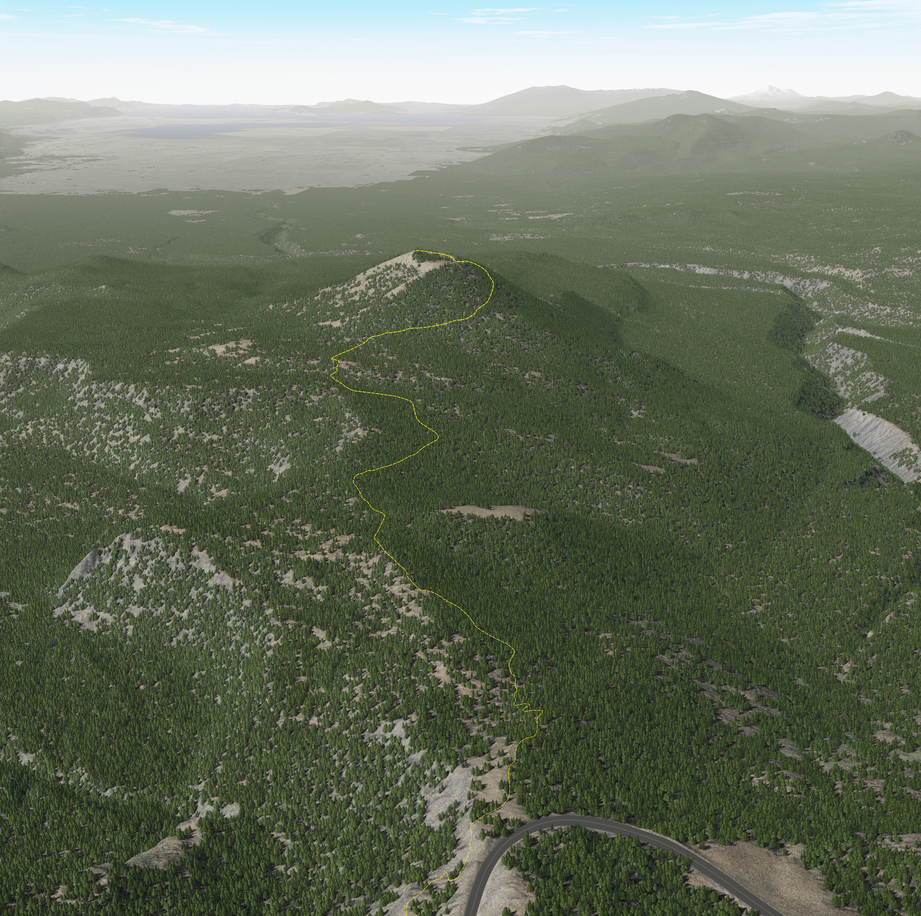
 The Cleetwood Cove trail map shows the parking lot as well as the downhill trail that leads to the tour boat landing down on the north side of Crater Lake. Good luck on the uphill return!
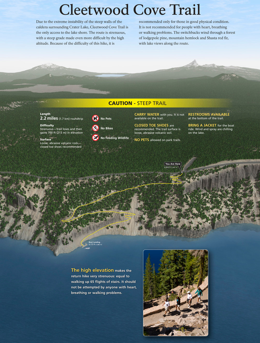 The labeled Cleetwood Cove map is from a wayside exhibit at the trailhead. This map is a little blurry, but unfortunately it’s in the highest resolution the NPS has made available. If you want more detail, use the one above.
Crater Lake lodging map
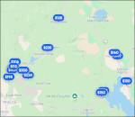 Crater Lake is pretty isolated in the mountains and there aren’t a lot of lodging options just outside the park. To the right, you can open an Expedia interactive Crater Lake lodging map that zooms out to include the closest major cities, including Medford to the west and Klamath Falls to the east. Consider also checking out Expedia’s top-rated Crater Lake lodging where you can compare options a bit closer in some smaller towns.
Crater Lake topo maps
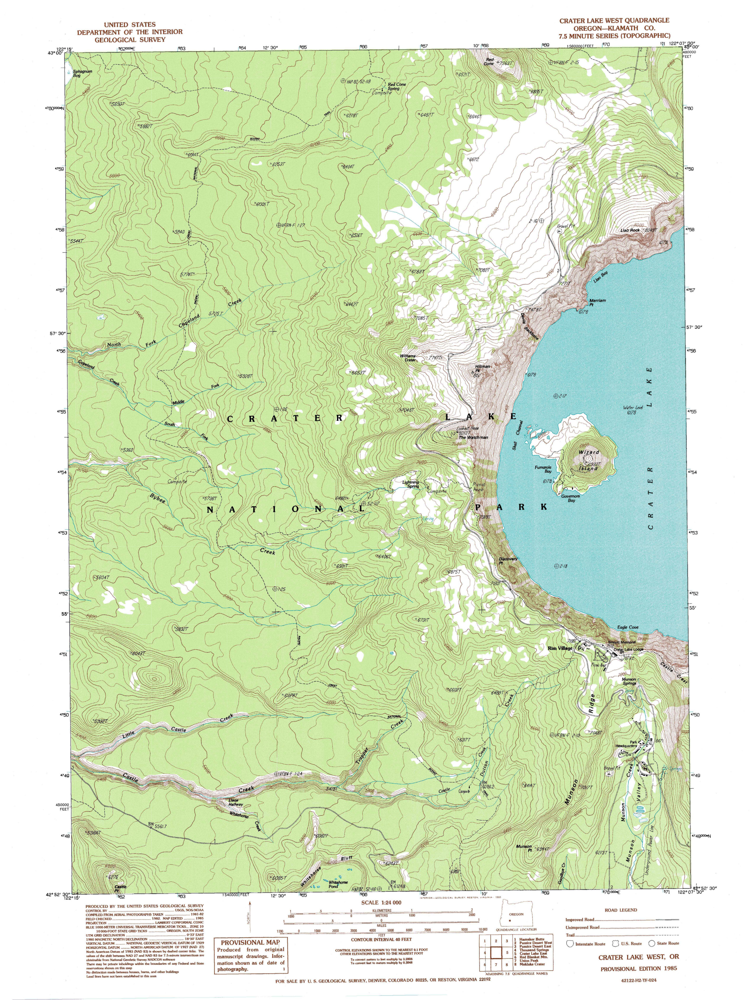 Here’s a west Crater Lake topo map from the USGS, including the west half of the lake and Wizard Island. Click the image to view a full size map or download the PDF.
 This is an east Crater Lake topo map, showing the (shocker!) east side of the lake and various viewpoints. Click the image to view a full size map or download the PDF.
Crater Lake geologic maps
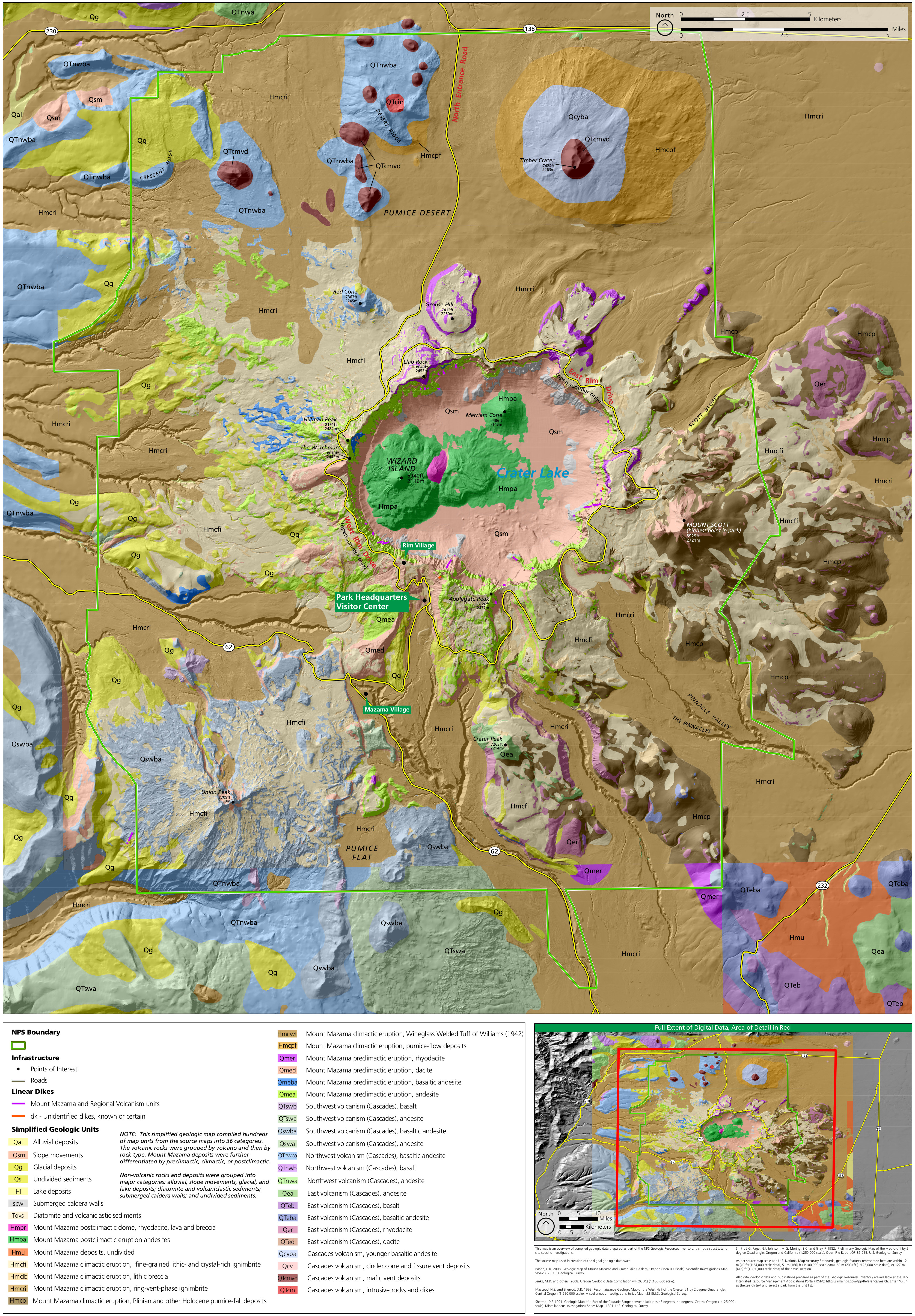 The Crater Lake geologic map overlays the various rock types onto a park map that shows the topographic features with shaded relief and elevation. No water on this map! Interesting to see the park with the lake removed.
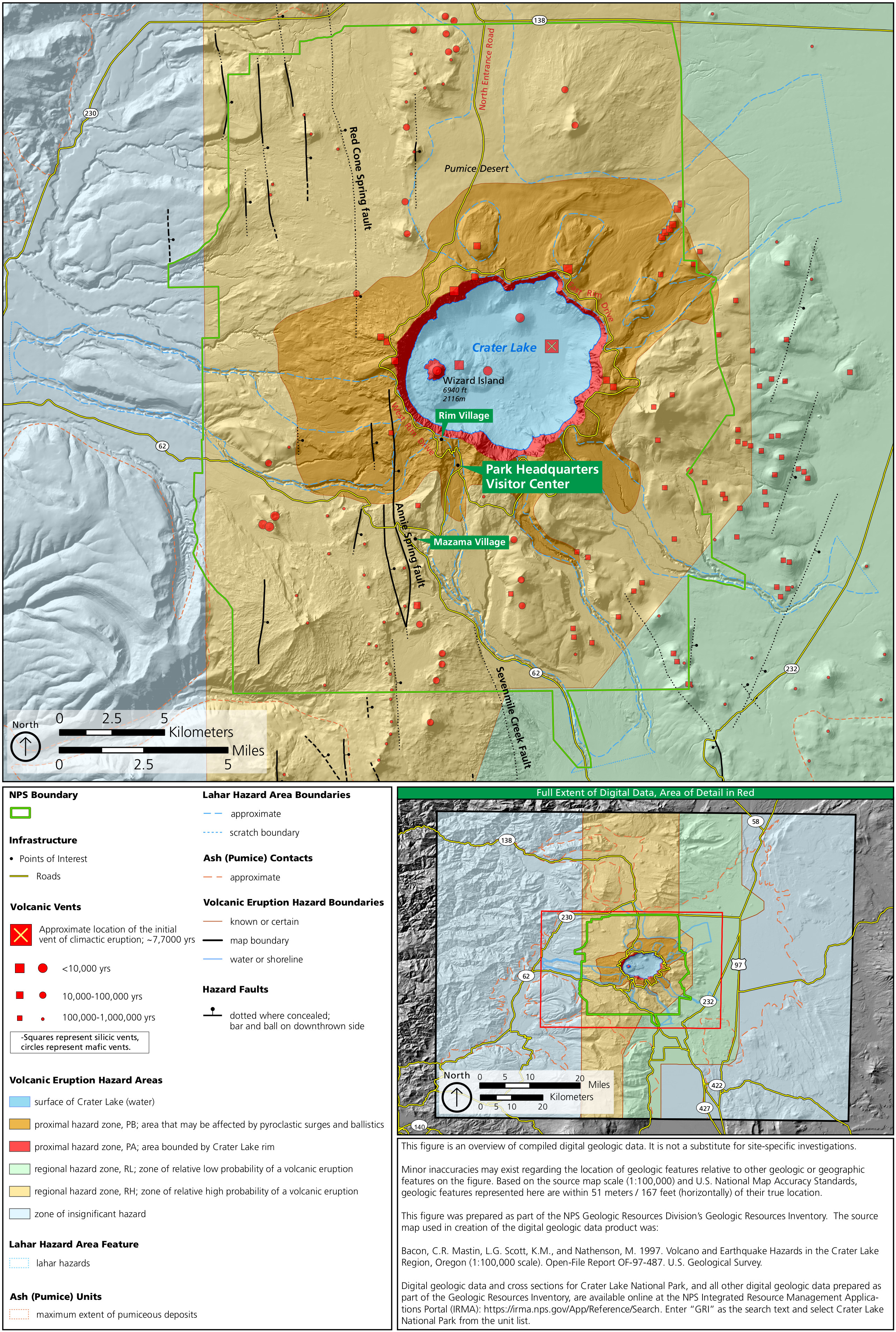 This geologic hazards map of Crater Lake shows both volcanic and earthquake hazards, including historical volcanic vents, earthquake fault zones, and lahar hazard areas.
Assorted Crater Lake maps
 This Mazama Village map zooms in on the Mazama Village area, including Mazama Campground, Annie Creek Canyon, and the various roads and parking lots at this major Crater Lake National Park junction.
 This is a Crater Lake region map, zooming out to show the various National Park units nearby: Redwood, Whiskeytown, Lassen Volcanic, Lava Beds, and Oregon Caves. Combine them all into one trip!
 This is a Crater Lake elevation map, which really hammers home how Crater Lake is filling the interior of a volcanic caldera. See how the mountain slopes up to the crater rim and lake?
 This Crater Lake illustrated map from compartmaps.com shows the park area in a very colorful, fun manner. It’s not ideal for navigation but does a great job of laying out points of interest.
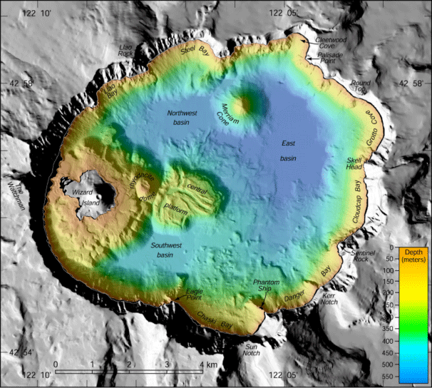 Here’s a bathymetric depth map of Crater Lake, showing what the lakebed looks like underneath all that water. Note the shallowness of the lake around Wizard Island and the depth on the northeast side.
Crater Lake climate maps
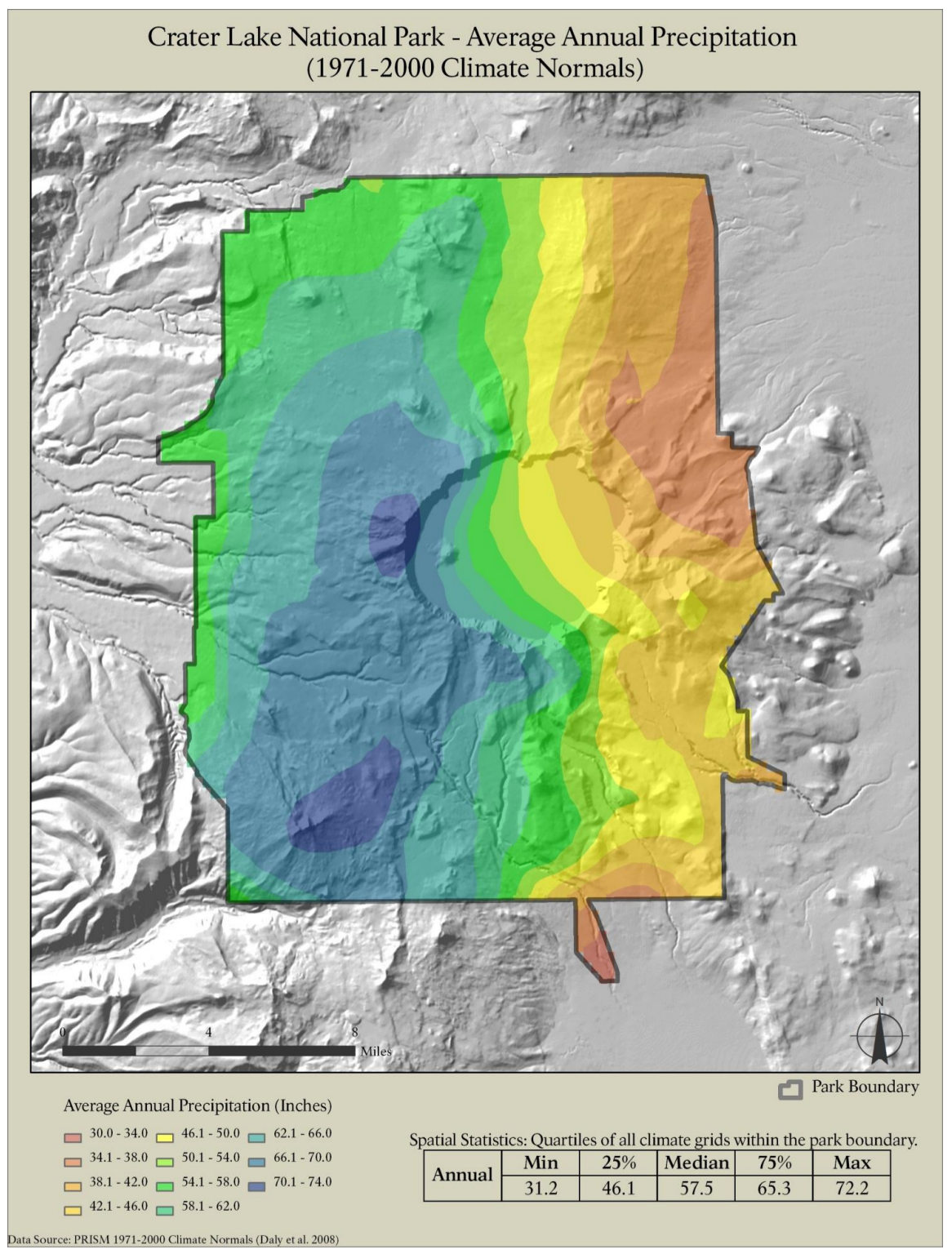 This is a Crater Lake precipitation map, plotting out the average annual amount of precipitation the park receives. Note the rain shadow effect, with much less precipitation on the east side!
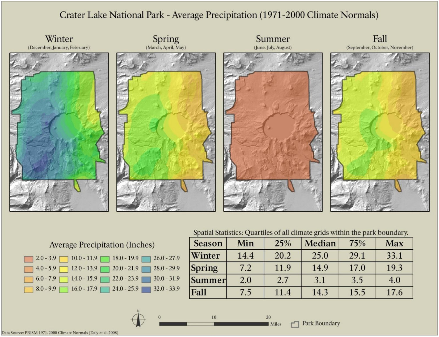 Here’s a seasonal precipitation map of Crater Lake, showing the differences in amount of precipitation by season. Look for a (relatively) dry summer and a whole lot of winter snow!
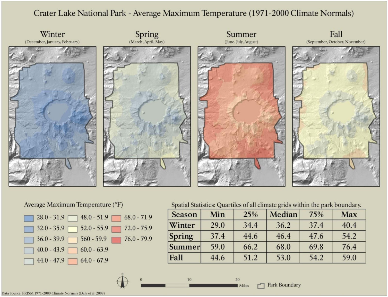 This is a Crater Lake seasonal temperature map, showing the average high temperatures for each part of the park throughout the year. Note how it cools as you get higher, and closer to the rim.
Crater Lake map prints and gifts

 Printed high-resolution Crater Lake map posters and other products are available at the Crater Lake store. For art prints, gift ideas, and souvenirs featuring other national parks, support this site and visit the National Park Maps store; you’ll find items to bring on vacation, keep at home for the memories, or give to your park-enthusiast friends and loved ones.
…and more!
< Return to National Park Maps home
< Return to Park List
< Return to List by State