Carlsbad Caverns maps from the park brochure
 Here’s the official NPS Carlsbad Caverns map. It features two self-guided trails, a ranger-led tour route, and the Bat Flight Amphitheater at the natural entrance. Click the image to view a full size map or download the PDF.
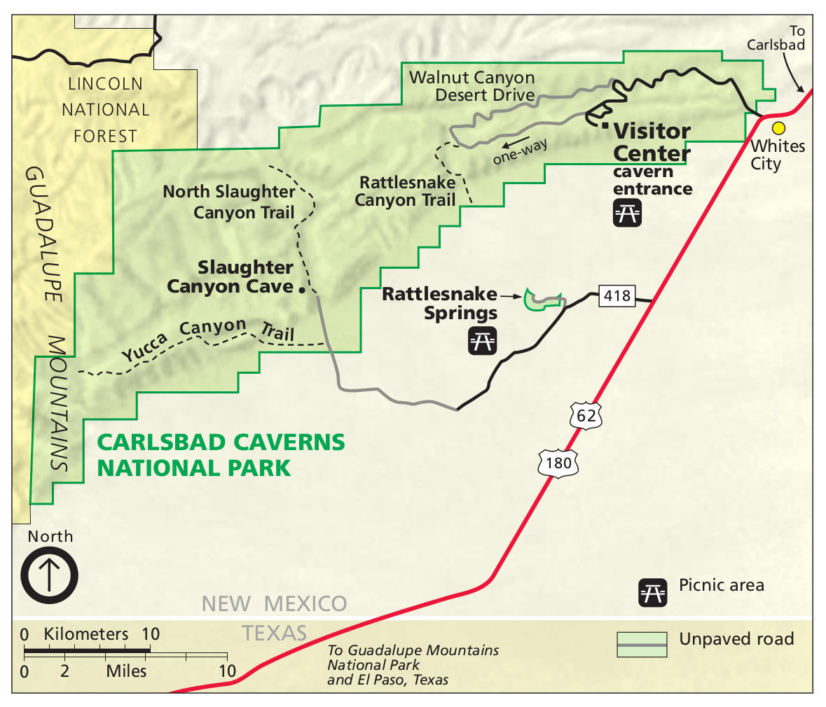 This is the Carlsbad Caverns National Park surface map, showing the main visitor center area and the rest of the park, including Slaughter Canyon Cave. Click the image to view the full size map or download the PDF.
Carlsbad Caverns trail maps
 This is a Guadalupe Ridge trail map, which starts in Guadalupe Mountains National Park and travels over 100 miles. This trail is currently closed due to flood damage. Download the NPS Guadalupe Ridge Trail guide (PDF).
 If you’re looking for a complete map of the publicly accessible portions of Carlsbad Caverns, the National Geographic Trails Illustrated map should meet your needs. I especially like that it labels prominent cave features along the routes. It also includes trails and topographic lines above ground, so it should prove useful no matter what you’re doing in the park, whether hiking above ground or caving underneath.
Carlsbad Caverns route maps
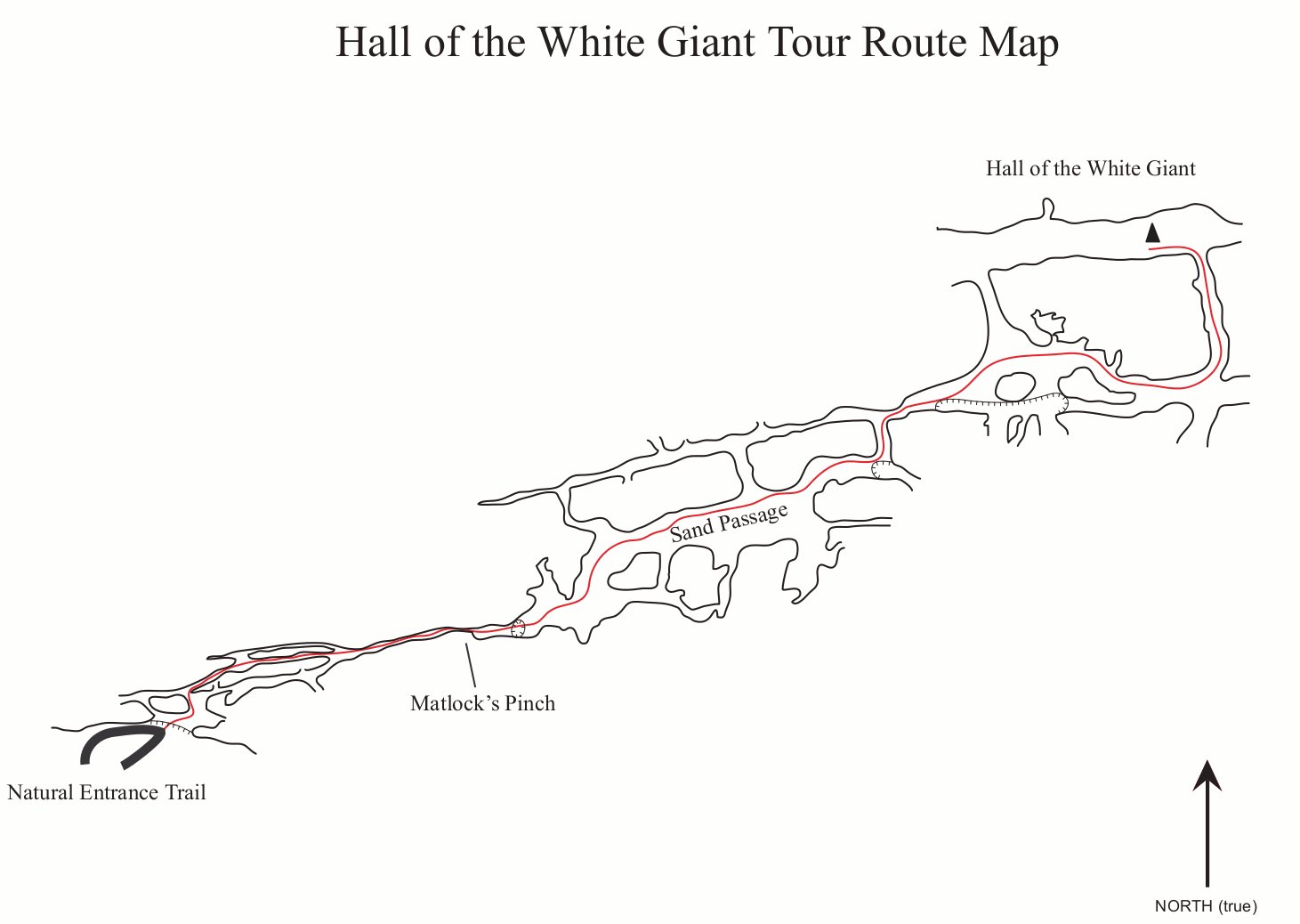 This is the Hall of the White Giant route map, one of the longer tours offered in Carlsbad Caverns. You’ll spend four hours navigating some tight spaces as you get a chance to view the White Giant.
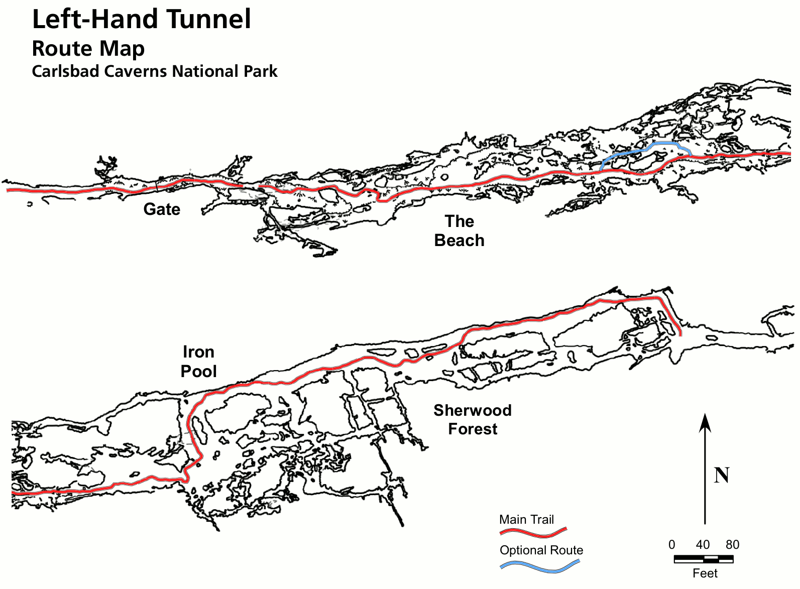 Here’s a Left Hand Tunnel route map, showing the route of this moderately difficult tour that uses only lantern and candlelight. It’s easy to imagine yourself going back in time!
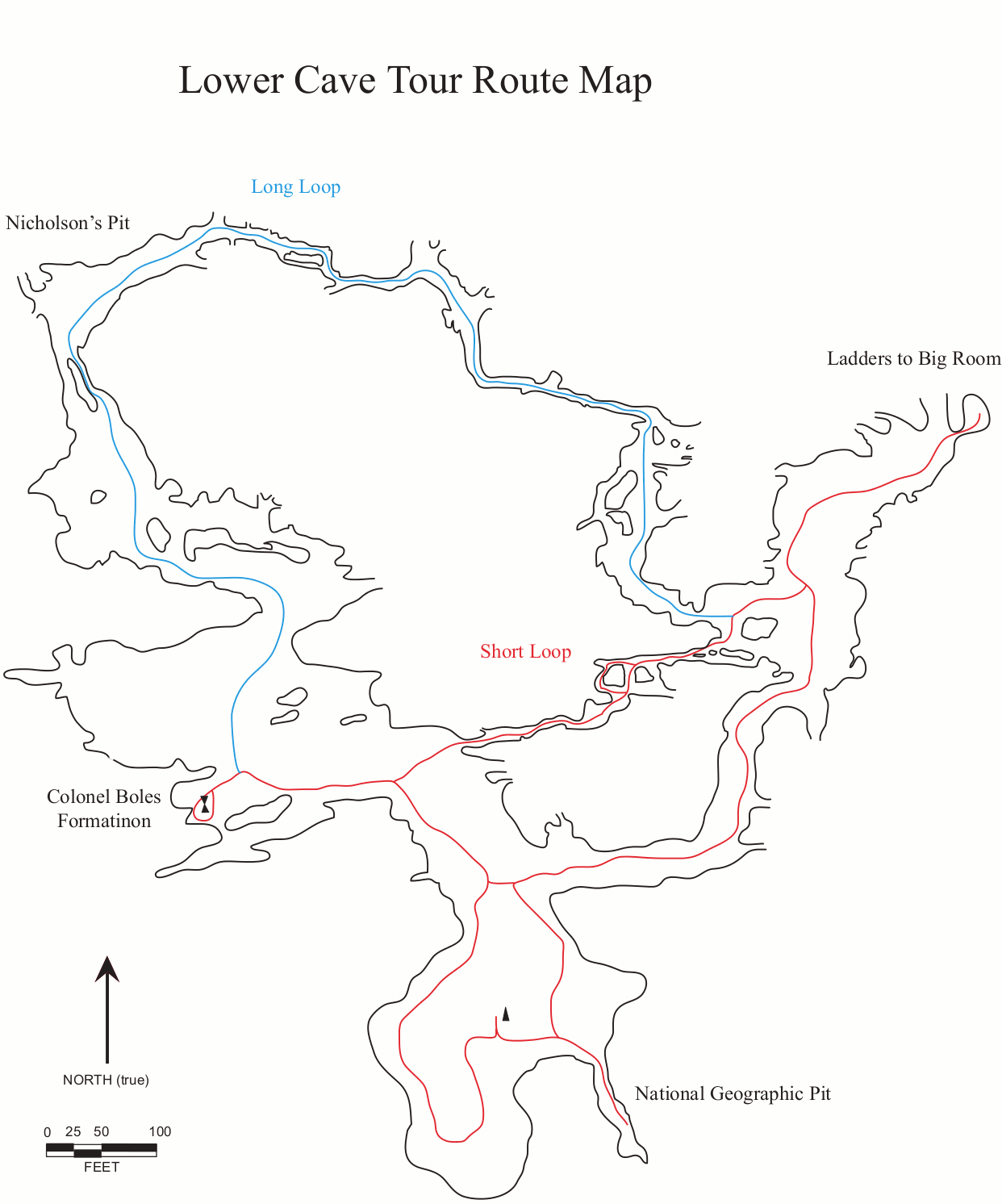 This Lower Cave route map shows the three-hour tour’s path, including the sixty feet of ladders to navigate to reach the system. You’ll see The Rookery, Colonel Boles Formation, and many others.
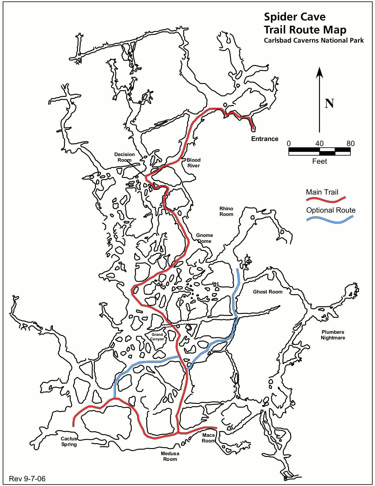 The Spider Cave route map shows the path taken by this tour featuring heights and tight spaces in an entirely separate cave from the main Carlsbad Caverns. Yes, there’s more than just the main cave!
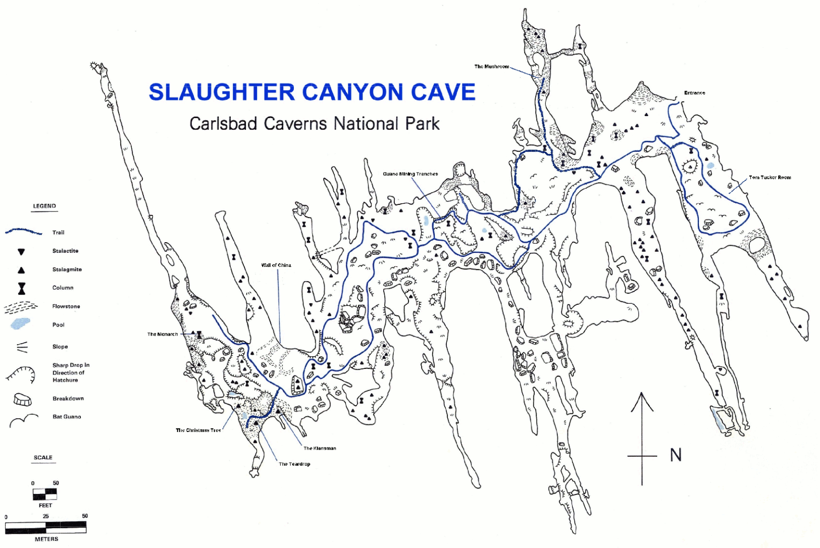 Here’s a Slaughter Canyon Cave route map, showing the 5 1/2 hour tour’s route through this wild undeveloped cave that requires a hike to get to. This is a wild and remote tour!
Carlsbad Caverns lodging map
 Carlsbad Caverns National Park is kind of in the middle of nowhere. The nearest town is Carlsbad, NM, and to the right you can view an Expedia.com interactive lodging map of your different Carlsbad options. You can check out the top-rated Carlsbad Caverns lodging where you can compare photos, amenities, and prices before booking. Hopefully you’ll be able to stay nearby to give yourself the most flexibility with booking cave tours.
Lechuguilla Cave maps
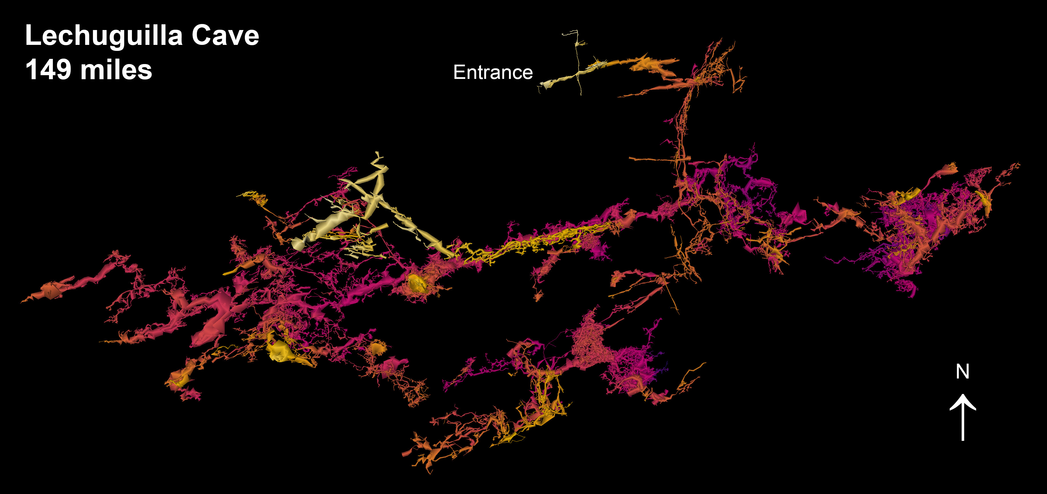 The Lechuguilla Cave map shows the gorgeous and mesmerizing layout of the explored portions of Lechuguilla Cave, which is now considered one of the top ten longest caves in the world and one of the four longest in the U.S.
 This Lechuguilla Cave diagram labels specific rooms and features of Lechuguilla Cave. If this cave sounds familiar, it’s probably because you saw it featured on the BBC’s Planet Earth series.
Assorted Carlsbad Caverns maps
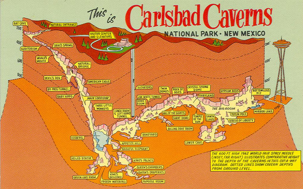 This retro Carlsbad Caverns map postcard shows a general layout of the cave system and labels individual rooms. (Unfortunately I’m a bit bummed that I can’t find the original source of this image in a higher resolution.)
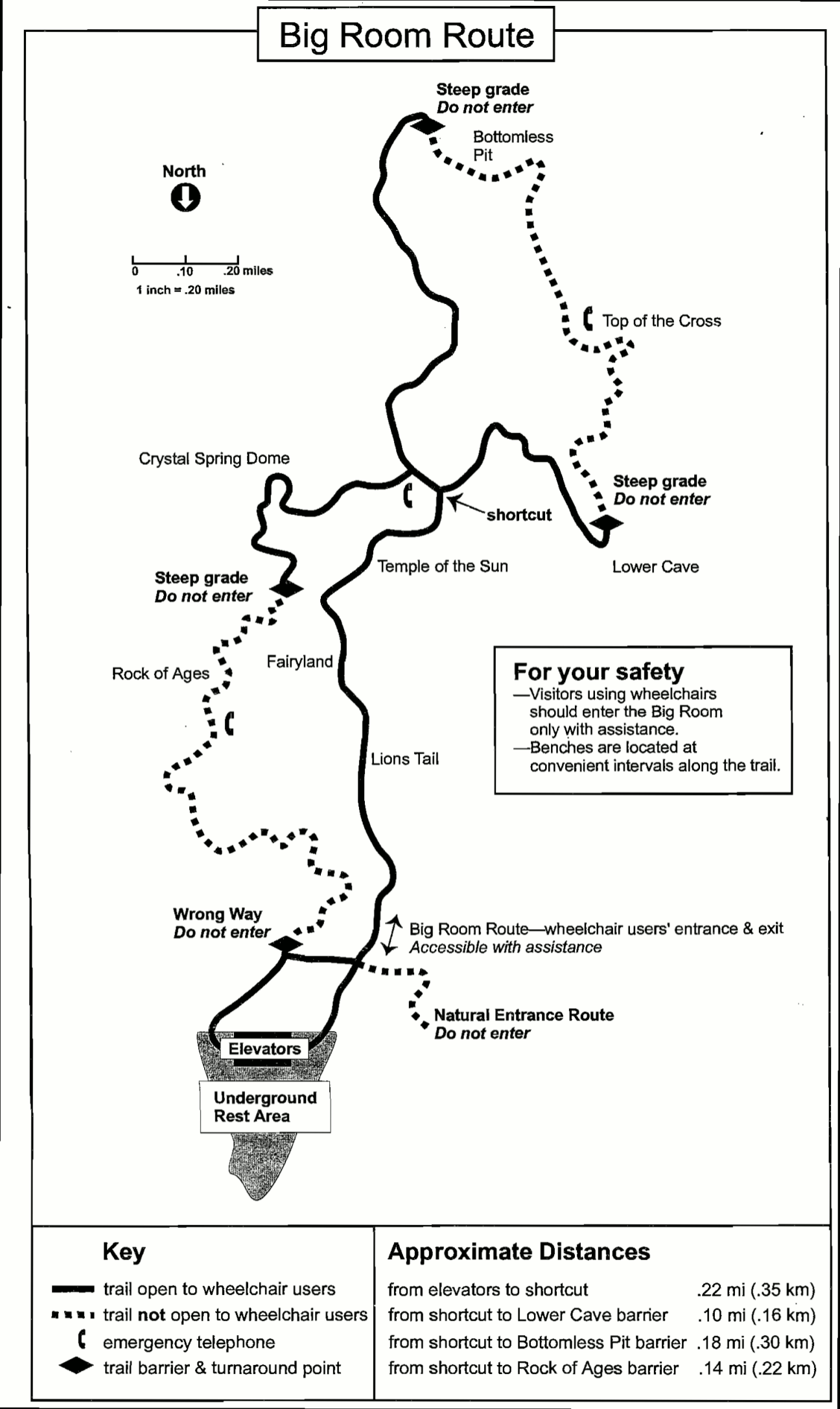
 This accessible map of Carlsbad Caverns shows areas through the Big Room and Hall of Giants that are open to wheelchairs and walkers. You can also download the NPS Carlsbad Caverns accessibility guide (PDF).
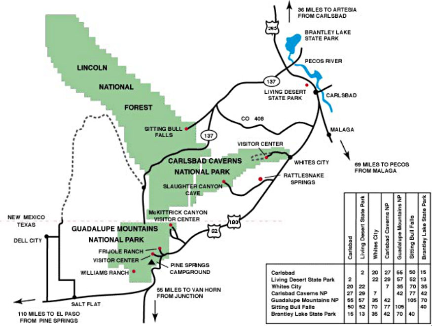
 This Carlsbad Caverns area map shows other points of interest in nearby New Mexico and Texas. Numbered locations on the map correspond with descriptions on the NPS Carlsbad Caverns Area Attractions guide (PDF).
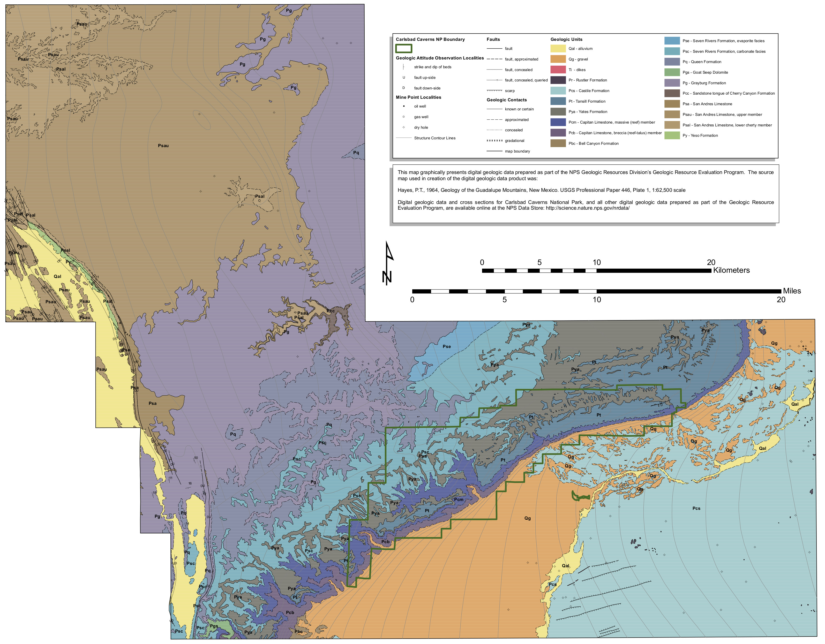 This is a Carlsbad Caverns geologic map, showing the various limestones and carbonates that make up much of the Carlsbad Caverns National Park bedrock and cave system.
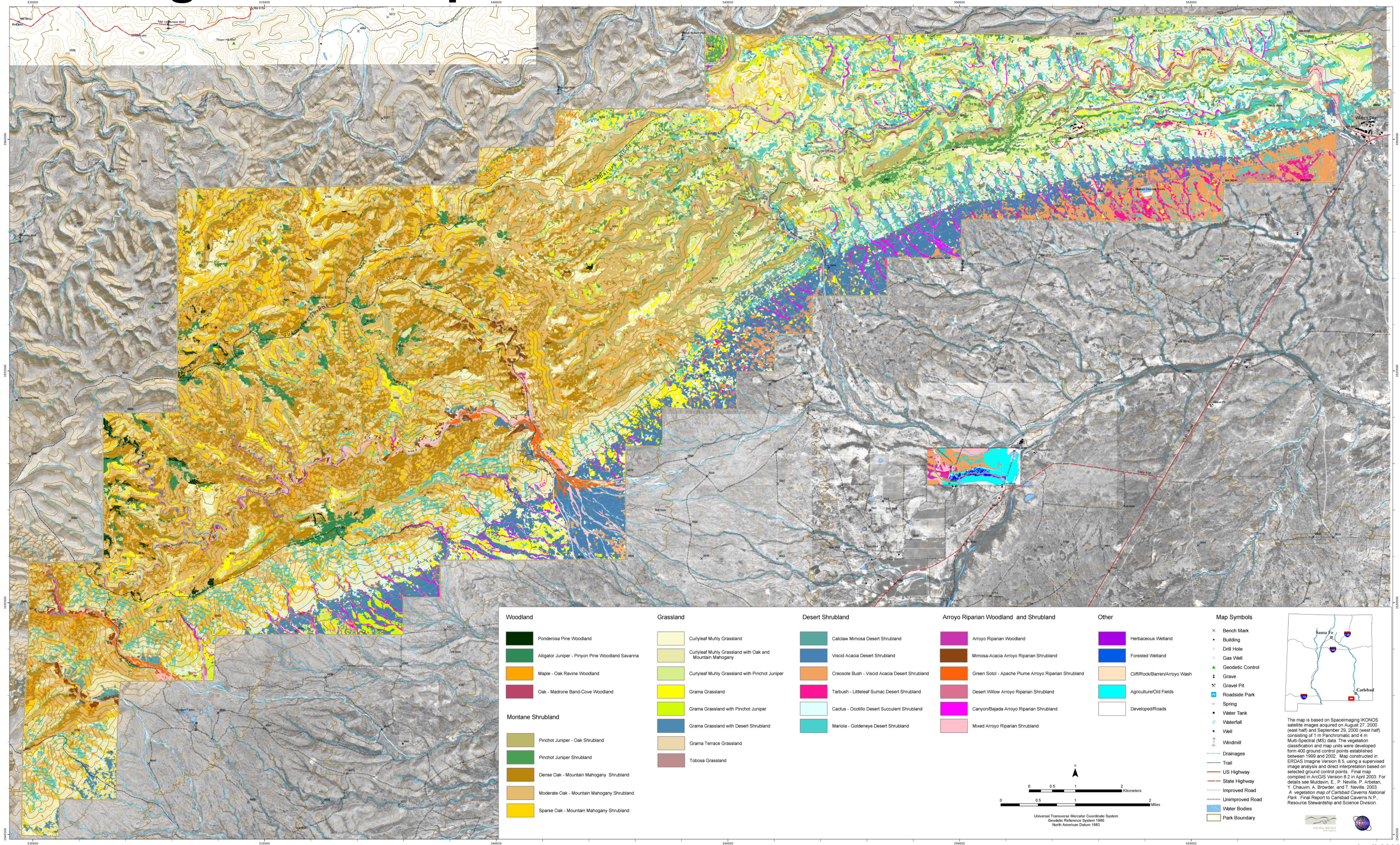 Here’s a Carlsbad Caverns vegetation map, showing the plant communities — because there’s more to the park than just the caves! (Although the caves are probably the reason for your visit.)
Archived Carlsbad Caverns maps
 Here is an old regional Carlsbad Caverns National Park map. It shows the surrounding roads and nearby Guadalupe Mountains National Park. Click the image to view a full size map or download the PDF.
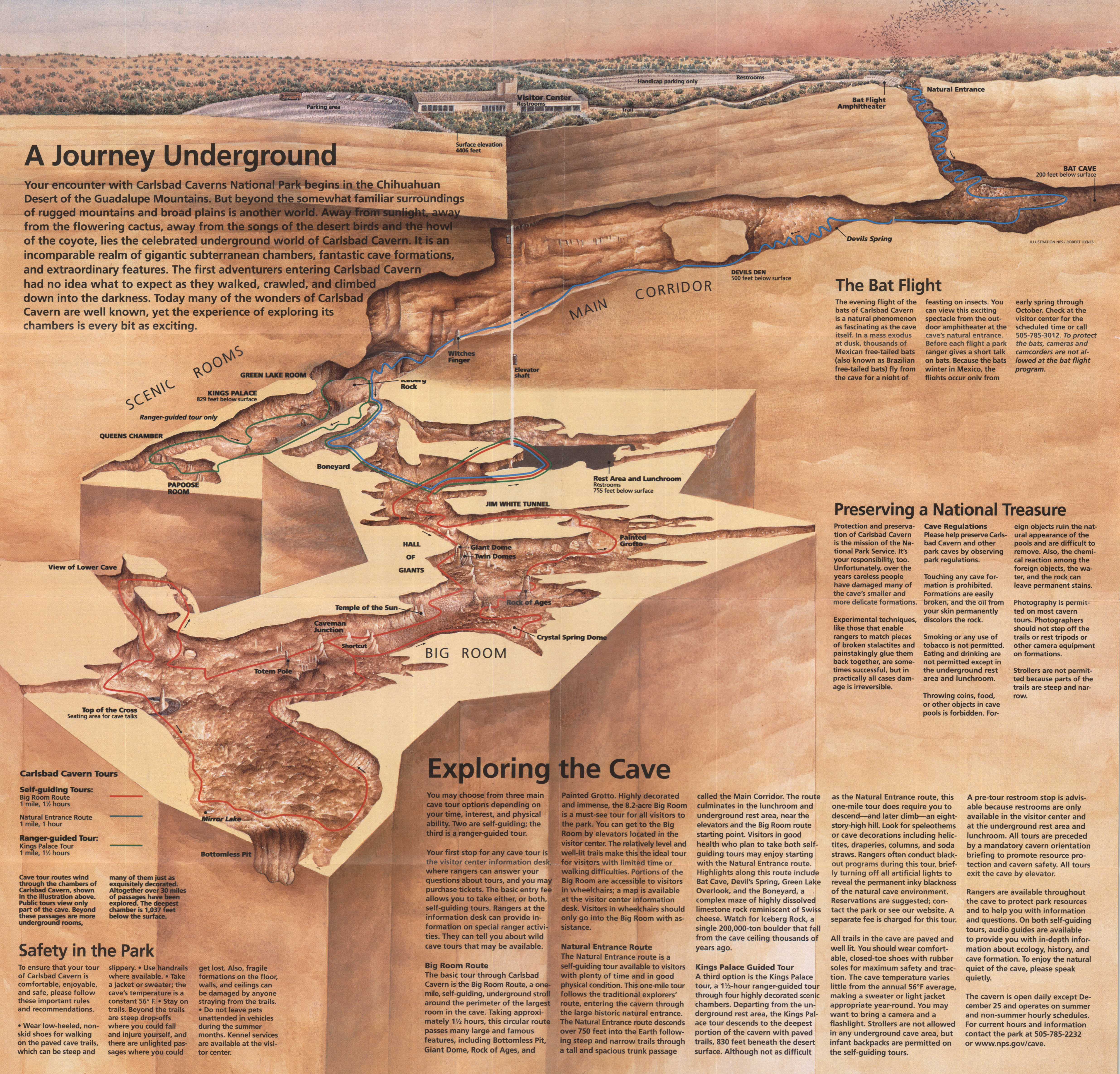 This Carlsbad Caverns brochure map shows the same 3D cave diagram as the top map on this page, but it includes all the additional educational and informational text directly from the NPS brochure.
 This old Big Room self-guided tour map shows the wheelchair-accessible routes into the Big Room from the elevators. The NPS has since published a newer wheelchair-accessible route map, listed further up this page.
…and more!
< Return to National Park Maps home
< Return to Park List
< Return to List by State