Rocky Mountain map from the park brochures
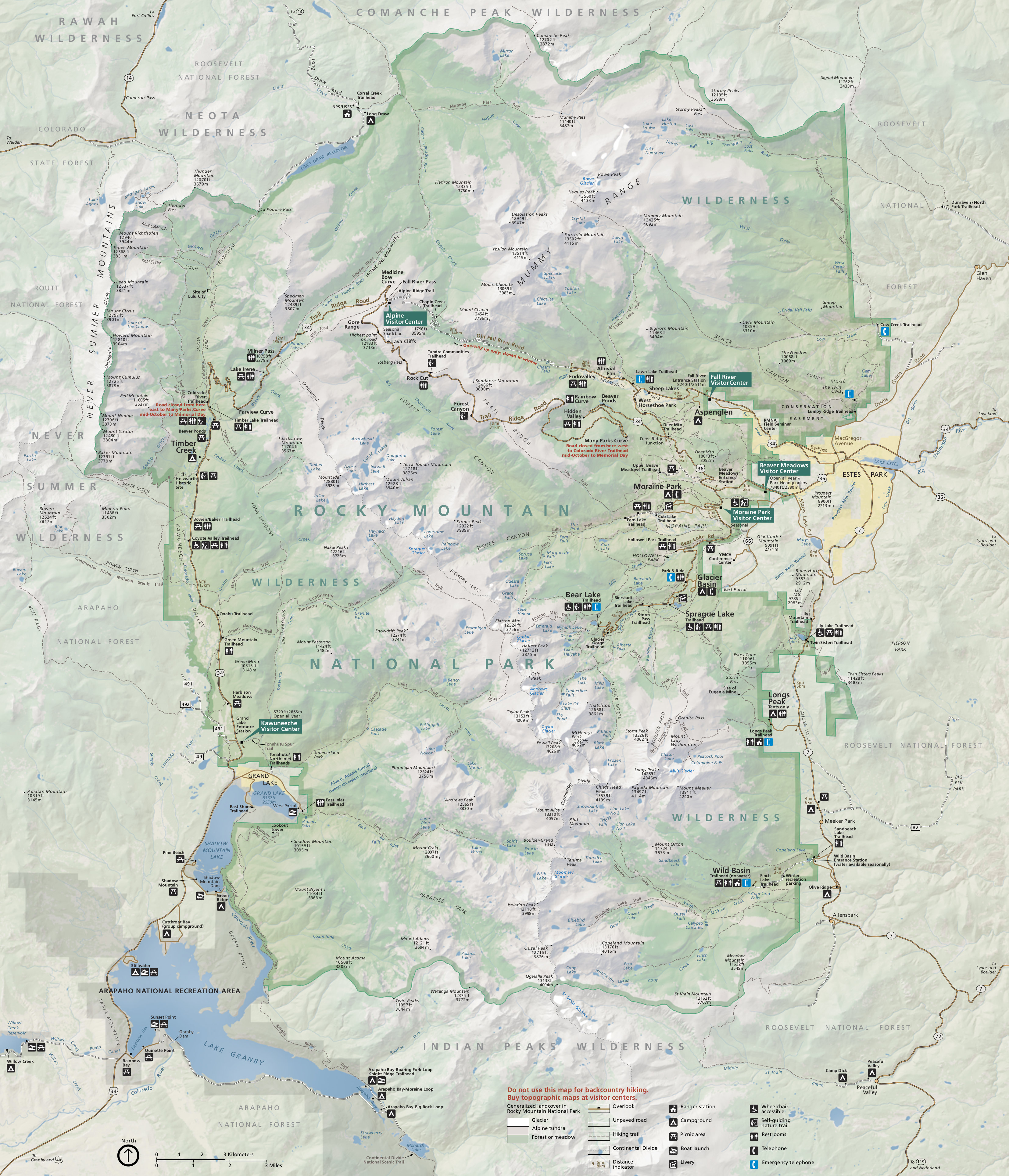
 This is the official Rocky Mountain National Park map from the 2025 NPS brochure. It includes roads and trails, including the extensive trail network near Bear Lake, Sprague Lake, and Longs Peak.
 Here’s a Rocky Mountain ecosystem map, color-coding alpine, subalpine, and montane ecosystems over a simple map that highlights points of interest like Beaver Meadows, Kawuneeche, and Alpine visitor centers.
Rocky Mountain trail maps
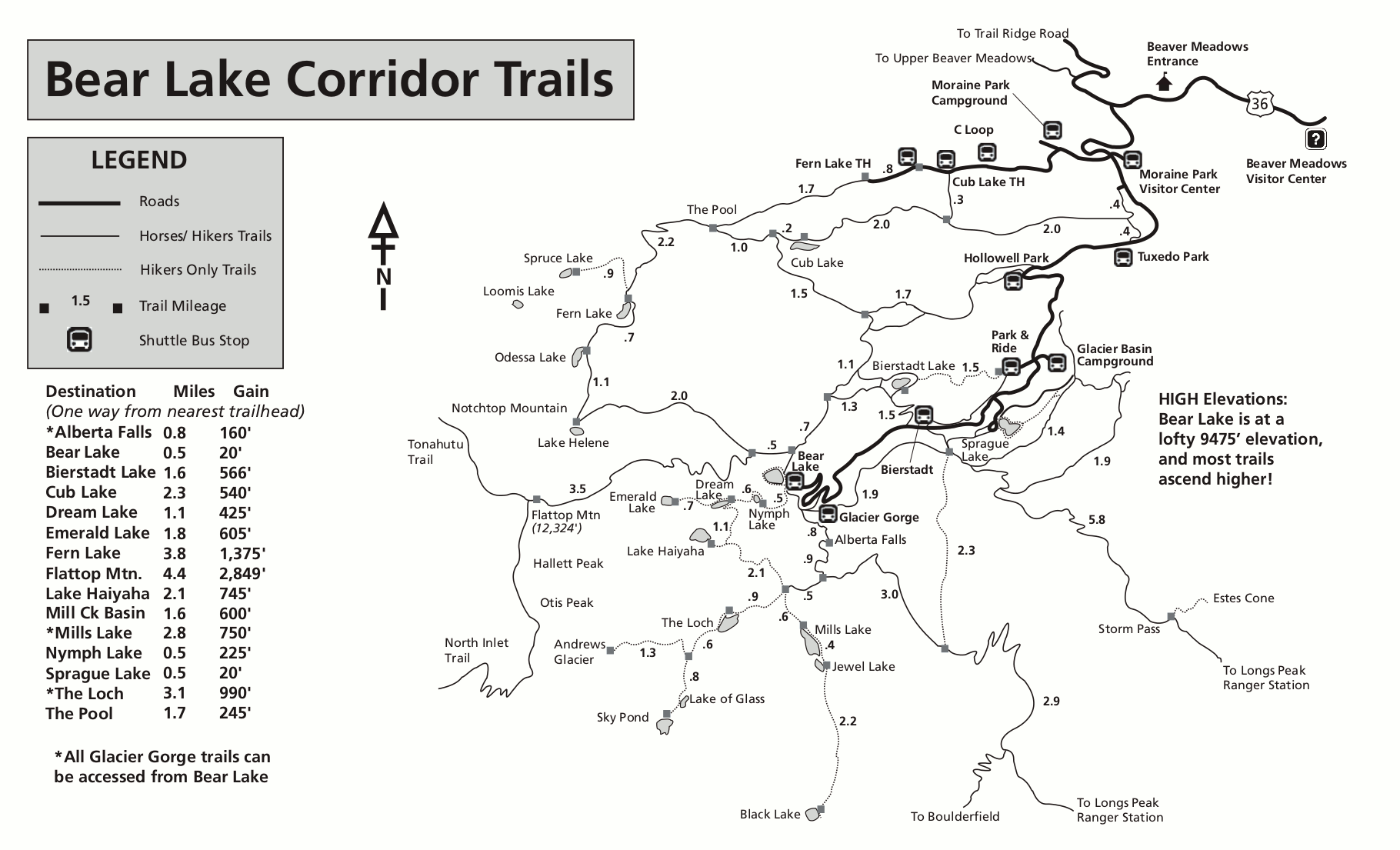
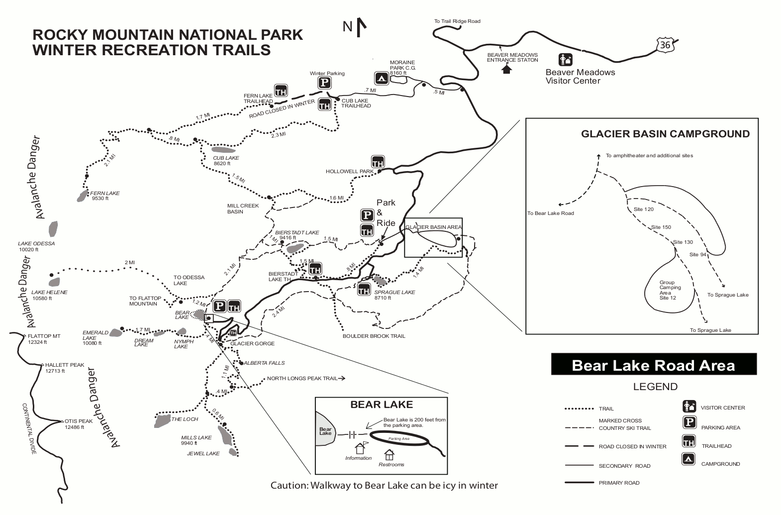
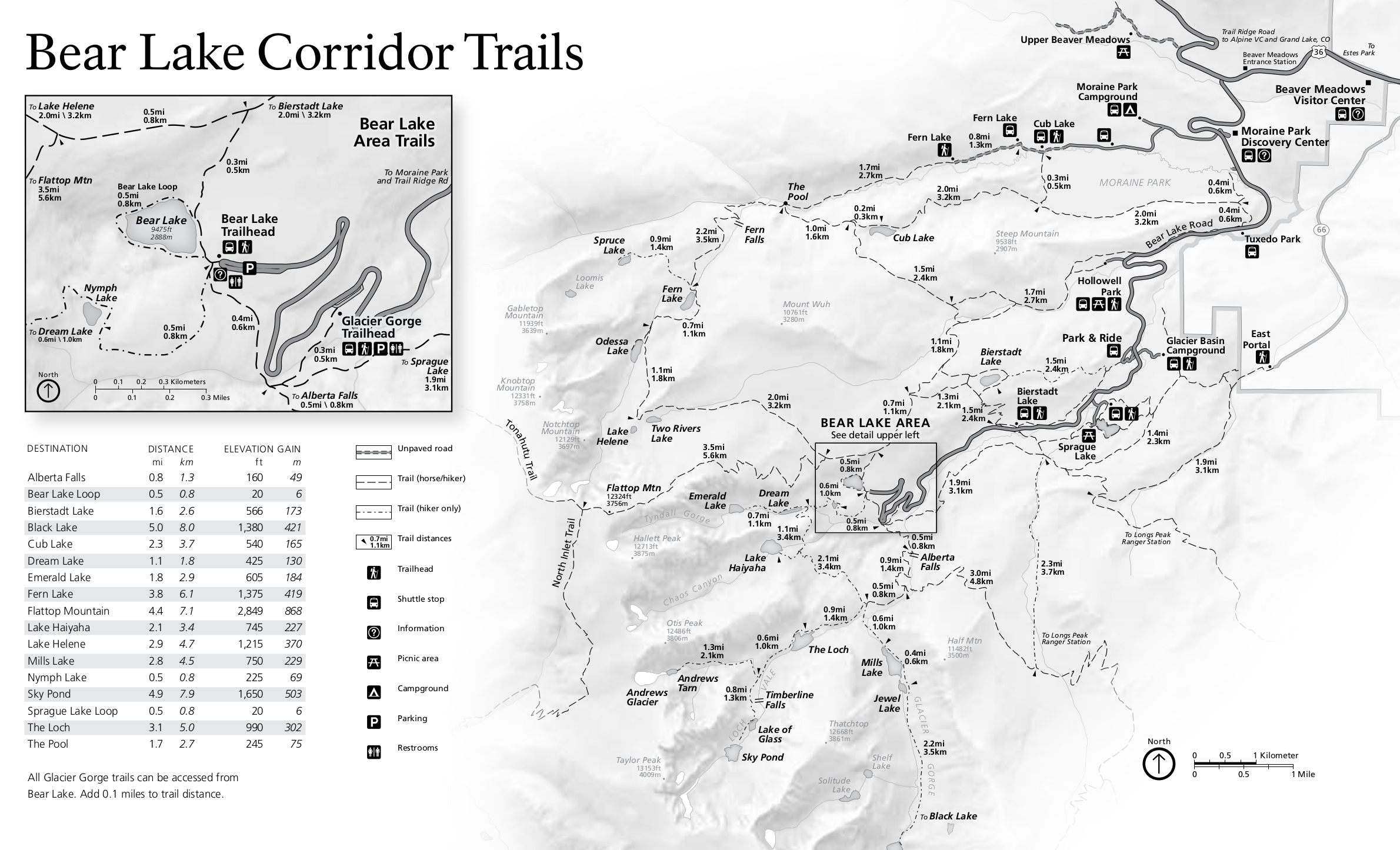 The Bear Lake trail map zooms in on the Bear Lake Road and shows mileages and elevation gain to popular destinations from the Bear Lake area: Glacier Gorge, Emerald Lake, Flattop Mountain, etc.
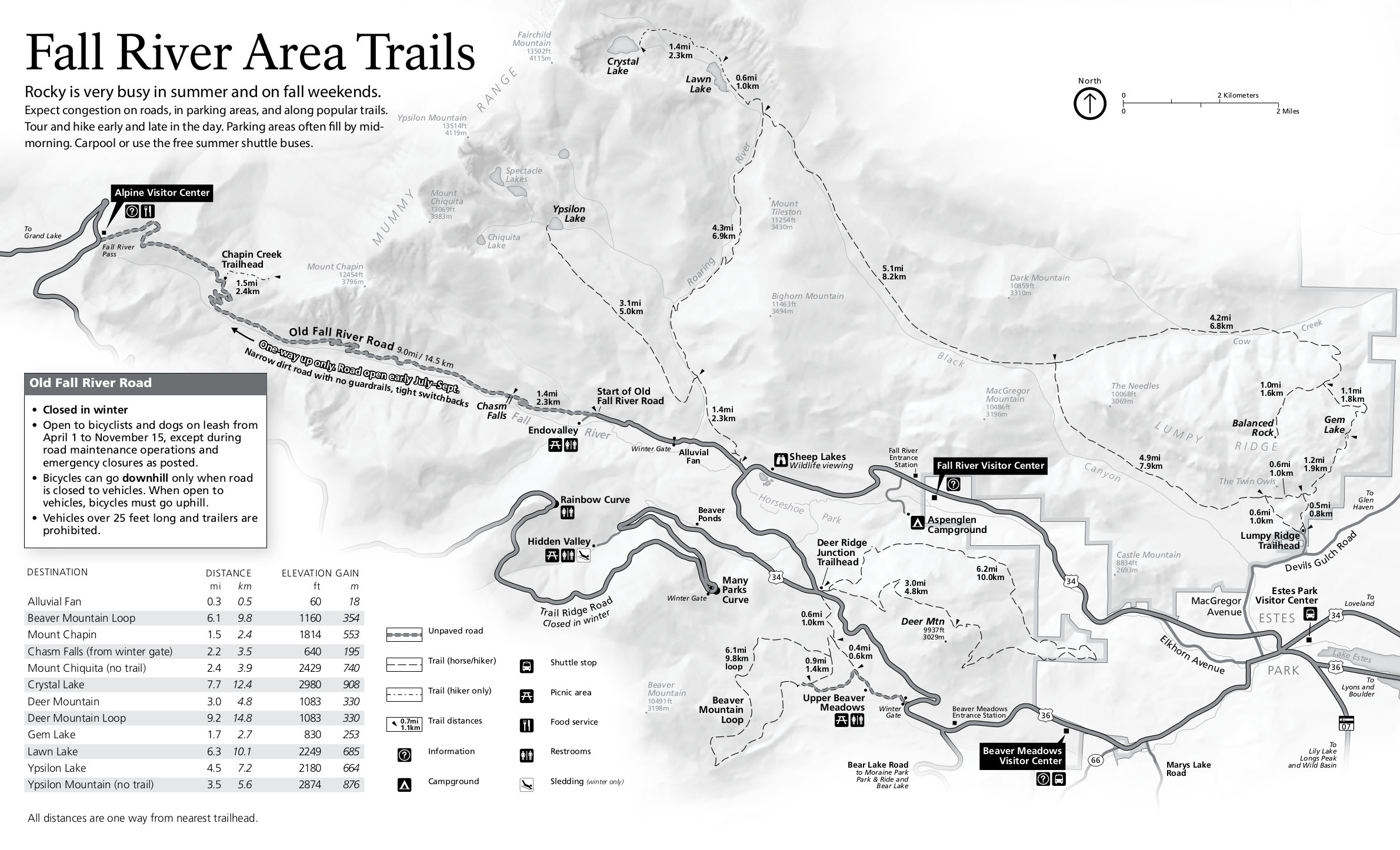 The Fall River trail map includes the Old Fall River Road and trails accessed from Upper Beaver Meadows, Deer Ridge, and more. These trails will be less crowded than the ones near Bear Lake.
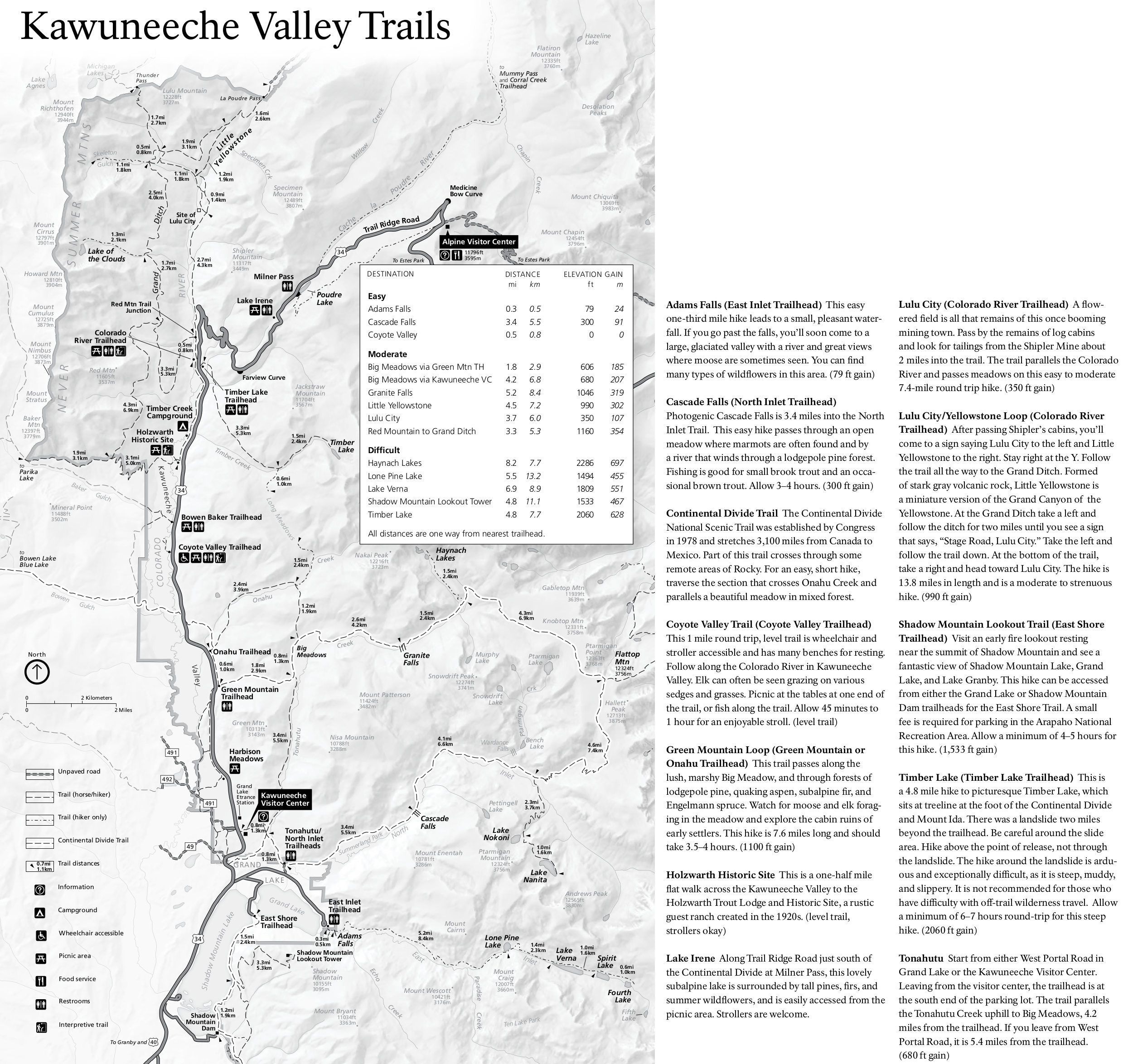 Here’s a Kawuneeche trail map and guide, showing the locations and distance of many of the relatively quiet west side trails. Also nice are the included trail descriptions and time estimates.
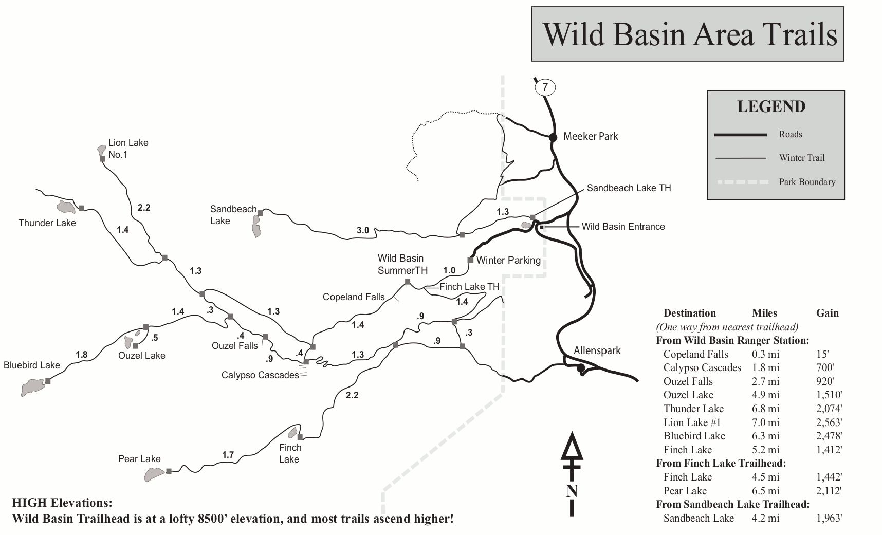
 This Wild Basin trail map shows the distance and elevation gain to popular locations such as Ouzel Falls, Bluebird Lake, and Sandbeach Lake. Get here early on summer weekends before parking fills!
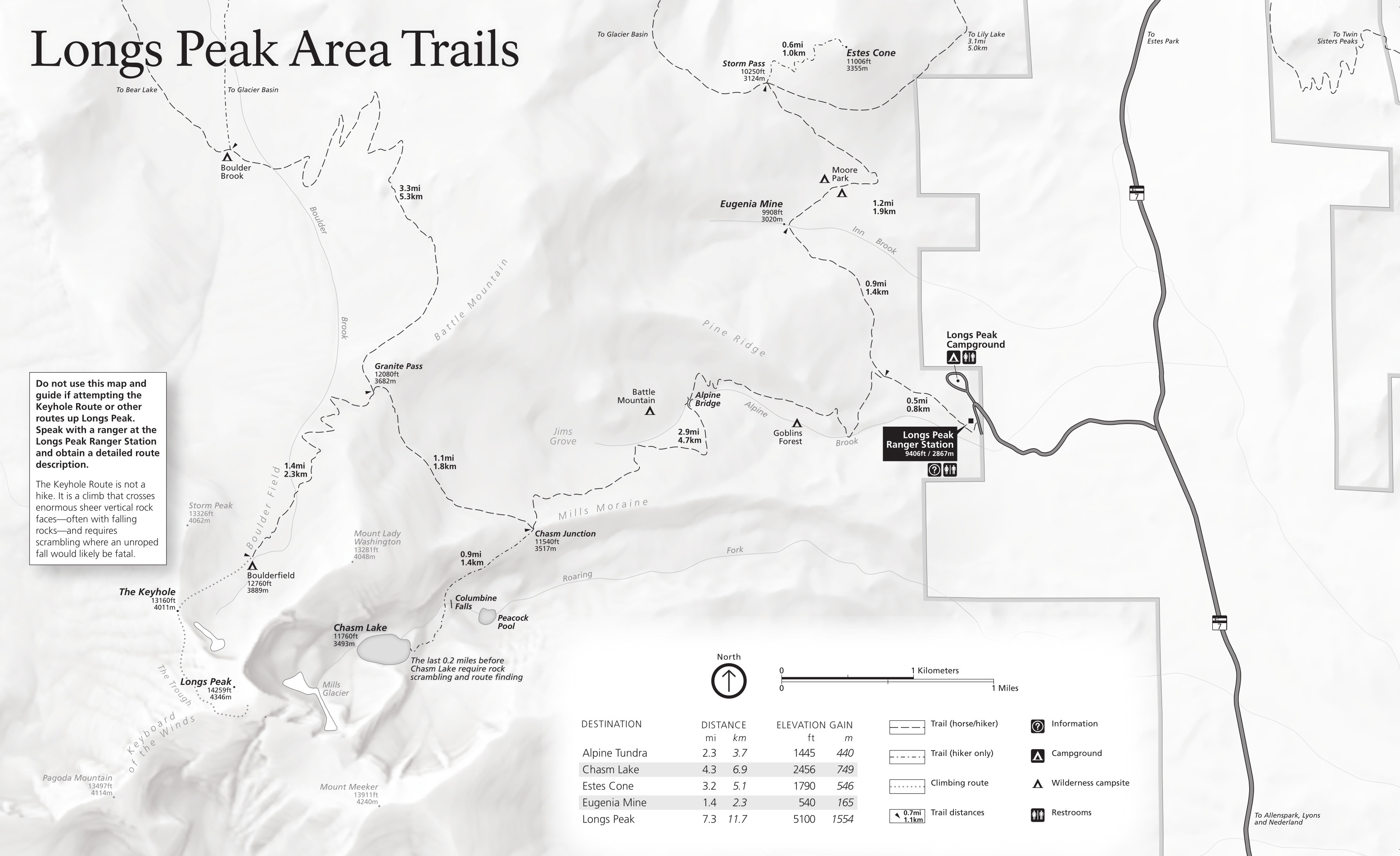 This Longs Peak trail map shows the network of trails accessed from the Longs Peak trailhead, including Estes Cone and Chasm Lake. Note the warning on the map: do not attempt the Longs Peak hike with only this map!
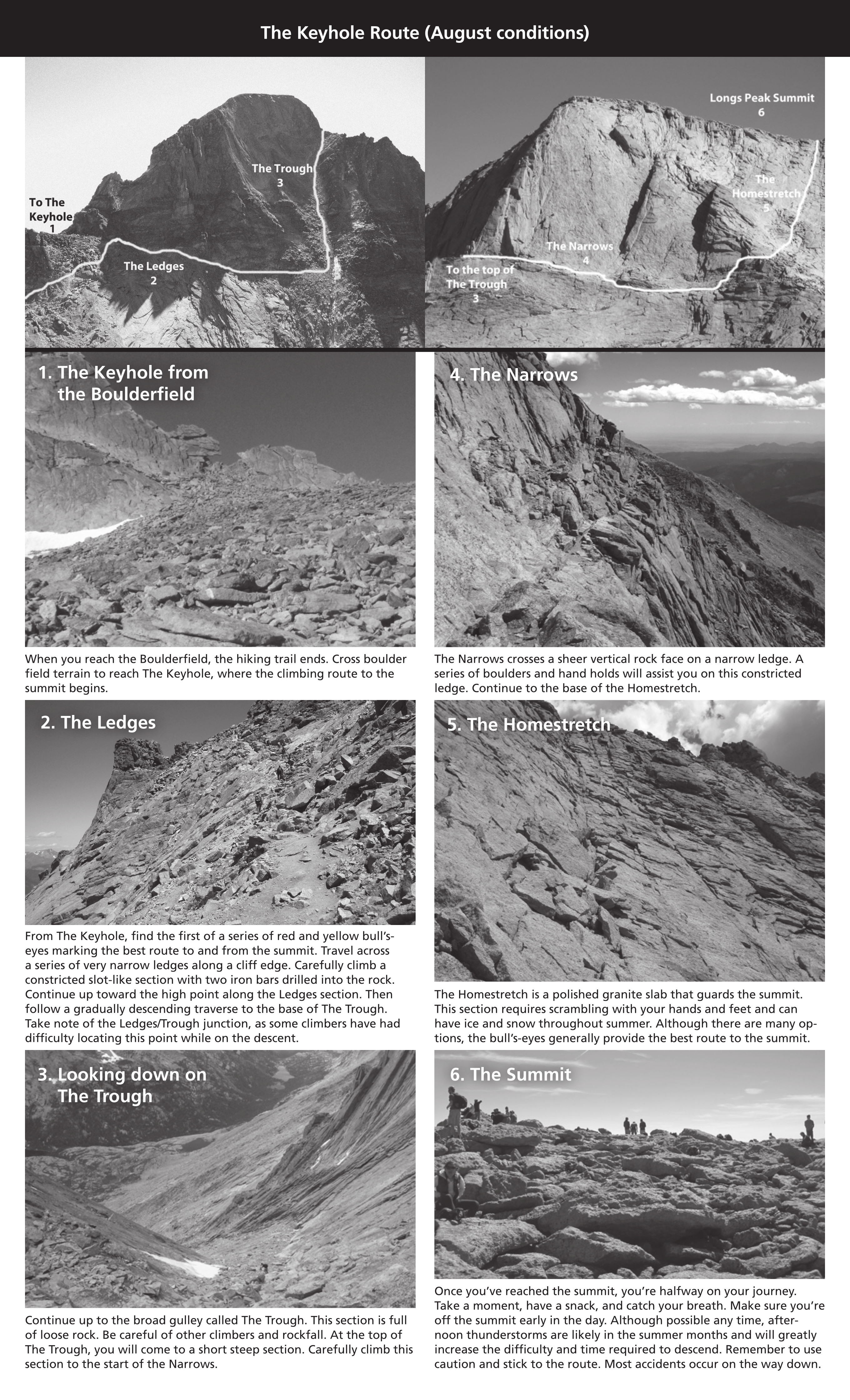 Here’s a Longs Peak Keyhole Route map. Well, “map.” It’s a couple lines drawn on some photos, with additional photos below it to help describe this very popular and dangerous route up Longs Peak.
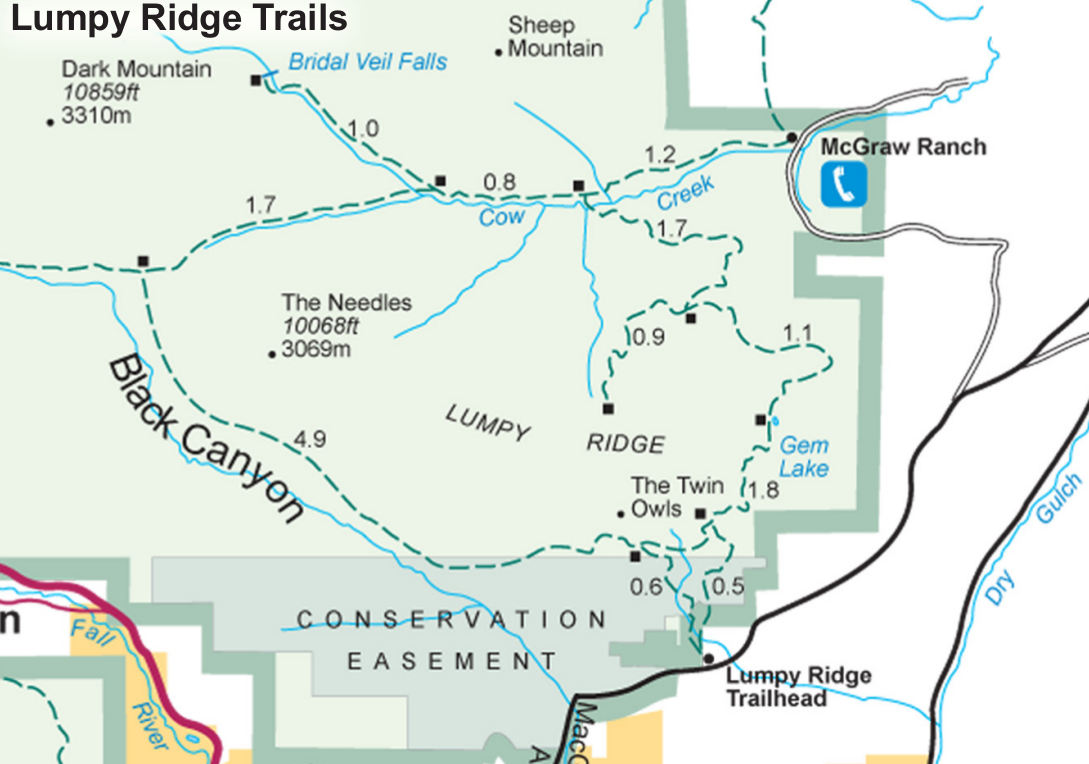 Here’s a Lumpy Ridge trail map, showing the popular trail to Gem Lake (and others) accessed from outside the main boundaries of Rocky Mountain National Park in Estes Park.
 This is a Rocky Mountain National Park wilderness map from 2025. It focuses on wilderness campsites, which can be reserved in advance by backpackers and picked up at Beaver Meadows or Kawuneeche.
 I haven’t yet found any free Rocky Mountain trail maps good enough for navigation or route planning, so the National Geographic Trails Illustrated map is your best bet for hiking since it shows topographic lines, trail mileages, and backcountry campsites. The free maps above are good for general planning, but won’t be too helpful once you’re on the actual trail due to lack of detail—they won’t help you navigate or determine your location too well.
Rocky Mountain campground maps
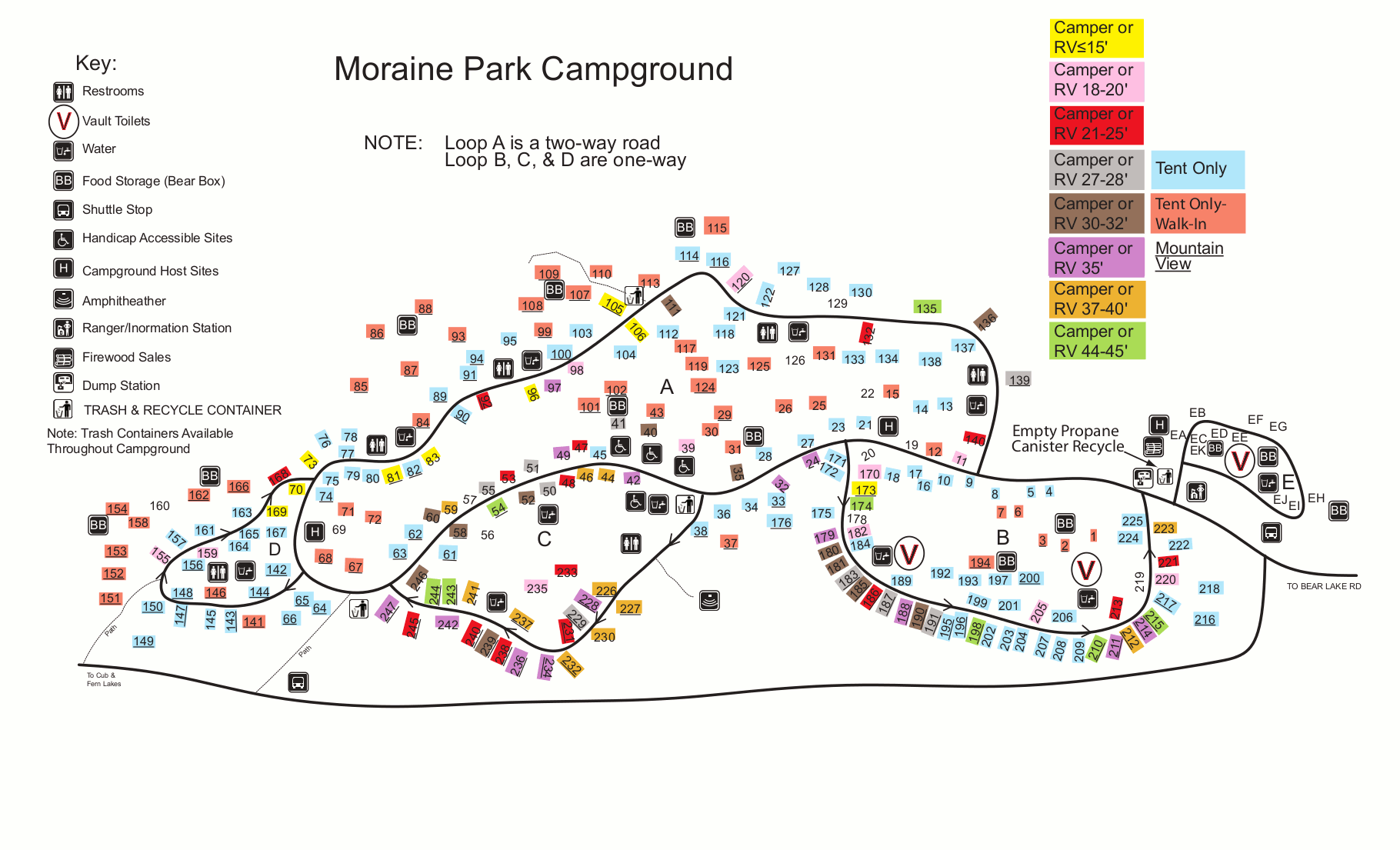
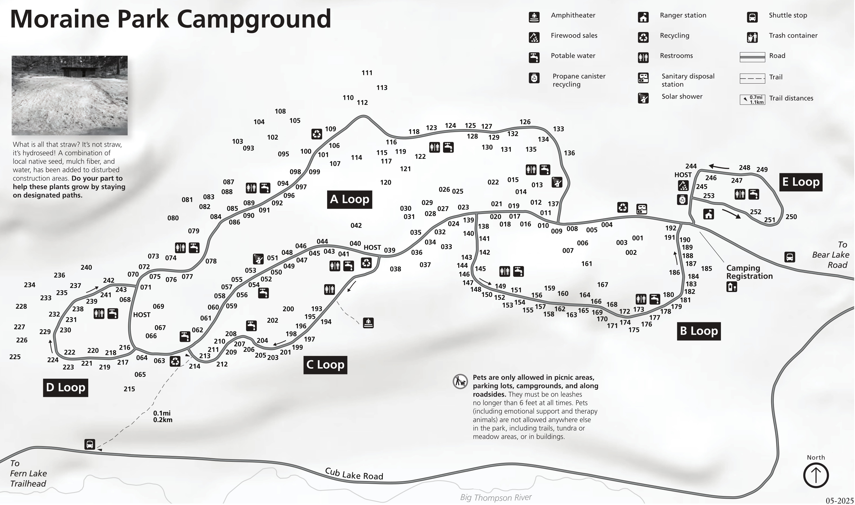 This is a Moraine Park Campground map from 2025. Moraine Park is the largest and most popular campground in Rocky Mountain National Park, due mainly to its beautiful and convenient location.
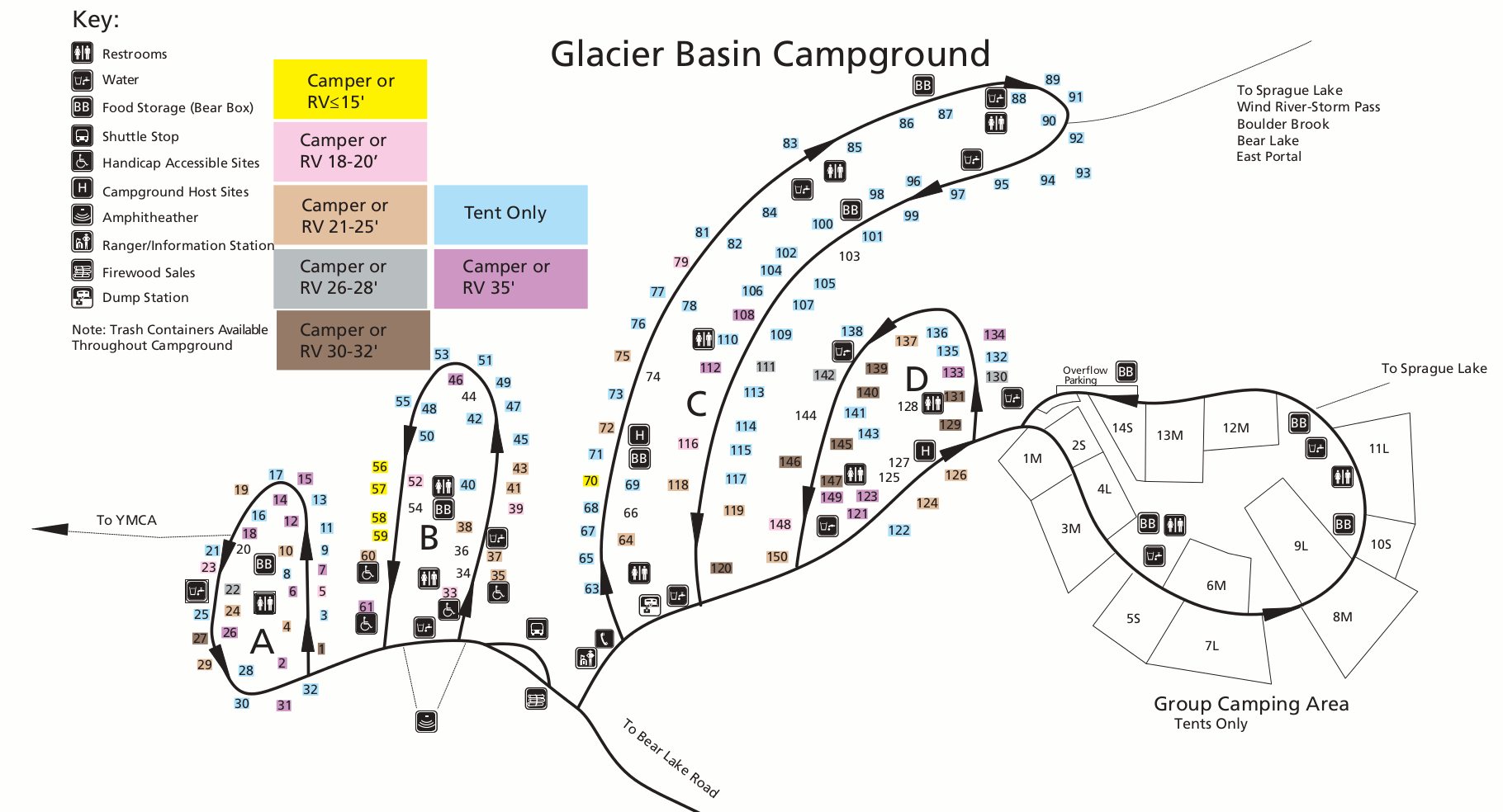 This is a Glacier Basin Campground map, located further down Bear Lake Road beyond Moraine Park, and at a higher elevation. This is the closest campground to Bear Lake.
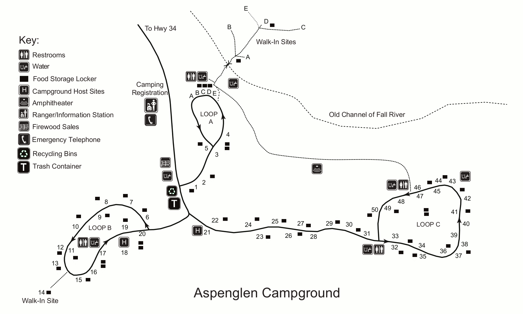 Here’s an Aspenglen Campground map, located near the Fall River Visitor Center in eastern Rocky Mountain National Park. This smaller campground is more laid-back and quiet since it’s away from Bear Lake.
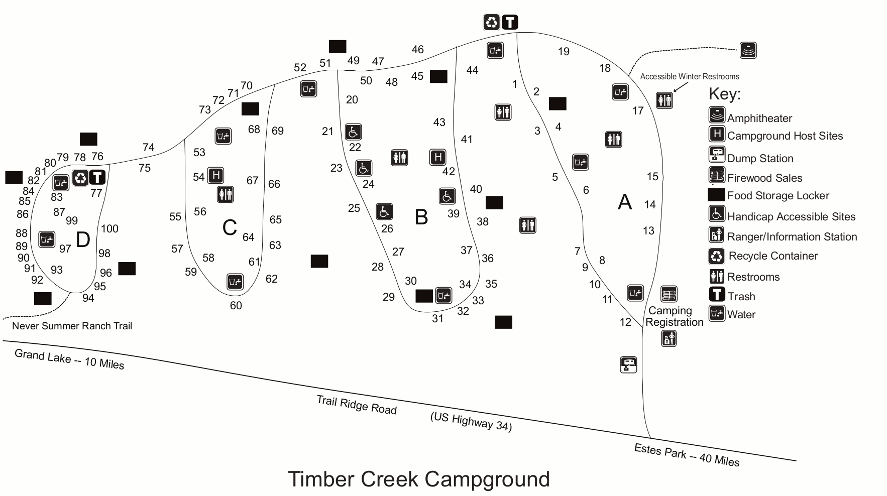 This Timber Creek Campground map shows the only NPS campground located on the west side of Rocky, which tends to be much less crowded and busy than the areas near Estes Park.
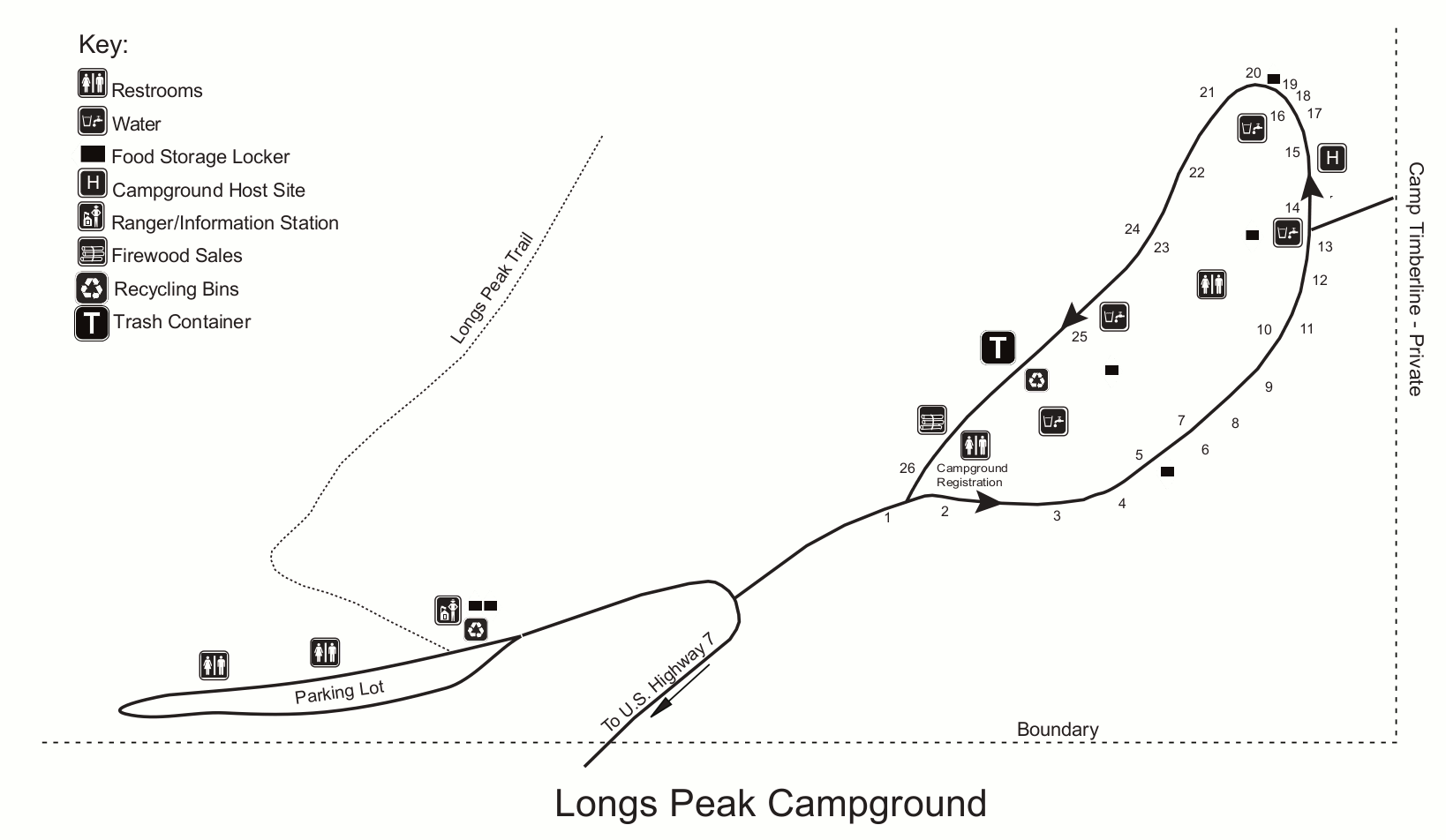 This is a map of Longs Peak Campground, a very small tent-only campground accessed from Highway 7 east of the park (and south from Estes Park). It’s primarily used by hikers in the Longs Peak area.
Rocky Mountain lodging map
 By far, the most popular place to stay among Rocky Mountain visitors is in Estes Park; to the right you can view an Expedia interactive Rocky Mountain lodging map. If you’d rather stay near the park’s quieter west side, the scenic town of Grand Lake would be a good choice. Regardless, you’re probably best starting out by comparing Expedia’s top-rated Rocky Mountain lodging to see prices, photos, locations, and reviews.
Rocky Mountain shuttle and road maps
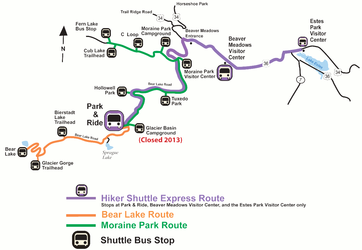
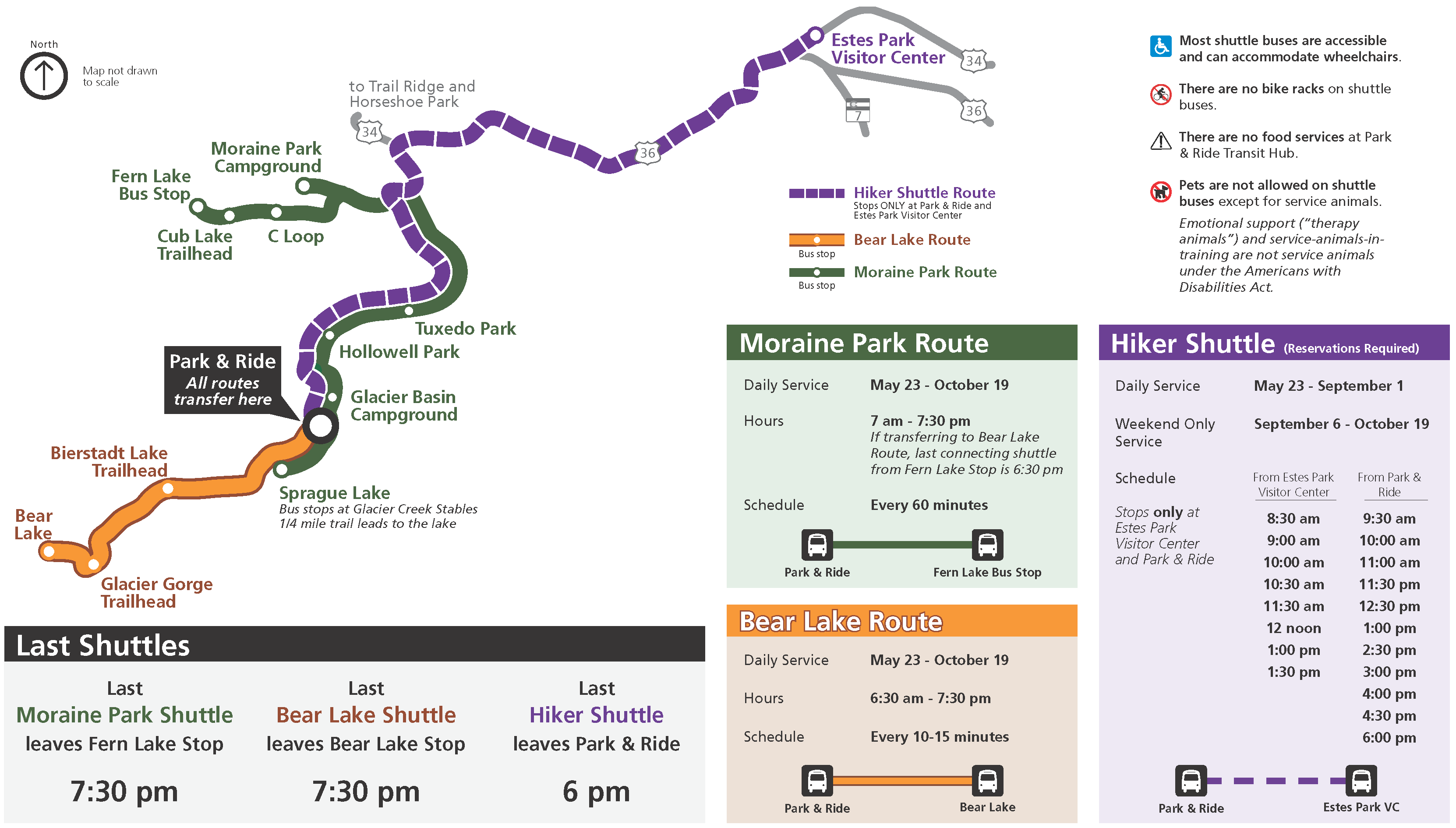 This Rocky Mountain National Park shuttle map was updated in 2025 and includes the hiker shuttle from Estes Park, the Moraine Park route, and the Bear Lake route, which all converge at the Park and Ride.
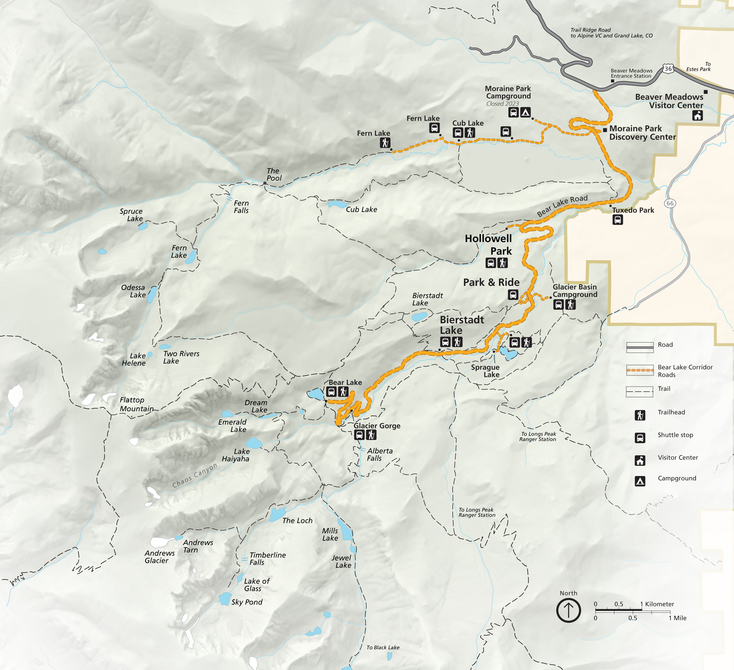 Here’s a Bear Lake Road map from 2023, zooming in on the busiest section of the park that requires vehicle permits in most years. You’ll find the trails near Emerald, Dream, and Bear Lake to be most crowded.
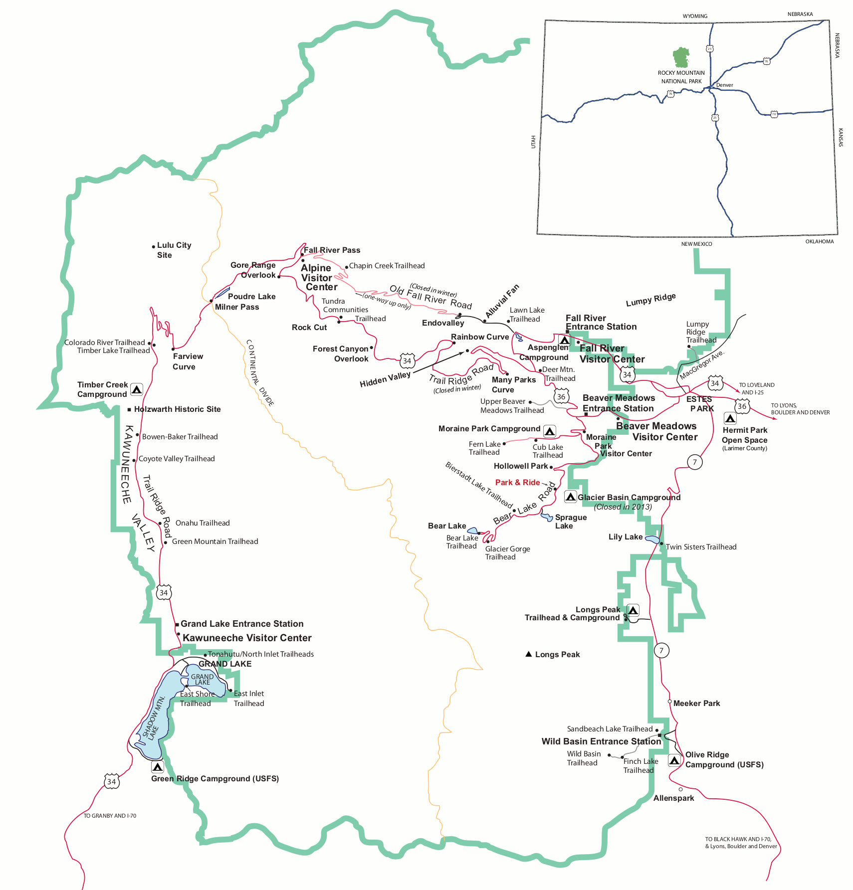
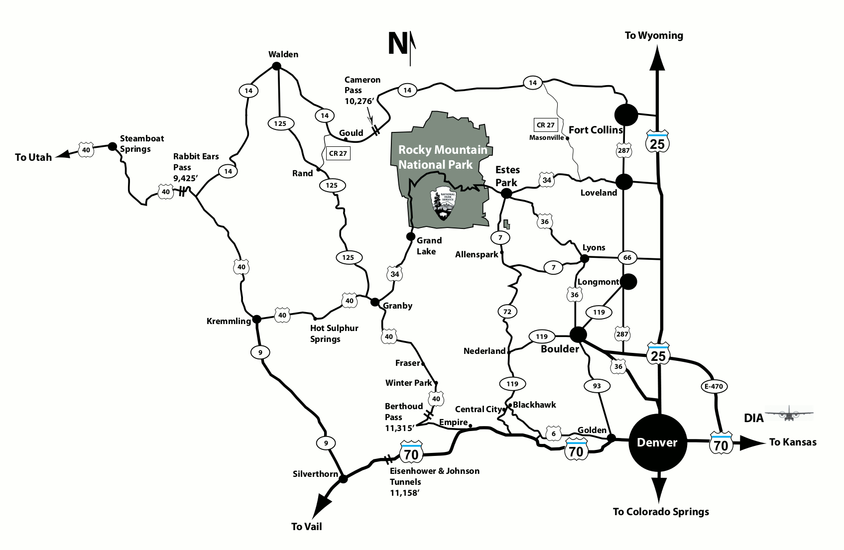 This is a map of roads surrounding Rocky Mountain National Park, showing Estes Park, Fort Collins, Denver, and other cities. Most visitors arrive from the east on Highway 34 or 36 to Estes Park.
Rocky Mountain winter maps
 Here’s a Bear Lake winter trail map, marking the different ski and snowshoe routes open during the winter months (and labeling those with high avalanche danger).
 This Wild Basin winter trail map shows the winter parking area and trailhead, which ends up adding nearly a mile to any ski or snowshoe destination compared to summer hiking.
 This is a Kawuneeche Valley winter trail map, showing trails accessible from the west side of the park near the Grand Lake entrance. You cannot get to these trails from Estes Park and the park’s east side.
Rocky Mountain topo maps
 Here’s a Rocky small scale topographic map, zooming out to show almost the entire park and much of the surrounding region, such as the Indian Peaks to the south toward Brainard Lakes.
 This is a Bear Lake area topo map, focusing on the Continental Divide peaks and trails at the end of the Bear Lake Road to places like Glacier Gorge, Mills Lake, the Loch, and Emerald Lake.
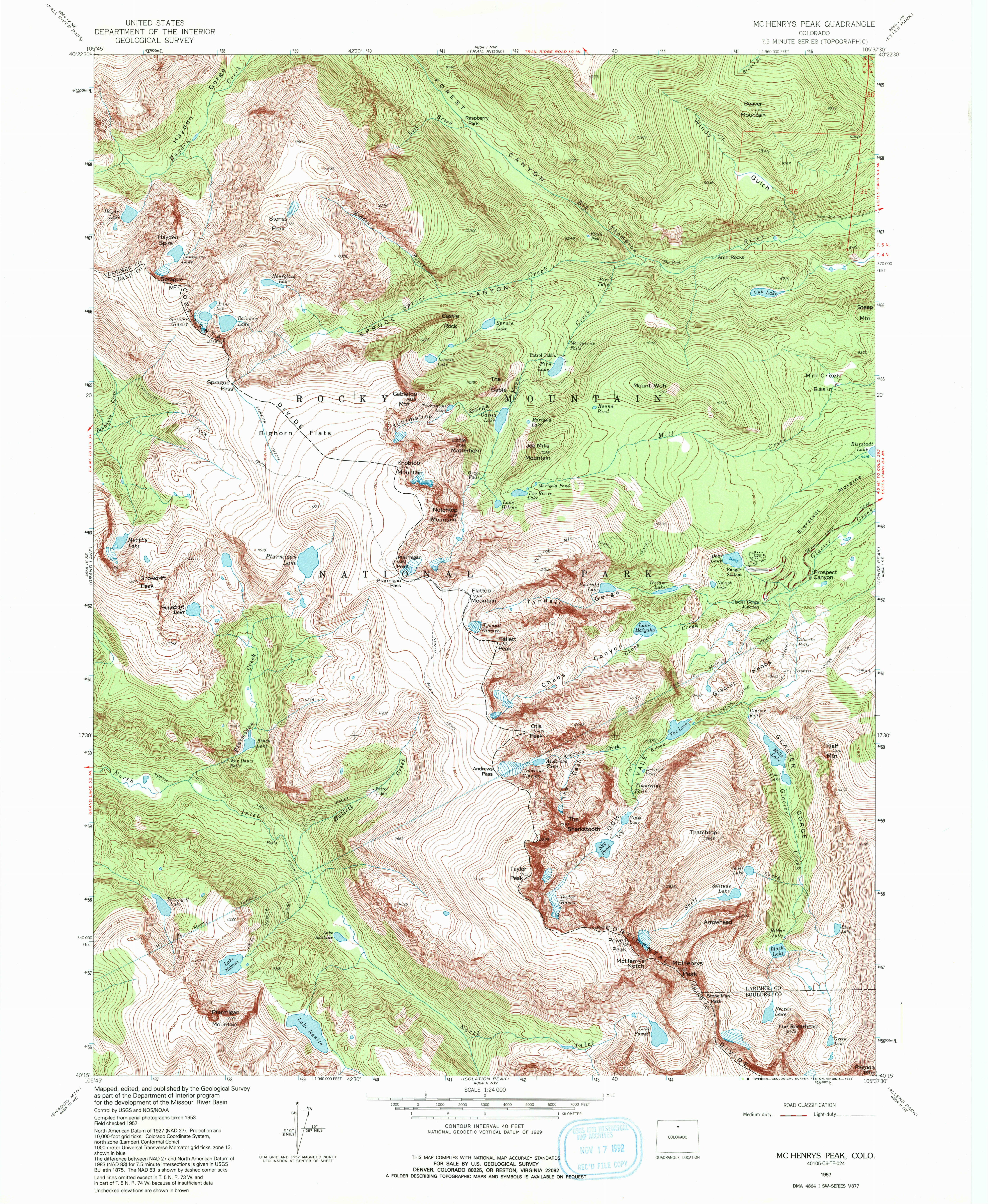
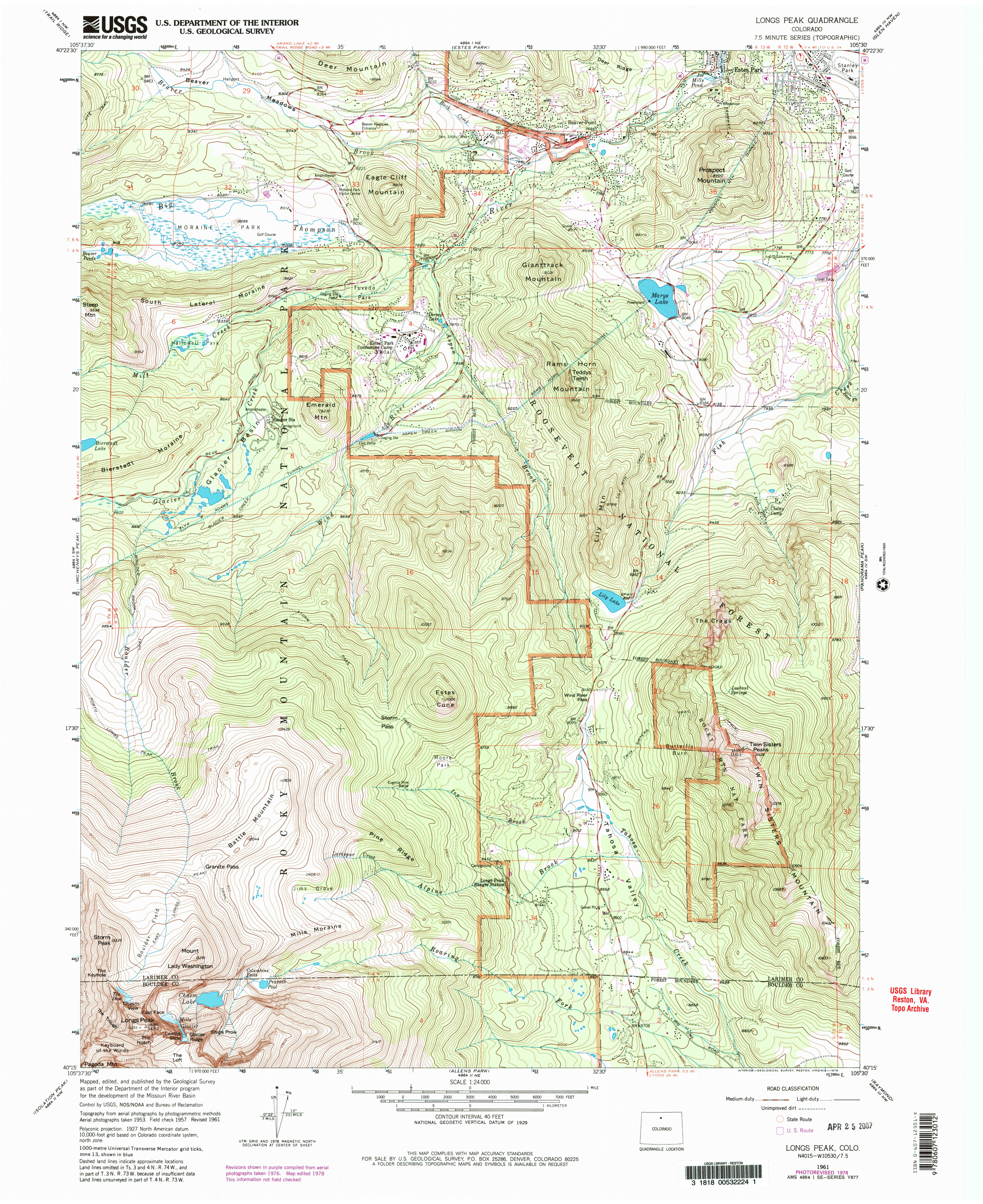 The Longs Peak topo map includes the summit of Longs Peak and other popular locations such as Moraine Park. Note that conditions may have changed since this map was last updated in 1978.
Rocky Mountain geologic map
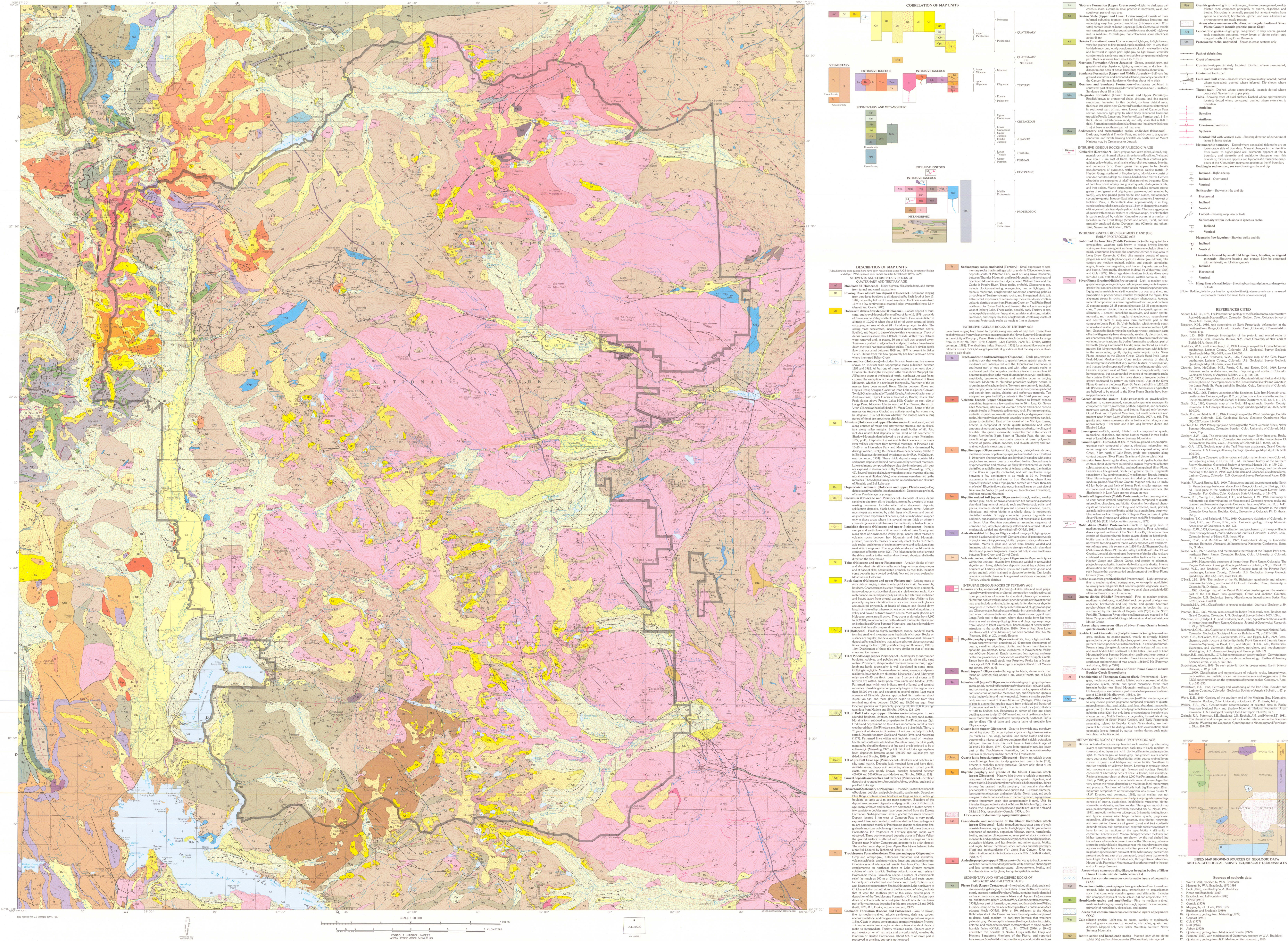 This geologic map of Rocky Mountain National Park shows all the rock layers while also providing extensive text descriptions explaining each rock type. You could teach a whole course with this amazing map!
Rocky Mountain trailhead maps
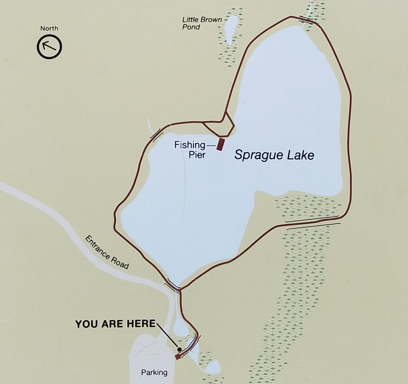 I took this Sprague Lake trailhead map photo at the Sprague Lake trailhead, where you can do the short scenic walk on the paved trail around the lake with views of the Continental Divide in the background.
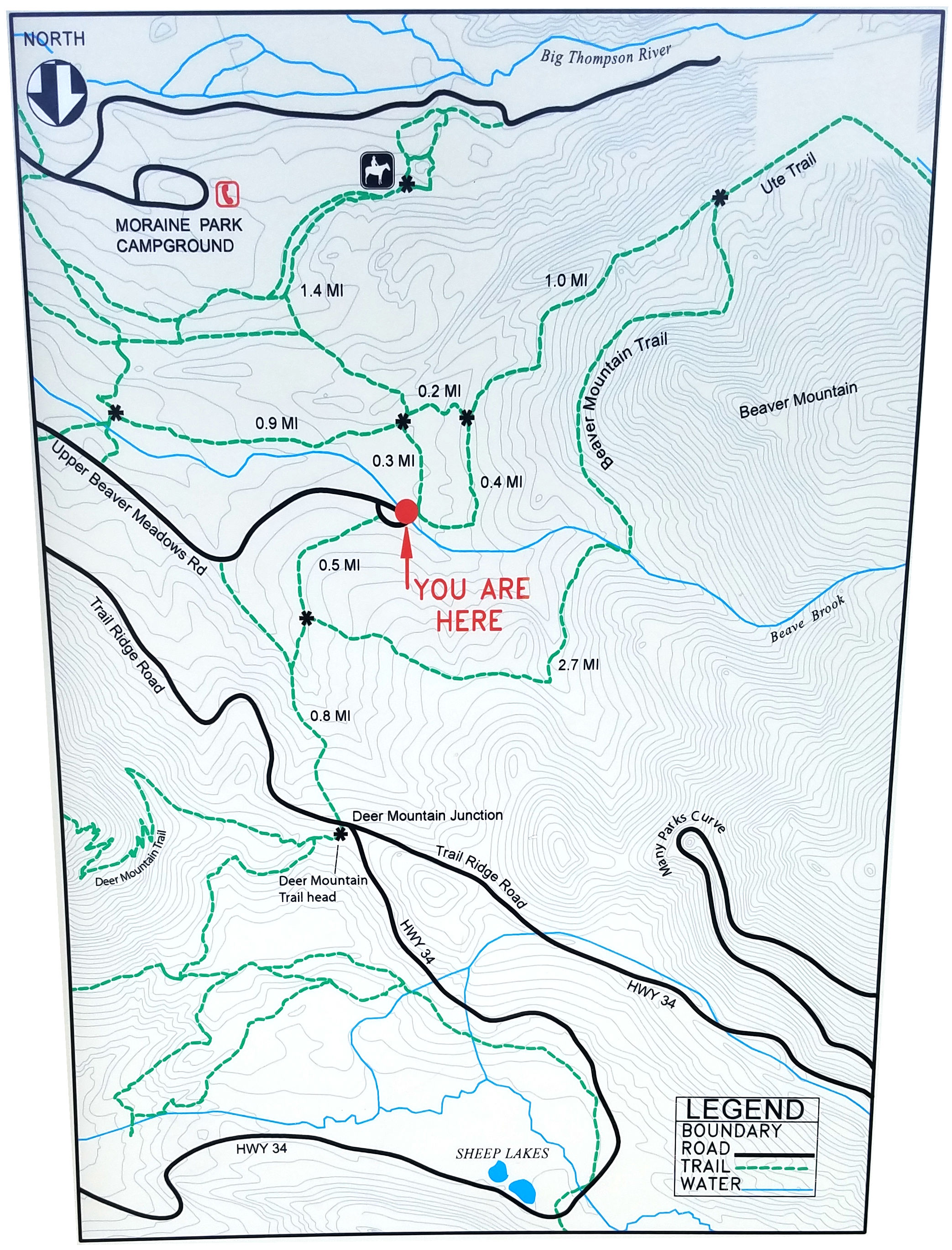 The Upper Beaver Meadows trailhead map is from the wayside sign at the end of the Upper Beaver Meadows road, showing the extensive network of trails toward Moraine Park and Deer Mountain.
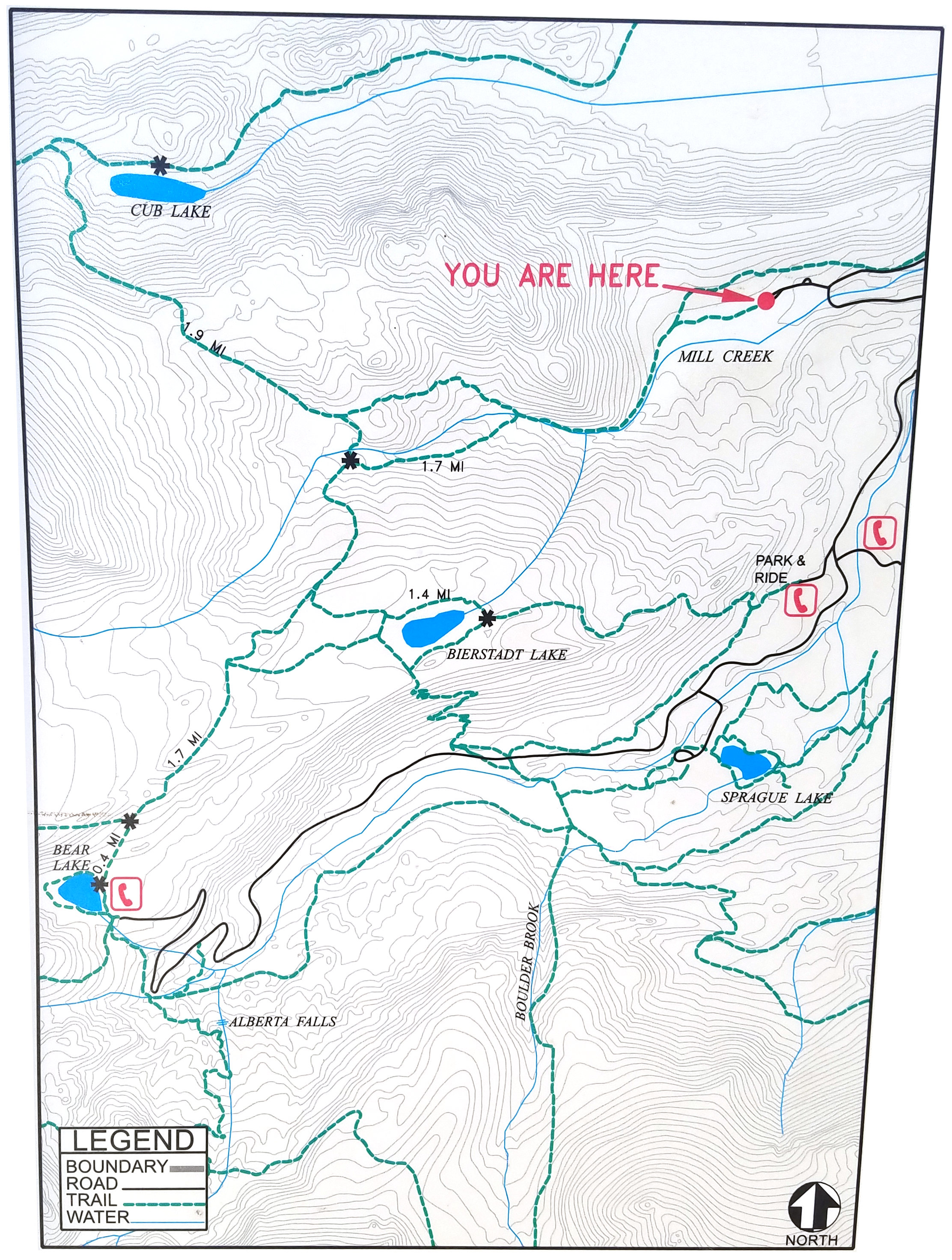 This Hollowell Park trailhead map comes from the sign at the Hollowell Park parking area, between Moraine Park and Sprague Lake. From here you can hike to Bierstadt Lake or Cub Lake.
Printable Rocky Mountain trail maps
 This is a simplified Rocky Mountain map, less pretty than the brochure map but easier to read and print out. It shows just the roads and points of interest like campgrounds, trailheads, and visitor centers.
Below you’ll find a few of Rocky Mountain National Park’s old-style trail maps that have been superseded by the new maps listed higher up on this page. I’m keeping these older ones here in case you prefer this hand-drawn style of maps.
 This is a Bear Lake trail map, showing the popular trails off the Bear Lake Road (Bear Lake, Glacier Gorge, Sprague Lake, Hollowell Park, Fern Lake, Bierstadt Lake, Flattop Mountain, etc).
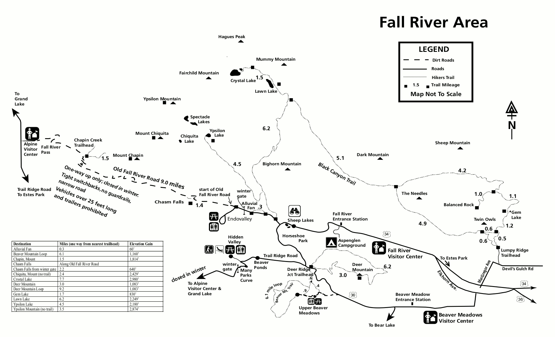 This is a Fall River trail map, showing trails accessed from the unpaved Fall River Road (north of Trail Ridge Road), open seasonally. Note that this road is one-way up to the Alpine Visitor Center.
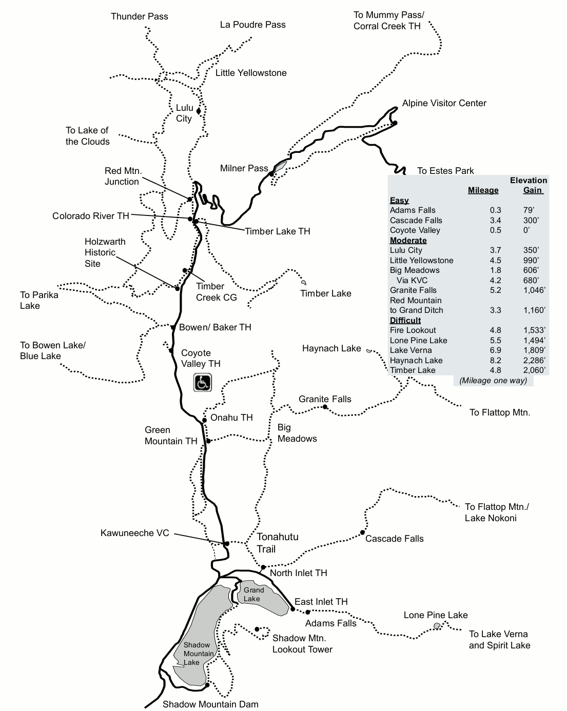 This is a Kawuneeche Valley trail map, showing trails on the west end of Trail Ridge Road past the Alpine Visitor Center. Here it is more quiet and relaxed than the east side, and you’ll probably see moose!
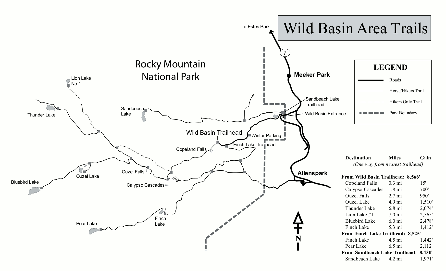 Here’s a Wild Basin trail map, showing trails originating from the Wild Basin area in the southeast corner of Rocky Mountain National Park. You come in here from a separate entrance off Highway 7.
 This hand-drawn Longs Peak trail map shows a very general overview of the trails in the Longs Peak region of Rocky Mountain National Park. Um, please don’t attempt to climb Longs Peak with just this!
 This is a Bear Lake winter trail map, showing trails for snowshoeing and skiing along the Bear Lake Road. This map specifically identifies trails marked for cross-country skiing.
 This is a Wild Basin winter trail map, showing trails originating from the Wild Basin section of the park, accessed from the winter parking lot in a separate park entrance off Highway 7.
Archived Rocky Mountain maps
The National Park Service often updates maps and releases new ones, and I try my best to share them as I find them. But I try to avoid removing old maps, as I believe it’s important to tell the story of how national parks change over time. So in this section, you’ll find maps that have since been superseded by ones above.
 This is a map of Rocky Mountain National Park from the mid-2010s. This was the previous NPS brochure map before the updated one on top of this page. Click the image to view a full size map or download the PDF.
 This is an old Rocky Mountain backcountry campsite map, from the 2010s, showing designated backcountry campsites and dispersed camping areas, including their elevations and distance from the trailhead.
 This is an old map of the Moraine Park Campground. This edition of the map was last updated in the mid 2010s and makes for an interesting comparison to the 2025 Moraine Park map further up this page.
 This is an old Rocky Mountain National Park shuttle map, showing the free shuttle bus stops along the Bear Lake Road from the mid-2010s. Click the image to view a full size map or download the PDF.
Rocky Mountain map prints and gifts

 Printed high-resolution Rocky Mountain map posters and other products are available at the Rocky Mountain Maps store. For prints, gift ideas, and souvenirs featuring other national parks, support this site and visit the National Park Maps store; you’ll find items to bring on vacation, keep at home for the memories, or give to your park-enthusiast friends and loved ones.
…and more!
< Return to National Park Maps home
< Return to Park List
< Return to List by State