Biscayne map from the park brochure
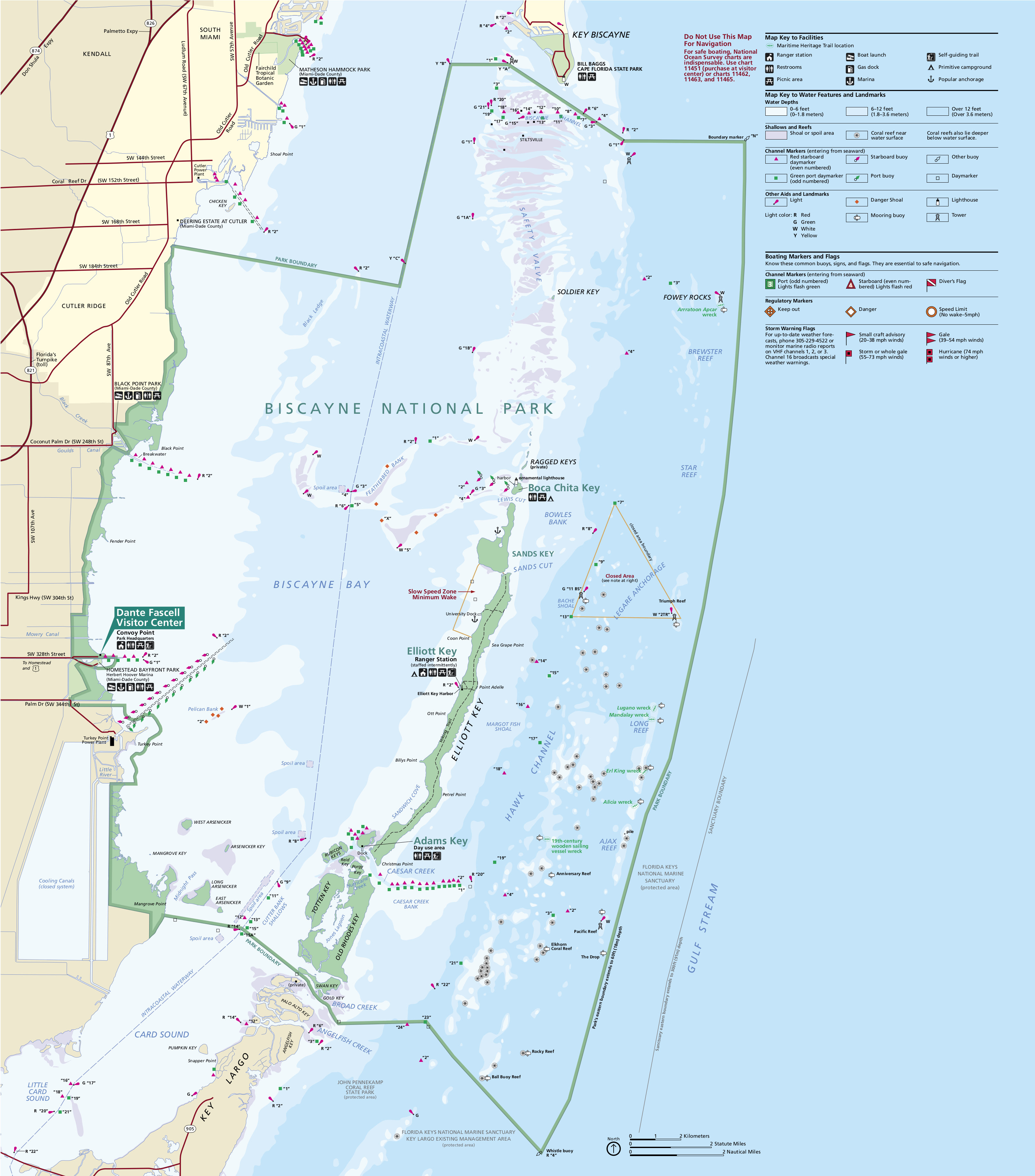
 Here’s the official Biscayne National Park map from the NPS brochure, identical to the one you receive when you visit the park. This edition was last updated by the National Park Service in 2024.
Regional Biscayne maps
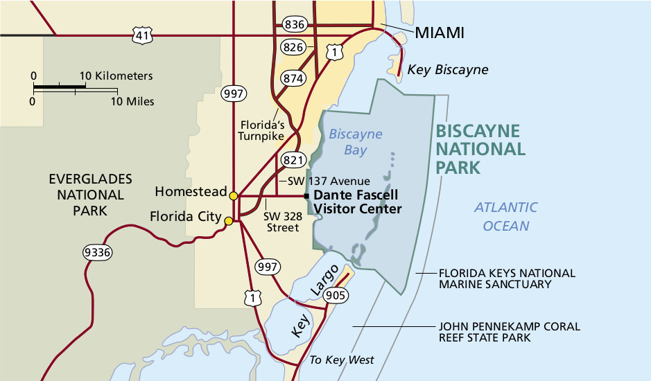 This is a regional map of Biscayne, showing the surrounding highways and Miami roads to bring you to the Dante Fascell Visitor Center. Click the image to view a full size map or download the PDF.
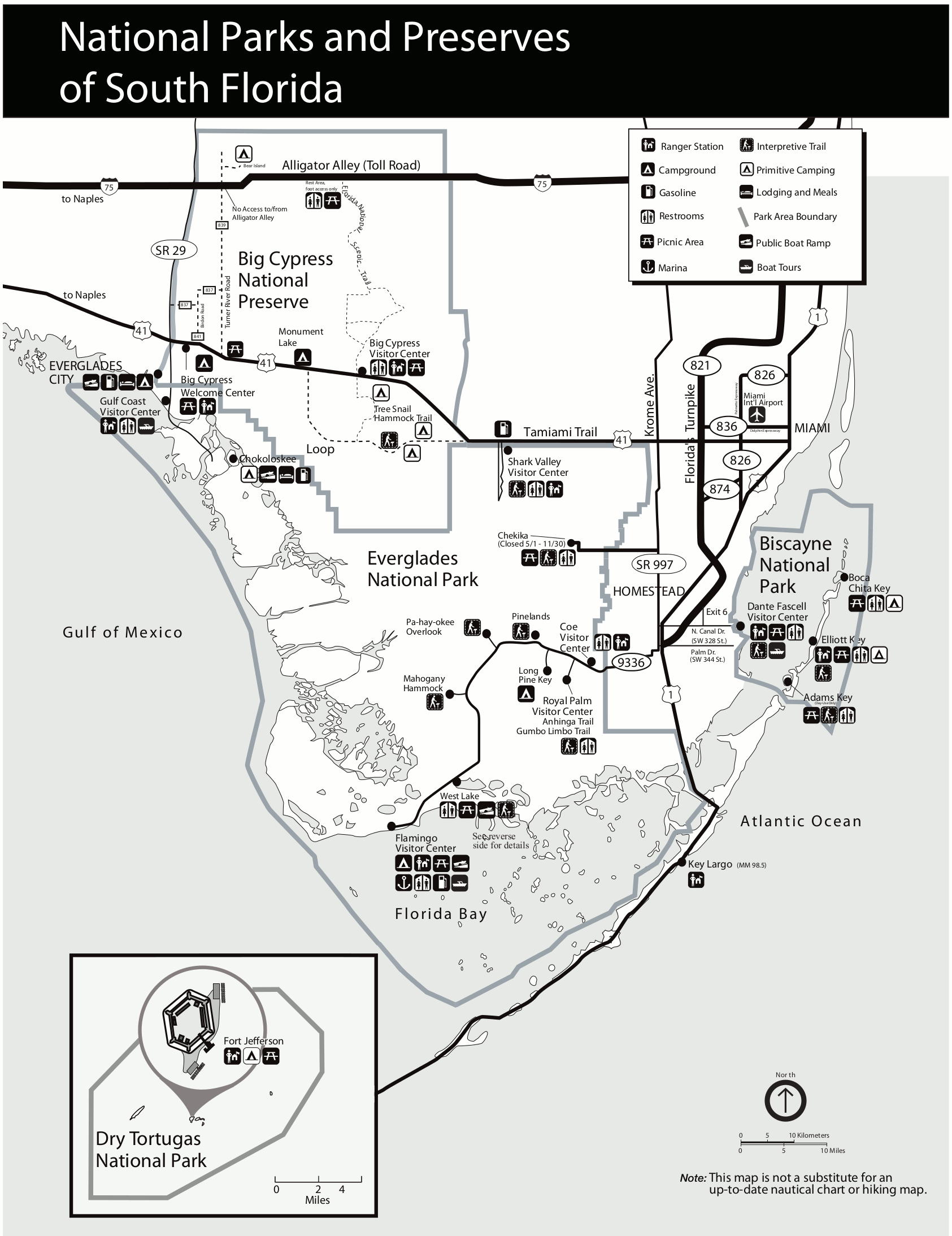 This is a South Florida national park map, showing Biscayne in relation to Big Cypress, Everglades, and Dry Tortugas National Parks. It’s easy to print and shows the major attractions of each park.
Biscayne islands maps
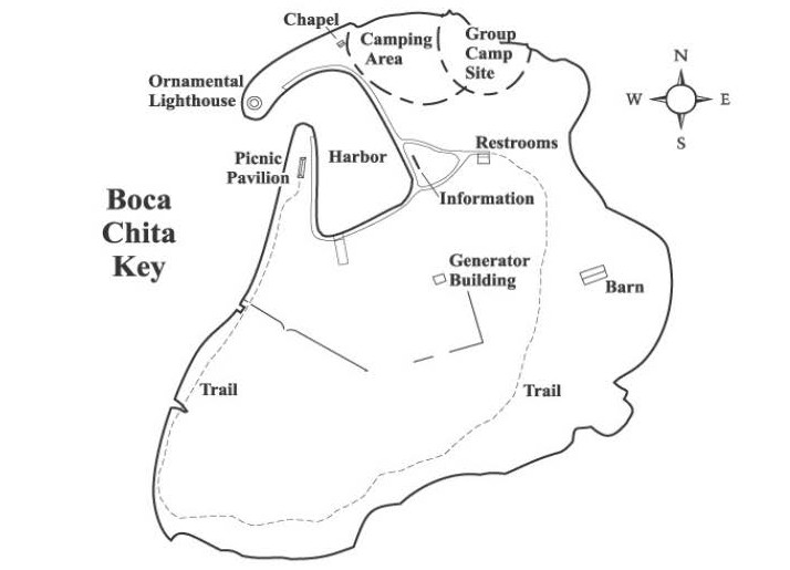 The Boca Chita Key map, zooming in to show the developed area of the most-visited island in Biscayne National Park. Many come here as part of a boat tour with the Biscayne National Park Institute.
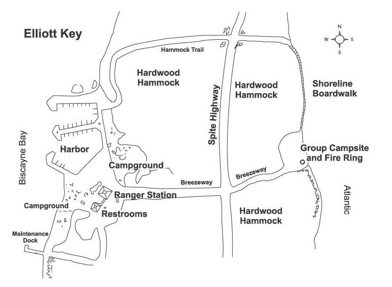 Here’s an Elliott Key map, showing the area of visitor services on this much larger island: the largest in the park. There’s no regular ferry service to this location so you must make your own way here.
Assorted Biscayne maps
 Here’s a Dante Fascell Visitor Center map, showing the self-guided Convoy Point Jetty Trail, which is the only Biscayne National Park hiking trail on the Florida mainland. It’s a little under half a mile to the end (one way).
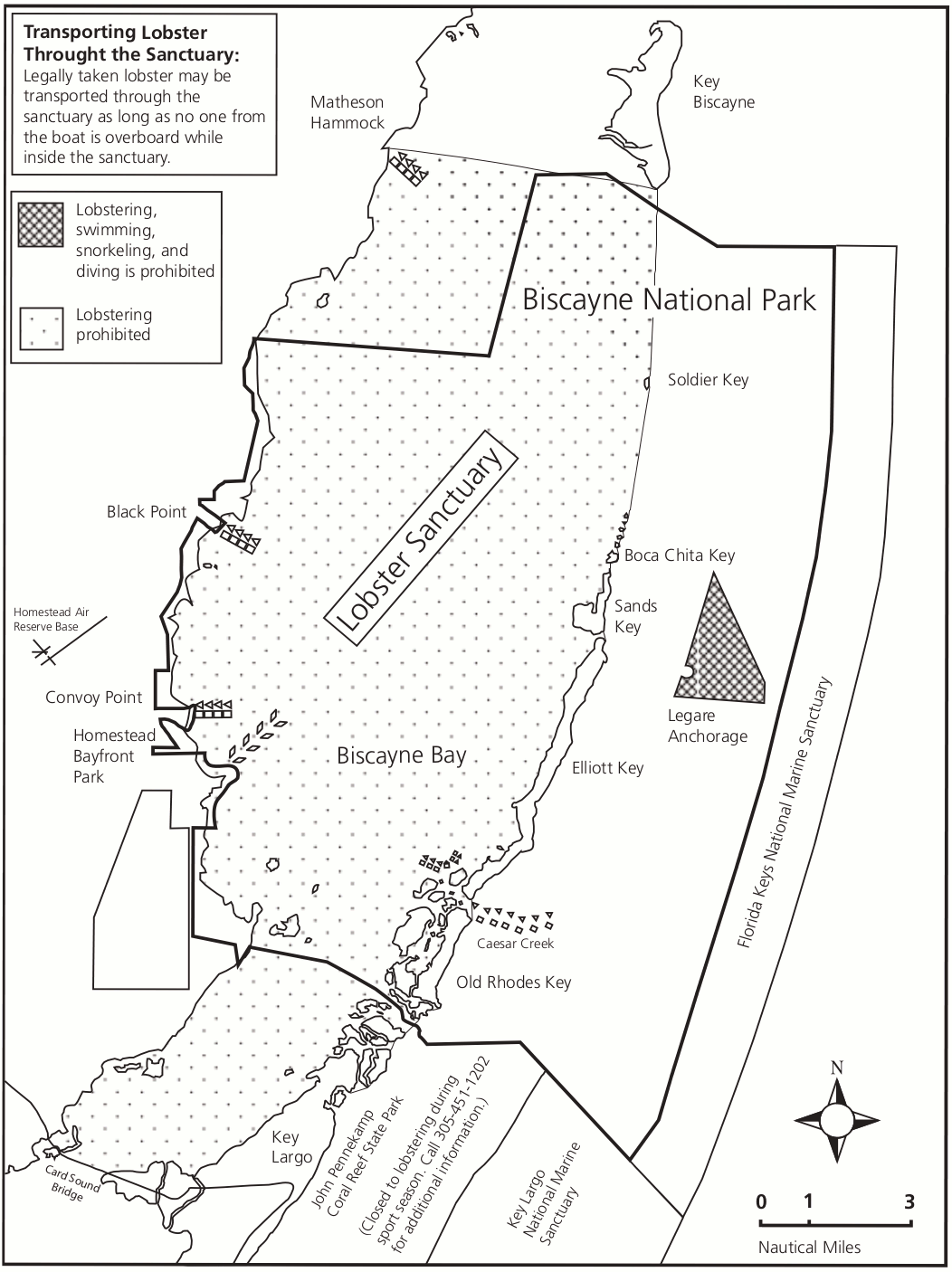
 The Spiny Lobster Sanctuary map shows where lobstering is prohibited in Biscayne National Park. It also includes other protection zones, such as Coral Reef Protection Areas and the Legare shipwreck site.
Archived Biscayne maps
As the National Park Service releases new maps, I do my best to include updated ones on this page. As maps get superseded and replaced, I move the old ones down to this section. I never delete maps as I feel that old maps are important to tell a park’s story of use and development. So please note that any map below has an updated one posted higher up this page.
 This is an old Biscayne National Park map from the official park brochure, showing the reefs and water navigation aids. The map dates from the mid-2010s. Click the image to view a full size map or download the PDF.
 This is an old map of the Biscayne lobster sanctuary, showing the area of Biscayne National Park where lobstering is prohibited to protect year-round breeding habitat. It’s since been superseded by a newer map above.
…and more!
< Return to National Park Maps home
< Return to Park List
< Return to List by State