Guadalupe Mountains map from the park brochures
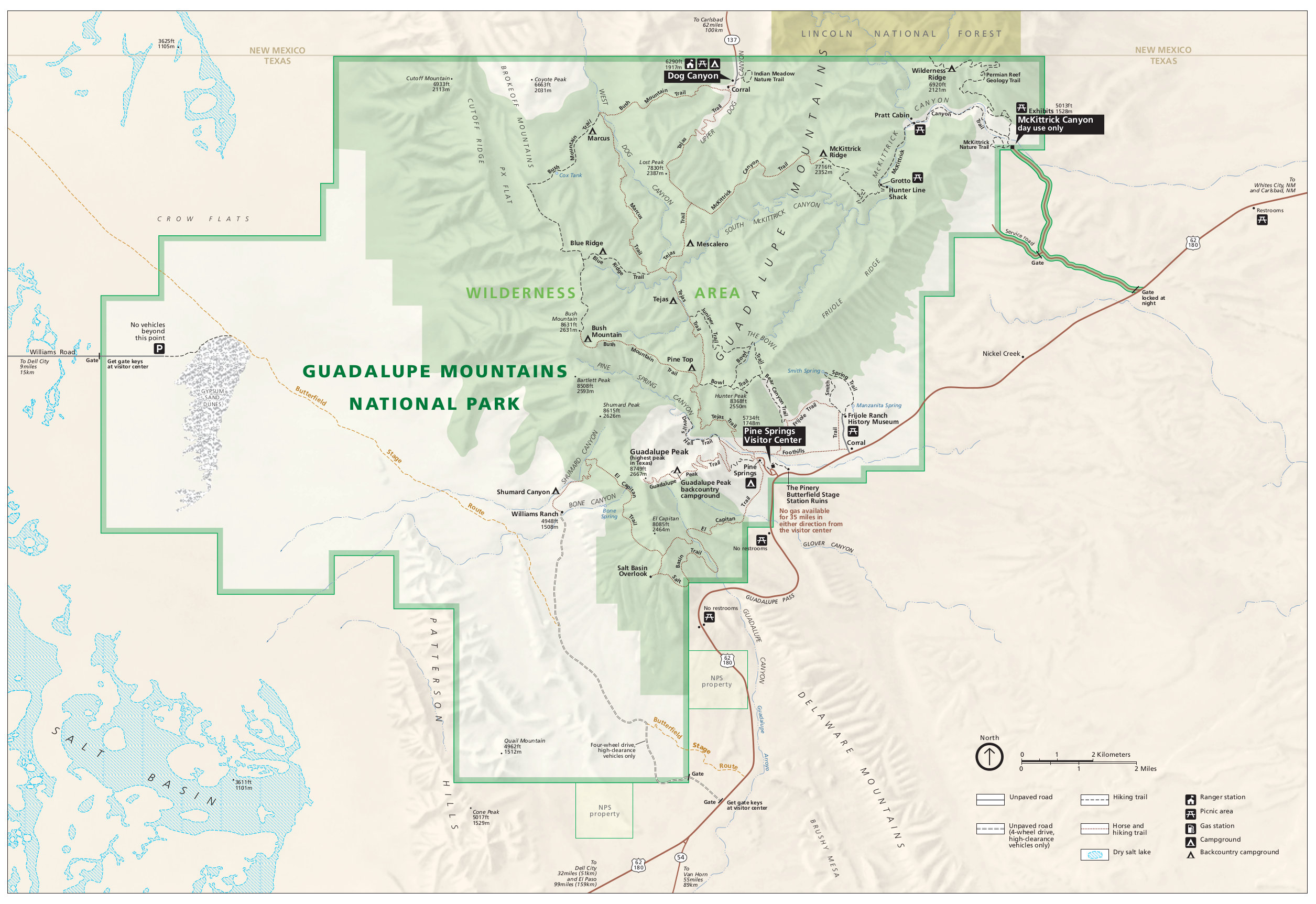
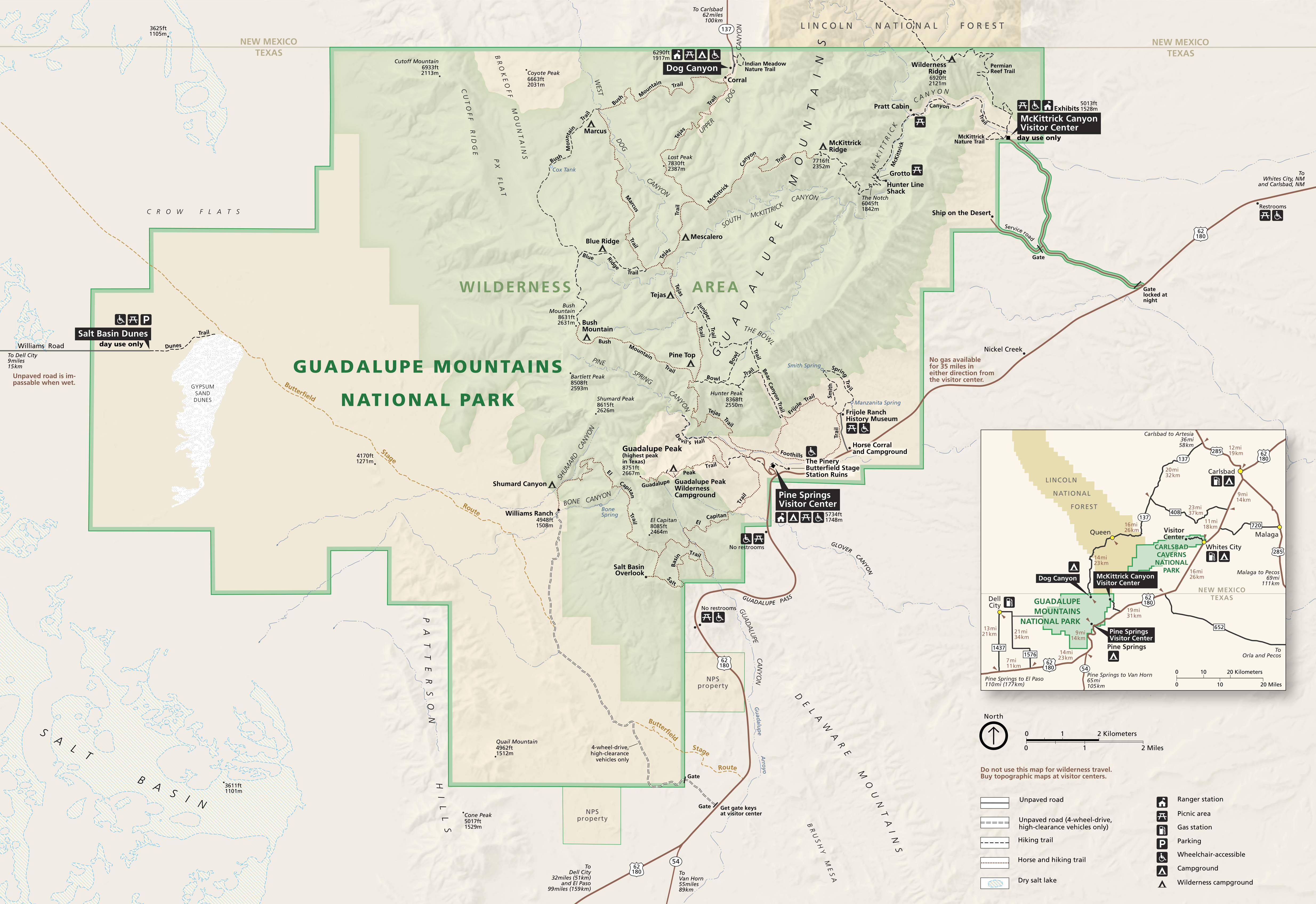 Here’s the official Guadalupe Mountains National Park map from the NPS brochure. It was last updated by the National Park Service in 2022. Click the image to view a full size map or download the PDF.
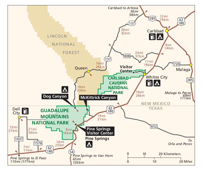 This is a regional Guadalupe Mountains map, showing area roads, nearby towns, and Carlsbad Caverns National Park. Click the image to view a full size map or download the PDF.
Guadalupe Mountains trail maps
 Unfortunately I haven’t been able to find a good free trail map covering all of Guadalupe Mountains. However, National Geographic does make a nice Trails Illustrated map of the park, which includes topographic lines and trail mileages. This map is especially great if you’re doing longer hikes up Guadalupe Peak or into the wilderness for backcountry camping. If you’re just driving through the park, this map isn’t really necessary.
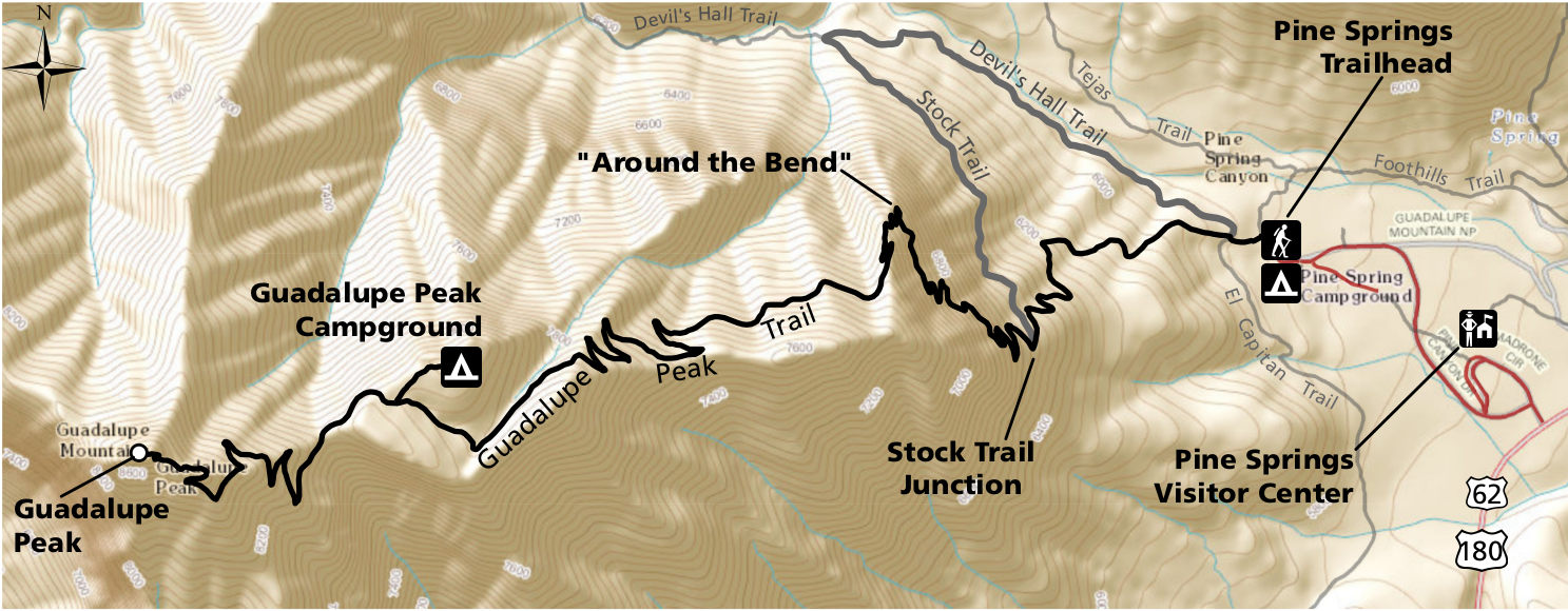 Here’s a Guadalupe Peak trail map, showing the trail that climbs to Texas’ highest point. This map includes topographic lines and shows the alternate route where the stock trail diverges from the hiking route.
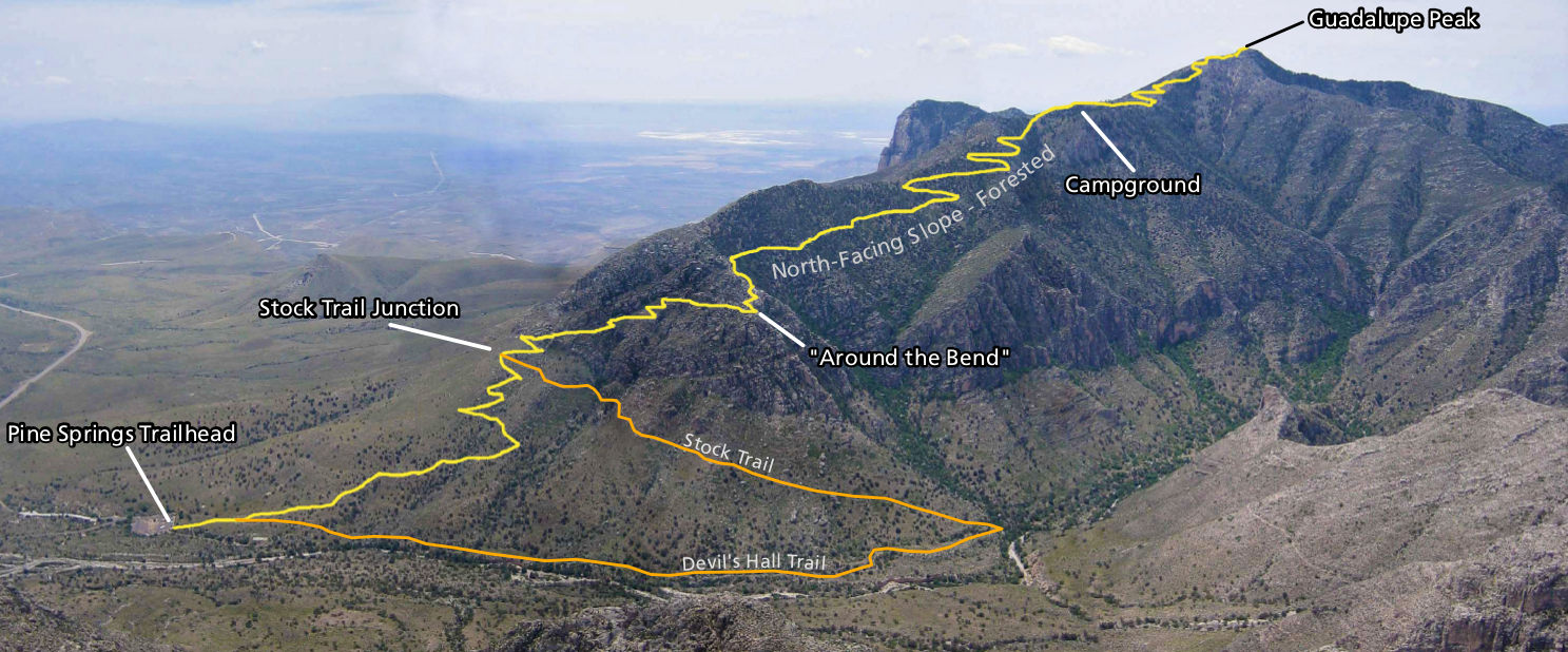 This shows the Guadalupe Peak trail map overlaid on a photo. This really gives you a sense of the elevation gain that must be tackled to reach the summit of the peak! The reward is well worth the effort.
Assorted Guadalupe Mountains maps
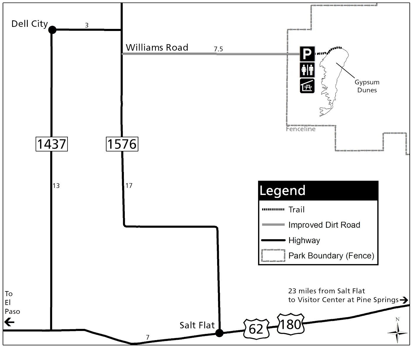 Here’s a Salt Basin Dunes map. These gypsum sand dunes are located well to the west of the main attractions of Guadalupe Mountains, and must be accessed through a separate primitive entrance road.
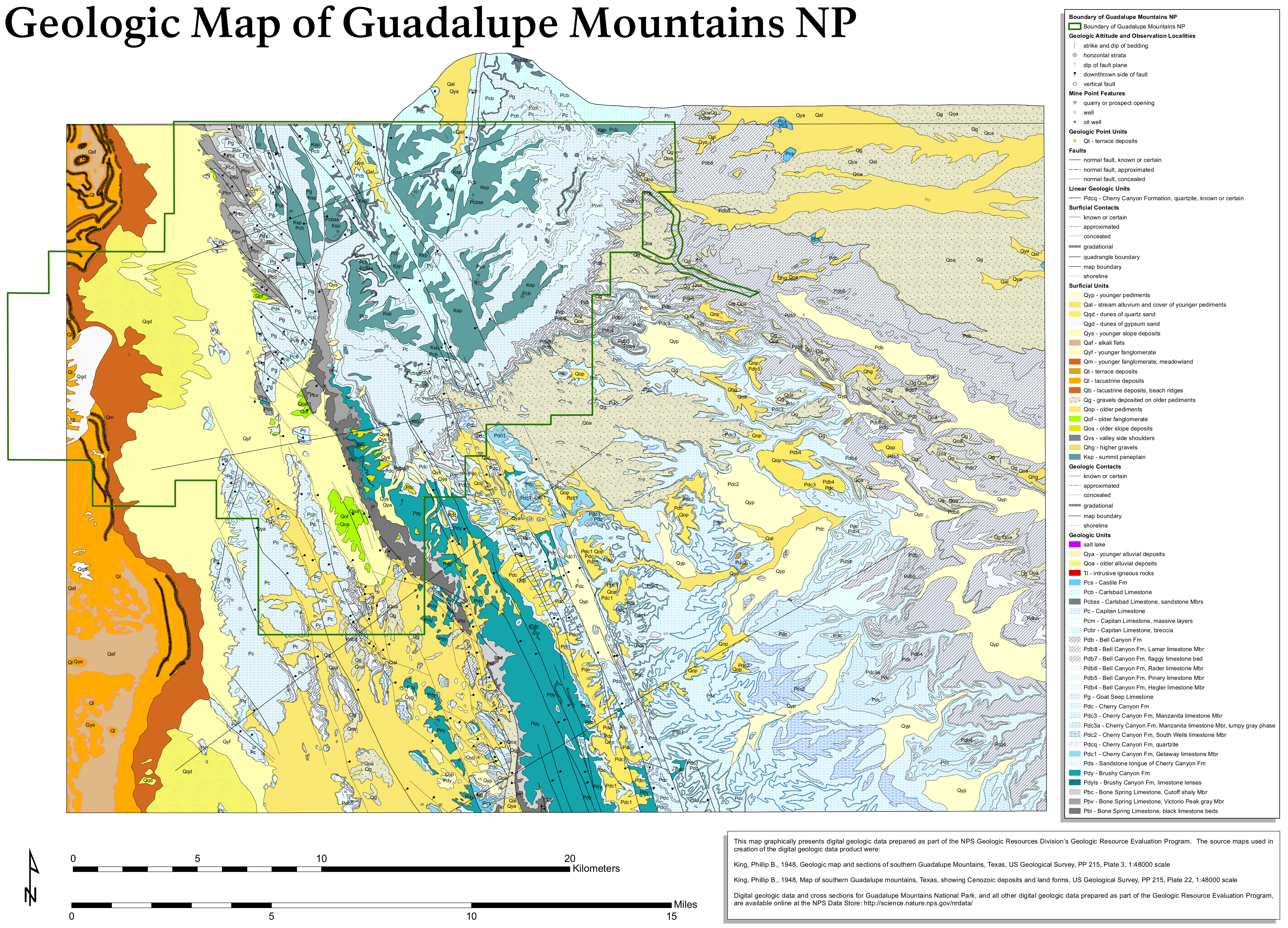 The Guadalupe Mountains geologic map includes both surficial deposits and bedrock geology, showing areas both inside and outside the park. Note how the rocks change once you leave the park!
 This is an old official Guadalupe Mountains map from the mid-2010s, showing roads, trails, and Guadalupe Peak. Click the image to view a full size map or download the PDF.
Guadalupe Mountains lodging map
 When you’re visiting an isolated park like Guadalupe Mountains, you can’t expect to stay right at the park entrance. To the right is an Expedia interactive lodging map of Carlsbad, NM—the closest town to the park. (It makes a handy way to see Carlsbad Caverns too.) Browse the best Carlsbad, NM lodging where you can read guest reviews, view photos, compare prices, see amenities, and narrow down on where to stay.
…and more!
< Return to National Park Maps home
< Return to Park List
< Return to List by State