Arches maps from the park brochures
 This is the official Arches National Park map, most recently updated in 2021. It’s the exact one you receive on the official National Park Service brochure. Click the image to view a full size map or download the PDF.
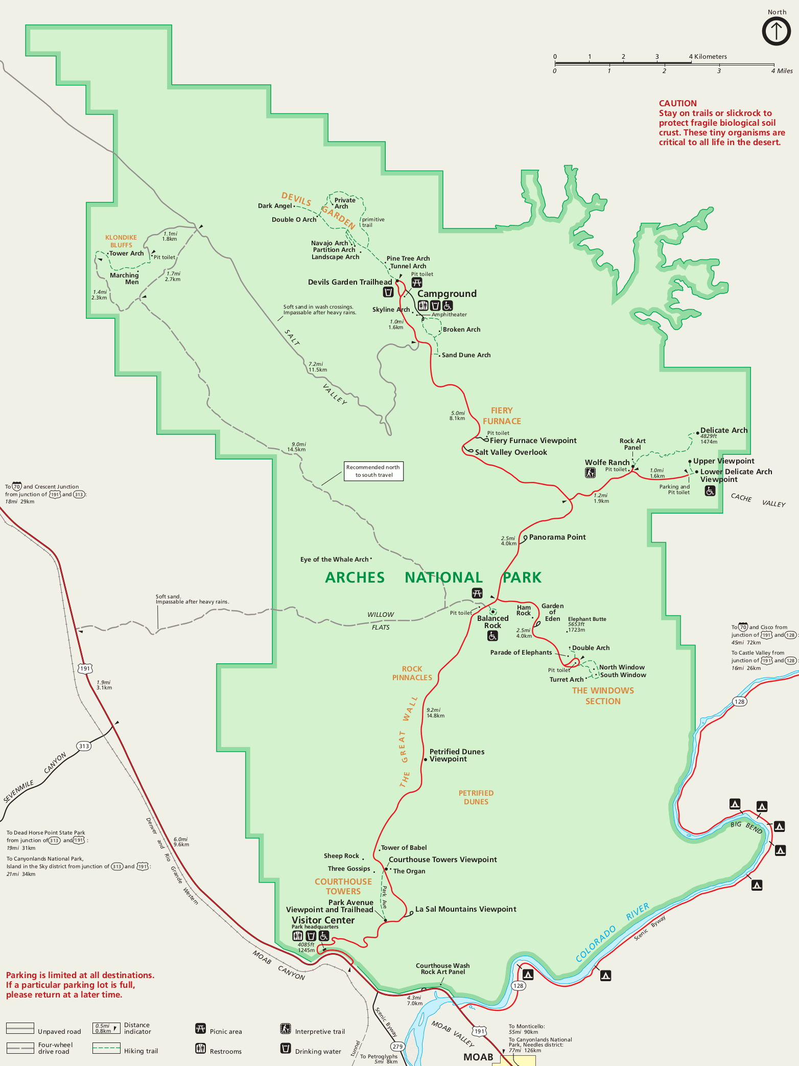 This is a simple map of Arches National Park, showing roads, hiking trails, overlooks, and various named arches just like the maps above, but in an easier-to-print format (without relief shading).
Since Arches is full of a few major visitor areas separated by stretches of less-visited locations, I’ve cropped down the full park map into four individual maps below. This way instead of printing/saving the entire national park map, you can download just the specific areas of the park you plan to visit. They’re arranged here in order from south to north as you encounter them on your way into the park.
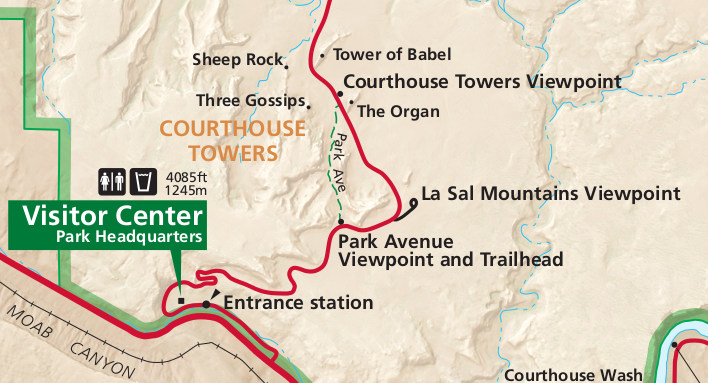 This Park Avenue map shows the 1-mile Park Avenue trail as it walks along Wall Street, Courthouse Towers, and other beautiful rock formations. Hike it one way and get picked up on the other end!
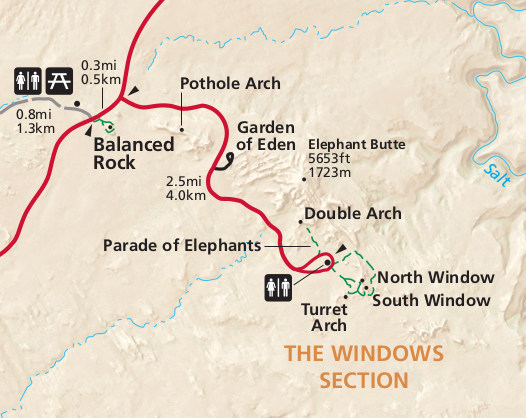 Here’s a Windows map which shows several arches accessible by short hikes (and can also be viewed from the road) including Turret Arch, Double Arch, and the North and South Windows.
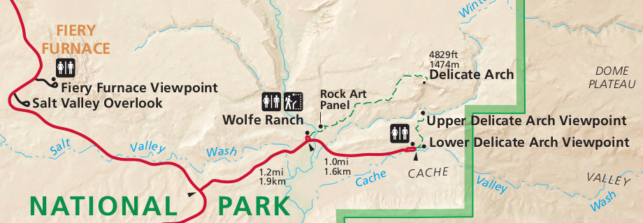 The Delicate Arch map shows the short hikes to the Delicate Arch viewpoints as well as the more strenuous 1.5-mile trail that leads to its base. Also here is the Fiery Furnace Overlook.
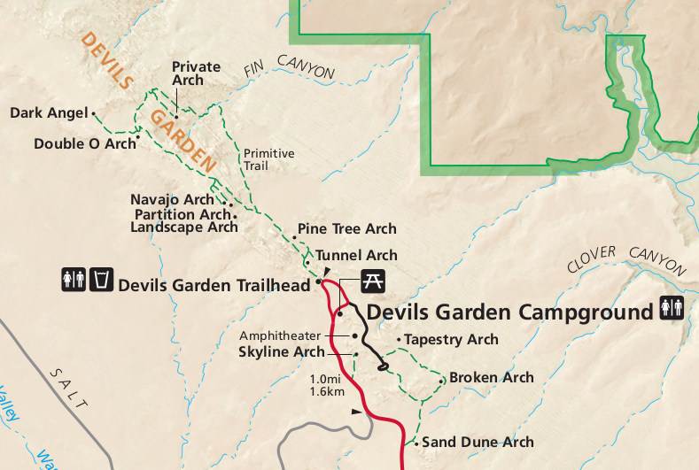 This Devils Garden map includes the entire loop hike that passes Landscape Arch, Navajo Arch, and Double O Arch. It also shows the arches accessible from the Devils Garden Campground, like Sand Dune Arch.
Arches trail maps
 If you’re looking for an Arches trail map that covers the entire park, you should probably go with the National Geographic Trails Illustrated map from Amazon. Although there’s not really a ton of backcountry hiking options in the park, the wide variety of different day hikes means a comprehensive trail map like this is quite useful. (I used this very map when hiking Lower Courthouse Wash.) The display of distances between points is a particularly nice touch.
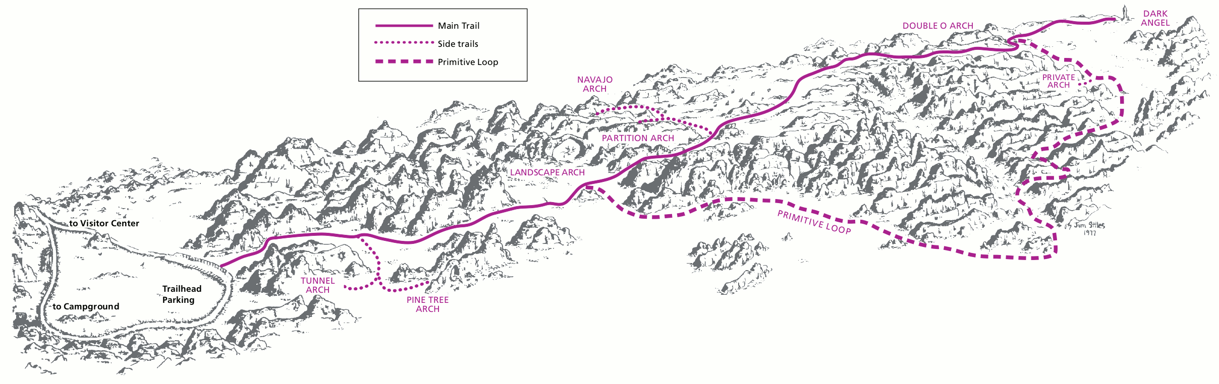 This is the Devils Garden Trail hiking map, showing the main trail to Landscape Arch, Partition Arch, and other rock formations. Hike it one way to Double O Arch or do the whole loop if it’s not too hot.
Assorted Arches maps
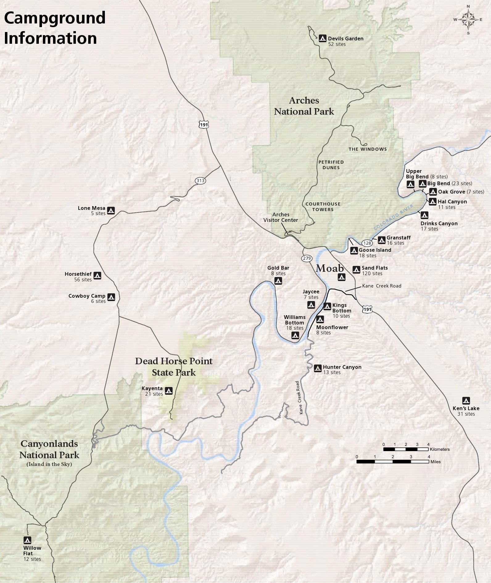 This is an Arches and Moab camping map, which shows campgrounds in and around the park. This is particularly helpful when the Devils Garden Campground is full, which is pretty much all the time during spring and fall.
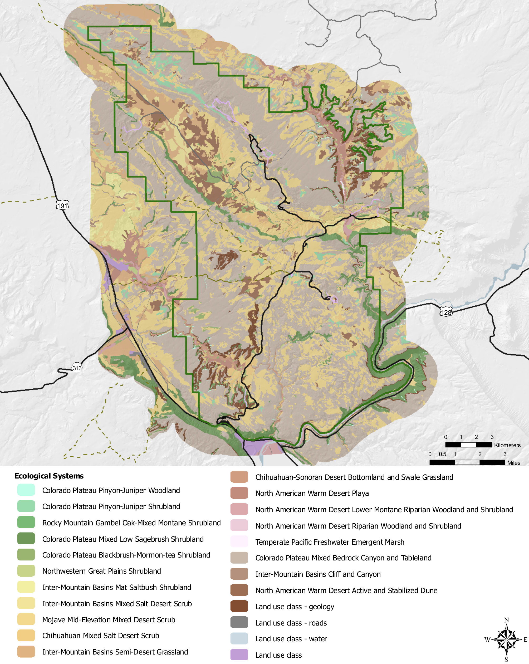 This Arches National Park vegetation map shows the different types of plant communities that grow in Arches – juniper woodlands, desert scrub, shrublands, etc. Also: where there’s nothing but bare rock.
Arches topographic maps
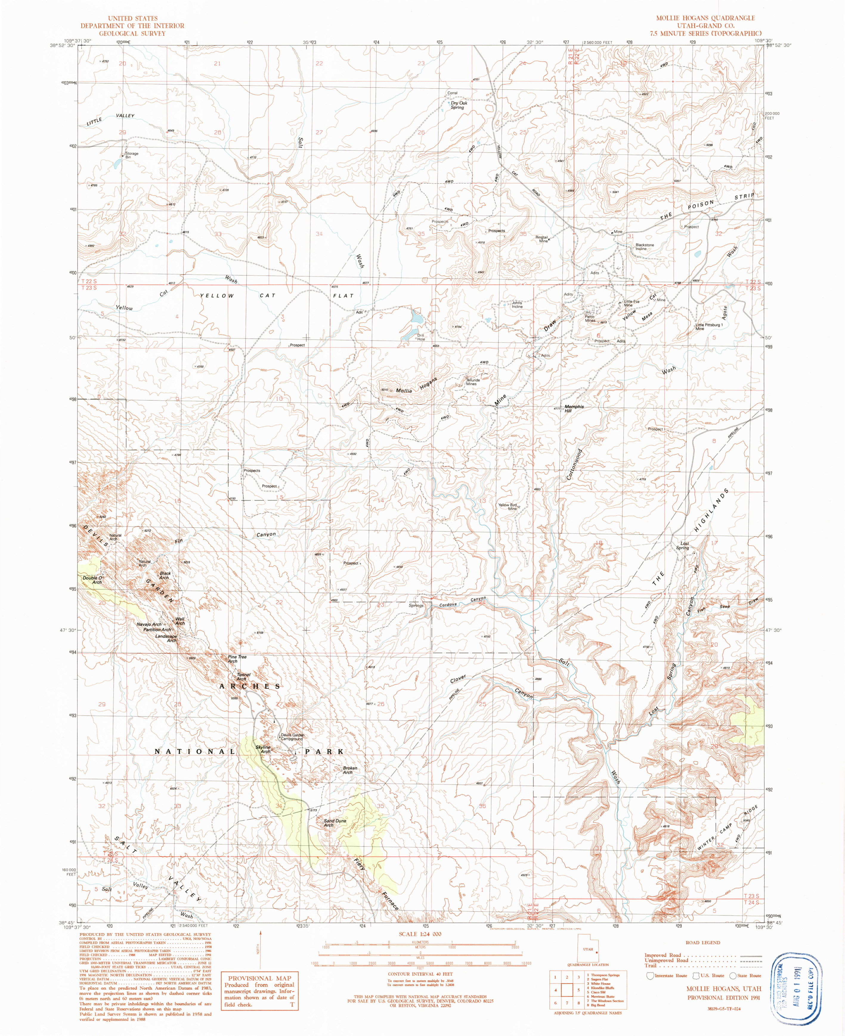 Here’s a Devils Garden topographic map, showing the Devils Garden trail and arches in the general area. Click the image to view a full size map or download the PDF.
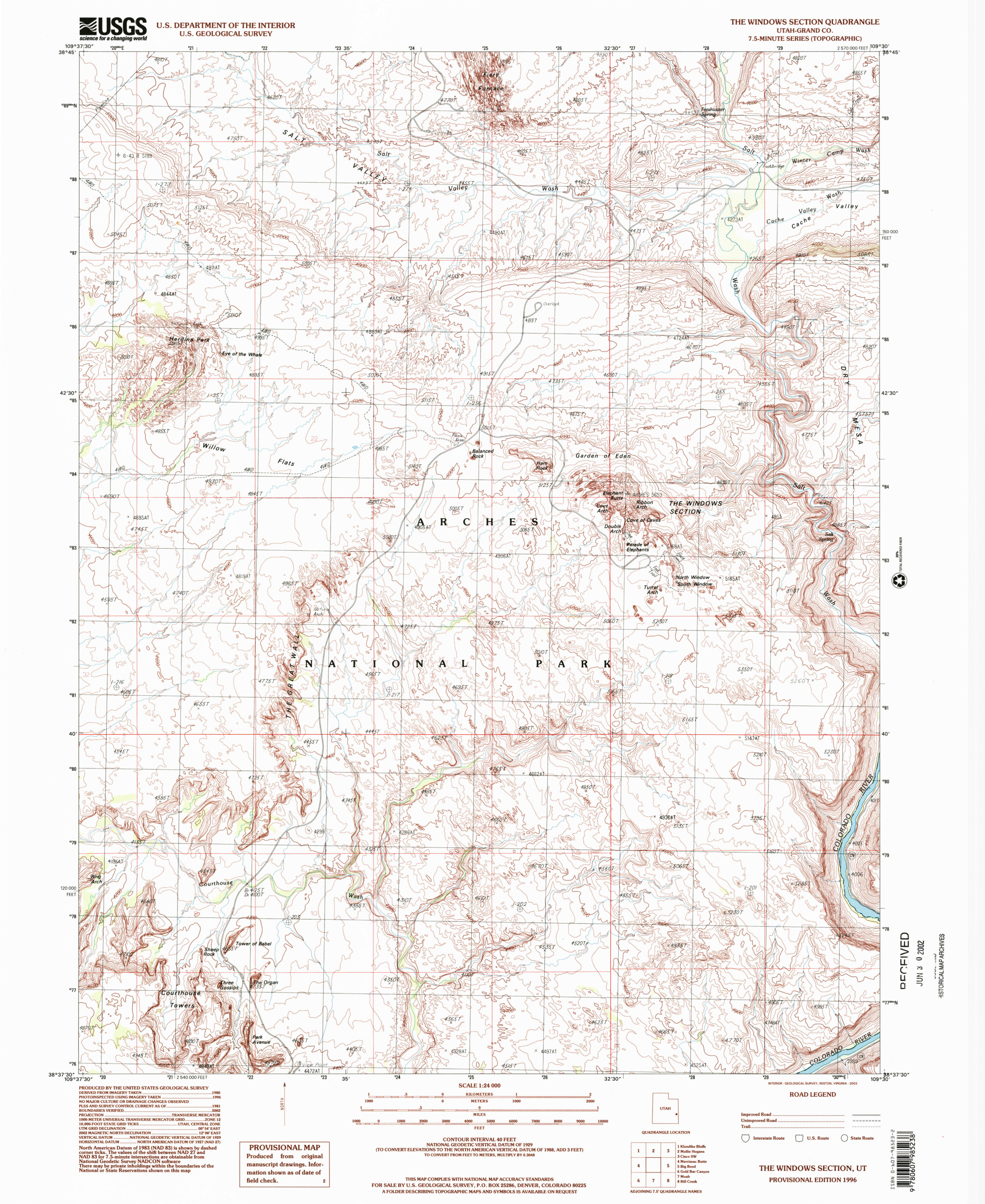 The Windows topo map shows the Windows section of Arches, along with parts of Wall Street and the Fiery Furnace. Click the image to view a full size map or download the PDF.
Arches lodging map
 If you’re visiting Arches, you’ll definitely be staying in Moab — the outdoors Mecca just outside the park that is a perfect base camp for your outdoor adventures. To the right you can open an Expedia interactive lodging map for Moab and can filter based on ratings or price. Or, you might instead want to browse Expedia reviews of the best-rated Moab lodging to compare photos and opinions.
Archived Arches maps
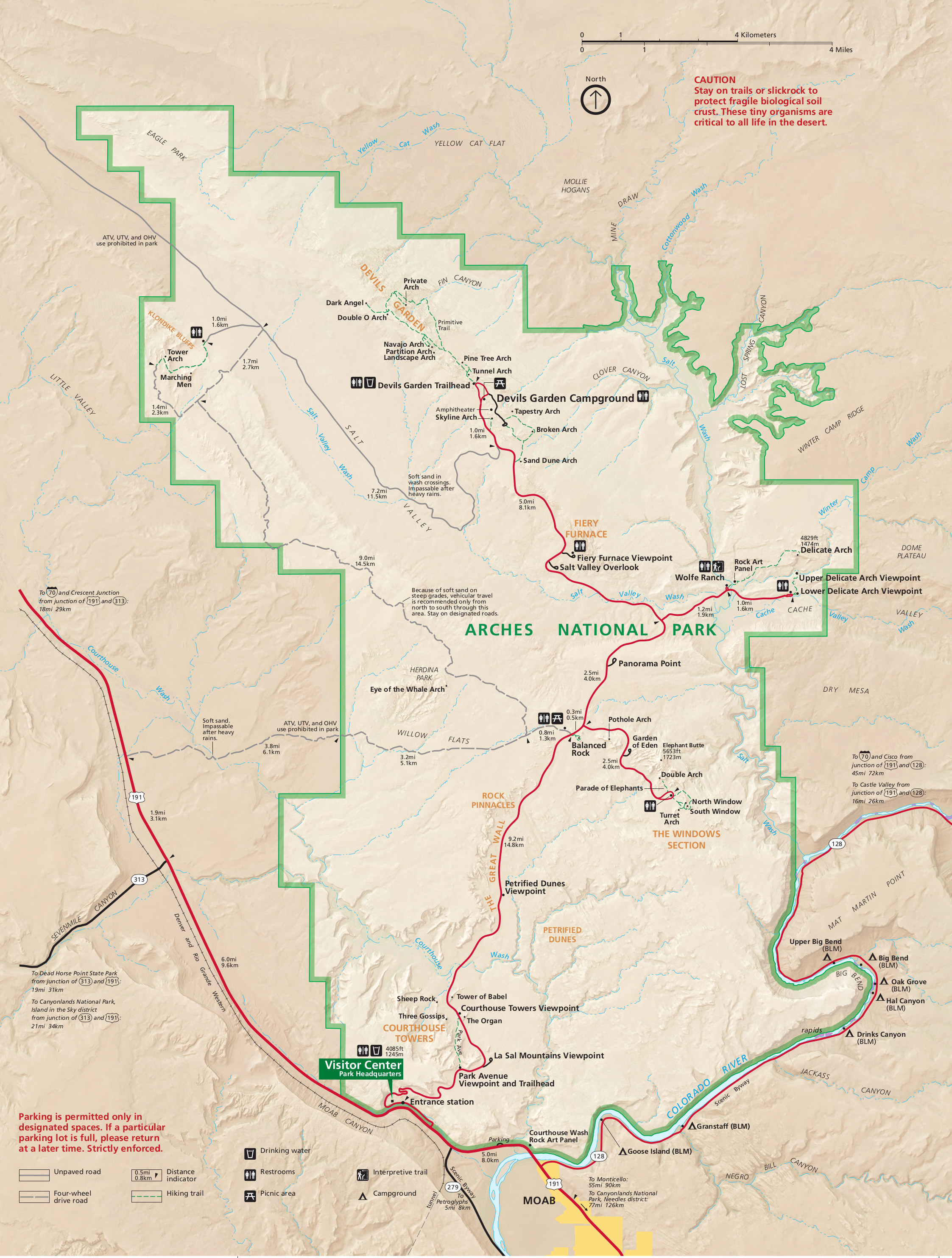 This is the 2015 Arches map. It used to be the main featured map on this page, but it’s since been superseded and is now provided here for historical record. Click the image to view a full size map or download the PDF.
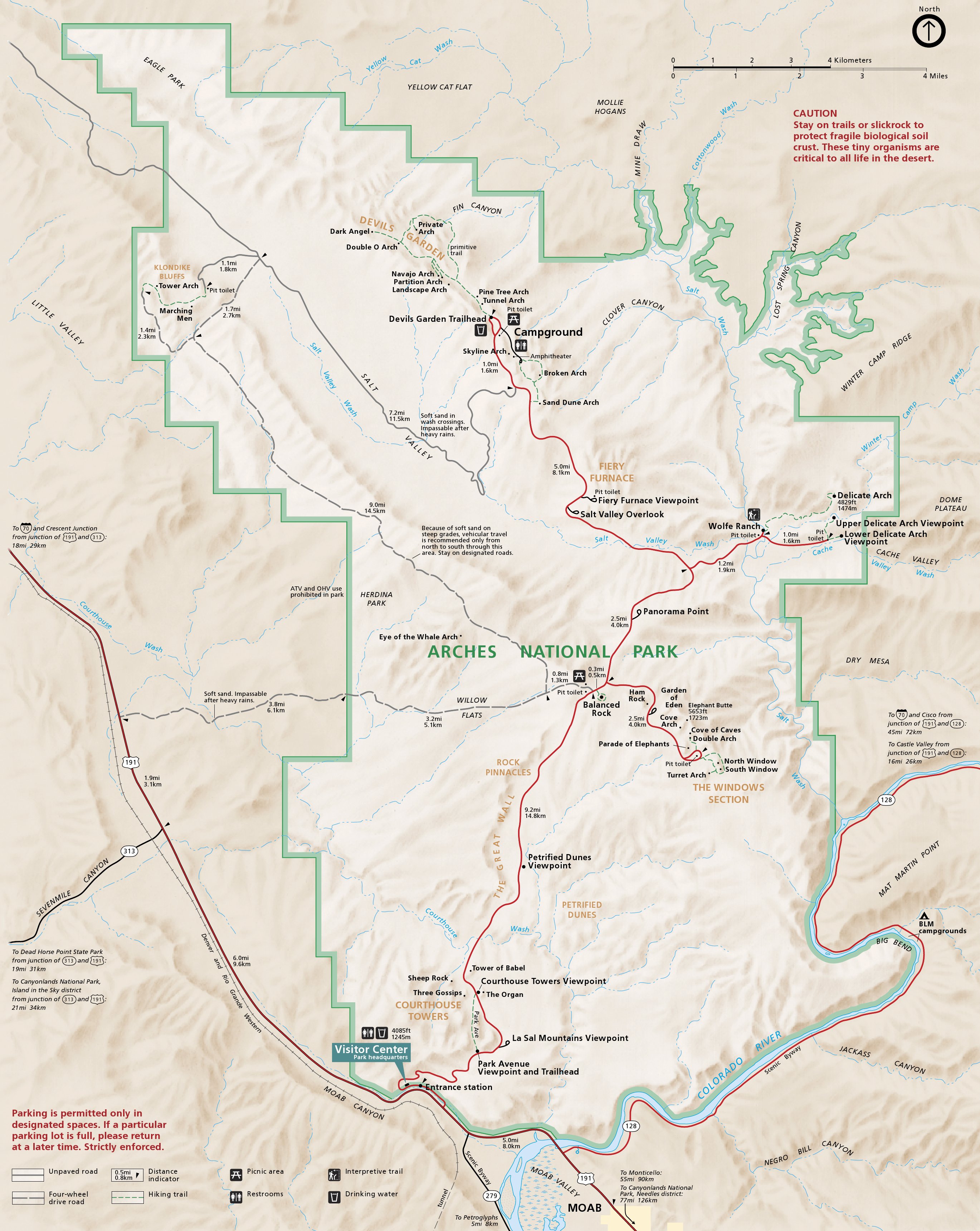 This is the main Arches National Park map from 2012, showing roads, hiking trails, campgrounds, and various named arches. Click the image to view a full size map or download the PDF.
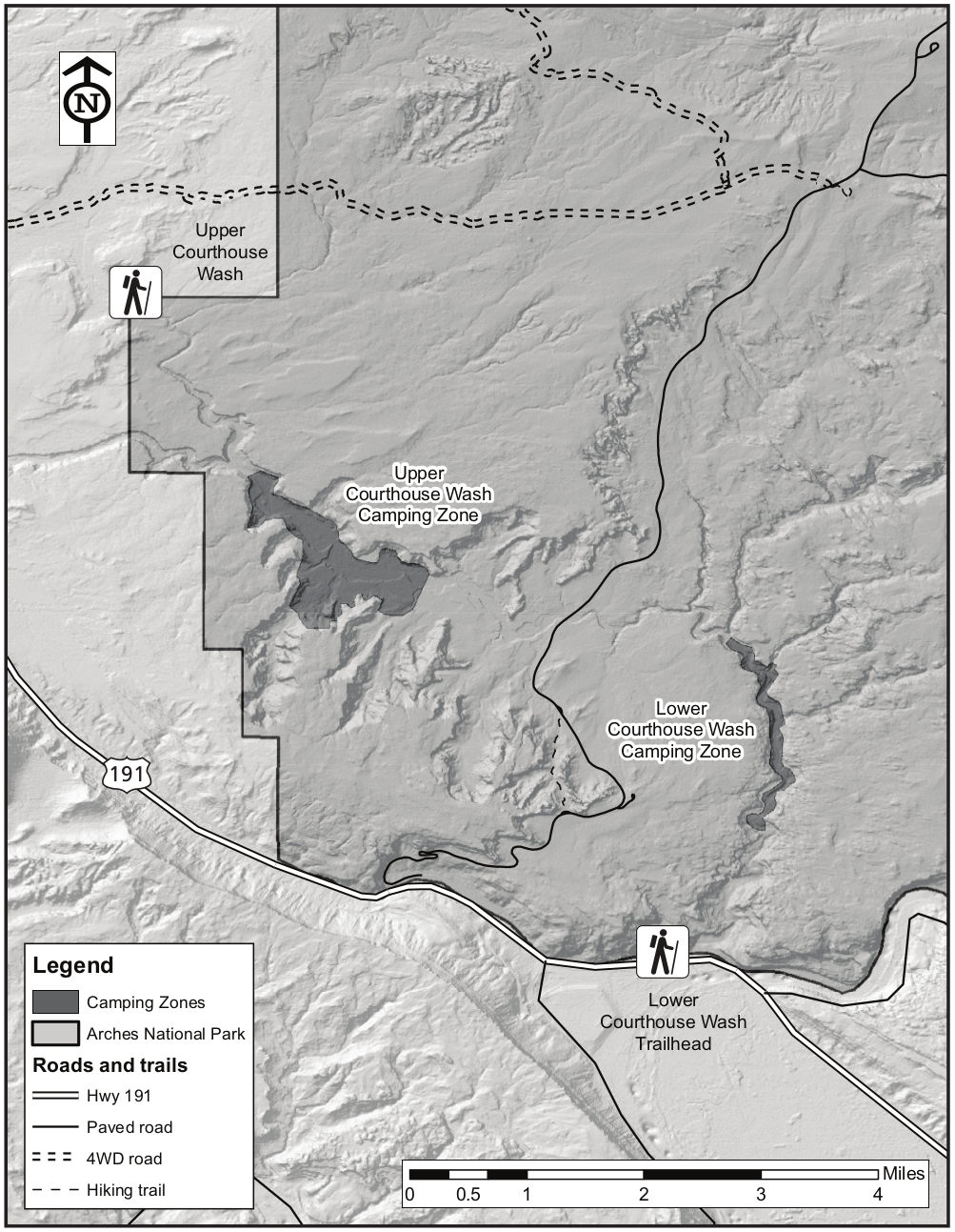 This is an Arches backpacking map from 2017, which superseded the map below. Because 2017 was full of road construction, there was no overnight parking in Arches and therefore backpacking was limited.
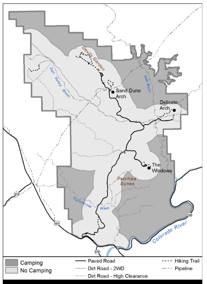 This old Arches backpacking map shows legal camping zones in Arches prior to 2017. As of 2025, the camping zones no longer exist, and instead only four specific backpacking campsites are available for reservation.
Arches map prints and gifts

 Printed high-resolution Arches map posters and other products are available at the Arches National Park Maps store. For art prints, gift ideas, and souvenirs featuring other national parks, support this site and visit the National Park Maps store; you’ll find items to bring on vacation, keep at home for the memories, or give to your park-enthusiast friends and loved ones.
…and more!
< Return to National Park Maps home
< Return to Park List
< Return to List by State