Montezuma Castle brochure map
 Here’s the official Montezuma Castle map, which also shows the location of Montezuma Well and Tuzigoot National Monument. Click the image to view a full size map or download the PDF.
Montezuma Well map
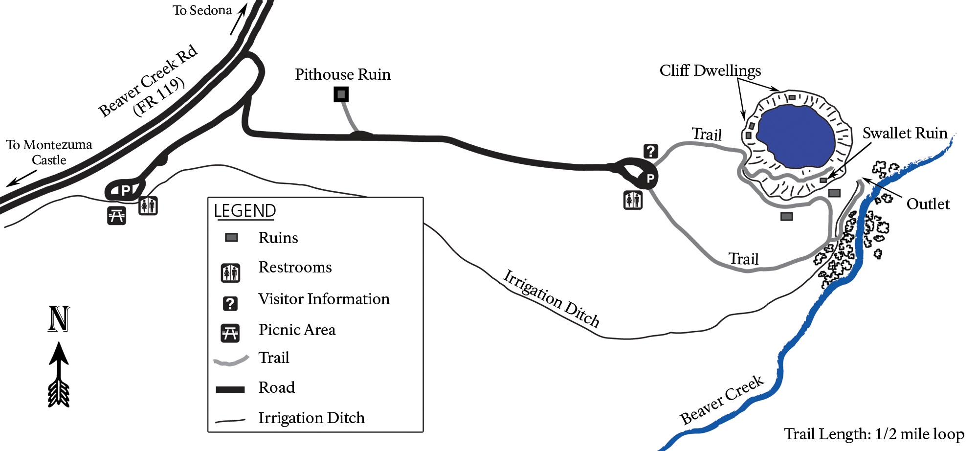 Here’s a Montezuma Well map. It’s still a part of Montezuma Castle National Monument, but you do have to drive 11 miles to get there. Make sure you check out this unique desert oasis!
Assorted Montezuma Castle maps
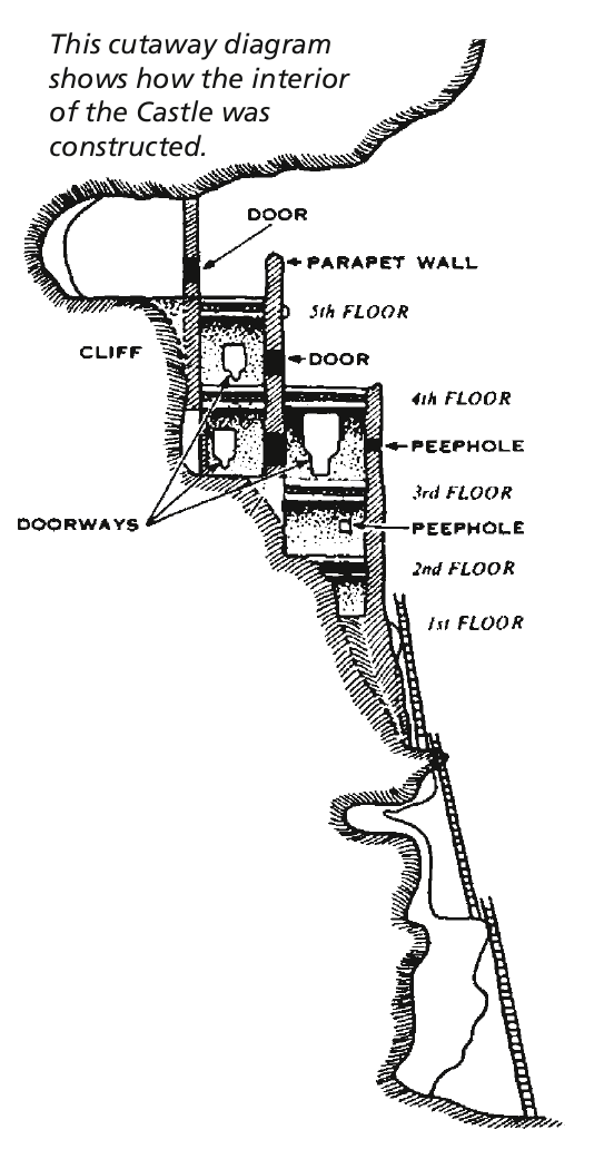 This is a Montezuma Castle cross-section, showing the layout of this incredibly well-preserved cliff dwelling, constructed over several centuries nearly 1,000 years ago.
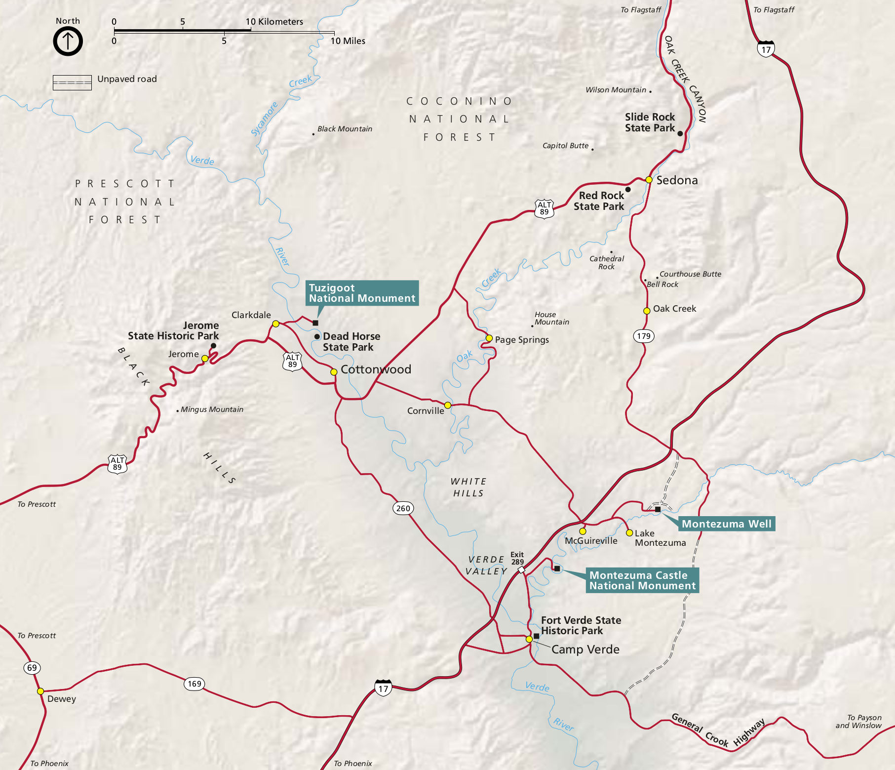
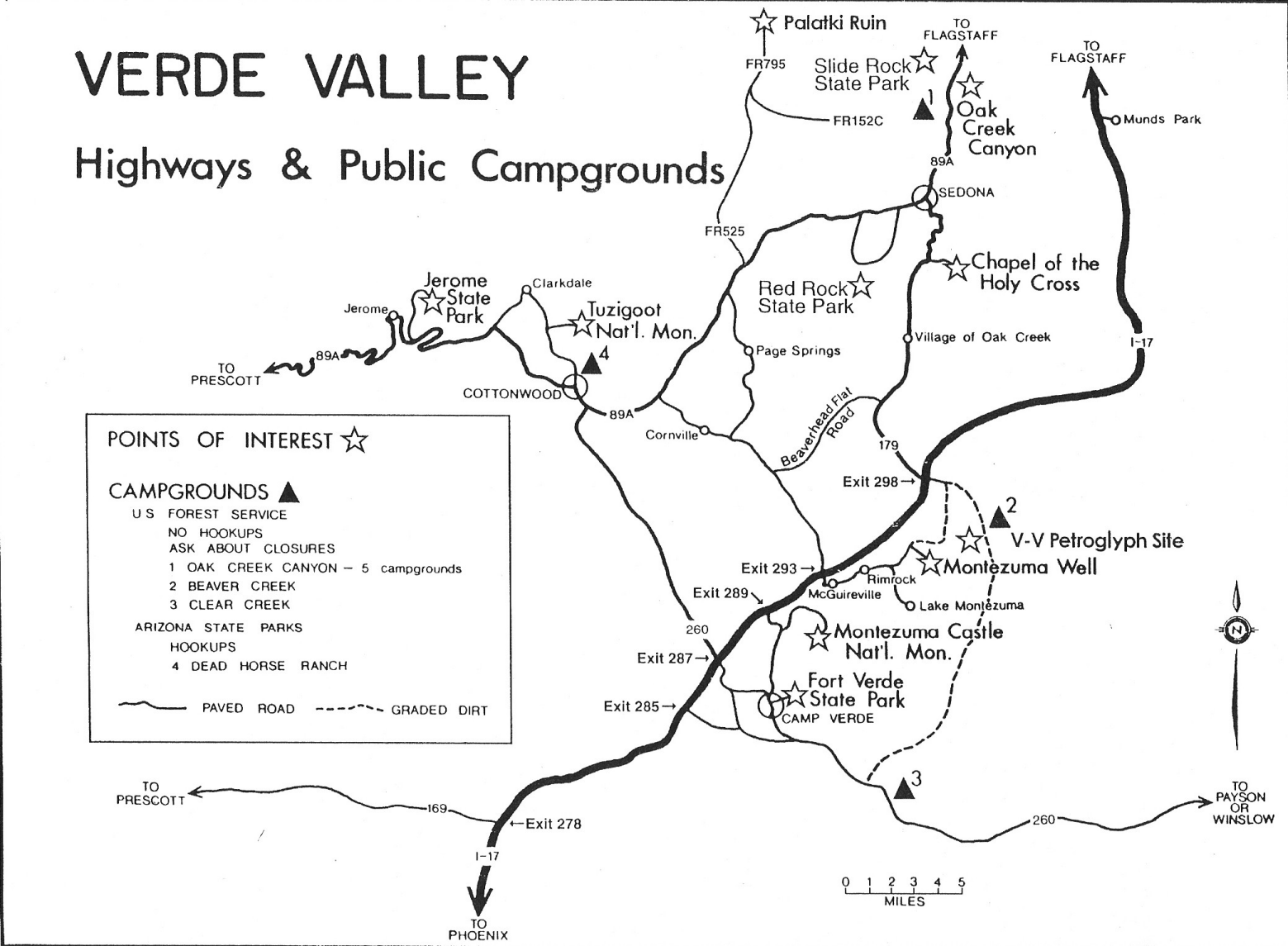 The Montezuma Castle regional map is hand-drawn and shows a lot of points of interest in the Verde Valley. You’ll find this handy if you’re visiting nearby sites or heading to Sedona.
Montezuma Castle science maps
 This is a geologic cross-section of Montezuma Well, a part of the monument located 11 miles from the main Montezuma Castle site. The well is a limestone sinkhole in the Verde Formation, fed by an underground spring.
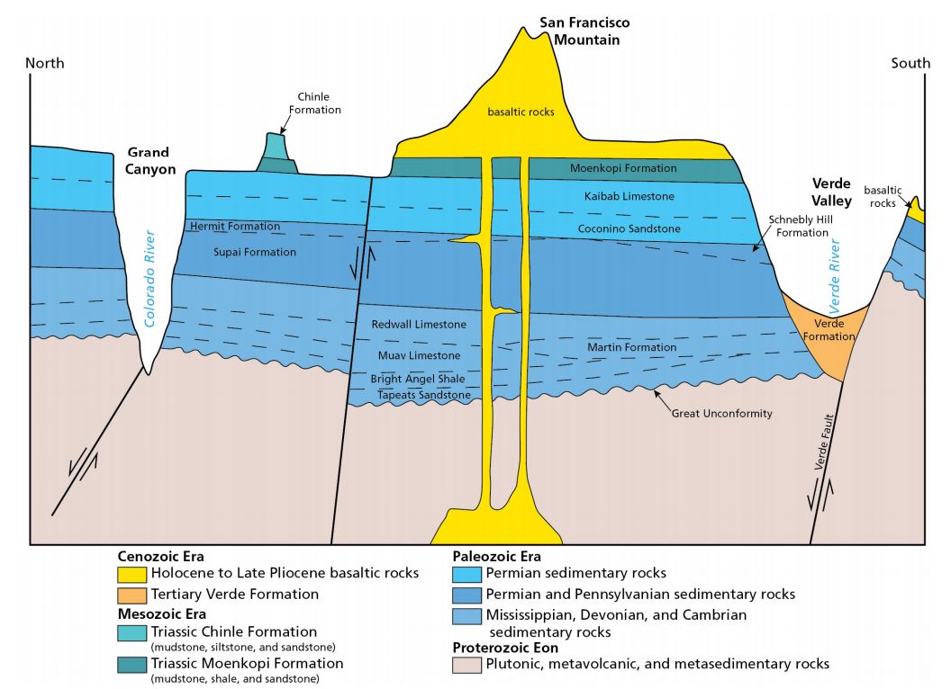 Here is a geologic cross-section of Northern Arizona, ranging from the Grand Canyon to the Verde Valley, where Montezuma Castle National Monument sits. Note the Verde Formation, which makes up the valley.
…and more!
< Return to National Park Maps home
< Return to Park List
< Return to List by State