Everglades map from the park brochure
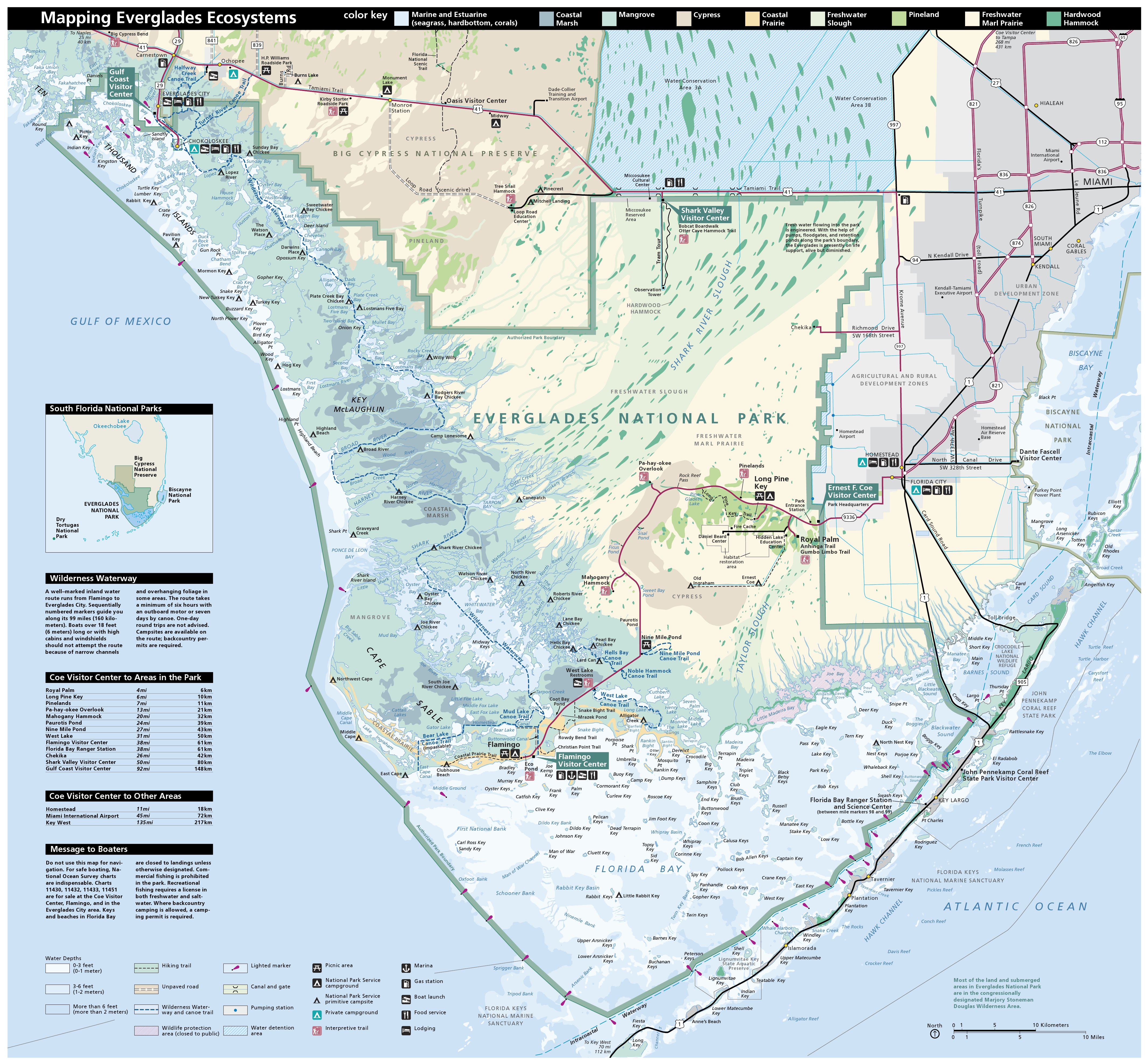
 This is the official Everglades National Park map from the NPS brochure. This map was last updated in 2025 and includes both the Gulf Coast section of the park and the main road to Flamingo.
Everglades trail maps
 The Everglades National Geographic Trails Illustrated map from Amazon is more detailed than the free maps below, and shows the hiking and paddling trails in the park. However, it doesn’t have enough detail to use for navigation by water; you should instead rely on navigation charts from NOAA or other specialty maps for that purpose. However, for general visiting, the Trails Illustrated map works well.
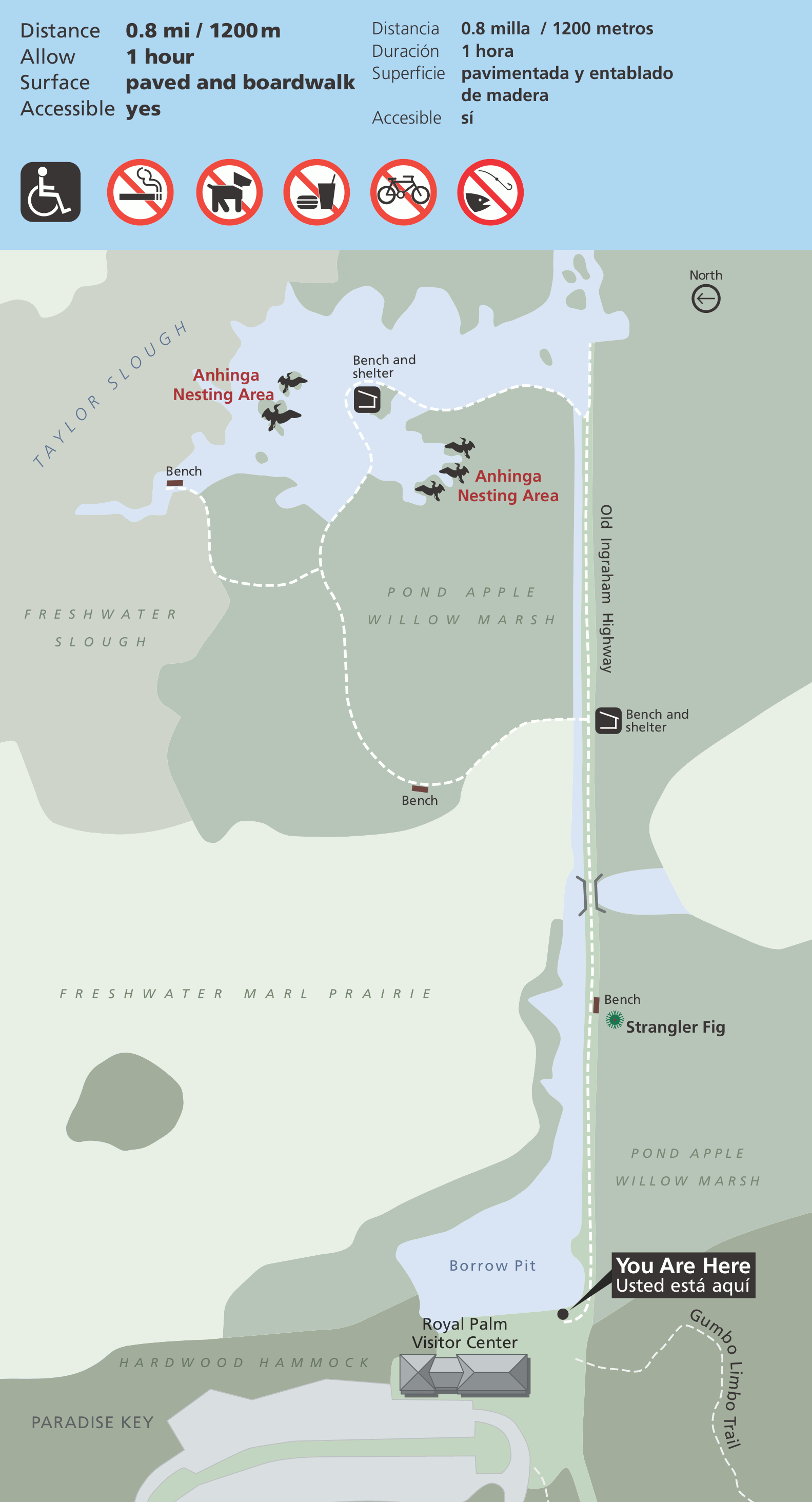 Here’s an Anhinga Trail map, the first trail you encounter after passing the Ernest F. Coe Visitor Center. This boardwalk is a good spot for birdwatching and viewing alligators skulking in the shallow waters.
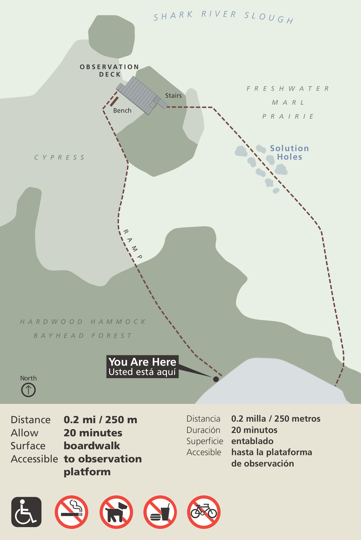 The Pa-hay-okee Trail map shows the very short path out to the observation deck, where you can make a loop. This trail is located off the main park road that leads to Flamingo.
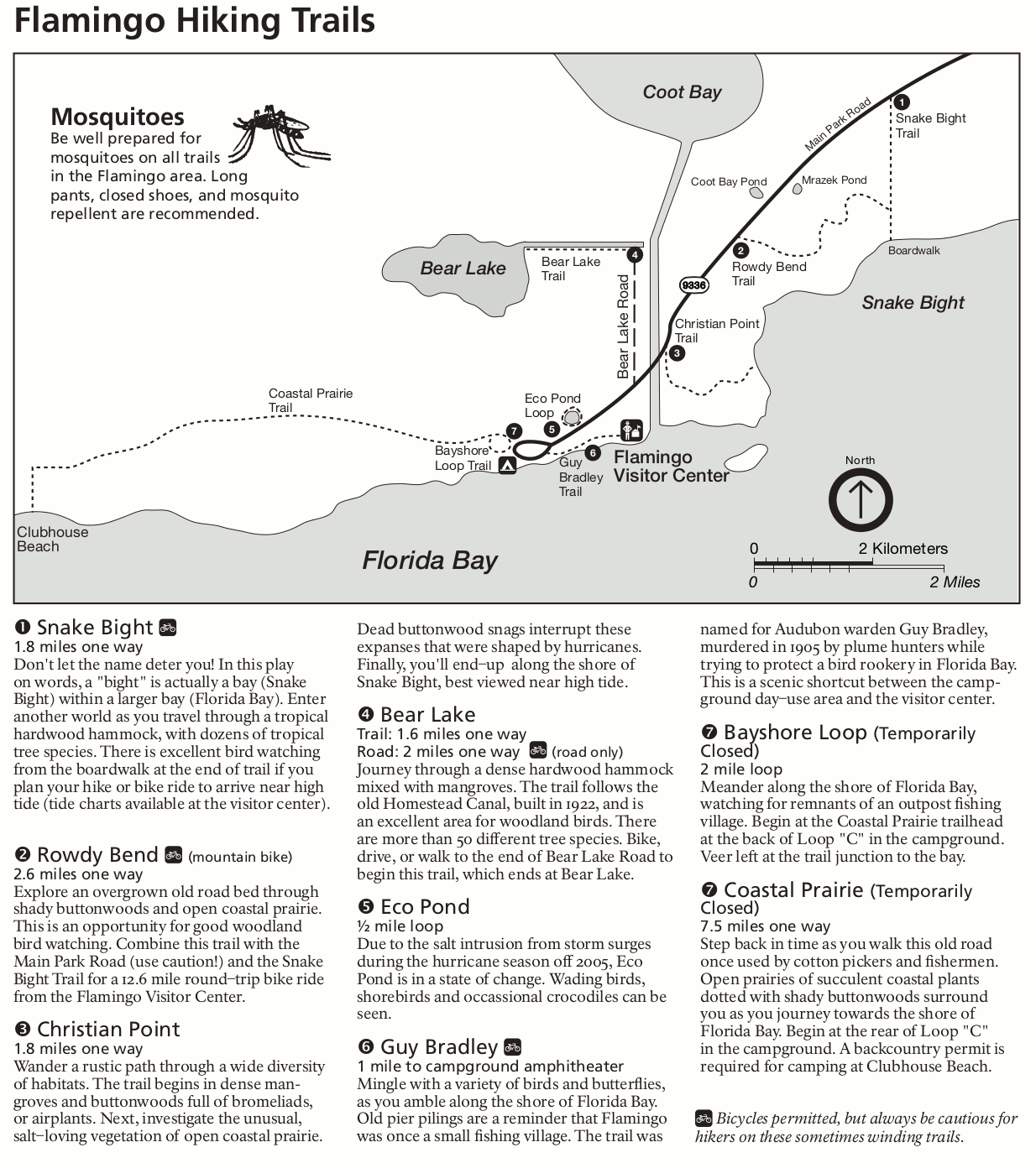 This Flamingo area hiking trail map shows the variety of trails that depart from near the Flamingo Visitor Center and campground. Included are descriptions and distances for each trail.
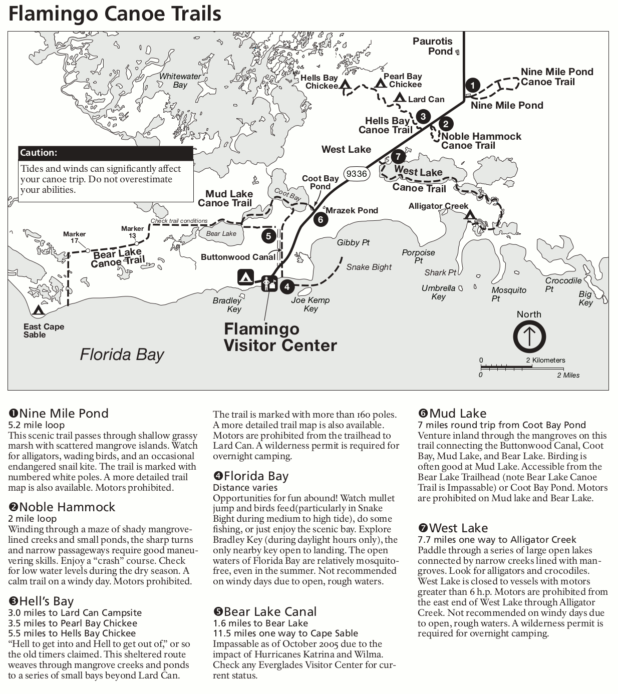 Here’s a Flamingo area canoe trail map, showing the popular canoe route to backcountry camping opportunities. Each trail is labeled with a short text description of the route and regulations.
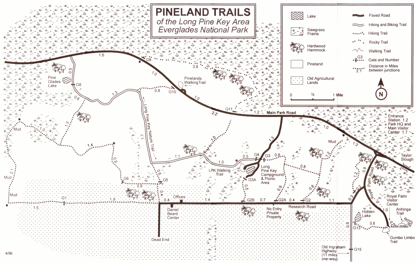 This is a Long Pine Key trail map, showing both hiking and biking trails just off the main park road, as well as the Long Pine Key Campground and picnic area. This area is not too far past the main entrance station.
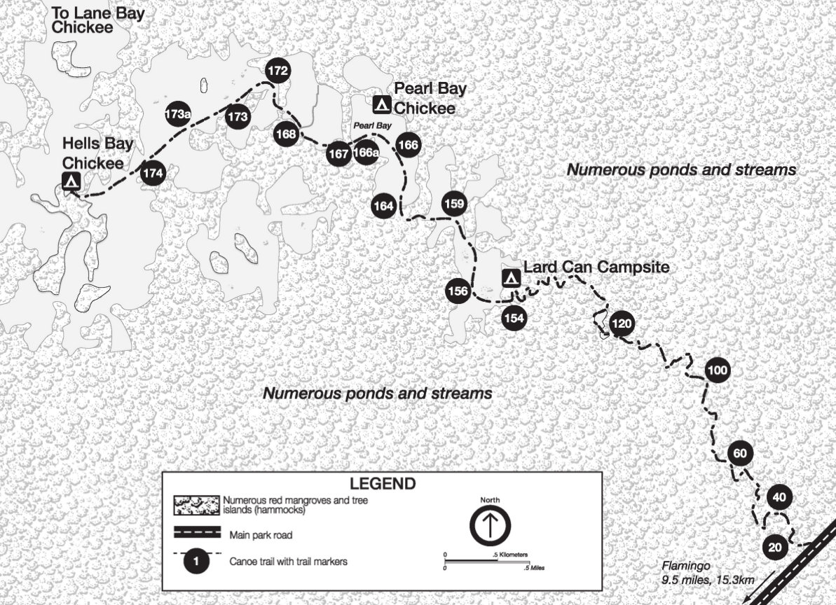 This is a map of the Hell’s Bay Canoe Trail, located in an Everglades mangrove swamp northeast of Flamingo. The map shows trail markers you’ll follow along this water route to various campsites.
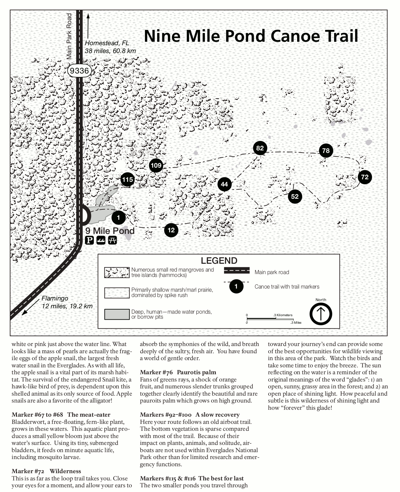 This is a map of the Nine Mile Pond Canoe Trail, located northeast of Hell’s Bay (above). This is marshier with fewer mangroves than Hell’s Bay. Text descriptions explain what you’ll find along the route.
Everglades lodging map
 To the right is an Expedia interactive Everglades lodging map, focusing on the city of Homestead, located outside the main entrance of Everglades. If you want more options you could stay farther away in Miami, but Homestead and Florida City are nearest the entrance and have many good options. Browse Expedia’s top-rated Everglades lodging to compare prices, locations, photos, and reviews of the various options.
More Everglades water maps
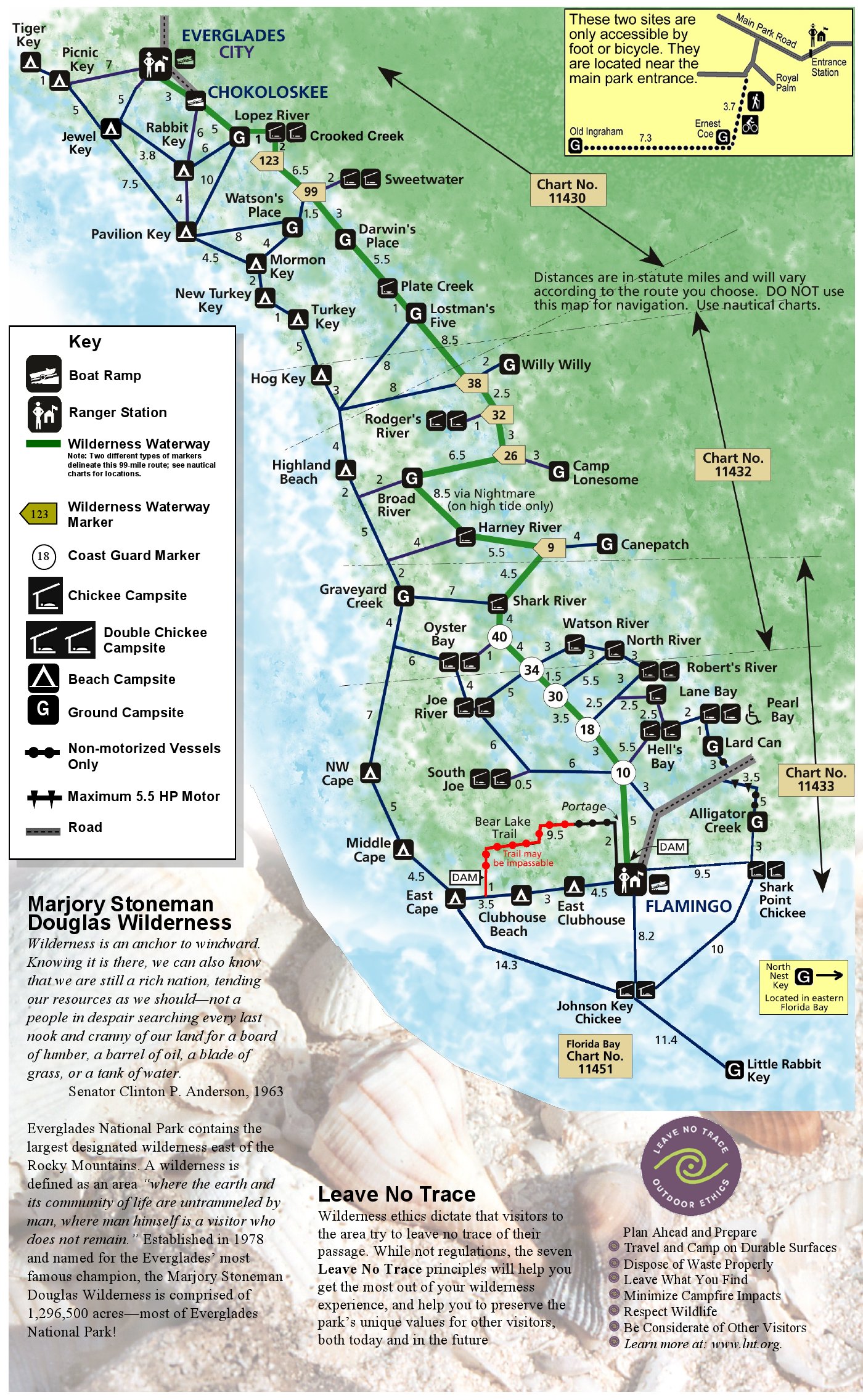 This is an Everglades wilderness campsite map, showing popular water routes and campsites along the Gulf Coast between Flamingo and Everglades City. Mileages are included.
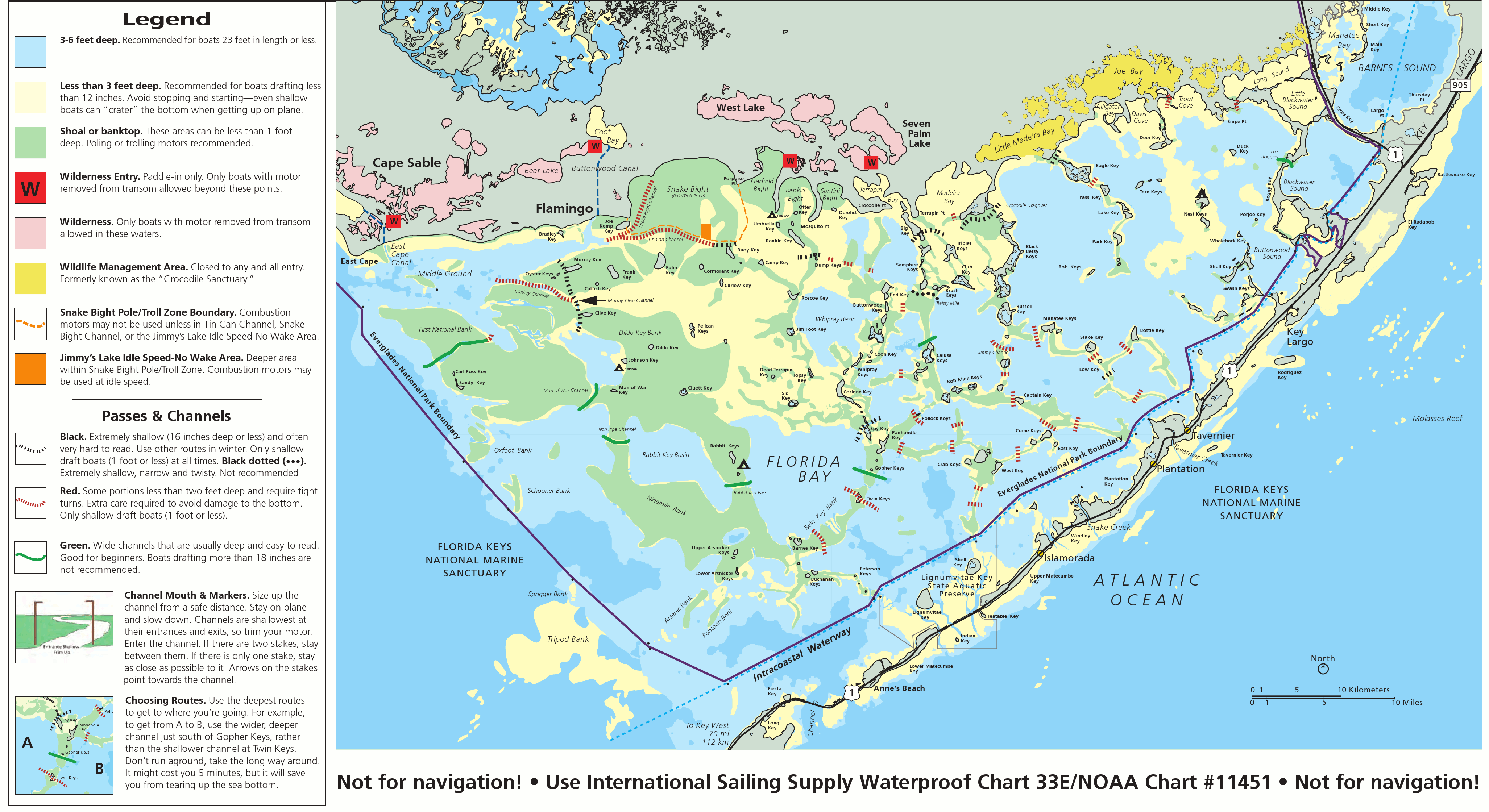 This is a map of Florida Bay, accessible from Flamingo and also from places in the Florida Keys, such as Key Largo and beyond. There’s a lot of shallow water here, so be careful to use the marked passes!
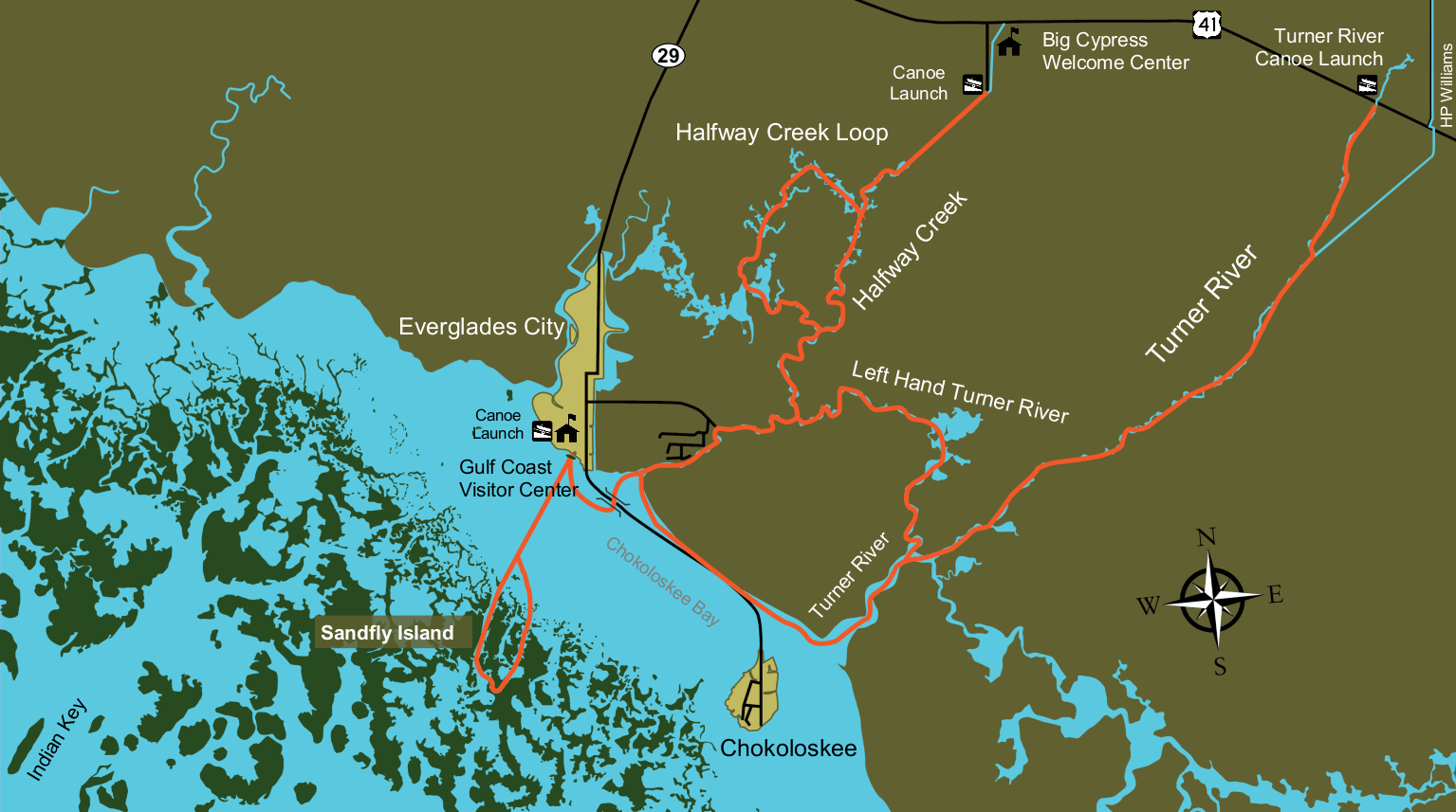 This is a Gulf Coast water route map, showing some of the popular paddling routes around the Gulf Coast Visitor Center near Everglades City in the far northwest corner of Everglades National Park.
Assorted Everglades maps
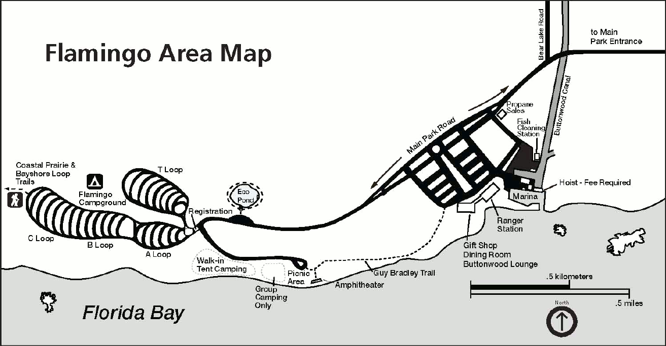 This is a detail map of the Flamingo area, which is the farthest you can drive into the Everglades. This map shows the marina, ranger station, gift shop, and several loops of the Flamingo Campground.
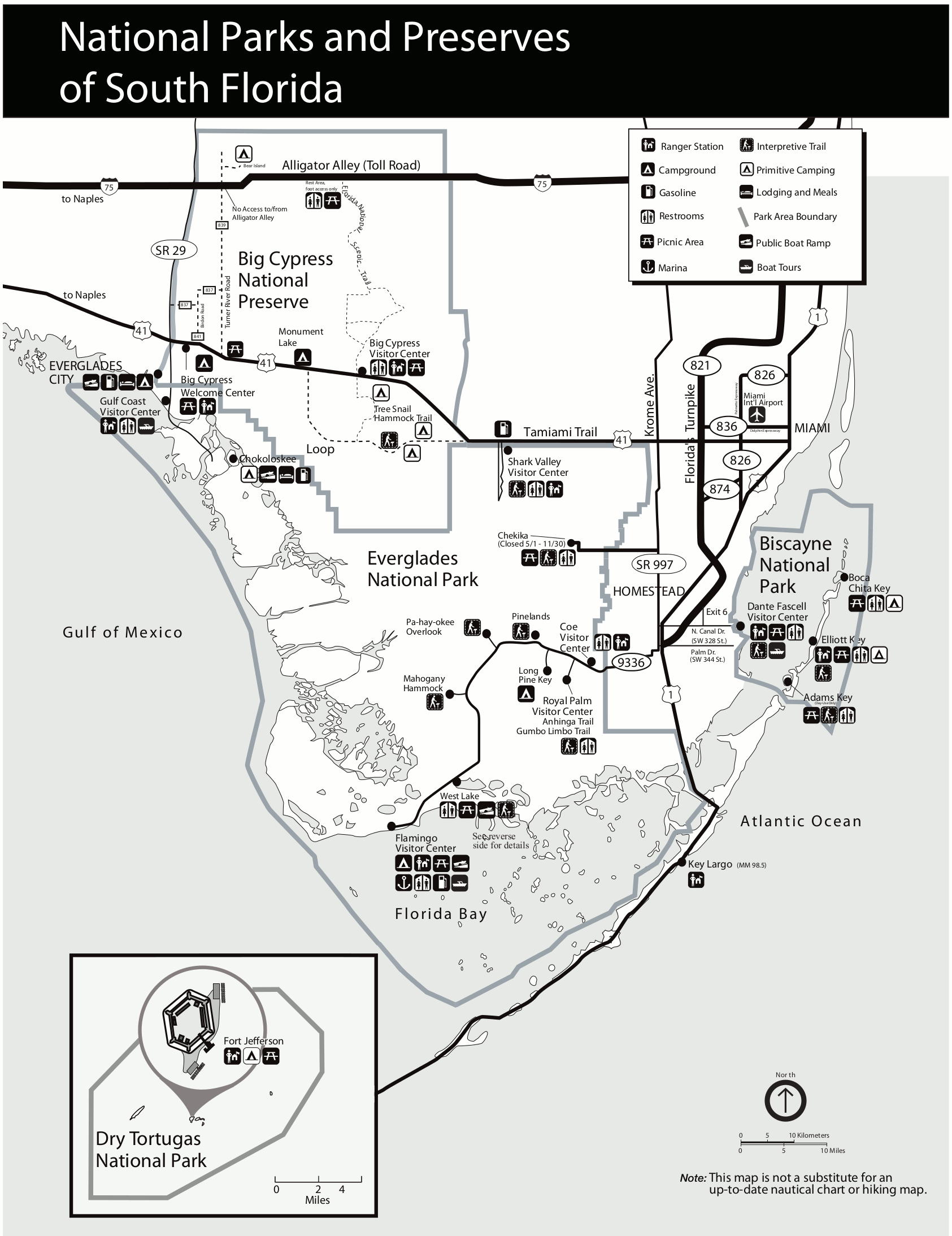 This South Florida national parks map is easy to print and shows both Everglades points of interest and other nearby parks: Big Cypress National Preserve, Biscayne National Park, and Dry Tortugas National Park.
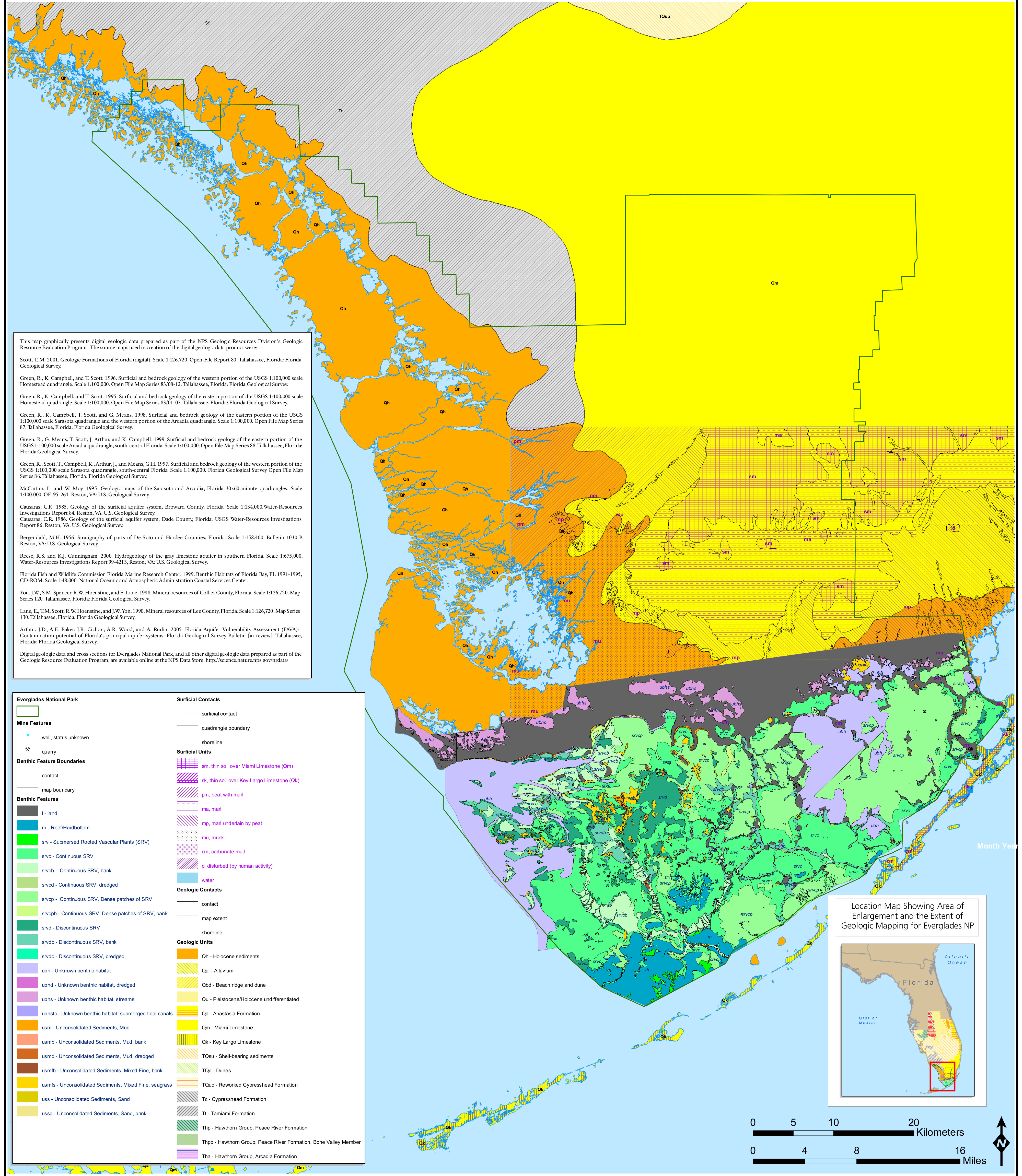 This crazy, chaotic Everglades geologic map shows the rock types as well as plant, vegetation, and water features in and around the national park. Fortunately a legend is provided!
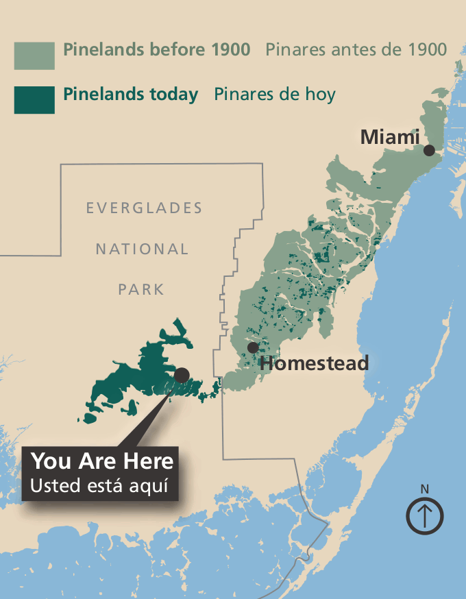 Here’s a pinelands map that shows the reduction in pinelands habitat in the Everglades since 1900. Over 98% of the pinelands in South Florida have now been lost, highlighting the importance of national parks.
 This is the old Everglades map from the official park brochure from the mid-2010s. Click the image to view a full size map or download the PDF. (This is one of the most beautiful maps in the national park system.)
Everglades map prints and gifts

 Printed high-resolution Everglades map posters and other products are available at the Everglades Maps store. For art prints, gift ideas, and souvenirs featuring other national parks, support this site and visit the National Park Maps store; you’ll find items to bring on vacation, keep at home for the memories, or give to your park-enthusiast friends and loved ones.
…and more!
< Return to National Park Maps home
< Return to Park List
< Return to List by State