Washita Battlefield brochure map
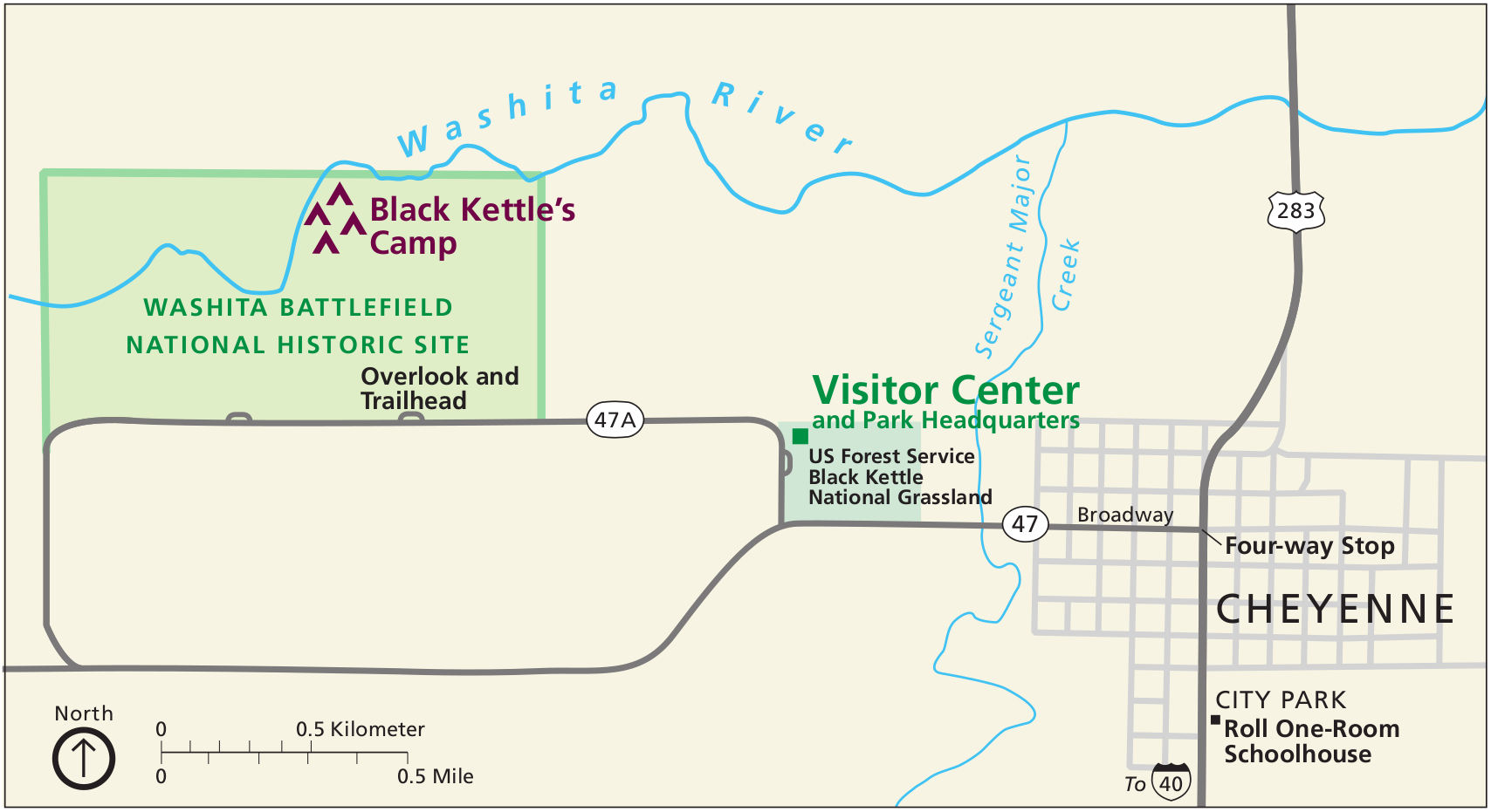 This is the official Washita Battlefield map from the park brochure, showing the battlefield area as well as the visitor center. Click the image to view a full size map or download the PDF.
Historical Washita Battlefield maps
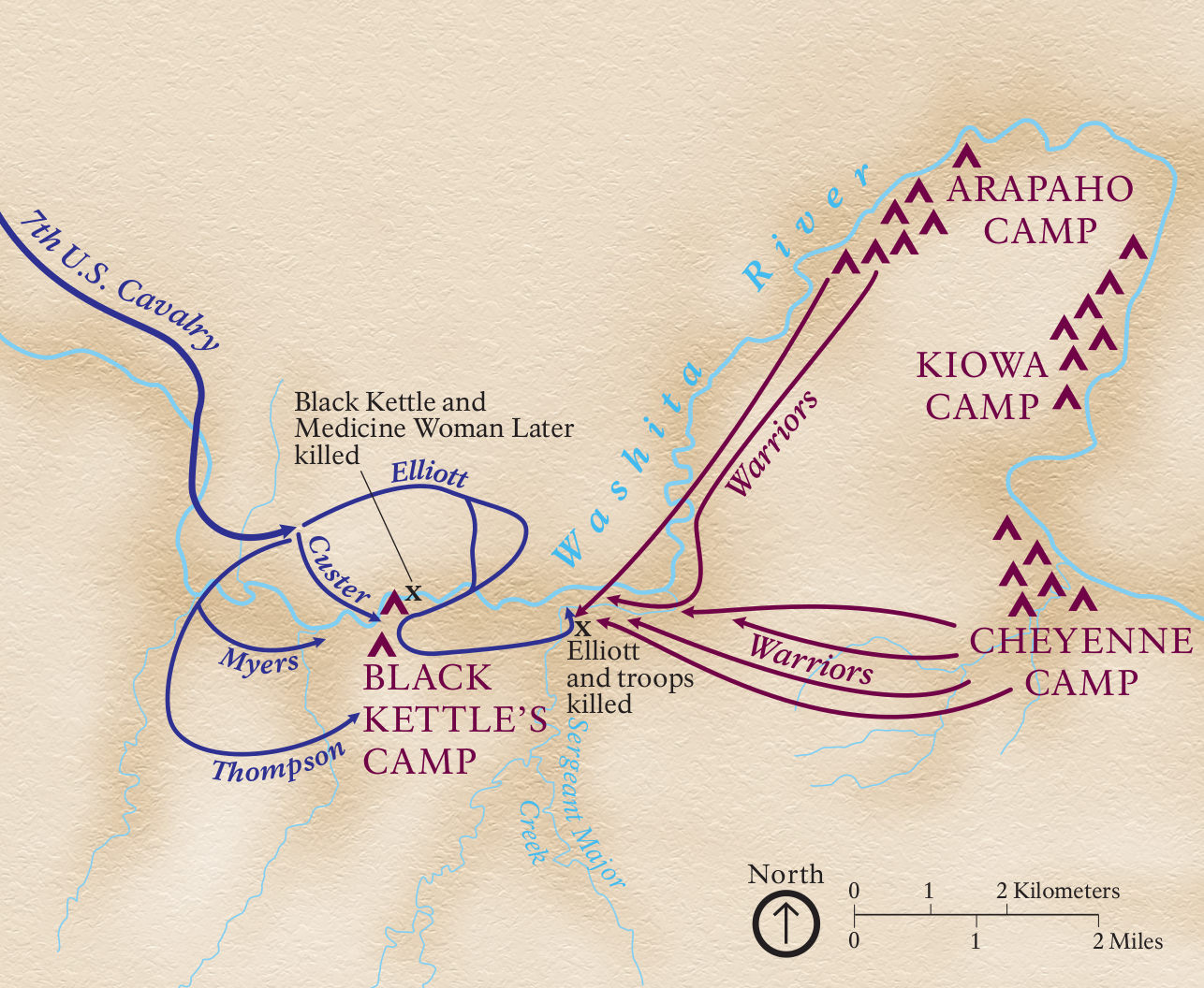 Here’s a Battle of Washita map showing the events of November 27, 1868, where George Custer’s U.S. Cavalry unit attacked the Cheyenne village of Chief Black Kettle along the Washita River.
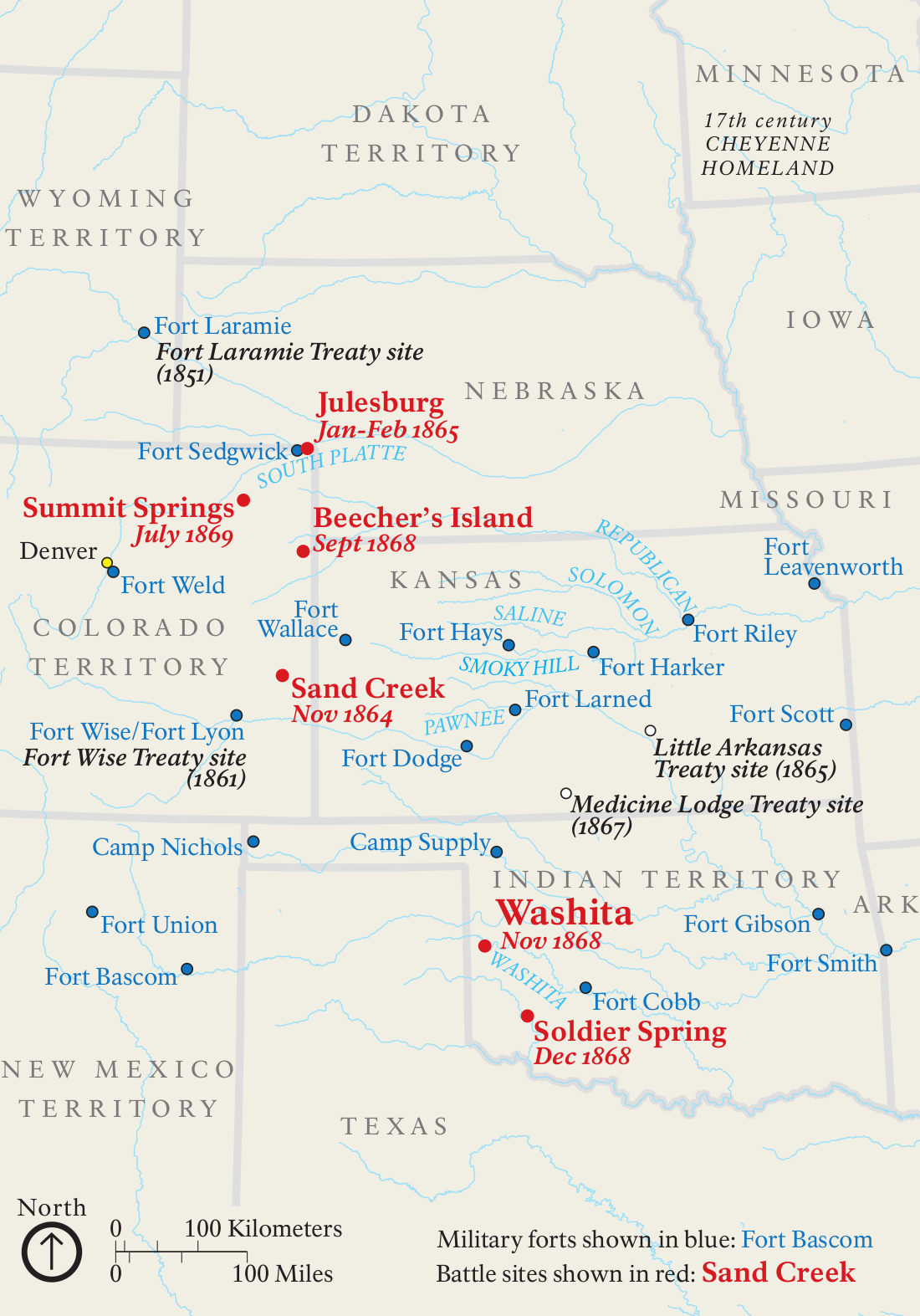 This is a regional battle map, showing the locations of various battles that took place between United States troops and local tribes. Click the image to view a full size map or download the PDF.
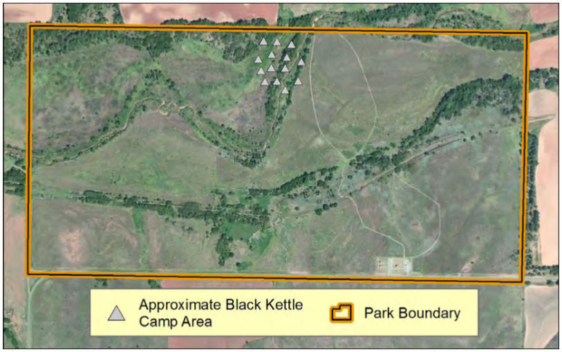 The Black Kettle Camp map shows where Chief Black Kettle’s camp was located on the Washita River. This map uses a present-day satellite photo to illustrate the camp’s location.
Washita Battlefield vegetation map
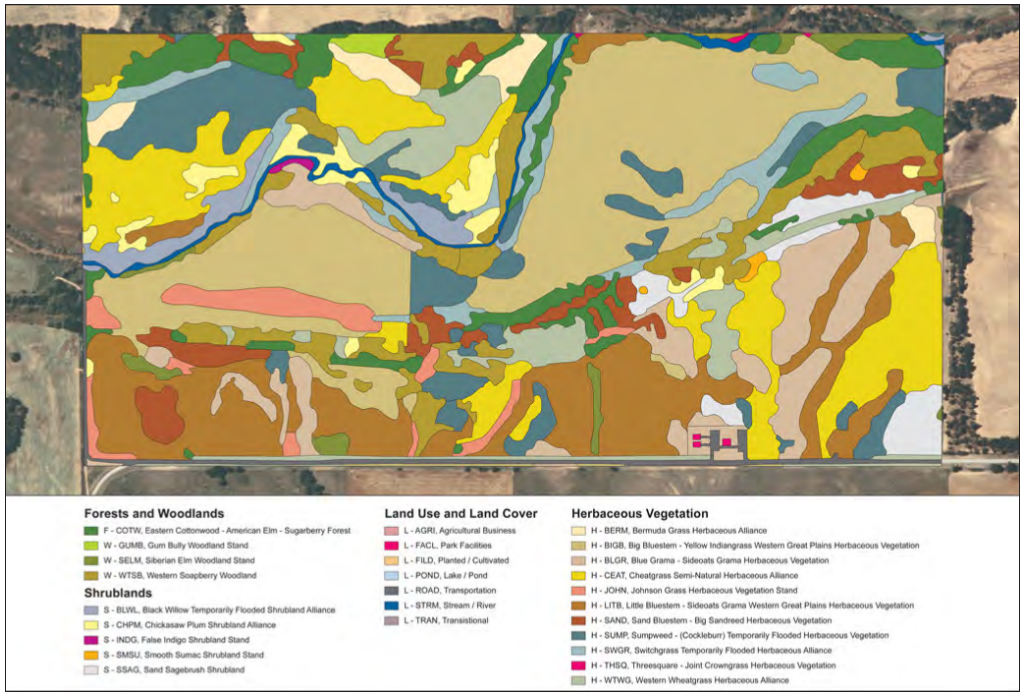 Here’s a vegetation map of Washita Battlefield, mapping out the various plants communities you’ll find in the park: forests, woodlands, shrublands, and grasses.
…and more!
< Return to National Park Maps home
< Return to Park List
< Return to List by State