Timpanogos Cave trail map
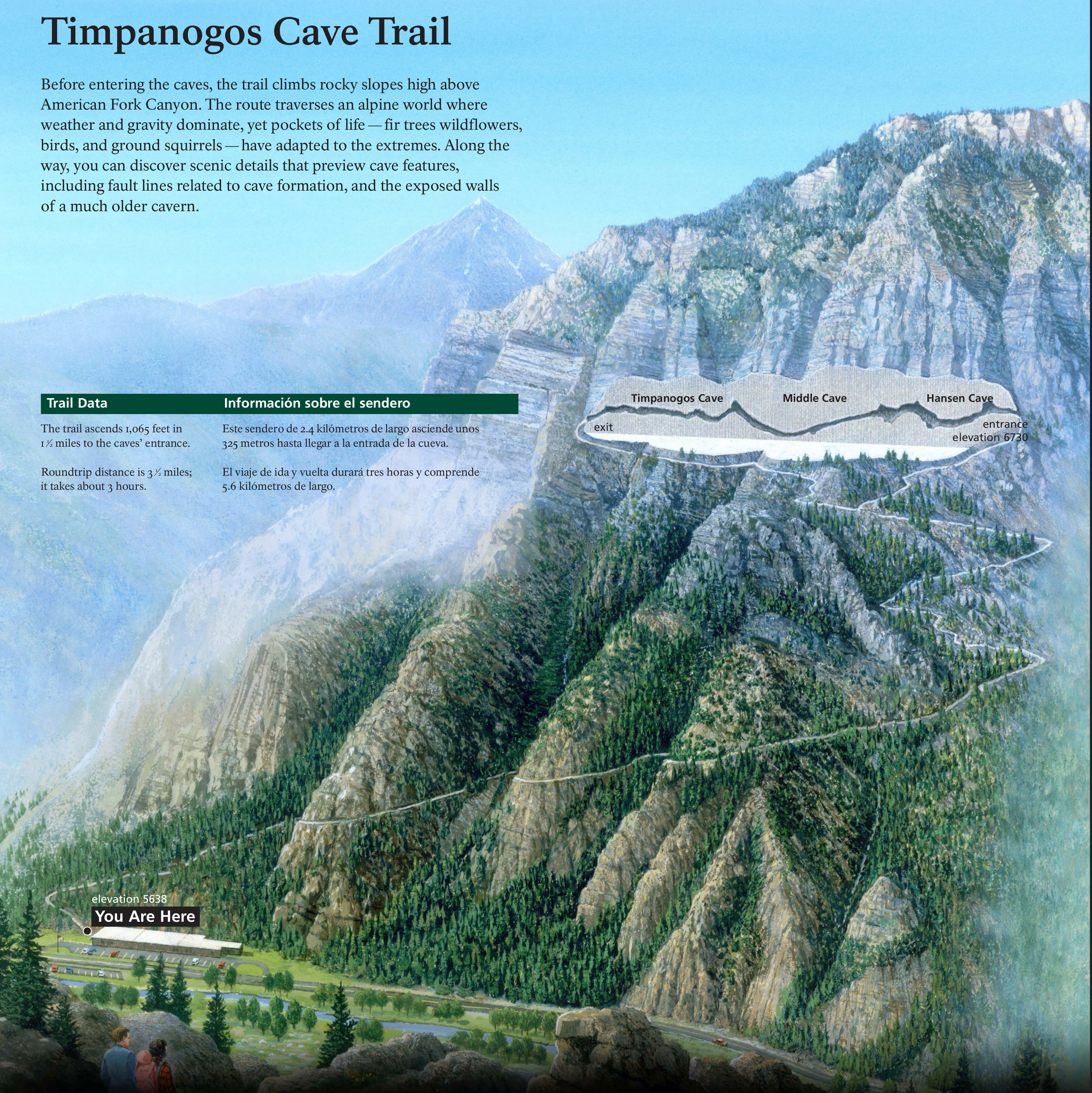 This is a Timpanogos Cave trail map – the same map that’s displayed on the wayside exhibit outside the park visitor center. It shows a cross-section of the cave and the trail to get you there.
Timpanogos Cave area maps
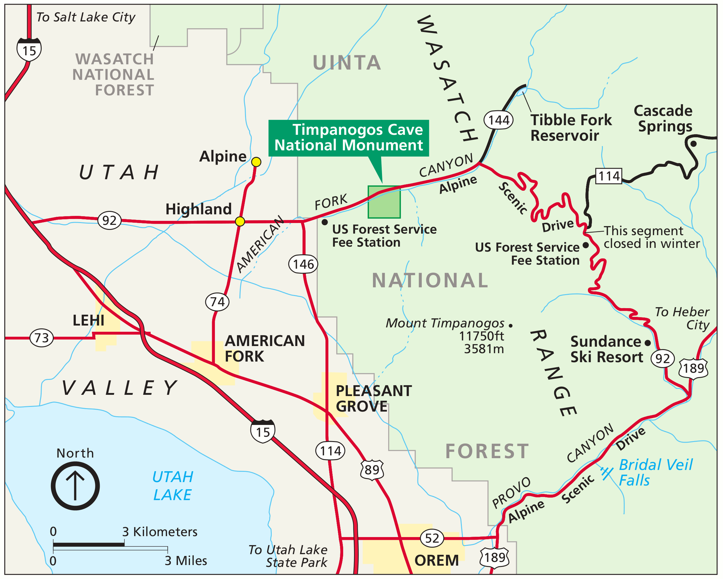 Here’s a regional Timpanogos Cave map, showing the main cities, roads, highways, and points of interest in this beautiful area of the Wasatch Range in Utah, south of Salt Lake City.
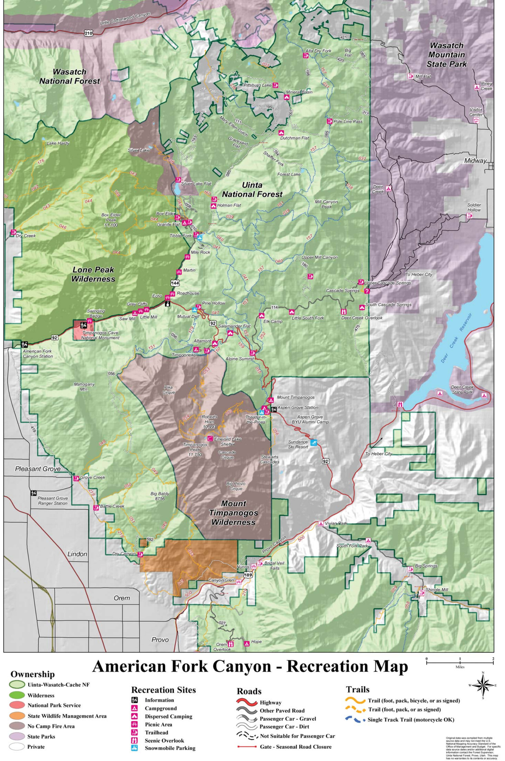 The Timpanogos Cave recreation map highlights the surrounding region in the American Fork Canyon, including a bunch of campgrounds nestled in the canyons in Uinta National Forest.
Timpanogos Cave vegetation map
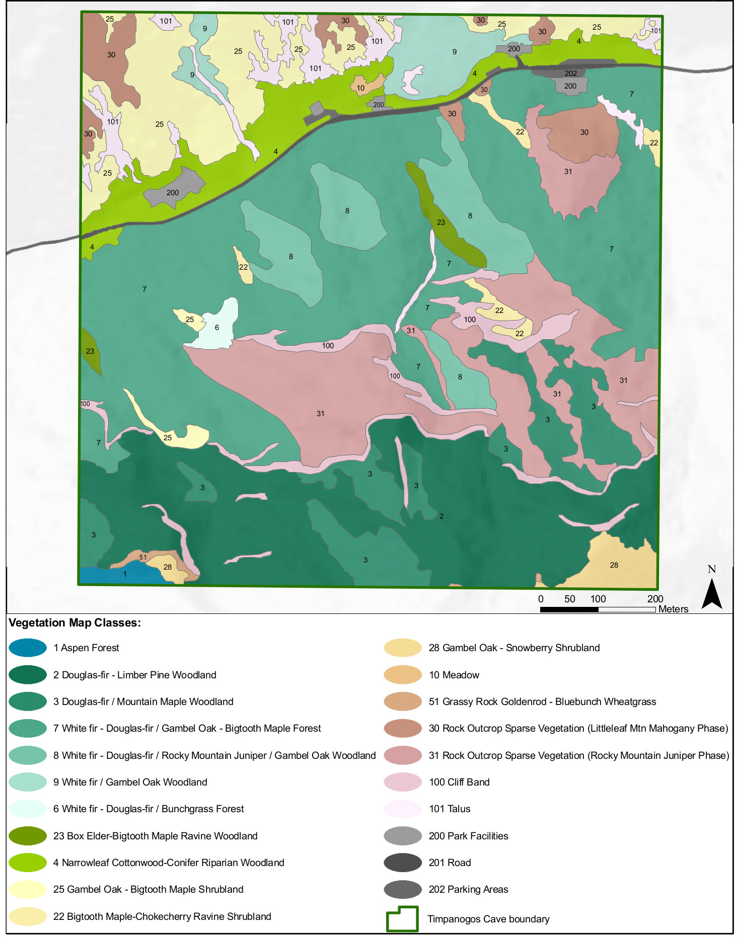 This vegetation map of Timpanogos Cave shows the various forest types in the monument and labels them with the dominant tree species – white fir, douglas fir, box elder, and so on.
…and more!
< Return to National Park Maps home
< Return to Park List
< Return to List by State