Tallgrass Prairie brochure maps
 This is the official Tallgrass Prairie map, showing the different roads, services, and trails throughout the park. See the maps below to zoom in on the various loop trails and the visitor center area.
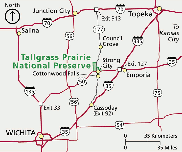 The Tallgrass Prairie regional map zooms out to show the park’s location in Kansas, southwest of Topeka and northeast of Wichita. Interstate highways as well as state routes are displayed.
Tallgrass Prairie trail maps
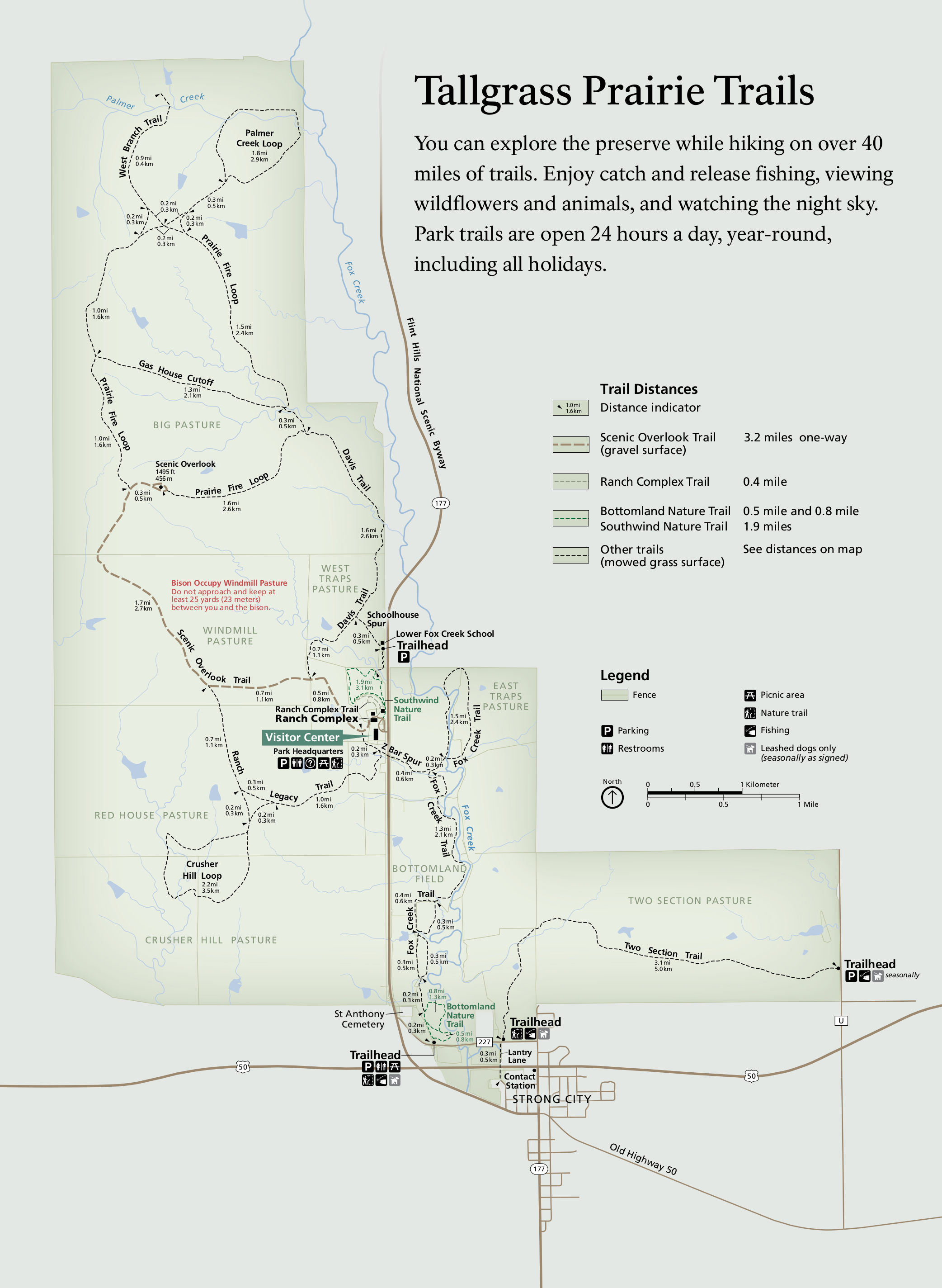 This Tallgrass Prairie trail map labels a variety of loop hikes along with their distances. It also shows the major trailheads used to access each of the routes, on and off the Flint Hills National Scenic Byway.
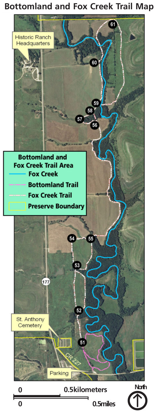 Here’s a Fox Creek trail map, overlaying the trail route over a satellite photo, showing the forest that the trail follows alongside. You can also see the Bottomland Trail on the southern edge of the map.
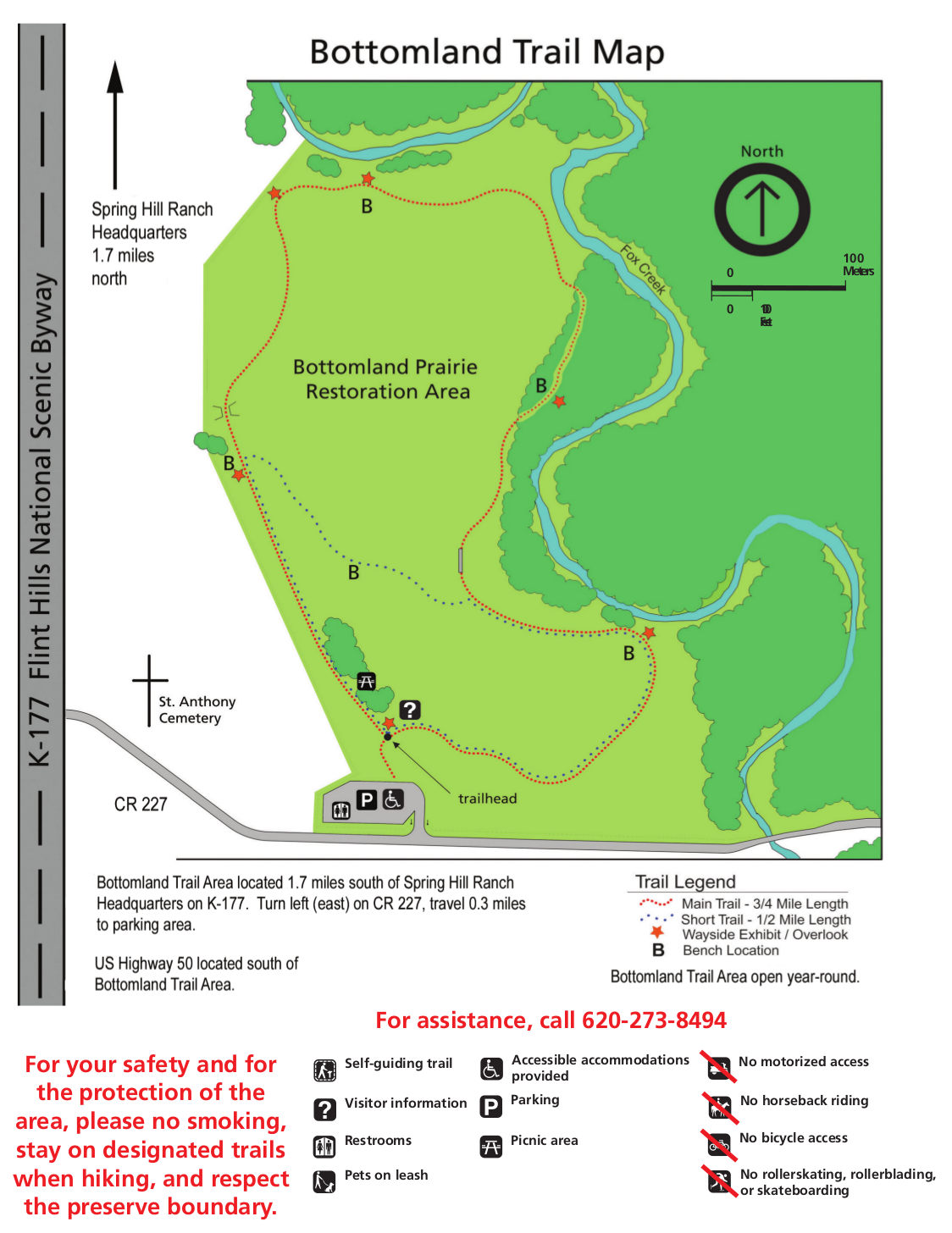 The Bottomland trail map zooms in on this three-quarters of a mile loop, identifying the locations of benches, wayside exhibits, restrooms, and parking in relation to the Flint Hills National Scenic Byway.
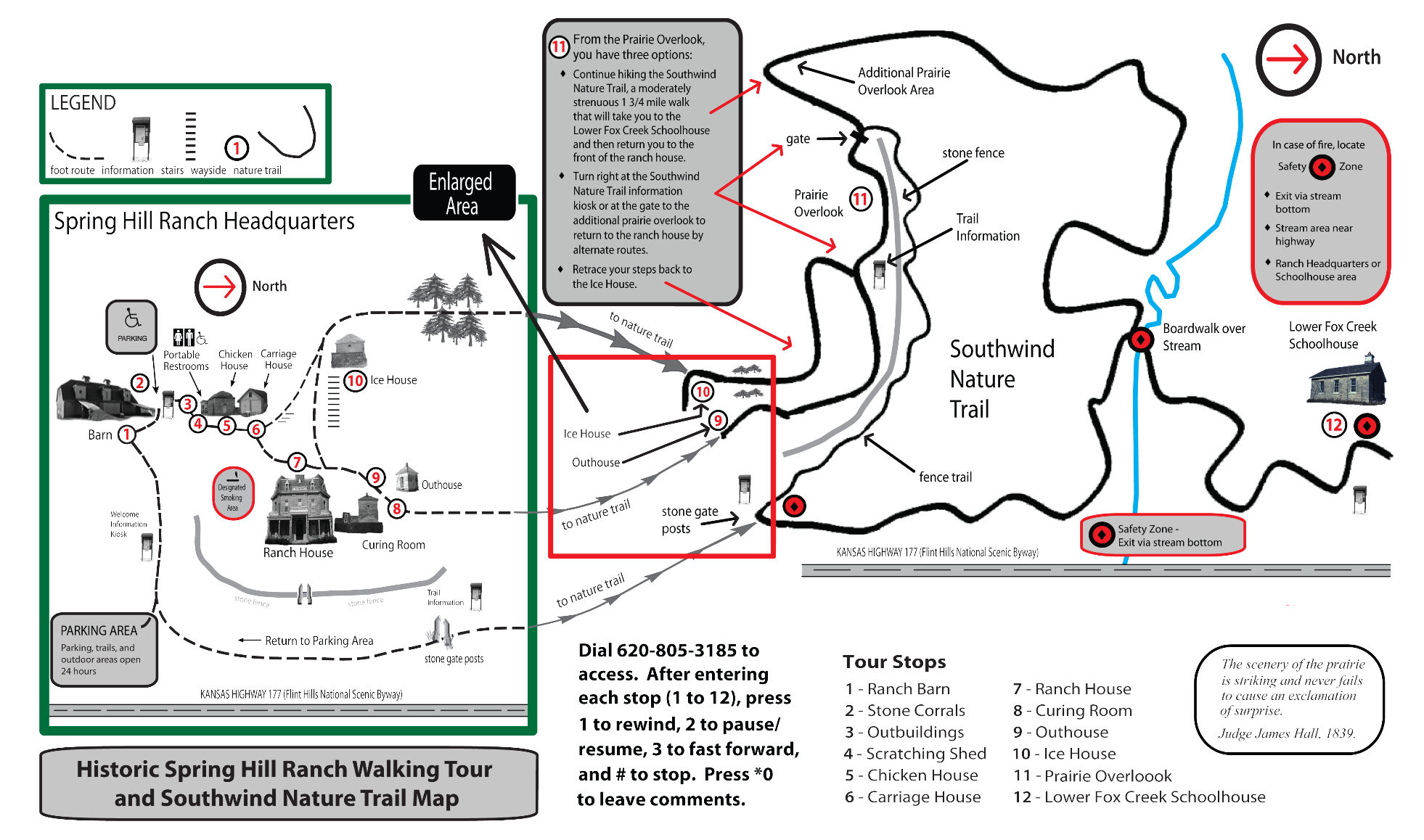 Here’s a Spring Hill Ranch map that also includes the Southwind Nature Trail. This map is a little bit confusing; note that north is to the right, and the left and right halves are on different scales.
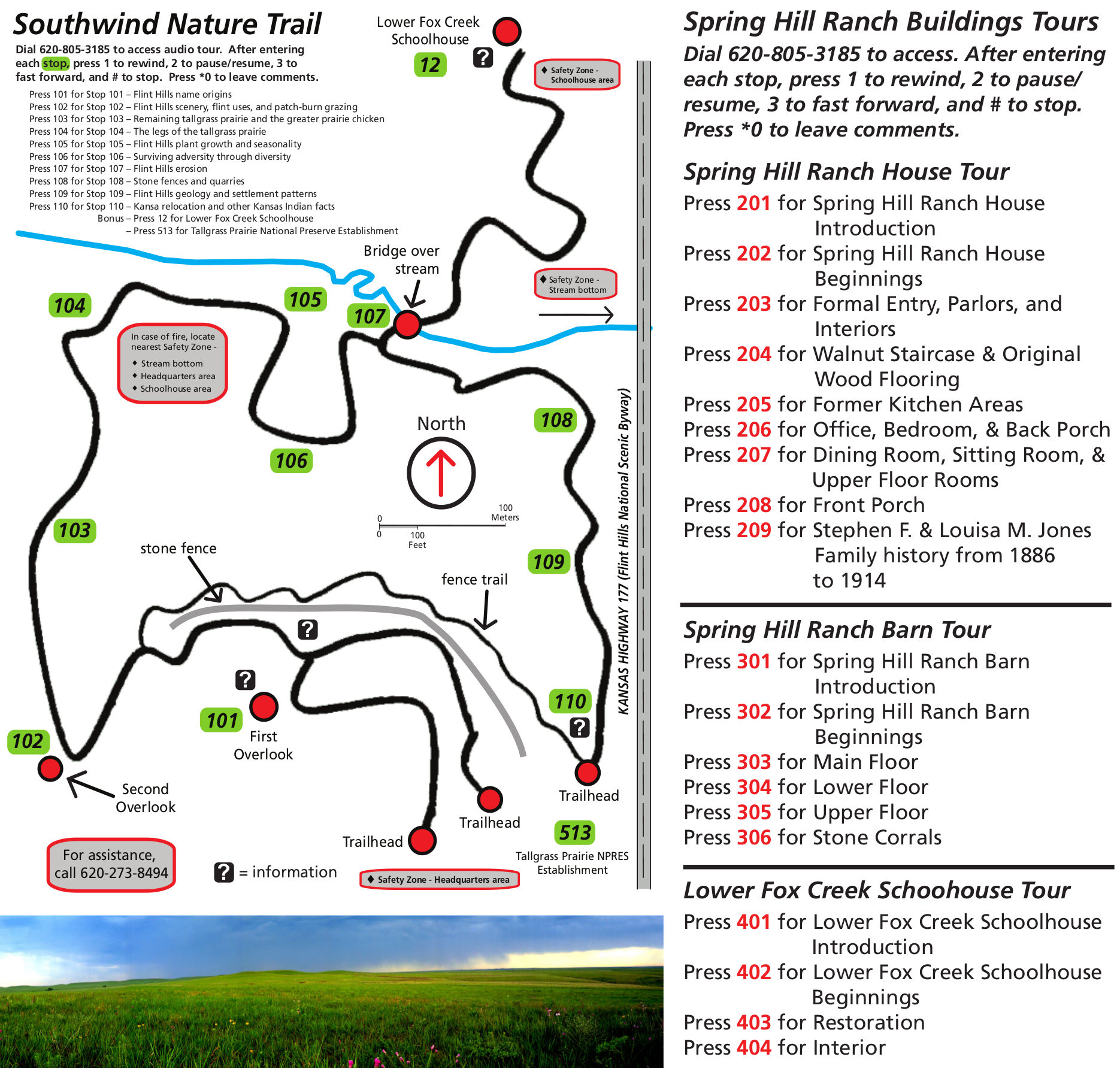 This is a Southwind Nature Trail audio tour map, showing the trail route labeled with numbers for which audio tour stop to call into. Audio tour information for Spring Hill Ranch is also included.
…and more!
< Return to National Park Maps home
< Return to Park List
< Return to List by State